Symons Alderman John: Kingstoniana. 1889 Hull. Folding map; other books and booklets of Hull interest; Victorian and later paper ephemera including newspapers, theatre programmes, letter headings and invoices, PDSA poster, sports programmes, social events, first day covers, Ordnance Survey maps, DVDs etcCondition Report:Condition varies dependent upon age but most in reasonable condition.Some rusting of staples to programmes etc
We found 109198 price guide item(s) matching your search
There are 109198 lots that match your search criteria. Subscribe now to get instant access to the full price guide service.
Click here to subscribe- List
- Grid
-
109198 item(s)/page
Sheffield and Twenty Miles Round - Gazetteer and General Directory of Sheffild by William White, 1852; History of Barnsley by R. Jackson, Bacon's new map of twelve miles around Barnsley, on cloth, The Story of Barnsley and South Yorkshire Railway Company Rules, Regulations and Bye-Laws, 1864. (5)
A Small Collection of Antiquarian Geography Related Books, including Beatties Switzerland (vol 2), Beauties of the Bosphorus, Canadian Scenery, Beatties Protestant Valleys of Piedmont & Dauphiny, Westmorland and Cumberland Illustrated, Heath's Picturesque Annual 1833, Galignanis New Paris Guide and Guide-Chaix Cartle de La Francais (map on linen).
Rocque (John) - Map of England & Wales Drawn From The Most Accurate Surveys Containing All The Cities And Boroughs, Market Towns & Villages - an 18th century concertina map of England & Wales, mounted on linen, 100 by 117cms.Condition ReportThe map shows some wear with tears to the folds, some staining and grubby marks to the image.
"Typus Geographicus Ducat. Lauenburgici (...)". OriginaltitelTeilkolorierter Kupferstich von Ruprecht Adam Schneider, erschienen bei Johann Christoph Homann Nürnberg (1703 - 1730), 1729. Karte des Herzogtums mit dem Stift Lübeck und dem Amt Ratzeburg. Links oben Nebenkarte von Hadeln und Ritzebüttel. Große, figürliche Kartusche mit Wappen. Platte 57 cm x 48,5 cm. Rahmen. Partly hand-colored copper engraved map by Ruprecht Adam Scheider, published by Johann Christoph Homann, Nuremberg 1729.
"Imperii Magni Mogolis sive Indici Padschach". OriginaltitelKupferstich von Matthäus Seutter (1678 - 1757), Augsburg, um 1740/50. Zeigt Nord-Indien mit Nepal, Tibet, Bangladesch Myanmar (Burma), Pakistan und einen Teil von China. Muschelförmige Titelkartusche und Maßstabsanzeiger mit allegorischer Figurenstaffage. In der Bengalischen Bucht großer Segler mit Versorgungsschiff. Ger. Knitterungen u. Quetschungen. Platte 50 cm x 57,5 cm. Rahmen. Copper engraved map of India by Matthäus Seutter, Augsburg circa 1750/50. Minor creases.
" der Keysrl: Freyen- Reichs- Wahl- und Handelstatt Franckfurt am Mayn mit ihrem Gebiet und Gräntzen (...)". OriginaltitelKolorierter Kupferstich von Johann Baptist Homann, um 1720. Dekorative Gesamtansicht Frankfurts, flankiert von allegorischen Darstellungen sowie einer Ansicht des Römers und der Kaiserkrönung im Dom. Darüber eine Umgebungskarte. Gebräunt. Passepartoutausschnitt 50 cm x 58,3 cm. Rahmen.Hand-colored copper engraving with a view and a map of Frankfurt and surroundings by Johann Baptist Homann, Nuremberg circa 1720. Foxing.
(...)". OriginaltitelAltkolorierter Kupferstich von Jacques-Nicolas Bellin aus der "Histoire Generale des Voyages" von Antoine-François Prévost, in der Platte dat. 1746. Die detailreiche Karte zeigt den Atlantik von der Ostküste der USA und Kanadas, der Karibik und der Nordküste Südamerikas bis Westafrika und Westeuropa, inklusive der Azoren, Kapverden und der Kanarischen Inseln. Plattenmaß 33 cm x 47 cm. Rahmen. A hand-coloured copper engraving with a map of the Atlantic Ocean by Jacques-Nicolas Bellin from the "Histoire Generale des Voyages" dated 1746.
"Persien nach seinem neuesten Zustande in das Oestliche Und Westliche Reich eingetheilt". OriginaltitelGrenzkolorierter Kupferstich von Christian Gottlieb Reichard (1758 - 1837), erschienen im Verlag des Geographischen Instituts Weimar, 1822. Passepartoutausschnitt 51,5 cm x 67,5 cm. Rahmen.Copper engraved map of Persia by Christain Gottlieb Reichard (1758 - 1837), published by Verlag des Geographischen Instituts, Weimar 1822.
Heinrich Himmler - Geschenkband "SS Kavallerie im Osten" mit Originalunterschrift Der für die von Himmler verschenkten Bücher typische schlichte Ledereinband mit geprägtem Titel. Auf dem Vorsatzblatt mit der Landkarte die eigenhändige Unterschrift "H. Himmler - 23 VI 1944" mit grünem Buntstift. Ansonsten dem von der SS-Kavallerie-Brigade herausgegebenen 196-seitigen Bildband entsprechend. Der Einband sichtlich bestoßen. Heinrich Himmler - a presentation book (tr.) "SS Cavalry in the East" with original signature Heinrich Himmler - a presentation book (tr.) "SS Cavalry in the East" with original signaturePlain leather binding typical for books given away by Himmler with embossed title. The front flyleaf with map and handwritten signature "H. Himmler - 23 VI 1944" in green pencil. All other features correspond to those of the 196-page illustrated book issued by the SS Cavalry Brigade. The binding visibly knocked.Condition: III +
Turkey.- Fraser (David) Persia and Turkey in Revolt, first edition, "sent by desire of Author" slip loosely inserted, frontispiece, plates, folding map at end, scattered spotting, previous owner's pencil signature, original cloth, gilt, slight bumping to corners and extremities, 1910 § Spencer (Captain) Turkey, Russia, the Black Sea, and Circassia, fifth thousand, chromolithograph frontispiece and 3 plates, illustrations, folding map at end, short tear with tape repairs to verso, bookplate, upper corner trimmed from front free endpaper, original cloth, gilt, bumping to corners and extremities, 1855 § Gautier (Theophile) Constantinople of Today, first edition, frontispiece, additional vignette title, plates, scattered spotting, previous owner's ink signature to front free endpaper, original cloth, a little rubbed, slight bumping to corners and extremities, 1854; and 2 others similar, 8vo (5).
NO RESERVE Case of the Earl of Stamford (The), Relating to the Wood lately Cut in Enfeild-Chace, folding engraved map, engraved armorial bookplate of John Towneley loosely inserted, later bookplate of Victor Hilton to front free endpaper, map with short tear to fold with very minor loss, some soiling or minor spotting, light damp-stain to lower outer corner (affecting small portion of map), contemporary marbled wrappers, chipped and frayed at edges, spine repaired, Printed, and Sold by A. Baldwin, 1701; and a quantity of Ephemera, mainly printed, much Scotland and Yorkshire related, v.s., 19th and 20th century (qty in 1 box)
Gloucestershire.- Atkyns (Sir Robert) The Ancient and Present State of Glostershire, first edition, with the Author's Epitaph leaf, engraved portrait, 8 plates of coats-of-arms, double-page map and 64 fine double-page views by Kip, woodcut head- and tail-pieces and initials, bookplates of the Rev. Fenwicke and Henry Hales Bouverie, first few gatherings with small wormhole to outer lower corner, mostly marginal but affecting a few coats-of-arms plates, plate at 4N2 trimmed just within plate and with repaired tear to fore-margin, plate at 5Q3 with small hole to image, some light spotting but overall a crisp copy, contemporary polished calf, gilt, rebacked preserving old backstrip, rubbed and scratched, head of lower cover sunned, corners and hinges repaired, [Maslen & Lancaster. Bowyer ledgers, 117], Printed by W. Bowyer for Robert Gosling, 1712.
America.- Burton (Sir Richard Francis) The City of the Saints and Across the Rocky Mountains to California, first edition, half-title, wood-engraved frontispiece and 7 plates, folding map, small chips to edges and laid down, folding table, short tear to split to foldline, illustrations, scattered spotting and staining, most marginal, Y5-6 with short marginal tear affecting odd letter, one or two marginal pencil notes, ex-library with occasional discreet blind-stamps, modern half-calf, [Penzer pp.68-69], 8vo, 1861.
NO RESERVE America.- Geographical Map of America. No. XIII, engraved map, with hand-colouring delineating European possessions, 480 x 695 mm (18 7/8 x 27 3/8 in), folds, with a few very short tears to ends, some minor surface soiling, R. Juigne, [early 19th century]; and other folding maps, including a Post Office Directory map of North-West London, v.s., 19th and 20th century (c.20)
Voyages.- Shelvocke (Capt. George) A Voyage Round the World, By the Way of the Great South Sea, second edition, engraved title-vignette and folding world map on 2 sheets, 4 engraved plates, 2 folding, bookplate of Frederick E. Ellis, his ink ownership inscription to front free endpaper, light offsetting, some foxing and soiling, hinges repaired, contemporary mottled calf, sympathetically rebacked, worn at corners, rubbed, [Sabin 80159], 8vo, Printed for W. Innys and J. Richardson, 1757.
Africa.- Carpeau du Saussay. Voyage de Madagascar, signatures E and F misbound, some light browning, contemporary French mottled calf, spine gilt, rubbed, spine ends chipped and upper joint cracking, 12mo, Paris, Chez Jean-Luc Nyon, 1722.⁂ Apparently one of two issues, this without plates and map.
NO RESERVE Great Exhibition of the Works of Industry of all Nations, 1851. Official Descriptive and Illustrated Guide, 3 vol., additional pictorial title, folding lithographed map with partial hand-colouring, plates and illustrations, a few chromolithographed, most wood-engraved, original pictorial blue cloth, gilt, 1851 § Illustrated London News, vol.18: Jan to June 1851, wood-engraved plates and illustrations, many relating to the Great Exhibition, some double-page and/or folding including one large and linen-backed, contemporary half calf, 1851 § Tomlinson (Charles, editor) Cyclopaedia of Useful Arts & Manufactures, 3 vol. in 10 parts, engraved vignette titles and plates, illustrations, hinges of part 10 weak, original pictorial red cloth, gilt, 1854-66 § Gowans (Sir James) Model Dwelling-Houses with a description of the Model Tenement erected within the grounds of the International Exhibition...1886, plates and plans mounted on stubs, most double-page, 3 chromolithographed, 11pp. illustrated advertisements at end, original red cloth, a little faded and stained, Edinburgh, 1886, some foxing, all rubbed; and 13 others relating to the Great Exhibition or similar, including the Official Catalogue of the 1862 exhibition, large 8vo & 4to (28)
Asien - China - - Sewall, John Kirk. A Pictorial Map of Peiping in full colours. Farbig lithographierter Einblattdruck. Tientsin und Peking, Peiyang Press, um 1933-35. 60 x 50 cm. Gefaltet in originaler roter Papierhülle mit Titelaufdruck (Ränder etwas berieben und verknickt, Öffnung ausgefranst).Erster Druck, mit deutscher Botschaftsflagge in den Farben Schwarz-Weiß-Rot (1933-35), ein späterer weist die Hakenkreuzfahne auf und ist mit "Peking" betitelt. - Dekorativer und übersichtlicher Stadtplan für den Touristen mit Kennzeichnung aller wesentlicher Bauwerke und Attraktionen wie der Liulichang-Straße, dem Longfusi-Markt und dem modernen öffentlichen Schwimmbad westlich der Verbotenen Stadt. Das Botschaftsquartier ist im Detail mit den Nationalflaggen gezeichnet, hinzu kommen Theater, Hotels, Post- und Polizeistationen, selbst der Verlagssitz. Der Bildplan ist mit zahlreichen treffenden Silhouetten aus dem Pekinger Straßenleben angereichert. - Gering geknittert, einige Löchlein und kleine Risse in den Faltenkreuzungen, insgesamt sehr gut und farbfrisch erhalten.
Wrington Interest: 19th Century print, 'Barley Wood and Wrington Church', inscribed in ink verso 'Barley wood the residence of Mrs Hannahn More... Born Nr Bristol 1745 D. Clifton Gloucs 1833', image size 12.5cm x 19cm, framed and glazed: together with Roberts (William), 'Memoirs of the Life and Correspondence of Mrs Hannah More', Vol. 1 1834, half calf and marbled boards; R. Brimley John 'The Letters of Hannah More' 1st Edn 1925, and a cased folding map of Wrington and Burrington, surveyed 1884, now in two parts, 56 panels cloth-backed, overall 131cm x 100.5cm, in gilt-stamped green Morocco slip case, 20cm x 14cm, (4)
Cary, John. [New Map of England and Wales with Part of Scotland, 1794], large scale map, copper-engraved with outline colour by hand, map sections numbered 1-81 but lacking nos. 62, 71, 72, 80, and with no. 63 defective and bound at the beginning, followed by 85pp. list of places, and 3pp. list of subscribers, quarto, bound in later brown paper & card covers, sold with all faults
A small collection of maps comprising: New Map of Cairo, engraved by A. Nicohosoff, Alexandria: Arts Graphiques, 1932, publisher's card covers; Cumberland, copper-engraved map by Robert Morden, [1695 or later]; four 19th-century steel-engraved maps including two of Suffolk. Various sizes, condition varied, four are framed & glazed (6)
A collection of antique prints comprising: The North East Prospect of Richmond in the County of York, etching by Samuel & Nathaniel Buck, dated 1749, two sheets conjoined, heavy laid/chain-lined paper, some toning and slight staining at right margin; The North Riding of Yorkshire, hand-coloured copper engraved map by Robert Morden [1695 or later], varnished laid paper mounted on board; Yorkshire, engraved map by John Seller with accompanying text; cattle beneath a tree, etching by Leopold Lowenstam (1842-1898); two hand-coloured aquatints of ships on the Thames, 1805; Doctor Syntax Entertained at College, an etched plate by Thomas Rowlandson, various sizes (7)
Ortelius, Abraham. Map of Ireland, oriented to the west, [1584]. Eryn. Hiberniae, Britannicae Insulae, Nova Descriptio. Irlandt. A hand-coloured, copper-engraved map of Ireland with Latin text verso, 359mm by 488mm (plate-mark), very well-preserved, clean & bright, central fold as issued, framed & glazed with window verso
Moll, Herman. Atlas Minor, London: Thomas & John Bowles, [1736 or later]. Quarto, 58 [of 62] hand-coloured, copper-engraved maps on laid/chain-lined paper. Map of America (45) shows California as an island; America (46) shows 'ye North Parts of America claimed by France'; Map of Germany (13) states, 'Lorrain was ceded to France AD. 1736'; Tartary (32) and Barbary (41) are dated 1732. Title with engraved pictorial border. The maps are generally good and bright, well-preserved, vibrant hand-colouring; some of the folded maps have splitting/wear at fold-lines; occasional light spots/marks/wear, some loss to margins of title (not affecting engraving); France (22) is defective with contemporary watercolour spillage and other marks; lacking four of the 62 maps: England (9), Spain (23), Turkey (27), Barbadoes (59). Full contemporary calf, worn with loss, upper board detached, sold as found with all faults
Pigot, J. The Commercial Directory for 1819-20, detailing the traders & merchants of the Midlands and parts of Northern England, including Birmingham, Liverpool, Manchester, Sheffield, York, and others, with a folding map of England & Wales as the frontispiece. Octavo, rebound in half-calf, several pages supplied in facsimile, sold with all faults
Derbyshire History & Topography. Magna Britannia, Vol. V, Derbyshire, by Rev. Daniel Lysons & Samuel Lysons, London: T. Cadell, 1817, quarto, complete with all 36 plates as called for, worn contemporary cloth, some spotting but otherwise good internally. Together with The Peak Guide, by Stephen Glover, Derby: Henry Mozley & Sons, [c. 1830], folding hand-coloured map frontispiece, octavo ribbed blue cloth; The Etymology of Derbyshire Place-Names, by Frederick Davis, London: Bemrose & Sons, [1880], octavo, pebbled cloth; Two Collections of Derbyisms, by Samuel Pegg, London: English Dialect Society, 1896, octavo, blue cloth; A History of Derbyshire, by John Pendleton, London: Elliot Stock, 1886, octavo, quarter blue buckram; a history of Norbury Church, Derbyshire, presumably taken from a larger work and bound without title, illustrated with lithographs (some hand-coloured), quarto, half crushed morocco, armorial bookplate & owner inscription of F. Arthur Wadsworth, and five other books on Derbyshire history, condition varied, sold with all faults (11)
[Richards, W. History of Lynn, Plates], comprising 15 hand-coloured aquatint etchings and one engraved map, no title or publisher imprint, architectural & topographical views on heavy wove paper, very clean & bright, later colour or possibly restrikes, small folio, rebacked & relined in half-cloth
Mountaineering. A collection of books comprising: Travels Amongst the Great Andes of the Equator, by Edward Whymper, second edition, folding map in rear wallet, plus Supplementary Appendix, London: John Murray, 1891-92, small quarto, publisher's gilt cloth; Scrambles Amongst the Alps in the Years 1860-69, by Edward Whymper, fourth thousand, folding maps at rear, London: John Murray, 1871, small quarto, full calf, rebacked; Edward Whymper, by F. S. Smythe, first edition, folding maps at rear, London: Hodder & Stoughton, 1940, octavo, red cloth with clipped dust-jacket; The Alps in 1864, A Private Journal, by A. W. Moore, first edition, Edinburgh: David Douglas, 1902, tall octavo, publisher's gilt green buckram, untrimmed edges; The Tour of Mont Blanc and of Monte Rosa, by James D. Forbes, first edition, Edinburgh: Adam & Charles Black, 1855, octavo, publisher's gilt green cloth, folding map frontispiece; The Early Mountaineers, by Francis Gribble, ex-library with stamps & labels, London: T. Fisher Unwin, 1899, blue library cloth, and A Short History of England, by Cyril Ransome, 12th edition, London: Longmans, 1901, blue cloth. Condition appears to be mostly good, internally clean & bright, but varied and sold with all faults (8)
Nansen, Fridtjof. Farthest North, complete in two volumes, London: George Newnes, 1898. Octavo, publisher's gilt pictorial cloth. Contents very good, clean & bright, light creasing to some page corners, slight wear to gutters & text of p.49 in the first volume, bindings tight & square, cloth covers well-preserved & bright with slight wear to corners and top edge, complete with the folding map at rear of first volume, colour lithographic plate (Evening Among the Drift-Ice) detached but present (2)NB. Proceeds from this sale will be going to Oxford Hospitals Charity, helping to transform care by funding the best medical equipment, research, training and facilities for patients and staff
SCRAP ALBUMS. A group of ten 'scrap' albums, including two relating to polar exploration, with cuttings from newspapers and books and the occasional mounted map, the others including cuttings taken from Punch, Kipling and other publications.Buyer’s Premium 29.4% (including VAT @ 20%) of the hammer price. Lots purchased online via the-saleroom.com will attract an additional premium of 6% (including VAT @ 20%) of the hammer price.
TRACTORS. A scarce Official Catalogue for the 'International Tractor Trials and Agricultural Machinery Exhibition' in South Carlton, Lincoln, dated September 24th to 27th 1919, 22cm x 13.5cm, containing a folding map and numerous full-page advertisements, the pictorial upper cover stamped 'Press' in ink.This lot is subject to a Buyer’s Premium of 24.5% (including VAT @ 0%) of the hammer price. Purchased online via the-saleroom.com, this lot will attract an additional premium of 5% (including VAT @ 0%) of the hammer price.
Memorial Catalogue of The French and Dutch Loan Collection, Edinburgh, 1888, together with Le Gros Clark (Cyril Drummond) Selections from the works of Su Tung-Po, Avant Garde, no.11, John Lennon's Erotic Lithographs,other books of international museum and art gallery collections, a map of the South Wales Coalfield (Western Section), books of Parish registers and ordnances and collector's scrapbook relating to Japan etc
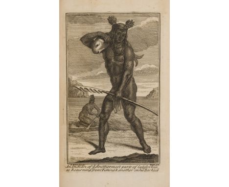
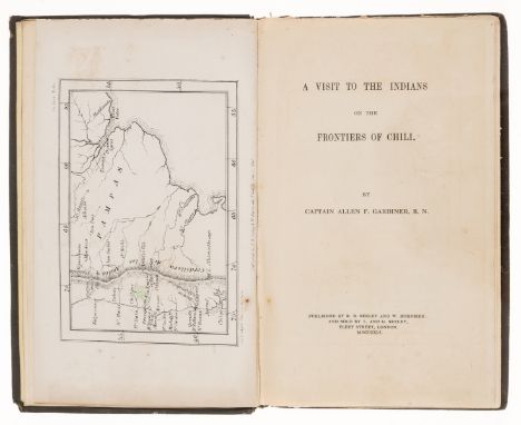
Burney (William) The Naval Heroes of Great Britain; or accounts of the lives and actions of the distinguished admirals and commanders who have contributed to confer on Great-Britain The Empire of the Ocean, Printed for Richard Phillips, London, 1806, together with A Brief inquiry into the present condition of the Navy of Great Britain and its resources, printed for S Highley, London, 1804, A Narrative of the Proceedings of His Majesty's Fleet under the command of Earl Howe, Printed by T.Burton, 1796, Tytler (Patrick Fraser) Life of James Crichton of Cluny, commonly call The Admiral Crichton, Printed by James Ballantyne and company, Edinburgh, 1819, Annals of Lloyds Shipping Register, 1884, Findlay (Alexander) A Hand-book for the navigation of the different channels of the Thames and Medway, a book of abstracts of the ships and vessels belonging to the British Navy between 1794 and 1820,Weynton (O) Elements of Navigation acquired during his education in the Royal Mathematical School of Christ's Hospital, De Lolme (J.L) The Constitution of England, or an account of the English Government, in which it is compared, both with the republican form of government, and the other monarchies in Europe, Printed for G.G.J and J Robinson, London, 1788, together with The Present State of Great Britain and Ireland, eighth edition, printed for J. Robertson, London, 1738, Rees (Rev.T) A Topographical and Historical Description of South Wales, printed for Sherwood, Neely and Jones, London, pull out map of South Wales inside front cover, circa 1815, Rogers (Rev. Charles) The Poetical Remains of King James The First of Scotland, one of one hundred and fifty copies, printed for the editor, 1873, Duhigg (Bartholemew Thomas) History of the King's Inns: or an account of the legal body in Ireland, printed by John Barlow, Bolton Street, 1806, Archer (Thomas) Our Sovereign Lady Queen Victoria, Her Life and Jubilee, volumes 1-4 (in two volumes) Blackie and Son, London, 1888, Whiston (William) The Genuine Works of Flavius Josephus The Jewish Historian, two volumes bound in one, Albion Press, London, Matthews (W.R) Saint Paul's Cathedral in Wartime 1939-1945, Hutchinson & Co, 1946, Morgan (Iwan) University College of Wales Aberystwyth, The College By The Sea, 1928, and a biographical memoir of Dr. John Douglas, bishop of Salisbury
-
109198 item(s)/page