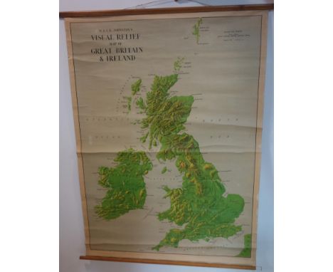
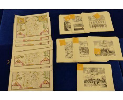
Map: Co. Wicklow, A m/ss "Map of Killalish in the Paris of Rivilly and County of Wicklow being the Joint property of Cornel Helden, Thomas Hume Esq., and Messrs Pendred, Surveyed in 1795 by James Grier; decorative cartouche reference key, hand cold. in outline, approx. 48cms x 68cms (19" x 27") in later frame. (1)
We found 109182 price guide item(s) matching your search
There are 109182 lots that match your search criteria. Subscribe now to get instant access to the full price guide service.
Click here to subscribe- List
- Grid
-
109182 item(s)/page
With Hand Coloured PlatesTravels: Mackenzie (Sir Geo. Steuart) Travels in the Island of Iceland, During the Summer of the Year 1810. 4to Edin. 1811. First Edn., lg. fold. map (hd. cold.) & 1 other map at end, & 15 other plts. include. (8 hd. cold. plts.) complete, engd. vignettes etc later strong hf. mor. (1)
Engraved Views: Bartlett (W.H.) & Allom (T.) Syria and The Holy Land Illustrated, 2 vols. in one 4to L. n.d. 3 engd. titles, 2 engd. maps, engd. port. & 111 engd. views, cont. hf. crimson mor. tooled gilt spine; Bartlett (W.H.) Walks about the City and Environs of Jerusalem, roy 8vo L. n.d. [1844] Engd. title, frontis & 9 plts. text illus., cloth; Beattie (Wm.) & Bartlett (W.H.) The Waldenses, or Protestant Valleys of Piedmont, Dauphiny, and The Ban de la Roche, 4to L. 1838. First Edn., port. frontis, engd. title, fold. map & 70 engd. plts. a.e.g., orig. gilt cloth. All good copies, with v. clean plates. (3)
Military interest: The Royal Artillery Commemoration Book 1939 - 1945, Lg. 4to L. 1950. Profusely illustrated, cloth & d.w.; Dobson (E.B.) History of the South Nottinghamshire Hussars, lg. 8vo York & Lond. 1948. Port. frontis, map in pocket at rere, orig. hf. calf, gilt; Stewart (Capt. P.F.) The History of the XII Royal Lancers (Prince of Wales's), 8vo L. 1950. Maps & illus., cloth & d.w.; Richards (Walter) Her Majesty's Army, 2 vols. 4to L. n.d. Numerous attractive cold. plts. by G.D. Giles, orig. red cloth, gilt decorated; & others of sim. interest. As a lot, w.a.f.(1)
1- Nouveau Dictionnaire Historique; ou histoire abrégée de tous les hommes ….Complete In 13 volumes. Caen, Le Roy, 1783(vols. 1-8); Lyon, 1791(vol. 9); & Lyon,1805(vols. 10-13). Bound in later marbled boards; rubbed and chipped; occasional foxing and browning; 2- Roy, J: Turenne, sa vie, les institutions militaires de son temps. Paris, Hurtrel, 1884. PP: xxii, 520; With colour map & plates. 4to. Original leather backed red boards and aeg; little rubbed; 3- Hegewisch, D. H: Histoire de l'empereur Charlemagne. Paris, Henrichs, 1805. PP: xxiv, 376. Leather backed boards; rubbed. (15)
Keddie, William: Highland Tours: 6 volumes bound in 1. All published in Glasgow by Maclure & Macdonald, no date, c1860’s. 1- Edinburgh & Glasgow to Stirling, Callander, lake of Menteith.. to Loch Lomond. Folding Map & 8 Plates; 83pp; 2- Glasgow to Oban. Folding Map & 8 Plates; 48pp; 3-Oban to Staffa & Iona. Folding Map & 7 Plates; 44pp; 4- Oban to Fort William & Banavie by Ballahulish & Glencoe. Folding Map & 6 Plates; 46pp; 5- Banavie to Inverness. Folding Map & 6 Plates; 50pp; & 6- Oban to the Isle of Skye. with a Map of Oban (Backed onto the title page), folding coloured Map of Skye, a sketch map of Cuchullin Hills in Skye, folding coloured map of the route.. & 7 Plates; 74pp. Half leather over marbled boards; rubbed; hinges cracked; occasional foxing.
Clutterbuck, Robert: The History and Antiquities of the County of Hertford; in 3 volumes. Nichols Son & Bentley, 1815. Large paper copy with Subscribers’ list. With a folding map plus 54 plates (3 coloured). Modern cloth; page 269 in vol.1 torn (without loss); vol.2 LACKING the following pages: 97-100; 241-244; 397-400; & 497-500 (16 pages in all). SOLD WITH ALL FAULTS. (3)
A small collection of three silver jockey cap caddy spoons, comprising: an Australian one by Davis and Son, Adelaide, a Victorian one by Hilliard and Thomason, Birmingham 1890, plus one William Neale Limited, Birmingham 1912, plus an Australian letter knife, modelled as a boomerang, by Proud, the centre applied with a map of Australia, length 11cm, approx. weight 1.7oz. (4)
A LATE 18TH / EARLY 19TH CENTURY EMBROIDERED OVAL SILK MAP OF ENGLAND AND WALES, with floral border and inset of classical figure holding title plaque, crowned compass towards bottom edge, indistinctly named and dated, silk in poor condition backed onto linen, oval approximately 51cm x 43cm, later mounted and framed (condition: silk has splits and losses in many areas, silk threads are also faded, text is largely intact)
FOUR ASSORTED ENGRAVED FRAMED MAPS, to include a William Kip coloured map of Lincolnshire, approximately 36cm x 38cm, taken from Camdens c.1610, a Richard Blome map of Lincolnshire, approximately 27cm x 33cm, c.1673, a Pieter Van Den Keere map of Lincolunshire, approximately 13cm x 9cm, c.1627 and a Thomas Moule map of Lincolnshire, approximately 20cm x 25.5cm, c.1836 (4)
New and Accurate Plan of the Cities of London and Westminster and Burgh of Southwark, with the new roads and new buildings to the present year 1786 from a late survey, to which is added many useful tables, to include inset views of St Paul's and Westminster Abbey, etc, hand coloured map, printed according to the Act of Parliament and sold by L. Marshall & Co, in Aldermary Church Yard, London, in a glazed and burrwood frame, 60 x 107cm
Large quantity of large reproduction maps & prints - Large map of stafford x 22, together with 7 different 18th century style different prints x 168 appx - Sandon Hall, Peatwood Hall, Stafford from Coton Hill, Norbury Manor & Shebden Poole, Okeover, Madeley Manor & Town Hall of Stafford (190 approx total)
Shropshire interest - A MAP OF THE LAND BELONGING TO THOMAS HUNT OF BOREATTON ESQ SITUATED IN THE TOWNSHIP OF BASCHURCH BOREATTON ND BIRCH IN THE COUNTY OF SALOP, two 18th century large rolled maps, hand drawn, coloured and annotated, signed to the bottom F. Higginson Fecit 1754, 142cm x 137cm, rolled into a toleware type tube - green painted with gilt name
-
109182 item(s)/page