

NO RESERVE Thomas (Edward) Oxford, 1903; Beautiful Wales, 1905 § Palmer (William T.) The English Lakes, map, 1905 § Mathew (Frank) Ireland, 1905 § Hope Moncrieff (A.R.) Surrey, 1906 § Home (Gordon) Yorkshire, folding map, 1908 § Mitton (G.E.) Buckinghamshire and Berkshire, folding map, 1920 § Goldsmith (Oliver) The Vicar of Wakefield, 1903, colour frontispieces & plates, first four publisher's catalogues, ink ownership inscriptions & stamps, seventh mentioned plate loose, second mentioned plate tipped-in, some spotting and browning to endpapers and edges, a few hinges pulling a little, original pictorial cloth, variously stamped in gilt and colours, rubbed and bumped, some marking and staining, a few spines faded; and another by Adam & Charles Black, 4to (9)
We found 109198 price guide item(s) matching your search
There are 109198 lots that match your search criteria. Subscribe now to get instant access to the full price guide service.
Click here to subscribe- List
- Grid
-
109198 item(s)/page

NO RESERVE Birds.- Moths.- Walpole-Bond (John) A History of Sussex Birds, 3 vol., first edition, 53 colour plates, occasional faint spotting, previous owner's ink inscription to front free endpapers, original brown cloth, slight bumping to extremities, 1938 § Kirby (W. V.) Butterflies and Moths of Europe, colour frontispiece and plates, captioned tissue-guards, occasional faint spotting, original decorative cloth, slight bumping to corners and extremities, 1903 § Slater (Henry H.) Manual of the Birds of Iceland, frontispiece, 2 plates, folding map, additional additional postcards and photograph pasted to blanks, occasional faint spotting, original cloth, a little rubbed, Edinburgh, 1901; and 11 others including a defective set of 'The Handbook of British Birds', 4to & 8vo (16)

Middle East.- Egypt.- Hart (Henry Chichester) Some Account of the Fauna and Flora of Sinai, Petra, and Wâdy 'Arabah, special edition numbered 28 of 500, folding colour map frontispiece, folding map and 10 lithographed plates, unopened, cracked hinges, special edition label pasted inside upper cover and signed by the Chairman of the Executive Committee, original cloth, gilt, slight bumping to corners and extremities, 4to, for the Committee of the Palestine Exploration Fund, 1891.
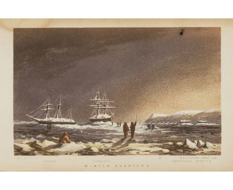
Polar.- Osborn (Lieut. Sherard) Stray Leaves from an Arctic Journal; or, Eighteen Months in ... search of Sir John Franklin's Expedition ..., first edition, chromolithographed frontispiece and 3 plates, illustrations, folding colour map, previous owner's ink signature and faint remnants of an ink name-stamp to frontispiece verso, faint damp-staining to 2 plates, manuscript notes on Osborn loosely inserted, modern half calf, modern slipcase, 8vo, 1852.
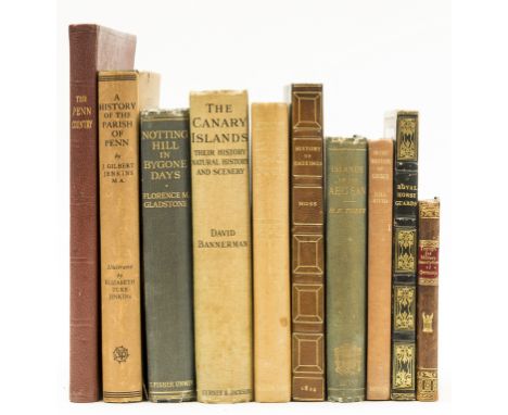
World.- Tozer (Rev. Henry Fanshawe) The Islands of the Aegean, first edition, folding colour map frontispiece, short tear, illustrations, occasional faint spotting, original cloth, rubbed, bumping to spine extremities, Oxford, 1890 § Moss (W. G.) The History and Antiquities of the Town and Port of Hastings, engraved frontispiece, list of subscriber's, folding map, facsimile and 17 plates, occasional faint spotting, bookplate, later half morocco, lightly browned spine, 1824 § Packe (Edmund) An Historical Record of the Royal Regiment of Horse Guards or Oxford Blues, lithograph frontispiece, hand-coloured title vignette and 7 plates, 6 hand-coloured, bookplate, contemporary straight-grain morocco, gilt, a little rubbed, 1834; and 7 others, similar, v.s. (10)
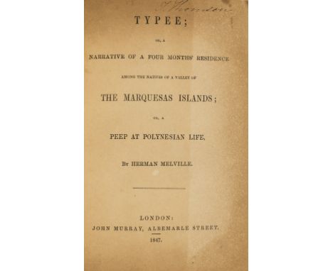
NO RESERVE Melville (Herman) Typee; or, a Narrative of a Four Months' Residence among the Natives of...the Marquesas Islands..., early issue, "Pomare" printed correctly line 1 p.19, lacking half-title, map and 16pp. catalogue at end, title with signature at head and browned, old calf-backed boards, slightly rubbed, 8vo, John Murray, 1847.⁂ The author's first book, first published by Murray in 1846, preceding the first American edition.
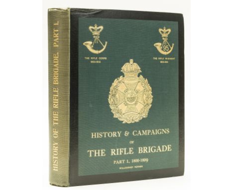
NO RESERVE Regimental history.- Verner (Col. Willoughby) History & Campaigns of the Rifle Brigade, 2 vol., first edition, engraved portrait frontispieces, plates, maps (including two folding contained in vol. II rear pocket), some browning to 1 folding map in rear pocket, both vol. occasional spotting, bookplates of John Martin Oakley, MC, Royal Artillery, 1914-1918, original pictorial cloth, gilt, vol.2 with dust-jacket, vol.1 spine little uniformly faded, rubbed, 4to, 1912-1919.

Beckford (William).- Rutter (John) Delineations of Fonthill and its Abbey, large paper copy, half-title, hand-coloured aquatint frontispiece, additional pictorial title and plate, 10 engraved plates including unnumbered plate of South West View (as usual), large folding lithographed plan hand-coloured in outline, wood-engraved vignettes, double-page genealogical table and list of subscribers at end, ex-Incorporated Law Society copy presented by the author with inscription on half-title and a few stamps, foxing to some plates, map torn at central fold, ink staining to margin of one leaf and edges, modern half calf, slightly rubbed and marked, [Abbey, Scenery 418], 4to (335 x 275mm.), Shaftesbury, by the Author, 1823.⁂ Account of Beckford's extraordinary Gothic mansion designed by James Wyatt. The construction was rushed and the huge tower collapsed several times. Beckford was forced to sell the property and most of its contents in 1822 due to financial constraints and the majority of the building was demolished in 1825.
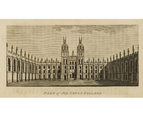
New Pocket Companion for Oxford (A)...to which are added Descriptions of...Blenheim, Ditchley, Heythrop , and Nuneham..., new edition, folding engraved map, 8 engraved plates, one loose and frayed at edges, original wrappers, rubbed and soiled, spine worn, preserved in modern board slip-case, Oxford, J.Cooke, 1809 § [Blore (Thomas)] A Guide to Burghley House, engraved frontispiece and plate, double-page pedigree, foxing, first few leaves loose, modern half calf preserving part of old spine, Stamford, Drakard, 1815 § Simond (Louis) Journal of a Tour and Residence in Great Britain...by a French Traveller, 2 vol., first English edition, 21 hand-tinted aquatint plates by J. Clark after the author, 2 folding tables, engraved illustrations in text, advertisements at end of vol.2, contemporary calf, a little worn, Edinburgh, George Ramsay, 1815 § [Patmore (P.G.)] British Galleries of Art, 2 vol. including an extra-illustrated volume of plates, modern morocco-backed cloth, 1824 § plates Evans (John) An Excursion to Windsor...including an account of Strawberry-Hill and of Hampton-Court, second edition, half-title, engraved frontispiece (offset on title), light staining, original cloth, uncut, damp-stained, 1827, most rubbed, 8vo et infra (6)
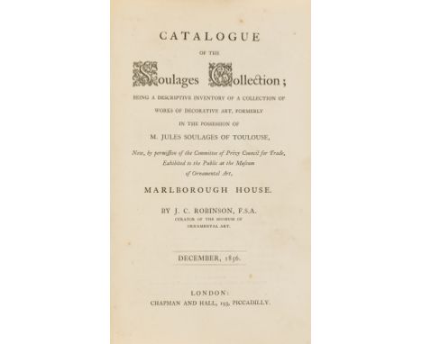
NO RESERVE Robinson (J.C.) Catalogue of the Soulages Collection...exhibited to the Public at...Marlborough House, original cloth, gilt, 1856 § Catalogue of the Art Treasures of the United Kingdom collected at Manchester in 1857, Advertisement dated 20th May 1857, half-title with map to verso, [1857] bound with Walk (A) through the Art-Treasures Exhibition at Manchester, under the guidance of Dr.Waagen...A Companion to the Official Guide, 1857 and Jerrold (W.Blanchard) Jerrold's Guide to the Exhibition..., folding plan, Manchester, 1857 and What to See and Where to See It! or the Operative's Guide to the Art Treasures Exhibition, Manchester 1857, plan at end, Manchester, 1857, together 4 works in 1 vol., modern half morocco, spine slightly faded; and another version of Catalogue of the Art Treasures of the United Kingdom collected at Manchester in 1857 marked "Provisional" (Advertisement dated 5th May 1857) and with an additional 100pp., 8vo (3)⁂ Jules Soulages (1803-57), a French lawyer, was a collector French and Italian Renaissance decorative art, mostly ceramics. On his death the collection was exhibited at Marlborough House and then formed the core of the Manchester Art Treasures Exhibition of 1857. After a lot of wrangling with the Treasury Henry Cole managed to purchase it for the nation for £11,000 in instalments from 1859-65.The Manchester exhibition was "the first opportunity for the public at large to inspect and to study the pictures, sculpture and ornamental art which private collectors had been amassing in the previous fifty years". The English as Collectors, p.312. It was inspired by the Great Exhibition of 1851, but this time on the theme of art rather than industry, and organised by Dr Waagen.


Five Maps of North American Interest:To include George Matthaus Suetter (1678-1757): Partie Orientale d la Nouvelle France ou du Canada, engraved by Lottner, circa 1750, H 56 x W 49 cm; Jacques Bellin, Map of Nova Scotia, 1757, H 21 x W 33 cm; a miniature example by John Gibson & two 19th century works, variously hand-coloured (5)


EPHEMERA, selection, inc. WWII cinema poster for Rosie L'Endiablee (Sweet Rosie O'Grady), with Betty Grable & Robert Young, with part map of Epsom area printed to reverse (1940), by Papeteries de Genval, Belgian tax stamp to front (12 x 16.5); cinema photos, inc. FoH stills, horror films (17), Brennende Betten, with Ian Dury (7, with 25 reproduction copies); sixteen 8 x 10 production stills from a Coulembier film (with Terry Thomas); When The Wind Blows (10+2, with ten reproduction copies), G to EX, 50+
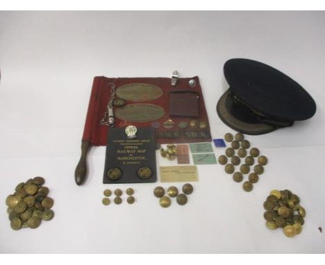
Railway related items to include a J Compton Sons & Webb Ltd, station masters cap with a gilt metal crest and embroidered badge, a railway clearing house official map of Manchester & District, a GWR notebook, ninety mainly GWR brass buttons, GWR cloth and enamelled metal badges, other metal badges, three tickets, two whistles, an audit office ticket and a red flag on a turned wooden handle


A mid-18th century map of the Caribbean Islands entitled 'A New and Accurate Map of Terra Firma and the Caribbe Islands Drawn from the Most Approved Modern Maps and Charts' c1747 by Emmanuel Bowen, with hand-coloured land and sea borders and decorative cartouche to the top right-hand corner, 36 x 42.5cm, in Hogarth frame and glazed. CONDITION REPORT No obvious signs of significant damage or repair.


Samuel Dunn; a complete map of the Holy-Land, Adapted to the Old & New Testament, Part 1st, engraving, printed in London for Robt Sayer, 1774, 35 x 50cm, unframed, together with two other engraved maps by Samuel Dunn: The Complete map of the Holy Land Part II and a Map of Barbary, 35 x 50cm, and 33 x 46cm, both unframed (3).Illustrated


German Third Reich non-portable award for Outstanding Achievements in the Southeast Command of the Luftwaffe. A good scarce heavy shield shaped uniface example. It depicts in relies, a Luftwaffe eagle and swastika in flight superimposed on map of the Command surmounted by “FÜR BESONDERE LEISTUNGEN IM SÜDOSTRAUM” with “DER KOMMANDIERENDE GENERAL UND BEFEHLSHABER DES LW.-KDO. SÜDOST” and facsimile of the General Der Flieger. Housed in black fitted case lined with blue flock card and white satin inner lid bearing gold embossed eagle; it falls forward to reveal the card award document for “Oberleutnant Georg Nied, 9.November 1944”. Shield shows signs of metal under the oxidised finish. Blue card with slight tears and usage. GCNied was promoted Oberleutnant 01.12.1941. Transferred to LN-flugsicherungs-Rgt Reich 10.01.1945. The Command covered Greece and the Balkans

German Third Reich. WW2 Kriegsmarine 3rd Flotilla E Boat plaque / non portable award. A pristine aluminium example. Shield surmounted by an eagle and swastika. The plaque is painted with a palm tree superimposed on a map of Europe and the Mediterranean. ‘3’ in top left corner, Iron Cross at the bottom; an E Boat forges its way across the centre. VGCAwarded by the commander of the 3rd Flotilla to the men who served with the flotilla during the campaign in the Mediterranean.

WW2 Royal Marine Commando attributed BC41 Fighting knife. A scarce and unusual example attributed to Sergeant Hide of 4 Troop 1 Commando. The steel knuckle grip moulded with the letters “BC41”. Bowie style blade, riveted through to the grip, tang again with stampings. Housed in original stitched and riveted leather scabbard, the reverse of this with pencil name “Hide”. The very tip of the blade is absent and the knife has been Chromium plated. ... Accompanied by an April 1945 Map of Penang Island pencil details “Sgt Hide 4 Troop 1 Commando”. Royal Marine Commando WW2 pattern green beret heavy age wear ... 2x Silk Escape Maps of Sumatra. ... etc.See “British & Commonwealth Military Knives” by Ron Flook Page 35.


John Speed (1552-1629). 'OXFORDSHIRE', a hand-coloured engraved map, titled 'OXFORDSHIRE described. with ye Citie and the Armes of the Colledges of ty famous University. Ao. 1605.', with an inset plan of Oxford, English text to verso, 39.8 x 53.2cm, in a later glazed double-sided ebonised and gilt frame.

John Speed (1552-1629). 'CAMBRIDGESHIRE', a hand-coloured engraved map, titled 'CAMBRIDGESHIRE described with the devision of the hundreds, the Townes situation, with the Armes of the Colleges of that famous Universiti.', with an inset plan of Cambridge, dated '1610', English text to verso, 41.5 x 53.7cm, in a later glazed double-sided ebonised and gilt frame.

John Speed (1552-1629). 'HUNTINGDONSHIRE', a hand-coloured engraved map, titled 'HUNTINGTON BOTH SHIRE AND SHIRE TOWNE WITH THE ANCIENT CITIE ELY DESCRIBED.', with an inset plan of Huntington, English text to verso, dated '1610', 40 x 52cm, in a later glazed double-sided ebonised and gilt frame.

John Speed (1552-1629). 'WARWICKSHIRE', a hand-coloured engraved map, titled 'THE COUNTI OF WARWICK THE SHIRE TOWNE AND CITIE OF COVENTRE described', with two inset plans of Warwick and Coventry, dated '1610', English text to verso, 40.5 x 53cm, in a later glazed double-sided ebonised and gilt frame.

John Speed (1552-1629). 'SUFFOLK', a hand-coloured engraved map, titled 'SUFFOLKE described and divided into Hundreds, The situation of the fayre towne IPSWICH shewed, with the ARMES of the most noble families that have bene either Dukes or Earles both of that Countie as also of Clare', with an inset plan of Ipswich, dated '1610', English text to verso, 40.2 x 52.6cm, in a later glazed double-sided ebonised and gilt frame.


Two early Victorian embossed relief maps of the Middle East by Richard Palmer, paper and papier-mâché on wooden board, published by Dobbs, Bailey & Co.134 FLEET ST & 13 SOHO SQUARE LONDON', comprising: 'RELIEVO MAP OF ARABIA PETRAEA AND IDUMAEA Illustrating the Prophetical Scriptures, the Journeyings of the Israelites & c.' and 'RELIEVO MAP OF PALESTINE OF THE HOLY LAND Illustrating the Sacred Scriptures AND THE Researches of Modern Travellers', 55.5 x 44.6cm, each in a stained pine frame. (2)


The Silver Map of Great Britain with the boundary lines and Coats of Arms of the Historic Counties, London 1978, a limited edition authorised and issued by the council for the protection of rural England, with silver gilt decoration and crests, within frame and with certificate of authenticity, limited edition No. 807/3000 68.5cm x 50cm


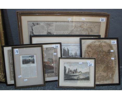
Group of assorted original maps and topographical engravings to include; Thomas Kitchin, 'Cardiganshire' and 'Pembrokeshire', uncoloured and restrike print after Samuel and Nathaniel Buck 'Haverfordwest castle', 18th Century engraving castle and bridge Haverfordwest, needlepoint map of Britain, 18th Century engraving Haverfordwest priory in Radnorshire and a text on Haverfordwest. (7)(B.P. 24% incl. VAT)


JOHN SPEED (1552-1629) 'Herefordshire', handcoloured map with a plan of the city of Hereford and a vignette of a battle scene, 37.5cmx 50cm; Charles Smith (fl. 1800-1852) 'A New Map of the County of Dorset' divided into hundreds, dated January 6th 1801, handcoloured map, 44.5cm x 50cm (to margin); John and Charles Walker 'Northamptonshire' published by Longman, Rees, Orme, Brown & Co (3)

-
109198 item(s)/page