We found 109182 price guide item(s) matching your search
There are 109182 lots that match your search criteria. Subscribe now to get instant access to the full price guide service.
Click here to subscribe- List
- Grid
-
109182 item(s)/page


Lot 910
30+ geological books and periodicals. Including; Siluria, The History of the Oldest Fossiliferous Rocks and Their Foundations by Murchison (pub. Murray 1859). Geological Surveys of; Boscastle & Holsworthy, Okehampton, Haslemere, etc (pub. HM Stationery Office). 20x Palaeontographical Soc. Monographs. 20+ geological maps of England & Wales. A very large wall hanging geological map of South Africa. QGC-VGC. £40-60


Lot 58
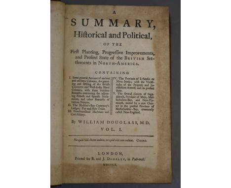
Douglass, William - A Summary of Historical and Political, of the First Planning ... of the British Settlements in North-America, 2 vols, 8vo, contemporary calf, lacking map, joints weak, bookplates of Lady Juliana Penn, R & J Dodswell, London 1760Note: Lady Juliana Penn (1729-1801) was the English wife of Thomas Penn, and she assisted him in the administration of the Colony of Pennsylvania in his later years. She corresponded with John Adams and other leaders of the early United States
![[Burke, Edmund, et al] - An Account of European Settlements in America, 2 vols, 6th edition, 8vo, calf, with folding map fron](https://cdn.globalauctionplatform.com/b3e2a407-e79a-49fa-91aa-ab09008bf9ac/3ba5ceaf-6c18-4ae5-a91e-ab0c0104e9b5/468x382.jpg)


Lot 249
Reproduction map of Italy after Giovanni Antonio Rizzi-Zannoni, made to scale of approx. 1:248,000, published by Valerio Pasquali nell' (1806) 96.5cm x 127cm and another 'Diversi Globi Terr-aquei' after Matthaeus Seutter (1678-1757) 43.5cm x 45cm both with original boxes and covers Click here for further images, condition, auction times & delivery costs

Lot 1027
19th century maps and engravings including 'The East Riding of Yorkshire' by J. Ellis, 'Scarborough' Road map, Blenheim Terrace, Scarborough, 'Northumberland', 'Derbyshire', 'Durham', Norfolk' max 27cm x 21cm (14) Condition Report Click here for further images, condition, auction times & delivery costs


Lot 640
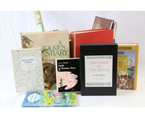
A collection of 15 hardback books including 9 written by or relating to J R R Tolkien featuring a boxed The Lord Of The Rings De Luxe Edition, The Hobbit (sealed), The Adventures Of Tom Bombadil, Farmer Giles Of Ham along with an illustrated Karma Sutra and Little Birds. Also included is a map relating to Bilbos travels

Lot 137
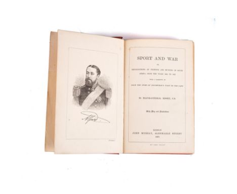
Bisset, Major General, C. B. SPORT AND WAR, OR RECOLLECTIONS OF FIGHTING AND HUNTING IN SOUTH AFRICA FROM THE YEARS 1834 TO 1867 London: John Murray 8vo, xviii + 268pp. Re-cased in original cloth binding. All edges gilt with gilt lettering on spine. With frontispiece, 14 illustrations and fold-out map at rear of book. Missing section of half title page has been repaired. Light rubbing and small stains to boards. Edgewear with chipping to top of spine. Crack to gutter between last page and map at back of book.
Lot 203
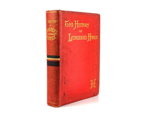
Pearse, Henry H. S. THE HISTORY OF LUMSDEN'S HORSE: A COMPLETE RECORD OF THE CORPS FROM ITS FORMATION TO DISBANDMENT London: Longman's, Green, and Co., 1903 8vo, xii + 506pp. Original cloth binding with gilt lettering to front board and spine, and top edge gilt. With 40 plates, 37 illustrations and fold-out map. Ex-library copy with some stamps throughout, no text or illustrations affected. Some rubbing to the boards and spine. Light soiling to front board. Small chip to front pastedown. Light offsetting to tissue paper facing frontispiece. Previous owner's signature to verso of title page in pencil. Errata slip pasted in gutter facing first page. A few pages are uncut. Small stains to fore edge of textblock.


Lot 669A
WW2 RAF Blouse Blue Grey - Air Crew. Size 2. Maker marked "H Leaning & Co Ltd" and dated Nov 1942. Complete with all buttons and original sewn embroidered insignia. Along with two patriotic hankies for the 1935 Jubilee and the Coronation 1937 and a collection of WW2 ARP paperwork, wartime cook books, map, ID card, petrol coupon book, etc.


Lot 678
WW2 Trench Art PoW work cigarette case made from aircraft alluminium engraved and cut out Mosque to front and map of Africa to reverse. Details picked out in colour. Inside features a beach scene and a lady. Size125mm x 80mm. Comes with a pocket size "Evening Prayer collects and Psalms" book.

Lot 684
WW2 British RAF Silk Escape Maps and F1 Marked Waterproof Money/Map Pouch. Contains six different maps. Map codes are: K3, 9Ca, 9J3, K2, J3 and S2. These examples are new to the market and were originally issued to an RAF Spitfire Pilot who fought throughout the war including the Battle of Britain, Seige of Malta etc.

Lot 702
WW2 British Army Officers pre war private purchase map case with leather sling. Snap fasteners are marked "Derby" and "Made in Germany". Named to "Capt Thornhill 293003". Capt Thornhill served in the Far East as a map maker. Included in the case are several maps including one hand drawn map of enemy positions and a large captured Imperial Japanese map showing air routes. Also included is a large group photo of British and Indian troops.

Lot 751
WW2 Third Reich & British Maps including four large town maps of Berlin, Stuttgart, Essen -Manheim, Michelin Map of Germany 1944 printed on back of German military map, Vienna, Hamburg & Berlin, SE England, Europe, Breslau, Chatham & Maidstone. 14 maps in total. War souvenirs of a British Soldier who served with the Intel Platoon, Coldstream Guards, Guards Armoured Div in 1944-1945 in Belgium, Holland, Germany inc Berlin.


Lot 1075
Printed silk WWII escape map scarf, sheet M & L French Indo China; sweetheart cards and souvenir embroidered handkerchiefs, printed cotton map of Europe, silk handkerchiefs of Allied flags, two CC41 cotton hankies and ration book, assorted 20th century handkerchiefs in silk, cotton and polyester, printed and embroidered, souvenir, royalty, nursery, mourning etc and album of clear plastic postcard pages, album containing stamps etc


Lot 131
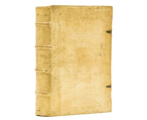
Strabo. De situ orbis libri XVII, collation: α4 AA-BB a-z A-Z aA-vV6 xX4, complete with blank leaf α4 and final leaf blank except for printer's woodcut device on verso, woodcut initials, small map on vV1 verso, double column Greek and Latin text, some browning, mostly light, some early ink annotations, small leather book-label of Haven O'More, contemporary blind-stamped pigskin over wooden boards, metal clasps intact, folio (310 x 204mm.), Basel, Henricus Petrus, 1549.⁂ A very impressive copy in a stunning contemporary binding of Strabo's geography, the only extant work covering the whole world known at the beginning of the Common Era.Literature: Adams S1905Provenance: contemporary ink inscription dated 1566 smudged so largely illegible.
Lot 173
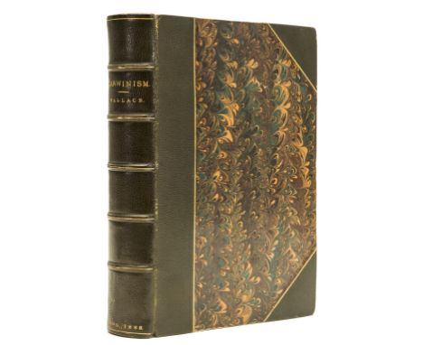
Wallace (Alfred Russell) Darwinism: An Exposition of the Theory of Natural Selection, first edition, half-title, portrait frontispiece, folding map, illustrations and diagrams, armorial bookplate dated 1886 and smal leather book-label of Haven O'More, contemporary green half morocco over marbled boards by C.Cross ('binder to the Queen'), t.e.g., 8vo, 1889.
Lot 233
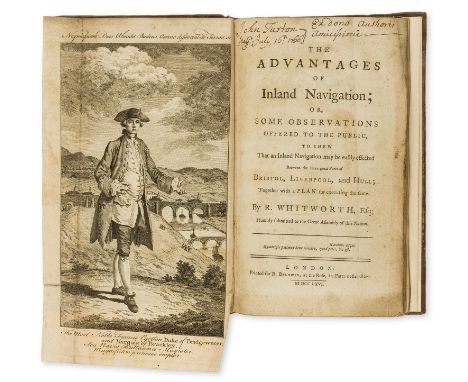
Canals.- Whitworth (Richard) The Advantages of Inland Navigation...to shew that an Inland Navigation may be easily effected between the three great Ports of Bristol, Liverpool, and Hull, first edition, presentation copy from the author to John Turton with Turton's ink inscription at head of title (and others to front free endpaper), folding engraved portrait of the Duke of Bridgewater, 4 folding tables of furnaces & forges, manufactures & merchandizes, expenses, & landowners, large folding engraved map with routes supplied in red or green, browned and soiled, slight worming to map, bookplate of John Turton of the Inner Temple, contemporary calf, rubbed, rebacked preserving old morocco label, corners repaired, worming to lower corners and edges, 8vo, for R.Baldwin, 1766.⁂ Rare work by the High Sheriff of Staffordshire 1758/9 and MP for Stafford from 1768 to 1780.

Lot 266
Winlove (Solomon) A Collection of the Most Approved Entertaining Stories, new edition, engraved frontispiece and 5 plates, woodcut illustrations, 3pp. advertisements, lacking rear endpaper, ink name to head of title and pastedown, original floral boards, loss to spine, rubbed, [Roscoe J381(6)], F. Newbery, [c.1795] § [Kilner (Dorothy)] The Life and Perambulation of a Mouse, 2 vol. in 1, frontispiece to vol. 1 only, engraved titles, woodcut illustrations, closely trimmed at head, affecting vol. 2 headlines, contemporary calf-backed boards, rubbed, [Osborne p.273], John Marshall, [c.1790] § [Longueville (Peter)] The English Hermit, or the Adventures of Philip Quarll, wood-engraved frontispiece, map, and 20 illustrations, 6 pages advertisements at end, original boards with paper label to upper cover, spine worn with loss, Baldwin, Cradock, and Joy, 1816; and 5 others, Newbery and Marshall, 12mo (8)⁂ All scarce, the first including popular fairy stories Jack Horner, Cinderella and Little Red Riding Hood.

Lot 268
Game.- Darton (W. & T., publisher) Walker's Tour through England and Wales, a New Pastime, hand-coloured engraved map with columns of letterpress directions to either side, dissected and mounted on linen, c.530 x 650mm., excellent bright colouring, folding into original speckled board slip-case with printed orange title to upper cover and publisher's label to lower, rubbed, wear to corners, [Whiteouse p.13], 8vo, W. & T.Darton, 1809 [water-marked 1819].

Lot 271
Game.- Jefferys (Thomas) The Royal Geographical Pastime; exhibiting a Complete Tour Round the World, in which are delineated the North East and North West Passages into the South Sea..., hand-coloured engraved map with columns of letterpress explanation and directions to either side, dissected and mounted on linen, c.510 x 710mm., a little soiled (mostly light but heavier to edge of some sheets from folding), folding into original marbled board slip-case with engraved label to upper cover, rubbed, worn at lower edge, [Not in Whitehouse], 8vo, Thomas Jefferys, [Printed & Sold by Wm.Faden], 1770.⁂ Very rare early board game with 103 numbered locations, each of which is briefly described in the letterpress sections with an occasional instruction to the "traveller" to stay a turn to see or experience the sights. At no.58, the North-West passage, "the traveller, who has been so fortunate to find his way through this Passage, shall be removed to Cape Horn, No.79". At no. 60 California "the inhabitants having no houses, dwell in arbours in summer, and creep into caves in the winter". Library Hub and WorldCat list one copy only (British Library). The earliest game with a tour of the world listed by Whitehouse is Wallis's 'New Geographical Pastime' of 1796.

Lot 273
Game.- Wallis (John, publisher) Wallis's Tour of Europe. A New Geographical Pastime, hand-coloured engraved sheet, dissected and mounted on linen, c.480 x 510mm., soiled, some spotting, with the booklet of rules, foxed, original wrappers, rubbed and stained, together in original board slip-case with hand-coloured engraved pictorial label mounted on upper cover, rather worn and stained, John Wallis, 1811 § Darton (W. & T., publisher) Walker's Tour through England and Wales, a New Pastime, hand-coloured engraved map with columns of letterpress directions to either side, dissected and mounted on linen, c.540 x 655mm., a little spotted and browned, folding into original speckled board slip-case with printed yellow title to upper cover and publisher's label to lower, a little worn and chipped, W. & T.Darton, 1809, [Whitehouse p.9 & 13], 8vo (2)
-
109182 item(s)/page