Auktionshaus Wendl
Lot 3356
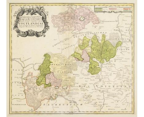
HOMANN, Johann Baptist (Erben) Landkarte des VogtlandesKolorierter Kupferstich. Passepartoutausschnitt: 49 x 56 cm. Gerahmt & hinter Glas : 75,5 x 101 cm. Detailreiche Landkarte der Herrschaftsgebiete Gera, Schleiz, Lobenstein, Burg, Saalburg, Greiz und Plauen, mit Titelkartusche "Delineatio Geographica Territorii Celsissimorum S.R.I. Comitum Ruthenorum de Plauen utriusque Lineae Senioris nempe ac Iunioris, partem Vogtlandiae olim ac hodia sic dictae constituentis.", ca. 1740. Bugfalte, etwas stockfleckig. Johann Baptist Homann (1664 - 1724), deutscher Kartograf, Kupferstecher, Verleger und Globenhersteller; bedeutendster deutscher Herausgeber von Atlanten und Landkarten im 18. Jahrhundert. Aufrufzeit 24. | Feb 2024 | voraussichtlich 10:03 Uhr (CET) HOMANN, Johann Baptist (heirs) Map of the VogtlandColored copperplate engraving. Passepartout cut-out: 49 x 56 cm. Framed & behind glass : 75.5 x 101 cm. Detailed map of the dominions of Gera, Schleiz, Lobenstein, Burg, Saalburg, Greiz and Plauen, with title cartouche "Delineatio Geographica Territorii Celsissimorum S.R.I. Comitum Ruthenorum de Plauen utriusque Lineae Senioris nempe ac Iunioris, partem Vogtlandiae olim ac hodia sic dictae constituentis.", ca. 1740. Fold, some foxing. Johann Baptist Homann (1664 - 1724), German cartographer, engraver, publisher and globe maker; the most important German publisher of atlases and maps in the 18th century. Aufrufzeit 24. | Feb 2024 | probably 10:03 am (CET)*This is an automatically generated translation from German by deepl.com and only to be seen as an aid - not a legally binding declaration of lot properties. Please note that we can only guarantee for the correctness of description and condition as provided by the German description.


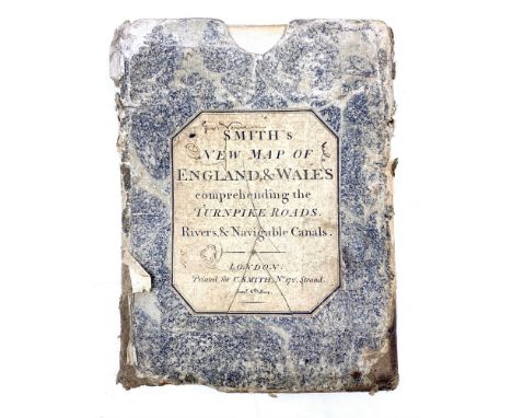


![Smith ([Charles]) A NEW MAP OF ENGLAND AND WALES linen-backed folding segmented map, 116 x 95cm, slip case, 1811](https://cdn.globalauctionplatform.com/7e76549f-d9dd-4800-857d-b11700f33c41/b269949e-f0c9-4425-afb6-b11700f7b6c6/468x382.jpg)


![Bacon (G[eorge] W[ashington]) BACON'S NEW CHART OF THE WORLD - MERCATOR'S PROJECTION linen-backed segmented map 96 x 120cm, p](https://cdn.globalauctionplatform.com/7e76549f-d9dd-4800-857d-b11700f33c41/1d385a2b-b6c5-44a0-88c6-b11700f7821a/468x382.jpg)