We found 109182 price guide item(s) matching your search

Refine your search

Year

Filter by Price Range
  • List
  • Grid
  • 109182 item(s)
    /page

Lot 310

British Isles.- Blaeu (Johannes) Insulae Albion et Hibernia, Ptolemeaic map of the British Isles, engraving with hand-colouring, platemark 380 x 440 mm (15 x 17 1/4 in), wide margins, central vertical fold with splitting repaired verso, marginal nicks and tears, some browning, off-setting, and surface dirt, unframed, [circa 1645]; together with Jan Janssons' Imperium Caroli Magni, engraving with outline hand-colouring, 370 x 520 mm (14 1/2 x 20 1/2 in), minor surface dirt, unframed, [circa 1650] (2)

Lot 291

West Indies.- Various cartographers (18th and 19th century) Collection of over 40 maps of the West Indies, including Barbados, St Christophe, Grenada and others, with Bellin's 'Carte de l'Isle de la Barbade', Edwards' 'Map of the Isalnd of Dominica for the History of the West Indies', Louis Le Rouge's 'La Barbade, une des antilles aux anglois', and others similar, engravings, some hand-colouring, various sizes, all loose, unframed, mainly 18th and 19th century (c.40)

Lot 302

World.- Gray (Hugh) [Letters from] Canada...exhibiting also the commercial importance of Nova-Scotia, New Brunswick, & Cape Breton, first edition, folding engraved map with routes supplied by hand in red and yellow (with short tear), 3 folding tables, portion cut away from head of title with loss of "Letters from", foxed, engraved bookplate of Genl. Hon.ble Robert Taylor with his note in pencil "Presented to me by my dear friend the Countess of Ormonde wife to Walter Earl & afterwards Marquess R.T." to front free endpaper, contemporary diced russia with elaborate gilt border, spine gilt in compartments, joints neatly repaired, [Sabin 28393; Goldsmiths' 19842; Kress B.5510], 1809 § Huish (Robert) The Travels of Richard and John Lander, into the Interior of Africa..., first edition, frontispiece, engraved title, map, and 5 plates (only of 6), lightly foxed, upper hinge broken, contemporary diced calf, rebacked, lightly rubbed, 1835, 8vo (2)

Lot 292

West Indies.- Various cartographers (18th and 19th century) Collection of 28 maps of Jamaica and Hispaniola, including Bertius' 'Hispaniola', Manesson Mallet's 'I. d'Hispaniola et P. Rico', Cary's 'A New Map of the West India Isles', Ruscelli's Isola Spagnola Nova', and others similar, engravings, some hand-colouring, various sizes, all loose, unframed, mainly 18th and 19th century (28)

Lot 288

West Indies.- Slavery.- Turnbull (David) Travels in the West. Cuba; with Notices of Porto Rico, and the Slave Trade, engraved map frontispiece, scattered faint spotting, contemporary half-calf, rebacked retaining original backstrip, slight white staining to backstrip, 8vo, 1840.

Lot 267

NO RESERVE Voyages.- [Johnson (James)] An Account of a Voyage to India, China, &c, first edition, folding engraved map frontispiece, short tear with neat old repair verso, occasional faint spotting, modern half-calf, 8vo, 1806.

Lot 108

NO RESERVE Europe.- Napoleonic Wars.- Kincaid (Captain J.) Adventures in the Rifle Brigade, in the Peninsula, France, and the Netherlands from 1809 to 1815, first edition, without half-title, publisher's advertisements at end, scattered spotting, new endpapers, contemporary half-calf, rebacked retaining original backstrip, a little rubbed, 1830 § Kennedy (General Sir James Shaw) Notes on the Battle of Waterloo, previous owner's ink notes to title, folding map, tears and splits with neat tape repairs verso, corrections inserted by a later hand, modern half-calf, 1865; and 2 others similar, 8vo & 12mo (4).

Lot 212

Polar.- Kane (Elisha Kent) Arctic Explorations: The Second Grinnell Expedition in search of Sir John Franklin, 2 vol., first edition, engraved portrait frontispieces, additional engraved titles, 18 plates, 3 maps, of which 2 folding, illustrations, spotting, bookplate, vol. 1 with advertisements at beginning, previous owner's ink signature , original cloth, slight bumping to corners and extremities, Philadelphia, 1856 § Huish (Robert) The Last Voyage of Capt. Sir John Ross, Knt. R.N. to the Arctic Regions ..., engraved frontispiece, additional engraved title, 5 plates only (of 6), missing plate provided in facsimile, one engraved map, scattered spotting and staining, modern crushed-morocco backed boards, 1835; and another on Franklin, 8vo (4)

Lot 272

Voyages.- Slavery.- Colomb (Capt. Philip Howard) Slave-Catching in the Indian Ocean, first edition, wood engraved frontispiece and 7 plates, 1 folding map, modern half-calf, gilt, 8vo, 1873.

Lot 38

Africa.- Ethiopia.- Portal (Sir Gerald) My Mission to Abyssinia, first edition, frontispiece, plates, folding map at end, short splits to folds with neat tape repairs verso, scattered spotting, cracked hinges, previous owner's ink signature, original cloth, rubbing to corners and extremities, 1892 Beke (Charles T.) The British Captives in Abyssinia, second edition, lithograph frontispiece, folding map, browned with chipping to edges, illustrations, ex-Kew College Library & ex New College Oxford with usual label and ink-stamps, original cloth, rebacked retaining original backstrip, a little rubbed, 1867 § Bent (J. Theodore) The Sacred City of the Ethiopians, half-title, frontispiece, plates (some folding), illustrations, folding map, scattered spotting, publisher's advertisements at end, original cloth, a little rubbed, slight bumping to corners and extremities, 1896; and others on Abyssinia, 8vo (7)

Lot 317

Essex.- Greenwood (C. & J.) Map of the County of Essex, from an Actual Survey made in the Year 1824, large county map with decorative title in the upper right and vignette view of Audley End House in the lower right corner, engraved map with original hand-colouring, sheet approx. 1325 x 1575 mm (52 1/4 x 62 in), dissected and mounted on linen, edged in green silk, folding with green endpanels, some minor spotting and slight browning, folding into calf book-style slipcase, spine with red morocco label gilt-tooled and lettered, scuffed and worn, 4to, Greenwood, Pringle & Co., 1825; together with a finely printed impression of Thomas Sparrow's ... Actual Survey of the Antient Town and Borough of Colchester in the County of Essex, engraved plan with numerous vignettes, sheet 590 x 750 mm (23 1/4 x 29 1/2 in), central vertical fold, marginal repaired nicks and tears, minor surface dirt, unframed, 1767 (2)

Lot 106

Europe.- Kennett (Basil) Romæ Antiquæ Notitia: or, the Antiquities of Rome, engraved portrait frontispiece, trimmed and laid down, 12 engraved plates (6 folding), of which 1 detached and 1 with tear and old repair verso, 1 folding engraved map, title in red and black, previous owner's ink inscription to frontispiece verso and title, spotting and staining, modern half-calf, Dublin, 1724 § Tyndale (Walter) An Artists in Italy, one of 250 copies signed by artist, tipped-in colour frontispiece, plates, captioned tissue-guards, original decorative vellum, lacking ties, light spotting, n.d.; and others Europe, v.s. (13).

Lot 173

Middle East.- Hammé (Lievin de) & Wilfrid C. Robinson. The Pilgrim's Handbook to Jerusalem and its Neighbourhood, first English edition, half-title, 3 folding maps, original cloth, fractional bumping to corners and extremities, 1890 § Al-Haram Al-Ibrihimi Al-Khalil. A Brief Guide, 7 plates, original paper wrappers, staple binding, upper corner of lower wrapper removed along perforations (used as ticket entry), light sunning to edges, [Hebron], Industrial Islamic Orphanage Printing Press, 1962 § Sykes (Rev. H.) A Soldier's Handbook. Palestine and Jersualem, printed map endpapers, original cloth, slight bumping to corners and extremities, [1917] § Whitty (John Irwine) Palestine Exploration: Further Revelations!, first edition, map frontispiece, scattered faint spotting, original printed wrappers, rust marks from staple binding, rubbed, London & Dublin, 1897; and others similar, 8vo & 12mo (12)

Lot 20

Middle East.- Harris (Walter B.) From Batum to Baghdad, first edition, half-title, frontispiece, plates and illustrations, 2 maps (1 folding), scattered faint spotting, bookplate, original cloth, bumping to corners and extremities, 1896 § Newman (John P.) The Thrones and Palaces of Babylon and Nineveh, frontispiece, double-page map, illustrations, bookplate, advertisements at end, original pictorial cloth, a little rubbed, slight bumping to corners and extremities, New York, 1876 § Osborn (Robert Durie) Islam under the Khalifs of Baghdad, ex-New College Library with usual labels and ink-stamps, scattered spotting, bookplate, original cloth, slight bumping to corners and extremities, 1878; and others Middle East, 8vo (26)

Lot 19

NO RESERVE Persia.- Wilson (Lieutenant A. T.) Military Report on S. W. Persia. Luristan., vol. 5 (of 5) only, linen-backed folding map at end, typescript, faint spotting to titles, later card wrappers, housed in modern cloth-backed chemise, 4to, Simla, [c.1911].

Lot 46

Africa.- Middle East.- Gadsby (John) My Wanderings being Travels in the East in 1846-47, 1850-51, 1852-53, 2 vol., illustrations, folding hand-coloured map, short tear at gutter with neat repair, vol. 1 with previous owner's ink inscription, vol. 2 with ?author's ink inscription to front pastedown, scattered faint spotting, contemporary half-calf, a little rubbed, slight bumping to corners and extremities, 1859-[60] § Olufsen (O.) Through the Unknown Pamirs, half-title, plates (2 folding), folding map at end, faint spotting to first few leaves, original cloth, sunned spine, slight bumping to corners and extremities, 1904 § Myers (Arthur B. R.) Life with the Hamran Arabs, frontispiece, plates, publisher's advertisements at end, ex-library with ink-stamps to title, original pictorial cloth, gilt, slight bumping to corners and extremities, 1876; and others similar, 8vo (12).

Lot 209

NO RESERVE Polar.- Bernacchi (L.C.) The Polar Book, first edition, folding map at end, short tear at gutter with tape repair verso, spotting, original pictorial wrappers, faint spotting, a little rubbed, slight bumping to corners and extremities, 8vo, [1930].

Lot 51

Africa.- Park (Mungo) Travels in the Interior Districts of Africa, second edition, portrait frontispiece, 5 engraved plates, 3 folding engraved maps, list of subscribers, one with short tear at gutter, scattered spotting, occasional faint off-setting, 1799; The Journal of a Mission to the Interior of Africa, in the Year 1805, first edition, illustrations, one folding map, occasional off-setting, scattered faint spotting, 1815, bookplate of Lord Belper, uniform contemporary tree calf, a little rubbed, bumping to corners and extremities, 4to, (2).

Lot 182

Middle East.- Saudi Arabia.- Saudi Arabia, 4 plates, 1 map, illustrations, original printed stiff paper wrappers, plastic ring binding, light spotting and staining to covers, a little rubbed, [Riyadh], [Lockheed Corporation], 1973 § Trans-Arabian Pipe Line, illustrations, California, 1957-8; and 3 other scarce Aramco pamphlets on the Saudi Arabian oil industry, folio (5).⁂ The first is a rare survivor. Originally printed as a guide for potential employees of the Lockheed Corporation, describing life in Jeddah. The report talks about food, transport, local customs, education, climate, history etc.

Lot 313

East Midlands.- King (William) A Map of a Tract of Country Surrounding Belvoir Castle including extensive Districts of the Counties of Leicester, Lincoln & Nottingham; and the whole of the County of Rutland, engraved map with outline hand-colouring, sheet 1150 x 1460 mm (45 1/4 x 57 1/2 in), dissected and mounted on linen, some offsetting and minor surface dirt, folding with publisher's printed label to upper panel into contemporary marbled slipcase, splitting and worn, manuscript label to upper cover, 4to, William Faden, 1806

Lot 166

Middle East.- Bartholomew (John) and others. Collection of nine maps of Arabia and the Middle East, including Jerusalem, including a military map of South Iran, showing part of the Arabian Peninsula including Qatar, two Geological surveys of parts of the Kingdom of Saudi Arabia, one published by the U.S. Geological Survey, 1958, the other by the Kingdom, 1978, Barhtolomew's Quarter-Inch Map of Palestine, folding, a large Plan of Jerusalem in the time of our Lord by Lt. Col. Conder, and other military maps of the region, all unframed, mid-20th century (9)

Lot 259

Turkey.- [Ottoman Map of Constantinople], map printed in colours, locations in Arabic, sheet 860 x 670 mm (33 3/4 x 26 1/4 in), dissected and mounted on linen, some toning, surface dirt, areas of abrasion, spotting, folding with publisher's labels to endpanels, 8vo, [1906]

Lot 29

Africa.- Big Game.- Drummond (William Henry) The Large Game and Natural History of South and South-East Africa, first edition, half-title, chromolithograph frontispiece and vignette title, 12 plates, illustrations, colour map at end, scattered spotting, cracked hinges, bookplate, cracked hinges, original pictorial cloth, a little rubbed, bumping to corners and extremities, [Hosken p.62], 1875 § Roosevelt (Theodore) African Game Trails, reprint, frontispiece, plates and illustrations, maps, advertisements at end, original pictorial cloth, slight bumping to spine extremities, 1910 § Chapman (Abel) On Safari: Big-Game Hunting in British East India, first edition, frontispiece, plates and illustrations, scattered spotting, advertisements at end, half-morocco by Bumpus, small neat repair to spine foot, [Hosken p.45], 1908; and another similar, 8vo (4).

Lot 238

Saudi Arabia.- Saudi Aramco (publisher) Saudi Arabian Gas Program Location Map, lithographed map, 1080 x 620 mm (42 1/2 x 24 3/8 in), old folds and some splitting, minor toning and surface dirt, unframed, 1976.

Lot 121

India.- D'Orléans (Prince Henry) From Tonkin to India by the Sources of the Irawadi January '95 - January '96, first edition, frontispiece, title printed in red and black, illustrations, folding map at end, previous owner's ink inscription, scattered spotting, new endpapers retaining Calcutta booksellers label, rebacked retaining original backstrip, neat repairs to corners, 1898 § Macintyre (Major-General Donald) Hindu-Koh: Wandering and Wild Sports on and Beyond the Himalayas, frontispiece, captioned tissue-guards, plates and illustrations, W.H.Smith blind-stamp to front free endpaper, original pictorial cloth, slight bumping to corners and extremities, 1891 § Holdich (Colonel Sir Thomas) The Gate of India being an historical narrative, half-title, 5 maps, of which 2 folding, one with splits to folds and tape repairs, previous owner's ink signature, faint spotting at beginning and end, original cloth, a little rubbed, bumping to spine extremities, 1910; and another similar, 4to & 8vo (4).

Lot 213

Polar.- Mawson (Sir Douglas) The Home of the Blizzard: being the story of the Australasian Antarctic Expedition, 1911-1914, 2 vol., first edition, half-titles, frontispieces, 17 colour plates, plates and illustrations, 3 folding maps in pocket at end, previous owner's ink signature to early blank, new endpapers, original pictorial cloth, rebacked retaining original backstrip, slight bumping to corners and extremities, 1915 § Fricker (Dr. Karl) The Antarctic Regions, second edition, frontispiece, folding colour map, plates and illustrations, original pictorial cloth, 1904; 8vo (3).

Lot 53

Africa.- Pike (Nicolas) Sub-Tropical Rambles in the Land of the Aphanapteryx, half-title, frontispiece, plates and illustrations, 4 folding maps, scattered faint spotting, original cloth, slight bumping to corners and extremities, New York, 1873 § Godman (Frederick du Cane) Natural History of the Azores or, Western Islands, map frontispiece, occasional tears, neat tape repairs, occasional pencil marginal notes, ex-library with partially erased ink-stamps, modern half-crushed morocco, 1870 § Keller (Professor Dr. C.) Madagascar, Mauritius and the other East-African Islands, first edition, illustrations, many full-page, folding colour map at end, scattered spotting, original pictorial cloth, gilt, sunned spine, bumping to spine extremities, 1901 § Sibree (James) A Naturalist in Madagascar, presentation blind-stamp to title, frontispiece, plates, folding map, publisher's advertisements at end, scattered faint spotting, previous owner's ink signature to front free endpaper, original cloth, gilt, slight bumping to corners and extremities, 1915; and others on Mauritius and Madagascar, 8vo (7).

Lot 81

Ancient World.- Roman road map.- Jansson (Jan) Tabula Itineraria ex Illustri Peutingerorum Bibliotheca quae Augustae Vindelicorum Beneficio Marci Velseri Septem-Viri Augustani in Lucem Edita, strip map of the Peutinger Table, or a Roman road map of the world, showing the imperial roads and posts within the Roman Empire throughout Europe, North Africa and Asia as far as Toprobana (Sri Lanka), engravings on laid paper without watermarks, 8 sheets, each sheet approx. 250 x 510 mm (9 3/4 x 20 in), old vertical folds, some with minor splitting and small losses, browning, faint spotting and surface dirt, unframed, [circa 1660].

Lot 242

South America.- Savage-Landor (A. Henry) Across Unknown South America, 2 vol., first edition, frontispiece, plates, folding map, original decorative cloth, a little rubbed, slight bumping to corners and extremities, 1913 § Whymper (Edward) Travels Amongst the Great Andes of the Equator, frontispiece, plates and illustrations, large folding map in pocket at end, scattered faint spotting, bookplate, cracked hinges, original cloth, rubbed, bumping to corners and extremities, 1892 § Conway (Sir Martin) Aconcagua and Tierra Del Fuego, frontispiece, plates, near contemporary half-morocco, rebacked retaining original backstrip, lightly sunned, a little rubbed, 1902; and others similar, 8vo (6)

Lot 76

America.- Slavery.- Murray (Henry A.) Lands of the Slave and the Free: or, Cuba, the United States, and Canada, 2 vol., first edition, 11 plates, one folding map, advertisements at end, ex-Ruthin Castle Library with ink-stamps to early blanks, original cloth, slight bumping to corners and spine extremities, 8vo, 1855.

Lot 61

Africa.- Slavery.- Devereaux (W. Cape) A Cruise in the "Gorgon," or, Eighteen Months on H.M.S. "Gorgon," engaged in the suppression of the Slave Trade on the East Coast of Africa, first edition, presentation inscription by author to Francis Renshaw dated 1869, folding map frontispiece, one or two corrections inserted by hand, modern half-calf, [Czech p.48], 8vo, 1869.

Lot 179

Middle East.- Rich (Claudius James) Narrative of a Journey to the Site of Babylon in 1811, first edition, half-title, wood engraved frontispiece, 23 plates, of which 19 folding, illustrations, one folding map, partially unopened, original cloth, sunned spine, slight bumping to corners and extremities, backstrip beginning to split at joints but holding firm, 8vo, 1839.

Lot 311

Cornwall.- Martyn (Thomas) A New and Accurate Map of the County of Cornwall from an Actual Survey, slightly reduced version based on Martyn's 1748 map of the county, engraving with some hand-colouring, sheet 555 x 735 mm (21 3/4 x 28 7/8 in), dissected and mounted on linen, some surface dirt, minor spotting and browning, unframed, 1784; together with another impression of the same, slightly better overall presentation, but is laid onto thick card support, showing old folds and small nicks, unframed, 1784 (2)

Lot 256

Turkey.- Allom (Thomas) Constantinople and the Scenery of the Seven Churches of Asia Minor Illustrated, second series, engraved frontispiece, additional engraved title, 49 engraved plates, one folding map, spotting, tissue-guards, original morocco, backstrip beginning to split at spine extremities but holding firm, a little rubbed, bumping to corners and extremities, 4to, [c.1840].

Lot 72

America.- Johnstone (E.) The Unique Map of California, decorative map with 20 vignette views showing various places of interest such as the Golden Gate, Coronado, Lake Tahoe, Big Trees, and Yosemite Valley, lithograph printed in colours, sheet 685 x 535 mm (27 x 21 in), laid on thin conservation support with several losses restored, and other repaired nicks and tears, handling creases, unframed, Dickman and Jones Co., [1885].

Lot 197

Mountaineering.- Mount Everest.- Howard-Bury (Lieut.-Col. C. K.) Mount Everest: The Reconnaissance, 1921, first edition, half-title, frontispiece, plates, 3 folding maps, original cloth, slight bumping to corners and extremities, 1922 § The Fight for Everest: 1924, first edition, colour frontispiece, plates, double-page panorama, folding map at end, scattered faint marginal spotting, original cloth, slight staining to upper cover, slight bumping to corners and spine extremities, 1925 § Ruttledge (Hugh) Everest 1933, Norman G. Dyhrenfurth's copy with his bookplate and signature, half-title, frontispiece, plates, maps, original cloth, slight bumping to corners and extremities, November 1934; and others on Everest, 8vo & 4to (40)

Lot 337

Staffordshire.- Phillips (J. & Hutchings W.F.) A Map of the County of Stafford Divided into Hundreds & Parishes from an accurate Survey, made in the Years 1831 and 1832, large county map with calligraphic cartouche, compass rose and inset vignette of Lichfield Cathedral, 1360 x 990 mm (53 1/2 x 39 in), dissected and mounted on linen, edged with green linen, some light offsetting, minor spotting, folding with marbled endpapers into contemporary calf book-style slipcase, gilt, very worn, 4to, Henry Teesdale, 1832; together with Greenwood's Map of the County of Cumberland, large engraved map with hand-colouring, with calligraphic title upper left and a vignette view of Carlisle from Stanwick in the lower right corner, 1840 x 1510 mm (72 1/2 x 59 1/2 in), six sheets joined, dissected and mounted on linen, with Stanford's yellow endpanels, some spotting and browning, minor surface dirt, folding into publisher's green boards, label to upper cover, 4to, J. & C. Walker, 1823 (2)

Lot 91

NO RESERVE Central Asia.- Ker (David) On the Road to Khiva, first edition, 7 mounted albumen prints, lacking folding colour map, bound without half-title and advertisements, p.15 with small loss to head affecting head-line, p.255 becoming detached and with small loss to fore-edge just touching odd letter, spotting and staining, cracked hinges, later endpapers, contemporary half-calf, rubbed, bumping to corners and spine extremities, 8vo, 1874.

Lot 32

Africa.- Campbell (John) Travels in South Africa ... being a narrative of a Second Journey in the Interior of that Country, 2 vol. bound as 1, first edition, 12 hand-coloured aquatints, 1 folding engraved map, short split to foldline, scattered spotting and off-setting, ex-Woolwich Public Library with perforated stamp to title and final ff. and occasional ink-stamps, short marginal tear to final 3 ff., modern cloth, [Abbey Travel 328; Hosken p40], 8vo, 1822.

Lot 217

Polar.- Shackleton (Ernest H.) South: The Story of Shackleton's Last Expedition 1914-1917, first edition, second impression, frontispiece, plates, folding map at end, small expert tissue strengthening at gutter, contemporary ownership inscription to front free endpaper, occasional faint marginal spotting, original pictorial cloth, slight bumping to corners and spine extremities, slight chipping to spine foot, 8vo, December, 1919.

Lot 214

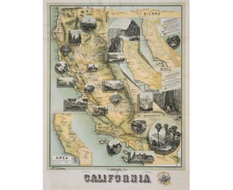
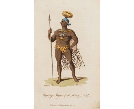
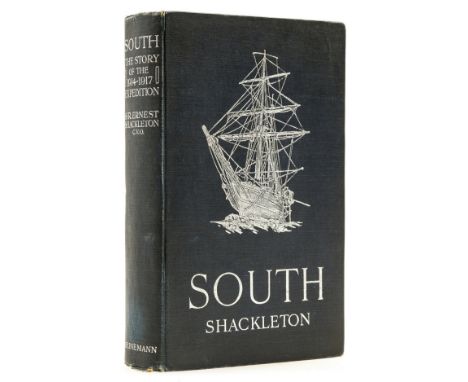
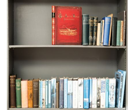
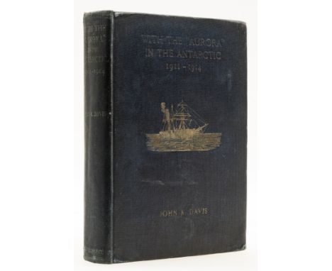
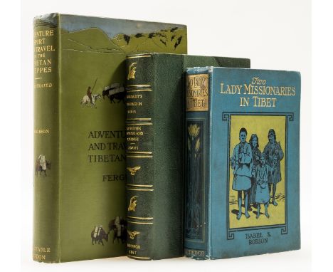
Polar.- Mikkelsen (Ejnar) Lost in the Arctic: being the story of the 'Alabama' expedition, 1909-1912, first edition, half-title, portrait frontispiece, plates, folding map at end, scattered spotting, original pictorial cloth, slight bumping to corners and extremities, 1913 § Peary (R. E.) Nearest the Pole, first edition, half-title, frontispiece, plates, 2 folding maps at end, cracked hinges, original buckram, backstrip split at upper joint but holding firm, chipping to corners and extremities, 1907 § The Arctic World: its Plants, Animals, and Natural Phenomena, frontispiece, plates and illustrations, spotting, new endpapers, original pictorial cloth, rebacked with red morocco, a little rubbed, slight bumping to corners, n.d. § Abruzzi (H.R.H. the Duke of) Farther North than Nansen being the Voyage of the Polar Star, frontispiece, one folding plate, illustrations,. ex-Royal Institution with occasional ink- or blind-stamps, original pictorial cloth, a little rubbed, bumping to corners and extremities, 1901 and others on the Arctic, including a second edition of Nansen's 'Farthest North', v.s. (39)

Lot 210

Polar.- Davis (John King) With the "Aurora" in the Antarctic 1911-1914, first edition, portrait frontispiece, loss to upper corner not affecting image, half-title, title in red and black, plates, one folding map at end, scattered faint spotting, cracked hinges, original pictorial cloth, bumping to corners and extremities, 8vo, [1919].

Lot 50

Africa.- Park (Mungo) The Journal of a Mission to the Interior of Africa, in the Year 1805, first edition, presentation copy from the Editor, half-title, large folding double-page map, half-title and title with small loss at upper inside corner, both with tissue repairs, marginal tear to F1, occasional faint water-staining, 2pp. advertisements at end, modern calf, 4to, 1815.

Lot 323

Hampshire.- Milne (Thomas) Hampshire, or the County of Southampton including the Isle of Wight. Surveyed at the expense of the proprietor in 1788, 89 & 90, large engraved county map with hand-colouring, centered on Winchester, with engraved vignette of a 'View of the West Gate of Winchester', two inset town plans of Winchester and Southampton, sheet 1480 x 1410 mm (58 1/4 x 55 1/2 in), dissected and mounted on linen, minor off-setting, some browning and surface dirt, folding into black morocco slipcase, upper cover gilt with the armorial device of Charles Stanhope, 3rd Earl of Harrington (1753 - 1829), rubbed and scuffed, 4to, William Faden, 1791.

Lot 18

Persia.- Southgate (Rev. Horatio) Narrative of a Tour through Armenia, Kurdistan, Persia and Mesopotamia, 2 vol., first American edition, half-titles, frontispiece to vol. 1 only, large folding map, bookplate, ex-Mount St. Joseph library with usual labels and occasional blind-stamps, original cloth, rebacked retaining original backstrips, slight bumping to extremities, 8vo, New York, 1840.

Lot 335

Shropshire.- Baugh (Robert) To the Right Honourable Edward Earl of Powis Lors Lieutenant and Custos Rotulorum of the Counties of Salop and Montgomery, This Map of Shropshire..., large county map with vignette and title in the upper right corner, engraving, sheet approx. 1400 x 1420 mm (55 1/8 x 55 7/8 in), dissected and mounted on linen, minor surface dirt and light browning in places, slightly rough edges, folding into marbled slipcase with manuscript label to upper cover 'Baugh/ Map of Shropshire', rubbed and scuffed, 4to, [1808].

Lot 82

Asia.- Fergusson (W. N.) Adventure Sport and Travel on the Tibetan Steppes, first edition, half-title, photogravure frontispiece, illustrations, many full-page, one folding map at end, original pictorial cloth, fractional bumping to corners and extremities, 1911 § Adams (Andrew Leith) Wanderings of a Naturalist in India: the Western Himalayas and Cashmere, wood engraved frontispiece, occasional pencil notes, frontispiece and first few leaves becoming loose, modern half-morocco, Edinburgh, 1867 § Robson (Isabel Suart) Two Lady Missionaries in Tibet, frontispiece, illustrations, publisher's advertisements at end, label to front pastedown, original pictorial cloth, slight bumping to corners and spine extremities, a little rubbed, n.d.; 8vo (3)

Lot 316

England and Wales.- Walker (J. & C.) England & Wales founded upon the grand trigonometrical survey. shewing all the Mail Coach, Turnpike & Rail Roads, the rivers & navigable canals..., engraved map with full original hand-colouring, 1330 x 1040 mm (52 1/4 x 41 in), dissected and mounted on linen, some minor browning and offsetting, folding with burgundy endpanels into contemporary burgundy slipcase, gilt, rubbed and worn, tall 8vo, 1848; together with a good copy of 'Cary's New Map of England and Wales with Part of Scotland', 1794, and with Edward Stanford's 1865 edition of his 'Map of England and Wales, Divided into Counties, Parliamentary Divisions, & Dioceses', presented in four sections, each section folding with marbled endpanels into later card case, 8vo, 1794-1865 (3)

Lot 237

Saudi Arabia.- Saudi Aramco (publisher) The Kingdom of Saudi Arabia, colour printed map, double sided, with Arabic text one side, English the other, map 590 x 675 mm (23 1/4 x 26 1/2 in), folding with text endpanels, minor handling creases, unframed, 1975; together with 5 further folding maps of the Arabian Peninsula, including two city maps of Jeddah, and a map of Qatar, colour printed maps, various sizes, all unframed, 20th century (6)

Lot 297

World.- Belzoni (Giovanni Battista) Narrative of the Operations and Recent Discoveries within the Pyramids, Temples, Tombs, and Excavations in Egypt and Nubia, second edition, 1 vol. only (of 2), lacking atlas vol., lithograph portrait frontispiece, 1 engraved plate, 1 folding engraved map, scattered spotting, ex-Tate Library with occasional ink-stamps, old bookplate retained and attached to front pastedown, modern half crushed-morocco, 1821 § Baker (Sir Samuel W.) The Nile Tributaries of Abyssinia, first edition, portrait frontispiece, plates (some misbound), 2 maps (1 folding), newspaper clipping on Lady Baker pasted to blank, new endpapers, original decorative cloth, rebacked retaining original backstrip, rubbed, 1867 § Ponting (Herbert G.) In Lotus-Land Japan, limited edition, plates, original pictorial cloth, slipcase, a little rubbed, Tokyo, 1985; and others, v.s (28)

Lot 328

Kent.- Andrews (John) & Andrew Drury & William Herbert. [A Topographical Map of the County of Kent in Twenty Five Sheets on a Scale of Two Inches to a Mile, from an actual survey], folding index map, and 23 engraved double-page sheets in 18 sections, lacking title section [no. 5], and blank sea section [no. 21], some hand-colouring, sheets of various sizes, all dissected and laid onto linen, scattered surface dirt and minor browning, each section with numbered ink inscription to endpanel, folding into marbled box with manuscript label, [circa 1769].

Lot 336

Shropshire.- Rocque (John) To His Royal Highness George...This Actual Survey of the County of Salop is most humbly Inscribed..., large county map, in two sheets, engraving, each sheet approx. 620 x 1040 mm (24 3/8 x 41 in), dissected and mounted on linen, some folds splitting, surface dirt and browning, folding without slipcase, tall 8vo, 1752; together with 4 further folding county maps, including Faden's 'County of Suffolk... 1787', 'Hampshire, or The County of Southampton...1796', and a reduced copy of Robert Baugh's 'Large Map of Shropshire...', 8vo, circa 1790s and later (4)

Lot 3

NO RESERVE India.- The History of the Indian Revolt and the expeditions to Persia, China, and Japan 1856-7-8, folding colour map frontispiece and 3 maps, of which 2 folding, one with short marginal tear, illustrations, many full-page, one or two tears into text with no loss, one with neat old repair, scattered faint spotting, bookplate, contemporary half-calf, cracked hinged, rubbed and worn, large 8vo, 1859.

Lot 271

Voyages.- Shipwrecks.- Bourchier (Capt. W.) Narrative of a Passage from Bombay to England, describing the author's Shipwreck in the Nautilus, first edition, lacking map frontispiece, occasional spotting, bookplate, contemporary boards, rebacked, slight bumping to corners and extremities, 12mo, 1834.⁂ Scarce in retail.

Lot 229

NO RESERVE Russia.- Siberia.- Cottrell (Charles Herbert) Recollections of Siberia, in the Years 1840 and 1841, first edition, folding map frontispiece, chipping to edges, short tear at gutter, errata slip bound-in, publisher's advertisements at end, bookplate, faint spotting to title, upper hinge cracked, original cloth, a little rubbed, slight bumping to corners and spine extremities, 8vo, 1842.

Lot 282

West Indies.- McCallan (E. A.) Life on Old St. David's Bermuda, frontispiece, plates, map endpapers, original cloth, mottling to covers, slight bumping to corners and extremities, Bermuda, 1948 § Wilkinson (Henry) The Adventurers of Bermuda, presentation copy to A. B. McGraw signed and dated by author, frontispiece, plates, map in pocket at end, original cloth, slight bumping to corners and extremities, 1933; Bermuda in the Old Empire, frontispiece, plates, map, original cloth, fractional bumping to corners and extremities, 1950; 8vo (3).

Lot 334

Nottingham.- Chapman (John) Nottinghamshire survey'd in 1774, second edition, county map in two sheets, engraving with outline hand-colouring, each sheet approx. 650 x 992 mm (25 1/2 x 39 1/8 in), dissected and mounted on linen, some offsetting, minor surface dirt and browning, folding into marbled slipcase with publisher's printed label to upper cover, worn, William Faden, [circa 1785].

Lot 39

NO RESERVE Africa.- Freeman (R. Austin) Travels and Life in Ashanti and Jaman, first edition, presentation copy from author dated Jan. 1903, half-title, frontispiece, plates and illustrations, folding colour map at end, spotting, contemporary cloth, a little rubbed, slight bumping to corners and extremities, 8vo, Westminster, 1898.

Lot 119

NO RESERVE India.- Cunha (J. Gerson Da) Notes on the History and Antiquities of Chaul and Bassein, half-title, photographic frontispiece and 18 photographic plates, 7 lithographs, 7 facsimiles of which 6 folding, one folding map with tear into image, previous owner's ink signature to Preface, worming, hinges and stitching broken, pages and gathering loose in original cloth, worming, bumping and small loss to corners and extremities, 8vo, Bombay, 1876.

Lot 204

Pacific.- Forrest (Capt. Thomas) A Voyage to New Guinea, and the Moluccas, from Balambangan: including an account of Magindano, Sooloo, and other islands, first octavo and Dublin edition, engraved folding frontispiece map and 3 plates, of which 1 folding, map bound in upside down and with short tear without loss within image, occasional spotting or staining, some finger-marking, lightly browned, contemporary calf, rebacked, spine in compartments and with original red leather label (gilt rubbed away), corners repaired, some staining, rubbed, 8vo, Dublin, Printed for Messrs. Price, W. and H. Whitestone, Sleater, Potts, [and others], 1779.⁂ Including Magindano and Papua vocabularies at end.

Loading...Loading...
  • 109182 item(s)
    /page

Recently Viewed Lots