Speed (John)The Countie and Citie of Lyncolne Described with the Armes of Them That Have Been Earles Thereof since the conquest.Engraved by Jodocus Hondius, 1610 [1611 or slightly later], hand-coloured engraved map, plate mark 388mm x 518mm, English text to reverse, pages 63/64, signature Nn, repaired tear to right of title and to sea below, loss to lower left corner of border, mounted, framed, glazed front and rear.
We found 109182 price guide item(s) matching your search
There are 109182 lots that match your search criteria. Subscribe now to get instant access to the full price guide service.
Click here to subscribe- List
- Grid
-
109182 item(s)/page
Speed (John)North Wales.Chiswell and Basset, no date [1676], hand-coloured engraved map, plate mark 387mm x 517mm, English text on reverse;idem, The Isle of Man, Exactly Described ... 1610, Bassett and Chiswell [1676], hand-coloured engraved map, platemark 385mm x 510mm, English text on reverse;idem, Holy Iland, Garnsey, Jarsey and Farne [Holy Island, Jersey, Guernsey and the Farne Islands].Sudbury and Humbell, 1610 [1611 or later], Jodocus Hondius celavit, hand-coloured engraved map, image 377mm x 500mm, repaired tears to Farne section, mounted. (3)
Barrow (John)... General Chart of the Colony of the Cape of Good Hope, Constructed from bearings, estimation of distances & frequent observations for Latitudes in travelling thro the Country in the Years 1797 & 1793.Cadell & Davies, Sept 1st 1800, map engraved by N.J. Neale, hand-coloured in outline with some offsetting, borders 465mm x 696mm, folds, small tear to right border (without loss). Believed to be the first scientific mapping of the Cape. Not in Tooley.
Speed (John) and Smyth (William)The Countye Palatine of Chester, With that most Ancient Citie described.Sudbury and Humble, no date [1611 or later], hand-coloured engraved map, platemark 380mm x 502mm, English text on reverse (pages 73/74, signature Ss, replacement top margin;Speed (John), Northampton Shire.George Humbell, 1610 [1611 or later], engraved by Jodocus Hondius, engraved map, platemark 388mm x 516mm, English text on reverse (pages 55 and 56, signature N2), repaired tear to top right quarter, loose in mount;idem, The Countie of Nottingham described, The Sire Townes Situation and the Earls There of observed.John Sudbury and Georg Humble, 1610 [1616], hand-coloured map engraved by Hondius, plate mark 381mm x510mm, Latin text on reverse (page 66 and ??, signature Oo, three small holes in centre of map, repairs to worn upper corners including printed area with loss of page number and several holes;Saxton (Christopher) and Lea (P.), A Map of Essex. Newly revised and Amended.No date [1693], hand-coloured engraved map, plate mark 416mm x 528mm, plain reverse, margins frayed and holed. (4)
Mercator (Gerard)Northumbria, Cumberlandia et Dunelmensis Episcopatus, 355mm x 468mm visible;idem, Eboracum, Lincolnia, Derbia, Staffordia, Notinghamia, Lecestria, Rutlandia et Norfolcia, 350mm x 417mm visible;idem, West Morlandia, Lancastria, Cestria, Caernarvan, Denbigh, Flint, Merionidh, Montgomery, Salopia, cum insulis Mania et Anglesey., 350mm x 405mm visible; idem, Warwicum, Northhamtonia, Huntingdonia, Cantabrigia, Suffolcia, Oxonium, Buckinghamia, Bedfordia, Hartfordia, Essexia, Berceria, Middelsexia, Southhatonia, Surria, Cantiu, & Southsexia. no date, hand-coloured engraved map, 367mm x 456mm visible;idem, Cornubia, , Devonia, Somersetus, Dorcestria, Wiltonia, Glocestria, Monumetha, Glamorgan, Caermarden, Penbrok, Cardigan, Radnor, Breknoke, Herefordia, & Wigornia, 367mm x 467mm visible;Five hand-coloured regional maps of England and Wales, no date [1595 or later], individually mounted, framed and glazed. (5)
Mercator (Gerard)Irlandiae regnum. Hand-coloured engraved map, no date [1595 or later], 330mm x 405mm visible, mounted framed and glazed;idem, Scotia regnum.Hand-coloured engraved map, no date [1595 or later], 350mm x 403mm visible, mounted framed and glazed (2) Ireland - Vertical creasing present. Couple of spots. Not examined out of frame. Scotland - some light tanning otherwise no obvious defects. Not examined out of frame.Extra images available on Tennants website.
Speed (John)Cambridgshire described with the devision of the hundreds, the Townes situation with the Arms of the Colleges of that famous University. Sudbury and Humbell, 1610 [1614], hand-coloured engraved map, image 381mm x 520mm, English text on reverse, pages 37/38, signature Z, restoration to left and right margins and borders, 3mm hole in Raddesley Hundreds, three smaller holes at top edge. framed, glazed front and rear.
Saxton (Christopher) and Speed (John)Norfolk, A Countie Florishing & Populous Described and Devided with the Armes of such noble families as have borne the titles therof.John Sudbury and George Humble, no date [1627], engraved by R. Elstrack, hand-coloured engraved map with re-engraved battlescene for this edition, English text verso (pages 35/36, signature Y), repair to lower left margin, neat repair to top left corner tear, small amount of annotation to rear lower margin, framed, glazed front and rear.
Speed (John)Northumberland.Sudbury and Humble, 1610 [1611 or later], hand-coloured engraved map, plate mark 385mm x 510mm, English text verso (pages 89/90, signature Ccc), side margins extended, framed, glazed front and rear;S[axton] (C[hristopher]) and Lea (P.), Comberland and Westmorland Exactly Described.No date [c1749], hand-coloured engraved map, plate mark 396mm x 498mm, framed and glazed. (2)
Saxton (Christopher)Westmorlandiae et Cumberlandiae Comit nova vera et Elaborata descriptio. Ano Dni 1576.Engraved by Augustine Ryther, 1579, hand-coloured engraved map, image 386mm x 494mm, 6cm closed tear to lower left of centre fold, repaired tear or crease further left, chip from top left margin, some tanning, mounted, framed and glazed.The earliest printed map of the two counties.Images added to Tennants website. You can see the tear if you scroll in to the image of the lower left quarter.
[Speed (John)]The Kingdome of Great Britaine and Ireland.J. Sudbury and George Humble, 1610 [1611 - 1653], hand-coloured map engraved by J. Hondius, plate mark 386mm x 517mm, English text to rear (pages 1 & 2, ?tape strip to rear lower margin obscuring signature and catchword), short margins, colours a little faded, framed, glazed front and rear.[Shirley, Early Printed Maps of the British Isles, no. 316].Small closed tear to top edge. Pin hole in two city views, stain to top margin.
[Mercator - Hondius] Polus Arcticus cum vicinis regionibus.[Samuel Purchas], no date [1625 or later], hand-coloured engraved map of the Arctic, reduced from Mercator's original map, platemark 135mm x 185mm, sheet circa 167mm x 217mm, mounted framed and glazed; Mercatorem (Gerardum) [Scotiae Regnum, Scotland South sheet]. no date [1595 or later], hand-coloured engraved map, plate-mark 350mm x 455mm, framed and glazed. (2)
Bowles [Henry Carington]Bowles's Geographical Game of the World, in a New Complete and Elegant Tour through the Known Parts thereof, laid down on Mercator's Projection.Carington Bowles, 12 August 1790, linen-backed hand-coloured folding map, issued as a game with playing directions below. Sixteen sections, visible dimensions 48cm x 64cm, wear to intersections of folds, slight wear to lower corners, some tanning, mounted, framed and glazed.
Teesdale (Henry)[Yorkshire] - To the Nobility, Gentry & Clergy of Yorkshire, this Map of the County, Constructed from a Survey Commenced in the Year 1817 & Corrected in the Years 1827 & 1828 is respectfully dedicated by the Proprietors.Henry Teesdale & Co. and C. Stocking, April 21st, 1828, large hand-coloured map in 72 sections, mounted on 3 linen sheets, overall 184cm x 222cm, some light tanning and dust marking, housed in contemporary book-form slipcase (some wear and restoration to case). [Whitaker 381]Some foxing to rear side of linen, wear to paper covers of each folded section.
North-West Natural History and ArchaeologyByerley (Isaac), The Fauna of Liverpool.1856, 125 pages, colour plate, cloth;Smith (Henry Ecroyd), Antiquarian Researches and Discoveries in the Mersey District During the Years 1863 to 1869 ... With Notes on Its Natural History in a Series of Papers.Liverpool, T. Brakell, 1871, two volumes (the author's own copy), the second volume has a general title and contents page identical to the first but the individual papers run from 1870 to 1874, plates, half calf;Brownbill (John), West Kirby and Hilbre, A Parochial History.Liverpool, 1928, plates as called for, folding map, original cloth;With twenty others [not collated] (24)
An Ottoman copy of the Marifetname of Ibrahim Hakki Erzurumlu (d.1780), an encyclopedic work ranging from mysticism to the “new astronomy” of Copernicus, Turkey, dated 1170AH/1709AD, 385ff., with 37ll. of black naskh script per page, numerous gold and polychrome diagrams of the moon's orbit, double-page world map, numerous gold and polychrome decorated floral headers, all with contemporary colouring, with colophon signed ‘Umar Sarri, known as Baş-kareh, dated 1233 AH (1817/18AD), noting the work’s composition in 1170 AH (1756-57AD), in dark brown tooled morocco binding with flap, the flap with a tooled seal impression, folio 31 x 19.5cm.Provenance: Private UK Collection
§ Alan Lowndes (British 1921-1978) The Dedicated Skittler, 1968 signed (lower left), titled and dated (to reverse), oil on boardDimensions:49.5 x 39.5cm (19 1/2in x 15 1/2in)Provenance:ProvenanceCrane Kalman Gallery, London from where acquired by David Mathias and thence by descent to the present owner.Note: Alan Lowndes’ trajectory from the son of a railway clerk to an artist assured of a place in the history of twentieth-century British art was far from orthodox. In 1972 he recalled: ‘I used to draw on fish and chip wrapping papers in the chip shop, at an early age, to cheer myself up and while away the time. At home we children used to draw a lot as ‘Our Dad’ (as we say in Stockport) used to draw for us…Somewhere about the age of 8 or 9 I decided very privately to myself that I wanted to become an artist.’ (1)After leaving school at the age of fourteen, Lowndes was apprenticed to a local painting and decorating business. He attended a Decorators’ Class at Stockport Technical College and continued his training as a draughtsman in a map-making unit during World War Two. Service in Italy allowed for first-hand experience of works by artists including Fra Angelico (1395-1455) and Giotto (d.1337) which provided long lasting inspiration. After demobilisation, Lowndes worked as a decorator and textile designer, whilst attending evening classes at Stockport Art School. By 1950 he had decided to become a professional artist and received his first solo exhibition that year, in Manchester. Having had his work displayed alongside that of Lucian Freud and John Craxton, he declared ‘From then on, as they say, I never looked back. It was not much use looking back anyway and I hadn’t the time.’ (2)In 1959 Lowndes moved to St Ives in Cornwall, where he remained for eleven years. He exhibited regularly in London for the rest of his career and to acclaim in New York in 1964. A move to near Dursley, Gloucestershire in 1970 was followed two years later by a retrospective exhibition at Stockport Art Gallery, in the artist’s childhood town.Lowndes’ work has been compared to that of L.S. Lowry (1887-1976) and to Christopher Wood (1901-30). However, the art critic Terence Mullaly explained his originality, writing in 1972:‘Lowndes has been called the only genuine working-class painter, he has been dubbed naif and called nostalgic…he is nobody’s fool…Lowndes looks at the world directly. He has no use for conventions, either academic or of the avant garde. What he does have is a considerable feeling for oil paint. At the same time, and most important, he is a witty observer. Above all, Alan Lowndes makes the ordinary seem terribly important. Neither sympathy nor sentiment, conscious comment nor self-conscious attitudes colour his observation of a world which he makes us feel is worthwhile simply because it exists.’ (3)1 / Alan Lowndes, ‘Notes’, Retrospective Exhibition of Paintings 1948-1972 by Alan Lowndes, Crane Kalman Gallery, London, 1972, p.13.2/ op.cit., p. 15.3 / Terence Mullaly, ‘Alan Lowndes is simply a good artist’, The Daily Telegraph, 13 December 1972
John Speed (1552 - 1629) A Map of the Kingdome of England The Map shows the whole of England and Wales with parts of Scotland, Ireland and France. There is a table giving details of the numbers of cities, town etc. Of all the shires, and on each side of the map there are figures depicted the manner of dress of the English. With full margins. Double-page engraved map and hand coloured Dimensions: (Paper) 15.5 in.(H) x 20.25 in.(W) (Frame) 22.5 in. (H) x 26.5 in. (W)
Engineering.- Perry (Capt. John) An Account of the Stopping of Daggenham Breach, first edition, with errata slip pasted to verso of title, folding engraved map by H.Moll (lightly offset, torn across corner and repaired), a little spotted and browned, near contemporary ink inscription "E. libris James Arrow Rochester Row, Tothill Field, Westminster 1775" to front pastedown and with several ink or pencil annotations to text and front free endpaper, contemporary calf, gilt, rebacked, red morocco label, 8vo, Benj. Tooke, 1721.⁂ Account of the extraordinary feat of engineering executed by the hydraulic engineer John Perry in repairing two breaches in the Thames embankment at Dagenham, caused by storms and neglect.
Military.- Spain.- Jones (Sir John) Journals of Sieges carried on by the Army under the Duke of Wellington, in Spain, 3 vol., third edition, half-title, additional engraved title, folding maps, publisher's catalogue at rear, ink ownership inscription and bookplates, original cloth, spines toned, corners bumped and scuffed, John Weale, 1846 § Bacon (John Francis) Six Years in Biscay, half-title, folding map, 4 double page plates, edges foxed, some spotting, original cloth, rubbed, Smith Elder & Co., 1838 § Walton (W.) The Revolutions of Spain, 2 vol., portrait frontispieces, bookplates, some spotting, original cloth-backed boards with paper labels to spines, spines sunned with a few small tears to joints, Richard Bentley, 1837; and 33 others similar, 8vo (39)
NO RESERVE British Isles.- Sanson (Nicolas) Les Isles Britannicques ou Sont Le Royaume d'Angleterre, double-page map of the British Isles, decorative cartouche in the upper right corner, text box in the upper left, engraving with outline hand-colouring, on two sheets conjoined, 550 x 750 mm (21 3/4 x 29 1/2 in), old folds, central vertical fold with some repairs, scattered spotting and minor surface dirt, some marginal tears reparied, unframed, Paris, 1747; with a small map hand-coloured map of Blome's 'Hartfordshire with its Hundreds', unframed (2)
Europe.- Stukeley (William) The Medallic HIstory of Marcus Aurelius Valerius Carausius, Emperor in Brittain, 2 vol., first edition, engraved frontispieces, 41 engraved plates, 4 folding, 1 engraved map, faint off-setting, scattered very faint spotting, bookplate, vol. 1 in contemporary speckled calf, richly gilt spine, vol. 2 in contemporary calf, 1757-59.
NO RESERVE Scotland.- Jervise (Andrew) Memorials of Angus and Mearns, 2 vol., number 47 of 60 large paper copies, vignette titles, plates, bookplate, contemporary cloth, fractional bumping to corners and extremities, Edinburgh, 1885; The History and Traditions of the Land of the Lindsays, presentation copy from the author to his sister, lithographed frontispiece, folding map, illustrations, inscription retained from original endpapers and pasted down, bookplate, modern boards, a little rubbed, Edinburgh, 1853; and 4 others by the same, 4to & 8vo (7)
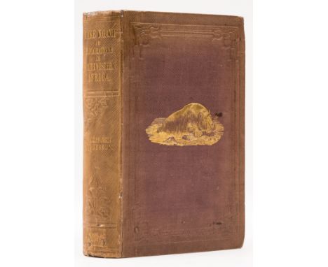
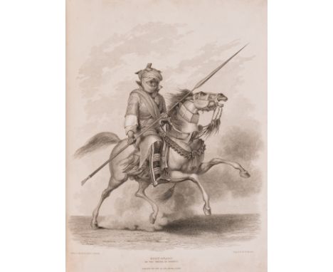
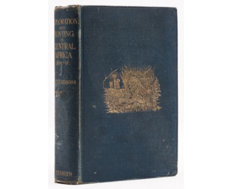
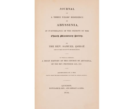
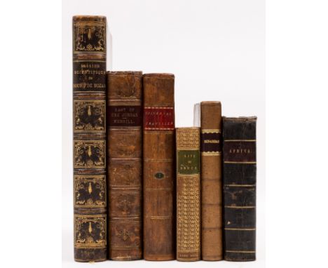
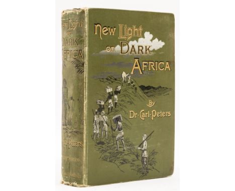
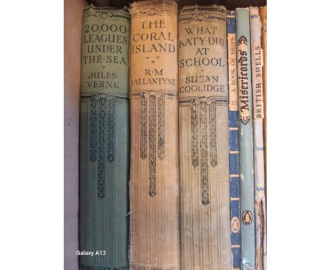
Africa.- Andersson (Charles John) Lake Ngami; or, Explorations and Discoveries, ... of South Western Africa, first edition, lithographed frontispiece and 15 plates, illustrations, engraved folding map, publisher's advertisements at end, bookplate, previous owner's ink signature, ink number to head a1, faint abrasion marks to front endpapers where labels removed, scattered spotting, original pictorial cloth, expert restoration to lightly sunned spine, slight bumping to corners and spine extremities, [Shapero, Africana 9; Mendelssohn I, p.41; Czech p.5], 1856 § Baldwin (William Charles) African Hunting: from Natal to the Zambesi, first edition, engraved portrait frontispiece, title printed in red and black, 10 wood engraved plates, 5 tinted lithographs only (of 6), S1 with tear and old tape repair, scattered finger-soiling and creased corners, occasional short marginal tears, bookplate, modern half-calf, [Czech p.12; Hosken p.10], 1863 § Gleichen (Edward, Count) With the Mission to Menelik 1897, first edition, photogravure frontispiece, plates and illustrations, 2 folding maps at end, 1 with tear and frayed edges, publisher's advertisements at end, original pictorial cloth, gilt, bumping to corners, chipping to spine extremities, 1898 § Junker (Dr. Wilhelm) Travels in Africa during the Years 1879-1883, first edition, vol. 2 only (of 3), half-title, portrait frontispiece, vignette title, plates and illustrations, folding map, short marginal tear, advertisements at end, bookplate, original pictorial cloth, bumping to corners and extremities, [Hosken p.111], 1891 § Campbell (John) Travels in South Africa undertaken at the request of the Missionary Society, first edition, engraved portrait frontispiece, folding hand-coloured map, short split to folds, 9 engraved plates on 8 sheets, errata tipped-in, occasional spotting, bookplate, previous owner's ink inscriptions, contemporary half-calf, rebacked, bumping to corners, [Hosken p.38], 8vo, 1815; 8vo (5)⁂ Provenance of the first mentioned: Ownership inscription of Sir Laurence Dudley Stamp, professor of Geography (1898-1966). 'A cornerstone book of African hunting in the middle of the nineteenth century. The London edition is much more difficult to locate than the American edition.' (Czech)
Africa.- Ethiopia.- Azaïs (R. P.) & R. Chambard. Cinq Années de Recherches Archéologiques en Éthiopie, 2 vol., first edition, half-titles, plates and illustrations, folding map, plates loose as issued, bookplate, text vol. in original printed paper wrappers, slight creasing to top edge and spine extremities, plate vol. original cloth-backed portfolio, old tape repair inside upper cover, lightly rubbed, Paris, 1931 § Coulbeaux (J.-B.) Histoire Politique et Religieuse d'Abyssinie, 3 vol., first edition, portrait frontispiece, plates and illustrations, 6 folding maps and plans, 1 colour, bookplate to vol. 1, original wrappers bound-in, small neat tape repair to vol. 1, short marginal tear to vol. 3, faint abrasion marks to title versos where label removed, modern cloth, Paris, 1929 § Stigand (Capt. C.H.) To Abyssinia Through an Unknown Land, first edition, half-title, frontispiece, plates, 2 maps, 1 folding, advertisements at end, bookplate, new endpapers, original pictorial cloth, gilt, mottled boards, slight bumping to spine extremities, [Czech p.156], 8vo, 1910. 4to (6).
Africa.- Bowdich (Thomas Edward) Mission from Cape Coast Castle to Ashantee ..., first edition, folding engraved map frontispiece, 7 plates, of which 6 hand-coloured and 1 folding, large hand-coloured folding panorama, folding facsimile, 5pp. sheet music, title japon backed with expert repair to tear, bound without half-title, occasional off-setting, bookplates loosely inserted, new endpapers, contemporary diced calf, rebacked retaining original backstrip, expert repair and restoration to corners, red crushed morocco spine label, a little rubbed, [Shapero, Africana 61], 4to, 1819.⁂ "The author had not initially been appointed to command this expedition ... but during the course of the journey ... Bowdich superseded his chief. As a result it was Bowdich who negotiated the treaty with the King of the Asante which promised peace to the British settlements on the Gold Coast in return for commercial and political co-operation" (Shapero, Africana).
Africa.- Coillard (François) On the Threshold of Central Africa, first edition, presentation copy inscribed 'from the author' on front free endpaper, portrait frontispiece, plates, folding map, splits to folds with tape repairs to verso, spotting, previous owner's ink signature, bookplate, publisher's advertisements at end, original pictorial cloth, gilt, slight bumping to corners and spine extremities, [Hosken p.48], 1897 § Melland (Frank H.) and Edward H. Cholmeley. Through the Heart of Africa, first edition, presentation copy inscribed "From the Author's Family", half-title, frontispiece, plates, folding map, publisher's advertisements at end, previous owner's ink signatures, bookplate, upper hinge crudely strengthened, scattered spotting, original pictorial cloth, slight bumping to corners and spine extremities, 1912 § Hinde (Sidney Langford) The Fall of the Congo Arabs, first edition, portrait frontispiece, folding map, short marginal tear, publisher's advertisements at end, bookplate, original cloth, mottling to fore-edge, slight bumping to corners, 1897 § Drummond (Henry) Tropical Africa, first edition, folding colour map frontispiece, 4 folding maps, publisher's advertisements at end, half-title trimmed, newspaper article pinned to half-title verso, bookplate, original cloth, slight bumping to corners and extremities, 1888; and another copy of Hinde's 'Fall of the Congo Arabs', 8vo (5).
Africa.- Denham (Maj. Dixon) & Captain Hugh Clapperton. Narrative of Travels and Discoveries in Northern and Central Africa, first edition, 37 engraved plates and plans, 1 hand-coloured, folding double-page map, illustrations, faint off-setting, scattered faint spotting, marginal worming Q3-2P2, mostly tiny, new endpapers, contemporary calf, rebacked, a little rubbed, [Shapero, Africana 116], 4to, 1826.
Africa.- Gibbons (Major A. St. H.) Exploration and Hunting in Central Africa 1895-96, first edition, half-title, portrait frontispiece, photographic plates, illustrations, folding map at end, publisher's advertisements at end, scattered spotting, original decorative cloth, gilt, small gauge to spine, slight bumping to corners and extremities, [Czech p.62; Hosken p.80], 8vo, 1898.
Africa.- Gobat (Rev. Samuel) Journal of a Three Years' Residence in Abyssinia ..., first edition, half-title, double-page engraved map, off-setting to map, bookplate, modern roan-backed boards, 8vo, 1834 § Jensen (Ad. E.) Völker Süd-Äthiopiens: Ergebnisse der Frobenius-Expeditionen 1950-52 und 1954-56, 3 vol., first edition, plates, illustrations, one or two marginal pencil marks, original cloth, dust-jackets, a little rubbed, vol. 1 & 3 with tears and old tape repairs, Stuttgart, 1959-63 § Frobenius (Leo) The Voice of Africa, 2 vol., first edition, colour frontispieces, plates, illustrations,maps, occasional marginal water-staining, bookplate, original cloth, rebacked retaining original backstrip, mottled spine, 1913; 8vo & 4to (6).
Africa.- Heron (Robert) The New Universal Traveller; or a collection of late Voyages and Travels ... vol. 1 Travels in Africa, vol. 1 only (of ?2), folding engraved map frontispiece, 13 engraved plates, tissue-guards, bookplate, contemporary calf-backed boards, a little rubbed, 1811 § [Knight (Ellis Cornelia)] Dinarbas; a Tale: being a continuation of Rasselas, Prince of Abissinia, third edition, scattered spotting, previous owner's stencilled surname and initials to title, previous owner's ink inscription to front pastedown, faint abrasion mark to front free endpaper where label removed, bookplate, contemporary calf, rebacked, 1793 § Jameson (Prof.), James Wilson & Hugh Murray, Narrative of Discovery and Adventure in Africa, first edition, frontispiece, vignette title, plates, advertisements at end, bookplate, contemporary half-calf, a little rubbed, slight bumping to corners and extremities, Edinburgh, 1830 § du Bourg de Bozas (R.) Mission Scientifique: de la Mer Rouge a l'Antlantique á travers l'Afrique Tropicale, first edition, portrait frontispiece, illustrations, 3 folding maps at end, one or two short splits to folds, bookplate, contemporary morocco-backed boards, slight bumping to corners and extremities, Paris, 1906; and 2 others similar, v.s. (6)⁂ The first is scarce. Susan Pickford & Alison E. Martin write of it, "... what distinguished Heron's collection from many of its predecessors was its considerable use of translation to extend the range of travel literature that could be presented to an Anglophone readership."
NO RESERVE Africa.- Peters (Dr Carl) New Light on Dark Africa, first edition, frontispiece, plates and illustrations, folding map in rear pocket (lightly torn), light foxing, manuscript bookplate to half-title, original pictorial cloth, rubbed, fraying to spine ends, lower cover rather soiled, [Czech p.218], 4to, 1891.
Africa.- Tuckey (Captain J. K.) Narrative of an Expedition to explore The River Zaire, usually called the Congo, in South Africa, in 1816, first edition, half-title, large folding map frontispiece, 13 engraved plates, of which 1 hand-coloured, scattered faint spotting, map with light off-setting, previous owner's ink signature to half-title, bookplate, new endpapers, contemporary calf, rebacked, gilt, very slight bumping to corners, [Hosken p.203], 4to, 1818
NO RESERVE Gibraltar.- Bellin (Jacques Nicolas) Carte de la Baye de Gibraltar..., coastal chart oriented with north to the left, showing soundings, compass rose and rhumb lines, rococo cartouche in the upper right corner, engraved map with early hand-colouring, platemark 455 x 610 mm (17 7/8 x 24 in), small margins, minor spotting and handling creases, unframed, Depot de la Marine, 1762; together with a duplicate copy of the same map, with variant early hand-colouring, a good impression of Willem Blaeu's Granata et Murcia Regna, and Homann Heir's 'Sevilla Regnum...', engravings, both with hand-colouring, various sizes, good margins, unframed, circa 1640-1781 (4)
Japan.- Chamberlain (Basil Hall) Things Japanese, second edition, folding map frontispiece, bookplate of Jennie Spencer Churchill, bookplate of Oliver & Jane Impey to front free endpaper, signed presentation inscription from the author to Lady Randolph Churchill to head of title, dated Tokyo 26th Sept. 1894, light foxing to peripheral ff., endpapers browned, upper hinge cracked, original cloth, gilt, spine a little faded, rubbed at extremities, 8vo, 1891.⁂ Jennie Spencer-Churchill, or Lady Randolph Churchill (1854-1921), mother of Sir Winston Churchill. Lady and Lord Randolph Churchill visited Japan as part of a round-the-world journey in 1894, which ultimately had to be abandoned due to Lord Churchill's failing health.
Russia.- Oliphant (Laurence) The Russian Shores of the Black Sea in the Autumn of 1852, fourth edition, revised and enlarged, lithographed frontispiece, lightly toned along edge, not affecting image, engraved head and tail pieces, folding map with route in red, with tear not affecting map, lightly spotted, H gathering loose, 16 pp. publisher's catalogue at end, original pictorial brown cloth, gilt, corners slightly bumped, head and tail of spine a little rubbed, 1854.
NO RESERVE Spain.- Blaeu (Willem Jansz.) Gallaecia Regnum descripta a F.Fer. Oja Ord Pred, map of northern Spain, specifically Galicia, engraving with original hand-colouring, platemark 380 x 495 mm (15 x 19 1/2 in), sheet 495 x 580 mm (19 1/2 x 22 3/4 in), Latin text verso, central vertical fold with careful old repairs verso, marginal surface dirt and browning, unframed, [circa 1635]; together with 3 further maps of northern Spain, including a variant impression of Blaeu's 'Gallaecia Regnum', Vaugondy's 'Partie Septentrionale de la Couronne de Castille', and Sanson's 'Royaume de Navarre Divise en Six Merindades', engravings with hand-colouring, various sizes, all with good margins, minor occasional spotting and surface dirt, unframed, 17th and 18th century (4)
Spain.- Clarke (Edward) Letters concerning the Spanish Nation, first edition, one or two ink annotations to rear, some light spotting, contemporary half calf, sympathetically rebacked, for T. Becket and P.A. de Hondt, 1763 § Bourgoanne (Chevalier de) Travels in Spain, 3 vol., first English edition, 8 folding engraved plates, 3 folding engraved map and plans (including of Madrid), without half-titles but with errata leaf, ink ownership inscriptions and stamps to preliminaries, a few instances of minor spotting or finger soiling, vol. 3 with small amount of worming to final ff. (not affecting text), contemporary calf with red morocco labels to spine, vol. 1 upper cover detached, for G.G.J et al., 1789 § Thicknesse (Philip) A Year's Journey through France and Spain, 2 vol., second edition, engraved plates, of which 1 folding, off-setting, contemporary calf with morocco labels to spine, very minor scuffing, 1788, 4to & 8vo (6)
NO RESERVE Spain.- Mariette (Pierre) and others. Collection of 6 maps showing parts of Andalusia, Castille, Grenada, including Sanson and Mariette's 'Les Estats de la Couronne de Castille, dans les Parties Plus Meridionales de l'Espagne...', Mercator and Hondius's 'Castiliae Veteris et Novae Descriptio', John Senex's 'A Map of Old & New Castile', and 3 variant impressions of Vaugondy's 'Partie Meridionale des Etats de Castille', engraved maps with some outline hand-colouring, various sizes between 415 x 540 mm (16 1/4 x 21 1/4 in) and 530 x 750 mm (20 7/8 x 29 1/2 in), all with good margins, central vertical folds, the Mercator with marginal toning to sheet, unframed, 17th and 18th century (6).
NO RESERVE Spain.- Mercator (Gerard) Catalonia, regional map from Mercator's 'Atlas sive cosmographicae meditationes', engraving with full hand-colouring, sheet 180 x 270 mm (7 x 10 3/4 in), minor handling creases and surface dirt, light toning, unframed, [circa 1630]; together with 8 further maps of Spain, including another Mercator hand-coloured map 'Arragonia et Catalonia', Santini and Remondini's published map of Vaugondy's 'Etats de la Couronne d'Aragon', 2 regional Spanish maps by Antonio Zatta of Andalusia and Extremadura, and 4 further regional maps of Spain by Pazzini Carli, engravings, all with hand-colouring, various sizes between 140 x 190 mm (5 1/2 x 7 1/2 in) and 540 x 740 mm (21 1/4 x 29 in), occasional minor handling creases and surface dirt, all unframed, 17th and 18th century (9)
NO RESERVE Spain.- Senex (John) A Correct Map of Spain & Portugal According to the newest Observations and Discoveries comunicated to the Royal Society at London and the Royal Academy at Paris, large map showing the Iberian Peninsula, including the islands of Minorca and Mallorca, as well as the Gibraltar Straits, engraving with full original hand-colouring, on two sheets of conjoined laid paper, total sheet 680 x 960 mm (26 3/4 x 37 3/4 in), mounted on linen, central vertical fold, large repaired tear to lower left quadrant, some even toning and minor surface dirt, unframed, [circa 1720]; together with 3 other maps of the Iberian Peninsula, including two variant coloured impressions of Bowen's 'A New Accurate Map of Spain and Portugal', and a hand-coloured example of R.W. Seale's 'A Map of the Kingdoms of Spain and Portugal', engravings, each approx. 400 x 500 mm (15 3/4 x 19 3/4 in), all unframed, 18th century (4)
-
109182 item(s)/page