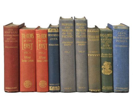
[Shehan, John V.]. Guide to Shikar on the Nilgiris by 'Big Bore', new edition with a map, Madras, Spck Depot, Vepery, 1924, folding map at rear, 12 pages of advertisements at end, original cloth, rubbed and some marks, frayed to head and foot of spine, and outer corners, 8vo, together with Burke (W.S.), The Indian Field Shikar Book, 5th edition, Calcutta and Simla, Thacker, Spink & Co., 1920, advertisements at rear, some spotting and toning, original green cloth gilt, rubbed, upper cover near-detached along upper inner hinge (front endpaper loose), oblong 8vo, plus Van Ingen and Van Ingen. The Preservation of Shikar Trophies, Van Ingen & Van Ingen, Artists in Taxidermy, Mysore, Wesleyan Mission Press, 1924, monochrome illustrations after photographs, original printed wrappers stapled as issued, a little rubbed and some marks, slim 8vo, and others related, including Henry Sullivan Thomas, The Rod in India, being hints how to obtain sport with remarks on the natural history of fish and their culture, 3rd edition, 1897, C.W.F. Noyce, A Climber's Guide to Sonamarg, Kashmir, New Delhi, Frontier Exchange Press for the Himalayan Club, 1945, Henry Hayden and Cesar Cosson, Sport and Travel in the Highlands of Tibet, 1st edition, 1927, Colonel A.I.R. Glasfurd, Musings of An Old Shikari, Reflections on Life and Sport in Jungle India, 1st edition, 1928, H.H. King, The Englishman's Dog in the Tropics, Field Press, [1922], and E.M. Forster, The Hill of Devi, reprinted 1953, all 8vo (9)


![[Shehan, John V.]. Guide to Shikar on the Nilgiris by 'Big Bore', new edition with a map, Madras, Spck Depot, Vepery, 1924,](https://cdn.globalauctionplatform.com/368dbb5d-6cf7-48af-9f15-a6a500f8b80f/a43c1476-dd06-4f9f-a8d5-4b1fc9976aaa/468x382.jpg)


![Nash (Treadway Russell). Collections for the History of Worcestershire, 2 volumes, 1st edition, [London]: Printed by John Nic](https://cdn.globalauctionplatform.com/368dbb5d-6cf7-48af-9f15-a6a500f8b80f/6302eb72-f58d-4db4-93a2-198e8ff15f7e/468x382.jpg)

![Americas. Ortelius (Abraham), Americae sive novi orbis nova descriptio, [1603], engraved map with contemporary hand colouring](https://cdn.globalauctionplatform.com/368dbb5d-6cf7-48af-9f15-a6a500f8b80f/423df91c-010e-4222-d851-6a978553dfae/468x382.jpg)

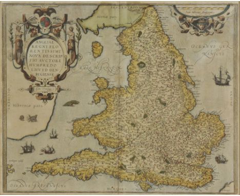
![British Isles. Ortelius (Abraham), Angliae, Scotiae et Hiberniae, sive Britannicar Insularum Descriptio, [1584], engraved map](https://cdn.globalauctionplatform.com/368dbb5d-6cf7-48af-9f15-a6a500f8b80f/2e324236-bb07-47d4-d460-38b3814718d0/468x382.jpg)
![East Indies. Ortelius (Abraham), Indiae Orientalis Insularumque Adiacentium Typus, Antwerp, [1589], engraved map with contemp](https://cdn.globalauctionplatform.com/368dbb5d-6cf7-48af-9f15-a6a500f8b80f/2e01df55-5c48-4a22-a99b-689d008cacaf/468x382.jpg)


![Scotland. Ortelius (Abraham), Scotiaeta Tabula, [1592], hand coloured engraved map, 360 x 475 mm, Latin text on verso Marcel](https://cdn.globalauctionplatform.com/368dbb5d-6cf7-48af-9f15-a6a500f8b80f/a7f76498-1f2b-4518-ad4d-1a5a4ee77ffb/468x382.jpg)