We found 109198 price guide item(s) matching your search
There are 109198 lots that match your search criteria. Subscribe now to get instant access to the full price guide service.
Click here to subscribe- List
- Grid
-
109198 item(s)/page
![[ATLAS] HUGHES (W.) & HALL (S.) General Atlas of the World, folio, single & double-page maps as called for, map end-p](https://cdn.globalauctionplatform.com/11849aff-3fd4-4d74-98b7-af880105a156/cbdd2c44-7bca-4229-951a-af88010ea343/468x382.jpg)

![[TRAVEL, etc.] JACOB (Gertrude) The Raja of Sarawak, 2 vols, 8vo, 2 frontispieces, 1 folding map only, half calf (worn &](https://cdn.globalauctionplatform.com/11849aff-3fd4-4d74-98b7-af880105a156/f5a66888-7c6e-4ced-a7be-af88010f6d20/468x382.jpg)
![[TRAVEL] DAVEY (R.) The Sultan and his Subjects, 2 vols, 8vo, frontis (loose), folding map, 1 plan, cloth (spines faded, inne](https://cdn.globalauctionplatform.com/11849aff-3fd4-4d74-98b7-af880105a156/0ea67a1c-65c9-46b3-b5fb-af88010f8561/468x382.jpg)
Lot 216
[TRAVEL] DAVEY (R.) The Sultan and his Subjects, 2 vols, 8vo, frontis (loose), folding map, 1 plan, cloth (spines faded, inner hinges cracking), 1st Edn., L., 1897; CANDLER (E.) The Long Road to Baghdad, 2 vols, plates, maps, clo., L., 1919; CRICHTON (A.) History of Arabia, 2 vols, 2nd Edn., clo., Edinburgh, 1834; & 2 other vols (8).

![[PERIODICAL, 18th c. / MAPS & PLATES] coll'n of 19 vols. of The GENTLEMAN'S MAGAZINE: a) vol. VII, 1736, frontis present](https://cdn.globalauctionplatform.com/11849aff-3fd4-4d74-98b7-af880105a156/f3706973-63a7-432d-8963-af88010e9389/468x382.jpg)
Lot 253
[PERIODICAL, 18th c. / MAPS & PLATES] coll'n of 19 vols. of The GENTLEMAN'S MAGAZINE: a) vol. VII, 1736, frontis present (no plates called for). b). vol. XII, 1742, frontis (Prague) backed & defective. c). vol. XXI, 1751, untrimmed, 19/22 plates / maps (1 defective) + 7 armorial plates. d). vol. XXVI, 1756, 12/17 plates (1 plate & maps 7, 8, 12 & 13 lacking). e). vol. XXIX, 1759, 21 of 23 plates, "Crown Point" American map & mermaid plate are present. f). ex-lib George Baker "My poem pag. 327", 8 plates as listed + 1 not, but only 6/8 German maps.g). XXXVII, 1767, 18 plates & maps but lacking June's Ornamental Flowers. h). XL, 1770, 16 of 18 plates / maps + Map of Turkey not listed. i.) XLI, 1771, 23 plates as listed, incl. Thames Plans (2), canal maps. Plate at p. 533 torn. j). XLIV, 1774, 21 plates, canal maps as listed + folding music. k). vol. L., 1780, 14 maps & plates as per plate list. l). vol. LVIII, 1788, 17/18 plates, but missing plate of 'lawyer' a text illus.?; & 7 other vols. lacking most of their plates / maps, quarter calf / full calf (worn, one or 2 covers off) (19, with all faults).

![[AMERICAN FARMER'S ALMANACKS] THOMAS (Robert B.) The Farmer's Almanack, No.XXIII, LI, LIV, 57 & 58, 5 separate issues, al](https://cdn.globalauctionplatform.com/11849aff-3fd4-4d74-98b7-af880105a156/1449c6af-06bc-47f7-9e1a-af88010fb2ee/468x382.jpg)
Lot 317
[AMERICAN FARMER'S ALMANACKS] THOMAS (Robert B.) The Farmer's Almanack, No.XXIII, LI, LIV, 57 & 58, 5 separate issues, all with woodcuts, all except the 1815 issue with a map of New England, Boston, Jenks, Palmer, 1815, 1843, 1846, 1849, 1850 [Notes: The 1815 issue has some damage with loss. The 1846 issue has an additional yellow outer wrapper with adverts for J. Grout, Jr, Bookseller and another ad for Stowe & Knowlton's Good Ware House, both situated in Worcester, Mass.] (5)
![[URUGUAY] LLOYD (Reginald), FELDWICK (W.), DELANEY (L.T.), C5RCELES (J.P.) & WRIGHT (A.) Impresiones de la Republica Del](https://cdn.globalauctionplatform.com/11849aff-3fd4-4d74-98b7-af880105a156/d255fef6-0db6-4c58-8d90-af88010e866c/468x382.jpg)
Lot 321
[URUGUAY] LLOYD (Reginald), FELDWICK (W.), DELANEY (L.T.), C5RCELES (J.P.) & WRIGHT (A.) Impresiones de la Republica Del Uruguay en el Siglo Veinte. Historia, Gente, Comercio, Industria y Riqueza, 4to, [Spanish text] pp. 511, map & numerous photographic text illus., contemp. morocco gilt, a.e.g., L., 1912

![[CARICATURE MAPS] "Geography Bewitched! or, a droll Caricature Map of England / Scotland", 2 x maps, trimmed within plate mar](https://cdn.globalauctionplatform.com/11849aff-3fd4-4d74-98b7-af880105a156/3adca5e4-baab-4f6a-a083-af88010ea9b1/468x382.jpg)
![[HUNTING MAPS] A. H. Swiss' No. 4 Hunting Map. The Herefordshire, Worcestershire, and Shropshire District, folding linen-back](https://cdn.globalauctionplatform.com/11849aff-3fd4-4d74-98b7-af880105a156/c22240ca-029b-4f24-aeed-af88010f2e09/468x382.jpg)
Lot 43
[HUNTING MAPS] A. H. Swiss' No. 4 Hunting Map. The Herefordshire, Worcestershire, and Shropshire District, folding linen-backed colour map with booklet, cloth covers, Devonport, A. H. Swiss, 1892; together with: No. 5 Hunting Map. Showing the Meets of 1. Lord Tredegar's 2. The LLangibby. [etc.], [covers South Herefordshire, the Cotswolds, etc.] lacking the booklet, 2nd Edn., Devonport, A.H.Swiss, [ca. 1890] (2)

![[MAPS] BLAEU (W., attributed to) Aethiopia Superior vel Interior Vulgo Abissinorum sive Presbiteri Ioannis Imperium, hand-col](https://cdn.globalauctionplatform.com/11849aff-3fd4-4d74-98b7-af880105a156/dfdae751-bdcc-415b-9e4e-af88010ea85a/468x382.jpg)
![[AMERICANA] a good facsimile colour map of FLORIDA, after the 16th c. original by Guillaume LE TESTU, 20 x 14.5 inches [S.],](https://cdn.globalauctionplatform.com/11849aff-3fd4-4d74-98b7-af880105a156/455e5fb8-54b7-4d75-ad3c-af88010f302e/468x382.jpg)
![[MAPS] hand col'd Morden map of Berkshire & another of Dorsetshire, f. & g. (2).](https://cdn.globalauctionplatform.com/11849aff-3fd4-4d74-98b7-af880105a156/1cdead0f-9406-4e2c-b792-af88010f318c/468x382.jpg)
![[MAPS] a hand col'd, engraved map of the Estates of the Great Duke of Russia Blanch, an engraved city plan & a map of the](https://cdn.globalauctionplatform.com/11849aff-3fd4-4d74-98b7-af880105a156/cd72dd0d-e153-4500-bd0d-af88010f3485/468x382.jpg)
![[MAPS] LONDON: P.O. Directory Map, 1884, sectioned, linen-backed (chipping); I.L.N. 1862 Exhibition map (folds & tears);](https://cdn.globalauctionplatform.com/11849aff-3fd4-4d74-98b7-af880105a156/d94554a1-e562-4806-8226-af88010f3f0d/468x382.jpg)
![[MAPS] LONDON, 6 misc. 18th / 19th c. plans & repro map of Islington (7).](https://cdn.globalauctionplatform.com/11849aff-3fd4-4d74-98b7-af880105a156/946a5a84-1e4d-40dd-8abc-af88010f404e/468x382.jpg)
![[MAPS] LONDON: WILLDEY (G.) New and Correct Map of Thirty Miles Round London, h-col'd outlines, backed (trimmed / chipped at](https://cdn.globalauctionplatform.com/11849aff-3fd4-4d74-98b7-af880105a156/acf8d5e6-eea1-4999-8c8d-af88010f40c9/468x382.jpg)
![[MAPS] WORLD MAPS, 7 miscellaneous, incl. Russell's map of Cook's Travels (trimmed/backed), unframed (7).](https://cdn.globalauctionplatform.com/11849aff-3fd4-4d74-98b7-af880105a156/5dc07c03-ff69-4698-a849-af88010f47c2/468x382.jpg)
![[SOUTH AMERICA] SMITH (E. R.) Panoramic View from the Summit of Santa Lucia, Santiago, hand-col'd litho, 29 x 174 cms (margin](https://cdn.globalauctionplatform.com/11849aff-3fd4-4d74-98b7-af880105a156/b1f7f438-bd14-42d5-ae78-af88010f4c6e/468x382.jpg)

Lot 203
Postcards, Zeppelin, an interesting hand-written thesis on LZ130 Graf Zeppelin II Flights to the Sudetenland, with two used cards one with 4 stamps the other on Wir Danken Map of Greater Germany, both with typed ‘mit Luftschiff Graf Zeppelin!’ and red circular Zeppelin cachet, used 1.12.1938 Frankfurt to Reutlingen, one CS (gd/vg)

Lot 291
Ephemera, Gardening, to comprise Gale & Polden Kew Gardens Popular Guide with Map circa 1900, French gardening calendar, circa 1920 copy of The Gardeners and Poultry Keepers Guide, various advertising items and approx 90 postcards showing various styles of carpet bedding (Royal, carpet, seaside etc.) (gen gd)


Lot 881
Postcards, a good South American collection of approx. 103 cards from Argentina, Columbia, Panama, Chile, Peru, Uruguay, with street scenes, scenic views, buildings, canal, railway station interior at Recreo (Chile), ethnic, ways of life, native S Americans, canal zone workers, map, military lancers (Argentina), clocks, lighthouse etc. Nice mix (mixed condition)

Lot 884
Postcards, a good West Indies collection of approx. 116 cards, with Bermuda (47), Martinique and Guadalupe (37), Bahamas (11, inc. 9 good RP street scenes), Trinidad (5), Barbados (5), Jamaica (5), and Cuba (6). Also street scenes, ethnic, farming, costume, transport, aerial view, loaded sugar cane, banana carriers, basket seller, windmill, Hindu temple, Trinidad's new island appeared 3 Dec 1911 (2), harbours, hotels, Golf Clubs, map, Jamaican Army parade RP etc (mainly gd)

Lot 938
Postcards, Comic, a military comic selection of 16 anti Kaiser WW1 cards, artists include Lewin, Michaelson, Meschini, G.A.S, Tempest, Bigger. Themes include world domination, map, football, Napoleon's uniform, telephoning God, Peace Terms up the Pole, toasting the Kaiser's downfall, 'You Dirty Boy', bathtime (several), hanging etc (mainly gd)

Lot 939
Postcards, Military, a good selection of 14 WW1 maps, inc. anti Kaiser comic showing his lack of progress during September 1915 (Edition Lorraine 5/6), Kaiser's Dream (German Empire), War map, 'Der Weltkrieg' (Europe, N. Africa), British Bulldog over the North Sea illustrated by miniature battleships, map of Belgium, Belgium Liberation map, and Doorway of England (2) (mainly gd)
Lot 314
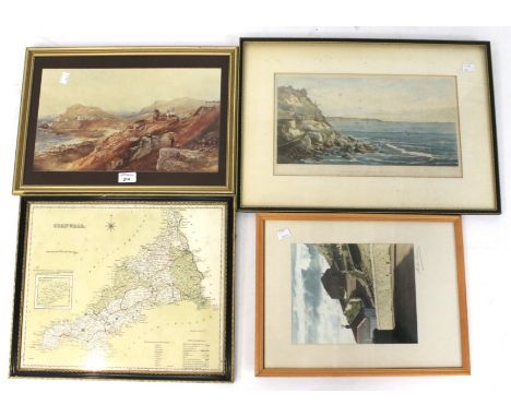
Assorted prints and maps. Including a 19th century hand coloured engraving of Cape Cornwall 40 x 23cm, a 19th century map of Cornwall, and other Cornish views The map of Cornwall including the Isles of Scilly, a print of a mining view in St Just and, a framed and signed photograph of a similar coastal view (4).


Lot 235
White (Walter) Northumberland and the Border, 8vo, illus. with fold-out map, second edition 1859; Woodman (William) Ulgham: Its Story, sml. 4to, quarter calf and boards, illus. with half-title woodcut frontispiece, Newcastle 1861; Hearse (George S.) The Tramways of Northumberland, 8vo, cloth, illus., Blanchland 1961; Graham (P. Anderson) Highways and Byways in Northumbria, 8vo, cloth, illus. by Hugh Thomson, 1921; and Denham (M.A.) Denham Tracts or A Few Pictures of the Olden Time in the North of England, facsimile edition, 8vo, cloth, Frank Graham, limited edition of 700 copies, 1974, with dw.


Lot 480
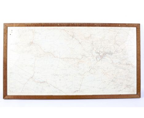
FIVE BOXES AND LOOSE SUNDRY ITEMS ETC, to include vintage fishing equipment comprising a J.W. Young Ambidex centre pin reel, boxed Black Knight baitcaster reel, Mibro Prefect F58/1 fishing rod, Mordex fishing rod, unbranded fibreglass rod, boxed Bakelite view-master with reels, Winsor & Newton easel, vintage Rotel headphones, Olympia Splendid 99 manual typewriter, brass wall mounted candle holders, brass hose nozzles, copper samovar, copper charger, Thomas Kinkaid mirror, Royal Air Force Edition map dated 1932 - England, SE & London, leather flying jacket etc. (5 boxes + loose)
Lot 611
A SMALL PARCEL OF PAINTINGS AND PRINTS ETC, to include a mixed media study of a Tawny Owl signed Maxine Bosworth, approximate size 42cm x 33cm, a watercolour depicting a canal scene with boats signed Garth Allan, unsigned pen and ink sketch with colours depicting a canal lock and bridge, a pencil sketch depicting an owl signed A.F. Addison, a lenticular (3D) print of an owl, a pencil sketch of a male figure wearing a flat cap signed Philip Greenwood, hand coloured Emanuel Bowen map depicting Worcestershire dated 1760, together with other assorted pictures etc, (box and loose)

Lot 444
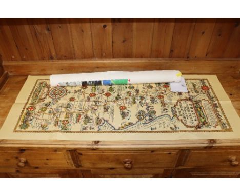
A MID-LATE TWENTIETH CENTURY WALL MAP OF THE BRITISH ISLES, titled 'Sales Promotion Map No 1: The British Isles' by George Philip & Son, map copyright date 1952, rolls up, and is mounted on canvas with wooden supports, approximate size - width 150cm x height 165cm including supports (1) (Condition Report: generally fair, has water damage , staining, tears and peeling down one side particularly, creases across the map, and a pen mark, otherwise appears ok)


Lot 1518
Three various whisky flasks including: stainless steel flask, marked capacity 6 ounces, with world map decoration, in original packaging, (height 13cm approx); together with a leather covered stainless steel flask, (height 16cm approx0; and a lady's blossom decorated pewter spirit flask, marked to base for Comoys, Sheffield, with capacity 7 ounces, (height 10.5cm approx).


Lot 373
Three Geoff Nutkins Military Aircraft Signed Colour Prints - ' Clifftop Chase ' limited edition no. 110/200, image measures 52cm x 34cm, ' The Height of the Battle - Sunday September 15th 1940 ' image measures 45cm x 31cm and ' The First of Four on the Fifteenth ', also signed by Wing Commander Thomas F Neil plus a John Freeborn signed Battle of Britain Photographic Print and an OS Map of Whitchurch, 52cm x 39cm, all framed and glazed


Lot 100
TALISKER 10 YEAR OLD MAP LABELSingle malt.Even by today’s standards Talisker distillery is a bit out of the way, nestled on the shore of Loch Harport on the west coast of the isle of Skye. This might explain why, in its early days, the distillery frequently changed hands, with owners struggling to turn a profit. It wasn’t until owner Roderick Kemp oversaw construction of a pier in the late 19th century, allowing much easier access for the boats that transported the casks to the mainland, that the distillery’s fortunes began to improve.Despite a minor stumbling block in 1960 when the distillery burned down and had to be completely rebuilt, it has grown to become one of the most recognisable single malt brands in the world.While more modern Talisker 10 Year Olds are still considered to be excellent, these older "Map Label" editions are regarded as being slightly superior.45.8% ABV / 70clFill level in high shoulder. There is some minor wear and tear to the carton.
-
109198 item(s)/page