We found 109198 price guide item(s) matching your search
There are 109198 lots that match your search criteria. Subscribe now to get instant access to the full price guide service.
Click here to subscribe- List
- Grid
-
109198 item(s)/page


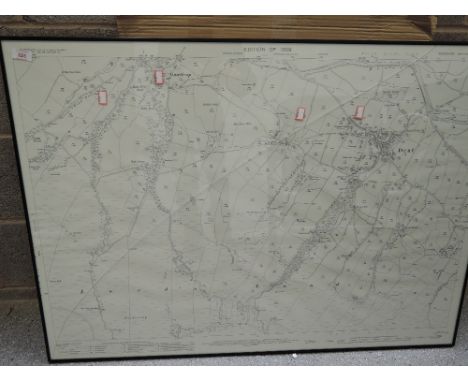


Lot 109
Lot to include a watercolour of a riverside scene of Beccles signed lower left by the artist Randall, mounted and framed under glass. Image size 23 cm x 50 cm. Also include are 2 printed maps, 1 of the North and East Ridings of Yorkshire, the other of Lancaster. Both framed. Image size of the Yorkshire map approximately 43 cm x 56 cm and 39 cm x 52 for the Lancaster map. (3)

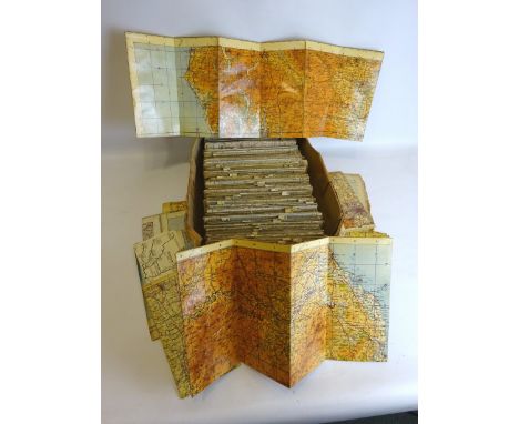
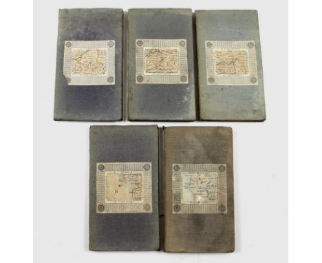
Lot 683
A group of five folding maps, circa 1880, engraved and printed onto linen backing in 21 sections with card and cloth cover, and marbled end sheet, 'Cruchley's Reduced Ordnance Map of England and Wales', published by G. F. Cruchley, Map Seller & Globe Maker, 81 Fleet Street, comprising sheet number 20, London, with trimmed lower edge, sheet number 37, Stafford and surrounds, sheet number 43, Manchester and surrounds, sheet number 47, Bay of Morecambe, Lancaster and coastlands, and sheet number 52, Lake District and surrounds, each hand coloured and with later additions showing railway lines in red, each 53.5 by 69cm, and 18.5 by 10.5cm, when folded. (5)


Lot 21
Two small framed and one unframed hand coloured maps 'A New Map Of The North Riding of Yorkshire' (30cm x 24cm) and 'East Riding And Anstey Of Yorkshire' (26cm x 21cm), 'North Riding Of Yorkshire' published by Archd Fullerton & Co Glasgow and engraved by James Neele & Co Burleigh Street Strand and framed map 'England And Wales' with illustrations by N Whittock and engraved by J Rogers (43cm x 49.5cm)


![Morden (Robt.), Episcopaius Dunelmensis Vulgo, The Bishoprick of Durham, nd. [1695 in pencil to rear], hand-coloured engraved](https://cdn.globalauctionplatform.com/262c3cd4-5ec8-407e-b0e3-a7f400ab6ac1/ce0db72b-0a25-482f-94a3-9afe750cc7e1/468x382.jpg)


Lot 212
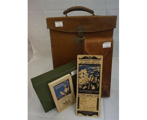
19th Century Walnut cased set of drawing instruments comprising of parallel rule, various attachments, 19th Century ivory bodkin and two folding maps; 'Bacon's County Map and Guide' and 'Brown's cycling, touring & driving road map' (4) Condition Report Click here for further images, condition, auction times & delivery costs


Lot 900
Interesting family medal groups, group of five King South Africa (erased) War medal and Victory medal (LT COL GUAYS) George V General Service Medal with Kurdistan clasp (LT COL F.L. GUAYS) and a Military O.B.E. Together with the conforming miniature group, also together with the lot Mrs M.L. Guays M.B.E. with M.B.E. related paperwork Included within the lot period paperwork relating to African mines, Cameroon expedition, Game licences with the amount of animals he may shoot, East Africa Forces Officers Release Book for Major Francis Lewis Guays 353 Italian co-op GRP, a hand drawn map of an African region, a silver trench watch, a compass, a photograph album relating the Guays family, Mr F.L. Guays Passport and Mrs M.l. Guays Passport, together with the lot a First World War pair War and Victory medal (M.L. FISON) and Second World War War medal and Africa Star, (qty)
![[HUNTING]. MAP A North Cotswold Hunt folding pocket map, retailed by Sifton, Praed & Co. Ltd, London, one-mile-to-an-inch,](https://cdn.globalauctionplatform.com/74b9f3c2-b6b2-4ffc-9386-a7fb00aff4f6/1a125214-344b-4657-bb3f-a243f676afcb/468x382.jpg)
![[HUNTING]. MAP A Cotswold Hunt folding pocket map, retailed by Sifton, Praed & Co. Ltd, London, one-mile-to-an-inch, colour](https://cdn.globalauctionplatform.com/74b9f3c2-b6b2-4ffc-9386-a7fb00aff4f6/8d19cab8-be39-4df1-c9f2-50d118d8065c/468x382.jpg)


-
109198 item(s)/page