We found 109198 price guide item(s) matching your search

Refine your search

Year

Filter by Price Range
  • List
  • Grid
  • 109198 item(s)
    /page

Lot 683

A Pembrokeshire geological Ordnance Survey map 1839 mounted on linen

Lot 901

A map of Shropshire by Archer for Dugdale 1846

Lot 1076

A set of three 19th century map prints of Edinburghshire from survey by James Knox, framed and glazed

Lot 326

A silver snuff box engraved with pirate island map, crossed swords and palm tree - Dutch hallmarks

Lot 201

STAFFORDSHIRE Speed (John), Stafford Countie and Towne with the ancient Citie Lichfeild described, hand coloured double page engraved map dated 1610, 15 1/2" x 20 1/4".

Lot 202

GLOUCESTER ROAD MAP E. Bowen, showing three routes around Gloucester, Winchcombe and Campden, Hand coloured engraved road map, circa 1720, 7 1/4" x 4 3/4", and a reproduction road map of Gloucester to Coventry, 16 1/4" x 21", (2).

Lot 203

GLOUCESTERSHIRE Speede (John), showing Gloucestershire map, town plan of Gloucester and Bristow,and Coat of Arms, hand coloured double paged engraved map dated 1610, 15 1/2" x 20 3/4".

Lot 1376

A framed coloured map of Stamford

Lot 384

Mordern: a hand-coloured map of Worcestershire, 14" x 17", and two other modern maps of Oxfordshire

Lot 994

A collection of prints including a Monet and a mounted map of Gloucestershire.

Lot 1028

A large print of the Mediterranean and a map of Gloucestershire

Lot 429

After Herman Moll. A late 18thC map of Africa, watercolour of two Suffolk barges, Jeffrey Webb.(1896-1991), Col Delhaute, Maritime Alps, oil on board, 25cm x 41cm. (3)

Lot 98

An Edward VII silver mounted leather Spectacle Case, a Cigarette Case, pair of silver and one plated Napkin Rings, silver mounted Button Hook, two Georgian silver Teaspoons, Propelling Pencils, Map Reader, sundry plated Spoons and Wine Label

Lot 531

Four Moorcroft Trinket Dishes decorated, Butterfly 2002, Fox in winter landscape, Map of British Isles, Pansies dated 2004

Lot 588

ROBERT MORDEN. A Map of Buckinghamshire, engraved map, coloured, 16 1/2 x 13 1/2 in; and an engraved map of Britain titled `Insulae Britannicae`; and an oval engraving after Bartolozzi depicting Heloise ; three (3)

Lot 599

ROBERT MORDEN. Herefordshire, engraved map, coloured, Pl. 14 x 16 in

Lot 1667

John Speed, `The Countie of Nottingham..`, sold by Thomas Bassett and Richard Chiswell, a hand coloured engraved map, with the plan of Nottingham, double glazed, 38cm x 51cm

Lot 1726

Indea seu Palaestina, Terra Sancta hand coloured map

Lot 873

Cooke (George Alexander) -Topographical and Statistical Description of the County of Lincoln..., a copious travelling guide forming a complete county itinerary, printed for C Cooke 17 Paternoster Row London, no date, circa 1820, folding frontis. map, red rebound leather small octavo; White (William). History Gazetteer and Directory of Lincolnshire and the City and Diocese of Lincoln, 1842, rebound tan leather; White (James). A Treaties of Veterinary Medicine in 2 Volumes, 8th edition London 1807, several coloured black and white plates to rear and coloured frontis. half calf marble boards. (3)

Lot 351

JOHN SPEED (1542-1629), `Suffolke` (1610), hand-coloured engraved map, in a gilt frame, the double sided mount with text to verso, 39 x 52cm.

Lot 352

JOHANNES LAUREMBERG (1590-1658), `Graecia` (circa 1650), handcoloured engraved map in gilt frame, 47cm x 56cm. (as found)

Lot 353

FREDERIK DE WIT (1629-1706), `Africa` (circa 1680), handcoloured engraved map, in a gilt frame, 50cm x 59cm (Provenance: purchased by the vendor from Frank Thorold, Johannesburg, 1983).

Lot 353A

HERMAN MOLL (1678-1732), `India Proper, or the Empire of the Great Mogul`, hand coloured engraved map, framed, 31cm x 21cm.

Lot 41

A coloured Richard Blome map of Devonshire

Lot 17

A quantity of framed prints including a map of Derbyshire, set of famous race-horses, large print of a steam train crossing a bridge on a lake and other prints (10)

Lot 113

A WWI PAIR TO 18913 PTE. W. INGLEY LIVERPOOL R., together with a WWI War medal to 44281 PTE. H. Ford N. Staff. R., ribbon missing, all medals as issued, six silks and a map of the Hazebrouck area of Belgium

Lot 349

`LEWIS`S TOPOGRAPHICAL DICTIONARY OF ENGLAND`, with a folding map of England and Wales by R. Creighton, plan of London and 43 county maps, all uncoloured, linen boards

Lot 184

An 18th century ink drawn and watercolour wash map of the section of land in Blean Common in Canterbury, printed in 1771, together with a colour print of a Victorian jug and a late Victorian Bible.

Lot 283

A silver National Maritime Museum Mercator World Map medallion, etc.

Lot 570A

ALL THE ORATIONS OF DEMOSTHENES ……, Trans Thomas Leland, L 1777, 3rd edn, 3 vols, engrd fdg map, unif old full cf gt, spines gt in compartments (3)

Lot 666

ANTONIO GALLENGA: SOUTH AMERICA, 1881, 2nd edn, with fdg map, orig cl gt, spine slightly worn, inner jnts split

Lot 668

BRYAN EDWARDS: THE HISTORY, CIVIL AND COMMERCIAL, OF THE BRITISH COLONIES IN THE WEST INDIES, Dublin 1793, 2 vols, engrd fdg map, 5 tables acf (the first as leaves, the rest fdg), old unif full cf gt, spine gt in compartments (2)

Lot 674

C W L BULPETT: A PICNIC PARTY IN WILDEST AFRICA ……, 1907, engrd col’d fdg map, orig cl gt

Lot 677

MAJOR E FELCE AND T H BARRY: PICTURESQUE NORFOLK ….., 1939, orig ptd paper wraps + BRITISH RAILWAYS HOLIDAY GUIDE – EASTERN AND NORTH EASTERN REGIONS, 1949, orig pict paper wraps + D A YATES COUNTY DIRECTORY OF NORFOLK OF TRADES, PROFESSIONS ETC, 1967-68, orig card wraps, inner jnts split, some contents loose, ex lib + JEAN GOODMAN: EDWARD SEAGO – THE OTHER SIDE OF THE CANVAS, 1978, 1st edn, orig cl gt, d/w + SUSANNA WADE MARTINS: A GREAT ESTATE AT WORK – THE HOLKHAM ESTATE AND ITS INHABITANTS IN THE NINETEENTH CENTURY, 1980, 1st edn, orig cl gt, d/w + MICHAEL FRIEND SERPELL: A HISTORY OF THE LOPHAMS, 1980, orig cl gt, d/w + CLIVE WILKINS-JONES (ed): THE MINUTES, DONATION BOOK AND CATALOGUE OF NORWICH CITY LIBRARY FOUNDED IN 1608, 2008, 1st edn, Norfolk Records Society, vol 72, orig cl gt, d/w + CAROLINE FENDALL: A NORFOLK ANTHOLOGY, 1972, orig cl silvered, d/w + DAVID H KENNETT: NORFOLK VILLAGES, 1980, 1st edn, orig cl gt, d/w + DOREEN WALLACE AND R P BAGNALL-OAKELEY: NORFOLK, 1951, 1st edn, with fdg map, orig cl gt, d/w (10)
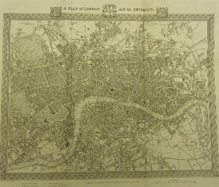
Lot 690

T BARBER: BARBER’S PICTURESQUE ILLUSTRATIONS OF THE ISLE OF WIGHT ……, [1834], 1 engrd fdg map, 40 engrd plts, old full blind stpd cf gt, slightly worn

Lot 695

[WILLIAM BATCHELLER]: THE NEW DOVER GUIDE ……, 1830, engrd fdg map, old cl bkd bds, ptd paper label to top bd

Lot 696

JOHN MURRAY: A HANDBOOK FOR TRAVELLERS IN SOUTHERN ITALY ------, 1865, 5th edn, with engraved folding map in rear pocket, old cl gt

Lot 739

FRANCIS BLOMEFIELD: AN ESSAY TOWARDS A TOPOGRAPHICAL HISTORY OF THE COUNTY OF NORFOLK ….., 1805-1810, vols 1-11, port frontis, 2 fdg plans, fdg map, 33 plts including 15 fdg, 14 fdg pedigrees, orig hf cf gt (11)

Lot 753

THE NORFOLK TOUR OR TRAVELLER’S POCKET COMPANION ….., 1795, 5th edn, recased, hf cf gt + G A COOKE: A TOPOGRAPHICAL AND STATISTICAL DESCRIPTION OF THE COUNTY OF NORFOLK ……, L 1822, engrd fdg map, 4 engrd views on 2 leaves, recased hf cf gt (2)

Lot 757

G CHRISTOPHER DAVIES: THE HANDBOOK TO THE RIVERS AND BROADS OF NORFOLK AND SUFFOLK, [nd], 18th edn, fdg map in pocket at rear, orig pict cl gt

Lot 761

KELLY’S DIRECTORY OF NORFOLK, 1937, with fdg map, orig cl gt + MICHAEL WINTON: NORWICH 1890 HISTORY AND DIRECTORY WILLIAM WHITE LIMITED, 1988, Limited Edition 431/1250, numbered and sigd, orig card wraps (2)

Lot 762

KELLY’S DIRECTORY OF CAMBRIDGE NORFOLK AND SUFFOLK, 1912, with fdg maps, orig blind stpd cl gt worn and soiled, spine faded, inner jnts slightly split + KELLY’S DIRECTORY OF NORFOLK, 1916, with fdg map (detchd), orig blind stpd cl gt, spine faded, inner jnts split, map and ttl pge detchd, lacks some contents (2)

Lot 763

KELLY’S DIRECTORY OF NORFOLK, 1937, with fdg map, orig cl gt

Lot 768

KELLY’S DIRECTORY OF NORFOLK, 1929, with map, orig cl gt worn and faded

Lot 781

VIEWS IN NORTH WALES, circa 1855, engrd ttl, 14 plts only, 3 others tipped in, old blind stpd cl gt, aeg, obl + JOHN MAYHALL: THE ANNALS OF YORKSHIRE ……., circa 1866, 2 vols, recased (not recent) qtr cf + J BULMER (ed): HISTORY TOPOGRAPHY AND DIRECTORY OF FURNESS AND CARTMEL ……, [1912], 2nd edn, fdg map inserted loose leaf, fdg pedigree, old hf cf gt (4)

Lot 788

[THOMAS KITSON CROMWELL]: EXCURSIONS IN THE COUNTY OF ESSEX ……, 1818-19, 1st edn, 2 vols, lge paper edn, 2 added engrd ttls, 96 engrd plts, fdg plan, lacks fdg map, rebnd full cf gt (2)

Lot 812

WILLIAM BEATTIE: SWITZERLAND ILLUSTRATED IN A SERIES OF VIEWS ….., [1835-36], 2 vols, 106 engrd plts acf, lacks fdg map and added vig ttls, old hf cf gt (2)

Lot 1531

A ARROWSMITH: MAP OF THE WORLD ON A GLOBULAR PROJECTION EXHIBITING PARTICULARLY THE NAUTICAL RESEARCHES OF CAPN J COOK FRS WITH ALL THE RECENT DISCOVERIES TO THE PRESENT TIME, engrd part outline col’d map, additions to 1799 in 4 sections mntd on linen, approximately 39” x 73”, f/g

Lot 1532

T KITCHIN: NORFOLK – A NEW MAP OF THE COUNTY OF SUFFOLK, 2 engrd col’d maps, circa 1780, approximately 6” x 7 ½” and 7” x 9 ½”, f/g (2)

Lot 1534

J CARY: NORFOLK, engrd col’d Map, 1787, approx. 8” x 10”, f/g

Lot 1535

T MOULE: A CAMBRIDGESHIRE, engrd col’d Map, circa 1850, approx. 10 ½” x 8”, f/g; + S HALL: NORFOLK, engrd col’d map, 1833, approx. 7” x 9”, f/g, (2)

Lot 1536

G A WALPOOLE AND A HOGG: A NEW MAP OF NORFOLK – A NEW MAP OF SUFFOLK, 2 engrd hand col’d maps on one sheet, circa 1784, approximately 13 ½” x 9”, f/g

Lot 1537

SAXTON / KIP: EXXEXIA, engrd col’d Map, circa 1637, approx. 11 ½” x 14 ½”, f/g

Lot 1538

T MOULE: SUFFOLK, engrd col’d map circa 1847, approximately 7 ½” x 9 ½”, f/g

Lot 1542

J OGILBY: THE ROAD FROM IPSWICH TO NORWICH AND THENCE TO CROMER, engrd hand col’d road map, circa 1675, approximately 12 ½” x 17”, f/g

Lot 1543

R MORDEN: NORFOLK, engrd hand col’d map [1695], approximately 14” x 22”

Lot 1545

R LARKE: A PLAN OF AN ESTATE IN THE PARISH OF SEETHING IN THE COUNTY OF NORFOLK BELONGING TO MRS MARY WADE, pen and ink and wash manuscript map on vell 1791, decor cartouche, approximately 33” x 25”

Lot 1546

SAXTON/KIP: HUNTINGDON COMITATUS, engrd hand col’d map circa 1637, approximately 10 ½” x 13 ½”, f/g

Lot 1548

R MORDEN: CAMBRIDGESHIRE, engrd map [1695], approximately 16” x 13 ½”, f/g

Lot 1550

J SPEEDE: NORTHUMBERLAND, engrd hand col’d map circa 1662, approximately 15” x 19 ½”

Loading...Loading...
  • 109198 item(s)
    /page

Recently Viewed Lots