We found 118276 price guide item(s) matching your search
There are 118276 lots that match your search criteria. Subscribe now to get instant access to the full price guide service.
Click here to subscribe- List
- Grid
-
118276 item(s)/page

Lot 199
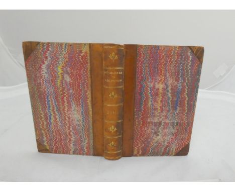
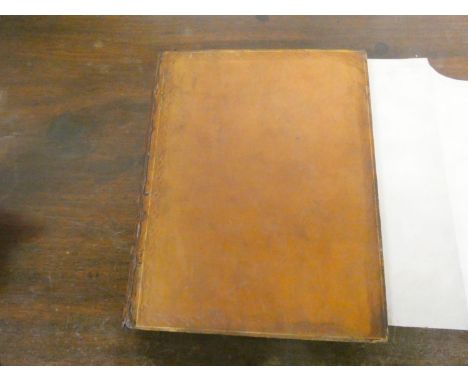
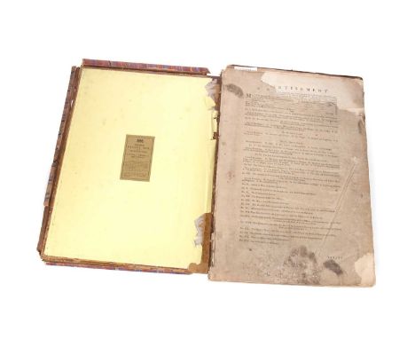
JOHNSTON A. K. The National Atlas of Historical, Commercial & Political Geography. 45 good double page eng. maps, mainly hand coloured in outline, also hand coloured Ethnographic Map of Europe. Large folio. Rubbed & worn orig. half morocco with soiling to endpapers but contents generally good. Edinburgh, n.d. but c.1843. Texas (map 49) is shown as a separate country from the United States.
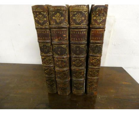
Lot 73
KEYSLER JOHN GEORGE. Travels Through Germany, Bohemia, Hungary, Switzerland, Italy and Lorrain. 4 vols. Eng. map frontis., 3 fldg. eng. plates. & 5 other eng. plates (one more than is customary in this edition). Quarto. Old mottled calf, tending to split at hinges. Book label of R.W. Webb. 1756-1757.
Lot 98
(HUC M.). Travels in Tartary, Thibet & China. 2 vols. Fldg. eng. map, eng. frontis, title vignette & text illus. Orig. embossed yellow cloth. 3rd ed., n.d.; also M. Huc, The Chinese Empire, A Sequel to Recollections of a Journey Through Tartary & Thibet, eng. frontis & title vignette, half calf, gilt back, New Edition, 1859. (3).
Lot 31
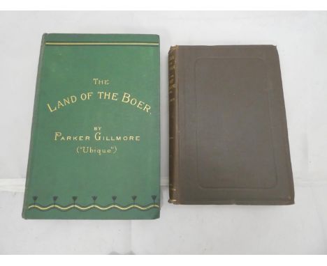
GILLMORE PARKER. The Land of the Boer or Adventures in Natal, the Transvaal, Basutoland & Zululand. Eng. frontis & map. Adverts. Orig. green cloth gilt. N.d.; also Leibbrandt, Rambles Through the Archives of the Colony of the Cape of Good Hope, orig. dark cloth, First Series, Cape Town, 1887. (2).
Lot 57
LIVERMORE MARY A. My Story of the War, A Woman's Narrative of Four Years Personal Experience as Nurse in the Union Army. Eng. port. frontis & col. & other plates. Orig. maroon cloth gilt, some wear & some internal foxing & spotting. Possibly the author's own copy inscribed to front free endpaper "Mary A. Livermore, Melrose, Mass. U.S.A."; also Frederick Milnes Edge, Major-General McClellan & the Campaign of the York Town Peninsula, fldg. map, orig. green cloth, 1865 & Alexander Begg, The Creation of Manitoba or A History of the Red River Troubles, frontis, Toronto, 1871. (3).
Lot 279
WEST THOMAS. The Antiquities of Furness, A New Edition with Additions by William Close. Eng. frontis, map, plates & illus. Subscriber's list. Worn bdg., internal browning & foxing. Ulverston, 1818; also P. J. Mannex, History, Topography & Directory of Westmorland & Lonsdale North of the Sands, no maps, adverts, 1849, & 1 other vol. (3).
Lot 94
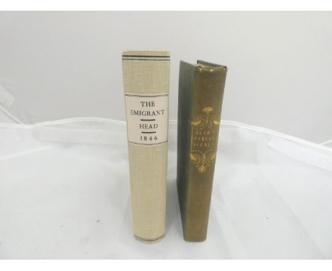
HEAD SIR FRANCIS B. The Emigrant. Half title with pres. inscription from the author to his niece. Publisher's adverts. Soiled orig. pict. brds., rebacked, internal foxing & spotting. 1846; also Sir George Head, Forest Scenes & Incidents in the Wilds of North America, half title, fldg. map, hand col. in outline, orig. green cloth, 1838. (2).
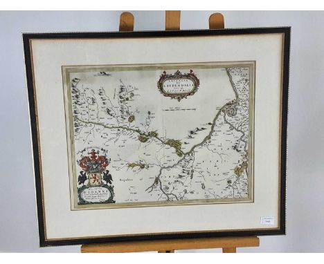
Lot 1246
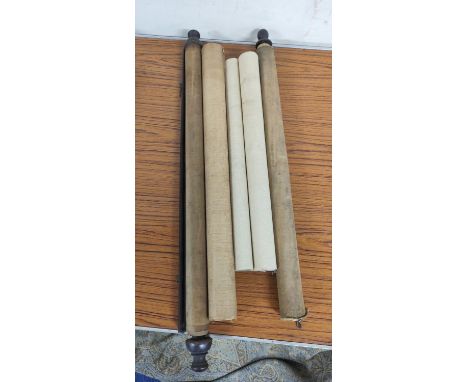
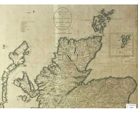
RENNELL (JAMES), COLLECTION OF MAPS RELATING TO INDIA, PUB. ACCORDING TO ACT OF PARLIAMENT, CIRCA` LATE 18TH CENTURY opening introduction and with Tables of Routes and Distances from Calcutta through the principal navigations, containing approximately twenty map plates (many fold out, some hand coloured), these titled and inscribed to persons of note, in loose boardsOverall fair condition, staining throughout, various creases, boards loose, various tears. See additional images added.
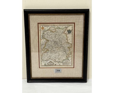
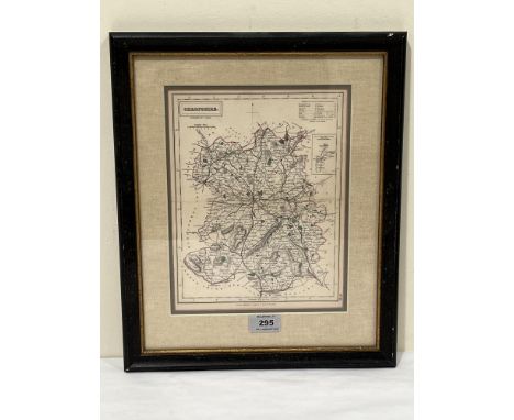
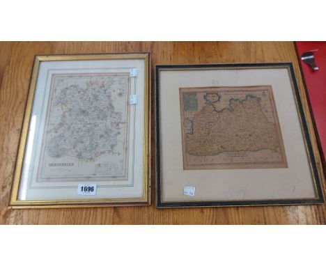
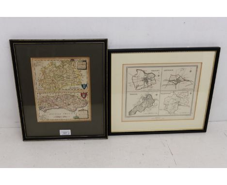
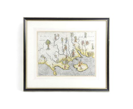
Lot 104
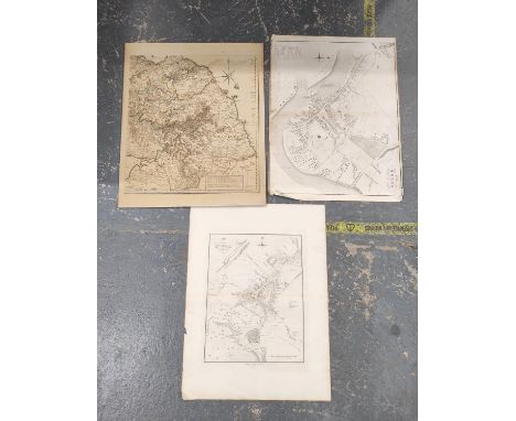
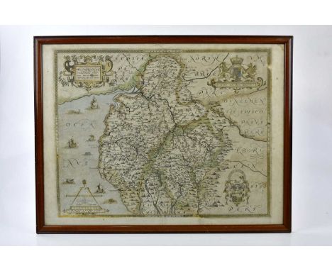
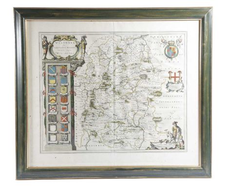
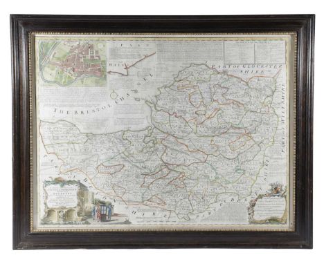
An old map of Herefordshire showing the heraldic coats of arms of the notable families of the county also inscribed Herefordia within the hand coloured decorative cartouche, 15.5" x 20" together with a further smaller map of Berkshire by Blome and bearing the date on a later label verso 1671 with the original price of £275, 8" x 12.75" (2)
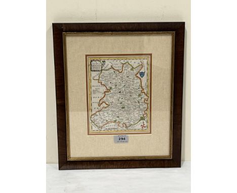
Lot 477
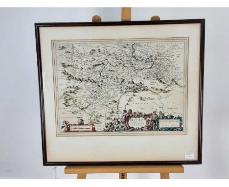
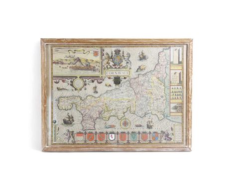
KING (D), THE VALE-ROYAL OF ENGLAND OR THE COUNTY PALATINE OF CHESTER ILLUSTRATED; engraved half title, two folding maps, three illustration plates and eleven plates of shields, London, John Streater, 1656, bound with, KING (D), A SHORT TREATISE ON THE ISLE OF MAN, in six chapters, engraved folding map and three plates, London, 1656, original board with later spine. (1)Provenance: Wear and scuffing to the leather with chips and boards to the long edges. Page 77-78 lacking page numbers because the long edge of the paper is incomplete but the text appears to be all present. Plates 8 and 9 mis-bound. Pagination errors. Some plates with old strengthening strips along the bottom edge.
Lot 3091A
A quantity of mixed 20th century prints, floral watercolours and 19th century colour prints to include; limited edition Simon Manby prints, signed by the artist, a Liz Talbot-Hall of Uttoxeter "Flowers in a Pottery Jug" watercolour/charcoal, small quantity of Norfolk floral artworks, map of Oxfordshire, a Vanity Fair supplement "Billy" print, Derick Brown large print, Michael Maccleay print, and others. (8 loose artworks and two boxes)
Lot 167
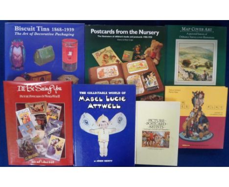
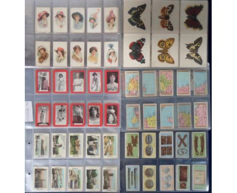
Cigarette cards, a large collection of approx. 1,800 cards in sleeves, mostly part sets & odds, many different issuers & series inc. Gallaher Useful Hints Series (77), Interesting Views (Coloured, set), Mitchell's Money (24/25), Hill's Inventors & Their Inventions (21-40, 18/20), Churchman's Sectional Cycling Map (34), Wills Transvaal Series (Black border, 18), (White border, set, 66 cards), Churchman's Boy Scout Series A Series (39) 2nd Series (41), 3rd Series (15, mixed backs), Phillips First Aid Series (set), Player's (Overseas) Butterflies (Girls) (33) & much more (very mixed condition, poor/gd)
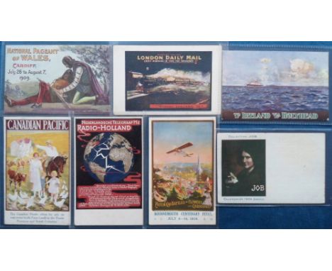
Lot 825
Postcards, Advertising, 7 poster ads for Canadian Pacific Railway, Netherlands Telegraph 'Radio Holland' with map of the world, Bournemouth Centenary Fetes 1910, Ireland to Holyhead (L & NW rail official), London Daily Mail Train, and National Pageant of Wales Cardiff 1909. Also Job Cigarettes featuring Calendrier 1906 (gd)
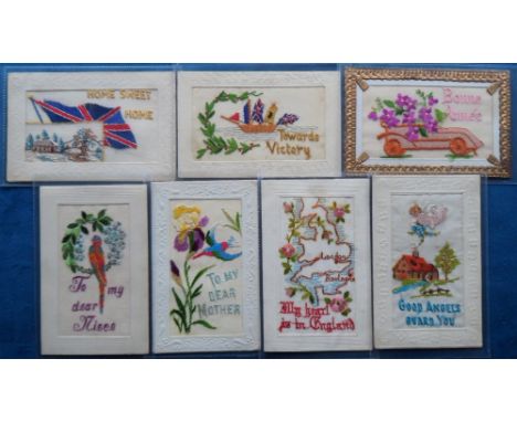
Lot 882
Postcards, Silks, a selection of 7 embroidered silk greetings and patriotic cards featuring kingfisher, parrot, decorated motor car, angel hovering over a cottage and garden, map of England with London and Boulogne captioned 'My heart is in England', boat with ship with four flags and captioned 'Towards Victory' and 'Home Sweet Home' showing Union Jack and inset country scene (mainly gd)

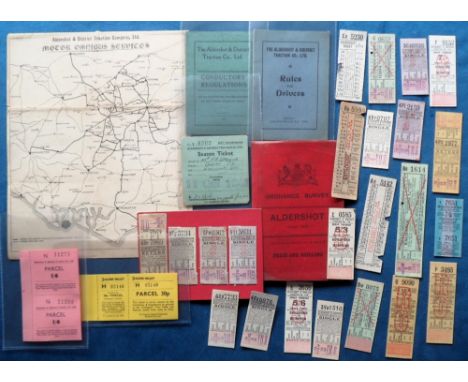
Lot 658
Ephemera, Transport, a good Aldershot District Traction Company selection, inc. season ticket for 1943, booklet for conductors regulations (1927) and rules for drivers (1928), bus tickets (23), share certificate which also shows a map of Traco bus services for 1927 and 6 parcel labels. Sold with Ordnance Survey map of Aldershot linen backed and published in 1900 (mainly gd)
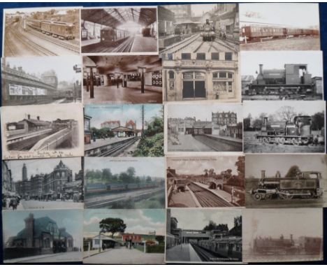
Lot 782
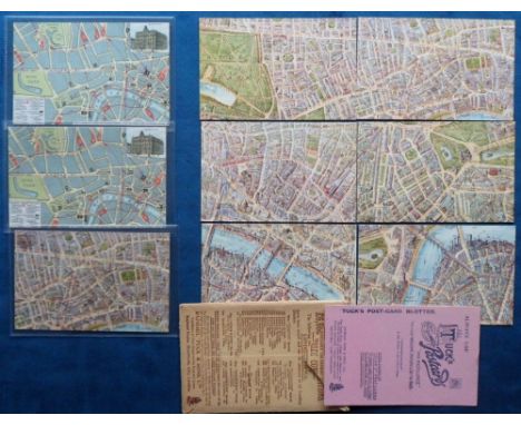
Postcards, Rail, a mixed selection of approx. 64 railway cards, with RPs of Ealing Broadway station interior, Piccadilly station from Lower Regent St; good RPs of locos, trains, rolling stock, carriage interiors mostly for the District Line (40). Also printed cards of stations at Sudbury Hill, Golders Green, Kingsbury-Neasden, Ruislip, Ealing Common, Southfields, Hounslow Town, and Post Office station London. Sold with folded map card and advert for Central London Tube (mixed condition)
Lot 592
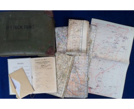
Militaria, RAF Observer's and Air Gunner's Flying Log Book belonging to W Elliott with details from 1942 to 1945 flying Defiants, Stirlings, Ansons, Martinets, Wellingtons, Henleys, Dakotas and Marauders (marked up with the words 'Duplicate Log Book' to the front page being Gunner Elliott's own contemporary duplicate with a hand written letter to confirm that the original and the copy co-exist), together with a 1941 dated, Broad Arrow marked map box marked 'O I/C Tech. Trng.' containing 12 WW2 dated maps and a qty. of other maps to include plotting maps, some marked up. Also a few post war examples (fair/ gd)
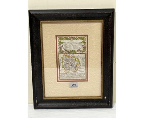
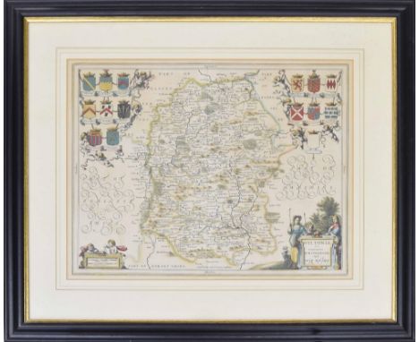
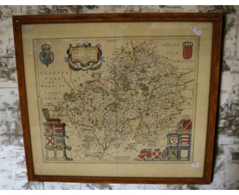
Lot 244
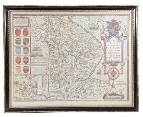
A MAP OF THE COUNTIE AND CITIE OF LYNCOLNE (LINCOLN)BY JODOCUS HONDIUS, C.1611described with the armes of them that have bene earles thereof since the conquest, sold by Bassett and Chiswell, with hand colouring, with 'The Description of Lincolnshire' verso, double glazed in a Hogarth style frame41.5 x 53.5cm
-
118276 item(s)/page