We found 109198 price guide item(s) matching your search

Refine your search

Year

Filter by Price Range
  • List
  • Grid
  • 109198 item(s)
    /page

Lot 199

British Isles. Speed (John), Britain as it was Devided in the tyme of the Englishe Saxons especially during the Heptarchy, pub. John Subury & George Humble, 1st ed., [1611], uncoloured engraved map, fourteen panels in the vertical margins depicting portraits and scenes of Saxon royalty, decorative cartouche and mileage scale, compass rose and numerous rhumb lines, 385 x 510mm, English text on verso, mounted. A fine dark mpression. Shirley, Early Printed Maps of the British Isles, no. 317. (1)

Lot 200

British Isles. Ruscelli (Girolamo), Anglia et Hibernia Nova, Venice [1598], uncoloured engraved Ptolomaic map , graduated scale to margins, decorated with sea monsters and a sailing ship, 190 x 255mm, Italian text on verso, mounted. Shirley, Early Printed Maps of the British Isles, no. 217. (1)

Lot 203

Devon. Speed (John), Devonshire with Excester Described and the Armes of such Nobles as have borne the titles of them, sold by Thomas Bssett & Richard Chiswell, [c.1676], uncoloured engraved map, inset town plan of Exeter, elaborate strapwork cartouche and mileage scale, old fold, water stained at base of image, 390 x 515mm, English text on verso (1)

Lot 204

England & Wales. Seaton (Robert), This New Plan of England and Wales, with the Adjacent Countries, compiled by Surveyors employed in the Ordnance Department, is Respectfully Dedicated to the King by his most Obedient Servant & Geographer, [c.1830], lg. folding map with orig. hand colouring, sectionalised and laid on linen, lg. vignette engraving of Windsor Castle, margins decorated with portraits of famous men from Great Britains historical past, edged in purple silk, 1200 x 960mm, contained in contemp. slip case, rubbed and worn, together with Philip (G. & Son, pub.),Perrier motor Map, [1906],colour printed map dissected and laid on linen in two sections, inset advertisement for Perrier mineral water, overall size approx. 1450 x 1900mm, contained in pubs. orig. red & green slip case, rubbed and soiled (2)

Lot 206

Europe. Wyld (James), Europe Describing all the Changes of Territory together with their Deviations in the Boundary Lines of its several Empires and States Agreed to and Confirmed by the Definitive Treaty of Paris, 1838, large engraved map with original outline colouring, sectionalised and laid on linen on two sheets, each sheet edged with green silk, calligraphic title, slight off setting, very occ. spotting, each sheet 1540 x 800mm, pubs. advertisements on verso, contained in contemp. slip case with printed label to upper board, rubbed and worn (1)

Lot 209

Gillray (James). The French Invasion; - or - John Bull bombarding the Bum-Boats, pub. H.Humphrey Nov. 5th 1793 but H.G.Bohn edition of 1849, uncoloured etching, slight overall toning, 350 x 250mm. A gloriously rude cartoon which depicts a stylised map of England and Wales complete with the face of King George III, defecating on France. The king’s faeces gradually evolve into warships which threaten the French coast. One of Gillray’s most vulgar cartoons which brilliantly captures the beligerent spirit of `John Bull’ in the face of the tyranny of France and Napolean. (1)

Lot 210

Glamorgan & Monmouthshire. Drayton (Michael), South Wales, the Bristol Channel and North Somerset, [1612 or later], uncoloured engraved map, numerous allegorical figures, 250 x 325mm, mounted, framed and glazed. Arguably the most attractive of all of Michael Drayton’s maps, and certainly the most charming with its depiction of a Welsh and English choral orchestra singing to each other across the River Severn. This musical theme gives it its colloquial title of `The Choirs map’. (1)

Lot 211

* Gloucestershire. Drayton (Michael), Gloucestershire and Worcestershire, [1612 or later], uncoloured engraved map, numerous allegorical figures, old folds, 255 x 335mm, mounted, framed and glazed. The map has a charming and vigorous depiction of the Robert Dover games, or `Cotswold Olympics’ which are held annually just outside Chipping Campden on Dovers Hill. (1)

Lot 212

Gloucestershire. Bryant (Andrew), Map of the County of Gloucester from Actual Survey by A. Bryant in the years 1823 & 1824, large engraved map with original hand colouring, sectionalised and laid on linen on two sheets, calligraphic title, uncoloured vignette of Gloucester Cathedral, slight off setting and toning, overall size approx. 1880 x 1740mm, contained in contemp. dec. gilt calf solander box, rubbed (1)

Lot 215

* Holy land. Stoopendaal (Daniel), De Gelegentheyt Van’t Paradys en’t Landt Canaan Mitsgaders D’eerst bewoonde Landen der Patriarchen...., pub. Hendrick Keur & Marcus Doornic, Amsterdam, [1688 or later], hand coloured engraved map, four oval vignettes depicting scenes from the Old Testament with a larger engraving of Noah’s Ark, 350 x 460mm, mounted, framed and glazed. A decorative Dutch `Bible map’ showing numerous biblical sites including the wanderings of the children of Israel, the Garden of Eden and the Tower of Babel. (1)

Lot 216

Homann (Johann Baptiste). Comitatus Hannoniae in suas quasque Castellanias Balliviatus... [1695 or later], engraved map with original hand colouring, 485 x 580mm, mounted, together with Seutter (Georg Matthaus),Alsatia Landgraviatus .... [1730 or later],engraved map with original hand colouring, 580 x 505mm, with Homann (Johann Baptist, Heirs of),Ducatus Silesiae Tabula Geographica Prima, Inferiorem Eius Partem...., 1745,engraved map with original hand colouring, 425 x 575mm, mounted, together with another eight similar maps including examples by De Vaugondy, Blaeu, Ortelius and Sanson, various sizes and condition (11)

Lot 217

Indian Ocean. De La Rochette (Louis Stanislas D’Arcy), A Chart of the Indian Ocean Improved from the Chart of M. D’Apres de Mannevillette with the Addition of a part of the Pacific Ocean as well as the Original tracks of the Principal Discoverers, or other Navigators to India and China, pub. W.Faden, June 4th 1803, engraved map with original outline colouring, sectionalised and laid on linen, two inset maps of the Anemo-Hydography of the Monsoons, 620 x 1160mm, pubs. printed label to verso (1)

Lot 218

Ireland. De Vaugondy (Gilles Robert), Royaume D’Irlande divise en ses quatre Provinces, et subdivise en Comtes, Paris, 1750, engraved map with orig. hand colouring, decorative cartouche, very slight staining just affecting image, occ. marginal closed tears, 495 x 545mm, mounted, framed and glazed (1)

Lot 220

Map Collector’s Circle. A broken run of eighty vols., nos. 1-7, 10-12, 15-32, 37-38, 40, 42-45, 47-48, 50, 53-54, 56-57, 59-62, 64-69, 72, 75, 77-87, 90-97, 99-101, 103, 106, 108 & 110, 1963-75, occ. b & w illusts. throughout, orig. pubs. printed wrappers. slight dust soiling, occ. rust marks to spines, 8vo (80)

Lot 231

Moxon (Joseph). Paradise , or the Garden of Eden with the Countries circumjacent Inhabited by the Patriarchs, [1661], uncoloured engraved map after N.Visscher, strap work cartouche, armorial crest and an engraved vignette of the expulsion of Adam and Eve, left vertical margin trimmed to plate mark, one closed tear affecting image, 320 x 470mm, together with A Map of all the Earth and how after the Flood it was Divided among the sons of Noah, [1671 or later],uncoloured engraved oval map of the world, California shown as an island twelve vignettes from the old testament surrounding map, right hand vertical margin trimmed to or on neat line, 320 x 455, with Jerusalem, [1671 or later],uncoloured engraved aerial city plan, title displayed in `ribbon cartouche’, table of explanation supported by an eagle, one armorial crest, 320 x 460mm, together with another seven uncoloured engraved `biblical’ and Holy Land maps by Lindenberg and Moxon, with nine engraved biblical scenes, various sizes and condition (19)

Lot 232

* Northamptonshire. Jansson (Jan), Comitatus Northantonensis vernacule Northampton Shire, [c.1650 or later], engraved map with original hand colouring, decorative cartouche and mileage scale, 390 x 510mm, central fold partially strengthened on verso, Dutch text on verso, framed and double glazed (1)

Lot 233

Ogilby (John). The Road from London to Portsmouth in com. Southhamp: Actually Surveyd & Delineated by John Ogilby Esq., [1675 or later], hand coloured engraved strip road map, toned overall, 330 x 440mm, together with Bowen (Emanuel),An Accurate Map of Cambridgeshire Divided into its Hundreds..., pub. J.Bowles, [1760 or later],engraved map with original outline colouring, engraved panorama of Ely, elaborate cartouche, slight water staining, 705 x 540mm, with three town plans by Thomas Moule each approx. 270 x 200mm (5)

Lot 235

* Ortelius (Abraham). Tartariae Sive Magni Chamiregni typus, Antwerp, [1570 or later], hand coloured engraved map of North East Asia, the Northern Pacific, Japan and North West America, elaborate cartouche, 350 x 465mm, mounted, framed and glazed. Koeman. vol. 3, p.25, Burden. The Mapping of North America, no.41. Marcel van den Broecke, Ortelius Atlas Maps, no.163. (1)

Lot 236

* Oxfordshire & Buckinghamshire. Drayton (Michael), Oxfordshire, Buckinghamshire and Berkshire, [1612 or later], uncoloured engraved map, numerous allegorical figures, very slight staining, 245 x 320mm, mounted, framed and glazed (1)

Lot 237

Plancius (Petrus). Tabula Geographica in qua Paradisus nec non Regiones Urbes oppida et loca describuntur quorum in Genesi menio fit: Pet Planc, pub. Jan Evertss Cloppenburgh, Amsterdam, [c.1653], uncoloured engraved map of the Holy Land alongside a depiction of Adam and Eve in the Garden of Eden, borders comprised of fifteen oval vignettes depicting various scenes from the book of Genesis, 290 x 490mm, Dutch text on verso, mounted. A very good dark impression of this scarce and highly decorative map. Originally published in a Dutch bible, the map shows paradise located just south of Babylon. (1)

Lot 238

Rose (F. W.). `Serio-Comic War Map for the Year 1877, lithographic map with original hand colouring, explanation and reference tables printed in German and English, some spotting but largely confined to margins, old folds where previously rolled, `Bacon’s Historical Map of Europe’ printed on verso, 440 x 610mm. Known as the `Octopus Map’, this socio-political map shows the sinister coils of Russia reaching out to envelope its neighbours in its tentacles. Scarce. (1)

Lot 239

Rose (F. W.). `England on Guard, A Serio-Comic Map for 1878’, pub. G.W.Bacon & Co., lithographic map with original hand colouring, slight spotting, old creases, one closed tear, 595 x 445mm. A belligerent British guardsman with his sabre half drawn defends the British standard which is firmly planted in the soil. A Russian makes an ineffectual attempt at chopping at the pole which supports the flag. Cannon balls cover the country and the caricaturist mocks the timidity of the aristocracy and the avarice of the industrialist Quakers. Scarce. (1)

Lot 242

Shirley (Rodney W.). The Mapping of the World, Early Printed World Maps, 1472-1700, pub. The Holland Press, 1983, col. and b&w illusts. of maps throughout, orig. cloth gilt, in d.j., folio, together with Tooley (R. V.), Collectors’ Guide to Maps of the African Continent and Southern Africa, pub. Carta Press, 1969, col. and b&w illusts. of maps., orig. cloth gilt, in d.j., slight tear to upper fold, small 4to, plus Ptolemy (Claudius), Geographia, Strassburg, 1513, pub. Amsterdam, 1966, b&w illusts. of maps, orig. cloth gilt, some fading to covers, folio, together with approx. sixty others, mostly map reference and travel related incl. Pitcairn: The Island, the People, and the Pastor..., by Rev. Thos. Boyles Murray, 1853, and nine Hakluyt Society vols. (approx. 60)

Lot 243

South America. Wyld (James), Colombia Prima or South America Drawn from the large Map on Eight sheets by Louis Stanislas D’Arcy Delarochette, 1838, engraved map with orig. outline colouring, sectionalised and laid on linen, edged in green silk, calligraphic title, tables of civil divisions and population, cross section of the Andes showing altitudes, 1095 x 790mm, publishers advertisement to end papers, contained in orig. slip case with orig. printed label to upper board, together with Andriveau-Goujon (E.),Confereration Argentine et Chili, Paris, 1891,hand coloured lithographic map, sectionalised and laid on linen, pubs. label to verso, contained in orig. green marbled chemise and slip case, contrasting gilt calf label to spine, worn and rubbed, with Waterlow & Sons Ltd, (pubs.),Argentine Railways, 1904,folding litho. map, printed in colours, with `Argentine Great Western Railway’ printed on verso, 600 x 620mm, together with a general letter from the secretary of the `Argentine Great Western Railway Company’, loose (3)

Lot 244

Spain & Portugal. Ruscelli (Girolamo), Tabula Europae II, [1561 or later], uncoloured Ptolemaic map, trapezoidal border with engraved scale, decorated with sea monsters and a sailing ship, 190 x 260mm, Italian text on verso, together with, Allard (Hugo),Nova et accurata Tabula Hispaniae, 1662 or later,engraved map with original hand colouring, central fold strengthened and restored on verso, toned overall, 445 x 555mm (2)

Lot 246

Spain & Portugal Homann (Johann Baptist), Regnorum Hispaniae et Portugalliae Tabula generalis de L’Isliana.... n.d., [1720 or later], engraved map with original hand colouring, elaborate b & w cartouche and mileage scale, additional title in Spanish above image, slight marginal staining, one printers fold running through cartouche, 515 x 605mm, together with Schenk (Pieter),Europa Excultissima, n.d., [1695 or later],engraved map with original hand colouring, decorative b & w cartouche, green watercolour has cracked with resulting slight loss, trimmed to plate mark, 505 x 580mm, with Mercator (Gerard),Morea olim Peloponnesus, n.d. c.1620,uncoloured engraved map, three worm holes to image, some place names underlined in brown ink, 345 x 415mm, Latin text on verso, with Ortelius (Abraham),Frisia Occidentales, [1584],hand coloured engraved map, separation along central fold with slight loss, strengthened on verso, 370 x 500, Latin text on verso (4)

Lot 247

Spain. De Wit (Frederick), Novissima et Accuratissima Regnorum Hispaniae et Portugalliae Tabula Auctore, Amsterdam, 1705, hand coloured engraved map, elaborate cartouche, central fold restored on verso, 505 x 590mm, together with De L’Isle (Guillaume),L’Esapgne Dressee sur la Description qui en ete faite par Rodrigo Mendez Sylva..., pub. Amsterdam, J.Covens & C.Mortier, n.d., c.1730,hand coloured engraved map, elaborate cartouche, central fold restored on verso, 500 x 605mm, with Visscher (Nicholaes),Hispaniae et Portugalliae Regna, Amsterdam, [1683 or later],engraved map with original outline colouring, slight spotting and staining, central fold strengthened on verso, 470 x 580mm (3)

Lot 248

Spain. Blaeu (Joan), Valentia Regnum; Contestani, Ptol. Edentani, Plin., [1650 or later], hand coloured engraved map, elaborate cartouche, compass rose and numerous rhumb lines, central fold strengthened on verso, 390 x 500, together with Arragonia Regnum Auctore Joanne Baptista Labanna, [1650 or later],hand coloured engraved map, elaborate cartouche, 420 x 525mm, with De Wit (Frederick),Accuratissima Principatus Cataloniae et Comitatuum Ruscinonis et Cerretaniae Descriptio, [1670 or later],hand coloured engraved map, elaborate cartouche and mileage scale, central fold strengthened on verso, 495 x 575mm, with another seven regional maps of Spain by J.Blaeu, various sizes and condition (10)

Lot 249

Switzerland. Munster (Sebastian), Nouvelle Description du Pais de Souysse, [c.1560], hand coloured woodcut map, title above image, restoration to corners of upper margin, 255 x 345mm, French text on verso (1)

Lot 255

West Indies. Moll (Herman), A Map of the West-Indies or the Islands of America in the North Sea with ye adjacent Countries; explaining what belongs to Spain, England, France, Holland &c., n.d., c.1710, large engraved map with orig. outline colouring, inset panorama of Mexico City and five inset maps of St. Augustin, La Vera Cruz, Havana, The Bay of Porto Bella and Cartagena, old folds, some fungal staining, one fold frayed and cracked with slight loss, strengthened on verso, trimmed to neat line on vertical margins, 600 x 1020mm (1)

Lot 256

Wiltshire. Greenwood, (C. & I.), Map of the County of Wilts, from an Actual Survey, 1829, engraved map with original hand colouring, calligraphic title, inset vignette of Salisbury Cathedral, 570 x 690mm, together with Bowen (Emanuel),An Improved Map of Wilt Shire, Divided into its Hundreds, pub. T.Bowles, [1760 or later],engraved map with original outline colouring, uncoloured cartouche, trimmed to plate mark at upper margin, marginal repaired tears, central fold strengthened on verso. 525 x 685mm, with Cary (John),A New Map of Wiltshire, Divided into Hundreds Exhibiting its Roads, Rivers, Parks &c., 1811,engraved map with original hand colouring, 580 x 520mm, and Ogilby (John),The Road from the City of Salisbury com. Wilts. to Campden com. Gloc. [1675 or later],hand coloured engraved strip road map, slight loss at central fold with strengthening to verso, 350 x 460mm, together with another four similar maps (8)

Lot 257

World. Bellin (Jacques Nicolas), Carte Reduite des Parties Connues du Globe Terrestre...., Paris, 1755, large engraved map with original outline colouring, decorative cartouche and advertisement, compass rose and numerous rhumb lines, 560 x 840mm (1)

Lot 258

World. Moxon (Joseph), A Map of all the Earth and how after the Flood it was Divided among the Sons of Noah, [1671 or later], hand coloured engraved map on an oval projection, California shown as an island, twelve decorative biblical vignettes, 320 x 450mm, mounted. A bible map dedicated to Gilbert Sheldon, Archbishop of Canterbury. Shirley, The Mapping of the World, no. 457. (1)

Lot 259

World. Buache (Philippe), Carte de Lieux ou Les Differentes Longuers du Pendule a Secondes ont ete Observees...., 1740, engraved map with original hand colouring, world map on a Mercator projection and two Polar maps on one sheet, each map approx. 250 x 385mm, together with, De L’Isle (Joseph Nicolas),Carte Generale des Decouvertes de L’Amiral Fonte, Paris, 1762,uncoloured engraved chart of the Bering straits, 315 x 395mm, with Geelkercken (Nicolaes van),Orbis Terrarum Descriptio Duobis Planis Hemisphaeriis Comprehesa, pub. J.Jansson 1632,uncoloured engraved hemispheral map, trimmed inside vertical margins with loss, several closed tears, map strengthened on verso and recto with archival tissue, 415 x 485mm, Shirley, Mapping of the World, no. 295, with one other similar map by Buache (4)

Lot 260

* World. Ruscelli (Girolamo), Orbis Descriptio, Venice [1561 or later], uncoloured engraved hemispheral map of the world, 190 x 260mm, mounted, framed and glazed. This is the first hemispheral map of the world to appear in an atlas. Based on Gastaldi’s map it show a land mass joining Asia to North America, and there is no southern continent (although this was amended on later editions). Shirley. The Mapping of the World, no. 110. (1)

Lot 421

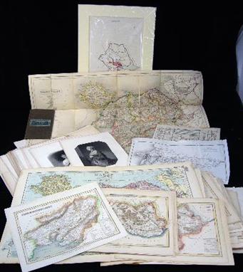
* Gordon (Charles George, 1833-1885). A long autograph letter signed `C.E. Gordon’, Khartoum, 27th November 1878, to Sir Samuel [Baker], `Thank you for your kind letter, 16 Oct. How well you write, I fear you have difficulty in reading my scrawls’, the letter continuing in a difficult hand, `Although I have made my apologies to you for my rudeness years ago, I think you will not think me breaking(?) impudence, if I mention what happened, at the same time, as I saw the McM[illan] advertisement. They were [?] the church Miss. Nyanza Expedition, and I have been writing to Grant, saying that Utesa was a Negro &c. &c. & that he & the troops might come into collision... `, continuing to give an account of why he had been cross with Baker and apologising once more then moving on to two numbered sections `Cairo Affairs’ and `Slave Trade’, the latter beginning, `Wylde tells me that our slaves have come to Jeddah & that the people are in despair. You must know I advised the seizure of III Dhows belonging to the Turks of Jeddah, who came over with water & food, evidently for slaves. We annexed the Dhows & sent the crews to Jeddah, this has stopped these people ...’, continuing which much detail about the slave trade and politics of it plus some account of his own actions and affairs, ending `As for trade with Blacks or any hope of getting any more ivory, it is over, each [?] having cost us 80 pounds & nothing, but misery. I hope you will come out. As for [?] tribunals, it has been this year, a terrible unhealthy year & I fear if any Europeans could stand the climate, you know the demands for high salaries & compensation which these men would bring forward (I think justly), and it makes me quail to think of the bother & expenses’, sending regards to Lord and Lady Baker and their nephew and finishing with postscript hoping he can ask Lieutenant Watson, R.E., to send Baker a copy of the Equatorial map, 15 pp. on four numbered bifoliums, a few spots and small marginal splits, final leaf sl. browned and worn on centrefold, 4to, together with Baker (Samuel), `The Albert N’yanza, Great Basin of the Nile’ [contained in] Proceedings of the Royal Geographical Society, vol. 10, no. 1, 14th December 1865, Baker’s first printed account of the discovery of the Albert Nyanza, folding map and 29 pp., orig. printed blue wrappers, a little soiling and wear to spine ends, slim 8vo (2)

Lot 427

* Nicholson (William, 1872-1949). Autograph letter signed `William Nicholson’, Sutton Veny, Wiltshire, 15th December 1925, to Phillis, thanking her for her letter, `I am sure your duties as night Nurse are hard enough without having to write letters of thanks but I am grateful just the same’ telling her that if she is in Southampton she might care to look in at a shop he has found that sells `clothes and things for sailor men and in the window you will see amongst other curious things some yellow gloves like this priced I think 3/6 a pair can you without worry try and send me two pairsÓ, hoping to see her at new year and saying that he is enclosing some money should she manage to get the gloves, written in red ink with a sketch map of the shop’s location at the foot of page one and a small picture of the gloves on page 2 inserted into the text with yellow and grey colouring, a little creased and soiled, 2 pp., 4to (1)

Lot 515

Mela (Pomponius). De Orbis Situ Libri Tres, Accuratis Sime Emendati..., Basel, 1522, titles within decorative woodcut border, second title part coloured, woodcut initials, lacking map as usual, Bb with small marginal repair, Ff6 with small strip torn away from inner margin, contemporary ownership inscription to first title (small marginal insect damage), occasional underlining and annotation, a few spots, near contemporary calf, insect damage at foot of spine, a little rubbed and stained, folio. Adams 1056. (1)

Lot 539

Stevenson (Robert Louis). Treasure Island, 1st ed., pub. Cassell, 1883, half title, three-colour map frontispiece, 8pp. publisher’s list coded 5R-1083, occasional light soiling and corner creases, small marginal burnhole, previous owner inscription to front endpaper, rear hinge weakening, original brown/green cloth, rubbed with a few stains, slight lean, 8vo. Prideaux 11. With the issue points: ÒDead man’s chestÓ not capitalised on pp. 2 and 7; no ÒaÓ in line 6 on p. 63; no ÒperiodÓ after ÒopportunityÓ in line 20, p. 178; ÒworseÓ for ÒworstÓ in line 3, p. 197. (1)

Lot 553

Kircher (Athanasius). Mundus Subterraneus, in XII Libros Digestus... 2 parts in one, 1st ed., pub. Jansson & Weyerstraet, Amsterdam, 1665, two additional engraved titles, engraved portrait of Pope Alexander VII (without the portrait of the author), thirteen engraved plates, two smaller plates, six engraved maps, folding tables, numerous illustrations, scattered minor spots, reference label to front pastedown, contemporary vellum, manuscript title label to spine, lacking three ties, light soiling, folio. Kircher’s influential survey of subterranean world, the first serious attempt to describe the geological and geographical makeup of the earth. The world map is one of the earliest to depict the movement of ocean currents with any degree of accuracy. Fergusson I, p.467; Sabin 37967. (1)

Lot 615

Haggard (H. Rider). Allan’s Wife and Other Tales, 1st ed., 1889, 32 pp. pubs. cat. at rear (dated September 1889), minor spotting or soiling, old ink price to half title, contemp. cloth gilt, a little rubbed and soiled, together with Black Heart and White Heart and Other Stories, 1st ed., 1900, first issue with Ò18Ó misprinted for Ò16Ó in the list of illustrations on page xi, occn. spotting and soiling, orig. cloth gilt, sl. rubbed and marked, spine cocked, plus King Solomon’s Mines, 34th thousand, 1886, folding colour map frontis. (two closed tears), pubs. ads. at rear, orig. dec. cloth gilt, somewhat rubbed and soiled, spine faded and frayed at ends, plus other Haggard titles including five MacDonald reprints in d.j.s., all 8vo (14)

Lot 677

Waugh (Evelyn). Black Mischief, 1st ed., 1932, map frontispiece, a few light spots, original cloth, slight lean, d.j., spine a little darkened and rubbed, 8vo (1)

Lot 683

Du Chaillu (Paul B.). Explorations & Adventures in Equatorial Africa, 2nd ed., 1861, folding frontis., num. wood-engs., folding map at rear, later half morocco gilt, rubbed and scuffed, 8vo, together with [Apperley, Charles James], The Life of John Mytton, Esq., of Halston, Shropshire, with his Hunting, Racing, Shooting, Driving, and Extravagant Exploits, by Nimrod, 4th ed., 1877, eighteen hand-finished aquas. (one sl. frayed at edges), orig. dec. cloth, a little worn at head and foot of spine, plus [Surtees, R.S.], Jorrocks’ Jaunts and Jollities. The Hunting, Shooting, Racing, Driving, Sailing, Eccentric and Extravagant Exploits of that Renowned Sporting Citizen, Mr. John Jorrocks, 3rd ed., 1869, sixteen hand-finished col. plts. after Henry Alken, orig. gilt-dec. cloth, worn on spine, inner joint cracked, 8vo, and other miscellaneous books (2 cartons)

Lot 359

ROBERT MORDEN - Map of Buckinghamshire, double page with hand colouring, 17" x 14" and a geological map of Buckinghamshire by John Cary (a late restrike) (2).

Lot 709

Chaillu (Paul B. Du). The Land of the Midnight Sun: Summer and Winter Journeys Through Sweden, Norway, Lapland, and Northern Finland..., 2 vols., 1881, num. b&w plts. and illusts., folding map in rear pocket of vol. 1, orig. dec. cloth gilt, rubbed, some staining, thick 8vo, together with Wilson (John M., ed.), The Rural Cyclopaedia, or a General Dictionary of Agriculture and of the Arts, Sciences, Instruments, and Practice, Necessary to the Farmer, Stockfarmer, Gardener, Forester, Landsteward, Farrier, &c, 16 orig. parts, 1847-49, num. b & w plts., lacking vol. 4 title, orig. printed wrappers, soiled, 8vo, with other miscellaneous books including natural history and farming, some of Welsh interest, plus a carton of maps, prints and pamphlets, etc. (3 shelves & a carton)

Lot 729

Farries (K.G. and Mason, M.T.). The Windmills of Surrey and Inner London, pub. Charles Skilton, 1966, frontis., b & w illusts. from photos, folding map, orig. cloth in sl. frayed d.j., 4to, with other miscellaneous books, including art reference, natural history, literature and biographies, etc., mostly recent hardback publications, many in d.j., G/VG (6 shelves)

Lot 732

Hastings (Max). Das Reich. Resistance and the March of the 2nd SS Panzer Division through France, June 1944, 1st ed., 1981, author’s presentation copy to Spike Milligan, inscribed on half-title, b & w illusts. from photos, map endpapers, orig. boards in d.j., 8vo, together with others of military interest (mostly WWII), mostly 20th c. hardback publications, many in d.j., G/VG. From the library of the late Spike Milligan, several volumes having gift inscriptions. (3 shelves)

Lot 18

A 19th century toy map globe or carpet bowl containing a rattle, the two halves jointed by an alphabet strip

Lot 548

An oval Needlework Map of England and Wales worked by `Susanna Dannans` showing counties and surrounding countries and having coloured floral border, 20 x 16in

Lot 154

"Greenwood`s Picture of Hull" with folding map, dated 1835 (detached boards etc.); C Jackson," Doncaster Charities Past and Present", published 1881 and other books of local interest.

Lot 63

C AND J. GREENWOOD (FLOURISHED IN THE 1820S), map of the Principality of Wales concluding the counties of Glamorgan, Brecon and Radnor. 24" x 27".

Lot 154

`Walkers North Wales` being a fold-out colour tinted map of the North Wales region by J N C Walker, printed by Longman & Co of Paternoster Row, London, the whole enclosed in a grey cloth bound booklet, also a quantity of other maps relating to North Wales, being the roads from Carmarthen to Cardigan (circa early 19th century), another of the map of the mail road from London to Holyhead, hand tinted map of Herefordshire, also maps of Anglesey, Monmouthshire, Carmarthenshire, Caernarvonshire etc, also a quantity of late 19th century black and white prints of actors and actresses comprising Juliette, Ophelia, Miranda, Anne Boleyn etc

Lot 161

A collection of books relating to the history of Chester comprising `History Of The City Of Chester From Its Foundation To The Present Time` by Pigott, printed for T Poole of Chester dated 1815 with numerous illustrations, bound with marble boards and leather spine, `The Strangers Handbook To Chester` by Thomas Hughes, printed by Thomas Catherall of Chester c.1858, with green boards with later leather spine, `Chester Archaeological Journal` volumes 2 and 3 of the first series printed at the Couant Office, Chester 1864 in blue half calf boards and black leather binding with gilt decoration (af), `Lectures On The History Of St John The Baptist Church And Parish In The City Of Chester` by the Reverend S Cooper Scott MA Vicar, printed by Phillipson & Golder of Chester 1892 in grey cloth, `The Walls Of Chester Their Origin And Extent` by Frank Simpson, printed by Phillipson & Golder, Chester 1910 in blue cloth, `The Story Of Chester` by James Williams, printed by Phillipson & Golder 1907 in blue cloth, `Chester In The Plantagenet And Tudor Reigns` by Rupert H Morris D D, printed for the author by G R Griffiths, "The Castle" Printing Works, Chester c.1895 bound in red cloth, `Old Chester` by H Hovell Crickmore, printed by J M Dent & Co, London 1895, bound in green cloth with gilt highlights, `The History Of The Church And Parish Of St Mary On The Hill Chester` by the late J P Earwaker, printed by Love & Wyman, London 1898, bound in green cloth with gilt highlights, `Chester` painted by E Harrison Compton, described by Francis R G Duckworth, published by A & C Black of London 1910, bound in red cloth with gilt highlights, `The Strangers Companion In Chester A New Edition` printed for G Batenham by Evans & Sons, Fourgate Street, c.1825 together with folded map and illustrations, bound in leather, `The River Dee Its Aspect And History` by J S Howson Dean of Chester and Alfred Rimmer, printed by J S Virtue & Co Ltd, London 1889, bound in brown cloth, `The Chester Guide Or A Walk Round The Walls And Through The City` printed by John Seacombe of Chester c.1828 with fold-out maps and illustrations, bound in black cloth with gilt highlights etc (18) (illustrated)

Lot 175

A collection of assorted books comprising `The Heavens` an illustrated handbook of popular astronomy by Amedee Guillemin, 5th edition, printed by Richard Bentley & Son 1872, bound in brown leather with gilt highlights, `The Moon` a complete description of the surface of the moon, containing the 300 inch Wilkins lunar map by Doctor H Percy Wilkins and Patrick Moore, printed by Faber & Faber Ltd, Russell Square, London 1955, red boards with leather spine with gilt highlights, `The Story Of The Heavens` by Sir Robert S Ball with twenty-four coloured plates and numerous illustrations, printed by Cassell & Co, London 1886 in blue cloth with gilt highlights, a paperback pamphlet entitled `Nasa`s 20th Anniversary` with space agency notes by Doctor Robert A Frosch, `Common Objects Of The Microscope` by the Reverend J C Wood with illustrations by Tuffen West, printed by George Routledge & Sons c.1900 bound in decorative boards with illustrations of a microscope together with insects etc (5)

Lot 180

A collection of books relating to North America comprising `Appendiculae Historicae Or Shreds Of History Hung On A Horn` by Fred W Lucas, printed for the author by Henry Stevens & Son Great Russell Street, London 1891, this being an authors presentation to R E Styles, covered in white board with decorative depiction of said horn with blue spine, `The History Of America` volume one by William Robertson D.D. the second edition printed for W Strahan in the Strand, London 1778 with fold-out map (repaired), fully bound in leather (af), `The Exploration Of North America 1630 To 1776` by W P Cumming, S H Hillier, D B Quinn, G Williams, printed by Paul Elek London 1974, bound in green cloth with original dust cover (3) (illustrated)

Lot 183

`The History Of The Jews From The Earliest Period Down To Modern Times` by Henry Hart Milman Dean of St Pauls, in three volumes, this being a fourth edition revised and extended printed by John Murray of London 1866, fully bound in brown leather with decorative gilt tooling and `The Land Of The Book, Or Biblical Illustrations Drawn From The Manners & Customs, The Scenes And Scenery Of The Holy Land` by W M Thomson with illustrations and a fold-out map, printed by T Nelson & Sons, London 1905, fully bound in brown leather with decorative gilt tooling (4)

Lot 399

After Christopher Saxton, Map of Somerset, coloured print, late impression.

Lot 422

Modern reprinted Map of Japan and two other Maps, various, framed, (3).

Lot 793

A beech six drawer map chest.

Lot 874

A pine seven drawer map chest.

Loading...Loading...
  • 109198 item(s)
    /page

Recently Viewed Lots