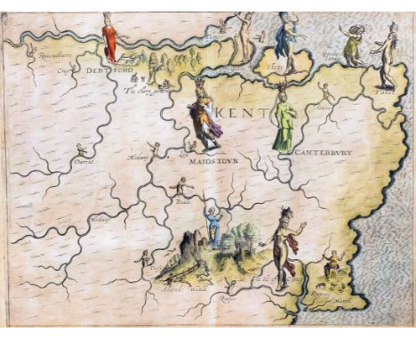
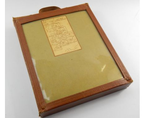
We found 109182 price guide item(s) matching your search

Refine your search

Year

Filter by Price Range
  • List
  • Grid
  • 109182 item(s)
    /page

Lot 349

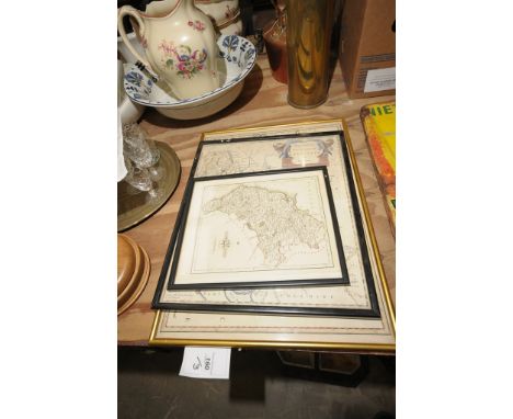
Emanuel Bowen (fl. 1714-died 1767) - Engraving - "An Accurate Map of the County of Kent divided into its Lathes" - Showing views of Canterbury and Rochester Cathedral, 16ins x 19.5ins, printed for Carington Bowles, No. 69, St. Pauls Churchyard, etc, 1st June 1777 (thought to be for Bowles' "New Medium Size English Atlas" published in 1785), and Richard Blome (fl. 1669-1705) - Engraving - "Mapp of Kent with its Laths", 10.5ins x 13ins (thought to be published for Britannia or "A Geographical Description of the Kingdom of England, Scotland and Ireland" published 1673), both in Hogarth frames and glazed

Lot 348

John Norden (1548-1625) and William Kip - Engraving - "Cantivm Quod Nunc Kent" - Map of the County of Kent, 11.5ins x 15ins, Latin text to reverse, published in Camden's Britannia 1607, in Hogarth frame glazed to both sides

Lot 351

Robert Morden (fl. 1668-1703) - Coloured engraving - "Map of the County of Kent divided into Hundreds", 13.5ins x 24.5ins, published for Camden's Britannia 1695 or later, in oak moulded frame and glazed, and Map of the Hundreds of Middleton alias Milton and of Tenham, 14.75ins x 19.25ins (slightly discoloured), from Hasted's "History of Kent", in Hogarth frame and glazed

Lot 353

Robert Morden (fl. 1668-1703) - Two coloured engravings - "Map of Kent", 13.75ins x 24.75ins (split on fold and slightly discoloured) and "North Riding of Yorkshire", 14.25ins x 16.5ins, sold by Able Swale, Alwnsham & John Churchill, published for Camden's Brittania, 1695-1715, both in oak frames and glazed

Lot 347

Michael Drayton (1563-1631) - Coloured engraving - Decorative Map of the County of Kent, 9.75ins x 12.75ins, published for Poly-Olbion 1612, in ebonised and gilt moulded frame and glazed Provenance : P.J. Radford, Sheffield Park, Uckfield, Sussex and Albrecht Carl Seutter (fl. 1741) - Two engravings - Map of East Kent and Map of the English Channel, 11.75ins x 10ins, thought to be published for Atlas Minor 1771/1774, both in Hogarth frames and glazed

Lot 398

A vintage gilt metal circular powder compact, together with a compact showing a map of France, and a small red folding picture frame

Lot 166

6 King & Country. 3x WW2 German Forces – WSS83 General Hasso von Manteuffel. WSS127 General Oberst Heinz Guderian. Plus WSS128 General Oberst Eduard Dietl. Plus 2x Battle of the Bulge, BBG11 Command Group comprising 2 figures and a map. Also BBG07 Sepp Dietrich. Also a Waffen SS WSS35 Der Fuhrer. All boxed with packing. Contents Mint.

Lot 137

A reproduction map after Jefferson Virginia, Maryland and Delaware

Lot 905

After Robert Morden - Hand-coloured and engraved county map of Hertfordshire; and a triptych print showing the rigging of a ship (2)

Lot 803

An early 19th century New Map of the County of Suffolk divided into Hundreds, engraving with later hand-colouring, 44 x 49cm

Lot 865

Assorted reproduction county map prints and engravings

Lot 866

An 18th century engraved county map of Norfolk, later hand-coloured; one other of Herefordshire by Robert Morden; and a new map of Chinese and Independent Tartary by John Cary 1806 (3)

Lot 402

Published late 19th century AD. In four volumes, published by William Mackenzie, 69 Ludgate Hill, London; including all the works of Robert Burns (1759-1796), with a biography and edited by Rev. George Gilfillan, titled The National Burns including the Airs of all the Songs, in dark green gilt cloth binding with portrait to front covers, aeg [(i): fp.; title; 7 pl. and map; life cxxxvi pp.; works 1-88pp.; (ii): fp.; title; 7 pl.; 89-232pp.; songs 1-80pp. (iii): fp.; title; 7 pl.; text 1-200pp. (iv): fp.; title; 6 pl.; text 201-408pp.; index 1-8pp; all with woodcuts]. Property of a Kent collector; by inheritance 1970; formerly property of Jack Smith, antiquarian and collector of Hebden Bridge, Yorkshire, UK, acquired 1920s-1960s. 4.42 kg total, 21 x 26cm (8 1/4 - 10 1/4"). [4, No Reserve] Good condition; some wear to bindings, one backstrip loose. Scarce set.

Lot 525

A 19th Century hand coloured map of Staffordshire by Bowen, hand coloured map of Westmorland by Moll and a frame book page depicting image of Dolwydellan castle.

Lot 308

Robert Morden hand coloured engraved map of Wiltshire (c.1695-1722)34 x 40 cms

Lot 309

Robert Morden handcoloured map engraved of Berkshire (c.1695-1722) 36 x 42 cms

Lot 310

Handcoloured printed British Gazetteer Map of Gloucestershire

Lot 311

Robert Morden handcoloured engraved map of Somersetshire (c.1695-1722) 36 x 42 cms

Lot 312

Handcoloured engraving, Robert Morden map of Berkshire and modern colour print of map and vignettes of the Cotswolds (2)

Lot 313

John Speed handcoloured engraved map of Worcestershire, "defcribed", (c.1627) English, having coats of arms and town plan of Worcester, text to verso, Map not laid down, 40 x 52 cms

Lot 195

T. BULMER - 'HISTORY, TOPOGRAPHY & DIRECTORY OF DERBYSHIRE', 1895 (A/F) together with various Kelly's Directories Derbys 1912, 1932 & 1936, Staffs 1921 & 1940, Sheffield & Rotherham 1974 (7)Buyers - for shipping pricing on this lot, visit www.cuttlestones.co.uk/shippingCondition Report:Bulmer's - lacks title page, map present but detached with 1" tear in margin, cover scratched

Lot 205

THE CHINESE TRAVELLER containing a Geographical, Commercial, and Political History of China', Vol. II only 1775, torn map with loss and plates missing, together with W. H. Bartlett - 'Jerusalem Revisited', 1863 and Adam Smith - 'An Inquiry into the Nature and Causes of the Wealth of Nations', 1839 (3)Buyers - for shipping pricing on this lot, visit www.cuttlestones.co.uk/shippingCondition Report:Please note: every page of every book is not checked, if you are unable to view yourself please ask for detailed information

Lot 217

A SAXTON-HOLE MAP OF WORCESTERSHIRE c.1637, together with a Cole & Roper map of Wiltshire, a Kitchin map of Staffordshire and a reproduction Robert Morden map of Warwickshire, all framed and glazed (4)Buyers - for shipping pricing on this lot, visit www.cuttlestones.co.uk/shippingCondition Report:Please note: every page of every book is not checked, if you are unable to view yourself please ask for detailed information

Lot 257

AN 'ACCOSON' BLOOD PRESSURE MONITOR ETC., a cased massage machine an optical examination device, a Lister hand map and a Chinon 470 cine camera (5)Buyers - for shipping pricing on this lot, visit www.cuttlestones.co.uk/shipping

Lot 115

A Victorian linen-backed folding map section of the Great Western Railway, and an accompanying LNWR 1850s memorandum (2)

Lot 209

A silver cigarette case, the lid engraved with map on India, gilt lined stamped sterling silver 4oz

Lot 352

A Morden map of Warwickshire, a landscape print and a watercolour Venetian scene (3)

Lot 492

Banksy Dismaland, Bemusement Park Official map & poster from location 4 (Guerilla Island) for pasting on walls outside the event, rolled, 16.5 x 11.5 inches.Provenance: Obtained from Dismaland exhibition in Weston-super-Mare. Photograph shown of an identical poster pasted on a wall at the bemusement park.

Lot 861

William Bill Hewison, original cartoon, A map of the world, Lyttleton Theatre Punch 2 Feb 1983, Bill Nighy, Sheila Scott-Wilkinson Roshan Seth, 10 x 15. Provenance; Bill Hewison was a well-known cartoonist who worked as Art editor for Punch for 24 years and produced many of their front covers. Collection sent in for sale by his family.

Lot 310

A 19th century Cary's map of the roads of the British Isles, a set of four other folding maps, including areas of Sussex, and another of Middlesex, all in card sleeves

Lot 413

John Speede, a 17th century map of Derbyshire, inscribed Darbieshire, Anno 1610, with town plan of Darbye and Coats of Arms, 41cm by 51cm

Lot 404

An 18th century topographical map of Sussex County by Thomas Gream, published by W Faden, 1799, 78cm by 37cm

Lot 160

A mid 17th century hand tinted map of Northumberland, by S R Sanson of Paris dated 1658, 38x53cm, mid 18th century hand tinted map of the county Palatine of Lancaster by Robert Morden, 41x36cm, late 18th century tinted map of Cumberland, published January 1st 1793 by J. Cary, 27x22cm, all framed and glazed (3)

Lot 320

A Victorian print , maid holding a tray , within a ribbon tied frame, a reproduction map and coloured reproduction interior scene with cardinals. (3)

Lot 306

A Reproduction framed map " A New Chart of the Islands of Scilly"

Lot 304

Nine assorted pictures and prints including a 19th Century black and white engraving, reproduction map, industrial landscape, etc.

Lot 913

OLYMPICS, selection, inc. German c/c, Olympia 1936 Vols I & II (with map), with duplicates laid down in scrap album; IOC Poster postcards (42), Impel US Olympic Hall of Fame (set of 90) etc., G to EX, 136*

Lot 9

FRY, Treasure Island Map, Canadian issue, creased (5), FR to G, 10

Lot 390

18973-5 Licenses to search for coal etc.. 3 licences given by John Ralph Ormsby Gore of Brogyntyn, Shropshire, to Sir Edmund Buckley of Dinas Mawddwy, Merioneth, Baronet and Bathurst Henderson of Plas Gwynne, Gobowen, Shropshire, Mining Engineer. Each licence accompanied by a large detailed map showing boundaries of the land etc.. Reserve: £20

Lot 341

A George II style Vauxhall mirror (faults); a reproduction Saxtons Caernarvonshire map

Lot 325

Ephemera - Views of Ypres; Bacons map; Brooke Bond tea cards; Postcards; letters; etc

Lot 380

Four 19th Century strip maps decorated the arms of Truro, Stamford, Christchurch and Banbury (double sided) and another strip map detailing the road from London to Bristol

Lot 341

T Kitchen: two 18th Century engraved maps, "Pembrokeshire" and "Cardiganshire", in oak frames, and one other map, "Sussex"

Lot 303

W. FORSTER AFTER THOMAS CHIPPENDALE - DESIGN FOR A CHIMNEYPIECE, PLATE CLXXXIII FROM THE DIRECTOR, ENGRAVING, 1761, FRAMED, A MINIATURE MAP OF DURHAM, AN INDIAN BRASS REPOUSSÉ DISH AND A VICTORIAN PEWTER MUG

Lot 365

FIVE 18TH AND 19TH CENTURY ENGLISH MAPS, INCLUDING A MINIATURE SPEED MAP OF DERBYSHIRE, ALL HAND COLOURED, VARIOUS SIZES

Lot 347

A BLAEU MAP OF DERBYSHIRE, FRAMED AND MISCELLANEOUS PICTURES AND PRINTS

Lot 1079

ANTIQUE STYLE MAP OF GREAT BRITAIN. Framed and glazed antique style map of Great Britain 39 x 50 cm

Lot 291

A map of Hertfordshire, by Kitchin, together with a book titled 'English Watercolours', and a collection of Perrier prints

Lot 458

'Legal London - A Map Showing the Inns of Court ... AD 1931', designed and drawn by G Spencer Hoffman and inscribed in pencil, published by The Barnard Press, 47 x 60cm

Lot 461

A David Roberts lithograph of a minaret, small map of Persia, by A Findlay, map of The Red Sea, and map of part of The Middle East, in Arabic, 66 x 100cm

Lot 449

A Philips large school room map of the world, showing 'The British Empire and other Colonial Powers and Commercial Highways', published in 1946, 111 x 184cm

Lot 268

A framed & glazed 19th century Henry Teesdale hand coloured map of Rutland. Frame size 50 x 58cm

Lot 180

A vintage German double sided chartometer map measuring wheel, scales are inches to miles/centimeters to kilometers on one side and on the other side are statute miles, kilometers & nautical miles. Together with a vintage hand held compass.

Lot 748

A selection of titles about the battlefields of the First World War including Peter Chasseaud, 'Topography of Armageddon: A British Trench Map Atlas of the Western Front 1914 -1918','The Western Front from the Air', 'Battlefields of the First World War: A Traveller's Guide', 'The Viking Atlas of World War I', 'Chronicles of The Great War' and 'The Macmillan Dictionary of the First World War'.

Lot 30

A vintage twelve sheet road map for motorists of England and Wales, in a leather reveal folder.

Lot 31

A George Philip and Sons vintage ten sheet motorist map, with leather reveal folder.

Lot 314

Railwayana; a quantity of books and printed ephemera, including a map of the Frontier Stations of Europe, station diagram after the Hertford North rail collision 6th February 1978, Instructions on conveying Armoured Fighting Vehicles by rail 1957, British Rail Rule Book 1950, and S&C planning diagrams around Cambridge, Wisbech, Ely and Spalding.

Lot 517

Group of assorted furnishing prints, map etc. (9)

Lot 545

A collection of assorted furnishing pictures to include prints, nude study in pencil by C. Hopkins, small cottage study in watercolours, other watercolours, map etc. (18)

Lot 561

Two 19th Century framed topographical prints, 'Carmarthen' and 'Cardigan' and a framed map of Carmarthenshire. Hogarth frames. (3)

Loading...Loading...
  • 109182 item(s)
    /page

Recently Viewed Lots