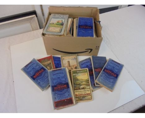
We found 109198 price guide item(s) matching your search

Refine your search

Year

Filter by Price Range
  • List
  • Grid
  • 109198 item(s)
    /page

Lot 228

Ornithology: Blackburn, Mrs [Jemima] Hugh - Birds Drawn from Nature, folio, half calf, with 40 only lithograph plates, Glasgow 1868; Ticehurst, Norman F - A History of the Birds of Kent, 8vo, cloth, 24 photographs and coloured folding map at rear, London 1909 and Witherby H.F. et al - The Handbook of British Birds, 5 vols, 8vo, cloth, London 1945 (7)

Lot 251

Speke, John Hanning - Journals of the Discovery of the Source of the Nile, 1st edition, 8vo, original cloth, with folding map in rear cover pocket, 2 engraved portraits and 24 plates, title page browned and with repair to top right, light spotting throughout, minor joints reinforced in green tape, William Blackwood & Sons, Edinburgh and London, 1863

Lot 265

Brady, John Henry - The Dover Road Sketch Book, 12mo, embossed cloth, with folding map and 8 road maps, Henry Ward, London 1837

Lot 270

Fussell, L.A. - Journey Round the Coast of Kent, 8vo, rebound, facsimile folding map, Baldwin, Craddock and Joy, London 1818 and Shindler; Rev. R - Mission Work among The Hop-Pickers in the Weald of Kent, London [circa 1895]; Oulton, W.C - Picture of Margate, and its Vicinity, 8vo, rebacked, lacking early text and some plates, other plates trimmed, remounted and bound in, London 1820 (3)

Lot 274

Hensall, Samuel and Wilkinson, John - Domesday ... This the Counties of Kent, Sussex and Surrey, qto, rebound half cloth, with double page map of Kent, London 1799; Scraggs, Sir William - The Practice of Courts-Leet, 8vo, calf, front cover detached, London 1728 and Ecton, John - Thesaurus Rerum Ecclesiasticarum, 2nd edition, qto, rebound cloth, London 1754 (3)

Lot 324

Jackson, Albert Bruce - Catalogue of the Trees and Shrubs (Excluding Rhododendrons) at Borde Hill, Sussex, in December 1932, with a foreword and notes by Colonel Stephenson Robert Clarke, C.B., portrait frontis, 8 photo plates and a folded sketch map, original half calf and gilt pictorial cloth, Oxford: printed at the University Press ... 1935, possibly one of a few copies bound for presentation (? with the map added); this one interleaved throughout - with some notes and a few loose inserts; the Colonel's initials ('S.R.C.') gilt stamped on upper cover, and his presentation inscription at front (recipients name crossed through); another copy, in a somewhat similar format had been gifted to the Du Cane Godmans (of South Lodge, near Horsham). This now famous collection had been built up by Colonel Clarke (1862-1948) from where the Estate had been acquired in 1893)CONDITION: Leather corners with some wear, the volume amateurishly rebacked, frontis with marginal spotting and guard torn, final 2 index leaves with unsightly cellotape repairs.

Lot 325

Brocklehurst, Capt. H.C. - Game Animals of the Sudan; their habits and distribution ..., 12 coloured plates by W.H. Riddell, numerous text illustrations and a folded map, gilt pictorial cloth, 1931; Wolhuter, Harry - Memories of a Game-Ranger, 6th edition, portrait frontis and 16 plates, numerous text illustrations, map on endpapers, gilt pictorial cloth, (Johannesburg 1958); together with 13 others on foreign travel and natural historyCONDITION: Brocklehurst-v.sl. wear/marks on cloth, spotting on half and title pages and slightly elsewhere; Wolhuter - sl. 'knocked' on spine, otherwise good copy; Others include Younghusband's Kashmir/Black's Colour Books, repr. 1911, 70 col. plts and folded map, good condition, Seton Thompson's Chinese Lanterns (N.Y. 1924), many photo plts, Very good copy, Roosevelts The Wilderness Hunter (Ist trade edition, 1883), 24 plts, 'edition-de-luxe' notice tipped in, reddish-brown chapter heads (? denotes first issue), gilt pictorial cloth (some wear and marks), few marks etc. inside-with 'used' feel

Lot 326

Bindings - Hissey, James John - On Southern English Road, 16 plates and folded map, earlier 20th century, royal blue gilt ruled levant, half morocco and cloth, gilt pictorial and panelled spine, gilt top and marbled endpapers, by Riviere, 1896; Roberts, Lord - Forty One Years in India ...., 14th edition, 2 vols, 29 plates including folded plans and maps, some coloured, gilt ruled red half calf and cloth, gilt decorated and panelled spines, marbled endpapers (by Bickers) 1897; Stephens, James - Collected Poems, limited edition, publisher's vellum backed blue paper boards, gilt lettered spine, fore and lower edges uncut, 1926, one of 500 large paper copies, signed by author, together with 5 other leather bound booksCONDITION: Hissey- some inside spotting, with 2/3 plate margins also, overall very good copy, original gilt pictorial cloth spine and upper cover bound-in at end, 1st edition. Roberts-title and other foxing, bindings very good, reprinted month following original issue

Lot 330

Cheesney, Francis Rawdon - Narrative of the Euphrates Expedition, 8vo, rebound cloth, with 45 litho plates and 1 map, lacking map at end, some staining to plate margins, Longman, Green and Co., London 1868

Lot 337

Sussex Interest: Shoberl, Frederick - A Topographical and Historical Description of the County of Sussex, 8vo, rebound quarter calf, folding engraved map, 9 plates, London [c.1813]; Chambers, George - Tourist's Guide to the County of Sussex, 12mo, cloth, with folding map, London 1883; A Guide to all the Watering and Sea Bathing Places, 12mo, rebound calf, with folding engraving of Brighton Pavilion, London [c.1823] and Paterson, Daniel - Paterson, Daniel - Paterson's Roads, 18th edition, with folding maps, London 1826 (4)

Lot 339

Brassey, Annie Allnutt - A Voyage in the Sunbeam, 6th edition, 8vo, cloth, with folding world map, London 1878; Gleichen, Count - With the Camel Corp Up The Nile, 8vo, cloth, London 1888; Waterton, Charles - Wanderings in South America, 8vo, rebound quarter calf, London 1879; Stevenson, Robert Louis - Treasure Island, illustrated by Rowland Hilder, qto, cloth with dj; Humphrey Milford, Oxford, 1929; Williamson, Henry - Tarka, 8vo, cloth, London 1932; Wilkins, W.H. - Mrs Elizabeth and George IV, 2 vols, 8vo, rebound half red morocco, London 1905, in slip case (7)

Lot 355

Andrews, John, Geographer and Dury, Andrew - A Topographical Map of the County of Kent...., folio, old half calf with marbled boards, with engraved title, dedication leaf, and 24 double-page sectional maps, many coloured in outline, plus a plan of Canterbury. London, 1769

Lot 356

Allen, Thomas - The Picturesque Beauties of Great Britain- A Series of Views from original drawings, 8vo, half calf with marbled boards, with fold out map, frontis of Canterbury Cathedral (foxed) and 52 plates, George Virtue, London, 1833; Greenwood, C - An Epitome of County History - Vol 1 - Kent, (all published), folio, blind stamped green cloth with gilt titling, with double-page hand -coloured map of Kent and 82 litho plates, London, !838 (2)

Lot 650

Robert Morden, hand-coloured map of Kent, 35 x 63cm

Lot 54

Early hand painted print Map of Anglesey by Christopher Saxton

Lot 152

Early 19th century hand coloured engraved map of Suffolk by John Cary, 1807, in glazed frame, 51cm x 58cm

Lot 304

Pigots directory of Essex 1839, rebound, with folding map, together with Whites Directory of Essex 1863. (2)

Lot 123

Scroll of pictures & map of Jerusalem, as seen from the Mount of Olives; double sided. Not available for in-house P&P

Lot 3168

German WWII type Map Case Stamped and dated 1939. P&P Group 2 (£18+VAT for the first lot and £3+VAT for subsequent lots)

Lot 245

A Saxton's map of Westmorland and Cumbria, dated 1970.

Lot 513

LOW TABLE, brass bound mahogany with old world map top under glass, 37cm H x 133cm x 91cm. (minor faults)

Lot 330

A World War British Battles and Their Effects Map and a World War I photograph album, for the Royal Artillery and Royal Highlanders, complete with photographs etc. (a lot)

Lot 16

17th C map of 'The Countie of Radnor' described by Christopher Saxon and published by John Speed for His Majesty, later hand coloured (59cm x 51cm)

Lot 23E

An 18th Century map, Plan of London, Westminster & Southwark, 41 x 52cms, framed

Lot 350

A Late 19th century Ordnance survey map of the English Lakes on cloth in original slip case.

Lot 662

Collection of Vintage Folded Ordnance Survey Maps including Bartholomews together with a few later Ordnance Survey Maps and Various Map Books, Atlas Books, etc

Lot 695

A collection of Militaria; ephemera, map, German Mother's Cross medal, reproduction cigarette box, etc.

Lot 196

A LARGE WORLD WALL MAP.

Lot 334

A SIGNED DENDY-SADLER PRINT, A MAP AND ANOTHER PRINT.

Lot 506

3D Military Map of Yorkshire 156cm x 134cm

Lot 595

7' x 3'4" 3D Map of Kilnsey to Spurn Railway

Lot 682

1/4" to Statute Mile 1940's War Revision Map of The Midlands and Lincolnshire - Escape Map Printed on Silk

Lot 145

Ducatus Eboracensis pars Occidentalis, The West Riding of Yorkshire, hand coloured map, Dutch text verso, mounted, framed, glazed front and rear.

Lot 150

Wood (John) Plan of Kendal, 1833, engraved map, linen backed, wooden headpiece and roller

Lot 151

[Jansson (Jan)] Comitatus Cantabrigiensis vernacule Cambridgeshire, no date [1646 or later], hand-coloured engraved map; John Speed, The West Ridinge of Yorkeshyre ...., 1610 [1676], hand-coloured engraved map, framed and glazed; [Blaeu (J.)], Westmoria Comitatus Anglice Westmorland, [1645 or later], hand-coloured engraved map, framed and glazed; with two others (5)

Lot 153

John Speed, The County Pallatine of Lancaster, Described and Divided into Hundreds 1610, [1676], hand coloured engraved map, framed, glazed front and rear

Lot 154

Bowen (Eman.), A New and Accurate Map of England and Wales ..., 1789, engraved map, hand coloured in outline, framed and glazed, with two others (3)

Lot 154A

Cary (J.) A Map of the North Riding of Yorkshire, no date, uncoloured, mounted framed and glazed, with four other maps of the North and East Ridings of Yorkshire by Cary, coloured and uncoloured (unframed); Saxton (Christopher) and William Hole, Eboracensis Comitatus pars Septrionalis vulgo North Riding, hand-coloured engraved map, mounted, framed and glazed; with three others (9)

Lot 231

Framed coloured Greenwood map of the County of Lincolnshire, framed map of the Fen Rivers, sundry pictures, framed photographs and prints

Lot 255

Saxton coloured map of Warwickshire and Leicestershire in contemporary frame

Lot 262

Gilt framed coloured map of the County of Lincolnshire

Lot 275

Early gilt framed coloured map of the eastern counties of England

Lot 11

Henrici Hondii, hand coloured engraved map - "The Fenns", 44 x 55cm

Lot 12

C & J Greenwood, hand coloured engraved map of the County of Leicester, circa 1830, 58 x 70cm

Lot 14

Ioannis Ianbonii - hand coloured engraved map, circa 1650 - A general plot and description of the Fennes and surrounded grounds in the six counties of Norfolke, Suffolke, Cambridge, with in the Isle of Ely, Huntingdon, Northampton and Lincolne, etc, 45 x 56cm

Lot 15

Engraved map of Great Yarmouth and surrounding area, 60 x 60cm

Lot 2

Christopher Saxton/Wilhelmus Kip, hand coloured engraved map of Cambridge, 29 x 32cm

Lot 24

John Bowles - a map of North Britain or Scotland from the newest surveys and observations, hand coloured engraved map printed by Carrington Bowles, 58 x 50cm

Lot 4

T I Murray, hand coloured engraved map of Norfolk, 35 x 45cm

Lot 5

Emanuel Bowen, hand coloured engraved map - A new and accurate map of The Netherlands or Low Countries, 36 x 43cm

Lot 6

Emanuel Bowen, hand coloured engraved map - An accurate map of the County of Huntingdon, 70 x 53cm

Lot 7

Thomas Badeslade, hand coloured engraved map - "A mapp of the Great Level of Ye Fenns called Bedford Level", 32 x 38cm

Lot 9

Emanuel Bowen, hand coloured engraved map - "An accurate map of Cambridgeshire divided into Hundreds, printed for Robert Sayer & John Bennett, June 1777", 49 x 40cm

Lot 256

John Speed - Antique map of Bohemia, newly described by John Speed 1626, with two vertical borders depicting citizens of the period and a horizontal border featuring Praga, together with six other cities, hand coloured with description on reverse, pages 17 & 18, being the description of the Kingdom of Bohemia, framed and glazed, 41cm x 51cm.

Lot 259

A map of the Hundreds of Hoo and of Chatham and Gillingham, hand coloured, framed and glazed, 48cm x 36cm.

Lot 211

"The Road from Ipswich to Norwich" engraved map by Owen and Bowen, Circa.1730, plus two reproduction maps of Suffolk, all framed and glazed (3)

Lot 214

Two reproduction maps: "Saxtons Map of Norfolk and Essex", a 19th Century map of Cambridgeshire by Moule (3)

Lot 22

A large reproduction antique map - Christopher Saxton's Map of Yorkshire, framed and glazed, 52cm x 73cm

Lot 341

John Cary: 'Map of England and Wales, with part of Scotland', engraved coloured folding map, backed onto linen, original slip case, printed paper label

Loading...Loading...
  • 109198 item(s)
    /page

Recently Viewed Lots