We found 108737 price guide item(s) matching your search
There are 108737 lots that match your search criteria. Subscribe now to get instant access to the full price guide service.
Click here to subscribe- List
- Grid
-
108737 item(s)/page

Lot 80
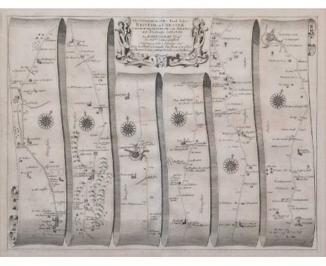
Ogilby (John). The Continuation of the Road from Bristol to Chester, Commencing at Ludlow com Shrewsbury and extending to Chester [1675], engraved strip road map, the road runs from Ludlow to Church Stretton, to Shrewsbury to Whitchurch, to Chester, together with another Thomas Kitchin, Cheshire, c.1786, engraved map with original hand-colouring in outline.plate size 35.5cm x 47cm (14in x 18.5in) and 15cm x 23cm (6in x 9in)Qty: 2Condition report: The maps are in good, original condition. The road map has some light time staining and browning around the edges of the paper near the mount board and some areas of browning across the sheet. The maps are both framed and glazed.
![Denbighshire. Speed (John), Denbighshire, Thomas Bassett and Richard Chiswell, [1676], hand-coloured engraved map, inset town](https://cdn.globalauctionplatform.com/9d549722-dd77-4001-999f-ac7d00b18ee1/fb1e0ced-22a3-4919-bd2e-ac9800d0cafb/468x382.jpg)
Lot 81
Denbighshire. Speed (John), Denbighshire, Thomas Bassett and Richard Chiswell, [1676], hand-coloured engraved map, inset town plan of Denbigh, English text on verso.38.5cm x 51.5cm (15.25in x 20.25in)Condition report: The map is in good, original condition. The paper has browned in some areas and there are some minor spots of foxing across the map. There are some creases across the sheet and some sellotape marks and minor staining around the edges of the sheet on verso. The map is framed and glazed on both sides. The frame has some minor scuffs and knocks commensurate with age.

Lot 82
Cheshire. Speed (John), The Countye Palatine of Chester with that most ancient Citie described, sold Bassett & Chiswell, [1676], hand-coloured engraved map, inset town plan of Chester, strapwork cartouche and mileage scale.40cm x 51.5cm (15.75in x 20.25in)Condition report: The map is in fair, original condition. The paper has browned in some areas and there is some foxing across the map. There are numerous tears and creases across the paper. The map is laid down. The map is framed and glazed.

Lot 83
Gerardus Mercator (1512-1594), "West Morlandia, Lancastria, Cestria, Caernarvan, Denbigh, Flint, Merionidh, Montgomery, Salopia", decorative cartouche and sea monster, hand-coloured engraved map of the North West and North Wales, French text on verso.plate size 36.5cm x 41.5cm (14.25in x 16.25in)Condition report: The map is in good, original condition. The map is framed and glazed on both sides. The frame has some minor scuffs and knocks commensurate with age.
![Derbyshire. Blaeu (Joan), Darbiensis Comitatus Vernacule Darbie Shire, [1659], hand-coloured engraved map, ornamental title c](https://cdn.globalauctionplatform.com/9d549722-dd77-4001-999f-ac7d00b18ee1/fa1f9eb2-1596-4071-8098-ac9800d0cea0/468x382.jpg)
Lot 84
Derbyshire. Blaeu (Joan), Darbiensis Comitatus Vernacule Darbie Shire, [1659], hand-coloured engraved map, ornamental title cartouche and armorials, Latin text to verso.45cm x 56.5cm (17.75in x 22.25in)Condition report: The map is in good, original condition. The paper has browned very lightly in some areas and there are some minor spots of foxing across the paper. The map is framed and glazed on both sides. The frame has some minor knocks and losses commensurate with age.
![Derbyshire. Speed (John), Thomas Bassett & Richard Chiswell, [1676], hand-coloured engraved map, inset town plan of Derby](https://cdn.globalauctionplatform.com/9d549722-dd77-4001-999f-ac7d00b18ee1/80b40681-fe81-4118-b319-ac9800d0cfda/468x382.jpg)
Lot 85
Derbyshire. Speed (John), Thomas Bassett & Richard Chiswell, [1676], hand-coloured engraved map, inset town plan of Derby and view of St. Anne's well, Buxton, title cartouche with Royal Crest, Arms of the Earls of Derby, from the time of the Normans Conquest unto this present, English text on verso.41.5cm x 54cm (16.5in x 21.25in)Condition report: The map is in good, original condition. The map is framed and glazed on both sides. The frame has some minor scuffs and knocks commensurate with age.

Lot 86
Shropshire. Speed (John), Shropshire described the sittuation of Shrowesbury shewed with the armes of thos Earles and other memorable things observed, published George Humble, circa 1627, hand-coloured engraved map, inset town plan of Shrewsbury, English text on verso.44.5cm x 53.5cm (17.5in x 21in)Condition report: The map is in good, original condition. The paper has browned in some areas and there are some minor spots of foxing across the map. There is a water stain along the lower edge of the sheet. The map is framed and glazed on both sides.

Lot 87
To include Eman (Emanuel) Bowen (1694-1767), hand-coloured engraving, An Accurate Map of Shropshire divided into its hundreds, printed for John Bowles in Cornhill, Carington Bowles in St. Paul's Church Yard, Robert Sayer in Fleet Street, Robert Morden maps of Darbyshire and Staffordshire, Road map by Thomas Gardner from Ludlow to Chester, Maps of Shropshire and Staffordshire for Walpole's New and Complete British Traveller and Seller's 1711 Map of Staffordshire. (6).various sizes 54cm x 72cm (21.25in x 28.25in)Qty: 6
Lot 115
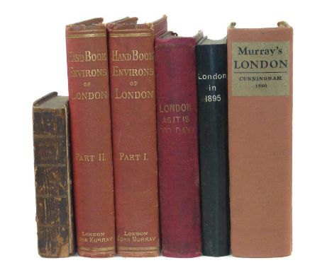
London as it is Today: Where to go and what to see during the Great Exhibition, 1851, illustrated with a map of London and many wood engravings, some coloured, red cloth, 12mo, 437 pages and five other "London" volumes, namely: Fry.H., London in 1895 illustrated, 252 pages, 12mo, Cunningham, P., Hand-Book of London past and present, 1850, Thorne, J., Handbook to the envious of London, 1876, red cloth, spine faded, 2 volumes and The Picture of London for 1803 being a correct guide, engravings 9x14cm, front board detached, all pages present, 6 volumes.Qty: 6
![After Abraham Ortelius (1527-1598), a two-page map, Europam sive Celticam Veterem [...], [Amsterdam: Jan Jansson, [n.d. 1638]](https://cdn.globalauctionplatform.com/7bb6c172-5ffb-4376-a617-ac8b00e6e08b/acb55ad2-0846-4962-99b1-ac9a0109c852/468x382.jpg)

Lot 5701
Cartography - B Cole, Walbrook Ward and Dowgate Ward with their Divisions into Parishes According to a New Survey, from William Maitland's History of London from its Foundation to the Present Day, coloured engraving, 24cm x 36cm; Emanuel Bowen, An Accurate Map of Germany Divided into Circles from the Best Authorities, 18.5cm x 22.5cm; other maps, Cambridgeshire; Suffolk; Essex (5)

Lot 5703
Cartography - The Times Contour Road Map of England and Wales in 10 Sheets, on the Scale of 3 Miles to 1 Inch/Each Sheet Measuring 31" x 40", London: [n.d.], printed in colour, canvas laid, red cloth box en suite; Ministry of Transport Road Map of England & Wales, ex-lib and in their cloth box; New Chart of North & Central England, [n.d., early 20th century], printed in colour, cloth covers; Plan of Nottingham, red cloth covers; Philips' Atlas for Beginners, late 19th/early 20th century; after Robert Morden (c. 1650 ? 1703), two-page map of Derbyshire, 18th century strike, hand-coloured engraving; early 18th century and later road maps; others; etc
![John Speed (1551/1552-1629), by and after, a two-page map, Leicester both Countye (sic) and Citie (sic) [...], [London]: Sold](https://cdn.globalauctionplatform.com/7bb6c172-5ffb-4376-a617-ac8b00e6e08b/8df1357c-a73e-402b-819a-ac9a0109cb48/468x382.jpg)
![John Speed (1552-1629), by and after, a two-page map, Darbieshire defcribed (sic, Derbyshire), [London]: [S]old in popes head](https://cdn.globalauctionplatform.com/7bb6c172-5ffb-4376-a617-ac8b00e6e08b/4913b120-2a7b-4009-ab6c-ac9a0109cbf7/468x382.jpg)
Lot 5706
Maps, a collection of rolls of Ordnance Survey and other maps, mainly of Venezuela and the Caribbean, to include American Geographical Society (NY) 1:1,000,000 Venezuela: Roraima, Caracas and Mouth of the Orinoco, colour printed 83 x 66.5cm; OS standard format maps 91 x 76cm of Jamaica 1966 1:250,000; others, 1959 1:50,000: Lucea, Savanna-La-Mar, Montego Bay-Falmouth, Mandeville-Black River, Malvern-Alligator Pond, St. Ann?s Bay-Moneague, Chapelton, May Pen-The Alley, Port Maria-Butt Bay, Kingston & Morant Bay; Tobago 1962-63 1:25,000 Scarborough, Roxborough-Charlottesville and Speyside, Plymouth; also Trinidad 1:50,000 Montserrat, with 1970 1:25,000 Matelot and North Coast, Northern Range Reserve, La Vache Bay, Western tip of island, Port-of-Spain east, Port-of-Spain west, Blanchisseuse, Chacachacate & Huevos Islands; 1:150,000 gulf of Paria and 1968 named tenancy and land allocation plan of Matura Ward, St. Andrew, black and white, along with France, poster style coloured map with inset island dependencies 100 x 68cm (1990) 1:1,500,000 also Soviet Union OS map (1958) 115 x 86cm 1:8,000,000 (qty)


Lot 5727
Russia, Soviet Union/USSR - a collection of Soviet Cold War era propaganda posters, 95 x 81 printed in simple colours, mainly published in 1977, including one anticipatory of the 1980 XXII Olympiad to be held in Moscow, with an oblique view of Red Square. Also two copies of a Moscow transport map c. 1970 colour printed and labelled throughout in Cyrillic 69 x 71cm, (8)

Lot 5743
Cartography - Gray (George Carrington), Gray's New Book of Roads, The Tourist and Traveller's Guide to the Roads of England and Wales, and Part of Scotland, on an Entirely New Plain [...], London: Printed for Sherwood, Jones, and Co., 1824, pp: [2] (blank), [iv], fold-out hand-coloured engraved map frontispiece, v, [3], 86, [7], 49 maps (some fold-out), [28] (index) [4] (blanks), 20th century brown morocco gilt over marbled boards by Graham Bloodworth, Leicester, his ticket, marbled endpapers en suite, square 8vo, [1] Provenance: 1) Edmund Fitz Moore of Lincoln's Inn and Albany, his c. 1840 Seal Armorial bookplates; 2) then William Garnett of Bleasdale and Quernmore Park, Lancashire, his slightly later 19th century Plain Armorial bookplates.
![Classics - Josephus (Flavius) and Whiston (William, translator), The Works [...], four-volume set, London: William Allason, 1](https://cdn.globalauctionplatform.com/7bb6c172-5ffb-4376-a617-ac8b00e6e08b/f7cd59b7-d15f-41ab-8c10-ac9a0109e68b/468x382.jpg)
Lot 5751
Classics - Josephus (Flavius) and Whiston (William, translator), The Works [...], four-volume set, London: William Allason, 1818, contemporary marbled boards rebacked to style in calf, 8vo, (4); Gibbon (Edward), The History of the Decline and Fall of the Roman Empire, twelve-volume set, London: T. Cadell and W. Davies, 1820, portrait frontispiece, fold-out maps, contemporary diced calf (rubbed, worn), contemporary retailer's ticket: Sold by Lawler & Quick, Old Bond Street, London, contemporaneous crested bookplates and dated ink MS inscriptions: George Welch, 1831, 8vo, (12); [Justinus (Marcus Junianus), Trogus (Gnaeus Pomepius), Hearne (Thomas, editor) and Toovey (James, editor), M. Juniani Justini Historiarum ex Trogo Pompeio Librix XLIV [...], Oxonii: E Theatro Sheldoniano, 1705, later institutional cloth over boards, 8vo, (1); [Euripides], Euripidis Tragoediae et Fragmenta [...], Lipsiae [Leipzig]: Ioa. Aug. Gottlob Weigel, 1829, contemporary English half-calf gilt over marbled boards, 8vo, (1); [Xenophon] and Hutchinson (Thomas, editor), Xenophontis De Cyri expeditione [...], Glasguæ: Andreas Duncan, 1813, printed in Classical Greek, fold-out map, contemporary speckled half-calf over marbled boards, 8vo, (1); [Fabricius (Johann Albert)], Jo. Alberti Fabricii Bibliothecæ Latinæ [...], volume II, Hamburgi: 1721, contemporary calf, early 19th century Plain Armorial bookplate: George Thornhill Esqr, 8vo, (1); Plutarch; Cicero; l'Abbé Rollin; Charterhouse Prize Binding, 4to, (1); Virgil; etc., [29]
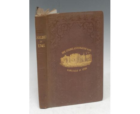
Lot 5767
Jacobitism and Jacobites - A Grandee of Carlisle's Copy, Mounsey (George Gill, editor), Carlisle in 1745, An Authentic Account of the Occupation of Carlisle [...] By Prince Charles Edward Stuart [aka Bonnie Prince Charlie], first and only edition, London: Longman and Co., &, Carlisle: James Steel, 1846, pp: x, 270, additional engraved title-page with numismatic vignettes, fold-out map, 5 full-page plates, some vignettes, contemporary gilt pictorial and blind brown cloth, yellow endpapers, 8vo, [1] Provenance: George Head Head (c. 1795-1876), of Rickerby Hall, Cumbria, his crested bookplate to pastedown. Head, a well-noted slavery abolitionist, was also a mayor, magistrate, banker, and mine owner in his native Carlisle.

Lot 5773
Local Interest - J.G. Harrod & Co.'s Postal and Commercial Directory of Derbyshire, second edition, London and Norwich: 1870, later red cloth, 8vo, (1); Kelly's Directory of Derbyshire with Map, 1925, adverts to prelims, red cloth, 8vo, (1); Robinson (Professor Brian), Walls Across the Valley: The Building of the Howden and Derwent Dams, signed by the author, numbered limited edition 123/500, Cromford: Scarthin Books, 2012, h/b, d/j, 4to, (1); Briscoe (J. Potter, editor), Notts. and Derbyshire Notes and Queries, Illustrated, Volume VI: 1898, Nottingham and Derby: Frank Murray, 1898, contemporary cloth, 8vo, (1); Jewitt (Llwellynn, editor), Black's Tourist's Guide to Derbyshire [...], with Map of the County, and Plan of Chatsworth, second edition, Edinburgh: 1857, contemporary cloth with adverts, 12mo, (1); Pendleton (John), A History of Derbyshire, London: 1886, contemporary green roan gilt over cloth, 8vo, (1); The Derbyshire Archaeological Journal, Volume CII: 1982, wrappers, 4to, (1); Auction Catalogue, Walker, Walton & Hanson:~ Beech Close, Car Colston, Illustrated Catalogue of the Sale by Auction of the Contents of the Residence, 26th & 27th October, 1966, annotated prices, original wrappers, 4to, (1); Derbyshire Bibliography, 1930, original wrappers; Exhibition: Art and Antiques in Nottinghamshire, May 6th to June 20th, 1934, 8vo; Old Nottinghamshire [...], Second Series, Illustrated, London: 1884, contemporary cloth, 8vo, (1); various parish histories, monographs, pamphlets; Landmark Collector's Library, various; country houses; transport, railways, trains, steam; etc

Lot 5774
Local Interest and Topography - Staffordshire, Molyneux (William, F.G.S.), Burton-on-Trent: Its History, Its Waters, and Its Breweries, London: Trübner & Co., [n.d., 1869], fold-out map, contemporary wrappers, 8vo, (1); Redfern (Francis), History and Antiquities of the Town and Neighbourhood of Uttoxeter [...], second edition, Hanley: Allbut and Daniel, 1886, in-text illustrations, contemporary cloth, 8vo, (1); Underhill (Charles Hayward), History of Tutbury and Rolleston, Burton-upon-Trent: Tresises, [n.d., 1949], contemporary cloth, 8vo, (1); Landmark Collector's Library, mining, etc., 20th century and later; Derbyshire, Glover's Derby, fourth edition, Derby: 1849, original boards (disbound), 8vo, (1); Bemroses' Guide to Derbyshire, Illustrated, contemporary cloth gilt, 8vo, (1); The History of Chesterfield [...], London: Whittaker and Co., 1839, disbound, 8vo, (1); Jennings (Louis J.), Rambles Among the Hills in the Peak of Derbyshire [...], London: John Murray, 1880, original cloth, 8vo, (1); Bennett's Business Directory for Derbyshire, Leicester and Nottinghamshire 1909, cloth, 8vo, (1); 19th century History of Nottinghamshire; Provincial Imprint, Walks in the Neighbourhood of Sheffield, Yorkshire, Sheffield: Robert Leader, 1830-31, disbound, 8vo, (1); Sykes (D.F.E.), The History of Huddersfield and its Vicinity, Huddersfield: The Advertiser Press, Limited, 1898, cloth, 8vo, (1); Furness (J.M.), Record of Municipal Affairs in Sheffield [...], 1843-1893, Sheffield: William Townsend and Son, 1893, cloth, 8vo, (1); pamhphlets; etc., [33]

Lot 5786
Miscellaneous - Travel, West (Rebecca), Black Lamb and Grey Falcon: The Record of a Journey through Yugoslavia in 1937, two-volume set, London: Macmillan & Co. Ltd., 1946, green cloth, d/j, 8vo, (2); Children's, Lang (Andrew, editor), The Yellow Fairy Book, illustrated, London: 1924, cloth, 8vo, (1); Provincial Imprint, Children's Mathematics, Walkingame (Francis), The Tutor's Assistant; Being a Compendium of Arithmetic [...], York: Thomas Wilson and Son, 1810, engraved fold-out chart, contemporary calf, 8vo, (1); Cartography, Paterson (Daniel), A New and Accurate Description of all the Direct and Principal Cross Roads in England and Wales [...], sixth edition, London: T. Carnan, 1784, two-page map, contemporary diced red calf covers only, 8vo, (1); Bartholomew's Handy Reference Atlas of London, sixth edition, Edinburgh: [n.d., c. 1930], colour maps, red cloth, 8vo, (1); "Geographia" Greater London Atlas [...], London: [n.d., c. 1930], colour maps, red cloth, 8vo, (1); Abbott (Jacob), History of Mary Queen of Scots, London: Thomas Allman, 1850, red pictorial cloth, all-edges gilt, small 8vo, (1); Bell's Edition, Poetical Works of William Shenstone, volume I only, London: 1784, additional double-page title, contemporary calf, 16mo, (1); Theology [Porteus] (Beilby, Late Lord Bishop of London), A Summary of [...] Christian Revelation, London: Rivington, 1814, contemporary Society for Promoting Christian Knowledge calf binding), their stamp, 8vo, (1); Lever (Charles) & Phiz (illustrator), Luttrell of Arran, London: Chapman and Hall, 1865, contemporary cloth, 8vo, (1); Charles Kinglsey, part-leather binding; The Antiquity of Hindu Medicine, second edition, London: 1927; Pont's British Character, 1948; The New Testament in Pitman Shorthand, London [n.d., c. 1880], black quarter-leather over cloth, 8vo; Neolithic Dew-Ponds and Cattle-Ways, second edition, 1907; angling/fishing; miniature prayer books; etc
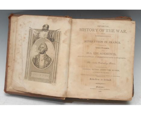
Lot 5824
Revolutionary Wars - Provincial Imprint, Anon, An Impartial History of the War, from the Commencement of the Revolution in France/Containing an Accurate Description of the Sea Engagements, Sieges, Battles, Expeditions and Conquests, of The various Contending Powers/Including an Account of the General Mutiny Among the Seamen, at Spithead and the Nore/Together with a Particular Narrative of the Rise, Progress, and Various Events Accompanying the Rebellion in Ireland, Manchester: Printed by S. Russell, 1802, printed in parallel columns, portrait frontispiece of the Duke of York, further full-page plates, fold-out map of France (faults), contemporary calf, 4to, [1]
Lot 5827
Scotland - Hydraulic Engineering, Glasgow Water Works, a Victorian sammelband of four monographs &/or tracts: Gale (James M.), The Glasgow Water Works: Papers Read During the Session 1863-64 [...], Glasgow: Printed by Bell & Bain, 1864, 56pp, additional lithograph title-page, 1 fold-out map and 3 fold-out charts; Glasgow Loch Katrine Waterworks, Banquet to Mr. Bateman [...], Westminster: Vacher & Sons, 1860, 47pp; a further sequence of six connected papers from a periodical, lacking title-page and a contents, paginated from [121]-266 and illustrated with 52 full-page engineering plates; Gale (Mr. James, C.E.), On the Port-Glasgow Water Works [...], Glasgow: William Munro, 1868, 8pp and 4 fold-out plates, contemporary half-morocco over moiré boards, red-stained edges, 8vo, (1); Sinclair (Catherine), Sketches and Stories of Scotland and the Scotch, With Corrections and Additions, London: Simpkin, Marshall, and Co., [n.d. 1868], contemporary three-quarter calf, marbled edges, 12mo, (1); Beeton's Dictionary of Useful Information [...], two-volume set, London: S.O. Beeton, [1859], volume I with fold-out chromolithograph chart, further b/w fold-out charts and plates, in-text illustrations, contemporary green quarter-calf, marbled edges and endpapers, 8vo, (2); The National Encyclopædia [...], volume I only, London: [n.d.], 8vo, (1), [5]


Lot 20
In order to view full details and any additional images for this lot as well as place advanced bids or bid live, please click here to view this lot on the auctioneer's websiteA good Second War M.C. and ‘Immediate’ Second Award Bar group of seven awarded to Major S. J. Hawkins, Royal Engineers, for his gallantry as a Bailey-Bridge Company Commander during the advance through both Sicily and Italy, where his ‘outstanding leadership, unremitting zeal, and complete disregard for his own personal safety’ in the construction of bridges under heavy enemy fire enabled the Allied Advance to be maintained without pause Military Cross, G.VI.R., the reverse officially dated 1944 and additionally privately engraved ‘201128 Major S. J. Hawkins. R.E. Sicily & Italy’, with Second Award Bar, this officially dated 1944; 1939-45 Star; Africa Star, 1 clasp, 8th Army; Italy Star; Defence and War Medals 1939-45, with M.I.D. oak leaf; Army L.S. & G.C., G.VI.R., 1st issue, Regular Army (Capt. S. J. Hawkins. M.C. R.E.) minor edge bruising to last, otherwise good very fine (7) £2,400-£2,800 --- M.C. London Gazette 23 March 1944: ‘In recognition of gallant and distinguished services in Sicily.’ The original recommendation states: ‘Major S. J. Hawkins, Commanding 252nd Field Company, during the advance of this Brigade from Sperro to Paterno and thence to Zefferana Etnea from 2 to 11 August. The advance involved the making of two crossings over the River Simeto and thereafter the bridging and filling in of numerous craters made by the enemy to impede our progress. Throughout the whole period Hawkins showed himself courageous in reconnaissance, rapid in decision, and untiring in work. He had an immediate answer to every difficulty encountered and removed each obstacle with such energy and speed that the advance was never appreciably held up and supporting arms including field guns and a regiment of tanks were always over in time for operations to continue without check. Major Hawkins was not only indefatigable himself but inspired his men by his own energetic and enthusiastic example to work with the same unremitting zeal as he himself displayed. It was very largely due to his most excellent work that the speed of the pursuit was maintained, and there is no doubt that without it the advance would have been seriously delayed.’ M.C. Second Award Bar London Gazette 6 April 1944: ‘In recognition of gallant and distinguished services in Italy.’ The original recommendation, for an Immediate award, states: ‘On 24 November 1943 during the advance of the 5th Division in Central Italy, 252nd Field Company, Royal Engineers, had the task of constructing a Bailey Bridge at junction map ref. H.0749. The task was scheduled to start at 1400 hours on 24 November, the site under direct enemy observation and was shelled continuously during the whole period of construction. Major Hawkins commanding 252nd Field Company was in charge of the bridging operation, and it was only by his outstanding leadership and complete disregard for his own personal safety that he so directed and encouraged the men under his command that the task was able to be completed in a remarkably short space of time, which enabled transport to move forward under cover of darkness. The gallant action of this officer was an inspiration to all who witnessed the operation.’ M.I.D. London Gazette 24 June 1943: ‘In recognition of gallant and distinguished services in the Middle East during the period 1 May to 22 October 1942.’ Stanbury John Hawkins was born in Southsea, Hampshire on 2 October 1911, and joined the Army as a Boy Soldier on 1 May 1926. Attending the Bridging Training School at Chepstow, he was subsequently posted to the Royal Engineers. He served with the 20th Fortress Company in Aden prior to the start of the Second World War, and thence in British Somaliland. Commissioned Lieutenant in the Royal Engineers on 18 April 1941, he was posted to the 4th Field Squadron, and saw service in Egypt and North Africa with the 8th Army, being promoted War Substantive Captain on 19 March 1942, and was Mentioned in Despatches. Promoted temporary Major on 6 January 1943, Hawkins was given command of the 252nd Field Company, and took part in the invasion of Sicily, for which he was awarded the Military Cross. He saw further service with the same unit in Italy, and for his gallantry was awarded a Second Award Bar to his Military Cross. Post-War he served as Quartermaster, was awarded his Long Service and Good Conduct Medal on 2 March 1948, and was promoted Major on 30 May 1954. He died in 1955. Sold together with the recipient’s Officer’s Record of Service and other research.
Lot 245A
Boxes and Objects - a George III mahogany rectangular guinea balance/scales box, lacking contents, c. 1800; a set of three miniature Napoleonic prisoner-of-war bone dice, c. 1810; a lacquered brass compass; a 17th century Baroque fragmentary architectural carving; Chinese hardwood stand; jade-coloured model; Robert Morden map of Derbyshire, hand-coloured engraving; early 19th century Georgian knife; late 19th/early 20th century Colonial hardwood fan, Bali, carved in relief; other fans; oil painting of a landscape, signed, oil on canvas, 31cm x 41cm; 18th century and later engravings, various; qty


Lot 1086
A quantity of books ordnance survey and reference books, comprising A-Z map of London various other ordnance survey maps on Germany Brittany and New York City, books on cookery short stories from a New Yorker, Dictionary of Quotations and Proverbs a Year of Space, Coming down the Zen, etc. (2 shelves)

Lot 202
MAPS, PRINTS & WATERCOLOUR - a coloured and tinted map by THOMAS KITCHIN of Glamorganshire, unframed but card mounted, 37cms including margin to the base x 54cms including narrow side margins, a coloured and tinted map, unframed but card mounted of Meirioneth and part Montgomery by PHILLIP HERBERT, 39 x 51cms, M P SPEIGHT coloured limited edition (73/500) print - a cricket match with spectators entitled 'Abergavenny', signed, 41 x 52cms, ANGELA HOPPE KINGSTON two watercolours - entitled 'Cowbridge Treeline', signed and dated 1991, 14 x 20cms and the second entitled 'Cat Drawing', signed and dated 1992, 12 x 14cms (light faded mounted to one) and a parcel of six sundry prints including AUDREY HIND and NEIL HOPKINS ETC


Lot 1255
Books, two volumes, England Illustrated, or, A Compendium of the Natural History, Geography, Topography, and Antiquities Ecclesiastical and Civil, of England and Wales. Printed for J. Dodsley, 1764, leather boundCondition report: I have counted 51 maps in total. Vol I has a large pull out map before the main title page, Vol II does not.


![John Speed (British 1552-1629): 'The North and East Ridins [sic] of Yorkshire', engraved map with later hand-colouring pub. J](https://cdn.globalauctionplatform.com/cc7c5c73-d76b-4288-bada-abff010294b7/303adf0c-f6d8-4482-b532-ac9100be346c/468x382.jpg)
Lot 1107
John Speed (British 1552-1629): 'The North and East Ridins [sic] of Yorkshire', engraved map with later hand-colouring pub. John Sudbury and George Humble, London 1610 [1611], window verso showing pages 81-82, 39.5cm x 51.5cmClick here to view further images, condition reports, sale times & delivery costs for this lot.

Lot 1108
John Speed (British 1552-1629): 'Oxfordshire described with ye Citie and the Armes of the Colledges of yt famous University [sic]', engraved map with later hand-colouring pub. John Sudbury & George Humble, London 1605 [c.1610] 40cm x 53cmClick here to view further images, condition reports, sale times & delivery costs for this lot.

Lot 1109
John Speed (British 1551-1629): 'Glamorgan Shyre with the sittuations of the cheife towne Cardyff and ancient Landaffe described [sic]', 17th century engraved map with later hand-colouring pub. John Sudbury & George Humble, London 1610, window verso showing pages 105-106, 40cm x 51cmClick here to view further images, condition reports, sale times & delivery costs for this lot.
![After John Speed (British 1552-1629): 'The North and East Ridins [sic] of Yorkshire', engraved map pub. (posthumously) Thomas](https://cdn.globalauctionplatform.com/cc7c5c73-d76b-4288-bada-abff010294b7/24972c67-f5e3-4f15-a00f-ac9100bf5f01/468x382.jpg)


Lot 1110
Christopher Saxton (British c.1540-c.1610): North Yorkshire - 'Eboracensis Comitatus pars Septentrionalis Vulgo North Riding', 17th century map engraved by William Hole with later hand-colouring 20cm x 34cmClick here to view further images, condition reports, sale times & delivery costs for this lot.


![After John Ogilby (British 1600-1676): 'The Road from London to Flambourough [sic] Head in County Ebor' showing the section f](https://cdn.globalauctionplatform.com/cc7c5c73-d76b-4288-bada-abff010294b7/1f10e1ca-da06-4601-a0e4-ac9100be5059/468x382.jpg)


Lot 1115
Johannes (Joan) Blaeu (Dutch 1596-1673): 'Ducatus Eboracensis Anglice Yorkshire', 17th century engraved map; Robert Morden (British c.1650-1703): 'Surrey', engraved map with later hand-coloured engraving pub. 1695; John Cary (British c.1754-1835): 'A Map of the East Riding of Yorkshire with Ainsty Liberty', early 19th century hand-coloured map, max 43cm x 53cm (3)Click here to view further images, condition reports, sale times & delivery costs for this lot.
Lot 1116
Thomas Kitchin (British 1719-1784): 'Most Accurate Map of the Roads of England and Wales with the Distances by the Mile Stones and other most exact admensurations between Town and Town', printed for R & I Dodsley, Pall Mall circa 1770, hand coloured 35cm x 35cmClick here to view further images, condition reports, sale times & delivery costs for this lot.

Lot 1117
After Frederik de Wit (Dutch c.1629-1706): 'Nova Totius Terrarum Orbis Tabula', very large 20th century world map formed as 32 paper panels mounted onto linen, after the edition by Giuseppe Longhi c.1675, 133cm x 200cmClick here to view further images, condition reports, sale times & delivery costs for this lot.
Lot 1118
Richard Blome (British 1635-1705): 'A Mapp of Richmondshire', engraved map with later hand-colouring pub. 1673; John Cary (British c.1754-1835): 'North Riding of Yorkshire', hand-coloured map pub. 1787; Jacob Van Langeren: 'Middlesex', map with distance tables pub. 1643; J Wallis: 'Middlesex', hand-coloured miniature map pub. 1821; 'Lincolnshire', 19th century map pub. Pigot & Co; an 18th century map of Leicestershire and an early 20th century map entitled 'Plan of Manchester and Salford', max 24cm x 30cm (7) (some unframed)Click here to view further images, condition reports, sale times & delivery costs for this lot.

Lot 1119
Owen & Bowen: 'Oxford', 'Preston' and 'New Radnor', three 18th century engraved strip maps with later hand-colouring; Thomas Bowen: 'A Map of the Roads from London to Barnard Castle', engraved strip map with later hand-colouring pub. 1774; Daniel Paterson (British 1739-1825): three Yorkshire engraved strip maps pub. Paterson's British Itinerary; and a facsimile copy of John Ogilby's 'Britannia' pub. 1939, max 19cm x 30cm (8)Click here to view further images, condition reports, sale times & delivery costs for this lot.

-
108737 item(s)/page