We found 109182 price guide item(s) matching your search
There are 109182 lots that match your search criteria. Subscribe now to get instant access to the full price guide service.
Click here to subscribe- List
- Grid
-
109182 item(s)/page


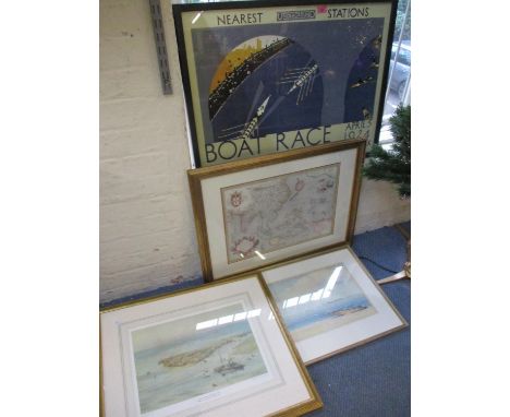


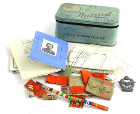
Lot 542
SR Southampton Docks Souvenir and Raphael Tuck Railway Panoramas, a 1930s souvenir guide of the Southern Railway Co's Southampton Docks in the form of a Liner, including map, published by Waterlow & Sons, together with two Father Tuck children's panoramas with moveable cut out figures, Railway Express Train of to Bournemouth from Waterloo (complete G) and Railway Express Flying Scotsman (complete, four cut out figures damaged missing heads) otherwise good and a1948 Ian Allan volume sectional maps of the British Railways (cover P), P-G (4)

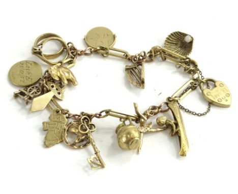
Lot 310
A 9ct gold charm bracelet, with heart shaped padlock engraved Love EL, on 9ct gold modern chain, with approx 15 charms, some hallmarked 9ct, others unmarked, comprising horse shoe, long boat, ballerina, 21 key, map, elephant, ring, clam shell, etc., the bracelet approx 18cm L overall, 25.4g all in.


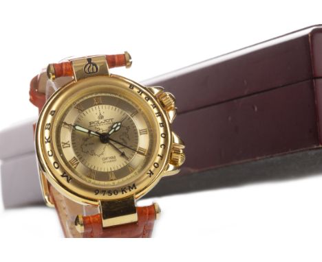
Lot 779
GENTLEMAN'S POLJOT TRANS-SIBERIAN RAILWAY GOLD PLATED MANUAL WIND WRIST WATCH, the round gold coloured dial with Roman numerals, central map of the Trans-Siberian Railway, inner seconds track, outer 24 hour track, lume squelette hands, centre seconds hand, 36mm case, with Russian script and 1891-1904, on a leather strap, in box, with booklet


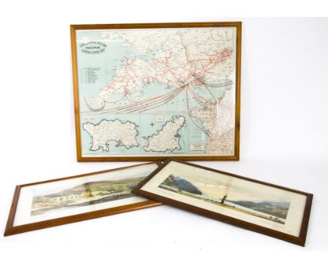
Lot 2254
Collection of books comprising: The History of the Rebellion and Civil Wars in England, by Edward Earl of Clarendon, Vol.I only, Oxford: Printed at the Theater, 1702, folio, contemporary calf, rebacked; The History of the Reformation, by Gerard Brandt, Vol.I only, London: Timothy Childe, 1720, folio, half-calf; A Practical Treatise on Coal Mining, by George G. Andre, Vol.I only, London: E. & F. N. Spon, 1876, folio, half-calf; The Centenary of George Stephenson, the Father of Railways (supplement to the Illustrated London News), 1881. Together with a framed Speed map/plan of Leicester, Nichols, 1795 (5)


Lot 179
AVIATION: Igor Sikorsky (1889-1972) Russian American Pioneer of Aviation, designed the first successful helicopter. Vintage fountain pen ink signature ('I. Sikorsky') and date, 31st May 1933, in his hand on an oblong 12mo card; Tom Sopwith (1888-1989) English Aviation Pioneer, co-founder of the Sopwith Aviation Company. Vintage fountain pen ink signature ('T. O. M. Sopwith') on a small oblong 12mo piece, neatly laid down and with some wrinkling; Claude Grahame-White (1879-1959) English Aviation Pioneer, the first to make a night flight during the London to Manchester Air Race, 1910. Vintage signed postcard photograph depicting the aviator leaving Rugby in his aircraft during a London to Manchester flight on 23rd April 1910. Signed in bold fountain pen ink with his name alone to the head of the image. Some heavy surface and corner creasing; Double Eagle II Signed and inscribed 8 x 10 photograph by all three crew members of Double Eagle II individually, comprising Ben Abruzzo, Maxie Anderson and Larry Newman, being the pilots of the first balloon to cross the Atlantic Ocean, 1978. The composite image depicts the balloon in flight, a map charting the route of the historic flight and an image of the three crew members in three quarter length poses together. Signed by each in black inks to the base of the image, Abruzzo adding an inscription in his hand and Anderson adding DEII in his hand beneath his signature. The image also features facsimile signatures of each of the crew. Autographs of Abruzzo are scarce following his untimely death in an airplane crash FR to VG, 4

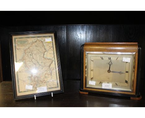
Lot 525
STAFFORD, ThomasPacata Hibernia or The Warres in Ireland, 1st edition, London 1633, with the Speede map (linen backed), 2 engraved portraits, 15 engraved plates of towns, sieges etc. and a map of the Barony of Muskerry, is early polished calf, the spine professionally restored, a desirable copy.


Lot 246
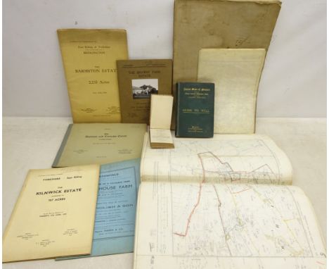
Yorkshire, collection of twenty-seven Ordnance Survey maps, scale six inches to one statute mile, Farndale folding map, 1930's & later Yorkshire land sale catalogues: The Brawby Park Estate, The Kilnwick Estate, Park House Farm, The Barmston Estate & others, The Land Valuer's Assistant by R. Hudson 1811, Illustrated Guide to Hull, pub. A Brown & Sons 1890 etc


-
109182 item(s)/page