

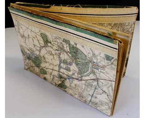
W T PALMER: THE ENGLISH LAKES, illustrated Heaton Cooper, 1929 reprint, original blind stamped cloth gilt, plus A MEE: THE KINGS ENGLAND - THE LAKE COUNTIES, 1938 reprint, original cloth, plus A G BRADLEY: HIGHWAYS AND BYWAYS IN THE LAKE DISTRICT, 1924, original cloth gilt, plus H I JENKINSON: TOURIST GUIDE TO THE ENGLISH LAKE DISTRICT, 1888, 6th edition, folding map, original cloth gilt, plus BADDELEY: THE LAKE DISTRICT, [no date], 22nd edition, original cloth gilt, dust wrapper, plus A WAINWRIGHT: THE PICTORIAL GUIDE TO THE LAKELAND FELLS..., circa 1965, 13th impression, original cloth, dust wrapper, plus SAWYERS: A LIST OF THE CUMBERLAND SHIPPING CORRECTED TO FEBRUARY 1840, 1975 reprint of 1840 1st edition, original wraps, plus G P JONES: SHORT HISTORY OF THE MANOR AND PARISH OF WITHERSLACK TO 1850, 1971, original printed wraps (8)
We found 109182 price guide item(s) matching your search
There are 109182 lots that match your search criteria. Subscribe now to get instant access to the full price guide service.
Click here to subscribe- List
- Grid
-
109182 item(s)/page


A World War II medal group of four attributable to 242761 Capt. G A Pearson The Hampshire Regiment, comprising 1939-45 Star; Africa Star, bar 1st Army; Defence Medal; 1939-45 war medal - mounted as worn - to/w officers release book, War Office London Gazette notice and a map of World War II Europe

An interesting collection of pictures including a 20th century woodcut type print of a town scene with washer women beneath a single arched bridge with indistinct signature bottom left J Chilbers (?), 36 x 52 cm approx, a hand coloured limited edition print after Josiah Parlby showing Uxbridge Cricket Club (an issue to commemorate the opening of the new club and ground 1971), 28 x 43 cm approx, an 18th century map of Hampshire by Robert Morden and two maps of Middlesex, one after Richard Blome and one by Robert Morden, together with further pictures including a watercolour of an Irish landscape signed John Crossley and dated 1999, a watercolour showing the Severn Bridge from Littleton by Neil Cairncross, a watercolour of a townscape signed Helena Burke, etc (all framed)


A Walton Heath Golf Club Old Course map signed by competitors at the inaugural European Open Championship in 1978, signed in biro by 23 golfers including Seve Ballesteros, Bernhard Langer, Greg Norman, Billy Casper, Ed Sneed, Ricky Bownan, Ewen Murray, Garry Harvey, Peter Oosterhuis, Willie Milne, Denis Durnian, Donald Armour, Mike Inglis, John O'leary, Guy Hunt, Peter Tupling, Eamonn Darcy, John Schroeder, Al Geiberger, Rod Funseth and David Russell, mounted in a frame under Glass, 58.5 by 33cm., 23 by 13in. These autographs were collected besides the 18th green on practice day.

Presentation Copy to Mary Spring Rice Hull (Eleanor) Editor. The Cuchullin Saga in Irish Literature, Being a Collection of stories relating to the Hero Cuchullin. 8vo L. 1898. First Edn. Thus., fold. map, adverts at end, orig. cloth backed boards, repaired. Good. * With bookplate of Monteagle & Brandon & with inscribed presentation 'Mary Spring Rice from Father, Xmas 1898, ' Mary Spring Rice Nationalist, was on The Asgard on its journey from Germany, importing arms into Howth in 1914. (1)
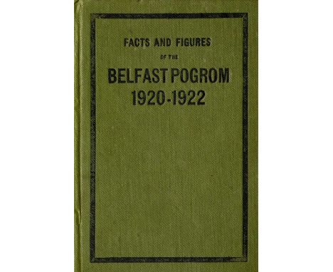
Extremely Rare Report - The Belfast Pogrom, 1920 - 1922 Only a Handful of which were for Private Distribution Northern Ireland: Kenna (G.B.) [Fr. John Hassan] Facts and Figures of the Belfast Pogrom 1920 - 1922, 8vo D. (O'Connell Published Co.) 1922. Sole Edn., fold. map, hf. title, title, 213pp. orig. green cloth, lettered within black border. A very fine copy of this Scarce-Work. * This work was reportedly commissioned by the Free State Government, at the investigation of Michael Collins to document the notorious Belfast Pogroms in which hundred of Catholics (together with some Protestants) were driven from their homes and work places, and when hundreds were killed. The work which was set in type, but publication had to be cancelled for fear of furthering more serious sectarian tensions. It is believed only about eighteen copies were ever bound. An excessively rare item. (1)

Signed Presentation Copy The Dublin Brigade: Dalton (Charles) With the Dublin Brigade (1917- 1921), 8vo L. 1929. First Edn., Signed Pres. Copy inscribed, 'With Best wishes to Little Perag? from Charlie December 1932' Hf. title, port. frontis, fold. map, orig. cloth. V. good. Scarce. (1) * An excellent account of the Troubles in Dublin.
![[Casement (Sir Roger)] Ballycastle Railway Company - Report of The Directors and Statement of Accounts, Year Ending December](https://cdn.globalauctionplatform.com/0a2353a1-4706-4340-b8b0-a5de00fcff57/b4dedfec-1b26-4bd6-b26e-41dd4604136f/468x382.jpg)
[Casement (Sir Roger)] Ballycastle Railway Company - Report of The Directors and Statement of Accounts, Year Ending December 1913, Folio Ballymoney (Ferguson & Son) 1914. Sole Edn., 14pp. with illus. map, stapled wrappers. V. Scarce. (1) * Roger Casement was a director of the above company, his address given as Magherintemple, Ballycastle.
![Signed by Captain Spindler
[Casement (Sir R.)] Spindler (Capt. Karl) Das Gehaimnisvolle Schiff, 8vo Berlin 1921. Rare First](https://cdn.globalauctionplatform.com/0a2353a1-4706-4340-b8b0-a5de00fcff57/43b2daa7-4653-48b6-a1c1-40a353b73d55/468x382.jpg)
Signed by Captain Spindler [Casement (Sir R.)] Spindler (Capt. Karl) Das Gehaimnisvolle Schiff, 8vo Berlin 1921. Rare First Edn., Signed by the Author, port. frontis fold. map & illus., & with many news cuttings loosely inserted, orig. gilt decor. cloth. rare. * Spindler captained The Aud which attempted to land arms for The Volunteers in Kerry in 1916. This book was later published in English as "The Mystery of the Casement Ship," Berlin 1931. (1)

1916 Rebellion: Boyle (John F.) The Irish Rebellion of 1916, L. 1916 First Edn. pict. d.w., v. good copy; Martin (Hugh) Ireland in Insurrection. An Englishman's Record of Fact, L. 1921. Map frontis; Redmond - Howard (L.G.) Six Days of the Irish Republic, D. & L. 1916, pict. wrappers; Stephens (James) The Insurrection in Dublin, D. 1917, Second, wrappers. (4)

The Irish in South Africa The Boer War: Williams (B.) & Childers (Erskine)eds. The H.A.C. in South Africa, A Record of Services Rendered in the South African War... 8vo L. 1903. First Edn. hf. title, fold. map, buckram; Childers (E.) War with The Arme Blanche, L. 1910. Hf. title, cat. at end, crimson cloth. Both Scarce. (2)

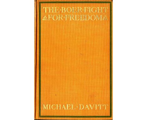
The Irish in South Africa The Boer War: Davitt (Michael) The Boer Fight for Freedom, 8vo N. York & L. 1902. First Edn. port. frontis errata slip, fold. map, numerous illus. maps, plts. etc., orig. decor. cloth, decorated in green & gold. V. good copy. (1) * Front loose blank inscribed 'David Mc Donnell, M.A. L.L.D. June 16th, 1902'.
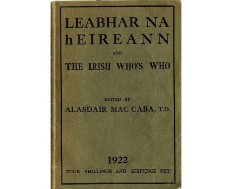
Rare 1922 Directory Mac Caba (Alasdair)ed. Leabhar na hEireann, 8vo D. (The Kenny Press) 1922. A very detailed directory, covering all facets of Irish life and business. With an attractive sketch by Grace Plunkett, a fold. map & many interesting adverts., orig. ptd. wrappers, v. good. (1) * Very Rare. With biographies of Members of the Dail, and leading figures in Ireland, including Michael Collins, Robert Barton, Sean Mac Eoin, Douglas Hyde, Kevin O'Higgins, Eoin O'Duffy, etc., and with articles on Oglaigh na hEireann, Cumann na mBan & much more. A most interesting volume.


-
109182 item(s)/page