We found 109182 price guide item(s) matching your search
There are 109182 lots that match your search criteria. Subscribe now to get instant access to the full price guide service.
Click here to subscribe- List
- Grid
-
109182 item(s)/page

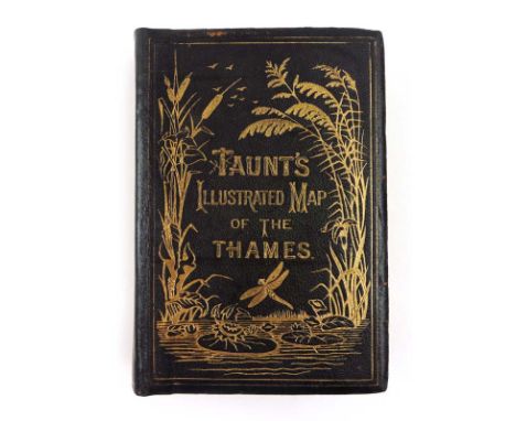
Lot 220
Taunt H. : A New Map of the River Thames, C. 1885. Fifth Ed. Small 8vo. Original calf binding with gilt titling & illustrations ( professionally re-backed ), aeg. Mounted photo frontis, text with sectional maps h/c in outline together with smaller mounted photos. Many contemporary adverts with engraved illustrations.
Lot 292
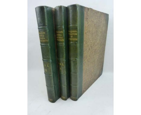
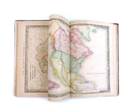
John Betts : World Atlas ( Lacking title page ) C.1840. Folio volume with 20 double page maps including two of the hemispheres. Every map has an upper and lower heading which reads 'The London Series of Sixpenny Maps' which may indicate that the volume is a less common edition of Betts' Family Atlas. Each map is coloured with deeper hand - coloured outlines. CONDITION REPORT: The boards are detached and the volume lacks the title page but, given the presence of the hemisphere maps, may be complete.
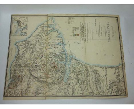
Lot 294
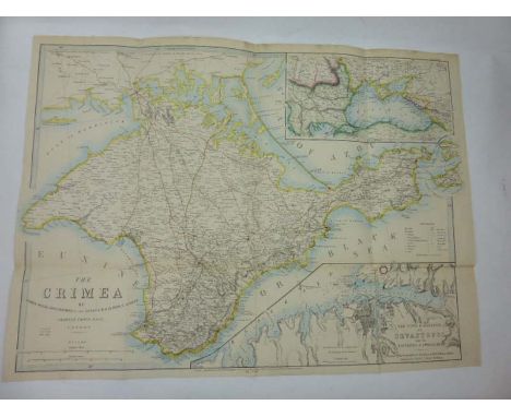
James Wyld : Siege of Sevastopol : The Environs of Sevastopol with the Batteries and Approaches, September 1st. 1855. Seventh Edition. One sheet dissected in 9 sections and mounted on linen, hand coloured in outline and detail. The map shows troop positions, siege trenches and fortifications erected by the opposing armies. Gun emplacements & tragectories are also shown. Inset plan of Eupatoria.
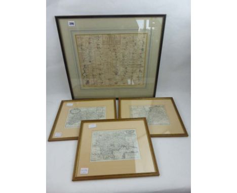
Lot 296
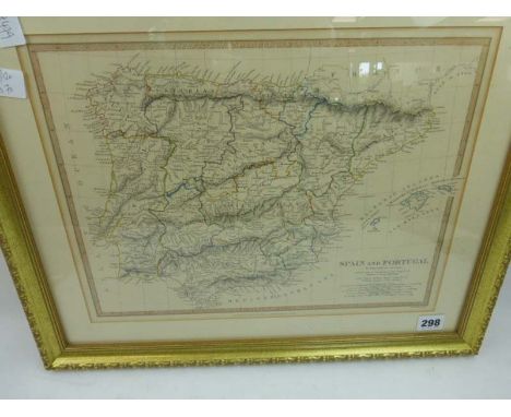
Blome R. : Mapp of the County of Midlesex, Mapp of the County of Surrey and Mapp of the County of Sussex' possibly from Taylor's England Exactly Described in 1715. Strip 'Road map from London to the 196 milestone in the way to St. David's measured from Cornhill' - Universal Magazine,1766? All mounted, framed & glazed.
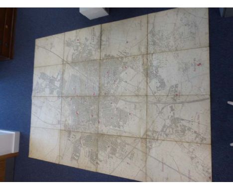
Lot 297
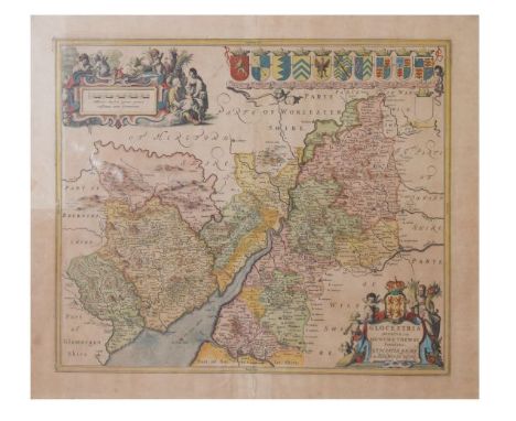
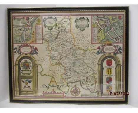
Leicester & Leicestershire : Large scale maps. Two elephant portfolios containing 70+ sheet maps of Leicestershire with 6" to 1 mile scale, dating mainly from 1950. Together with a large linen-backed, sectional map ( in two halves ) of the city of Leicester, 25" to 1 Mile scale with Anglican parish boundaries outlined by hand, C.1930s.
Lot 299
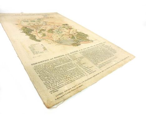
"The Battle of Waterloo - ( A Plan / Map ) Taken on the spot after the action of the 18th. June 1815, Presented & Dedicated with permission to H.R.H., the Duke of York, by Lieut. Tyler 2nd. G.B." Linen backed, h/c, engraved map, 47cm x 29cm, depicting troop dispositions ( with key ), geographical features and brief annotations providing a chronological account of the battle. A scarce, 1st.Ed. copy of possibly the first commercially available of the battle published about 6 weeks after.

Lot 1390
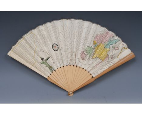
A George III twenty-stick paper and boxwood fan, printed with a List of Steward's appointed for the several Meetings of Archers on Blackheath, for the Year 1793, surmounted by a hand-coloured map of North-Western Europe, the sinister margin with an archer, inscribed with verse and further wit, boxwood guards and bone fastening pegs, 25.7cm long, dated 1793


Lot 5369
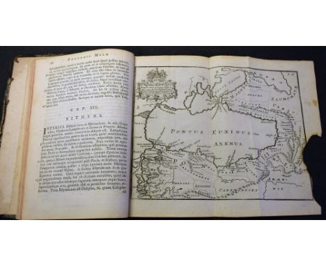
Mela (Pomponius), Pomponii Melæ de Situ Orbis, Libri Tres, Ad omnium Angliae et Hiberniae Codicum MSS. fidem fumma (sic) cura et diligentia recogniti et collati; Tabulisque, cuncta in eo Scriptore Gentium Locorumque amplectentibus, nunc primum illuftrati (sic) [...], T. Pote, [Eton] 1789, [ii], 64pp, index [xxii], three-fold engraved map at page 20 with inset coat of arms of Sir Hans Sloane (loss), contemporary quarter-green leather and marbled boards, gilt embossed title to spine, pastedown with Plain Armorial bookplate: Stephen Eaton, 8vo

Lot 5397
Morant (Philip), The History and Antiquities of the County of Essex, Compiled from the Best and Most Ancient Historians; From Domesday-Book, Inquisitiones (sic) post mortem, And other the most valuable Records and MSS. &c., The Whole digested, improved, perfected, and brought down to the present Time, two-volume set, T. Osborne [...], London & Meggy and Chalk, Chelmsford, 1816, volume I with fold-out hand-coloured engraved map of the county at title-page, later 19th century quarter-calf and buckram boards incorporating earlier elements, red leather title labels to spine, medium folios


Lot 26
Zippo solid brass 1932 - 1990 Americas Spirit Statue of Liberty solid brass lighter, Zippo United States of America brushed brass lighter, Zippo Statue of Liberty, Liberty Island brushed brass lighter, sealed, Zippo 380 Niagara Falls Skyline brushed chrome lighter and Zippo map of America brushed chrome lighter, sealed, all in cases - 5 in total (26)- Unused (FC12)


Lot 344
Emmanuel Bowen (fl. 1714- died 1767) - Coloured engraving - "An Accurate Map of the County of Kent, Divided into it's Lathes" - Showing a view of "The Downs", with a dedication to Lionel Sackville, Duke of Dorset, within rococo cartouche, surmounted by the Duke's arms, printed John Bowles, Carrington Bowles, and Robert Sayer, 20.5ins x 27.25ins, in maple frame and glazed
-
109182 item(s)/page