We found 109182 price guide item(s) matching your search

Refine your search

Year

Filter by Price Range
  • List
  • Grid
  • 109182 item(s)
    /page

Lot 69

Vintage (c.1950) Graham Leach map of Whitby H55.5cm, Smiths Art Deco period mantel clock, barometer, wall mirror, set of six Royal Worcester Company Palissy plates and an Satsuma plate

Lot 130

'The Cries of London' set of twelve early 20th Century colour prints after Francis Wheatley, Map of the West Riding of Yorkshire (20th century print) after Robert Morden and a Brown's Self Interpreting Family Bible

Lot 160

Timothy Pont, hand coloured map of Renfroana, together with another of Teviotia - Blaeu after Timothy Pont, both framed, largest 60 x 50cm (2)

Lot 161

Lewis and Harray - hand coloured map, framed, 60 x 50cm

Lot 179

Orkney & Shetland (Orcadum et Schetlandle) 18th century hand tinted map, 38 x 49cm together with another of Stirling and Dumbarton Shires, 32 x 28cm

Lot 180

Early 19th century hand coloured map - Charte von Africa by I.C.M Reinecke, published Weimar 1802, framed, 63 x 55cm

Lot 181

Early 19th century hand coloured map - Charte von Senegambien, Nigrittien and Guinea, by IC.M Reinecke, published Weimar 1801, framed, 60 x 50cm

Lot 182

Early 19th century hand coloured map - Charte der Nordkuste Africas oder die Staaten Marocoosfes, Algieri, Tunis, Tripoli and Aegyptin by I.C.M Weimar 1802, framed, 60 x 55cm

Lot 8

A silk scarf depicting a map marked Hermes, Paris

Lot 290

AFTER JOHN OGILBY "The Road from Glocester to Montgomery North Wales", strip map, colour engraving, together with "A perspective view of the City of Glocester", colour engraving, and colour map of "Hantshire"

Lot 302

ENGLISH SCHOOL "A New Map of The County of Wilts divided into hundreds", colour engraving, published 1801 for C. Smith London

Lot 34

Four boxes of assorted decorative china to include vintage tea sets, etc., a box of assorted glassware, two boxes of sundry items to include an oak candle box, vintage map, various linen, etc.

Lot 536

A large rectangular green crushed velvet upholstered OKA footstool with painted frame, and a selection of various modern framed maps, etc. to include "Saxon's Map of Gloucestershire", "Keble College Oxford", etc.

Lot 1117

An Ordnance Survey map of Britain in The Dark Ages

Lot 770

A William Kip map of Dorcestriae (sic), with hand colouring, a John Bastard Plan of the Town of Blandford (cut), other pictures and prints (qty)

Lot 1270

F F De Wit, Japonia Regnum, handcoloured map, pl.42 x 57cm.

Lot 1271

Abraham Ortelius, Galliae Regni Potentiss: Nova Descripto, Ioanne Ioliveto Auctore, hand coloured map, 35 x 50cm.

Lot 1274

Jan Elwe, Partie de la Nouvelle Grande Carte Des Indes Orientales, handcoloured map, 53 x 61.5cm.

Lot 1294

Johan Nieuhoff, an antique hand coloured map of China, 43 x 52cm; together with another antique hand coloured map of China, 29.5 x 40cm.

Lot 1572

An antique hand coloured map of Norfolk by Robert Morden, 38.5 x 59.5cm. Condition Report: The colours are bright and overall the map is in good order. However there are two small areas of damage along the top, near to the middle crease and there is slight discolouration in places, along creases and to left corner.

Lot 1586

A Britains model farm part set, boxed; together with a Britains farm tractor and implements set, boxed; and a Britains Nestles 'Map of the World' cow model.

Lot 835

Lot Second World War British webbing, holsters, map cases, entrenching tool, spade and sundry militaria

Lot 1225

A WWI Turkish shell head complete with fuse displayed on period Oak and Brass stand, Turkish map to bottom of Oak base

Lot 512

Various old greetings cards and ephemera including an 1856 map of the Great Green, Thrandeston

Lot 1041

A WWII era silk map (Germany and France)

Lot 427

MEDALS, 中國 - 紀念章, Qing Dynasty 清朝 / Germany 德國: Silver Medal, Boxer Rebellion 八國聯軍, 1900, Obv Kaiser Wilhelm II in uniform to right, wearing cocked hat, Rev map of the Yellow Sea centred on Tsingtao, showing the German expedition’s route from Shanghai to the Peiho River, KRIEG IN CHINA 1900 across it, 39mm. Prooflike mint state, rare.

Lot 274

A folding map backed onto canvas "A plan of London and Westminster with the Borough of Southwark, 1817", Published by W Faden, geographer to His Majesty and to HRH the Prince Regent Jan 1st 1817 CONDITION REPORT: In overall poor condition, stained and discoloured

Lot 533

A Swiss & Co's No.12 Hunting Map, together with velum legal documents

Lot 550

Bacon's excelsior Map of Wales and Monmouthshire, together with The Mabinogion, translated with notes by Lady Charlotte Guest, London, 1877, leather and marbled board bound

Lot 85

An early 20th century Gecophone mahogany box; a pewter mug; an EPBM sugar scuttle; an Ordnance survey map, 1900; estate maps; a pewter tankard, a pressed glass sugar bowl ; etc

Lot 177

Books and Records - Bibby's Annual, 1918; map books; Nature books including Wild Flowers of the wayside and woodland; Charles Dickens, David Copperfield; The Forsythe Saga; classical records and music books; etc. (5 boxes) '

Lot 136

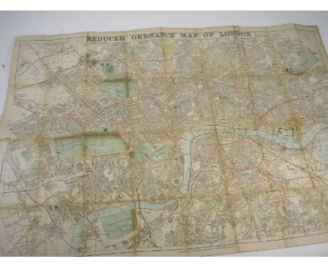
KEITH-FALCONER, Adrian - The Oxfordshire Hussars in The Great War,: Illustrated, cloth, folio, 1927; WYLLY, Col. H.C. - History of the 1st & 2nd Battalions The Leicestershire Regiment in the Great War. portrait and plans, cloth, 4to., n.d.; BROWNE, Montagu - The Vertebrate Animals of Leicestershire and Rutland, 4 plates, map etc., cloth, 4to., 1889; together with Whitbread's Reduced Ordnance map of London. (4)

Lot 143

Plan of the Battle of Waterloo in 1815 : hand coloured manuscript map, 370 x 290 mm, f & g. * attractive example

Lot 156B

COLERIDGE, Henry Nelson - Six Months in the West Indies, in 1825 : frontis map, cont. half calf, 8vo, 1826. * Association copy

Lot 164

FEARNSIDE, W.G. (ed.) - Tombleson's Views of the Rhine & Upper Rhine,: 2 vols., Ill. steel engravings, panoramic map, qtr. cf., 1832. (2)

Lot 171

HOZIER, Captain H.M - The Franco-Prussian War : 2 vols, plates, maps, half calf, 4to, c1870. With - Wyld, James - Post Map of Europe : hand coloured folding map mounted on linen in slipcase. (3)

Lot 191

SHACKLETON, Sir Ernest - South : photographic plates as listed, folding map, errata slip, org. cloth, front free endpapers detached, light browning throughout, 1st edition 1919.

Lot 202

WYLD, Jas [pub] - Wylds New Plan of London and it's vicinity : hand coloured folding map mounted on linen, in slipcase, 750 x 575 mm, 1886. With two related items. (3)

Lot 310

BLOME, Richard - [Great Britain] : A Generall Mapp of the Isles of Great Brittaine ... hand coloured map, 510 x 395 mm, tear no loss lower margin, possibly laid down, f & g, 1669.

Lot 314

COUNTY CORK - A large hand-coloured map (in poor condition, possibly incomplete), c.1700. ** Sold with All Faults not subject to return.

Lot 315

DE FER, Nicholas : Le Plan de Paris, ses Faubourgs et ses Environs, uncoloured map, 750 x 560 mm, pub. Visscher, Amsterdam, early 18th cent ?

Lot 317

After HIROSHIGE : Fifty-three Stations of the Tokaido : 56 coloured woodblocks, port, map, contemporary brocade covers with worn slipcase, oblong 4to, 19th cent.

Lot 320

HONDIUS, Jodocus - Montisferrati Ducatus : hand coloured map, 475 x 370 mm, f & g, c1620.

Lot 322

JAILLOT, B : Plan de la Ville de Paris et de ses Faubourgs Dedie au Roi - large uncoloured map mounted on linen, 1765.

Lot 329

MORDEN, Robert - Somersetshire : hand coloured map, 400 x 355 mm, f&g, c1695.

Lot 348

SCHENCK, Pieter & VALCK, Gerard - [Tuscany] : Toscana ... hand coloured map, 495 x 400 mm, f & g, c1720.

Lot 349

SEUTTER, Georg Mattaus - [English Channel] : La Plus Grande Patie de la Manche, qui contient Les Cotes D'Angleterre ... hand coloured map, 565 x 470 mm, tear in lower margin no loss, with minor worm damage, probably laid down. f & g, c1730.

Lot 352

SPEED, John - [Derbyshire] : Anno Darbieshire Described - hand coloured map, 500 x 380 mm, Bassett & Chiswell, f & g, c1676.

Lot 353

SPEED, John - Devon Shire with Excester Described : [English text], hand coloured map, 510 x 375 mm, Sudbury & Humble, framed and double glazed, c1614. * nice example

Lot 354

SPEED, John - Dorsetshire : ( Latin text) hand coloured map, 500 x 375 mm, f & g, defective to left hand margin, c1620.

Lot 86A

CURTIUS, Q. R - Q. Curtii Rufi Historiarum libri : engraved title-page [trimmed], folding map, cont. vellum, 12mo, Elzevir, 1660. With - six other books mainly on classical subjects. (7)

Lot 140

JOHN SPEEDE (British, 1552-1629), 'Caemarden' [sic] 'both Shyre and Towne described'. Original uncoloured map, Sudbury and Humble edition. 15" x 19.75" (38.5 x 51cm) CONDITION REPORT: Uncoloured, creased in places, two minor tears, appearing not stuck down. 7.5/10

Lot 141

JOHN SPEEDE, (British, 1552-1629), 'Penbrokeshyre' [sic], 'describe', original later coloured map, Bassett and Chiswell edition with English text verso. 15.25" x 20.25" (39 x 51.25cm) CONDITION REPORT: Good condition, some minor foxing spots, good margins, no tears in the map.

Lot 293

British Railways Sectional Maps Based on official map, issued by the Railway Clearing House to show the geography of Britain's railways at December 1947. Very interesting.

Lot 305

India - 1960-61 'The Himalayan Scientific Mountaineering Expedition' hand stamp on Aerogramme Kathmandu to son at Dorset School - content includes hand drawn map by G.Pugh expedition member. Also 'Carried by Runner' hand stamp.

Lot 514

A late 19th/early 20th century map, 'The Landmarks of London', published by Cassell, Petter & Galpin

Lot 122

ANTIQUARIAN MAP 'A PLAN OF THE NAVIGABLE CANAL CITY OF COVENTRY FRADLEY HEATH 1767' F/G 33CM X 17CM APPROX

Lot 331

LONDON ATLAS MAP OF THE CANARY ISLANDS BY EDWARD STANOFORD

Lot 352

Nathaniel Coultman's map of North and South Wales, two presentation medals, a group of Second World War miniatures and other assorted items

Loading...Loading...
  • 109182 item(s)
    /page

Recently Viewed Lots