We found 109182 price guide item(s) matching your search
There are 109182 lots that match your search criteria. Subscribe now to get instant access to the full price guide service.
Click here to subscribe- List
- Grid
-
109182 item(s)/page


Lot 457
Wales. Blaeu (Johannes). Penbrochia Comitatus et Comitatus Caermaridunum, Amsterdam, circa 1648, engraved map with contemporary outline colouring, 415 x 535 mm, Dutch text on verso, mounted, together with Jansson (Jan). Denbigiensis Comitatus et Comitatus Flintensis; Denbigh et Flintshire, Amsterdam, circa 1650, engraved map with contemporary outline colouring, mount stained with two small repaired holes to left-hand vertical margin, 385 x 510 mm, Dutch text on verso, mounted, with Blaeu (Johannes). Montgomeria Comitatus et Comitatus Mervinia, Amsterdam, circa 1645, engraved map with contemporary outline colouring, slight staining, heavily creased, small holes repaired on verso, 385 x 500 mm, mountedQty: (3)
Lot 81
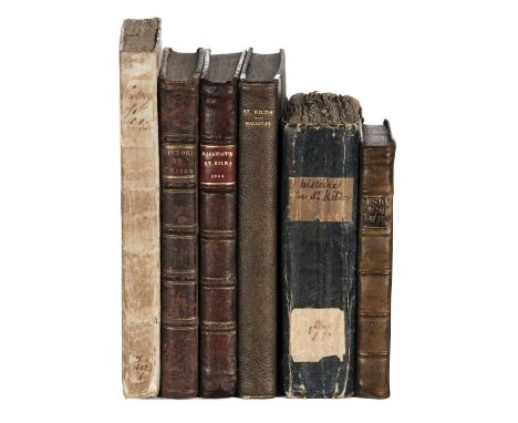
Macaulay (Kenneth). The History of St.. Kilda, Containing a Description of this Remarkable Island; the Manners and Customs of the Inhabitants; the Religious and Pagan Antiquities there found, 1st edition, London: for T. Becket and P. A. De Hondt, 1764, half-title, engraved folding map, advertisement leaf, occasional spotting, armorial bookplate (with earl's coronet, motto of the Order of the Garter, and griffin with wings addorsed), uncut in original comb-marbled boards, contemporary ownership inscription effaced from front board, housed in custom pull-off case, 8vo (22.5 x 14.2 cm), together with: Histoire de Saint-Kilda, imprimée en 1764, traduite de l'anglois, 1st edition in French, Paris: Knapen, & fils, 1782, pp. xxiv 96 336 [4] xvi 17-60, half-title, uncut in original wrappers with marbled blue backstrip, housed in custom quarter leather solander box, 12mo (17.6 x 10.5 cm), A Voyage to, and History of, St. Kilda, 1st Dublin edition, Dublin: printed by James Hoey, 1765, half-title, advertisement leaf, browning, marginal spotting, a few other marks, contemporary sheep, rebacked, 12mo (15.9 x 9.2 cm), and 3 other copies of the same work, all 1st editions (London, 1764), in contemporary mottled calf (front joint cracked), contemporary calf (lacking half-title, engraved bookplate of William Salkeld, spine-label renewed), and 20th-century quarter morocco (spotting and browning, ink-stamps)Qty: (6)NOTESTHE DAVID WILSON LIBRARY PART III: SCOTLAND, HIGHLANDS & ISLANDS ESTC T90614 (first edition), T76273 (first Dublin edition); Freeman 2389 (both editions). Kenneth Macaulay was a Church of Scotland minister who visited St Kilda in 1758. 'James Boswell showed the book to Samuel Johnson before their visit to the Hebrides in 1773, and Johnson pronounced it "very well written, except for some foppery about liberty and slavery" (Boswell, Life, 2.150). The two travellers visited Macaulay on their journey to the Hebrides and from conversation with him came to the conclusion that he could not have written the book ... Boswell was told that the book had been written by John Macpherson of Skye from materials supplied by Macaulay, but it is now generally accepted that the bulk of the book is Macaulay's own work, with some contributions from Macpherson' (ODNB).

Lot 418
Merionethshire. Speed (John), Merionethshire Described, George Humble, circa 1646, uncoloured engraved map, inset plan of Harlech, decorative strapwork cartouche, mileage scale and compass rose, slight marginal creasing, 390 x 515 mm, English text on verso, together with The Countie of Radnor described and the Shyre Townes Sittuatione, John Sudbury & George Humble, circa 1627, uncoloured engraved map, an inset town plan of Radnor, large strapwork cartouche, mileage scale and compass rose, one printer's fold, 385 x 510 mm, English text on versoQty: (2)
Lot 417
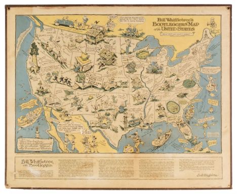
McClandlish (Edward). Bill Whiffletree's Bootlegger's Map of the United States, Hagstrom Compnay Inc. New York, circa 1944, circa 1944, large pictorial lithographic map of North America mocking prohibition in the United States, slight spotting and staining, slight surface abrasion to lower left, faded, laid on card with two metal 'hanging holes' to upper corners, two additional holes to lower corners, 660 x 815 mmQty: (1)NOTESThe map was first published in 1926 by the Washington Post and parodies the prohibition on the sale of alcohol in the United States. There was another edition published in the 1920s by the Griswold Press and the popularity of the map continued even after the lifting of prohibition in 1933. The map is filled with illustrations and puns with place names altered to Chi-keg-o and Albu-corky for example. This example by Hagstrom was copyrighted in 1944 under the Bill Whiffletree trademark in order to accompany Whiffletree's very scarce 'Ration Map of the United States'.
Lot 420
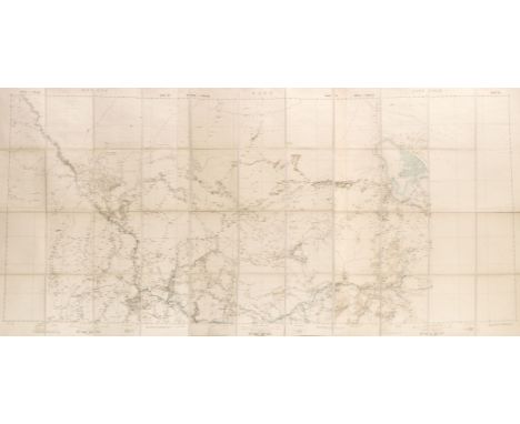
Nigeria. Untitled map of Lake Chad, printed for the Intelligence Division, War Office by Messrs. W. & A. K. Johnston, Edward Stanford, 1902, large photolithographic map, sectionalised and laid on linen, 970 x 2075, marbled endpapers, contemporary cloth slipcase with publisher's printed label to upper cover, slipcase a little wornQty: (1)NOTESOne of six maps of Nigeria produced for the Intelligence Division of the War Office. The maps were published during the short-lived 'Northern Nigerian Protectorate, which lasted from 1900 - 14.

Lot 427
Ogilby (John). The Road from London to Buckingham Continued to Banbury in Com. Oxon. circa 1675, hand-coloured engraved strip road map, commencing at London, 340 x 445 mm, laid on hardboard, together with The Road from Bristol com Glos. to West Chester, circa 1675, engraved strip road map with sparse later hand colouring, slight staining, 350 x 435 mm, with The Road from Glocester to Coventry, circa 1675, hand-coloured engraved strip road map, mount stained and heavily toned, 315 x 440 mm, plus a collection of 44 smaller road maps, including 21 by John Senex and 6 by John Owen and Emanuel Bowen, various sizes and conditionQty: (47)
Lot 30
Ségur (Philippe-Paul, comte de). Histoire de Napoléon et de la grande-armée pendant l'année 1812, 4th edition, Paris: Baudoin frères, 1825, 6 engraved plates including frontispieces (collation unknown), folding map, spotting, bookplates of Henry Terry with motto 'ubique fecundant imber', contemporary green half roan, worn, 8vo, together with: Fabry (Jean-Baptiste-Germain). Itinéraire de Buonaparte de l'île d'Elbe à l'île Sainte Hélène, 2nd edition ('considérablement augmentée), Paris: Normant, Rey et Gravier, 1817, half-titles, contemporary half calf, rebacked and refurbished, 8vo, Bussey (George Moir). History of Napoleon. Illustrated by Horace Vernet, 2 volumes, London: Joseph Thomas, 1840, original cloth, headcaps worn, sides marked, 8vo, Collingwood (G. L. Newnham). A Selection from the Public and Private Correspondence of Vice-Admiral Lord Collingwood,1st edition, London: James Ridgway, 1828, engraved frontispiece (spotted), engraved plan of Trafalgar, contemporary half calf, front board detached, 4to, and 10 others on Napoleon, French and English, 19th and early-20th century, the lot not collated and sold as seenQty: (22)
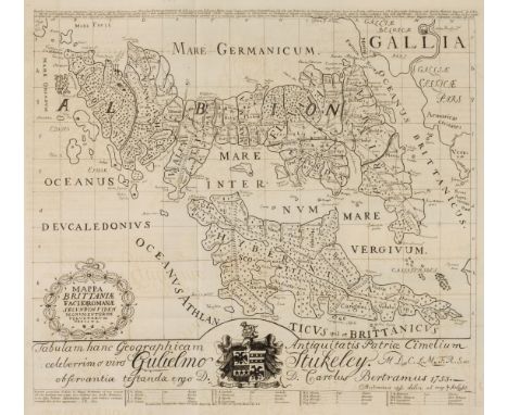
![[Cox, Thomas]. Magna Britannia et Hibernia, Antiqua & Nova, volume I only London: John Nutt, 1715, 22 folding engraved ma](https://cdn.globalauctionplatform.com/097ee6b6-2081-432a-b7f6-ac6000a6c3d8/3c1b72c7-5aff-4f98-a307-ac6001172e29/468x382.jpg)
Lot 38
[Cox, Thomas]. Magna Britannia et Hibernia, Antiqua & Nova, volume I only London: John Nutt, 1715, 22 folding engraved maps by Robert Morden, Herman Moll and others, 3 folding plates, Dorset map with two holes affecting image, other maps and plates with some tears and frayed and insect predated margins with some losses, a little light spotting and soiling, contemporary inscription in Latin relating to William Morgan of Tredegar, dated 1720 to front pastedown, contemporary panelled calf, rubbed with splits to spine ends, small 4to, together with Chamberlayne (John). Magna Britannia Notitia: or, the Present State of Great-Britain, with divers remarks upon the antient state thereof... The Two and Twentieth edition of the South Part call'd England, and the first of the North part call'd Scotland, 2 parts in one, 1708, engraved portrait frontispiece of Queen Anne, advertisements at end, some light spotting and soiling, small modern presentation inscription to front endpaper, contemporary panelled calf, some wear and worming to spine and lower cover, 8vo, with three others (two odd volumes) including Robert Heron's The Letters of Junius, 2 volumes, 2nd edition, 1804, extra-illustrated with 20 hand-coloured engraved portraits of royalty, nobility and notable figures (covers detached)Qty: (6)

Lot 387
Derbyshire. (Greenwood (C. & J.), Map of the County of Derby, from an actual survey made in the years 1824 & 1825..., Greenwood, Pringle & Co., 1825, large scale engraved map with contemporary outline colouring, sectionalised and laid on later linen, calligraphic cartouche, engraved vignette view of Chatsworth House, compass rose and table of explanation. toned overall, slight spotting, slight fraying, old drawing-pin holes in each corner, 1570 x 1200 mm, later marbled endpapersQty: (1)

Lot 408
* Lithuania. Mercator (Gerard), Lithuania, circa 1619, engraved map with contemporary outline colouring, some overall toning, slight text show through, 375 x 445 mm, French text on verso, together with Blaeu (Willem Janszoon). Livonia vulgo Lyesland, Amsterdam, circa 1640, hand-coloured engraved map, 385 x 500 mm, Latin text on verso, with another later uncoloured example which is slightly toned and with some marginal repairs and no text on the versoQty: (3)NOTESThe map extends from Cracow to the Baltic in the west and Kiev and Smolenzio in the east. Jansson's original plate was passed to his heirs - Johannes Waesberghe - who together with Moses Pitt and Stephen Swartr re-published the map in Oxford with the added reticulation.


Lot 456
United States. Rand, McNally & Co's New Official Railroad map of the United States with portions of The Dominion of Canada, The Republic of Mexico and the West Indies, Edward Stanford, 1900, large colour lithographic map, sectionalised and laid on linen, inset map of Alaska, 785 x 1115 mm, yellow card endpapers, lacking slipcaseQty: (1)

Lot 431
* Poland. Blaeu (Guillaume & Joan), Comitatus Glatz authore Jona Sculteto, Amsterdam, circa 1640, three engraved maps with contemporary outline colouring, decorative cartouche and mileage scale, three copies mounted in a multi-aperture mount, one map stained with a short closed tear across the central fold, one map lightly toned, each 415 x 505 mm, framed and glazed, together with Swinemünde (Swinoujscie). Merian (Matthaus), Abriss der Einfarth auss der OstSee in die Oder die Swine genandt. [1652], engraved plan with contemporary hand-colouring with another uncoloured example, each 245 x 340 mm, displayed in a double aperture mount, framed and glazedQty: (2)
Lot 414
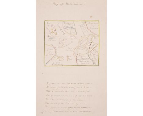
Map of Matrimony. Manuscript allegorical map, circa 1830, a manuscript ink and watercolour allegorical map of matrimony with eight lines of verse below the image, map size 75 x 90 mm, overall size 270 x 205 mm, old adhesion scars to versoQty: (1)NOTESThe adhesion scars on the verso of the sheet would indicate that the map was at some time, in an album.

Lot 44
Leycester (Peter). Historical Antiquities, in Two Books. The First Treating in General of Great-Brettain and Ireland. The Second Containing Particular Remarks Concerning Cheshire......., Whereunto is annexed a Transcript of Doomsday-Book, so far as it concerneth Cheshire, taken out of the Original Record, London: W. L. for Robert Clavell, 1673, title in red & black, folding uncoloured engraved map of Cheshire by John Speed (Roger Rea published), several woodcut heraldic crests to text throughout, occasional light dust-soiling and few minor marks, later endpapers, contemporary sheep, rebacked, maroon morocco title label preserved, folioQty: (1)NOTESUpcott pp.64-66.

Lot 378
Blaeu (Johannes). Staffordiensis comitatus vulgo Stafford Shire, Amsterdam, circa 1650, engraved map with contemporary outline colouring, large decorative cartouche and mileage scale, 415 x 505 mm, German text on verso, mounted, together with Episopatus Dunelmensis vulgo The Bishoprike of Durham, Amsterdam, circa 1645, engraved map with contemporary outline colouring, mount stained, some spotting, 385 x 495 mm, Latin text on verso, with Valk (G. & Schenk P.). Comitatus Darbiensis, Amsterdam, circa 1710, engraved reticulated map with contemporary hand colouring, uncoloured cartouche and mileage scale, some oxidisation of old watercolour causing cracking to the image, repaired on verso, 380 x 490 mmQty: (3)
Lot 84
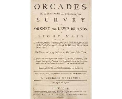
Mackenzie (Murdoch). Orcades: or, a Geographic and Hydrographic Survey of the Orkney and Lewis Islands, in Eight Maps ... The third edition, with additional soundings, and some corrections, London: printed for the author, by M. Say, and sold by K. Mackenzie, 1776, [2] 6 pp., 8 engraved large folding maps by Emanuel Bowen after Murdoch Mackenzie (various dimensions: see note) each with title and dedication within separate rococo cartouches (map 1 title within figural cartouche), bar scales, and inset coastal profiles, text and maps all mounted on stubs, title-page with lower margin excised (removing an old inscription, the printed text unaffected), soiling, and short closed tear at lower inner corner, the maps with contemporary manuscript captions in black ink rectos (inside and outside plate-marks) and versos, variable light dust-soiling, browning, and offsetting, early paper-reinforcement along folds verso, maps 1-3 and 7 closely trimmed along at least one edge (to neat line in cases, cropping top neat-line in map 7), map 1 with shallow chip to left-hand edge affecting plate-mark but not neat line and with short closed tear to lower margin, short closed tear to lower inner corner of maps 2 and 6 affecting frame only, map 5 with outer section reattached at an early date with concomitant darkening and disruption to image, map 7 with short (3cm) split to foot of one old fold and a little fraying along close-trimmed top edge, minor paper-disruption and soiling along one fold of map 8 (the fold with old paper-reinforcement verso as noted), a few other marks, nicks and chips, modern red-brown half morocco binding, atlas folio (binding dimensions 62.2 x 42.2 cm)Qty: (1)NOTESTHE DAVID WILSON LIBRARY PART III: SCOTLAND, HIGHLANDS & ISLANDS Very rare: not in ESTC, which cites only the first edition of 1750, for which six copies are traced. 'Mackenzie set new standards for hydrographic surveying in Britain' (ODNB). The maps are dated 1750 at the foot, indicating that the original plates were used; most are signed by Emanuel Bowen. Some of them bear interesting dedications: map 5 is dedicated to 'Alexander Mackenzie of Hampton in Virginia', map 7 to the governor and adventurers of the Hudson's Bay Company. Titles and dimensions are as follows: 1) The Orkney Islands (57.8 x 78 cm). 2) The South Isles of Orkney (60.2 x 67 cm). 3) Pomona or Main-Land (55.5 x 78 cm). 4) The North East Coast of Orkney (68 x 55.2 cm). 5) The North West Coast of Orkney (52.7 x 57 cm). 6) The Lewis, or North Part of Long-Island (58.7 x 65 cm). 7) The North Part of the Lewis (60 x 85 cm). 8) The South East Coast of the Lewis (63 x 60 cm).
Lot 400
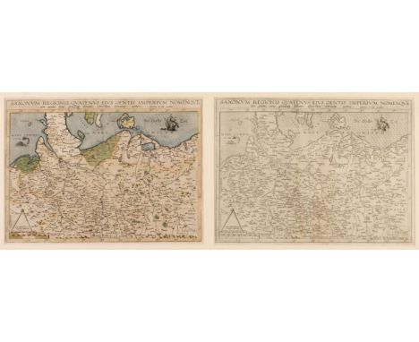
* Germany/Saxony. De Jode (Cornelis), Saxonum Regionis Quatenus eius Gentis Imperium Nomenque Antwerp, 1593, engraved map with contemporary hand colouring, displayed in a double aperture mount with another uncoloured example, each 330 x 455 mm,, framed and glazedQty: (1)NOTES"In 1578 Gerard de Jode published his Speculum Orbis Terrarum, an atlas aimed at competing with the Theatrum of Ortelius. However, the latter had first been issued in 1570 and had already built a commanding market presence, and so despite de Jode's longer standing reputation the atlas did not sell very well. Only a dozen or so examples have survived. Undeterred, he made plans for another expanded edition, and upon his death in 1591 it was taken on by his son Cornelis. The Speculum Orbis Terrae of 1592 likewise did not sell well and was never reissued. Although more examples than the first edition have survived, it too is very scarce. Many of de Jode's maps are judged to be superior to those of Ortelius, both in detail and style." (Burden)

Lot 432
* Poland. De Fer (N.), Les Etats de la Couronne de Pologne sous les quels sont Compris la Grande et la Petite Pologne, le Grand Duche de Lithuanie, Les Prusses et la Curlande. Divisez en provinces et Palatinats, Desnos, Paris, 1760, map with contemporary hand colouring, engraved by P. Starckman, presented in a double-aperture mount with another example (1736 edition) with contemporary outline colouring, one small hole in title cartouche, each 470 x 585 mm, framed and glazedQty: (1)

Lot 428
Ogilby (John). The Road from London to the City of Bristol, circa 1675, uncoloured engraved strip road map, some fraying to the vertical margins, slight spotting and mount staining, 335 x 470 mm, together with The Continuation of the extended Road from Buckingham to Bridgnorth in com. Salop, circa 1675, uncoloured engraved strip road map, 345 x 445 mm, with The Road from Prestaine in com. Radnor to Carmarthen, circa 1698, uncoloured engraved strip road map, slight creasing, toned overall, 315 x 445 mm, plus The Road from London to Shrewsbury continued to Welshpool com. Montgomery in North Wales, circa 1675, uncoloured engraved strip road map, some creasing, additional horizontal and vertical folds, slight staining, 340 x 425 mmQty: (4)

Lot 422
Northamptonshire. Greenwood (C & J), Map of the County of Northampton, from an actual survey made in the years 1825 & 1826..., Greenwood, Pringle & Co., 1826, large scale uncoloured engraved map, sectionalised and laid on linen, calligraphic cartouche, compass rose, table of explanation, engraved vignette of South West View of Peterborough Cathedral, slight staining and offsetting, 1340 x 1360 mm, marbled endpapersQty: (1)

Lot 407
Leicestershire. Prior (John), To the Right Honourable Francis Earl of Huntingdon, Baron Hastings, Hungerford, Newmark, Peverel, Botreaux, Molins, Moet and de Homet, by his Lordships Permission. This Map of Leicestershire from an Actual Survey, Begun in the Year 1775, and Finished in the Year 1777..., William Dawson, London, J. Gregory, Leicester, 1779, large scale map, engraved by John Luffman, with contemporary hand colouring on four conjoined sheets, old folds with short closed tears, inset map of a plan of Leicester, large uncoloured cartouche, water-stained and dust-soiled, slight staining, slight fraying to lower margin, slight offsetting, old folds strengthened and repaired on verso, slight marginal fraying, 1115 x 1210 mmQty: (1)

Lot 404
India. Stanford's Sketch map of the North-Western Frontier of India, Edward Stanford, 1897, colour lithographic map, sectionalised and laid on linen, 810 x 655 mm, three examples of the same map, one map appears to have been 'stabbed' with numerous small holes possibly created with a compass, contemporary red cloth boards with printed label to upper cover, one example with discoloured boardsQty: (3)
Lot 96
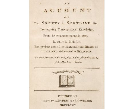
Society in Scotland for Propagating Christian Knowledge. An Account of the Society in Scotland for Propagating Christian Knowledge, From its commencement, in 1709. In which is included, the present state of the Highlands and Islands of Scotland with regard to Religion, 1st edition, Edinburgh: A. Murray and J. Cochrane, 1774, engraved title-page, modern marbled quarter calf, 4to (24.9 x 19.4 cm), together with: Barry (George). The History of the Orkney Islands, 1st edition, Edinburgh: for the author by D. Willison, 1805, 11 engraved plates including frontispiece, folding map, retaining final leaf with directions to the binder and publisher's advertisement, plates and map spotted and offset, ink-stamp to title-page, short closed tear to inner fold of map, modern half calf, 4to (26.6 x 19.7 cm), Low (George). Fauna Orcadensis: or, the Natural History of the Quadrupeds, Birds, Reptiles, and Fishes, or Orkney and Shetland. From a Manuscript in the possession of Wm. Elford Leach, 1st edition, Edinburgh: for Archibald Constable and Company [and others], 1813, half-title, moderate browning, edges untrimmed, modern quarter calf, 4to (26.5 x 20.4 cm), and 3 others, including 2 other copies of Low, Fauna Orcadensis, both 1st editions, 1813 (one in c.1900 green half morocco by J. Leighton, with bookplate of J. Griffith Dearden of Walcot Hall, Stamford; the other in c.1900 blue half morocco, top edge gilt, others untrimmed, damp-stained)Qty: (6)NOTESTHE DAVID WILSON LIBRARY PART III: SCOTLAND, HIGHLANDS & ISLANDS ESTC T82929 (SSPCK); Freeman 206 (Barry), 2323 (Low); Mullens & Swann pp. 43-4 (Barry), 361-2 (Low). Chapter two of the first item (pp. 13-19) discusses the Society's activities in North America.

Lot 382
Cheshire. Greenwood (C.), Map of the County Palatine of Chester from an actual survey made in the year 1819, Wm. Fowler Wakefield & C. Greenwood, London, June 15th 1819, uncoloured large scale map on four sheets, calligraphic cartouche and dedication, compass rose and table of explanation, each sheet approximately 580 x 755 mm, bound in modern quarter cloth over marbled boards with printed label to upper cover, slim upright folio, binding size 640 x 405 mmQty: (1)NOTESA clean example with no perceived faults.
![[Scotland; Convention of Estates]. The Acts made in the first Parliament of our most High and Dread Soveraign, Charles the Fi](https://cdn.globalauctionplatform.com/097ee6b6-2081-432a-b7f6-ac6000a6c3d8/3e0504b9-d4e6-4633-9854-ac6001174d66/468x382.jpg)
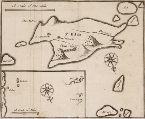
Lot 91
[Scotland; Convention of Estates]. The Acts made in the first Parliament of our most High and Dread Soveraign, Charles the First ... Holden by himselfe, present in Person, with his three Estates at Edinburgh, upon the Twenty eight day of June, Anno Domini, 1633 [-The Laws and Acts made in the first Parliament of ... Charles the Second], Edinburgh: David Lindsay 1683, bound with: An Index of Abridgment to the Acts of Parliament made by J. James the I. and II. III. IV. V. Queen Mary, Ja. VI. K. Charles I. and Charles the II ... Digested into Heads, Edinburgh: John Reid, 1685, 2 works in 1 volume, tightly bound, first work without blank Z5, recent quarter calf, 12mo (14.2 x 7 cm), together with: Hall (James). Travels in Scotland, by an Unusual Route: with a Trip to the Orkneys and Hebrides, containing Hints for Improvements in Agriculture and Commerce, 2 volumes, 1st edition, London: for J. Johnson, 1807, engraved folding map, 29 engraved plates, signature 2N5 (pp. 553/4) present in two settings (i.e. retaining cancelled leaf; each with portions of text deleted in manuscript by a contemporary hand), plates spotted, modern quarter calf, 8vo (23.1 x 14 cm), and 6 others (not collated), leather-bound: Miscellanea Scotica, 4 volumes, 1st edition, 1818-20; Anderson, Scotland in Early Christian Times, 2 volumes, 1881; Basil Hall, Fragments of Voyages and Travels. Third Series, 3 volumes, Edinburgh: Robert Cadell, 1833; James Wilson, A Voyage Round the Coasts of Scotland the Isles, 2 volumes, 1st edition, 1842; Charles St John, 2 volumes, 1st edition, 1849; Sinclair, General Report of the Agricultural State and Political Circumstances of Scotland, 3 volumes and 2 appendix volumes, 1st editions, 1814, lacking volume 1 title-page, edges untrimmedQty: (21)NOTESTHE DAVID WILSON LIBRARY PART III: SCOTLAND, HIGHLANDS & ISLANDS ESTC R183958 (Scotland, Acts), R22587 (An Index ...).
Lot 63
Faujas de Saint-Fond (Barthélemy). Voyage en Angleterre, en Ecosse, et aux îles Hébrides, 2 volumes, 1st edition, Paris: H. J. Jansen, 1797, half-titles, 2 errata leaves, 7 engraved folding plates, contemporary French tree sheep, gilt spines, 8vo (19.3 x 11.6 cm), together with: Knox (John). A Tour through the Highlands of Scotland, and the Hebride Isles, in MDCCLXXXVI, 1st edition, London: for J. Walter [and others], 1787, contemporary sprinkled calf gilt, red morocco label, 8vo (20.8 x 12.5 cm), Anderson (James). An Account of the Present State of the Hebrides and Western Coasts of Scotland, 1st Dublin edition, Dublin: by M. Graisberry, for Messrs White [and others], 1786, half-title, engraved plan and map (both folding), folding table, plan with closed tear to inner fold, map browned and with repairs verso, table spotted, ink-stamps of William Irvine of Lerwick to initial blank and contents page, contemporary calf, red morocco label, joints cracked at feet but sound, 8vo (19.8 x 11.9 cm), Buchanan (John Lan[n]e). Travels in the Western Hebrides: from 1782 to 1790, 1st edition, London: For G. G. J. and J. Robinson, and J. Debrett, 1793, half-title discarded, contemporary sprinkled calf, red morocco label, loss to headcaps, front joint slightly cracked but sound, label partly chipped, 8vo (20.9 x 12.5 cm), and 4 others (not collated), all in contemporary calf or half calf, including Aust, A Companion and Useful Guide to the Beauties of Scotland, 2 volumes, 3rd edition, 1810 (bookplates of Margaret Smith-Burges), Defoe, A Tour through the Island of Great Britain, 4 volumes, 8th edition, 1778 (with folding map), Scotland Described, 'New and Improved Edition', 1799 (with folding map), and Fraser, A Letter to the Rt. Hon. Charles Abbot, Speaker of the House of Commons, containing an Inquiry into ... the Extension of the Fisheries, 1st edition, 1803 (with folding map)Qty: (13)NOTESTHE DAVID WILSON LIBRARY PART III: SCOTLAND, HIGHLANDS & ISLANDS ESTC T92815 (Knox), N23361 (Anderson), T144646 (Buchanan); Ward & Carozzi 783 (Faujas de Saint-Fond). All good, unrestored copies in contemporary bindings. Faujas de Saint-Fond's work is of geological relevance and contains striking engravings of Fingal's Cave and other rock formations on Staffa.Condition update 6/11/2020: please note the front joint of Buchanan, Travels has deteriorated during viewing, and the cover is near-detached as a result.

Lot 459
Wales. Speed (John), Cardigan Shyre Described with the due forme of the Shire town as it was surveyed..., Thomas Bassett & Richard Chiswell, [1676], hand-coloured engraved map, an inset town plan of Cardigan, slight toning to central fold, 390 x 515 mm, together with Merionethshire Described, Henry Overton, [1713 - 1743], hand-coloured engraved map, inset view of Harlech, large strapwork cartouche, mileage scale and compass rose, slight creasing, 385 x 510 mm, no text on verso, with Denbighshire, Thomas Bassett & Richard Chiswell, [1676], hand-coloured engraved map, an inset town plan of Denbigh, slight mount staining, 380 x 510 mm, English text on versoQty: (3)
Lot 53
Arrowsmith (Aaron). Memoir relative to the Construction of the Map of Scotland published by Aaron Arrowsmith in the Year 1807, 1st edition, London: A. Arrowsmith, [1809?], 45 pp., 3 engraved maps ('Map of the Island of St Kilda, Borrera, etc. etc., Taken Aug. 1799'; a Ptolemaic map of Britain after Richard of Cirencester, folding; and 'A Part of the N. E. Coast of the Shetland Isles surveyed in Jan[uar]y 1785 by Lieut. Columbine', dated 1807, folding, opening to 108 x 62.5 cm), staining to first few text-leaves with concomitant paper-disruption to title-page, St Kilda map spotted, 'A Part of the N. E. Coast of the Shetland Isles ...' map with recoverable paper-disruption to intersections of a few folds, front free endpaper excised, edges untrimmed, original boards, cloth backstrip, wear to corners, 4to (31.5 x 25.5 cm), together with: Loch (James). Memoir of George Granville, late Duke of Sutherland, 1st edition, London: 'not published', 1834, 83 pp., engraved frontispiece, lithographic plate (both spotted), inscribed 'John Horton Esq, Priors Lee, from the Duchess Countess of Sutherland' on the front free endpaper, original cloth, 4to, Barnard (Frank). Picturesque Life in Shetland, 1st edition, Edinburgh: George Waterston & Sons, 1890, collotype or halftone plates from paintings by Barnard, adhesive staining to endpapers, original roan-backed boards, some wear to spine, oblong folio, number 230 of 300 copies only, Lewis (Samuel). A Topographical Dictionary of Scotland ... Supplementary Volume: Map of Scotland, London: S. Lewis and Co., 1846, lithographic map hand-coloured in outline, divided into 6 folding sheets mounted on stubs (individually opening to 71 x 67 cm, each with short recoverable split at central intersection of folds), original cloth, 4to, Crawfurd (George). A General Description of the Shire of Renfrew ... continued to the Present Period by George Robertson, Paisley: J. Neilson, 1818, 3 engraved plates including frontispiece, 2 hand-coloured engraved folding maps, engraved folding facsimile, frontispiece spotted and damp-stained, one map with repairs verso, text not collated, original moiré cloth, paper spine-label, wear to spine, 4to, and 7 others including a large Ordnance Survey map of the parish of Newbattle (1854; linen-backed and finely bound in contemporary maroon morocco with patterned endpapers), another copy of Loch, another copy of Lewis (dated 1851), and similarQty: (12)NOTESTHE DAVID WILSON LIBRARY PART III: SCOTLAND, HIGHLANDS & ISLANDS
Lot 85
Martin (Martin). A Late Voyage to St. Kilda, the Remotest of all the Hebrides, or Western Isles of Scotland, 1st edition, London: for D. Brown, and T. Goodwin, 1698, half-title, engraved folding map, engraved folding plate (depicting a fulmar and an 'assilag', or storm petrel), advertisement leaf, browning, variable damp-staining in gutter, more extensive in last two quires (K-L), contemporary ownership inscription contemporary mottled calf, rebacked with original spine laid down, 8vo (17.9 x 11 cm), together with: ibid. A Voyage to St. Kilda, 3rd edition ('corrected'), London: for R. Griffith, 1749, bound with: Mallet (David). Amyntor and Theodora: or, the Hermit. A New Edition. Corrected by the author, London: for Paul Vaillant, 1748, 2 works in 1 volume, toning, occasional spotting, Martin title-page with small hole from removal of ownership inscription, 19th-century half calf, partial fading to front cover, 8vo (19.2 x 11 cm), Mackenzie (J. B., editor). Episode in the Life of the Rev. Neil Mackenzie at St. Kilda from 1829 to 1843. Edited by his son, minister at Kenmore, 1st edition, [Aberfeldy]: privately printed, 1911, 57 pp., original wrappers bound in, inscribed on front wrapper 'To Miss Marcus with Mr Mackenzie's compliments & best wishes, 1911', blind stamp of Malcolm Stewart, laird of Hoy to title-page, modern quarter calf, 8vo (24 x 14.8 cm), and 6 others, all St Kilda-related, including another 1st edition of Martin, A Late Voyage to St. Kilda (lacking half-title, but retaining map, plate and advertisement leaf, spotting and browning; contemporary panelled calf, rebacked, recornered and relined)Qty: (9)NOTESTHE DAVID WILSON LIBRARY PART III: SCOTLAND, HIGHLANDS & ISLANDS ESTC R12939 (Martin, first edition), T152363 (Martin, third edition); Foxon M49 (Mallet); Wing M847 (Martin, first edition).
![Buchanan (John Lan[n]e). Travels in the Western Hebrides: from 1782 to 1790, 1st edition, London: for G. G. J. and J. Robinso](https://cdn.globalauctionplatform.com/097ee6b6-2081-432a-b7f6-ac6000a6c3d8/20760bbf-2f1d-4fcf-9a7d-ac60011736e1/468x382.jpg)
Lot 58
Buchanan (John Lan[n]e). Travels in the Western Hebrides: from 1782 to 1790, 1st edition, London: for G. G. J. and J. Robinson, and J. Debrett, 1793, half-title, uncut in original boards, housed in a custom solander box, 8vo, together with: Neill (Patrick). A Tour through some of the Islands of Orkney and Shetland, 1st edition, Edinburgh: for A. Constable and Company, 1806, pp. xi;[1];239;[8], half-title, 8 pp. advertisements, uncut in original boards, 8vo, [Botfield, Beriah]. Journal of a Tour through the Highlands of Scotland during the Summer of MDCCCXXIX, 1st edition, Norton Hall, [Northamptonshire]: [for the author], 1830, pp. [6];xvi;376;23;[1], engraved frontispiece and additional title-page (spotted), signatures L6-7 loose, original boards, head of spine restored, rear joint cracked (the board held by bottom cord only), 12mo, [Browne, James]. A Critical Examination of Dr. Macculloch's Work on the Highlands and Western Islands of Scotland, 1st edition, Edinburgh: Daniel Lizars, 1825 pp. [4];302;[1], pencil underlinings, uncut in original boards, 8vo, Stark (John). Biographia Scotica, Edinburgh: by J. Stark for Arch. Constable and Co. [and others], 1805, bookplate (Lord Walsingham), unpaginated, signatures pi3 2M6 chi1, with 5 engraved portraits (collation unknown), advertisement leaf, light browning, offsetting, uncut in original boards, loss to spine-ends, front joint cracked but firm, 12mo, Barry (George). History of the Orkney Islands ... The Second Edition, with Corrections and Additions by the Rev. James Headrick, London: Longman, Hurst, Rees, and Orme, 1808, 11 engraved plates with tissue-guards, advertisement leaf, without folding map (text not collated), bookplate of Maxwell of Kirkconnell, uncut in original boards, 4to, and 3 others, 19th-century Scottish travel in similar conditionQty: (9)NOTESTHE DAVID WILSON LIBRARY PART III: SCOTLAND, HIGHLANDS & ISLANDS ESTC T144646 (Buchanan); Freeman 2786 (Neill), 206 (Barry); Mullens & Swann pp. 103 (Buchanan), 431 (Neill), 44 (Barry). The Journal of a Tour through the Highlands of Scotland appears to be the first published work by noted antiquarian and book collector Beriah Botfield (1807-1863).

Lot 438
* Prussia. Blaeu (Willem Janszoon), Prussia Accurate Descripta a Gasparo Henneberg Erlichensi, Amsterdam, circa 1645, engraved map with contemporary outline colouring, heightened in gold, decorative cartouche and table of explanation, very slight creasing, 385 x 500 mm, displayed in a double-aperture mount with another example similar, framed and glazedQty: (1)

Lot 429
* Orkney & Shetland Islands. Blaeu (Willem Janszoon), Orcadum et Schetlandiae Insularum accuratissima descriptio, Amsterdam, circa 1650, two engraved maps on one sheet (as published) with contemporary outline colouring, slight dust soiling and staining, 405 x 535 mm, mounted, framed and double-glazed, French text on verso, together with Depot de la Marine (publisher). Carte des Isles Shetland après le Plan du Capne. Anglais Preston..., circa 1800, hand-coloured engraved chart, inset map of Valey Sound, several horizon profiles, slight dust soiling and staining, old folds, 900 x 600 mm, framed and glazed, with Conder (T.). A New Map of the Counties of Orkney, Cathness, Sutherland, Ross & Cromarty, Alex Hogg, [1786], hand-coloured engraved map, inset maps of the Shetland and Orkney islands, slight mount staining, 205 x 325 mm, mounted, framed and glazed, plus Morden (Robert). Midlesex, [1695 or later], hand-coloured engraved map, some staining and spotting, some worming to lower margin, 365 x 425 mm, framed and glazedQty: (4)

Lot 447
Scottish Islands. Blaeu (Johannes & Pont Timothy), Leogus et Haraia insulae ex Aebudarum numero quae quamquam isthmo cohaereant pro diversis habentur. Lewis and Harray of the numbre of the Westerne Yles which two although they joyne be a necke of land ar accounted dyvers ylands, Amsterdam, circa 1654, engraved map with contemporary hand colouring, large decorative cartouche and mileage scale, slight creasing, 405 x 525 mm, Dutch text on verso, mounted, together with Jura Insula. The Isle of Jura one of the Westerne Isles of Scotland, Amsterdam, circa 1654, engraved map with contemporary outline colouring, slight text show through, 420 x 530 mm, Dutch text on verso, mounted, with Insulae Quaedam Minores es Aebudis quae Mulam et Skiam insulas interjacent. Some of the Smaller Westerne Yles lying betweene the Yles of Mule and Skye, Amsterdam, 1654, engraved map with contemporary outline colouring, slight text show through, 395 x 530 mm, Dutch text on verso, mounted, with another copy (circa 1662) with no text on verso, plus Schenk (P. & Valk G.). Tabula Leogi et Haraiae ac Skiae et Skianae Insularum, Amsterdam, circa 1714, engraved reticulated map with contemporary outline colouring, some oxidisation to old watercolour causing some cracking and splitting, repaired on verso, central fold strengthened on verso, 445 x 525 mm, mountedQty: (5)
Lot 395
Folding maps. A mixed collection of fourteen maps, mostly 19th century, including Lewis (Samuel). A Map of England & Wales Divided into Counties, Parliamentary Divisions & Dioceses..., 1847, large scale engraved map in four parts with contemporary outline colouring, sectionalised and laid on linen, large calligraphic cartouche, table of the Dioceses of Canturbury, table of explanation, large uncoloured vignette of the General Post Office in London, slight offsetting and staining, each sheet approximately 1045 x 865 mm, contemporary green morocco gilt boards lacking spines, one board detached from each section, worn and rubbed, together with Manuscript plan. Plan of the Parish of Pelynt in the County of Cornwall, circa 1860, unattributed pen and watercolour plan, sectionalised and laid on linen, later pencil annotations, slight overall toning, 760 x 1020 mm, with England & Wales. Cheffins (C. F. publisher). Cheffins's Map of the English & Scotch Railways, circa 1860, lithographic map with contemporary outline colouring, sectionalised and laid on linen, inset map of the 'Principal Railways of Scotland', slight dust soiling and toning, 680 x 575 mm, contemporary cloth boards with publisher's printed label to upper cover, with another copy similar, plus Environs of Bristol. A Map of the Country Eleven Miles round the City of Bristol, engraved for Chilcott's Guide to Bristol, Clifton and Hotwells and its Environs, By permission from McDonne's Map of the Country 21 Miles round the City, Sold in Bristol, Bath &c. by all the principal Booksellers, circa 1820, uncoloured engraved folding map, 235 x 215 mm, publisher's cloth boards with printed label to upper cover, and Donne (Benjamin). Donne's Map of the County Twenty Miles round the City of Bristol..., June 4th 1801, uncoloured engraved circular folding map, some fraying to margins, one ink stain affecting the printed surface, long splits along old folds, 365 x 360 mm, with others similar, various sizes and conditionQty: (14)

Lot 443
Scotland. Blaeu (Johannes & Pont Timothy), Glottiana Praefectura Superior, The Upper Ward of Clyds-Dale, Amsterdam [1654 - 62], engraved map with contemporary outline colouring, large decorative cartouche, very slight creasing, 395 x 540 mm, no text on verso, mounted, together with Glottiana Praefectura Inferior cum Baronia Glascuensi, The Nether Ward of Clyds-Dale and the Baronie of Glasco, Amsterdam, circa 1654, engraved map with contemporary outline colouring, central fold strengthened on verso, 395 x 545 mm, Latin text on verso, mounted, with Tuedia cum vice comitatu Etterico Forestae etiam Selkirkae dictus. Twee-Dail with the Sherifdome of Etterick-Forrest called also Selkirk, Amsterdam, circa 1654, engraved map with contemporary outline colouring, mount stained, 425 x 515 mm, Latin text on verso, mounted, plus Cunninghamia, Amsterdam [1654 - 62], engraved map with contemporary outline colouring, slight staining, central fold strengthened and repaired on verso, 425 x 565 mm, Latin text on verso, mountedQty: (4)

Lot 439
* Radnorshire. Speed (John), The Countie of Radnor described and the Shyre Townes sittuatione, John Sudbury & George Humble, circa 1627, hand-coloured engraved map, inset town plan of Radnor, large strapwork cartouche and mileage scale, small margins, central fold a little toned and partially strengthened on verso, slight overall toning, 385 x 510 mm, framed and double-glazed, English text on versoQty: (1)
![[Johnson, Samuel]. A Journey to the Western Islands of Scotland, 1st edition, 1st issue, London: for W. Strahan and T. Cadell](https://cdn.globalauctionplatform.com/097ee6b6-2081-432a-b7f6-ac6000a6c3d8/7ea4b992-1b76-47ae-9715-ac60011743c9/468x382.jpg)
Lot 76
[Johnson, Samuel]. A Journey to the Western Islands of Scotland, 1st edition, 1st issue, London: for W. Strahan and T. Cadell, 1775, errata leaf (with 12 lines), with cancels D8 and *U4, all other signature-marks unstarred, errata uncorrected, worm-track with variable effect on text in quires B-P, further worming in fore margins throughout, contemporary sprinkled sheep, joints superficially cracked at feet, 8vo (21.6 x 12.9 cm), together with: ibid. A Dictionary of the English Language, 2 volumes, 6th edition, London: for J. F. and C. Rivington [and others], 1785, signatures a-b4 c-h2 i-k4 [superscript 2]g-h4 B-6X4 (-6X4, probably blank), pi1 B-3Y4 2Z2 [superscript 2]A-3Y4 3Z2, half-title, engraved portrait frontispiece, contemporary ownership inscriptions ('John Woolly'), damp-staining, volume 2 signature 2A1 torn affecting headline, contemporary tree calf, rubbed, rebacked, tips worn, 4to (26.2 x 20.5 cm), Boswell (James). The Journal of a Tour to the Hebrides with Samuel Johnson, LL.D., 3rd edition ('revised and corrected'), 2nd issue, London: by Henry Baldwin, for Charles Dilly, 1786 [i.e. 1791], half-title, engraved folding map (dated 1791 and not present in the first issue), with final advertisement leaf for The Life of Samuel Johnson not mentioned in ESTC, closed tear to signature 2G1 extending through headline into text, bookplate of William Scott Kerr of Chatto laid in, front pastedown partially abraded, contemporary sprinkled calf, smooth spine gilt in compartments with urn tools red morocco label, front joint cracked at head, 8vo (21.1 x 12.5 cm), Macpherson (James). Fingal, an Ancient Epic Poem, in SIx Books: together with several other Poems, composed Ossian the SOn of Fingal, 2nd edition, London: T. Becket and P. A. de Hondt, 1762, without the two advertisement leaves, no frontispiece called for in ESTC, a little spotting, edges untrimmed, modern quarter calf, 4to (28 x 21.5 cm), and 1 otherQty: (6)NOTESTHE DAVID WILSON LIBRARY PART III: SCOTLAND, HIGHLANDS & ISLANDS Chapman & Hazen p. 151 (Johnson, Journey); Courtney & Smith p. 57 (Johnson, Dictionary); ESTC T84319 (Johnson, Journey), N18 (Johnson, Dictionary), N2632 (Boswell), T10103 (Macpherson).

Lot 425
Ogilby (John). The Continuation of the Road from London to St. Davids, commencing at Abington com. Berks and extending to Monmouth, circa 1675, hand-coloured engraved strip road map, slight marginal fraying and staining but not affecting image, 325 x 450 mm, together with The Road from London to Montgomery North Wales, circa 1675, hand-coloured engraved strip road map, slight overall toning, slight marginal chipping and tape staining but not affecting image, 325 x 455 mm, with The Road from the City of Salisbury com. Wilts to Camden com. Gloc..., circa 1675, hand-coloured engraved strip road map, slight marginal chipping and dust soiling, slight spotting and creasing, 340 x 445 mm, plus The Road from Cambridg to Coventry, circa 1698, hand coloured engraved strip road map, some closed tears and marginal chipping causing slight loss to the printed image, 350 x 435 mmQty: (4)NOTESSheet numbers 15, 44, 85 & 61.

Lot 412
London Ward Plans. A collection of nine ward plans, published in 'The London Magazine', circa 1770, uncoloured engraved ward plans, old folds, each approximately 180 x 235 mm, with A Map of the Surrey side of the Thames from Westminster Bridge to the Borough. With a plan for laying out the Roads & Black Fryars Bridge, The London Magazine, circa 1770, uncoloured map, old folds, 260 x 205 mm with another copy similar, plus Hughes (W.). The Environs of London, circa 1848, two uncoloured engraved maps, published for James Barclay's/Thomas Moule's 'Barclay's Dictionary...', each 165 x 220 mm, and Weller (Edward). Suburbs of London, Sheet 3 Bromley, Blackwell &c [and] Suburbs of London, Sheet 4, Hammersmith &c, The Weekly Dispatch', circa 1860, two uncoloured plans of parts of London, some creasing, each approximately460 x 310 mQty: (15)

Lot 52
Thoroton (Robert). The Antiquities of Nottinghamshire, 1st edition, London: printed by Robert White for Henry Mortlock, 1677, title printed in red and black, (title & imprimatur leaf lined to verso), folding engraved county map, eight plates of coats-of-arms on four leaves and engraved slip with eight coats-of-arms, 16 engraved plates and plans (including 13 folding, folding plate of 'South Prospect of the Church of Newarke upon Trent' lined to verso), engraved illustrations to text many by Hollar, hole to blank fore-edge margin of S4, lower outer blank corners of 2U3 & 2U4 repaired, a few tiny burn holes to occasional leaves of text, all edges gilt, 20th century maroon morocco by A. Price of Oxford, elaborate gilt decoration, folioQty: (1)NOTESWing T1063; Upcott pp.1047-1051.

Lot 452
Sussex. Speed (John), Sussex described and divided into Rapes with the situation of Chichester the cheife Citie thereof, and the armes of such Nobles as have bene dignified with the title of Earles since the conquest and other accidents therein observed, George Humble, 1st edition, 1611, hand-coloured engraved map, inset town plan of Chichester, some creasing, vertical borders trimmed to strapwork margin with slight loss, margins extended, central fold strengthened on verso, 385 x 510 mm, mounted, English text on versoQty: (1)

Lot 14
Shackleton (Ernest). South. The Story of Shackleton's Last Expedition 1914-1917, new impression, December 1919, colour frontispiece, monochrome illustrations, folding map at end (a couple of small reinforcements), some light spotting, contemporary presentation inscription to front endpaper, original blue cloth decorated in silver, spine and edges a little rubbed, corners bumped, 8voQty: (1)
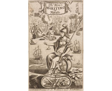
Lot 240
Molloy (Charles). De Jure Maritimo et Navali: or, A Treatise of Affairs Maritime and of Commerce, 7th edition, London: John Walthoe Junr. & J. Wotton, 1722, engraved frontispiece and additional engraved title, contemporary calf, upper joint split and lower joint cracked at foot, some wear to extremities, 8vo, together with: Impey (John), The New Instructor Clericalis, Stating the Authority, Jurisdiction, and Modern Practice of the Court of King's Bench [& Court of Common Pleas], 2 volumes, 2nd edition, London: printed for the author, 1785-86, ownership inscription to title of first volume, some dust-soiling, contemporary sheep, joints split and some wear, 8vo, Morgan (John), Essays upon I. The Law of Evidence, II. New Trials, III. Special Verdicts, IV. Trials at Bar, and V. Repleaders, 3 volumes, London: J. Johnson, 1789, titles with early ownership of John Williams, Attorney, Carmarthen, contemporary calf, lacking title labels to spines, joints cracked, 8vo, Ibid, The Attorney's Vade Mecum, and Client's Instructor..., 2 volumes, London: Strahan & Woodfall for T. Cadell, 1787, ownership inscription of John Williams, Attorney, Carmarthen to titles, contemporary calf, joints cracked, 8vo, Robinson (Richard), The Lot Book of the Commissioners for draining the Fen Lands lying between the Hundred Foot River and the River Ouse; being a book of references to the map of that level, done from a survey taken by Richard Robinson in the year 1758, by Order of the said Commissioners..., Cambridge: printed by J. Archdeacon, 1768, some dust-soiling, original boards, worn, 8vo, and eight other 18th & 19th century law relatedQty: (17)

Lot 423
* Northern Europe. Du Val (Pierre), Les Royaumes du Nort c'est a Dire le Danemarq la Suede et la Pologne..., Paris, circa 1660, engraved map with contemporary outline colouring and some later enhancement to the cartouche, mounted with another later addition (circa 1670) with the title changed to 'Les Royaumes du Nort ou sont principalement les estats de la Couronne de Pologne...,', the second map with some staining each map 405 x 555 mm, framed and glazedQty: (1)NOTESThe map shows southern Scandinavia, northeastern Germany and northern Poland.

![John Speed (1552-1629), Map of Sussex Described and divided into Rapes. [London:] John Sudbury & George Humble, 1610 (but](https://cdn.globalauctionplatform.com/07fddfe0-1f4a-4aed-9d3b-ac6b013ee4fb/17edf5e5-ac5f-4017-a9c2-ac6f00e0437c/468x382.jpg)
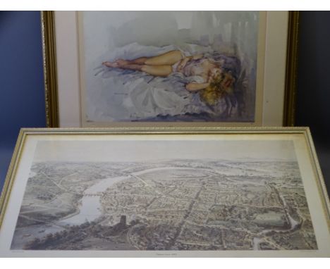
Lot 281
John Speed (1552-1629), Map of Sussex Described and divided into Rapes. [London:] John Sudbury & George Humble, 1610 (but 1611 or later), engraved map, inset bird's-eye-view of Chichester, Royal coats-of-arms supported by a lion and a unicorn, sea-monsters and galleons, English text on verso, 39 x 51cm


![Thomas Theodor Heine (1867-1948) Portret van Olaf Gulbransson, inkttekening, gemon. r.o., 27,5 x 20 cm. [map]](https://cdn.globalauctionplatform.com/641623af-bfa3-4ad5-bd66-ac6400d0bc96/2524ef44-521e-4696-9d9d-ac640105dc8c/468x382.jpg)
-
109182 item(s)/page