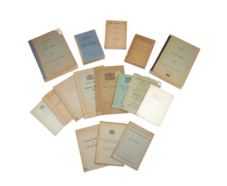
ISRAEL, PALESTINE, AND THE BRITISH MANDATEA collection of 16 scarce pamphlets relating to Israel, Palestine and the British Mandate in the 1920s-40s, comprising:Palestine during the War. Being a Record of the Preservation of the Jewish Settlements in Palestine, 47pp., Zionist Organisation, 1921The Establishment in Palestine of the Jewish National Home. Memorandum on the Development of the Jewish National Home, 1924-1925 Submitted to by the Zionist Organisation to the Secretary-General of the League of Nations for the Information of the Permanent Mandates Commission, October 1925, dual text in English and French, a few small losses to margins of wrappers, [Zionist Organisation, 1925]Reports of the Experts Submitted to the Joint Palestine Survey Commission [on Agricultural Colonization; Labor; Public Health], 741pp., one folding map, 3 letterpress tables, photographic illustrations in the text, rebacked, Boston, Mass., Daniels Printing Co., 1 October 1928Palestine. Blue Book 1931, 401pp., rebacked, Jerusalem, Printing and Stationary Office, 1931Palestine. Blue Book 1932, 441pp., rebacked with loss to one corner of upper cover, Jerusalem, Printing and Stationary Office, 1932Palestine. Department of Migration. Annual Report 1934, 42pp., ex-libris of Yitzhak Gruenbaum in Hebrew, Jerusalem, Printing and Stationary Office, 1935Palestine. Department of Migration. Annual Report 1936, 97pp., errata slip, small loss to spine extremities, Jerusalem, Printing and Stationary Office, 1937LOURIE (ARTHUR) Britain and Palestine. An Examination of Present British Policy in the Light of the Mandate for Palestine, 19pp., stapled as issued with integral titled wrappers, in later boards, [New York, The American Zionist Emergency Council], c.1940Report of the Anglo-American Committee of Enquiry Regarding the Problems of European Jewry and Palestine, Lausanne 20th April 1946, 80pp., H.M.S.O., 1946[ANGLO-AMERICAN COMMITTEE REPORT] Din-Ve-Heshbon: Shel Va'ad-Ha-Hakirah Ha-Angli-Amerikani bi-devar Beayoteshen shel Yahadat Eropah Ve-Shel Palestinah [Report of the Anglo-American Committee of Enquiry Regarding the Problems of European Jewry and Palestine, Lausanne 20th April 1946], text in Hebrew, 67pp., small loss to extremities of spine, Jerusalem, Government Printing House, 1946Historical Memoranda. I. The Number and Density of the Population of Ancient Palestine. II. The Jewish Population in Palestine from the Fall of the Jewish State to the Beginning of Zionist Pioneering. III. The Waves of Jewish Migration into Palestine (640-1882), 104pp., 5 folding lithographed map sheets, rebacked, upper wrapper detached, Jerusalem, [General Council (Vaad Leumi) of the Jewish Community of Palestine], 1947The Political History of Palestine Under British Administration, Jerusalem [Memorandum by His Britannic Majesty's Government Presented in July 1957, to the United Nations Special Committee on Palestine], 42pp., publisher's wrappers laid down on card, Jerusalem, 1947The Jewish Plan for Palestine. Memoranda and Statements Presented by The Jewish Agency for Palestine, 559pp., some toning, stamps of the Rotberg High School, spine worn at extremities with paper shelf label, Jerusalem, The Jewish Agency for Palestine, 1947The Jewish Case Before the Anglo-American Committee of Inquiry on Palestine as Presented by the Jewish Agency for Palestine. Statements & Memoranda, 686pp., stamps of the Bet Shturman Library, spine repaired with old paper shelf label, Jerusalem, The Jewish Agency for Palestine, 1947BEN-GURION (DAVID) The Yishuv and the Zionist Struggle Now [Supplement to the Jewish Agency's Digest of Press and Events, No.166], 23pp., stapled as issued with integral titled wrappers, in later boards, Jerusalem, [Hashiloah Printing Press], April 1947 BEN-GURION (DAVID) A Jewish State Now [Supplement to the Jewish Agency's Digest of Press and Events, No.192-193], 16pp., stapled as issued with integral titled wrappers, in later boards, Jerusalem, [Hashiloah Printing Press], October 1947together 16 works, institutional stamps to some titles, pages and covers, publisher's wrappers, 8vo and small 4to (16)Footnotes:Provenance: Giavat Havivah Libary, stamps on some titles and covers of all but 2 of the titles.This lot is subject to the following lot symbols: •• Zero rated for VAT, no VAT will be added to the Hammer Price or the Buyer's Premium.For further information on this lot please visit Bonhams.com


![LONDON - EVELYN, THE GREAT FIRE AND POLLUTIONComposite volume, containing the following plans and works:[KITCHIN (THOMAS)] A](https://cdn.globalauctionplatform.com/0bd63aaa-74ab-480d-abc7-b12c00be1b45/2c6db093-f12c-4fa4-aa50-b12c00c12d0e/468x382.jpg)
![TOLKIEN (J.R.R.)[The Lord of the Rings] The Fellowship of the Ring; The Two Towers; The Return of the King, together 3 vol.,](https://cdn.globalauctionplatform.com/0bd63aaa-74ab-480d-abc7-b12c00be1b45/9744cb83-46b8-46fe-9764-b12c00c0f2c9/468x382.jpg)
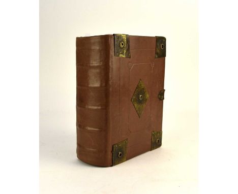
![BIBLE, IN ENGLISH, BISHOPS' VERSION[The Holy Byble], black letter, Psalter, Apocrypha and New Testament with separate titles](https://cdn.globalauctionplatform.com/0bd63aaa-74ab-480d-abc7-b12c00be1b45/59a18423-634d-4276-bb45-b12c00c32ea7/468x382.jpg)


![SPEED, John, Map of Shropshire, 380mm x 510mm, Bassett & Chiswell [1676]. Hand coloured, framed and glazed.With OGILBY, John,](https://cdn.globalauctionplatform.com/071e8afc-7ece-43d4-a29e-b0bb0114ffd9/8c9ef7b0-7335-4d51-879f-b13400c54597/468x382.jpg)