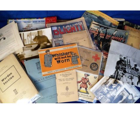
We found 108737 price guide item(s) matching your search

Refine your search

Year

Filter by Price Range
  • List
  • Grid
  • 108737 item(s)
    /page

Lot 240

Japan.- Fugestu (Shozaemon) Kyoto ku kumiwake saizu [Map of Kyoto Prefecture], colour printed woodcut, on thin japan, sheet 475 x 720 mm (18 3/4 x 28 1/4 in), folding with original yellow endpapers with publisher's label to upper cover, slightly rubbed and scuffed, 8vo, [circa 1880]; together with a group of six folding maps of Asia and the East Indies, including Andriveau-Goujon's Carte de L'Asie Orientale comprenant L'Empire Chinois, Le Japon, Girard et Barrere's Carte de Chine, Japon Manchukuo, two part 19th century folding German maps of Kiautschou Bay, and a folding lithographed map of Vietnam, Voyage de S.E. Le Jonkheer de Graeff, and Thacker's Reduced Survey Map of India by J.G. Bartholomew, various sizes, 8vo, 19th century (7)

Lot 226

Asia.- Speed (John) A Newe Mape of Tartary, detailed map showing from Lake Baikal through the regions of present-day Manchuria and Siberia to the north of the Great Wall of China, with Korea as an Island, featuring 8 side panels with the people of Tartary in their native costume, and four vignette views above of Nova Zembla, and the silk route cities of Astrakan, Samarkand and Cambalu, engraving with hand-colouring, on laid paper with watermark of fleur-de-lis, platemark 400 x 515 mm (15 3/4 x 20 1/4 in), sheet 430 x 565 mm. (17 x 22 1/4 in), central vertical fold as issued, with toning to sheet and exposure lines from previous mount, spotting and surface dirt, unframed, Bassett and Chiswell, [1676]; together with A New Map of Turkey in Asia by Monsr. D'Anville, engraving with hand-colouring, sheet 570 x 815 mm (22 1/2 x 32 in), unframed, 1794; and with Bellin's Carte de L'Entrée de la Riviere de Canton, engraving with hand-colouring, 280 x 220 mm (11 x 8 3/4 in), unframed, [1764] (3)

Lot 222

Africa.- Hondius (Henricus) Africae nova Tabula Auct. Hen. Hondio., detailed and decorative map of the continent from 'Atlas Novus', featuring sailing ships, flying fish, various sea monsters, and Neptune with a mermaid, inland is decorated with elephants, lions, zebras, ostriches, and a dragon, engraving with hand-colouring, platemark 380 x 500 mm (15 x 19 3/4 in), sheet 495 x 580 mm (19 1/2 x 22 3/4 in), central vertical fold with repairs verso to splitting at head and foot, scattered spotting and browning, unframed, 1631; together with 3 others, including Blaeu's Guinea, Sanson's L'Afrique, ou Lybie Ulterieure: ou Sont Le Saara, ou Desert, Le Pays de Negres, La Guinee, and Pieter van den Keere's Africa, engravings, various sizes, unframed, 17th century (4)

Lot 231

East Indies.- Sanson (Nicolas) Partie Meridionale de l'Inde en Deux Presqu'Isles, l'une deca et l'autre dela le Gange..., map of southern Asia extending from India in the west to Sumatra and Borneo in the east, with part of China in the north east, decorative title within a clam shell in the lower centre, engraving with outline hand-colouring on laid paper with watermark of a large ornate coat of arms, platemark 385 x 530 mm. (15 1/4 x 20 7/8 in), sheet 435 x 580 mm. (17 1/8 x 22 3/4 in), central vertical fold as issued, minor nicks to extremities, some toning and browning, minor damp-stains and some surface dirt, unframed, Pierre Mariette, 1654.

Lot 228

Atlases.- Martin (Robert Montgomery, editor) The Illustrated Atlas..., and Modern History of the World, Geographical, Political, Commercial, and Statistical, engraved pictorial title, 2 engraved comparative plates of rivers and mountains in the eastern and western hemispheres and 80 engraved maps with vignette illustrations and hand-coloured in outline, some light marginal soiling, title with short tear to lower edge just extending into imprint, some maps with stab-holes to outer edge, loose in binding, contemporary half straight-grain morocco, worn, folio, J. & F.Tallis, [c.1856].⁂ Map of Mexico, California and Texas including vignette of gold-panning and with gold regions highlighted in yellow.

Lot 219

NO RESERVE Africa.- Cape Verde.- Jansson (Jan) Insulae de Cabo Verde Olim Hesperides, sive Gorgades, engraving on laid paper, platemark 440 x 555 mm. (17 1/4 x 21 3/4 in), sheet 510 x 600 mm. (20 x 23 5/8 in), Latin text verso, central vertical fold with some splitting to margins, minor surface dirt, unframed, [circa 1657 and later] § Coronelli (Vincenzo Maria) Bocche del Fiume Negro et Isole di Capo Verde, showing Cape Verde Islands and of part of the coast of Senegal to the right, engraved map, on laid paper with swallowtail flag watermark, platemark 460 x 615 mm. (18 1/8 x 24 1/4 in), lower edge re-margined, some nicks and tears, minor handling creases, unframed, Venice, Padovani, [circa 1696] (2).

Lot 254

Scotland.- Beattie (William) Scotland Illustrated, 2 vol., additional engraved titles and 118 plates, tissue-guards, folding map, short marginal tear, occasional spotting, occasional faint marginal staining, original morocco, gilt, a little rubbed, slight bumping to corners and extremities, 4to, 1838.

Lot 18

NO RESERVE Archaeology.- Artis (Edmund Tyrell) The Durobrivae of Antoninus...Roman Station in the vicinity of Castor, Northamptonshire, first edition, folding hand-coloured engraved map and 59 engraved or lithographed plates and plans, some with aquatint, 4 folding or double-page, 10 hand-coloured, light spotting or water-staining to a couple of plates, bookplates of George E.Foe and Will.Stephenson, contemporary half roan, rubbed and stained, spine worn and torn, upper cover detached, folio, for the Author, 1828.⁂ Handsome work on the various Roman sites around Castor, Northants., including views, plans and plates of the mosaics, building materials, furnaces, pottery, jewellery, and household utensils.

Lot 232

East Indies.- Santini (Paolo) Les Indes Orientales..., map showing India, Thailand, Cambodia, Vietnam, Malaysia, the island of Sri Lanka, the Maldives, and a portion of Sumatra, and includes Singapore, engraving with hand-colouring, sheet 530 x 625 mm (20 7/8 x 23 1/2 in), central vertical fold with minor splitting to foot, some surface dirt to edges, light handling creases, unframed, Venice, Remondini, 1779; together with four other maps of the region, including Bowen's A New and Accurate Map of the Empire of the Great Mogul, d'Apres de Mannevillette's Carte de la partie comprise entre la sortie du détroit de Malac and A chart of the eastern coast of the Gulf of Bengal, and with Jansson's map of the Spice Islands, Insularum Moluccarum Nova Descriptio, enrgavings, some hand-colouring, various sizes, all unframed, 17th and 18th century (5)

Lot 224

NO RESERVE Africa - Madagascar.- Sanson (Nicolas, publisher) Isle d'Auphine, Communement Nommee par les Europeens Madagascar, et St. Laurens, et par les Habitans du Pays Madecase..., large-scale map of Madagascar and the surrounding islands in the Indian Ocean off the southeast coast of Africa, engraving on laid paper with watermark of decorative coat of arms, sheet 620 x 455 mm (24 1/4 x 18 in), central horizontal fold, some nicks and tears, occasional handling creases, minor surface dirt, unframed, Paris, 1697; together with Emanuel Bowen's Particular Draughts of Some of the Chief African Islands in the Mediterranean, showing St Helena, Malta, Tenerife, Cape Verde, and Madeira, engraving, sheet 405 x 490 mm (15 7/8 x 19 1/4 in), old folds and surface dirt, some browning, unframed, [c. 1760] (2).

Lot 260

Birds.- Crawshay (Richard) The Birds of Tierra del Fuego, first edition, limited edition of 300, this copy 'out of series', 21 hand-coloured lithographed plates, 23 photogravure plates, colour map at end, bookplate, hinges strengthened, contemporary morocco-backed boards, slight bumping to corners and extremities, 4to, 1907.

Lot 252

NO RESERVE London.- [Grant (James)] The Great Metropolis, 2 vol. in 1, half-titles, original green cloth, uncut, spine faded, New York, 1837 § Baines (Thomas) Liverpool in 1859, folding map, 8pp. advertisements printed on pink paper at end (faded at edges), also 4pp. on the Royal Insurance Company printed in red and green, original blind-stamped cloth, London, Liverpool & Manchester, 1859, both a little rubbed, the second faded at edges and worn at head of spine, 8vo (2)⁂ The first is an interesting work on London, published using the sheets of the London edition with a New York imprint. There is information on theatres, clubs, gaming houses, and newspapers.

Lot 223

Africa.- Keulen (Gerard van) De Stad Haven En Mouillie Van Algiers Neven Desselfs Kasteelen, double-page bird's-eye view of the port and city of Algiers, with detailed key in the lower right corner, engraving with hand-colouring, on laid paper with watermark initials 'CWP', sheet 540 x 610 mm (21 1/4 x 24 in), central and lower vertical folds, left edge expertly restored, some minor nicks and handling creases, unframed, Amsterdam, [circa 1720]; together with W. Segher's poster map showing from Italy to Abyssinia, numerous folds and splits, unframed, 1935 (2)

Lot 221

Africa.- Hondius (Jodocus) Nova Africae Tabula Auctore Jodoco Hondio, detailed and decorative map of the continent featuring sailing ships, various sea monsters, and strapwork cartouche in the lower left corner, engraving with hand-colouring on laid paper without watermark, platemark 380 x 500 mm (15 x 19 3/4 in), sheet 440 x 550 mm (17 1/4 x 21 3/4 in), Latin text verso, margins inset onto old paper support, central vertical fold with repaired splitting and support verso, minor browning, mainly to margins, unframed, [Amsterdam, circa 1606].Literature:Tooley p. 54

Lot 235

India & Ceylon.- Homann Heirs. Peninsula Indiae citra Gangem, hoc est Orae Celeberrimae Malabar & Coromandel. Cum Adjacente Insula non Minus Celebratissima Ceylon, map of the southern part of India and Sri Lanka, with colonial possessions and trading posts delineated with flags along the coastline, decorative title cartouche with elephant in the lower left corner, engraving with hand-colouring on laid paper with cross-based watermark, platemark 570 x 505 mm. (22 1/2 x 19 7/8 in), sheet 590 x 520 mm. (23 1/4 x 20 1/2 in), central horizontal fold as issued, some toning, mainly to margins, some handling creases and surface dirt, unframed, 1733.

Lot 244

Pakistan, Afghanistan & Northern India.- Jansson (Jan) Magni Mogolis Imperium, map of the Empire of the Great Mogul in northern India including the region from Iran to Burma, decorated with title in the upper left corner, and with numerous elephants, big cats, and a camel, engraving with some outline hand-colouring on laid paper, platemark 370 x 495 mm. (14 1/2 x 19 1/2 in), sheet 505 x 600 mm (20 x 23 1/2 in), good margins, central vertical fold as issued, some splitting to head and foot of fold, a few pin holes repaired verso, minor spotting and browning, unframed, [circa 1650 and later].

Lot 158

NO RESERVE Carey (Peter) My Life as a Fake, first edition, signed presentation inscription from the author to Tariq Ali, jacket upper panel with short tear to head and some patch of foxing to foot, light discolouration to spine, Sydney, 2003; True History of the Kelly Gang, first English edition, signed by the author, "Ned Kelly's Australia" map loosely inserted, jacket with light sunning to spine, 2001; Jack Maggs, first English edition, signed presentation inscription from the author, jacket with light creasing to spine ends, 1997, original boards, dust-jackets, excellent or near-fine; and 6 others by the same, 8vo (9)

Lot 246

World.- Apian (Peter) Charta Cosmographica, Cum Ventorum Propria Natura et Operatione, cordiform world map based on the larger map of the world by Gemma Frisius, from the 3rd block as described by Shirley with flourish to the 'A' of America, from 'Cosmographia Petri Apiani...', woodcut on laid paper with indistinct watermark, sheet 235 x 320 mm (9 1/4 x 12 1/2 in), old folds as issued, some repairs to splitting, minor spotting and surface dirt, unframed, [Cologne, 1574]Literature: Shirley 131

Lot 17

NO RESERVE Britain.- [Gough (Richard)] British Topography..., 2 vol., first edition, engraved title vignettes, 7 folding engraved maps and large map (plate 8) in 3 parts, bookplate of George Gallwey Mills, contemporary russia, rubbed, spines worn, joints split, covers of vol.1 detached, 4to, T.Payne & Son, and J.Nichols, 1780.

Lot 225

Ancient World.- d'Anville (Jean Baptiste Bourguignon) Orbis Veteribus Notus, map of Asia and Europe centred on Saudi Arabia, engraving with some outline hand-colouring, sheet 550 x 810 mm (21 3/4 x 31 3/4 in), central vertical fold with splitting, surface dirt and ink stains, minor browning, handling creases and faint damp-stains, unframed, [Paris], 1783; together with 10 further maps by D'Anville, including the two-sheet map Prémière Partie de la Carte d'Europe, Asiae, quae vulgó Minor dicitur, et Syriae, Tabula Italiae Antiquae Geographica, Gallia Antiqua ex Aevi Romani Monumentis, Orbis Romani Pars Occidentalis, Aegyptus Antiqua, and others, engravings, various sizes, spotting, surface dirt, browning and minor damp-stains throughout, all unframed, [circa 1780s] (11)

Lot 383

COLLECTION OF 16 FRAMED PICTURES INCLUDING A HAND COLOURED MAP OF DURHAM BY ROBERT MORDEN

Lot 459

[SHIPPING INTEREST]. A HOLLAND-AFRICA LINE ROUTE NETWORK WALL MAP, 1954 by George Philip & Son, Ltd, with baton supports, overall 100.5cm x 80cm.

Lot 548

[CHILDRENS] Milne, A.A. Winnie-the-Pooh, first edition, Methuen, London, 1926, dark green cloth gilt, top edges gilt, map endpapers, illustrations by Ernest Shepard, octavo (newspaper cutting taped to front blank).

Lot 4252

Perckhammer, Heinz: Peking Peking. With an introduction by Arthur Holitscher. XIV, 200 p. with 200 illustrations and 1 map. 30 x 22,5 cm. Original grey linen with blue pressed title on cover and spine (faded). Berlin, Albertus-Verlag, 1928. First edition. Perckhammer's photographic study of Peking, China from 1928. – In very good condition. – With: Chine. With text by Paul Claudel. 3 l., 80 p., 3 l. with 26 plates with illustrations after photographs by Hélène Hoppenot printed in fine rotogravure. 35,5 x 26,5 cm. Original wrappers (slightly dusty, edges soiled/rubbed, some staining). Paris, D'Art Albert Skira, 1946. - Binding slightly loose, slight traces of use. Perckhammer, Heinz: Peking Peking. With an introduction by Arthur Holitscher. XIV, 200 p. with 200 illustrations and 1 map. 30 x 22,5 cm. Original grey linen with blue pressed title on cover and spine (faded). Berlin, Albertus-Verlag, 1928. First edition. Perckhammer's photographic study of Peking, China from 1928. – In very good condition. – With: Chine. With text by Paul Claudel. 3 l., 80 p., 3 l. with 26 plates with illustrations after photographs by Hélène Hoppenot printed in fine rotogravure. 35,5 x 26,5 cm. Original wrappers (slightly dusty, edges soiled/rubbed, some staining). Paris, D'Art Albert Skira, 1946. - Binding slightly loose, slight traces of use.

Lot 699

[DAVOUT LOUIS NICOLAS]: (1770-1823) Marshal of France, Duc d´Auerstaedt and Prince of Eckmuhl. Known as the Iron Marshal, Davout was the only Napoleonic Marshal not to have been defeated in battle by 1815. Attractive 16 x 21 contemporary printed public notice, one page, Paris, 10th April 1815, in French. The Affiche announcement bears an attractive vignette to the heading with a crowned eagle and is issued during the Hundred Days, and only few weeks after Napoleon´s return from his exile on the island of Elba. The printed heading states “Proclamation - the Minister of War - To all non-commissioned Officers and Soldiers on leave or retreated in French territories”. The proclamation harangues the crowds claiming `You have wanted your Emperor, he has arrived. Come and be ready to defend your Homeland against the enemies who will want to decide the colours we should wear, to impose the Souvereigns and dictate constitutions.”, further saying “Soldiers,.. if your wounds have healed, if you can serve, come, the Honour, the Emperor and the Homeland are calling you. What complaints would you not have to make to yourself if ….foreigners would withdraw France out of the map of Europe!” Bearing multiple and clean contemporary annotations to the verso. Folded, with trimmed edges. G Napoleon Bonaparte returned from the island of Elba on 20th March 1815, starting the historical period known as The Hundred Days war, or the War of the Seventh Coalition which lasted until 8th July 1815, ending with the second restoration of King Louis XVIII.

Lot 295

Charles Montagu Doughty. Arabia Deserta, 1888, published by Cambridge University Press, 2 volumes, folded map to the back of one of the volumes

Lot 300

ACKERMANN, FRANZ ACKERMANN, FRANZ 1963 Neumarkt-St. Veit Titel: Mental Map. Untertitel: Konvolut von zwei Werken: a) The election, b) Soft landing. Datierung: Jeweils: 2001. Technik: Mischtechnik auf Papier. Maße: 13 x 19cm. Bezeichnung: Beide betitelt signiert und datiert verso: The election bzw. Soft landing Franz Ackermann 01. Rahmen/Sockel: Jeweils Rahmen. Provenienz: - Giò Marconi, Mailand (Aufkleber) - Privatsammlung Italien Den Werken liegt jeweils ein vom Künstler unterzeichnetes Zertifikat der Galerie Giò Marconi, Mailand, bei. Erläuterungen zum Katalog Franz Ackermann Deutschland Zeitgenössische Kunst Unikate 2000er Stadtlandschaft Papierarbeit Mischtechnik ACKERMANN, FRANZ ACKERMANN, FRANZ 1963 Neumarkt-St. Veit Title: Mental Map. Subtitle: Mixed lot of two works: a) The election, b) Soft landing. Date: Each: 2001. Technique: Mixed media on paper. Measurement: 13 x 19cm. Notation: Both titled, signed and dated verso: The election or Soft landing Franz Ackermann 01. Frame/Pedestal: Each framed. Provenance: - Giò Marconi, Mailand (label) - Private collection Italy Enclosed is a signed cetritifcate of Galerie Giò Marconi, Milan of each artist. Explanations to the Catalogue Franz Ackermann Germany Contemporary Art 2000s Cityscape Works on paper Mixed media

Lot 1007

Postcards, a comprehensive collection of approx. 80 comic pull-outs and map cards all of Aberystwyth. Artists inc. Cynicus, Reg Carter, Stocker-Shaw, G F Christie, Ellam, G E Shepheard etc. Map cards by Walker (3), Bacon (1), various themes (mixed condition, fair/gd)

Lot 580

Ephemera, 170+ items dating from the late 19th/mid 20thC to include Chislehurst Golf Club Route Map of South London, Ringwould Riding School brochure, cookery leaflets (Colman, Veltex, Brown & Polson), Meccano instructions, letters, menus, calendars, Mazawattee calendar, die cut advertising insert, invitations etc. also includes 50+ property auction catalogues and flyers for the Lincolnshire region (gen gd) (170+)

Lot 106

Cigarette cards, two albums containing an interesting selection of odds & part sets, many scarce cards noted but in various condition, inc. Morris Golf Strokes (20), Australian Cricketers (15), Sarony Tennis Strokes (17), Anstie's Scout Series (46), Racing Series (50), Baker Beauties of All Nations (10, some trimmed), several BAT issues, Edwards, Ringer & Bigg Dogs (35 inc. some duplicates), Our Pets (36), War Map of the Western Front (38), various Faulkner's cards inc. Angling, South African Series, 'Ation' Series etc, also Cohen, Weenen, Hignett's, Hill's, Franklyn, Davey, Lea & others (condition very mixed, poor/gd) (1200+ cards)

Lot 1081

Postcards, Comic, a collection of approx. 520 mainly post WW2 comic cards with many Bamforths (1970/80's). Artists inc. Trow, Quip, Fitzpatrick, Taylor, Chas (much duplication). Also approx. 100 mostly 1950's comic again with many Bamforths but also McGill, Lawson Wood, Phylis Purser, Harry Parlett etc. Sold with approx. 280 modern map cards (mixed condition, fair/gd)

Lot 834

Military Ephemera, a large quantity of military items to include cotton escape maps 66-B, 66-C, 66-F and 66-G all Anglo-Egyptian Sudan, silk escape map Sheet A (France Belgium Holland), WW1 and WW2 magazines, Civil Defence training booklets, maps, certificates, photographs, manuals, jigsaw puzzles, playing cards, company orders, 2 Essex Regt badges and pips etc. (mixed condition fair/gd) (qty)

Lot 1782

Cartography - Paterson (Daniel, Esq., Assistant Quarter-Master General of His Majesty's Forces): Paterson's British Itinerary/Being A new and accurate Delineation and Descriptions of the Direct, and Principal Cross Roads of Great Britain, second edition, two-volume set, London: Printed for the Proprietors, Bowles & Carver, 1796, pp: two-page map, [3], xxxv, [1], maps 1-340, 341-403, [3] (blanks); [4] (blanks), [2], maps 404-449, 450-634, [3] blanks, contemporary mottled calf, gilt-lettered red and green morocco pieces, 8vo, (2); A New and Accurate Description of all the Direct and Principal Cross Roads in Great Britain [...], three copies: third edition, 1776, eighth edition, 1789, and tenth edition, 1794, various contemporary bindings, each with contemporaneous and/or later ownership inscriptions, 8vo, (3), [5]

Lot 937

Étienne Dupérac (c. 1525-1604), by, six sheets of his bird's-eye view map of Ancient Rome, Urbis Romae sciographia ex antiquis monumentis accuratiss delineata, Rome: [Giovanni Giacomo de Rossi, n.d. 1649-1660], engravings, 63cm x 50.5cm, [6]

Lot 1781

Cartography - Gray (George Carrington), Gray's New Book of Roads, The Tourist and Traveller's Guide to the Roads of England and Wales, and Part of Scotland, on an Entirely New Plain [...], London: Printed for Sherwood, Jones, and Co., 1824, pp: [2] (blank), [iv], fold-out hand-coloured engraved map frontispiece, v, [3], 86, [7], 49 maps (some fold-out), [28] (index) [4] (blanks), 20th century brown morocco gilt over marbled boards by Graham Bloodworth, Leicester, his ticket, marbled endpapers en suite, square 8vo, [1] Provenance: 1) Edmund Fitz Moore of Lincoln's Inn and Albany, his c. 1840 Seal Armorial bookplates; 2) then William Garnett of Bleasdale and Quernmore Park, Lancashire, his slightly later 19th century Plain Armorial bookplates.

Lot 1795

Local Interest, Staffordshire - J. Dower, after Phillips (J.) and W.F. Hutchings, A Map of the County of Stafford, Divided into Hundreds & Parishes, From an accurate Survey, Made in the Years 1831 and 1832, London: Published by Henry Teesdale & Co., August 1st, 1832, named-view architectural vignette of Lichfield Cathedral to the lower-right, hand-coloured engraving over forty-folds, laid on linen, the margins green silk-mounted, 137cm x 100.5cm, contemporary calf book-shaped library case (chipped and worn), marbled edges, push-cover, 27.5cm high, [1]

Lot 1780

Cartography - [Toms (William Henry) & Badeslade (Thomas), Chorographia Brittaniæ., Or, A Set of All the Maps of the Counties in England and Wales [...]], first edition, [London: W.H. Toms, 1742], copperplate printed, lacking title-page, pp: engraved dedication double-page, 46 b/w double-page maps and 5 double-page tables, 20th century crimson morocco gilt over marbled boards by Graham Bloodworth, Leicester, his ticket, marbled endpapers en suite, spine incorrectly dated 1741, 8vo, [1]Provenance: James Wyld, Junior (1812-1887), the British geographer and map-seller, best known for Wyld's Great Globe. His Plain Armorial bookplate to recto pastedown.

Lot 145

Map-Scotland-Dornoch-War Office Edition-ordnance survey map-folded-published 1949 sheet 21-good condition

Lot 136

Scotland 'Thirso Reay' War Office Edition, ordnance survey map sheet 11, published in 1950 folded

Lot 132

Pickering Yorkshire-Ordnance Survey War Office Edition Map/National Grid, sheet 92, War Office Published 1948 - 2nd Edition 1902 folded, very good.

Lot 143

Map-Scotland-Ullapool & Loch Ewe-War office Edition-sheet 19-Ordnance survey map-published 1949 folded-mint condition

Lot 134

Scotland War Office Edition, Orkney Island (Mainland) - sheet 6. Ordnance survey map - published 1950, Mint condition

Lot 142

Scotland 'Helmsdale' War Office Edition, sheet 17 -Ordnance survey map, published 1949. Folded excellent condition

Lot 141

Scotland 'Laig Loch Shin' War Office Edition-Ordnance survey map - sheet 16- published 1950-mint condition

Lot 137

Scotland 'Wick' sheet 12, War Office Edition - ordnance survey map, published 1950. Folded in mint condition

Lot 140

Scotland 'Lochinver & Loch Assynt' War Office edition, sheet 15 - ordnance survey map- published 1950. Folded, mint condition

Lot 294

British WWII North Africa 'El Daba' Cloth backed map, t88his map covers the whole area east and west of El Alamein, and southwards to the Qatara Depression. It is perfect for studies of the Battle of El Alamein and other operations in the area. It was published in 1942 and includes going information which was vital to motorised and armoured units. In very worn condition with some loss to the paper.

Lot 11

Scotland War Office Edition Map - Ordnance Survey - sheet 5 - (Orkney Islands (North) Published 1948 - folded, very good condition

Lot 146

Map-Scotland-Sollas-War Office Edition-Ordnance survey map-sheet 22- published 1949-folded-good condition

Lot 138

Scotland 'Loch Roag & Tarbert' War Office Edition, sheet 13, ordnance survey map, published 1950, folded - slight tear on the bottom

Lot 135

Scotland 'Cape Wrath' War Office Edition Ordnance Survey map, sheet 9 - Published 1950, folded, mint condition

Lot 144

Map-Scotland-Strath Oykell-War Office Edition-Ordnance survey map- sheet 20-published 1949 - folded- excellent condition

Lot 139

Scotland 'Stornoway' War Office Edition, ordnance survey map, sheet 14 - published 1950. Folded

Lot 350

A hand coloured engraved map of Lancaster and Lancashire by Joannem Janssonium, with crests in top right for Edmund Crouckbak E. and John of Gant D., glazed to reverse, published Amsterdam 1646, 38 x 51cm.

Lot 227

Galbatorix's (John Malkovich) hero sword from Stefen Fangmeier's fantasy film Eragon. King Galbatorix used his sword to slash a hanging map of Alagaësia, which fell to reveal his black dragon, Shruikan.The sword comprises a blunted aluminum blade; an ornate faux-gold metal guard formed into the shape of a two-headed dragon; a dark wooden grip with incorporated gold-coloured banding; and a circular pommel decorated with a dragon emblem. The black textured leather scabbard features matching faux-gold detailing and decorative black leather thongs wrapped around the upper section. The weapon exhibits signs of production use, including minor scratches on the blade and light paint wear to the metal components, and the scabbard displays some signs of scuffing. Dimensions: 122 cm x 18 cm x 4 cm (48" x 7" x 1 1/2")Estimate: £4,000 - 6,000 †

Lot 393

A script, collection of storyboards and assorted ephemera from the production of John Glen's Bond movie For Your Eyes Only. Bound in a yellow card cover, the revised script is labelled "9", dated "12 August 1980", and consists of 129 annotated pages printed single-sided on US Letter paper. A majority of the printed storyboards are bound within two folders and show several scenes from the film, including the sequence in which Bond (Roger Moore) and Melina (Carole Bouquet) explored the shipwrecked St Georges and discovered the ATAC. The lot also contains assorted ephemera, including call sheets, shooting schedules, travel documents, a map of Italy, and a brochure for the Royal World Charity Premiere event, which took place at the Odeon, Leicester Square on 24 June 1981. The lot shows signs of production use, including creasing, folded corners, dirt marks, light discolouration from age, and minor water damage on the script cover. Dimensions (script): 28.5 cm x 22 cm x 2 cm (11 1/4" x 8 3/4" x 3/4"); (largest storyboard folder): 31 cm x 24.5 cm x 2 cm (12 1/4" x 9 1/2" x 3/4"); (brochure): 29.5 cm x 21 cm x 0.5 cm (11 1/2" x 8 1/4" x 1/4")Sold without copyright; see copyright notice in the Buyer's Guide.Estimate: £600 - 800 M

Lot 434

A park visitor brochure from Steven Spielberg's Academy Award®-winning sci-fi action-adventure Jurassic Park. The park's brochures appeared in the film at various locations, including the Visitor Centre and within the Ford Explorer tour vehicles.This double-sided paper brochure features a printed map of Jurassic Park on one side, pinpointing different sites on the island including the Visitor Centre, helipad, dinosaur enclosures and electric fences. The reverse shows a printed drawing of the park gates, with general information including a section in Japanese, a Kodak Film advertisement, and a mountain terrain photograph that forms the front cover of the brochure when folded. The brochure exhibits minor wear, most notably a sunbleached cover. Dimensions (folded): 21 cm x 9.5 cm (8 1/4" x 4")Estimate: £2,000 - 3,000 M

Lot 517

A Hamunaptra map from Stephen Sommers' fantasy adventure The Mummy. Evelyn (Rachel Weisz) and Jonathan (John Hannah) found the map to Hamunaptra, the lost "City of the Dead", inside the Book of the Dead key. The map was burned when their river boat was attacked by the Medjai. The map is printed on thin paper stained to mimic the look of ancient papyrus. It shows some wear from production use and age, including fading to some parts and minor creasing. Dimensions: 30 cm x 42 cm (11 3/4" x 16 1/2")Estimate: £600 - 800 M

Loading...Loading...
  • 108737 item(s)
    /page

Recently Viewed Lots