We found 109198 price guide item(s) matching your search
There are 109198 lots that match your search criteria. Subscribe now to get instant access to the full price guide service.
Click here to subscribe- List
- Grid
-
109198 item(s)/page


Lot 376
1057821 Gnr C Stannard - Royal Artillery military medal, 1914-15 Star, 14-18 War Medal and Victory Medal, Long service and Good Conduct medal (George V In Field Marshalls Uniform), 39-45 War Medal & Defence medal in postage box addressed to C Stannard, together with a cloth map of Europe and a brooch made from two spent bullets


Lot 771
A 19th century oil painting on canvas of a river scene with figure and cottage, signed bottom right Francis, 51 x 77 cm approx, unframed together with a further unframed oil painting on canvas of a mountainous lake scene, a mid-20th century coloured print of a floral still life after Barbara Shaw, dated 1951, in swept gilt frame, a 1921 Ordnance Survey map of the Synwell area of Wotton under Edge and another of the Bournstream area, both unframed


Lot 148
STEVENSON, Robert Louis: 1. Kidnapped. Cassell, 1886, 1st edn. with a folding frontis map; p311 (half title present),and (xvii) publisher’s catalogue, dated: 4.86 (April 1886). Original red cloth; worn and faded; map torn at fold and repaired;2. Catriona - A Sequel To Kidnapped. Cassell, 1893, 1st edn. P xii (including half title, 371,and (xviii) publisher’s catalogue, dated: 8.93 (August 1893). Original N. blue cloth; little worn and faded; o/w vg;3. The Master Of Ballantrae. Cassell, 1889, 1st edn. p332 (half title present), and (xx) publisher’s catalogue, dated: 7.89 (July 1889). Original pictorial red cloth; little worn and smudged;4. Treasure Island. Cassell, 1886, illustrated edition, 8th. thousand; p292 (half title present), and (xx) publisher’s catalogue, dated: 9.86 (Sept 1886). Original red pictorial cloth; little worn and smudged. (4)

Lot 17
1. STANFORD, Edward (Publisher); Toronto Lithographing Co. (Engraved & printed by): Canada: Nine linen backed folding coloured Maps: British Columbia; Manitoba; Mackenzie; Ontario; Newfoundland; Quebec; Ungava; Yukon; and The United States. Each in 6 sections, except for the US which is in 10 sections and 5 smaller ones. Dates: 1902-1906 (where available). All the maps are very good; and housed in the original full leather box, (which is worn and torn); 2. Bartholomew, John: The Royal Atlas of England and Wales. G. Newnes, nd, c1890. Folio; frontis general map and 69 double-page colour maps and plans; and ppxii, 72. Cont. half leather; rubbed; o/w G+; 3. Butler, S: An Atlas of Antient Geography. Longman, green, 1864, new edn. With 24 double-page colour maps and index. Cont. half leather (price: 12/-); covers rubbed; couple of the maps loose; o/w G+ (3)


Lot 20
1. Wilson, J M: Imperial Gazetteer of England and Wales, in 6 Divisions. Edinburgh, Fullarton, no date, ca 1860, two volumes in 6 divisions, with 3 plates, and 20 plans on 19 pages. Original gilt pictorial cloth; worn; ex-libra, with only a couple of stamps; o/w G+;2. Bartholomew, J G: Cassell's Atlas of the world. Cassell, 1909, with colour double-page maps; later binding; VG;3. Cary's New Itinerary of Great Roads of England, Wales & Scotland. Cary, 1810?, 4th. edn. with folding general map(defective), + 4 folding cold. Maps; PP936, 12(adds). Half leather- worn torn with loss; front cover detached; A/F; and three unframed maps (11)


Lot 247
21 Leather bound volumes, including: The comic History of England, Besant: Westminster, 1902; London, 1900; Ainsworth: Windsor Castle, c1859; Macaulay: Critical & Historical Essays, 3 vols.; Coleridge: Poetical works; 2 vols. 1890; Hallam: Europe during Middle Ages; 3 vols. 1878; Plus 8 others & Baedeker’s London (lacking map). (22)
Lot 25
MARTIN, R. Montgomery (editor): Tallis's Illustrated Atlas, and Modern History of the World, Geographical, Political, Commercial and Statistical. John Tallis and Company, no date, c1851 (inscribed 1854). Engraved title page with vignette, and decorative border, an extra double-page plan of Liverpool, 2 plates of comparative views, Plus 79 maps of the 80 listed (lacking one map: Gibraltar, Malta.., doesn’t look like it was ever bound in), all hand-coloured in outline and with vignettes. Folio, (38 x 28 cm). Cont. half leather; covers worn and detached, manuscript numbering to verso of maps and top corners; o/w the maps are very clean

Lot 258
SALE CATALOGUE: 1. Nineteen Days’ Sale at Stowe, Near Buckingham. The Freehold of the Historic Mansion & Estate [followed by]: The Contents of the Mansion including the Supremely Valuable Collection of Heirloom Pictures, Tapestries and Historic Furniture, starting July 4th 1921. Jackson, Stops, Northampton, 1921, 1st edn. Folio, original paper covered boards, 232 pages plus 4 coloured plans (3 folding), a location map and 58 plates (possibly of 60?); the only other copy we located has 56 plates? Covers rubbed, spine cut and hinges cracked; few pencil prices in margins;2. Sparrow, W Shaw: In The Open Country - The Work of Lucy E Kemp-Welch. 1905, 1st folio, 21 tipped-in colour plates; covers worn; plus 2 others, two illustrated by Lionel Edwards. (4)

Lot 263
WW1 WAR POSTER: US Troops: Food Economy; St. Clements press, nd. (37 x 25.5cm); Map of Bokhara, Cabool, Beloochistan, SDCK, 1838, (414.5 x 34.5cm), coloured in outline; Hoover, J Edgar: TLS on US Department of Justice headed paper, July 8m 1971; addressed to S. Masty; signed in full; Burns, George: 2 TLS; May & Sept, 1971; Plus a quantity of Engravings, etc. (qty.)

Lot 27
ILLUSTRATED CHILDREN:A Collection Including: Kate Greenaway: Dame Wiggins of Lee and Her Seven Wonderful Cats, 1855, 1st; G+; Birthday Book For Children, nd, c1880, with 12 colour plates plus numerous ill. G+; Under the Window, nd, c1880; Randolph Caldecott: Graphic Pictures, 1883, 1st, oblong folio, original pictorial boards; G+; A Sketch-Book, nd, c1883; G+; Caldecott's Picture Books, some single as issued and a few bound together; most with the one shilling price on covers, and most worn and some with loose pages; plus: American scenes for Tarry-at-home travellers, nd, inscribed 1825; title-page and folding map are missing. All 84 illustrations are present; few illustrations coloured-in. (qty.)
Lot 312
1. Sandys, George(trasl): Ovid's Metamorphosis Englished, Mythologiz'd and Represented in Figures. Oxford, John Lichfield, 1632. Folio, Facsimile Frontis, engraved title, title & one plate(lacking the other plates); preliminary leaves repaired; 1-549, (i) Errata; folio, recent half leather; pages repaired and bleached; A/F; 2. Dryden, John(trasl): The Life of St. Francis Xavier, J. Tonson, 1688, 1st.?(p266 instead of 267), Facsimile title, first dedication page repaired(loss to margin, text not affected); PP(x), (viii)to Reader, 1-768, last page repaired, with loss); lacking map?; C20 three-quarter calf, marbled boards & new endpapers; light damp staining to few pages;3. Errington, A: Catechistical Discourses in.., Paris, 1654; facsimile title; lacking all before last page of Dedication; PP(xxii), 1-726, (xiv)table; last two leaves repaired(with loss); cont. full calf; new spine & endpapers (3)

Lot 315
1. Salmon (Mr.): A New Abridgement and Critical Review of the State Trials, 1 volume bound in 2, with 2 titles. Dublin, J. Leathley, etc. 1741, 2nd. edn. Folio, PP522; 523-918. Solid C20 half leather binding; G+/VG; 2. Malham, John: The Grand National History of England civil and ecclesiastical, from the earliest period of genuine record to the year 1816. T. Kelly, 1816. With a map Plus 34 plates. Folio, PPvi, 1114, xxii(appendix), (viii)Index. Solid C20 half leather binding; foxing & browning and the odd small tear (3)
Lot 316
CRANE, WALTER: Large collection, c58 Books, etc., All Illustrated by WALTER CRANE (1845-1915), including:Eight Illustrations to Shakespeare's Two Gentlemen of Verona; With 8 Dallastype plates by Duncan C. Dallas. J.M. Dent, 1894, Limited edition, #191 OF 650 COPIES SIGNED BY CRANE AND DALLAS. Folio, contents loose as issued in original gilt-stamped cloth solander box, mild blistering and rubbing; mounts foxed, sometimes affects plates; Eight Illustrations to Shakespeare's Tempest. With 8 Dallastype plates by Duncan C. Dallas. J.M. Dent, 1893, Limited edition, #375 OF 650 COPIES SIGNED BY CRANE AND DALLAS. Folio, contents loose as issued in original gilt-stamped cloth solander box, mild blistering and rubbing; mounts foxed, sometimes affects plates; Triplets- comprising: Baby's Opera, Baby's Bouquet and Baby's Own Aesop. Routledge, 1899, Limited edition, #294 OF 500 COPIES. Vellum backed boards (grubby), some foxing;SPENSER'S FAERIE QUEENE: edited by Thomas J. Wise, in 6 volumes. George Allen, 1895-97, Limited edition of 1000 copies on handmade paper printed by Charles Whittingham of the Chiswick Press. 88 full- page woodcut illustrations (one double-page), 132 head and tailpieces, & numerous woodcut initials. Cont. full suede; dry, chipped and covers detached; light browning to paper edges and a hint of foxing; on the whole, internally clean; Walter Crane's New Toy Book Routledge, no date (inscription dated 1872), 1st. edn. Original pictorial covers; worn & chipped;Spencer’s The Shepheard's Calendar. 1898, 1st. edn. Original pictorial cloth; rubbed; Oscar WILDE: The Happy Prince. 1910, 7th. impr. Spine little darkened; A Book of Christmas Verse. 1895, 1st. edn. Spine little darkened;Queen Summer.. 1891, 1st. edn. lower board rubbed & cut;The New Forest. 1863, 1st. edn. gilt pictorial cloth; cut to side of spine; double-page map with tear to fold; The Song of Sixpence picture Book. Routledge, nd, 1st? Covers little worn;Ideals in Art. 1905, 1st. Spine & part of covers faded; Don Quixote,(2 copies). 1900, 1st? inner hinges cracked; India Impressions. 1907, 1st. edn. Covers worn; The Hind in the Wood. Nd, (1910), 1st. wrappers worn & torn; ETC. (qty.)

Lot 38
HOSKYN, E L: Stories of Old. A&C Black, 1912, 1st. edn. With 12 coloured allegorical maps by Lillian Tennant, each showing a historical or mythological character set within a map of the country of the story’s origin. Publishers decorative boards with colour printed panel to upper cover (chipped with small loss); small blind stamp to title page: “Presentation Copy”; covers worn; maps very clean.
Lot 42
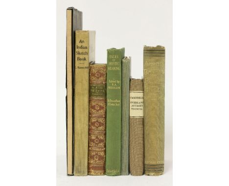
1. Across the Border or Pathan and Biloch. Chapman and Hall, 1890, 1st edn; with large folding map; inscribed: to Alfred Baldwin, from J L Kipling. From the library of Peter Hopkirk, with his label; original pictorial cloth; little blotched and spine faded; folding map torn at folds; o/w G+; 2. Raven-Hill, L (ill): An Indian Sketch-Book. Punch office, nd, c1903, 1st 4 to. fully ill; 3. Campbell, D: Narrative of the Extraordinary Adventures, and Sufferings by Shipwreck and Imprisonment. Overland Journey to India. Vernor, Hood & Sharpe, 1808, 6th edn with plates (Frontis plus 2 other plates). Later cloth backed boards; vg; 4. Burnaby, F: A Ride to Khiva: Travels and Adventures in Central Asia. Cassell, 1877, cheap edn. with 3 large folding maps. Cont. full calf; rubbed; maps torn at folds; front endpaper pasted to pastedown; 5 Nicholson, R A (ed): Tales of Mystic Meaning. 1931, 1st; 6. Guide to the Buildings and Gardens of Delhi Fort. Delhi, 1937, reprint; 7. Thokcha. The Ancient Amulets Of Tibet. Limited edn, slipcase; fine. (7)
Lot 44
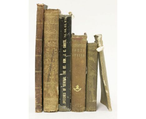
1. SMUTS, J C: Greater South Africa : plans for a better world; the speeches. Johannesburg, Truth Legion, 1941, 2nd edn. signed by author, dw; plus loosely inserted a colour portrait of Smuts, signed??; dw torn and chipped; o/w G+; 2. Scoresby, W: The Whaleman's Adventures in the Southern Ocean; Sampson Low, 1850, 1st pp: (ii) adverts, xiii, (i) list of ill., 304, 24 (publishers adverts); with additional engraved tinted title and 7 tinted engraved plates. Original cloth, worn and inner hinges cracked; adverts at back mostly loose; some damp staining to plates; 3. Bladon, S (Printers): Account of the Several Cities and Market-towns in England and Wales. No date, c1775; price 6d. plain wrappers sewn on; G+; 4. Livingstone, D: Popular Account of Missionary Travels and Researches in South Africa. J. Murray, 1861; with folding frontis, folding map, 13 plates and 20 text ill. pp: (x), 436, 32(pub. Ads. Dated April 1861); original cloth; worn and inner hinges cracked; map torn on fold; 5. Two works in 1 vol.: The Bee (illustrated eastern & western periodical, in English and Arabic); Vol.1 no. 11: Nov. 15, 1877; p:161-176; bound with: Campbell, T: Gertrude of Wyoming. T. Bensley, for the Author, 1809; in 3 parts; pp:134. Half leather; worn; damaged to top corners of first work; 6. Birket Foster’s Pictures of English Landscape. Routledge, 1863, 1st original decorative cloth; spine torn; damp staining; many pages loose; A/F. (6)


Lot 52
1. GROSVENOR, E M: Diary of a Tour in Sweden, Norway, and Russia, in 1827. Hurst & Blackett, 1879, 1st edn; p (vi), 297, 16 (catalogue). Original cloth; worn and cuts to spine;2. Sastri: Guide to Elephanta. Delhi, 1934, with a folding map (plates only issued with the illustrated edn.). Original cloth; inner hinges cracked; 3. Belloc, H: Esto Perpetua: Algerian Studies and Impressions. 1906, 1st colour frontis (loose); covers worn; 4. Huxley, A: Beyond the Mexique Bay. Chatto & Windus, 1934, 1st original cloth; soiled and worn; 5. Lin Yutang: Moments in Peking. NY, J. Day, 1939, 1st? Original cloth; p815; 6. Frost, Thomas: The Secret Societies of the European Revolution, in 2 volumes. Tinsley Bros, 1876; p300; 338. Half leather; lacking spines; 7. The Chinese Traveller Containing a Geographical, Commercial and Political History of China; vol. 1 only of 2. Printed for E and C Dilly, 1775, 2nd edition with a frontis, folding botanical plate and folding table; 267p. Full leather, covers worn and detached; 8. Burnley, J: Summits of Success: How They Have Been Reached. 1904, 1st original pictorial cloth; G+.(9)

Lot 54
LEWIS, Samuel: A Topographical Dictionary of England, Comprising the several Counties, Cities, Boroughs, Corporate and Market Towns, Parishes, Chapelries, and Townships, and the islands of Guernsey, Jersey, and Man, with Historical and Statistical Descriptions; Illustrated by Maps of the different counties and islands; A Map of England, shewing the principal towns, roads, railways, navigable rivers, and canals; and a plan of London and its environs; and embellished with engravings of the arms of the cities, bishopricks, universities, colleges, corporate towns, and boroughs. and of the seals of the several municipal corporations. In Four Volumes. S. Lewis, 1831, 1st. edn. with a list of subscribers. Large 4to/Folio, with a large folding map and county maps (some folding). Cont. half leather; covers worn and cut; occasional foxing (4)

Lot 57
LIVERPOOL:1. HOPE, E. W (Edit.): City of Liverpool Handbook for the Congress of the Royal Institute of Public Health, 1903. Lee and Nightingale. n.d. (1903), 1st. edn. 4to. with large coloured Map of Liverpool Tramways 1903, a large folding commercial Map of the world with trade connections with the Port of Liverpool, a double-page colour plate (Colonial Flags) Plus numerous plates and plans (many folding). Original cloth with gilt emblem to front cover; covers little worn; a couple of plates and pages creased; o/w VG; 2. Moss, W: Liverpool Guide; including a sketch of the environs: with a map of the town; and Directions for Sea Bathing. Liverpool, J. McCreery, for W. Jones,1801, 4th. Edn. enlarged. Folding Map and vignettes. 192pp; cont. marbled boards and paper spine which is worn/torn; o/w G+; 3. Moss, W: Liverpool Guide; …. with a map of the town (lacking). Liverpool, for Crane and Jones, 1796, 1st. edn. enlarged. (iv), 132pp; cont. marbled boards; worn and lacking the spine as well as the map; a number of pages trimmed; o/w G (very scarce, even without the map); 4. Gore’s Liverpool Directory for the year 1807, with alphabetical list of merchant, traders,… Liverpool, J. Gore, nd, ca1807. Vignette title; PP270, 112 (Appendix for 1807): DEFECTIVE copy, lacking two leaves: 215/216 and 251/250; A/F; 5. Shaw, G T & I: Liverpool's Fifth Directory: Liverpool, H Young, 1932, a reprint Of The Names And Addresses From Gore's Directory For 1774.. with a frontis. 120pp; 6. Shaw, G T: Liverpool directory for 1766. Facsimile copy of pages 113-162. (6)

Lot 59
ENFIELD, William: An Essay towards the History of Liverpool, with views and Maps. Lon, Joseph Johnson, 1774, 2nd. edn. with additions. Complete with Large folding Map, Large folding diagram, large folding chart of the Harbour, Plus 9 plates; iv, (vi)list of Subscribers, 116pp. Small Folio, very nicely rebound in full leather, gilt and decoration to spine; the folding chart torn at the fold(without loss); offsetting; o/w G+

Lot 60
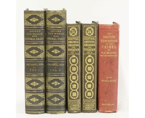
1. Young, J R: Around the World with General Grant, in 2 Volumes with 800 illustrations. NY, American News Company, 1879, 1st. edn. Vol.1- ppxxii, 631 + 21 Plates(including Frontis); Vol.2- ppxvi, 631 + 21 Plates(including Folding Map). Cont. half leather with gilt ruling and gilt lettering and decoration to spines, raised bands, marbled endpapers and all edges. VG+;2. Stephens, J. L: Incidents of Travel in Central America, Chiapas and Yucutan, in 2 Volumes. J. Murray,1842, new Edn. Vol.1- 424 + frontis, folding map, 31 plates (one extra plate not called for), and illustrations; Vol.2- 474 + double-page frontis, 45 plates, and illustrations. Original cloth with gilt decoration to front covers and spines; foxing & browning; o/w G+;3. Russell, W H: The British Expedition to the Crimea. Routledge, 1858, revised edn. with 14 plates and folding plans (including 4 in back pocket); original red cloth; cut to side of spine; o/w G (5)
Lot 63
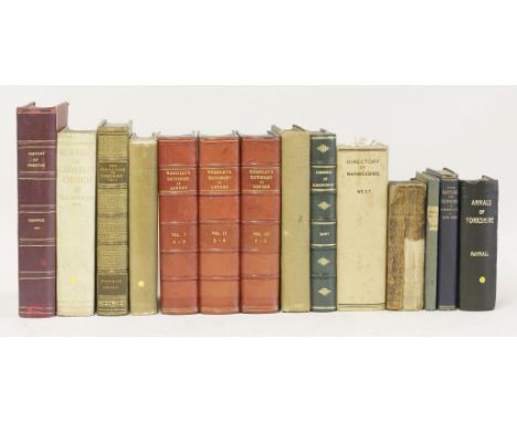
BRITISH TOPOGRAPHY:1. West, W: History, Topography and Directory of Warwickshire. Birmingham, R. Wrightson, 1830. With large folding coloured Map & 27 plates. PP26(pub. Catalogue), xiv, 800. C20 cloth rebound; occasional foxing; o/w G; 2. Wheatley, H B: London Past and Present, in 3 volumes. Murray, 1891, 1st. edn. Later leather backed boards; VG; 3. Fishwick, H: History of the Parish of Preston. Rochdale, J Clegg, Aldine Press, 1900, 1st. edn. 4to. Illustrated. Half leather; covers chipped; pencil notes & lines in margin; browning to couple of pages; o/w G; 4. Stapleton, H: Memorials of Calverley Parish Church. Leeds, R Jackson, nd, limited edn No. 65/100. 4to. original full vellum gilt. Slight discolouring of covers; o/w VG; 5. Horley, E: Sefton, A Descriptive and Historical Account. Longmans.., 1893, 1st. with plates. Original cloth with gilt emblem to front cover; covers little chipped and grubby; o/w G+; 6. Harleian Society: Pedigrees Made at the Visitation of Cheshire, 1613… 1909. Full morocco with gilt decoration; little rubbed; o/w VG; 7. Blott, W: chronicle of Blemundsbury; a record of St Giles in the Fields and Bloomsbury…1892, 1st. with folding Maps/Plans & plates. Later leather binding. Last page of index with frayed edges; o/w VG; Plus 4 others: Tooley: Royal Palaces,1902, 1st, with plates; Mayhall: Annals of Yorkshire, 1862, 1st. with plates; Baines: Directory & Gazetteer of York. Vol. 1 only; 1822; Dean: Historical Middleton. Nd. with plates; & Money: First and Second Battles of Newbury and the Siege of Donnington Castle During the Civil War A.D.1643-6. 1884, 2nd. edn. with plans and plates. (14)
Lot 66
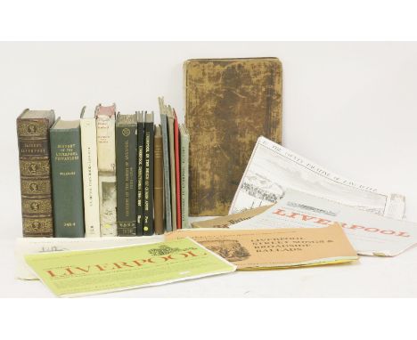
LIVERPOOL:1. Liverpool Town Books: Proceedings of Assemblies, Common Councils, Portmoot Courts Etc, 1550-1862, IN 2 Volumes. For University of Liverpool, 1918 & 1935. With plates (many folding); original cloth; VG; 2. Picton, J A: City of Liverpool. Selections from the Municipal Archives and Records, from the 13th to the 17th Century inclusive. Liverpool, G G Walmsley, 1883. PP356 + Frontis & List of subscribers. Leather backed boards and gilt emblem to upper cover; spine worn and hinges cracked; 3. Peet, H: Liverpool in the Reign of Queen Anne: 1705 and 1708. Liverpool, 1907; with frontis, 2 folding maps and another plate. VG; 4. Stewart-Brown, R: The inhabitants of Liverpool from the 14th to the 18th century. Liverpool, 1930, Privately printed Limited edition of 150 copies; presentation slip from author tipped-in. Original cloth backed paper boards; little blotched; o/w VG; 5. Williams, G: History of the Liverpool Privateers and Letters of Marque with an Account of the Liverpool Slave Trade. Heinemann, 1897, 1st. with 4 facsimile plates; Ex-Libra, with library cloth and usual stamps; 6. Baines, T: History of the Commerce and Town of Liverpool. Longman…, 1852. With one large folding map (Only), plus 8 plates?? PP544,12, 13(list of subscribers). Rebound preserving the original gilt pictorial leather; damp staining; A/F; PLUS 10 Others: Enfield: Essay towards the history of Liverpool, 1774, 2nd. edn. Defective copy; A/F; Harrison: Place-Names of the Liverpool district, 1898; Peet: Earliest Registers of Parish of Liverpool. 1909; Kelly’s Directory of Liverpool. 1930, no map, damp staining; Harries: Landmarks in Liverpool History. 1949, dw; Liverpool Burgess Rolls during C16. Facsimile; Ordnance Map of Liverpool. Linen backed folding, vg; Birrell: Some early recollections of Liverpool. 1924; Power: Liverpool town books, 1649-1671. 1999 rep.; & Chandler: Liverpool under Charles I. 1965, 1st. dw. Vg. (20)
Lot 68
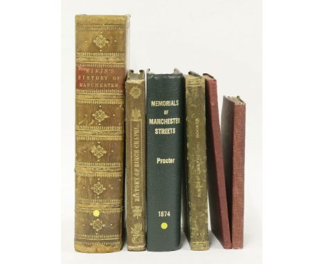
MANCHESTER:1. Aikin, J: A Description of the Country from thirty to forty Miles round Manchester. John Stockdale, 1795, 1st. edn. With Only 69 out of 73 Plates and Maps, large folding Plan of Manchester present (lacking the following: large folding map, View of Christ church, view of Manchester, & Plan of Castle Croft..). 4to. C19 full leather, gilt. Covers little rubbed; folding plan torn at fold; 2. Booker, John: A history of the ancient chapel of Birch, In Manchester parish. For Chetham Society, 1859, 1st. with 4 plates and many folding pedigrees; 253pp, original embossed cloth; spine chipped; inner hinges weak; 3. Another copy, as above; half leather, worn; 4. Procter, R W: Memorials of Manchester Streets. Manchester, T Sutcliffe, 1874, 1st. edn. Photographic frontis plus plates & illustrations; 388pp. Modern cloth rebound; vg; 5. Royle, W: Rusholme Past and Present. Manchester, Wm. Hough & Sons, 1905, 1st. with Map and plates; original cloth gilt; VG; 6. Buckley, J S: The History of Birch-In-Rusholme. Sherratt & Hughes, 1910, with illustrations. (6)


Lot 79
SALMON, Nathaniel: The History of Hertfordshire; Describing the County, and its Antient Monuments, Particularly the Roman. 1728, 1st. edn. With a double page Map. Folio, PPtitle, (iv)dedication, (ii)list of subscribers, 368, (without page 369: Norton Appendix). Cont. full leather with later spine G+/VG
Lot 82
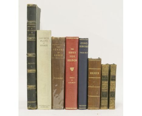
ESSEX:1. Excursions in the County of Essex; in 2 vols. Longman... 1818-19, 1st. edns. With folding map, folding plan, 2 extra engraved titles, plus 96 plates. Cont. half leather; rubbed; occasional foxing; 2. White, W: History, Gazetteer and Directory of the County of Essex. Sheffield, Leader, 1848. PP732(including adverts); lacking the map. Cont. full calf; rubbed; lacking rear endpaper; o/w G+; 3. Suckling, A: Memorials of the antiquities & Architecture, family history & Heraldry of Essex. Weale, 1845, folio; with only 32 out of 34 Tinted & some coloured, plates. Half leather; worn; foxing (a little heavy to few plates); 4. The Essex Foxhounds with notes upon hunting in Essex. Vinton, 1896, 1st. list of subscribers and plates. Leather backed boards, aeg. VG; 5. Fisher, W R: The Forest of Essex. 1887, 1st. PP448; with colour maps & illustrations. Leather backed boards; rubbed; endpapers stained; o/w G+: 6. Benton, G M: Church Plate of the County of Essex. Colchester, 1926, 1st. 4to. with plates; cloth backed boards; VG; 7. Roe, F: Essex Survivals. Methuen, 1929, 1st. original cloth, teg; little blotched; o/w VG (8)
-
109198 item(s)/page