Dominic Winter Auctions
Lot 171
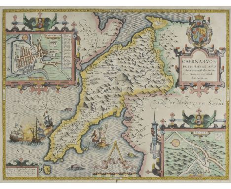
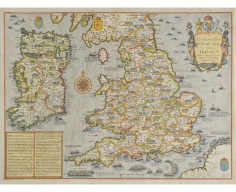
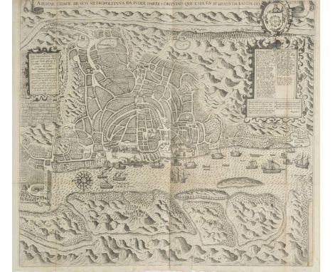
Essex. Speed (John), Essex devided into Hundreds with the most antient and fayre towne Colchester described and other memorable monuments observed, 1st edition, published George Humble, circa 1611, uncoloured engraved map, inset town plan of Colchester, vertical borders trimmed with loss to strapwork margins, central fold a little worn and stained and strengthened on verso, 385 x 500 mm, English text on verso, together with Kent with her cities and earles described and observed, circa 1611, uncoloured engraved map, inset town plans of Canterbury and Rochester, central fold trimmed and worn with loss, trimmed with loss along lower border, slight worming, 370 x 495 mm, English text on verso, with Suffolke described and divided into hundreds..., 1st edition, published George Humble, uncoloured engraved map, inset town plan of Ipswich, central fold frayed with some loss, vertical margins trimmed with some loss to strapwork margins, 385 x 510 mm, English text on verso, plus The countie and citie of Lyncolne described..., 1st edition, circa 1611, uncoloured engraved map, inset map of Lincoln, trimmed to strapwork margin, central fold split and crudely repaired on verso, lower margin frayed and chipped, occasional closed marginal repaired tears, torn with loss to lower left corner, slight staining, 385 x 510 mm, English text on verso (4)

![Bill (John). Mountgomerieshire [and] Brecknockshire, [1626], two uncoloured engraved maps, some staining and dust soiling to](https://cdn.globalauctionplatform.com/b5b00720-e986-4bfc-98da-a78501119e93/a93dfe00-661b-4b03-d9cc-bf48e5bf0242/468x382.jpg)


![Greece. Atlas van Morea..., getekend door F[ranciscus] J[ohannes] Boonzaajer, circa 1810, manuscript atlas with 1 general do](https://cdn.globalauctionplatform.com/b5b00720-e986-4bfc-98da-a78501119e93/b4b51ae7-a2fe-440a-ab9e-c1252a8991a2/468x382.jpg)

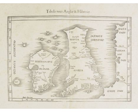
![British Isles. Fries (Martin, Waldeseemuller Martin), Tabula nova Angliae & Hiberniae, published Vienne [1541], uncoloured wo](https://cdn.globalauctionplatform.com/b5b00720-e986-4bfc-98da-a78501119e93/ab85d68d-2a01-4e4a-a544-0a753b8b36b6/468x382.jpg)
![British Isles. Gastaldi (Giacomo), Tabula Europae I, [1548], uncoloured Ptolemaic map with decorative vignettes to vertical m](https://cdn.globalauctionplatform.com/b5b00720-e986-4bfc-98da-a78501119e93/04b2ad50-4ffa-40c0-db99-7052017bf1f4/468x382.jpg)


![Cyprus. Magini (Giovanni Antonio), Cypri Insula, published Venice, [1596 or later], uncoloured map, engraved by G.Porro, Ital](https://cdn.globalauctionplatform.com/b5b00720-e986-4bfc-98da-a78501119e93/8f384867-7290-400e-979b-04bbde07b0b6/468x382.jpg)


![*Drayton (Michael). Untitled map of South Wales and North Devon and Somerset, [1612 - 1622], uncoloured engraved allegorical](https://cdn.globalauctionplatform.com/b5b00720-e986-4bfc-98da-a78501119e93/7f7252d7-ebb8-41bd-99c8-e8e4d9c829bf/468x382.jpg)


![*Europe. Jansson (Jan), Europam sive Celticam veterem sic describere conobar Abrahamus Ortelius, [1640 or later], hand colour](https://cdn.globalauctionplatform.com/b5b00720-e986-4bfc-98da-a78501119e93/0fce3939-0e93-49ac-c120-61650d9847d8/468x382.jpg)


![Ireland. Ortelius (Abraham), Eryn. Hiberniae Britannicae Insulae nova descriptio, [1592] uncoloured engraved map orientated](https://cdn.globalauctionplatform.com/b5b00720-e986-4bfc-98da-a78501119e93/d9e67100-cf18-43ca-8e95-13157359ccec/468x382.jpg)


![London. Environs of London - Windsor Castle to Gravesend, published 'The Illustrated London News', [1855], uncoloured engrave](https://cdn.globalauctionplatform.com/b5b00720-e986-4bfc-98da-a78501119e93/aa04331d-8fa0-432b-e8ff-9e6274c523f6/468x382.jpg)

![Mexico. Ortelius (Abraham), Hispaniae novae sivae magnae recens et vera descriptio, [1592 - 1612], engraved map, large ornate](https://cdn.globalauctionplatform.com/b5b00720-e986-4bfc-98da-a78501119e93/c01e709e-b2c5-4fa9-9a91-4408bb857004/468x382.jpg)