We found 109182 price guide item(s) matching your search
There are 109182 lots that match your search criteria. Subscribe now to get instant access to the full price guide service.
Click here to subscribe- List
- Grid
-
109182 item(s)/page


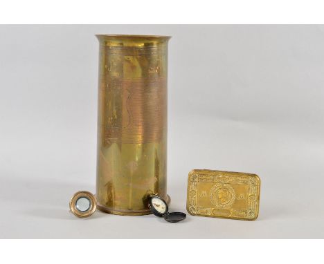
Lot 750
Militaria, WW2 Escape and Evasion equipment. 2 half inch Escape Compasses (gd), Escape Map double sided colour sheet 44/0 showing S. Honan, N Hunan, S. Kiangsu, E.Hupeh, N. Kiangsi, Chekiang, Anhwei, S. Hunan, S.Kiaingsi, E.Kwangtung, Fukien and Formosa (Taiwan) (approx. size 107 x 87 cms) (gd with some slight foxing), red dog tag "1631419 RAF CE Davies P", lightweight military goggles (poss skiing), small German military Eidelweiss badge together with a small black enamel badge showing and ice pick and the letters MA in green together with a tie pin and 2 small RAF buttons (10)


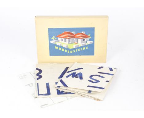
Lot 254
Austrian Wundersteine Lego Style construction set and various Posters, Wundersteine Set No 5 comprising pale coloured bricks with windows, doors, signs and instructions, in original box with a few pieces of Lego, VG, box G together with four Posters, Vauxhall Craftsman's Guild 1966/7 Model Car Comp, School Savings and National Savings Royal Air Force, Save for Holidays and Map of British Isles, F-G, all maps have significant patterned writing on the backs (5, set + four posters)


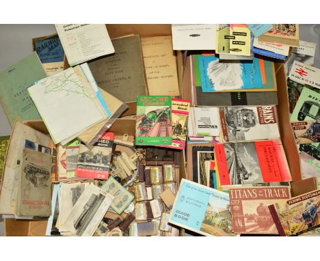
Lot 1251
A QUANTITY OF PAPER RAILWAYANA AND OTHER RAILWAY EPHEMERA, to include Railway Clearing House Appendix to the Official Handbook of Railway Stations etc 1916, L.M & S Railway list of stations and map 1939, B.R. (W.R.) Train Register Book from Priestfield Junction Signal Box (between Wolverhampton & Dudley) for August and September 1961, L.M. & S.R. General Instructions 'Curvest', B.R. Information Sheets regarding the painting of stations, dated 1949, B.R. L.M.R. Guide to Station Display, Midland Railway Passes & Season Ticket Information for 1918, 1955 Sutton Coldfield Accident Report, assorted maps, pocket and other timetables, handbills, information leaflets, reports, staff magazines, Ian Allan ABC's and other books and pamphlets, badges, cigarette cards, diesel locomotive piston ring, playing cards, jigsaw, etc (three boxes)

Lot 447
A LARGE CIGAR BOX CONTAINING A WWII GROUP OF MEDALS, as follows, 1939-45, Atlantic (France & Germany bar), Africa Star (North Africa 1942-43 bar), Defence & War medal, together with a ribbon wearing bar, group is swing mounted on a wearing bar and an identical miniature group on bar, also a British War & Merchantile Marine medal, named to Stanley Coates, together with two other tins containing a number of believed original Military cap badges WWI/II era and two envelopes containing buttons etc, together with some enamel badges, also a 1944 Military canvas map case, a pair of stirrups and what is believed to be a wristband for holding a music sheet, possibly for a Bandsman and Signal card book dated 1937

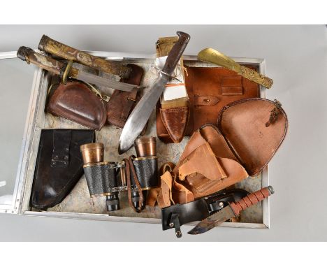
Lot 478
A LARGE GLASS TOP DEALER STYLE DISPLAY CASE CONTAINING THE FOLLOWING ITEMS, brown leather WWII era Japanese Army map/document case, Japanese pistol holster, a pair of 'Nikko' WWII era Military binoculars 7 x 50, a fold over cover leather holster, believed Japanese, a brass shoehorn believed Japanese, a black leather German 3rd Reich pistol holster, marked with 1944 and Eagle/Swastika, a dagger by Whitby & Co R.O.C.A., a WWI era US made Machine Gunners Bolo knife and scabbard by 'Plumb' St. Louis, model 1917 C.T. with information attached, a Japanese (Far Eastern ?) Ceremonial knife, in metal scabbard, ornate and decorated


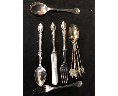
Lot 25
A silver Christening set, of Dog nose pattern, comprising fork and spoon, Chester 1906, makers mark of S.I.Ld for Stokes and Ireland Limited; an EPNS childs fancy Christening set, comprising Knife, Fork and Spoon; and six white metal spoons stamped 830, barley twist handles with terminals formed as a map of Cyprus (11)


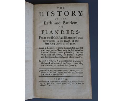
Lot 60
Bentivoglio, Guido, Cardinal (1579-1644) - The History of the Wars of Flanders, folio, with 22 (of 24) portraits, London 1654, bound with Bentivoglio. Historicall Relations of the United Provinces of Flanders ..., contemporary calf, Port torn and damp stained in 2d work; 1st work lacking map, London 1652


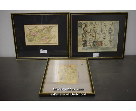
Lot 10
Teesdale (Henry), A MAP OF THE COUNTY PALATINE OF LANCASHIRE DIVIDED INTO HUNDREDS AND PARISHES FROM AN ACCURATE SURVEY OF 1828 AND 1829, engraved and hand-coloured, engraved cartouches, dissected and mounted on linen, 1150 x 1600mm, contained in slip-case, contemporary tree calf, morocco spine label, H. Teasdale, 1830 Additional image attached

Lot 11
Greenwood (C. & I.), A MAP OF THE COUNTY OF DERBY FROM AN ACCURATE SURVEY OF 1824 AND 1825, engraved and hand-coloured, engraved cartouches, dissected and mounted on linen, 1200 x 1550mm, contained in slip-case, contemporary green straight-grained morocco, tooled in gilt, morocco spine label, 1825 Additional image attached

Lot 116
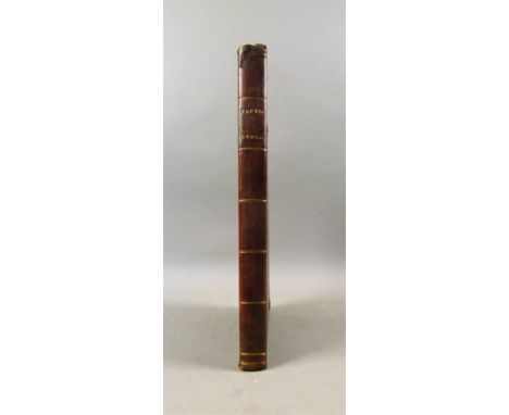
Fine Binding.- King (Daniel), THE VALE-ROYALL OF ENGLAND. OR, THE COUNTY PALATINE OF CHESTER ILLUSTRATED…, additional engraved title page, 1 folding engraved plate, 2 double-page maps and a double-page plan, 12 single-page plates, 11 heraldic and 3 in-text woodcuts; bound with .- A SHORT TREATISE ON THE ISLE OF MAN 1 double-page map and 3 engraved plates, bookplates of Mathew Wilson and Frances Mary Richardson Currer, nineteenth century fine green straight-grained morocco, tooled in gilt, spine ornately gilt, gilt dentelles, g.e., J. Streater, 4to, 1656. See illustration
Lot 127
Brannon (George), VECTIS SCENERY BEING…THE PICTURESQUE BEAUTIES OF THE ISLE OF WIGHT…, folding engraved map, engraved title and 36 engraved plates, occasional light spotting, damp-stain to a couple of plates impinging slightly upon image area, contemporary calf over boards, spine ends a little bumped, Isle of Wight, 4to, 1846


Lot 132
Whitaker (Thomas Dunham), AN HISTORY OF THE ORIGINAL PARISH OF WHALLEY AND HONOR OF CLITHEROE…, third edition, 46 engraved plates, including frontispiece and a folding engraved map and 8 folding pedigrees, ex-libris John Townley, g.e., near-contemporary fine straight-grained morocco, tooled in gilt, spine in gilt compartments, folio, 1818† Includes a hand-drawn pedigree on Townley Hall paper


Lot 140
Redding (Cyrus), THE PICTORIAL HISTORY OF THE COUNTY OF LANCASTER…, Extra-illustrated, numerous in-text woodcut engravings, 34 engraved plates, many additional from different works, a watercolour of Orrel Mount, dated July 12th 1831, folding engraved map, 1844; bound with Kendrick (James) PROFILES OF WARRINGTON WORTHIES, engraved title and 5 plates of silhouettes, Warrington, 1835, near-contemporary crushed morocco over boards, spine gilt, 4to,


Lot 162
Allen (T.), THE PANORAMA OF LONDON…, frontispiece, additional engraved title, folding engraved map and 71 engraved plates, contemporary half calf over patterned boards, 1830 § [Anon.] S.W. A VISIT TO LONDON CONTAINING A DESCRIPTION OF THE PRINCIPAL CURIOSITIES IN THE BRITISH METROPOLIS 6 engraved plates, one folding, contemporary half calf over patterned boards, 1813, contemporary ink ownership inscriptions to titles § Nelson's Handbooks for Tourists.- KEW, RICHMOND, TWICKENHAM, AND HAMPTON COURT, 12 chromolithographed plates, tissue guards, publisher's cloth, 1859, 8vo & 12mo (3)

Lot 174
Skelton (Joseph), ENGRAVED ILLUSTRATIONS OF THE PRINCIPAL ANTIQUITIES OF OXFORDSHIRE…, Large Paper Copy, contemporary ink ownership inscription to f.f.e's, engraved frontispiece, title on India Paper, engraved map and 49 engraved plates, tissue-guards, list of subscribers, modern half calf over patterned boards, Oxford, for the author, folio, 1823. See illustration

Lot 193
Whitaker (Thomas Dunham), THE HISTORY AND ANTIQUITIES OF THE DEANERY OF CRAVEN IN THE COUNTY OF YORK, second edition, hand-coloured additional title offsetting onto title, engraved frontispiece, folding engraved map, 24 hand-coloured plates plus 16 duplicate plates in uncoloured state and 28 engraved plates, heavy offsetting, folding pedigrees, modern half calf over patterned boards, morocco spine label, folio, 1812
Lot 211
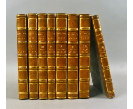
Gilpin (William), OBSERVATIONS RELATIVE CHIEFLY TO PICTURESQUE BEAUTY...MOUNTAINS AND LAKES OF CUMBERLAND AND WESTMORLAND, third edition, 2 vol., 30 tinted lithographed plates and 3 hand-coloured maps,1792; .- …THE HIGHLANDS OF SCOTLAND, 2 vol. second edition, 34 tinted lithographed plates, 5 hand-coloured maps and a chart, 1792; .- REMARKS ON THE FOREST SCENERY...IN HAMPSHIRE, 2 vol (all published), second edition, 31 tinted lithographed plates, 1 hand-coloured map, 1794, R. Blamire; .- OBSERVATIONS ON THE WESTERN PARTS OF ENGLAND... 18 tinted lithographed plates, 1798; .- OBSERVATIONS ON THE RIVER WYE... fifth edition, 17 tinted lithographed plates, 1800, T. Cadell, bookplate of Sir Joseph Radcliffe, consecutively numbered and uniformly bound in contemporary calf over patterned boards, 8vo (8). See illustration
-
109182 item(s)/page