We found 109182 price guide item(s) matching your search
There are 109182 lots that match your search criteria. Subscribe now to get instant access to the full price guide service.
Click here to subscribe- List
- Grid
-
109182 item(s)/page


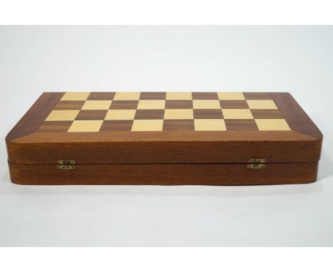
Lot 307
A chess set and board, the board of folding case form with rounded corners, inlaid with mahogany and other woods, opening on hinges to reveal a similarly decorated backgammon board, inlaid with a light wood silhouette map of a State/Country (?), containing Staunton style weighted chess pieces and others, 51cm x 48cm (open)


Lot 1022
PRINTS / MAP: Henry Alken, 'Sporting Meeting in the Highlands', hand-coloured, aquatint, 27.5cm., x 37.5cm., published T. McLean, 1820; with a smaller copy, and three further prints of Edinburgh and figures in Scottish dress; together with Pierre JACOTIN: Carte Geographique de L'Egypte et des pays environnans, reduite d'apres la Carte Topographique levee pendant l'Expedition de l'Armee Francaise . . . 3 parts ex 4, large engraved map on 3 double-page sheets, 68cm x 101cm, engraved title, Paris, 1818. (6)


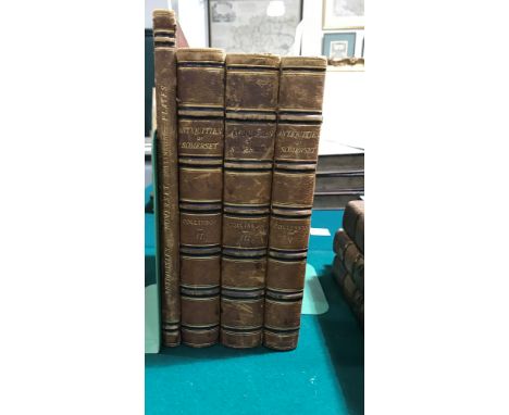
Lot 105
Collinson, John. The History and Antiquities of the County of Somerset, 3 volumes bound in 4, first edition, folding engraved map, 40 engraved plates, light spotting, nineteenth century half morocco, rubbed, 4to, Bath: R. Crutterwell, 1791 The plates for this work have been bound as a separate, oversized volume.
![Morden, Robert. Devonshire, engraved map hand-coloured in outline, spotted, 414mm x 357mm, [London]: Abel Swale and John Chur](https://cdn.globalauctionplatform.com/e548628d-15c9-459c-9b26-aaa10043e2fb/91f89f06-60ae-4273-9968-aaae00fa518d/468x382.jpg)
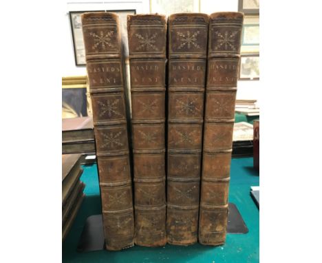
Lot 108
Hasted, Edward. The History and Topographical Survey of the County of Kent, 4 volumes, first edition, 60 engraved plates, some folding, 37 engraved maps and plans, 36 double-page, large folding engraved county map, hand-coloured in outline, repaired along folds, numerous engravings in text, some spotting, nineteenth century calf, extremities rubbed, joints cracked, folio, Canterbury: Printed for the Author, 1778-99
Lot 281
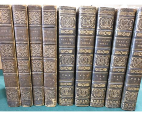
Cervantes Saavedra, Miguel de. The Life and Exploits of the Ingenious Gentleman Don Quixote de la Mancha, 4 volumes, folding engraved map, engraved plates, light spotting, contemporary green straight-grained morocco, tooled elaborately gilt, all edges gilt, 8vo, London: William Miller, 1810; Pindar, Peter. The Works, 5 volumes, engraved portrait frontispiece, contemporary green straight-grained morocco, tooled elaborately gilt, all edges gilt, 8vo, London: J. Walker et al., 1812 (9)

Lot 183
Speed, John. Dorsetshyre, With the Shyre-towne Dorchester described, hand-coloured engraved map, English text verso, a few minor holes to paper surface, affecting image, 508mm x 380mm, London: Thomas Bassett, 1662; Ogilby, John. The Continuation of the Road from London to Lands-End, hand-coloured engraved map, shaved to right and left margins with loss of image, 482mm x 342mm, London, c.1675, both framed and glazed (2)
Lot 347
Marryat, Frederick. Mr. Midshipman Easy, 3 volumes, half-titles, advertisement leaf at end of volume 2, London: Saunders and Otley, 1836; Masterman Ready; or, The Wreck of the Pacific, 3 volumes, mixed edition, wood-engraved illustrations, London: Longman, Orme, et al., 1841, 1842 and 1845; The Mission: or, Scenes in Africa, 2 volumes, first edition, frontispieces, map, without publisher's catalogue, London: Longman, Brown, et al., 1845, together 8 volumes, uniformally bound in late nineteenth century green half morocco gilt, 8vo
Lot 282
Cervantes Saavedra, Miguel de. El Ingenioso Hildalgo Don Quixote de la Mancha, 4 volumes, 4 engraved frontispieces, engraved portrait and 31 engraved plates after Antonio Carnicero, numerous engraved head- and tail-pieces, double-page engraved map, occasional light browning, contemporary etched calf, spines tooled gilt, slightly worn, joints cracked, head of spine of volume 2 lacking, 4to, Madrid: Joaquin Ibarra, 1780


Lot 175
Bowles, Henry Carrington and Samuel Carver. Bowles's Road Director through England and Wales, being a New and Comprehensive Display of the Roads and Distances from Town to Town, folding hand-coloured engraved map in 20 sections, backed on linen, in slipcase, 543mm x 605mm, London: Bowles and Carver, [1811]; and 5 other maps (6)


Lot 265
Bible, English. The Holy Bible, containing the Old and New Testament, Black Letter, wood-engraved titles, double-page wood-engraved map, genealogies by John Speed, a few leaves with contemporary annotations, minor tears, fore-edge shaved, occasionally affecting marginal notes, the Book of Common Prayer lacking all before A, The Whole Booke of Psalmes lacking all after F8, occasional soiling and rust-marks, eighteenth century panelled calf, worn, joints cracked, 4to, London: Robert Barker and J. Bill, 1630, sold not subject to return [Darlow and Moule 429]
Lot 234
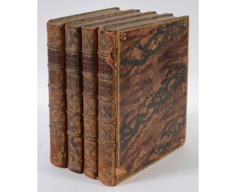
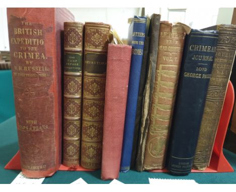
Crimean War. Russell, William Howard. The British Expedition to the Crimea, revised edition, engraved portrait frontispiece, 3 plates, 10 folding maps and plans, including 4 in pocket at end, original cloth gilt, spine repaired with some loss, 8vo, London: George Routledge, 1858; [Bushby, Henry Jeffreys] A Month in the Camp Before Sebastopol, first edition, contemporary half calf, 8vo, London: Longman, et al., 1855; [Money, A. and George Henry] Sevastopol. Our Tent in the Crimea; and Wanderings in Sevastopol, first edition, folding map, contemporary half calf, 8vo, London: Richard Bentley, 1856; [Drummond, Major Hugh] Letters from the Crimea, original cloth gilt, London: Printed by Norris & Son, 1855; Cornwallis, Major Fiennes. Letters from the Crimea, original cloth, 8vo, Privately Printed, 1868; Stanford, Edward. Stanford's New Map of Sebastopol, second edition, hand-coloured folding lithographed map in 18 sectioned, backed on linen, cloth wallet, December 1854; and 6 others, similar (12)
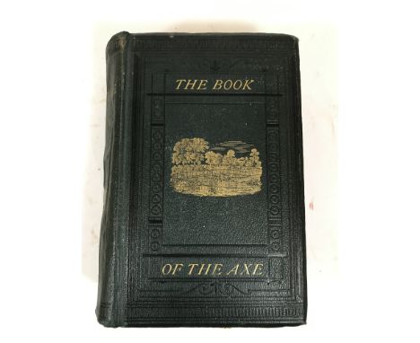
Lot 117
Pulman, George P.R. The Book of the Axe, fourth edition, PRESENTATION COPY, inscribed, 'H.P. Pulman Esq., with the Author's Kind Regards, June 4 1875', folding map, backed on linen, 15 lithographed or wood-engraved plates, title browned, light spotting, original cloth, cocked, 8vo, London: Longman, 1875
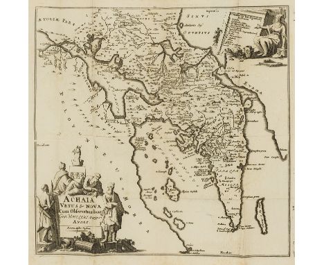
Lot 162
Wheler, George. A Journey into Greece... In Company of Dr. Spon of Lyons, first edition, 7 engraved illustrations on 5 sheets, the first shaved at foot, folding engraved map, engraved illustrations throughout, Dd4 with rust-hole to margin, Yy3 with rust-hole, slightly affecting text, a few later leaves with evidence of minor worming to gutter, occasional light browning, contemporary calf, rebacked, bookplate of Elwin Millard, folio, London: William Cademan, Robert Kettlewell and Awnsham Churchill, 1682 [Wing W1607] The first attempt at a systematic topographical description of Greece.
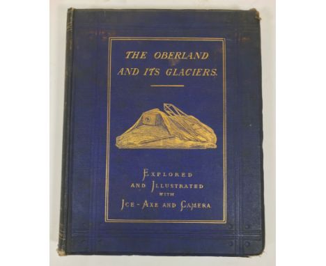
Lot 138
George, Hereford Brooke. The Oberland and its Glaciers: Explored and Illustrated with Ice-Axe and Camera, first edition, half-title, 28 mounted photographic plates by Ernest Edwards, the full-page plates with tissue guards, browned, double-page lithographed map, spotted, original cloth gilt, extremities chipped, all edges gilt, library stamped, 4to, London: Alfred W. Bennett, 1866

Lot 140
Heylyn, Peter. Cosmographie in foure Books. Contayning the Chorographies & Historie of the whole World and all the Principall Kingdomes, Provinces, Seas and Isles Thereof, 4 parts in one volume, fifth edition, engraved additional title, title printed in red and black, 3 [of 4] double-page engraved maps, shaved with slight loss, occasional spotting and rust-marks, Aa3-Aa4 with paper fold flaw, contemporary calf, spine chipped with loss, bookplate of Coker Court, folio, London: A.C. for P. Chetwind and A. Seile, 1677 [Wing H1695] Lacking the map of Europe.


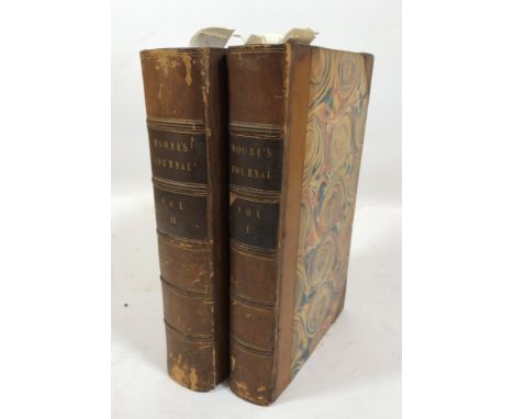
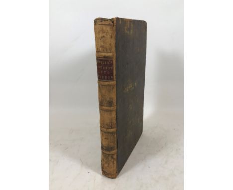
Lot 150
Moore, John. A Journal during a Residence in France, from the Beginning of August, to the Middle of December, 1792, 2 volumes, first edition, folding engraved map, hand-coloured in outline, without half-titles, light spotting, contemporary half calf, spines lightly rubbed, 8vo, London: G.G.J. and J. Robinson, 1793
![Alexander, James Edward. Transatlantic Sketches, 2 volumes, first edition, half-titles, 9 [of 10] engraved plates, engraved m](https://cdn.globalauctionplatform.com/e548628d-15c9-459c-9b26-aaa10043e2fb/7ab6b6de-a8b6-4b4c-8be6-aaac011fdfb5/468x382.jpg)
![Blair, John. Graecia Antiqua, engraved map, hand-coloured in outline, 567mm x 418mm, [London, 1788]; and 4 others, Turkey and](https://cdn.globalauctionplatform.com/e548628d-15c9-459c-9b26-aaa10043e2fb/d5fdfeab-97d8-4237-acc0-aaac012042db/468x382.jpg)
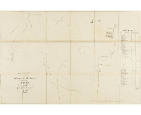
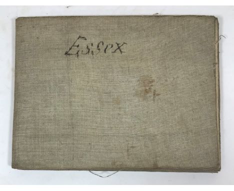
Lot 55
Essex.- Gosselin (Martin Hadsley, of Ware Priory and Blakesware, Hertfordshire).- Map of Estates in the Parishes of Elmdon Chrishall and Littlebury in the County of Essex..., manuscript estate map, pen and ink and watercolour wash, in sections, linen-backed, slightly browned, original morocco, gilt, corners rubbed, 540 x 980mm., 1850; and 10 others, comprising 9 estate maps of land and property belonging to Gosselin, including: Great and Little Amwell, Hertfordshire, Albury Hall Estate near Bishop's Stortford, River Lee, Widford etc., and a letter signed Beadall relating to the Widford estate, folds, some tears, browned, v.s., v.d. (11 pieces).
![Oxford.- [Pechell (Sir John)] The History of the University of Oxford, to the Death of William the Conqueror, first edition,](https://cdn.globalauctionplatform.com/b853f260-e104-45bc-8338-aa9b00b17641/1bc3e9c2-22df-4552-bd96-aab800b0d8d4/468x382.jpg)
Lot 203
Oxford.- [Pechell (Sir John)] The History of the University of Oxford, to the Death of William the Conqueror, first edition, occasional faint spotting, correction inserted by hand, modern front free endpaper, bookplates, additions and errata bound at end, contemporary marbled boards, rebacked, rubbed, Oxford, 1772 § Norris (John) A Catalogue of the Pictures, Models, Busts, &c. in the Bodleian Gallery, Oxford, Oxford, [1840] bound before Haskins (John) The Battle of Waterloo. A Poem, 1816, occasional faint spotting, engraved plates pasted to pastedowns, engraved portrait sewn to front free endpaper, bookplate, presentation inscription to blank, contemporary half-calf, a little rubbed, § Wade (W. M.) Walks in Oxford, 2 vol., engraved frontispieces, 11 plates and a large folding map, occasional faint spotting, bookplate, modern morocco-backed boards, Oxford, 1817; and 8 others, Oxford, 8vo & 12mo (12)⁂ The first is a preface to a much more substantial work printed the following year: a history from William I's death, also printed in Oxford and almost ten times as long.
Lot 174
Wheler (George) Voyage de Dalmatie, de Grece, et du Levant, 2 vol., second edition in French, titles in red & black, engraved frontispieces, 56 plates (9 folding), and 29 maps (1 folding), woodcut decorations and illustrations, folding map with minor marginal loss at upper left corner, light browning, contemporary diced calf, gilt, g.e., extremities worn, joints splitting, some loss at spine ends, [Blackmer 1787 for first edition, but vide accompanying footnote; also Atabey 1329], 12mo, The Hague, Rutgert Alberts, 1723.
Lot 189
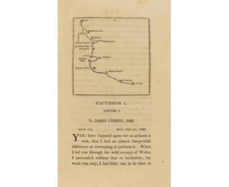
England.- Warner (Rev. Richard) Excursions from Bath, first edition, vignette title, engraved map illustrations, occasional faint spotting, bookplate, contemporary diced calf, rubbed, Bath, 1801; A Companion in a Tour Round Lymington, first edition, half-title, small marginal loss neatly restored (C1), short tear (C4), bookplate, later half-calf, rubbed, Southampton, [1789]; 8vo & 12mo (2)
Lot 184
West Indies.- Edwards (Bryan) The History, Civil and Commercial, of the British Colonies in the West Indies, 2 vol., first Dublin edition, folding engraved map with short tears, 5 folding tables, vol.1 X8 with tear repaired in margin, vol.2 with defect to lower margin of c.20ff., contemporary calf, one spine label slightly chipped, 8vo, Dublin, Luke White, 1793.

Lot 191
Hampshire.- Warner (Rev. Richard) and D. Y., Collections for the History of Hampshire, and the Bishopric of Winchester: Including the Isles of Wight, Jersey, Guernsey, and Sarke, 5 vol., 61 engraved plates and portraits, 2 hand-coloured, engraved folding map, bound without the 'Plan of the Form of Jersey' as usual, occasional spotting, corner missing (Q3, vol. 1 part 1), bookplates, contemporary half-calf, rubbed, vol. 1 part 2 joints cracked, rubbed, 4to, [1795].

Lot 185
Bartlett (William Henry) & others. La Syrie, La Terre-Sainte, L'Asie Mineure, etc. Illustrées, text by John Carne, translated by Alexandre Sosson, 3 vol., additional engraved titles, 116 plates & 2 maps, vol.II lacking plate 'Camp à Ras-el-Ain, près de Balbek', plate 'Bayruth, et le Mont Liban' with pencil inscriptions to upper margin, vol.I preliminary ff., map and 1 plate detached (the latter creased and folded in margin), foxing and soiling, marginal damp-staining, vestiges of labels removed from pastedowns, hinges split or broken, vol.I and 3 text block detached, contemporary roan-backed boards, worn along extremities, spines faded, 4to, 1836.

Lot 188
British Isles.- Senex (John & Price Charles) A New Map of Great Britain, corrected from the observations communicated to the Royal Society at London, with inset map of the Shetland & Orkney islands, engraved map with contemporary outline hand-colouring, 945 x 645 mm. (37 1/8 x 25 3/8 in), even toning, folds as issued, with some splitting, and further marginal tears, unframed, 1714 § Moll (Herman) The south part of Great Britain, called England and Wales, engraved map with contemporary outline colouring, tables to vertical margins, 610 x 980 mm. (24 x 38 1/2 in), slight overall toning, handling creases, marginal nicks and tears, circa 1762; and two other small maps of England and Wales, unframed (4).
-
109182 item(s)/page