We found 109198 price guide item(s) matching your search
There are 109198 lots that match your search criteria. Subscribe now to get instant access to the full price guide service.
Click here to subscribe- List
- Grid
-
109198 item(s)/page


![Kip, Wihelm. Hertfordiae Comitatus, engraved map, hand-coloured in outline, 344mm x 280mm, [London, c.1637], framed and glaze](https://cdn.globalauctionplatform.com/6f903f01-b92e-4753-bb9b-ac1f003aa4c3/f47df6ad-daf6-4e4f-9097-ac1f01806e97/468x382.jpg)

![Modern, Robert. The Smaller Islands of the British Ocean, hand-coloured engraved map, 422mm x 356mm, [London] Abel Swale, Awn](https://cdn.globalauctionplatform.com/6f903f01-b92e-4753-bb9b-ac1f003aa4c3/4f401332-f72c-4938-b1aa-ac1f01806988/468x382.jpg)


Lot 131
Russia. Carte de da partie europeenne de l'empire de Russie: avec l'indication des chemins de poste, ainsi que des douanes frontieres et de la repartition actuelle en gouvernements et districts..., large folding engraved map on 48 sections, backed on linen, original slipcase, 123cm x 120cm, St. Petersbourg : [Depot imperial des cartes], 1818
Lot 132
Rome and Naples. Carta de contorni di Napoli per uso de'forestieri e viaggiatori di Giov. Enrico Westpahl, folding engraved map in 24 sections, backed on linen, with guidebook in original slipcase, 79.5cm x 74cm, [Naples: Detken and Rocholl] 1832-3; Carta topografica dell'antichita di Roma: la quale esattamente contiene tutte le vestigie delle antiche fabriche, e monumenti secondo il giro metodico di tutte le antichita..., folding engraved map on 24 sections, backed on linen, lightly spotted, in original slipcase, 83cm x 61cm, Rome: Venanzio Monaldini, 1805 (2)
Lot 134
Slater, Isaac. I. Slater's New British Atlas, comprising the Counties of England, (Upon which are laid down all Railways Completed and in Progress), with Separate Large Sheet Maps of England and Wales, Scotland and Ireland, first edition, 3 large hand-coloured folding maps, backed on linen, 39 hand-coloured engraved county maps, folding hand-coloured map of the environs of London, tissue guards, a few later manuscript maps added by a previous owner, contemporary half calf, rubbed, folio, London: Isaac Slater, [1857]

Lot 135
Smith, C. Smith's New and Accurate Map of the Lakes, in the Counties of Cumberland, Westmorland, and Lancaster, hand-coloured folding engraved map on 16 sections, backed on linen, 50cm x 61.5cm, London: C. Smith. 1802; Sayer, Robert. An Accurate Modern Map of England and Wales, folding engraved map in 16 sections, backed on linen, hand-coloured in outline, some wear, 40.5cm x 47.5cm, in slipcase, London: Robert Sayer, [c.1770]; and 16 others, similar miscellaneous maps (18)


Lot 140
Stucchi, S. Carta Statistica e Postale Dell'Italia, folding engraved map on 24 sections, backed on linen, hand-coloured in outline, 81cm x 93cm, in slipcase, Milan: Ferd. Artaria e figlio, 1842; Faden, William. Correct Map of France, large folding engraved map on 2 sheets, each of 24 sections, backed on linen, hand-coloured in outline, each 120cm x 62cm, London: W. Faden, 1806; and 6 others similar, Europe, v.s. (8)

Lot 141
Turkey. Stanford's Map of Turkey in Europe and Her Tributary States; together with such Parts of Russia, Austria, Turkey in Asia and Persia as are more immediately concerned with the settlement of the Eastern Question, hand-coloured folding lithographed map on 32 sheets, backed on linen, original cloth wallet, 112cm x 75.4cm, London: Edward Standford, April 12 1877; The Environs of Sevastapol, with the Batteries and Approaches, folding lithographed map, hand-coloured in outline, backed on linen, original cloth wallet, 98cm x 70cm, London: James Wyld, June 25th, 1855 (2)

Lot 151
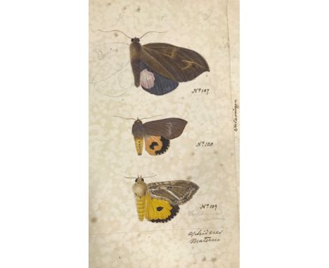
Ceylon Heterocera. A group of 39 pencil and watercolour studies of the moths of Ceylon, multiple specimens per sheet, each captioned or numbered, 200mm x 320mm approx., and a manuscript map, 350mm x 210mm, in the remains of an envelope addressed to 'Dr. Templeton... Dublin', postmarked, May 1867 (40)
Lot 197
Hardy, Thomas. Jude the Obscure, first edition in book form, later issue, engraved frontispiece, tissue guard, map, original cloth gilt, top edge gilt, other untrimmed, 8vo, London: Osgood, McIlvaine and Co., 1896; Later Lyrics and Earlier, first edition, original cloth, dust-jacket, 8vo, London: Macmillan & Co., 1922; Dali, Salvador. The Secret Life of Salvador Dali, third edition, one of 1000 copies, plates, original cloth, 4to, London: Vision Press, 1939; and 6 others, miscellaneous (9)
Lot 251
Campo, Antonio. Cremona fedelissima citta et nobilissima colonia de romani : rappresentata in disegno col suo contato et illustrata d'una breve historia delle cose piu notabili..., engraved title, soiled, repaired, engraved dedicatory portrait verso, engraved allegorical frontispiece, 33 engraved medallion portraits and engraved view of a military procession in text, large folding engraved map of Cremona, repaired with minor loss, folding engraved map of the environs of Cremona, 5 architectural engravings on 3 folding plates, minor ink and rust marks, portrait on G3 with small hole, slightly affecting text verso, 8*ii-iii with some discoloration and ink marks, M4 verso soiled, P2 with tear, repaired, P2-3 with light stain, centre, lacks errata, contemporary full calf, rubbed, folio, Cremona: In casa dell' istesso avttore, 1585
Lot 72
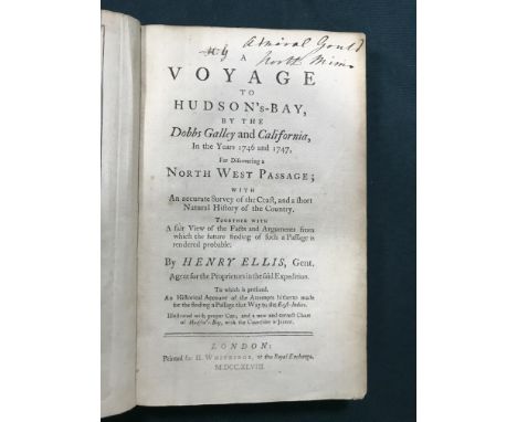
Ellis, Henry. A Voyage to Hudson's-Bay, by the Dobbs Gallery and California, In the Years 1746 and 1747, for Discovering a North West Passage..., first edition, folding engraved map frontispiece, 9 engraved plates, including 5 folding, occasional rust-marks, browning to last few leaves, contemporary calf, joints cracked, extremities rubbed, 8vo, London: H. Whitridge, 1748 PROVENANCE: Admiral Davidge Gould (1758-1847), with his signature on the title page.

Lot 73
Prior, Capt. Samuel. All the Voyages Round the World..., new edition, folding engraved map, 72 wood-engravings on 36 leaves, contemporary black roan, upper cover detached, extremities rubbed, 12mo, London: Sir Richard Phillips & Co., 1821 PROVENANCE: The Library of Admiral Davidge Gould (1758-1847).
Lot 78
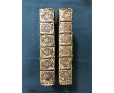
Camden, William. Camden's Britannia Abridg'd; with Improvements, and Continuations, to this present time, 2 volumes, 2 engraved portrait frontispieces, 59 [of 61] folding engraved maps, occasional spotting, contemporary crushed morocco gilt, rubbed, bookplates of Rt. Hon. Francis L. Brooke and Elwin Millard, 8vo, London: Joseph Wils, 1701 [Chubb CXX] A FINE COPY. This copy lacks the maps of Middlesex and Northumberland, but includes the Map of Jersey, not called for by Chubb.

Lot 79
Cary, John. Cary's New Itinerary: or An Accurate Delineation of the Great Roads, Both Direct and Cross throughout England and Wales, eleventh edition, 6 folding engraved maps, without general folding map, title repaired, contemporary red roan, spine repaired, 8vo, London: G. and J. Cary, 1828; and 9 others, British topography, v.s. (10)
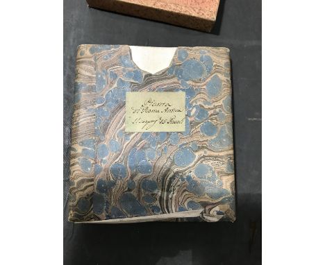
![[Debes, Lucas Jacobson] Faeroe, & Faeroa Reserata: That is a Description of the Islands and Inhabitants of Foeroe: Being](https://cdn.globalauctionplatform.com/6f903f01-b92e-4753-bb9b-ac1f003aa4c3/af2dc4f0-877c-49c1-a066-ac1f0180d13a/468x382.jpg)
Lot 80
[Debes, Lucas Jacobson] Faeroe, & Faeroa Reserata: That is a Description of the Islands and Inhabitants of Foeroe: Being Seventeen Islands subject to the King of Denmark... Englished By J.[ohn] S.[torpin], first edition in English, folding engraved map, folding engraved plate of a whirlpool, woodcut, some browning and spotting, seventeenth century calf, extremities rubbed, rebacked, new endpapers, 12mo, London: William Iles, 1676 [Wing D511] PROVENANCE: Admiral Davidge Gould (1758-1847), with his signature to title. Admiral Davidge Gould was a distinguished Royal Naval officer, born at Sharpham Park near Bridgwater, Somerset. He was one of Lord Nelson's Band of Brothers at the Battle of the Nile in 1798 and served in the American Revolutionary, French Revolutionary and Napoleonic Wars.
Lot 81
Dillon, John Talbot. Travels through Spain, with a view to illustrate the Natural History and Physical Geography of that Kingdom, first edition, engraved portrait frontispiece, engraved dedication leaf, folding engraved map, 6 engraved plates, 2 folding, engraved tail-piece, light offsetting, occasional spotting, nineteenth century half calf, spine defective, upper board loose, 4to, London: G. Robinson, 1780
Lot 83
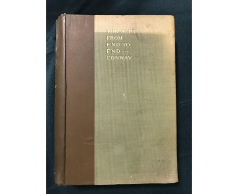
Edwards, Amelia B. Untrodden Peaks and Unfrequented Valleys, second edition, folding map, illustrations, original publisher's pictorial cloth gilt, all edges gilt, 8vo, London: George Routledge, 1890; Conway, William Martin. The Alps from End to End, half-title, plates, original cloth, boards sunned, 8vo, London: Archibald Constable and Co., 1895 (2)
Lot 92
Redford, George. The History of the Ancient Town and Borough of Uxbridge, first edition, 7 aquatint plates and 3 wood-engraved, later half calf by Zaehnsdorf, 8vo, Uxbridge: For the Authors, 1818; Barber, Thomas. Picturesque Illustrations of the Isle of Wight, engraved title, folding engraved map, split along fold, 40 engraved plates, some browning, contemporary half morocco gilt, rubbed, 8vo, London: Simpkin Marshall, [1834]; and 7 others topography, v.s. (9)


Lot 53
18th Century map "Broad Street & Cornhill Wards divided into parishes according to a new survey", 23.5cm x 18cm, housed in a silvered glazed frame, later coloured map of Kent published by Alexander Hogg, 22cm x 12cm, housed in a gilt glazed frame, later coloured wood engraving "London Bridge 1756", housed in a gilt glazed frame (3)


Lot 427
A COLLECTION OF VARIOUS 19TH CENTURY AND LATER DECORATIVE PRINTS AND WATERCOLOURS a reproduction map of France, a small watercolour of a girl with her broken doll signed Mary Smith 1903, a watercolour coastal view by David Woodrow, a late 18th century print after Bunbury 'Patty' etc (12) Condition: mixed condition overall, all but one framed


Lot 440
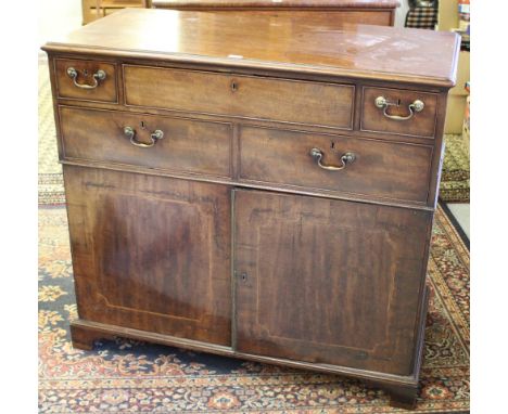
An unusual George III mahogany secretaire map or plan chest (possibly made in Whitehaven), the moulded rectangular top above a central secretaire drawer with brass button release, opening to reveal the internal pigeon holes and drawers, flanked by two short end drawers and over two larger drawers, the lower stage with inlaid panelled doors opening and closing on a steel mechanism and enclosing slides, raised on bracket feet 109cm x 120cm x 58.5cm marks and scratches, veneer splits to doors, some minor losses, old worm damage to base.


Lot 300
Taylor (George) and Skinner (Andrew), Taylor & Skinner's Survey and Maps of the Roads of North Britain or Scotland, pub. London 1776, oblong folio with engraved frontspiece, general folding map of Scotland and sixty-one plates (plate 61 bound out of order between plates 6 and 7), in a modern cloth binding.

Lot 2092
A 1950's Esso Counter-Top Road Map Folder, with painted white lettering FOR HAPPY MOTORING IT PAYS TO SAY ESSO, containing thirty road maps printed by Edward Stanford 1951, the stand 45cm by 10cm by 46cm. The maps consist of eight Road Map No.7 for Northern Scotland, two Road Map No.1 for London, eight Road Map No.3 for South West and West England, six Road Map No.4 for Wales and Midlands, six Road Map No.2 for South and East.

Lot 2170
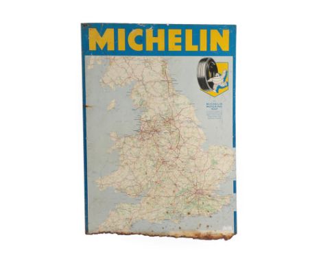
Michelin: A Single-Sided Aluminium Sign, of the Motoring Map of Great Britain (corroded); The New Motoring Encyclopaedia, parts 1-35 (excluding No.19), paperbacks; A Bound Volume the ICME Manual, 1934-1951; and A Quantity of Vintage Spares, to include spark plugs, car blubs, oil filters etc
-
109198 item(s)/page