We found 109198 price guide item(s) matching your search
There are 109198 lots that match your search criteria. Subscribe now to get instant access to the full price guide service.
Click here to subscribe- List
- Grid
-
109198 item(s)/page


Lot 27
Patteson (Rev. Edward). A General and Classical Atlas, Adapted to the Study of Ancient and Modern Geography, circa 1805, title page and advertisment, thirty-three (complete as list) engraved maps with contemporary outline colouring, each map faced with an uncoloured outline duplicate, several of the outline maps with juvenile pencil annotations, (map of Scotland with closed tear affecting image), contemporary half sheep, boards detached, rubbed and worn, 4to (1)
Lot 283
*Wiltshire. A Map of the South Part of the Parishes of Great Chiverell and Little Chiverell in the County of Wilts, by William Tubb, Salisbury, circa 1797, manuscript on vellum, conjoined along lower edge with A Map of the North Part of the Parishes of Great Chiverell and Little Chiverell in the County of Wilts, by William Tubb, Salisbury, circa 1797, together two manuscript plans on vellum with entries for field areas and landowners etc., first map torn with slight loss, dimensions approximately 68 x 55cm and 54 x 56.5cm respectively, attached to 29 leaves of neatly written manuscript relating to the division and enclosure of the area, rolled, plus other Wiltshire related ephemera, mostly 19th century, including printed reports for the Income & Expenditure of the Kennet and Avon Canal, 1820s-40s, and early 19th century probate documents etc. (a carton)
![Bible [English]. The Holy Bible, Containing the Old Testament and the New. Newly Translated out of the Originall Tongues...,](https://cdn.globalauctionplatform.com/bf7f6b51-c0bb-47e6-bf07-a5b100f98eec/93ac14e0-6ed3-4e01-c70b-c877e35cbe10/468x382.jpg)
Lot 293
Bible [English]. The Holy Bible, Containing the Old Testament and the New. Newly Translated out of the Originall Tongues..., Imprinted at London by Bonham Norton and John Bill, 1628, general and New Testament titles present, each within decorative woodcut borders, Apocrypha present, double-column black letter text, some close trimming with occasional slight loss to printed marginal notes, some early annotations and inscriptions to verso of New Testament title and final leaf of Revelation, complete with Genealogies by John Speed, containing double-page woodcut map (torn to lower border with loss), contemporary inscription 'Joseph Harison 166-' to lower margin of page 13 of Genealogies (cropped at foot with consequent loss to inscription), bound with an incomplete Book of Common Prayer at front and Psalms at rear, some dust & finger soiling, occasional dampstains & few marks etc. throughout, lacking free endpapers, later sheep over earlier boards, crude reback, boards rubbed and scuffed, 4to Herbert 411. (1)

Lot 30
S.D.U.K. The Family Atlas Containing Eighty maps Constructed by Eminent Geographers and Engraved on Steel under the Superintendence of the Society for the Diffusion of Useful Knowledge, Including the Geological map of England and Wales by Sir R.I.Murchison, the Star Maps by Sir John Lubbock and the Plans of London and Paris..., published Edward Stanford, 1860, title page and contents, seventy-nine (of eighty) double page engraved maps with contemporary hand colouring, lacking map 75 (star map of the North Pole), gutter percha partially perished with a few maps detached, a.e.g., hinges weak and cracked, contemporary half morocco gilt, worn and frayed, folio (1)
Lot 316
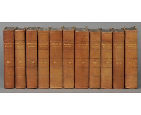
Gentleman's Magazine, Or, Monthly Intelligencer, 151 vols. bound in 259, a near-complete run, 1731-1886, only lacking 1843 part 2, 1868 part 1 and 1886 part 2, volumes from 1783 onwards each bound in two parts, numerous copper-engraved maps and plates (a few close-trimmed), wood-engraved illustrations, a few repaired tears, some occasional spotting and offsetting, a few leaves loosening, bookplates of the Library of the Yorkshire Archaeological Society at front of each volume, 1731-1834 bound in contemporary brown half calf (each neatly rebacked), 1835 onwards mostly bound in navy half calf (rubbed with some covers detached), together with A List of Plates, Maps &c. Contained in the Gentleman's Magazine, from the Year 1731 to 1813 Inclusive, 1814; General Index to Fifty-Six Volumes of the Gentleman's Magazine, from its Commencement in the Year 1731, to the End of 1786, Compiled by Samuel Ayscough, 2 volumes, 1818, and Index to the Biographical and Obituary Notices in the Gentleman's Magazine from 1731 to 1780, 3 vols, 1886-91 Contains sixty-four of the required sixty-nine American maps, as listed in David Jolly's 'Maps of America in Periodicals Before 1800', lacking 'An Accurate Map of the West Indies...' and 'A New Map or Chart of the Western or Atlantic Ocean...' (both in volume 10, 1740), 'A New Chart of the Coast of New England...' (volume 16, 1746), 'South America Drawn from the Best Maps...' (volume 32, 1749) and 'Sketch of the Country Illustrating the Late Engagement in Long Island' (volume 46, 1776). The Gentleman's Magazine, founded by Edward Cave, was a long-standing periodical, running from 1731 to 1922, and includes the first British printing of the US Declaration of Independence (volume 46, 1776), the US Constitution (volume 57, part II, 1787), early works by Samuel Johnson, among other scientific, philosophical, artistic and literary contributions. (265)
Lot 33
Teesdale (Henry & Co., publisher). A New General Atlas of the World, Compiled and Constructed with the Greatest Care from the Latest Government and other Approved Modern Surveys and Authorities, both English and Foreign..., 1848, double page printed title and contents, forty (only of 45) double page engraved maps with contemporary outline colouring (map of India folding), and a comparison plate, (lacking Eastern Hemisphere, Western Hemisphere, Ireland, Australia and the Colony of New South Wales, Van Dieman's Land), a few maps detached, some marginal finger and dust soiling, contemporary diced sheep, rear board detached, lacking spine, heavily rubbed and worn, folio Sold as a collection of maps, not subject to return. (1)
Lot 34
Thorn (Major William). Memoir of the War in India, Conducted by General Lord Lake, Commander-in-Chief, and Major-General Sir Arthur Wellesley, Duke of Wellington; From its Commencement in 1803, to its Termination in 1806, on the Banks of the Hyphasis, 1st ed., 1818, half title, folding engraved map with hand-colouring, eight engraved plans (seven hand-coloured), title with lower margin excised, some offsetting onto text leaves, occasional light spotting, contemporary half calf, upper board and spine detached, rubbed, 4to (1)
Lot 35
Weston (Rev. Walter). Mountaineering and Exploration in the Japanese Alps, 1st ed., 1896, two folding maps, half-tone illustrations, light spotting front and rear, bookplate of Viscount Southwell, original cloth gilt, some fading and stains, 8vo (Neate W45), together with Whymper (Edward), The Ascent of the Matterhorn, 1st ed., 1880, two folding maps, illustrations, light spotting, Barking Book Club label at front, front hinge a little tender, residue to pastedowns from label removal, original blue cloth gilt, edges rubbed, a few stains, 8vo (Neate W65, abridged edition, originally published as 'Scrambles Amongst the Alps' in 1871), plus Stutfield (Hugh E.M. & J. Norman Collie), Climbs & Explorations in the Canadian Alps, 1st ed., 1903, folding map, half-tone illustrations, previous owner inscription at front, original cloth, 8vo (Neate S177), with two others: William Spotswood Green's The High Alps of New Zealand, 1883, and Among the Selkirk Glaciers, 1890 (5)
Lot 350
Fuller (Thomas). The Historie of the Holy Warre, 2nd edition, Cambridge, 1640, title printed within decorative typographical border, some soiling and old damp staining, lacks frontispiece and map, contemporary calf, some wear and boards detached, together with Pearson (John), An Exposition of the Creed, 3rd revised and enlarged edition, 1669, title printed in red and black, contemporary calf, rubbed and some wear to extremities, plus Hammond (Henry), A Paraphrase and Annotations upon the Books of the Psalms, 1659, title printed in red and black with engraved vignette, old armorial bookplate to front pastedown, some soiling, inner upper hinge crudely repaired with brown paper affecting margin of half-title, contemporary calf, some wear and covers near detached, all folio, plus other 17th-century theology folios, generally worn and with some defects (20)
Lot 360
Beattie (William). Switzerland. Illustrated in a Series of Views Taken Expressly for this Work by W.H. Bartlett, 2 vols., 1836, additional engraved titles, 108 engraved views, folding map, scattered light spotting, bookplates of E.H. Greenly, contemporary half morocco, a little rubbed, 4to, together with The Waldenses or Protestant Valleys of Piedmont, Dauphiny, and the Ban de la Roche, 1838, portrait frontispiece, additional engraved title, 70 engraved views, folding map, some spotting, uniformly bound as above, 4to (3)
Lot 378
Gastineau (Henry). Wales Illustrated, in a Series of Views, Comprising the Picturesque Scenery, Towns, Castles, Seats of Nobility & Gentry, Antiquities &c, 1830, engraved title, 176 engraved views on 88 sheets, scattered light spotting, signature and bookplate of E.H. Greenly, contemporary green half calf, joints cracking, a little rubbed, 4to, together with Roscoe (Thomas), Wanderings and Excursions in North Wales/South Wales, 2 vols., 1844, half title and folding map to each, 100 engraved plates, including additional titles, scattered spotting, bookplates, all edges gilt, contemporary presentation inscription to North Wales half title, contemporary terracotta morocco gilt, spines faded, a little rubbed, 8vo (3)
Lot 380
Gillies (John). The History of Ancient Greece, its Colonies, and Conquests; From the Earliest Accounts till the Division of the Macedonian Empire in the East. Including the Literature, Philosophy, and the Fine Arts, 2 vols., 1st ed., 1786, folding engraved map frontispiece to each (volume II map close-trimmed at top margin just shaving headline), some offsetting to titles, scattered light spotting, bookplates and ownership signature of E.H. Greenly, contemporary calf, joints cracked, spines and edges rubbed, 4to (2)
Lot 39
Brannon (George). Vectis Scenery: or, a Series of 26 Well-known Views, Exhibiting the Picturesque Beauties, Local Peculiarities, and General Aspect of the Isle of Wight..., a New and Improved Edition, to which have been added, a Concise Topographical Description of the Island, and Itinerary Guide, &c., Published by the engraver, Southampton, 1824, engraved map, twenty-six engraved plates (view of East Cowes Castle cropped to blank margin, detached and slightly ink stained), some spotting and dust-soiling mostly to margins, free endpapers renewed, original boards, covers detached, torn and worn, lacking spine, oblong 4to, together with View Book, Picturesque Scenery in North Wales, Carnarvon: H. Humphreys, circa 1850, decorative title and 33 engraved plates (some with multiple views to each), all edges gilt, lightly dust-soiled, oblong 8vo, with Lake and Mountain Scenery, Westmorland and Cumberland, from Drawings on the Spot, by T. Allom and G. Pickering, circa 1850, 30 engraved plates (frontispiece & one other plate loose), all edges gilt, original cloth, extremities rubbed, oblong 8vo, plus Gastineau (Henry), Wales Illustrated in a Series of Views..., 1830, engraved title and numerous plates, some dust-soiling and spotting, contemporary cloth, covers detached, 4to (4)
Lot 390
Laborde (Leon de). Journey through Arabia Petraea, to Mount Sinai, and the Excavated City of Petra, the Edom of the Prophecies, 1st English ed., 1836, m folding engraved map, plates and illustrations, some spotting and offsetting, contemporary calf gilt, spine a little rubbed, 8vo, together with A History of the Eastern Roman Empire. From the Fall of Irene to the Accession of Basil I. (A.D. 802-867), by J.B. Bury, 1st ed., 1912, advertisement leaf at end, light toning and owner inscription to front endpaper, untrimmed, original blue cloth, a few minor marks, 8vo, plus The Ancient History of the Near East. From the Earliest Times to the Battle of Salamis, by H.R. Hall, 1st ed., 1913, maps and illustrations, publisher's list at end, half title toned, previous owner signatures, original cloth, spine and extremities faded, 8vo, with four others including Vincent Smith's Akbar the Great Mogul 1542-1605, 2nd ed., 1919 and A.V. Williams Jackson's Persia, Past and Present, 1909 reprint (7)
Lot 392
Lewis (Samuel). A Topographical Dictionary of Wales, 2 vols., 1833, folding engraved map, 12 single-page engraved maps, some spotting and offsetting, original green cloth, spines browned and split along joints, 4to, together with An Historical Account of the City of Hereford. With some Remarks on the River Wye, and the Natural and Artificial Beauties Contiguous to its Banks, from Brobery to Wilton, by John Price, Hereford, 1796, seven engraved plates, occasional spotting and toning, manuscript inscription at front, contemporary half vellum, shelf number to spine, a little soiled, 8vo, plus Topographical and Statistical Description of North Wales/South Wales, by G.A. Cooke, 2 vols. in one, c. 1800, wood-engraved frontispiece and additional titles, two folding hand-coloured engraved maps, eight engraved plates on four sheets, some offsetting and light spotting, original cloth, spine label chipped, head of spine torn, 12mo, with other Herefordshire and Wales related including George Strong's The Heraldry of Herefordshire, 1848, Ella Mary Leather's The Folk-Lore of Herefordshire, 1912 (2 copies), William Owen's The Cambrian Biography: Or Historical Notices of Celebrated Man among the Ancient Britons, 1803, W. Howells' Cambrian Superstitions..., 1831 and A.T. Bannister's The Place-Names of Herefordshire, 1916 (32)
Lot 396
Maurice (Thomas). The History of Hindostan; its Arts, and its Sciences, as Connected with the History of the Other Great Empires of Asia, During the Most Ancient Periods of the World, 4 vols., 1st ed., 1795-1809, without the Supplement of 1810 at end of second volume of the Modern History of Hindostan, 19 engraved plates, folding hand-coloured map, some occasional spotting, offsetting and toning, ownership signature of Elizabeth Browne Greenly and bookplates of E.H. Greenly, rebound in uniform contemporary half calf (originally vellum-bound), volume I joints cracking, spines rubbed, 4to Provenance: A one page manuscript letter, adhered at front of volume I, to Elizabeth Greenly from Thomas Maurice, dated 5 July, 1798, thanking her for her subscription to his work on India and asking her to accept his elegy to his late friend Sir William Jones (1795), and his new poem 'The Crisis' (1798). (4)
Lot 401
Murchison (Roderick Impey). The Silurian System, Founded on Geological Researches in the Counties of Salop, Hereford, Radnor, Montgomery, Caermarthen, Brecon, Pembroke, Monmouth, Gloucester, Worcester, and Stafford: With Descriptions of the Coal-Fields and Overlying Formations, 2 parts in one, 1st ed., 1839, 56 engraved and lithographed maps and plates, including nine hand-coloured folding sections, without the rare separate three-sheet geological map as usual, occasional light spotting and offsetting, bookplate of E.H. Greenly, contemporary half calf, a little rubbed, 4to (1)
Lot 408
Salmon (Thomas). A New Geographical and Historical Grammar..., 3rd ed., with very great Additions and Improvements, 1754, half title, title printed in red and black, 22 folding engraved maps and one engraved plate by Thomas Jefferys, world map torn without loss, some offsetting and scattered light spotting, one or two short closed tears, previous owner signature of E. Brown, 1765, bookplate of E.H. Greenly, contemporary calf gilt, upper joint a little cracked, some edge wear, 8vo (1)
Lot 410
Shepherd (Thomas H. & John Britton). Bath and Bristol, with the Counties of Somerset and Gloucester. Displayed in a Series of Views; Including the Modern Improvements, Picturesque Scenery, Antiquities &c., 1829, additional engraved title, 48 engraved views on 24 sheets, bound with Devonshire & Cornwall Illustrated, from Original Drawings by Thomas Allom, W.H. Bartlett &c., 1832, additional engraved title, engraved map, 92 engraved views on 46 sheets, bound with Cornwall Illustrated, in a Series of Views, 1831, engraved map, 44 engraved views on 22 sheets, some scattered spotting, previous owner signature of E.H. Greenly to first title, his bookplate, contemporary half calf, spine rubbed and faded, 4to (1)
Lot 43
Bullar (John). A Historical and Picturesque Guide to the Isle of Wight, 4th edition, Southampton: Printed by T. Baker, 1818, engraved frontispiece, annotation to upper margin of page 65, some spotting, contemporary cloth, spine torn at head & foot, 12mo in 6s, together with Phillips (C.J.), The New Forest Handbook: Historical and Descriptive, Lyndhurst: J.G. Short, [1876], folding lithograph map frontispiece, ten mounted albumen photograph plates by J.G. Short, title reattached, title and plates with removed ink stamp to verso, all edges gilt, original green cloth with blocked decoration in gilt and black, 8vo, with Wise (John R.), The New Forest: its History and its Scenery, 1st edition, 1863, black & white frontispiece and vignette illustrations, all edges gilt, original green cloth, with gilt blocked decoration, slightly frayed at head & foot of spine, 4to, and White (William), History, Gazetteer, and Directory of Hampshire and the Isle of Wight..., Sheffield: Printed for the Author, by Robt. Leader, 1859, one leaf detached, original blind decorated brown cloth, slightly frayed to upper joint and head & foot of spine, 8vo, and Fowler (Sir James K.), A History of Beaulieu Abbey, A.D. 1204-1539, London: The Car Illustrated, [1911], black & white plates and folding plans, half-title inscribed 'P. Clare Bestwishes Montagu of Beaulieu, Christmas 1955,' with loosely inserted typed letter signed from Montagu of Beaulieu to Mr Clare dated 20.12.55, original cloth gilt, 8vo, plus Van Raalte (Charles), Brownsea Island, 1906, colour frontispiece and plates by Florence Van Raalte, top edge gilt, original cloth gilt, spine faded, 4to, plus other Isle of Wight and Hampshire related, including Victoria County History, Hampshire and the Isle of Wight, 6 vols. including index, 1900-1914, numerous black & white plates and folding plans etc., top edge gilt, original red cloth gilt, spines faded, folio (approx. 30)
Lot 44
[Bullar, John]. A Companion in a Tour Round Southampton: Comprehending Various Particulars, Ancient and Modern, of New-Forest, Lymington, Christchurch, Romsey, Bishop's Waltham, Titchfield, &c, and a Tour of the Isle of Wight: with Notices of the Villages, Gentlemen's Seats, Curiosities, Antiquities, &c, Occurring in the different Roads described, 2nd edition, Improved and Enlarged, Southampton: Printed & sold by T. Baker, 1801, edges untrimmed, early 20th century calf, gilt decorated spine with red morocco title label, 12mo in 6s, together with Bullar (John), A Companion in a Tour Round Southampton..., 4th edition, improved & enlarged, Southampton, 1819, hand-coloured folding engraved map frontispiece, contemporary calf, gilt decorated spine, joints rubbed, 12mo in 6s, with Cooke (William), A New Picture of the Isle of Wight..., To which are prefixed, an Introductory Account of the Island and a Voyage round its Coast, 2nd edition, with Improvements, Published Southampton & London, 1813, double-page hand-coloured engraved map (torn to central fold and repaired), thirty-six engraved plates (including frontispiece, & one double-page), some spotting & offsetting, contemporary half calf, upper board detached and lower joint split, 8vo, and Gilpin (William), Remarks on Forest Scenery, and other Woodland Views..., 2 vols., 2nd edition, 1794, hand-coloured double-page engraved map, 28 etched plates (including sepia aquatint views), leaf I4 in vol. 2 torn to lower outer corner with loss of text, and N1 with repaired long horizontal closed tear, occasional spotting and offsetting, contemporary half calf, gilt and blind decorated spines, 8vo, plus Bullar (John), A Companion in a Visit to Netley Abbey: To which is Annexed, Mr. Keate's Elegy, 2nd edition, Southampton, 1807, engraved frontispiece, 20th century half calf, 12mo in 6s (6)
Lot 46
Gilpin (William). Remarks on Forest Scenery, and other Woodland Views..., Illustrated by the Scenes of New-Forest in Hampshire, 3 parts in 2 vols., 1st edition, 1791, half-titles, 31 etched plates (including tinted aquatint views), double-page hand-coloured etched map, all edges gilt, contemporary straight grain red morocco gilt, 8vo, together with Smith (Horace), The New Forest. By the author of 'Brambletye House', 3 volumes, 1829, contemporary quarter calf gilt, some wear to spines, 8vo, with Britton (John & Brayley, Edward W.), The Beauties of England and Wales..., vol. 6 only (Hampshire), 1805, numerous engraved plates, contemporary inscription to titles, top edge gilt, remainder untrimmed, late 19th century red half morocco by Zaehnsdorf, gilt decorated spines, rubbed, some wear & marks, 8vo, with New Forest, An Abstract of all the Claims on the New Forest, in the County of Southampton, entered at the Lord Chief Justice in Eyre's Court, Adjourned from the Swainmote Court, held at Lyndhurst, the 27th of June, ... and held at Winton, the 29th day of September, 1670, Salisbury: printed by Benj. Cha. Collins and J. Johnson, for the author, 1776, original wrappers, spine repaired, 8vo, plus Chafin (William), A Second Edition of the Anecdotes and History of Cranbourn Chase..., to which are added, some scenes in, and anecdotes of Windsor Forest, 1818, engraved frontispiece (spotted & stained), some spotting throughout, edges untrimmed, original boards, modern cloth spine, boards worn, 8vo (9)
Lot 469
Somerset (FitzRoy, First Baron Raglan, 1788-1855). Letters from Head-Quarters, or, the Realities of the War in the Crimea, by an Officer on the Staff [Somerset John Gough Calthorpe], volume 1 (of 2) only, 1856, portrait frontispiece and 2 folding coloured plans, ownership signature of Second Baron Raglan to head of title and his bookplate to front pastedown with later Cefntilla family bookplate beneath, original cloth, some fraying to extremities and joints crudely repaired, together with Torrens (Henry), Field Exercise and Evolutions of the Army, 1824, 12 folding engraved plates at rear, author's presentation inscription to Lady Fitzroy Somerset (wife of First Baron Raglan) dated 1824 at head of title, later family library bookplate to front free endpaper, all edges gilt, contemporary diced calf, upper cover detached and backstrip deficient, plus Paget (George), The Light Cavalry Brigade in the Crimea , 1881, lacks map, some spotting and old dampstaining, presentation inscription to George Fitzroy Henry Somerset on his birthday 18th September 1881 from his aunt, original cloth, inner hinges weak, covers damp stained and lower joint frayed, all 8vo, plus other mostly military and Crimea interest and many with Raglan family bookplates (17)
Lot 47
Gilpin (William). Remarks on Forest Scenery, and other Woodland Views..., Illustrated by the Scenes of New Forest in Hampshire, 3 parts in 2 vols., 3rd edition, 1808, half-titles, 31 etched plates (of 32, lacks plate 10), including hand-coloured double-page map and numerous sepia aquatint views, occasional spotting and some dampstaining, edges untrimmed, armorial bookplate of Henry D. Gilpin to upper pastedowns, lacking free endpapers, modern green half roan, 8vo, together with Observations on the Western Parts of England..., To which are Added, a few remarks on the Picturesque Beauties of the Isle of Wight, 1798, ink name stamp of Comte de Ludolf to lower blank margin of title, twelve sepia etched plates only (of 18), occasional spotting and browning, repaired closed tear to P2, modern green roan, 8vo, plus seven other topography & antiquarian related, including a Treatise of the Roman Ports and Forts in Kent, by William Somner, Oxford, 1693, lacking portrait frontispiece, contemporary calf, worn, 8vo (10)
Lot 479
Hampshire. The New Forest, by Mrs. Willingham Rawnsley, Deluxe edition, London: Adam & Charles Black, 1904, numerous colour plates, spotting throughout, top edge gilt, remainder untrimmed, original decorative cream cloth, spine discoloured & rubbed, large 4to, (limited edition 27/100, signed by Alice Julia Rawnsley), together with Wise (John R.), The New Forest, Its History and its Scenery, 3rd edition, 1880, black & white frontispiece, illustrations and folding map, original gilt decorated green cloth, 8vo, together with Cornish (C.J.), The New Forest, 1894, black & white plates, jmodern cloth, 8vo, and Reports from Commissioners..., Woods and Forests, Harbours, Railway and Canal Bills, Local Acts, Session 3 December 1857-2 August 1858, vol. 31, 1857-58, eight lithograph maps only (some folding), contemporary half calf, folio, plus Report from the Select Committee on New Forest; together with the Proceedings of the Committee, Minutes of Evidence, and Appendix, 1875, contemporary cloth, spine torn, folio, plus other Hampshire related including three early 20th century albums containing photographs, newspaper cuttings and postcards relating to Hampshire, plus Hampshire related pamphlets etc. (4 cartons)
Lot 5
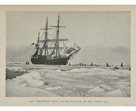
Bernacchi (Louis). To the South Polar Regions. Expedition of 1898-1900, first edition, "Colonial issue", London: Hurst and Blackett, 1901, black & white frontispiece and plates (including folding panorama), single-page plan, folding map of Victoria Land loosely inserted at rear with repaired closed tears, lacking map of South Polar Regions, ownership inscription to half-title, occasional spotting, lacking front free endpaper, original red 'Colonial issue' cloth, spine faded, joints and extremities frayed, slightly marked, 8vo, (Spence 124), together Borchgrevink (C.E.), First on the Antarctic Continent, being an Account of the British Antarctic Expedition 1898-1900, 1st edition, 1901, photogravure portrait frontispiece, black & white plates & illustrations, three folding colour maps at end, publisher's advertisements at rear, manuscript ownership to front free endpaper, original red cloth gilt, spine faded and frayed at head & foot, 8vo, with Maury (M.F.), The Physical Geography of the Sea, and its Meterorology. Being a Reconstruction and Enlargement of the Eighth Edition of "The Physical Geography of the Sea", 1st ed., 1860, fourteen engraved maps and tables at rear (of 16, mostly folding, few with closed tears), some dampstaining, approximately 14 leaves torn at head with occasional loss of text, flowing diagonal signature of the Swedish Polar explorer & geologist Otto Gustaf Nordenskj”ld (1869-1928) to title, written whilst in the Royal Swedish Navy, later endpapers, original cloth, crudely rebacked preserving original spine, 8vo, plus other Polar related & miscellaneous etc. (9)
Lot 51
Kelly's Directory of Dorsetshire, 1885, folding map (split along one fold), advertisements, a few spots, original red cloth gilt, spine faded, 8vo, together with Brownsea Island, by Charles Van Raalte, with illustrations by Florence Van Raalte, 1906, colour illustrations, light toning to endpapers, top edge gilt, original cloth, edges slightly rubbed, 4to, inscribed by Florence Van Raalte, with four other including C.E. Robinson's A Royal Warren or Picturesque Rambles in the Isle of Purbeck, 1882 and Sir Meron Russell-Cotes' Home and Abroad, 1921 (7)
Lot 52
Lewis (Percival). Historical Inquiries, Concerning Forests and Forest Laws, with Topographical Remarks, upon the Ancient and Modern State of The New Forest, in the County of Southampton, 1811, half-title, engraved frontispiece by C. Sherringham, hand-coloured folding engraved map, edges untrimmed, armorial bookplate of John Hiley Austen to upper pastedown, original cloth backed boards, manuscript paper title label to spine, frayed and worn at head & foot of spine, 4to (1)
Lot 543
Johnston (George). Christianity Older than the Creaton or, THe Gospel the Same with Natural Religion, J. Noon, 1733, 80pp, bound withFancourt (Samuel), An Essay Concerning Liberty, Grace and Prescience, R. Ford et al, 1729, 148pp, bound with other two other 18th century sermons, scattered spotting and slight damp-stianing, bookplate of Charles Grave Hudson to upper pastedown, contemporary paneled calf, worn and slightly scuffed, 8vo, together with Biblia Sacra, vulgatae editionis..., edito nova, Paris: Jacob Vincent, 1741, title printed in red and black, folding engraved map, slight scattered spotting, contemporary marbled calf, rubbed and worn, spine deficient, contents slightly shaken, thick 8vo, plus other similar 18th and 19th century titles, all in contemporary leather, some worn, few odd volumes (6 shelves)
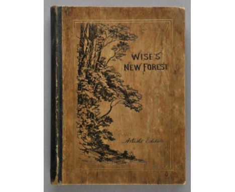
Lot 55
Sumner (Heywood, illust.). The New Forest, Its History and its Scenery, by John R. Wise, Artist's Edition, London: Henry Sotheran & Co., 1883, twelve etched plates by Heywood Sumner, 63 illustrations on india paper by Walter Crane, engraved by W.J. Linton (including frontispiece), two map illustrations on india paper, top edge gilt, remainder untrimmed, original quarter morocco gilt with wood veneer covered boards, blocked pictorial title to upper board, joints slightly rubbed, folio, (Limited edition 24/50), together with Sumner (Heywood), The Book of Gorley, Printed at The Chiswick Press, 1910, hand-coloured frontispiece, black & white illustrations, top edge gilt, remainder untrimmed, original green cloth gilt, small folio, (Limited signed edition 20/25, with frontispiece coloured by Heywood Sumner), with The Ancient Eartworks of Cranborne Chase, London: Chiswick Press, 1913, numerous black & white plans and maps (including double-page & folding), occasional spotting, top edge gilt, remainder untrimmed, original cloth in slightly torn dust jacket, small folio, (limited signed edition 123/200), plus Excavations in New Forest Roman Pottery Sites..., London: Chiswick Press, 1927, black & white plates & plans (few folding), edges untrimmed, with loosely inserted autograph letter signed by Heywood Sumner, original cloth in dust jacket, 8vo (4)
Lot 56
Sumner (Heywood, illust.). The New Forest, Its History and its Scenery, by John R. Wise, Artist's Edition, London: Henry Sotheran & Co., 1883, 12 etched plates by Heywood Sumner, 63 illustrations on india paper by Walter Crane, engraved by W. J. Linton (including frontispiece), two engraved map illustrations on india paper, top edge gilt, remainder untrimmed, original quarter morocco, wood veneer covered boards with blocked pictorial title to upper board, some wear to extremities, torn at head of spine, folio, (limited edition 216/350), together with The Ancient Earthworks of the New Forest..., London: Chiswick Press, 1917, black & white plates, illustrations & folding map by Heywood Sumner, top edge gilt, remainder untrimmed, original cloth with blocked decoration in black to upper board, small folio, (limited signed edition 98/200), with The Avon, From Naseby to Tewkesbury, 1882, 12 etched plates by Sumner, black & white illustrations, endpapers renewed, original gilt & blind decorated cloth, spine discreetly strengthened, folio, and The Book of Gorley, London: Chiswick Press, 1910, black & white frontispiece, illustrations and double-page map, marbled endpapers, original cloth, small folio, plus other topography, archaeology & literature books illustrated and by Heywood Sumner, including Cinderella: A Fairy Opera in Four Acts, Composed by John Farmer, [1882], Undine, A Romance, Translated from the German of Delamotte Fouque, 1888, Sintram and His Companions, A Romance translated from the German of Delamotte Fouque, 1883 (26)
Lot 57
Vancouver (Charles). General View of the Agriculture of Hampshire, INcluding the Isle of Wight. Drawn up for the Consideration of the Board of Agriculture and Internal Improvement, 1813, engraved folding map frontispiece, 12 engraved plates (one folding), and 10 folding tables, some spotting and offsetting, contemporary half calf, slight wear to joints and extremities, 8vo, together with [Hampshire], The Annual Hampshire Repository; or, Historical, Economical, and Literary Miscellany; A Provincial Work, of entirely original Materials, Comprising all Matters relating to the County, including the Isle of Wight, &c., 2 vols., Winchester: Printed by Robbins, [1799-1801], four engraved plates (including two folding, one hand-coloured), two folding tables, 20th century half calf, 8vo, with Gilpin (William), Remarks on Forest Scenery..., 2 vols., 3rd edition, 1808, numerous etched and sepia aquatint plates, contemporary diced calf, gilt decorated spines, joints cracked and some wear, 8vo, plus [Oldfield, Thomas Hinton Burley], An Entire and Complete History, Political and Personal, of the Boroughs of Great Britain..., 2 vols., 1792, library stamps and labels to titles, edges untrimmed, early 20th century cloth gilt, library classification to spines, 8vo, plus four other Hampshire related including The New Forest: Its History and its Scenery, by John R. Wise, 1863 (12)
Lot 59
Warner (Richard). Collections for the History of Hampshire, and the Bishopric of Winchester: Including the Isles of Wight, Jersey, Guernsey and Sarke, by D.Y., 5 vols. (all published) in three, [1795], folding engraved map, 60 engraved and aquatinted plates and portraits, including two hand-coloured, lacking 'Plan of the Form of Jersey' as usual, few woodcut illustrations, includes Domesday portion (sometimes deficient), spotting and offsetting, armorial bookplate of Baron Haldon of Haldon House, nr. Exeter, Devon, upper hinge to vol. 1 repaired, contemporary diced calf, rebacked, 4to, (Only 250 copies printed), together with Warner (Richard, Junior), Hampshire Extracted from Domes-Day Book..., To which is Added a Glossary, Explanatory of the Obscure and Obsolete Words, 1789, contemporary calf, old reback, joints cracked, some wear to spine, 4to (4)
Lot 61
Woodward (B.B., Wilks, Theodore, & Lockhart, Charles). A General History of Hampshire, or the County of Southampton, including the Isle of Wight, 3 vols., circa 1860s, engraved frontispiece and additional engraved title to each, 2 single-page map, numerous engraved plates, closed tears to letterpress title of vol. 1, some spotting, all edges gilt, armorial bookplate of Wellington College, all edges gilt, contemporary red half morocco, gilt decorated spines with library classification mark at foot of spines, rubbed and some wear, 4to, together with Klitz (Philip), Sketches of Life, Character, and Scenery in the New Forest..., 1850, contemporary ownership to title, original cloth gilt, some fading, 8vo, with Wise (John R.), The New Forest: Its History and its Scenery, 1867, black & white frontispiece, illustrations and folding map, original gilt and blind decorated green cloth, 8vo, plus other New Forest and Hampshire related (approx. 50)
![Americas. Hondius (Jodocus), America, published Amsterdam, [1630], hand coloured engraved map, inset view of a scene of Brazi](https://cdn.globalauctionplatform.com/bf7f6b51-c0bb-47e6-bf07-a5b100f98eec/a864eefe-08d7-4ffa-e30d-4c2d8a65fcb4/468x382.jpg)
Lot 80
Americas. Hondius (Jodocus), America, published Amsterdam, [1630], hand coloured engraved map, inset view of a scene of Brazilian native Indians brewing and drinking, one professionally repaired closed tear just affecting image, 375 x 500 mm P.Burden. The Mapping of North America. no.150. (1)
Lot 83
Asia Minor. Blaeu (Johannes), Natolia quae olim Asia Minor, published Amsterdam, circa 1645, engraved map with contemporary outline colouring, slight overall toning, 385 x 500 mm, Latin text on verso, together with, Ortelius (Abraham), Natoliae quae olim Asia Minor nova descriptio, [1612], uncoloured engraved map, 325 x 235 mm, Latin text on verso, with, Chatelain (Henri), Bosphore de Thrace. Vue De Constantinople Due Cote Du Bosphore [on sheet with] Aqueduc De Constantinople [and] Colomne De Pompee, published Paris, circa 1710, three uncoloured views on one sheet (as published), descriptive text to vertical margins, 375 x 435 mm, with one other similar (4)
![Berkshire. Simmons (Matthew), Barkeshire with some consining Townes, [1625 or later], uncoloured map engraved by J Van Langer](https://cdn.globalauctionplatform.com/bf7f6b51-c0bb-47e6-bf07-a5b100f98eec/ff67b70a-290f-4b7b-d5bb-243565e13a0c/468x382.jpg)
Lot 86
Berkshire. Simmons (Matthew), Barkeshire with some consining Townes, [1625 or later], uncoloured map engraved by J Van Langeren, some soiling, wear and slight loss to margins, strengthened on verso, 110 x 100 mm, together with, Van den Keere (Pieter), Connack Millaria Anglicana, circa 1627, hand coloured map, 85 x 120 mm, English text on verso, with, Gibson (John), Somersetshire, [1759], uncoloured engraved miniature map, 65 x 110 mm, plus, Belfast Ropework Company Ltd, Brass measuring scale, circa 1910, brass and wood sliding measuring scale, calibrated with the measurements for rope, wire, tared hemp and Manilla coils, 120 x 45 mm, with a pewter medal showing the two hemispheres of the world, diameter 50 mm, and, Jaques & Son Ltd (publishers), The Counties of England. A Geographical Game, 2nd. series, circa 1910, forty-eight (complete as key card) colour printed cards, contained in publisher's card slipcase with printed label to upper board, a little worn and frayed (6)
![*Bohemia. Speed (John), Bohemia Newly described..., published Richard Chiswell & Thomas Bassett, [1676], hand coloured engrav](https://cdn.globalauctionplatform.com/bf7f6b51-c0bb-47e6-bf07-a5b100f98eec/7296e059-520e-4e10-87e3-feb047a18ceb/468x382.jpg)
Lot 88
*Bohemia. Speed (John), Bohemia Newly described..., published Richard Chiswell & Thomas Bassett, [1676], hand coloured engraved 'carte-a figure' map, ten costume vignettes to vertical margins and seven oval vignettes of principal cities to upper horizontal margin, very slight toning to central fold, 415 x 525 mm, mounted, framed and double glazed, English text on verso (1)
![British Isles. Ortelius (Abraham), Britannicarum Insularum Typus, [1595], uncoloured engraved map originally published in the](https://cdn.globalauctionplatform.com/bf7f6b51-c0bb-47e6-bf07-a5b100f98eec/c7edd945-c325-4c49-e0e3-db708d93ae11/468x382.jpg)
Lot 92
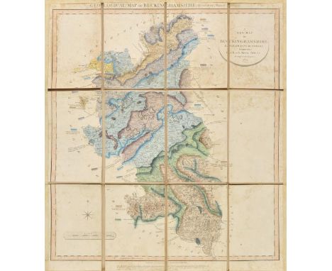
Buckinghamshire. Cary (John), A New Map of Buckinghamshire. Divided into Hundreds, Exhibiting its Roads, Rivers, Parks &c. [with secondary title above map] Geological Map of Buckinghamshire by W.S.Smith, Mineral Surveyor, 1824, engraved maps with contemporary hand colouring, sectionalised and laid on linen, some staining, margins strengthened on recto with old tape, 600 x 510 mm, contemporary blind stamped sheep boards with gilt title to upper siding, retaining old silk ties, worn and heavily frayed with slight loss at corners, together with, Stephenson (John), An Actual Survey of the Coast of Kent from Dim Church to Rye Harbour with the New Shoal to the Westward of Dungeness by John Stephenson a Master in the Royal Navy, published Robert Sayer, 1787, uncoloured engraved chart with two horizon profiles, old folds, 490 x 695 mm (2)
Lot 93
*Cambridgeshire. Bowen (Emanuel), An Accurate Map of Cambridgeshire Divided into its Hundreds, Drawn from Surveys, assissted by the most modern Maps, with variety of Improvements..., published Bowles & Carver, Laurie & Whittle and R.Wilkinson, circa 1794, engraved map with contemporary outline colouring and some later enhancement, near contemporary manuscript annotations to image, 700 x 520 mm, mounted, framed and glazed, together with, Blaeu (Johannes), Regiones Inundatae in sinibus Comitatus Norfolciae, Suffolciae, Cantabrigiae, Huntingtoniae, Northamtoniae et Lincolniae, circa 1648, engraved map with contemporary hand colouring, 440 x 550 mm, mounted (2)

Lot 94
*Cambridgeshire. Speed (John), Cambridgshire described with the devision of the hundreds the Townes situation with the Armes of the Colleges of that famous Universiti, published John Sudbury and George Humble, circa 1627, hand coloured engraved map, inset town plan of Cambridge, twenty-four heraldic shields to margins, slight creasing, 385 x 520 mm, mounted, framed and glazed (1)


Lot 10
Davis (John). Tracks of McKinlay and Party Across Australia. Edited from Mr. Davis's Manuscript Journal; with an Introductory View of the Recent Australian Explorations of the McDougall Stuart, Burke and Willis, Landsborough, etc., by William Westgarth, 1st ed., 1863, half title, folding map (repaired), 14 tinted lithographed plates (one or two margins a little frayed), a few light spots, later half calf, spine faded, label renewed, 8vo Ferguson 9005. (1)
Lot 100
Croatia. Blaeu (Johannes), Karstia, Carniola, Histria et Windorum Marchia, published Amsterdam, circa 1650, engraved map with contemporary outline colouring, two small worm holes to image, very slight staining to one margin, 385 x 500 mm, Dutch text on verso, together with, Cluverius (Philip), Veteris et Nova Pannoniae et Illyrici Descriptio, published Leiden, circa 1698, uncoloured engraved map, old folds, slight mount staining, 210 x 245 mm, with one other map similar (3)
Lot 101
Cumberland. Speed (John), Cumberland and the Ancient Citie Carlile Described with many Memorable Antiquities therein found observed, publisher Roger Rea, circa 1662, uncoloured engraved map, inset town plan of Carlisle, occasional marginal closed repaired tears, small library blind stamp to margin, 385 x 505 mm, English text on verso (1)
![*Denmark. Speed (John), The Kingdome of Denmarke, published Thomas Bassett & Richard Chiswell, [1676], hand coloured engraved](https://cdn.globalauctionplatform.com/bf7f6b51-c0bb-47e6-bf07-a5b100f98eec/0b8d7628-88db-4564-d3a3-688c5b2fc0f6/468x382.jpg)
Lot 103
*Denmark. Speed (John), The Kingdome of Denmarke, published Thomas Bassett & Richard Chiswell, [1676], hand coloured engraved 'carte-a-figure' map with ten costumed figures to vertical margins and six oval vignettes of principal cities to upper horizontal margin, central fold strengthened on verso, 390 x 505 mm, mounted, framed and double glazed, English text on verso (1)

Lot 104
Derbyshire. Speed (John), Anno Darbieshire described, published Roger Rea, circa 1662, uncoloured engraved map, inset town plan of Derby and inset view of St Anne's well at Buxton, small library blind stamp to margin, short split to central fold, repaired on verso, slight staining, 385 x 510 mm, English text on verso (1)
Lot 105
Devon. Untitled maps of Devon, published Ordnance Survey by Lt Col. Mudge, 1809, uncoloured engraved map on eight sheets, sectionalised and laid on linen, each sheet approximately 600 x 920 mm, contained in contemporary gilt calf book box with gilt crest of the Ordnance office to recto, worn and bumped at extremities and lacking base panel (1)

Lot 107
*England & Wales. Speed (John), The Kingdome of England, published William Humble, 1646, engraved 'carte-a-figure' map with early hand colouring, eight costumed figures to vertical margins, slight staining, central fold partially split, strengthened and repaired on verso, 390 x 515 mm, framed and double glazed, English text on verso (1)
Lot 108
England & Wales. Lea (Philip), Untitled map taken from Christopher Saxton's large scale map of England and Wales first published in 1583, this state published Philip Lea, Globemaker at ye Atlas and Hercules in Cheapside nere the corner of Fryday Street in London, [1687 - 1700], engraved map with contemporary outline colouring on five sheets, with two additional loose sheets, bound in contemporary vellum with manuscript title 'Mappe of England' on outside of vellum and rolled presumably to facilitate ease of carriage when travelling, half compass rose, table of longitude and latitude of principal towns, some fraying to map strip margins, appears to be lacking two smaller portions (East coast of Norfolk & Suffolk and South West Cornwall), each sheet approximately 285 x 855 mm, two loose sheets approximately 280 x 200 mm R.W.SHirley. Early Printed Maps of the British Isles 1477 - 1650, no.137, state 5. Christopher Saxton published his twenty sheet wall map in 1583. It was re-issued by Cade & Morgan in 1678. Philip Lea aquired the copper plates in about 1685 and re-published the map on a smaller scale designed to be used as a travelling map. He reduced the map to ten full sheets and four half sheets and removed a great deal of the sea, thus making the map relevant to land based travellers. The map was pasted into five horizontal strips. The top three sheets made up of two sheets and the last two sheets made of two sheets with a half sheet pasted at each end. It appears that two of these half sheets are lacking from this example. Philip Lea re-engraved the plates at least five times during his perod of ownership. This example is his 5th and final state and therefore state 7 of a total of nine states. Lea moved from Poultry to Cheapside in 1687 and remained there until 1700. Following Lea's death, Anne his widow, re-engraved and re-issued the map with Richard Glynne in 1720 and Thomas & John Bowles & Son repeated this in 1758. Scarce. (1)

Lot 113
*Gloucestershire. Speed (John), Glocestershire contrived into thirty thre severall hundreds & those againe into foure principall devisions. The Citie of Glocester & Bristowe discribed with the armes of such noble men as have bene dignified with ye titles of Earles & Dukes thereof, published Thomas Basssett & Richard Chiswell [1676], hand coloured engraved map, inset town plans of Gloucester and Bristol, slight creasing, central fold partially split, strengthened on verso, one margin partially extended, 385 x 515 mm, framed and double glazed, English text on verso (1)
Lot 114
*Gloucestershire. A mixed collection of ten maps, 17th - 19th century, engraved maps, several with hand colouring, including examples by Greenwood, Bowen, Kip, Moule, Morden, Teesdale, Lewis [and] Owen & Bowen, all framed and glazed, various sizes and condition, together with maps of Suffolk and Leicestershire by Thomas Moule and a Map of Northamptonshire by Samuel Lewis, with six framed and glazed advertisements originally published in 'Griffith's Cheltenham', with three others similar, plus two map reference books (23)

Lot 115
Gloucestershire. Speed (John), Glocestershire contrived into thirty thre severall hundreds & those againe into foure principall devisions. The Citie of Glocester & Bristowe discribed with the armes of such noble men as have bene dignified with ye titles of Earles & Dukes thereof, published Thomas Basssett & Richard Chiswell [1676], hand coloured (watercolour somewhat faded) engraved map, inset town plans of Gloucester and Bristol, slight overall toning with slight discolouration to central fold, very slight worming to image, two small holes in margin but not affecting printed surface, 385 x 515 mm, English text on verso (1)
-
109198 item(s)/page