We found 109182 price guide item(s) matching your search
There are 109182 lots that match your search criteria. Subscribe now to get instant access to the full price guide service.
Click here to subscribe- List
- Grid
-
109182 item(s)/page


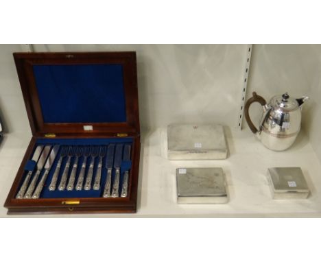
Lot 2163
A set of twelve pairs of King's pattern plated dessert or fruit knives and forks, with a mahogany case, a plated hot water jug, a plated cigar box, a Danish ciagarette box, the lid detailed with a map of the island of Aruba, detailed 830 S and a silver rectangular table cigarette box, the lid engine turned, presentation inscribed Birmingham 1934, (5).


Lot 324
A parcel of ephemera, vintage card games, motorist's map & a vintage black and white photograph of a town-band ETC Condition Report: please request* *Condition is not stated in this type of auction with description and must be obtained by email prior to bidding as items are otherwise are purchased 'as seen'


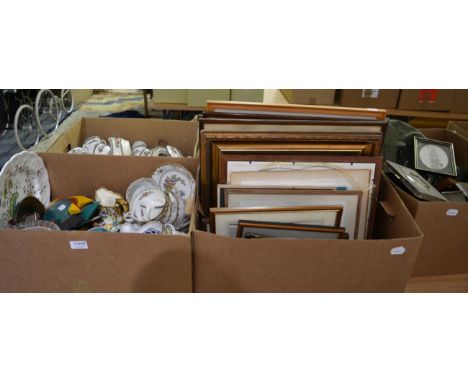
Lot 1169
Two Copeland Spode part dinner services, ''Indian Tree Johnson Bros'' and ''Old Bow'' patterns, ''Chelsea'' pattern part tea service, two mantel timepieces, quantity of prints, oil-on-canvas portrait of a lady, reprinted map of Yorkshire, mahogany fire screen with embroidery crest ''Trinity Coll Cambridge'', etc (qty)


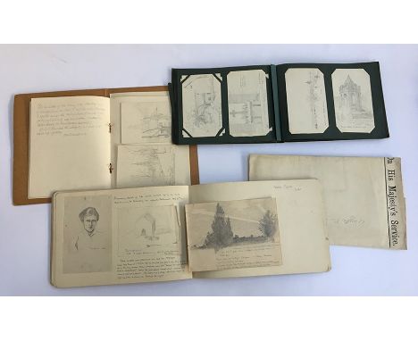
Lot 265
WW1 interest: Edward J Horne, The Queen's Royal Regiment, 1918 war diary, map of France (19 November 1918 - Valenciennes area), sketchbook with notes and poetry of life in the trenches and army, etc, 1918-1919, some watercolours, pencil sketch postcard album (1917-1918), hand written letter from Winston Churchill (December 1950); other correspondence; The Soldiers Own Diary commencing 1 January 1918 with notes on troop movements and advance in 1917 all in pencil, copy of Gazetter Des Ardennes (27 January 1918); Queens Royal Regiment Comrades Association book; pencil sketches and notes of France in book (October 1918 to January 1919), etc
![[TOPOGRAPHY]. TAUNTON (SOMERSET) Toulmin, Joshua. The History of the Town of Taunton, by Norris, Taunton, 1791, modern half](https://cdn.globalauctionplatform.com/2378dbcf-3b4f-4dcc-b4c8-a97500b9938e/0fccf525-e29b-4e9d-99de-a98500c4ed73/468x382.jpg)
![[TOPOGRAPHY]. ISLE OF WIGHT Barber's Picturesque Illustrations of the Isle of Wight, Simpkin & Marshall, London, no date](https://cdn.globalauctionplatform.com/2378dbcf-3b4f-4dcc-b4c8-a97500b9938e/9830d516-b878-41c7-b8f9-a98500c4f1a4/468x382.jpg)
![[TRADE & ADVERTISING] Wright's Bristol Directory, 1906 (108th Edition), Kelly's Directories, London, as dated, armorial](https://cdn.globalauctionplatform.com/2378dbcf-3b4f-4dcc-b4c8-a97500b9938e/9d36e7d9-8d58-4f0a-b990-a98500c4ff3d/468x382.jpg)
![[MAPS]. Owen, John, & Bowen, Emanuel. The Road from High Wycombe to Oxford & Islip and [verso] The Road from Islip t](https://cdn.globalauctionplatform.com/2378dbcf-3b4f-4dcc-b4c8-a97500b9938e/4d11e49b-69a8-408a-96e5-a98500c52e43/468x382.jpg)
![[MAPS]. Ogilby, John (1600-1676). 'The Road from London to Barstable [Barnstaple], engraved ribbon map, hand-coloured, 37cm](https://cdn.globalauctionplatform.com/2378dbcf-3b4f-4dcc-b4c8-a97500b9938e/013bfcba-f4da-41e0-997a-a98500c53100/468x382.jpg)
![[MAPS]. SOMERSET Saxton, Christopher (c.1540-c.1610), & Kip, William (fl. 1585-1618). 'Somersettensis Comitatus vulgo So](https://cdn.globalauctionplatform.com/2378dbcf-3b4f-4dcc-b4c8-a97500b9938e/2787fa1e-5b15-460e-9d28-a98500c5342f/468x382.jpg)
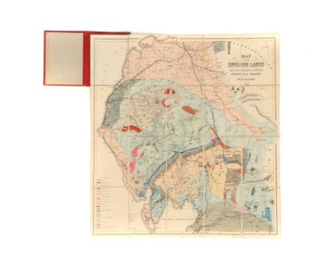
![[MAPS]. SOMERSET An Ordnance Survey Tithe Survey map, one-inch-to-one-mile, linen-backed and hand-coloured, 100cm x 140cm.](https://cdn.globalauctionplatform.com/2378dbcf-3b4f-4dcc-b4c8-a97500b9938e/2df54065-544b-4c76-ac6b-a98500c55043/468x382.jpg)
![[DOCUMENTS] A manuscript commonplace book, circa 1770s-80s, comprising notes, quotes, maxims, historical facts and a few rec](https://cdn.globalauctionplatform.com/2378dbcf-3b4f-4dcc-b4c8-a97500b9938e/edf121a3-df34-41a0-9b32-a98500c55305/468x382.jpg)
Lot 526
[DOCUMENTS] A manuscript commonplace book, circa 1770s-80s, comprising notes, quotes, maxims, historical facts and a few recipes, the front free endpaper inscribed 'Robert Dewse of / High Melton / near Doncaster / Yorkshire / March 20th / 1773', unillustrated, approximately 90pp, vellum-bound, 15.5cm x 10cm; together with another manuscript commonplace book, circa 1840, comprising notes, maxims, poetry and prose (some original), with one hand-drawn and coloured map and three title vignettes (otherwise unillustrated), also in the family name of Dewse, approximately 115pp, leather-bound, 23.5cm x 19.5cm; and a manuscript note and account book, circa 1820s-30s, also in the family name of Dewse, approximately 79pp, leather-bound, 20.5cm x 16.5cm, (3).


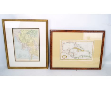
Lot 160
A Lake District Folding Geological Map, Ruthven, John, folding map titled ‘Travelling Map of the English Lakes Geologically Coloured’, geological map showing from North Lancaster to Carlisle and from Whitehaven to Brough, with extensive hand-colouring, 47cm x 44cm, laid onto thin linen support, light surface dirt, unframed, published by John Garnett, Windermere, 1855
![[§] WILLIAM WILSON (1905-1972) STAINED AND LEADED GLASS PANEL, CIRCA 1954 the panel depicting a chalice filled with fruiti](https://cdn.globalauctionplatform.com/860ec78e-5245-44e7-ab1a-a969010cf5f3/64b62e24-d7d6-423f-83a5-b6bc8cdf72ed/468x382.jpg)
Lot 260
[§] WILLIAM WILSON (1905-1972) STAINED AND LEADED GLASS PANEL, CIRCA 1954 the panel depicting a chalice filled with fruiting vines and barley, and enclosed within an entwined border, damages 96cm x 53cm Note: Wilson started his career as a map maker before serving an apprenticeship with James Ballantine & Son in Edinburgh in 1920 and opened his own stained glass studio in 1937. During his career he produced over 300 windows, for churches, cathedrals and secular buildings all over Scotland including these examples, installed at the chapel of Convent of St. Mary Reparatrice, Elie in 1954 (now demolished).


Lot 350
R Fran Sutton b.19112 - Visit of The Black Watch to Ludgrove School, 31.5.65, a coloured chalk drawing on paper, artist monogram and dated to lower right corner, titled with artist's name in pencil to mount, 10 1/8" x 14 2/8", mounted and glazed in ebonized frame, a 17th century map of Berkshire and a mixed quantity of 19th century and later prints and pictures, some unframed

Lot 5350
Military Ephemera - Seat of War map, published by Laurie & Whittle, London, A New Map of the Emperors Dominion exhibiting The Post Roads of Germany, Hungary and the Netherlands with thofe of the Adjacent Parts of France, Switzerland, Italy and Poland, linen, marbled slip; Army Book, 136a; Military Books; Chrisamas and New Year folding paper, H.M. Forces; Trench Sketch; etc


Lot 29
SCOTTISH (PARTICULARLY EDINBURGH AND GLASGOW INTEREST), Glasgow Past and Present, 3 vols worn cloth bindings inscribed to "Colin Campbell with the kind regards of the publishers" - this set is number 6 of 500, 1884, with a crisp copy of 1778 folding map"From An Aereial Survey By John McArthur" with "Old Houses in Edinburgh" drawn by Bruce J Home, unfaded folio and a shelf of Scottish books.


-
109182 item(s)/page