We found 109182 price guide item(s) matching your search

Refine your search

Year

Filter by Price Range
  • List
  • Grid
  • 109182 item(s)
    /page

Lot 81

NO RESERVE Japan.- Prostitution.- De Becker (Joseph Ernest) The Nightless City; or the ''History of the Yoshiwara Yukwaku'', fifth edition, half-title, folding colour map, folding plan, plates, some colour, short tear at head of pp.28-74, original pictorial cloth, gilt, spine faded, lightly stained, 4to, Yokohama [& others], [1905].⁂ An account of the entertainment district of Tokyo.

Lot 76

Berkshire. John Speed (1552-1629) Map of 'Berkshire described'a late 17th century engraving with near period sparse outline colouring, published Bassett and Chiswell (1676), large inset view of Windsor Castle, cartouche framed title, framed, double glazed42 x 54 cm.Condition: Slight marginal tear bottom margin approx. 2 cm, otherwise in good condition with bright colouring

Lot 77

Cambridgeshire. John Speed (1552-1629) Map of 'Cambridgeshire described with the devision of the hundreds the townes Situation with the Armes of the colleges of that famous Universiti', a late 17th century engraving with near period sparse outline colouring, published Bassett and Chiswell (1676), inset town plan of Cambridge, border with heraldic shields, framed, double glazed40.7 x 53 cmCondition: Some discolouration around the central fold, very small marginal nick bottom left hand side edge. Colouring bright

Lot 264

A quantity of Land Rover memorabilia to include a spare wheel cover, a vintage folding map, various Land Rover and European car magazines, and other items

Lot 404

A large vintage metal trunk by Best Steel together with contents comprising a Caribbean oil on canvas, mixed prints, a vintage mirror, a reproduction map of Chester, a vintage golf club, a mahogany standard lamp and a vintage ladder together with a set of four Edwardian mahogany dining chairs, together with a pair of Edwardian mahogany chairs with caned seats, and a bentwood chair Location:

Lot 437

Eighteen framed prints to include an original Robert Morden map 'The County Painting of Lancaster' Location: LWF

Lot 316

Boxes and Objects - advertising tins including Columbia Gramophone Needles, Thornes Toffee, Oxo, etc; commemorative scarf the Royal visit to Salford 1905; Great War printed cloth map of Europe; Mauchline ware needle case, Ryde Pier, 8.3cm; miniature book of common prayer, 1902; powder compact, cylindrical card and knotwork and silk flowers, mirror and puff, etc

Lot 298

Cornelium Dankerum: a map of Spain with coloured boundaries, in Hogarth frame

Lot 299

John Ogilby: a 17th century hand-coloured strip map of the road from Bristol to Weymouth, in Hogarth frame

Lot 300

A bound copy of a map of the navigable rivers in North West India, green boards, dated 1948

Lot 80

Collection of vintage Palitoy/Cherilea Action Man boxed items and loose equipment, including, Cherilea, box complete life raft, in good play worn condition with a loose one, boxed complete commando kayak, Palitoy boxed armoured jeep, missing wire cutters, machine gun and mounting, jeep is in good play worn condition fair to good with edge/age wear crease with stars and instructions leaflet, boxed machine gun emplacement, near complete missing shovel, in untested good play worn condition, box is in fair to good missing stars, boxed special operations tenet, missing some poles, table and map, box has missing stars in fair condition has edge/age wear creases and tears, boxed training tower, unchecked, box is in fair condition has edge/age wear tears and creases, loose SAS dingy, plus, Bags of accessories, one bag of shoes, one bag of hat/helmets and small items, one bag of large accessories and weapons, two bags full of clothing, netting, broken bike and mix matched dolls 1970s plus parts,(a lot)
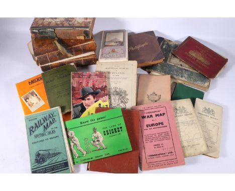
Lot 68

An early framed Robert Morden coloured engraved map of Worcestershire, frame size 50 x 44cm.

Lot 366

DALLAS DHU 1974 Highland single malt Scotch whisky bottled under the Connoisseurs Choice range by Gordon and MacPhail, map label, 75cl, 40% abv. 

Lot 472

A photograph booklet containing photographs including Hotel Fortingall with horse and carriage, The Cabinet Album views of Forth Bridge and South Queensferry, The Statistical Account of Scotland 1792 and 1794, North British Railway Ticket Stock book for Edinburgh to Haymarket etc. C1894, The Goldsmiths and Silversmiths Company Ltd book, Military Map Reading third edition 1915 etc., 

Lot 150

A framed coloured cycling map of Grantham, with various advert surrounds in a black and gilt frame, 62cm x 72cm.

Lot 362

Arlott (John) ed. John Speed's England, facsimile map, part 4, coloured engraved plates, slip case folio.

Lot 367

Orange (James) The History and Antiquities of Nottingham, 2 vol, engraved frontispieces and plates, contemporary diced calf, worn, boards detached, 4 to., 1840; Laird (Mr) A Topographical and Historical Description of The County of Nottingham......, publisher's boards, engraved plates and map, n.d. (3)

Lot 373

Bailey (Thomas) Annals of Nottinghamshire, History of The County of Nottingham....., 4 vol, folding map.

Lot 379

AFTER CHARLES BROOKING (18TH CENTURY)A Map of the City and Suburbs of Dublin, and also the Archbishop and Earl of Meath's Liberties with the Bounds of each ParishMonochrome engraving, 59 x 143cm

Lot 407

LAGENIA ANGLIS LEINSTERA Map of the Province of LeinsterHand coloured engraving, 54 x 64.5cm (sheet size)

Lot 408

A ROYAL GEOGRAPHICAL SOCIETY SILVER MAP OF THE WORLD, London 1977, printed, depicting various sea life, sailing ships etc and the busts of Ptolemy and Mercator. Framed overall size 51cm x 70cm

Lot 610

A 17th century map county engraving by John Speed 'Shropshyre' 38.5 x 51 cm framed and glazed 

Lot 357

Two boxes of various photographic equipment and other items to include: a book entitled 'Cameras from Daguerreotypes to Instant Pictures', some Vivitar lens adaptors, flashes, a Praktica BX20 camera and another three Praktica cameras, the LTL3 model, the Super TL3 model and the B100 model, a cased inspection lamp and road map, a cutting disk etc. (B.P. 21% + VAT)

Lot 94

Nine volumes of Kerr's collection of voyages and travels with leather spines and marbled boards printed by James Ballantyne & Co Edinburgh, 1811-1816, together with another leather spined book 'My Cousin the Army' printed for J Johnston, 98 Cheapside 1822, a vintage road map 'Anywhere to Anywhere, 700 routes, the open road, coloured road map' and a Simonds Hotels and Catering Houses booklet. (B.P. 21% + VAT)

Lot 662

An extra large 1930s geographical map "Osteelander", East Land/Scandinavia

Lot 663

An extra large 1930s school room geographical map of Australia

Lot 798

A large framed Bartholomew's world wall map, 156cm x 101cm

Lot 5223

Crescent B.185 painted lead figure of a pilot in a flying suit, holding a map case, rectangular base; John Hill & Co. 267MC RAF mechanic figure, circular base, each unboxed (2)

Lot 5479

Poster, Transportation, Aviation and Advertising - a BEA (British European Airways and British Travel & Holidays Association) poster, illustrated with a map of Great Britain, designed by Kempster and Evans and printed in England by Chromoworks Ltd., London, 102cm x 64cm, unframed

Lot 338

An early Chad Valley teddy bear, with blonde mohair, clear and black glass eyes with brown painted backs, pronounced muzzle, black stitched nose and claws, swivel head, jointed limbs with light brown silky cloth pads, hump, inoperative growler and rare pink map of Britain celluloid covered label --19½in. (49.5cm.) high (balding around base of head and around eyes, general wear and thinning)

Lot 490

A late 19th century French Cubes Géographiques, with maker's initials JFL?, six sided map blocks with guides, in blue box --15½in. (39.5cm.) wide (very slight wear); and a Toys That Teach The Rainbow Cup, in original box with instructions (worn)

Lot 989

Antique hand coloured map, ' Barbadoes ', by William Mayo, engraved and improved by Thomas Jefferys, geographer to the King, gilt framed, 24ins x 19ins

Lot 304

A Modern Reprinted Map of Somerset After Robert Morden, 35x30cm

Lot 438

A collection of framed pictures and prints, subjects including classic cars, a map of Somerset and other items, 66 cm x 56.5 cm max.

Lot 1030

D. Coster, artist signed Limited Edition print, modern warfare, 9.5ins x 11.5ins, framed together with a reproduction map of Black Heath, a coloured print ' London from Greenwich ' and a gilt framed aquatint ' The Clyde '

Lot 1044

Framed antique hand coloured map of Hereford by C. Smith, 1804

Lot 1046

Small antique hand coloured map of Leicestershire by Moll, unframed together with a quantity of 18th and 19th Century World maps and other maps, unframed

Lot 222

Case containing a quantity of late 19th / early 20th Century drawing instruments together with a pocket barometer (at fault), a dashboard clock and a map marker

Lot 878

Framed antique hand coloured map of Surrey by Cary, together with a small framed antique map of England and Wales from a French atlas

Lot 883

Framed antique hand coloured map of Surrey, together with a framed map ' The Road from London to Hythe ' by Ogilby and another small framed map of Surrey by Cary

Lot 88

FRAMED AND GLAZED MAP OF BEDFORDSHIRE AFTER JOHN CARY, TOGETHER WITH A FRAME AND GLAZED COLOURED ENGRAVING OF TORQUAY.

Lot 128

A LEATHER TRUNK with studwork and a map of the world to the top

Lot 231

A 19TH CENTURY BIBLE WITH PORTLAND CONNECTIONS inscribed, 'Sarah Ann Bowring' with an 1896 marriage certificate, 'Alice Bowring' 23 Wakeham.... a Rudyard Kipling book, two similar, three pictures and a reproduction map of Dorset

Lot 595

GEORGE P. R. PULMAN: 'THE BOOK OF THE AXE' 'containing a piscatorial description of that stream...' Longman, 1875, with fold-out map (some staining)

Lot 630

JAN JANSSON: 'ANGLIA REGNUM', LATIN TEXT VERSO the map with colouring (probably later, with discoloured, unframed)

Lot 632

JOHN OGILBY; 'THE ROAD TO LONDON...' one map, showing Newhaven, 'Brighthelmston' etc (discoloured)

Lot 633

CHRISTOPHER SAXTON: MAP OF WORCESTERSHIRE 'Wigorniensis comitatus Sabrinae...', with colouring, in a maple frame

Lot 634

JOHN SPEEDE: MAP OF GLOUCESTERSHIRE highly coloured, and mounted to the border

Lot 635

JOHN SPEEDE/ CHRISTOPHER SAXTON: NORFOLK 'A counte florishing & populous....', the map with English text verso, glazed both sides (not coloured)

Lot 654

A COLLECTION OF PICTURES AND PRINTS to include a map of Glocestershire

Lot 320

After Jodocus Hondius, reproduction map of Northamptonshire 1610, 32.5cm x 43.5cm, framed and glazed.

Lot 110

"Griffith's New Historical Description of Cheltenham and its Vicinity ..., maps of the town and county from the latest surveys and a plan of Pittville", Longman Rees Orme Brown & Green, London 1826, engraved plates with tissue guards, map frontis, advertisements at the back, index, maps - not complete, small folio, rebound full calf with gilt rules and decorations, raised bands, gilt titles to backstrip and date, marbled ep, sold as seen BOOKS NOT COLLATED UNLESS OTHERWISE STATED, PLEASE ENSURE YOU ARE SATISFIED BEFORE YOU BID

Lot 113

Roach-Smith, Charles"Illustrations of Roman London", printed for the Subscribers 1859, illustrations throughout, plates bound in the back, six colour plates, foxing throughout, half leather, raised bands and gilt titles to the backstrip, rather bumped and worn "The Authentic Map Directory of London and Suburbs", 4th edition, Geographica Limited, advertisements, index, cloth, gilt titles, blindstamped rules, corners and edges bumped (2) BOOKS NOT COLLATED UNLESS OTHERWISE STATED, PLEASE ENSURE YOU ARE SATISFIED BEFORE YOU BID

Lot 119

Brooks, R M D "The General Gazetteer; or Compendious Geographical Dictionary ...", 13th edition, London 1807, printed for J Johnson, W J & J Richardson, Ogilby & Sons, etc, folding double page map of the world frontis, 8 folding maps, contemporary full tree calf, raised bands to backstrip and red pastedown with titles, browning to ep, world map outer edge a little creased and in the fold, BOOKS NOT COLLATED UNLESS OTHERWISE STATED, PLEASE ENSURE YOU ARE SATISFIED BEFORE YOU BID

Lot 151

Le Carre, John " The Honourable Schoolboy" Hodder and Stoughton  1977 , signed by the author on the title page, map on endpapers, black cloth, d-j not price clipped,  "Single & Single" Hodder and Stoughton, signed and dated by the author on title page ' 25 11 '99 Cheltenham', maroon cloth, d-j not price clipped  "Smiley's People" Hodder and Stoughton 1980,  signed on title page, blue cloth, d-j not price clipped ( 3)BOOKS NOT COLLATED UNLESS OTHERWISE STATED, PLEASE ENSURE YOU ARE SATISFIED BEFORE YOU BIDCondition ReportThe Honourable Schoolboy is first edition, first printing, slight chips to top of d-j, see further images

Lot 2

Fullarton A " Companion Atlas to the Gazetteer of the World" [1860] , Subscribers' Edition, original 18 parts, 48 hand coloured engravings, mainly double page, to include The Map of the British Empire Part 14,  each part  48 x 33.5 cms approx, two or three maps in printed covers, all with protective tissues, housed in restored publisher's folderBOOKS NOT COLLATED UNLESS OTHERWISE STATED, PLEASE ENSURE YOU ARE SATISFIED BEFORE YOU BID

Lot 27

Woodville, Roger " The Grand Magazine of Magazines or, a Public Register of Literature and Amusement ...for the Year 1751..."  M. Cooper 1750 ( 1751) , pirated printing of Thomas Gray  'Elegy in a  Country Churchyard'  April, engraved frontis, folding engraved plates, one a map of The French Settlements in  North America, rebound quarter leather, marbled boards, gilt title on red pastedownBOOKS NOT COLLATED UNLESS OTHERWISE STATED, PLEASE ENSURE YOU ARE SATISFIED BEFORE YOU BID

Lot 3

Bacon, George (ed. and published) " New Large-Scale Ordnance Survey Map of the British Isles" 1884, handcoloured lithographed maps and town plans, publisher's boards, rebacked and recornered, gilt titles and raised bands to backstrip, aegBOOKS NOT COLLATED UNLESS OTHERWISE STATED, PLEASE ENSURE YOU ARE SATISFIED BEFORE YOU BID

Lot 8

" A Compendious Geographical Dictionary containing Concise descriptions ....Europe, Africa and America..." W. Peacock and Sons 1804, world map folding frontis, numerous folding maps to include South America, ffep removed, contemp tree calf , 12. mo. gilt titles on red paste downs, gilt decorations withCapper B.P  " A Compendious Geographical Dictionary....Every Remarkable Place in Europe, Asia, Africa and America..."  Peacocks and Bampton 1813, coloured folding map frontis, various coloured folding maps engraved by John Russell, 12 in all though title page specifies nine, rebound in paper covered boards. title on pastedown on back strip, 12 mo. ( 2)BOOKS NOT COLLATED UNLESS OTHERWISE STATED, PLEASE ENSURE YOU ARE SATISFIED BEFORE YOU BID

Loading...Loading...
  • 109182 item(s)
    /page

Recently Viewed Lots