MAPS – PENINSULAR WAR. ‘Théatre des Opérations de l'Armée d'Aragon.' And ‘Plan des Attaques de Tarragone assiégée & prise d'assaut le 28 Juin 1811. Par l'Armé Francaise d'Aragon,' with large vignette ‘vue de Tarragone' at foot. With 13 other linen-backed engraved Napoleonic War maps in the same series, various sizes; together with a map of Switzerland, ca. 1825. (16)
We found 109182 price guide item(s) matching your search
There are 109182 lots that match your search criteria. Subscribe now to get instant access to the full price guide service.
Click here to subscribe- List
- Grid
-
109182 item(s)/page
TUNNICLIFF, Wm. A Topographical Survey of the Counties of Hants, Wilts, Dorset, Somerset, Devon, and Cornwall. [Frontis hand-coloured folding map.] For the Author, Salisbury, 1791, quarter calf. WILLIS, B. Notitia Parliamentaria: Containing and Account of the First Returns and Incorporations of the Cities, Towns, Buroughs, in England and Wales. For the author, 1750, calf; and two others. (6)
POUNCY, H. A Short History of the Old King's Arms Hotel, Dorchester. Corrected typescript, 1914. Folio, loose in folder. KEATS, C. The Writings and Recollections of a Durnovarian. Printed for private circulation only, Dorchester, 1894. Folio, cloth, inscribed by the author to Henry Ling. CRISWICK, J. A Walk Round Dorchester. [Frontis, map.] Criswick, Dorchester, 1820, boards; and a quantity of books and pamphlets on Dorchester and district. (50)
PULMAN, G. The Book of the Axe. [Folding map frontis.] Longman, 1875, cloth. ROBERTS, G. The History and Antiquities of the Borough of Lyme Regis and Charmouth. [Map, folding plate.] Bagster, 1834, cloth. ------. An Account and Guide to the Mighty Land-Slip of Dowlands and Bindon. Dunster, Lyme, 1840, later cloth, original wrappers retained; and others, mostly on Lyme and district. (14)
WEYMOUTH. The Weymouth Guide: exhibiting the Ancient and Present State of Weymouth and Melcombe Regis. For the editor, Weymouth, [1785], marbled wrappers. BUCKINGHAM, J. A Summer Trip to Weymouth and Dorchester. [Folding map.] Weymouth, 1842, cloth. ELLIS, G. The History and Antiquities of the Borough and Town of Weymouth. [Frontis.] Benson, Weymouth, 1829, boards; and others on Weymouth and Portland. (23)
HUTCHINS, J. The History of the Town and County of Poole; compiled from Hutchins's History . . . with many additions and corrections. Moore, Poole, 1788, calf. BRANNON, P. The Illustrated Historical & Picturesque Guide to the Town and Harbour of Poole. [Illustrations, map.] Sydenham, Poole, 1867, wrappers; and others on Poole. (15)
TUTCHIN, J. The New Martyrology: or, The Bloody Assizes. [Frontis.] Dunton, 1689, contemp. calf, with three further editions, 1693, 1705 and 1872. ROBERTS, G. The Life, Progresses, and Rebellion of James, Duke of Monmouth. [Portrait, map.] Longman, 1844, 2 vols., cloth; and others on the Monmouth Rebellion. (8)
HINE. The History of Beaminster, With forty illustrations and maps. Barnicott & Pearce, Taunton, 1914, 4to, cloth. COOKE, G. Topographical and Statistical Description of the County of Dorset. Illustrated with a map of the county. Cooke, [ca. 1810], 12mo, wrappers. SAVAGE, J. The History of Dorchester. [Illustrations by W. Barnes.] Weston, Dorchester, 1837, boards; and others, Dorset and West Country. (16)
BRADSHAW. Bradshaw's Railway Companion, containing the Times of Departure, Fares, &c. [Folding maps at beginning and end, tinted engraved maps in text.] Bradshaw, Manchester, 1840. 16mo, cloth, label. MACAULAY's Station Map of the Railways in Great Britain. Smith & Ebbs, [ca. 1854]. Linen-backed folding map, cloth boards; and another. (3)
PENSELWOOD. ‘Plan of Property in the Parish of Penselwood in the county of Somerset belonging to The Rt. Hon. The Earl of Ilchester and Sir Henry Ainslie Hoare, Bart, 1876.' Large professionally drafted linen-backed estate map (approx. 50” by 62”), coloured outlines defining individual and joint properties, with names of adjacent landowners and holdings.
MAPS. A New Map of the County of Dorset Divided into Hundreds. C. Smith, January 6th 1804. 2nd Edition Corrected to 1808. Hand-coloured, 18” by 21” on 12 linen panels, original card case. CARY, J. A New Map of Devonshire divided into hundreds. Exhibiting its Roads, Rivers, Parks &c. Cary, 1821, hand-coloured, 20.5” by 23” on 15 panels. DIX, T. A New Map of the County of Dorset, Divided into Hundreds. Darton, 1820, hand-coloured, 15” by 18.5” on 12 panels, engraving of Arched Rock, Lulworth at lower left, original card case; and further Dorset maps by Walker (1835), Bacon (ca. 1900) and others. (7)
GASK, Norman. Old Silver Spoons of England. [Plates.] Jenkins, 1926, 4to, cloth. HOPE, R. The Legendary Lore of the Holy Wells of England. Copiously illustrated. Stock, 1893, cloth. RIMMER, A. Ancient Stone Crosses of England. Illustrations on wood. Virtue, 1875, cloth. POOLEY, C. An Historical and Descriptive Account of the Old Stone Crosses of Somerset. [Map, plates.] Longmans, 1877, cloth; and others. (7)
Songs of the Celtic Past by Norreys Jephson O'Conor. New York: John Lane 1918. With author's dedication 'Frances Cheney with greetings from a fellow craftsman and friend, Norreys Jephson O'Conor. Time is nothing, loveliness is all. May 29th 1918' Selection from the Poems of William O`Leary Graig-na-Managh Illustrated, 8vo Galway 1926, illus., 44 pp., good. The Way That I Went, An Irishman in Ireland by Robert Lyoyd Praeger. Dublin: Hpdges, Figgis. 1939. First, illus with folding map, blue cloth with dust jacket. (Natural History) Arrows: Poems by George Nobel Plunkett. Dublin: M.H. Gill 1921. 64 pp. Cover worn. Girl Friday by Jane Dolinger. London: Jarrolds1967. Seán Ó Corcora bookplate. Illus. Poems by Fanny Fisher. London: T. Fisher Unwin 1889. With dedication from the author. Appreciations with an Essay on Style by Walter Pater. London: McMillan and Co., 1913. Albert Fox, The Devout Merchant, A Memoir by Rev. John Jones. Liverpool: Howell 1867. Christmas at Annesley by M.E. Shipley. London: Marcus Ward & Belfast: Royal Ulster Works 1875 (9).
Report to The Commissioners On The Drainage And Reclamation In The Doohulla District. Samuel Nicholson, C.E. Dublin: Alexander Thom, 87 Abbey Street. 1846. Featuring an original coloured map of The Doohulla District. Also to include Discovery of Human and Other Remains, with similar to those of a Crannoge. R. J. Usher. Dublin: Printed at the University Press, 1898. Seven copies of The Factionist 'The smallest paper in the world' February 1917 - April 1917. Also The Report From The Parliamentary Commitee of the Loyal National Repeal Association. September , 1844.(4)
BRITISH 18th CENTURY TOKENS, Peter Kempson, Copper Halfpenny, 1794, obv A MAP OF FRANCE 1794, a foot within a square border, HONOR (trampled) underneath, FRA-NCE divided, THRONE (turned upside down), GLORY (defaced), RELIGION (broken up), FIRE (in every corner), daggers (murder) on every side, and bloodshed all over, rev MAY GREAT BRITAIN EVER REMAIN THE REVERSE radiated within an oak wreath, large letters in inscription, G of GREAT and N of BRITAIN touch the wreath, edge PAYABLE AT THE WAREHOUSE OF THOMAS CLARKE (Atkins p.369, 98a; D&H Middlesex 1016a). A couple of spots and light brush marks, otherwise good extremely fine retaining much brilliance, very rare.
BRITISH 18th CENTURY TOKENS, William Mainwaring, White Metal Medal, obv A MAP OF THE PRESENT STATE OF FRANCE, foot within a square border, HONOR (trampled) below, LIFE (in) DANGER, PROPERTY SECURED, GLORY (defaced), RELIGION (broken up), FIRE (in every corner), THRONE (turned upside down), FRANCE between two serpents, rev MAY MONARCHY FLOURISH AND ANARCHY PERISH EVERLASTINGLY, edge plain (Atkins p.361, 19; D&H Middlesex 228). Light surface marks, otherwise nearly mint state retaining substantial brilliance, rare. ex F S Cokayne Collection
Fine bindings including:- Hall, Captain Basil "Extracts from a Journal, written on the coast of Chile, Peru and Mexico in the years 1820, 1821, 1822", Edinburgh 1824 in two vols., 3rd edition, folding map to vol. one Davis, Frederick "The History of Luton with its Hamlets, etc.", printed for the author by J Wiseman, Luton 1855, various plates, bearing bookplate for Woburn Abbey 1873 (11)
A tarot set in a wooden and pierced box, Legends the Arthurian tarot set in a pierced wooden box, a first day cover "Man's First Landing on the Moon", a postcard of Gloucester Cathedral, a ten sheet road map of England and Wales, a 30th anniversary of John Boorman's Excalibur with Morgana, Helen Mirren, signed Terry English and dated 2012 and Lewis Hamilton picture with facsimile signature
TWO VOLUMES ON THE PENINSULAR WAR BY FRANZ XAVER RIGEL FROM THE PAVLOVSK PALACE LIBRARYRIGEL, Franz Xaver (German, 1783-1852) Der siebenjahrige Kampf auf der Pyrenaischen Halbinsel vom Jahre 1807 bis 1814; besonders meine eigenen Erfahrungen in diesem Kriege nebst Bemerkungen uber das Spanische Volk und Land [A seven-years battle on the Iberian Peninsula from the year 1807 to 1814; particularly my own experiences in this war including my remarks about the Spanish people and the country] Rastatt, 1819. Published at author`s expense by the author himself. 12mo (206 x 133 mm) each volume. 532 pages (volume I); 454 pages (volume II). Both volumes contain a label from the Pavlovsk Palace Library indicating item`s location and inventory number. Contemporary red Morocco binding with gilt tooling along the borders and on the spines. All edges gilt. Silk endpapers. Volume I containing a full-page copperplate etching depicting a Spanish insurgent, and a foldout map of a battle plan. Volume II containing six full-page copperplate etchings featuring a Spanish national dance Bolero, and various landmarks of the territories where the battles took place.PLEASE NOTEIf you will be bidding live on auction day, please note that Session I of the Auction (Asian and Russian Fine & Decorative Art), starts at 10:00 AM New York Time and goes from Lot 1 through Lot 254. Session II of the Auction (European, American and International Fine & Decorative Art) starts at 3:00 PM New York Time and goes from Lot 500 through Lot 676. We sell approximately 70 lots per hour.
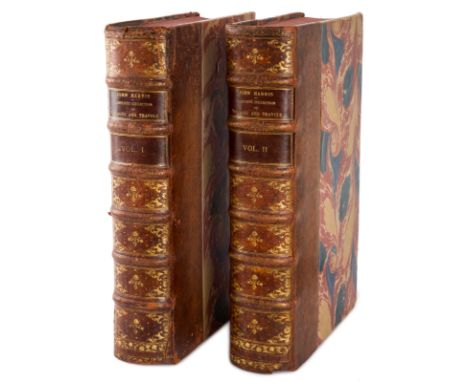
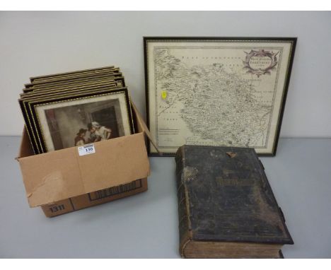
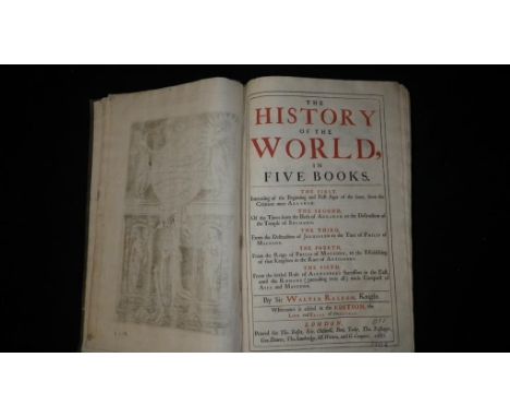
TWO VOLUMES OF NAVIGANTIUM ATQUE ITINERANTIUM BIBLIOTHECA HARRIS, John (English c. 1666-1719) Navigantium Atque Itinerantium Bibliotheca, Or A Complete Collection of Voyages and Travels., London: T. Woodard, A. Ward, S. Birt, D. Brown (et al.), 1744-1748. Large folio (417 x 267 mm) each volume. 984 pages (volume I); 1056 pages (volume II). Second edition. Contemporary quarter mottled calf binding with marbled paper. Spine with six raised bands and intricate gilt tooling. All edges stained. Marbled endpapers matching the cover. Royal privilege as frontispiece in volume one, engraved frontispiece in volume two. Containing 61 full-plate engravings, 39 of which featuring panoramas and landscape views, scenes from the life of locals depicting their customs and traditions; and 22 maps, most of them folding.LOT NOTESThis highly regarded work contains the first separate map of Australia, and one of the first maps of Georgia and the southeast United States-, along with valuable cartography on the Northwest Passage, North and South America, the Arctic regions, and more. It is the second edition, regarded as the best, notably by Hill who commented "This revised edition is the one collectors should seek. It is so expanded compared with the first edition that it is almost a new work." Particularly valuable is the inclusion of a printing of Tasman`s original map and two short articles printed on the map. One discusses Quiro`s voyage, while the other speculates about the possibility of the Australian continent being colonized. To the original extensive collection are added accounts of voyages completed since the first publication: Christopher Middleton to Hudson`s Bay in 1741-42; Bering to the Northeast in 1725-26; Woodes Rogers`s circumnavigation in 1708-11; Clipperton and Shelvocke`s circumnavigation, 1719-22; Roggeveen to the Pacific, 1721-33; and the various travels of Lord Anson, 1740-44. Rearranged to reflect the new English interest in the Pacific.PLEASE NOTEIf you will be bidding live on auction day, please note that Session I of the Auction (Asian and Russian Fine & Decorative Art), starts at 10:00 AM New York Time and goes from Lot 1 through Lot 254. Session II of the Auction (European, American and International Fine & Decorative Art) starts at 3:00 PM New York Time and goes from Lot 500 through Lot 676. We sell approximately 70 lots per hour.
Vintage Ordnance Survey map of Scarborough, pair carved wood elephant bookends H17cm, 'The Story of the Life of George Stephenson Railway Engineer' by Samuel Smiles pub. 1862 and other books, pair brass wall sconces and a letter rack, model of a galleon, two dressing table mirrors and a collection of vintage cards
-
109182 item(s)/page