We found 109198 price guide item(s) matching your search
There are 109198 lots that match your search criteria. Subscribe now to get instant access to the full price guide service.
Click here to subscribe- List
- Grid
-
109198 item(s)/page
An Accurate Map of the County of Suffolk... by Eman Bowen, printed for Carington Bowles... folding map on linen approx. 72 x 54cm in 16 segments, title vignette with sheep and cattle top right, dedication vignette and extensive engraved descriptive notes, hand coloured in outline, in original slipcase (1)
HERMAN MOLL [DUTCH 1654-1732], HAND COLORED ENGRAVING, " A NEW MAP OF GREAT BRITAIN" 40" X 24" SIGHT: "A New Map of Great Britain, According to the Newest and Most Exact Observations By Herman Moll Geographer", "Printed and sold by Herman Moll and By John King at the Globe in the Poultrey near Stocks Market". On laid paper; modern framing. From the Estate of Leonard Chevalier, Mt Clemens, Mi.
Two BROOKS "Les Grandes Marques à Monaco" racing Car posters and two similar posters, AFTER ELEANOR ANDREW "The Dogana, Venice" black and white drypoint etching, inscribed and signed in pencil, a reproduction map of the "Borough of Cricklade", and two enamel cigarette/tobacco signs CONDITION REPORTS General wear and scuffs. Some dents and damage to metal items. Some wear and chips and loose joints to frames. Jaguar poster is a modern reproduction print. Other posters are 20th and 21st Century.
A North America map published under the direction of The Committee of General Literature and Education appointed by The Society for Promoting Christian Knowledge and of The National Society, sold at The Depositories, 77, Great Queen Street, Lincolns Inn Fields, WC October 1st 1868", a similar map of Europe and four further maps contained within an ebonised pine rod box CONDITION REPORTS Maps are in very poor and deteriorated condition - with most quite disintegrated. Maps appear to be 19th Century and 20th Century.
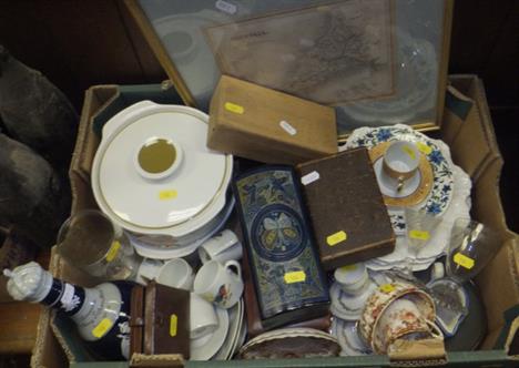
A box containing a collection of sundry items to include a Copeland late Spode commemorative decanter inscribed "Coronation of King George V and Queen Mary June 22nd 1911", with crown shaped stopper, AFTER J ARCHER - a framed and glazed map of Cornwall, two J & G Meakin pottery lidded tureens decorated with poppies, two 19th Century drinking glasses, an Oriental lacquered box, three further boxes, a collection of plates, etc
The following Collection of items are related to two brother airmen, Lieut. G.S.M. Insall VC and A.J. Insall. The brothers both flew with 11 Squadron RFC serving in Vickers FB5 two seater fighters. Lieut G.S.M. Insall VC was later captured, escaping on the third attempt. An antique leather flying jacket with fleece lining belonging to A.J. Insall, an RAF tunic, a leather cylindrical map carton printed Lt. A.J. Insall RFC No. 11, a gilt painted plaster bust of an airman (possibly G.S.M. Insall VC) and a large quantity of ephemera and photographs to include: a set of Ribbons with mounted oak leaf and an Observers tunic wing, Certificate of Mention in Dispatches of Second Lieutenant A.J. Insall dated 1st January 1916, Photograph of Lieut. G.S.M. Insall VC wearing escape disguise and another of a Vickers FBS of No. 11 Squadron, `Observer` book by A.J. Insall, etc
A Limited edition signed print entitled `Dawn of Victory`, 8/250, together with a collection of related ephemera to include 1983 calendar welcome home 1983 in out card case, Falkland Islands 150th Anniversary calendar 1983, Portsmouth evening news Victory in the Falklands, campaign map for Falklands, map, signed print `Britannia Rules` poster of Falklands Task Force, Poster of Battle of Trafalgar, Shell case from HMS Intrepid. HMS Intrepid baseball cap and sweatshirt, Argentinian combat helmet, etc. *Notes - Formerly the property of Lieut - Commander A Manning RN, who was present aboard the task force on HMS Intrepid from which his personal photographs were used to produce the Dawn of Victory commemorative print.
Lots 721-730 are from the collection of The Estate of the Hon Christopher Lennox-Boyd Isaac Beckett, British 1653-1719- "Mrs Turner", after Sir Godfrey Kneller; mezzotint, 34x24.5cm: After Sir Peter Lely, Dutch/British 1618-1680- "Her Grace The Dutchess of Somerset", sold by Alex Browne at ye blew ballcony in little Queen Street; mezzotint, 33x24cm: Isaac Beckett, British 1653-1719- "The Dutchess of Cleaveland", after Sir Peter Lely; mezzotint, 19.5x13.8cm: James Wilson fl.1760-1780- "Mary, Lady Boynton", after Francis Coates, publ by Robt Sayer Map & Printseller No 53 Fleet Street 1st Sept 1771; mezzotint, 35.5x25.7cm: Gerard Valck, Dutch c.1651-1726- "Wilhelmus Henr D G Mag Brit Franc et Hib Rex", c.1688; mezzotint, 35x25.5cm: Andrew Miller, British fl 1739-1763- "Elizabeth Dutchess of Hamilton Brandon & C", after Francis Coates, publ by John Bowles at the Black Horse in Cornhill; mezzotint, 33.5x22.3cm: R Housman, 17th/18th century- "Miss Nancy Parsons", after R Renold; mezzotint, 35.2x25cm., (7)
Samuel William Reynolds, British 1773-1835- "The Age of Innocence", after James Northcote RA; mezzotint, 36.5x27cm: Alexander Browne, British fl 1659-1706, Publ- "Frances Stuart Countess of Portland", after Anthony van Dyck; mezzotint, 39x27.2cm: James Wilson, British fl. 1760-1780- "Miss Jones", after Catherine Read, c.1768-1771; mezzotint, 35x25cm: Richard Purcell, British fl. 1746-1768- "The Revd John Cennick", after Thomas Jenkins; mezzotint, 35x25cm: Robert Sayer & J Bennett No 53 Fleet Street 17 April 1779, Publ- "Blind Plaintiff lame Defendant Share the friendly Law`s impartial Care. A Shell for him a Shell for thee. The middle is the Lawyers Fee"; mezzotint, 36x24.5cm: Carington Bowles, Map & Printseller No 69 in St Pauls Church Yard London, Publ, 18th century- "Beau Mordecai Inspir`d"; mezzotint, 35.5x25cm., (6) Provenance: From the collection of The Estate of the Hon Christopher Lennox-Boyd
Carrington Bowles, Map & Printseller, No 69 St Pauls Church Yard, London, Publ- "Spring and "Summer"; mezzotints, a pair, 35x26cm., ea: Miss Ollivier, British act. 1785- "The Poor Soldier", after Charles Ansell, publ by Le Noir, under the Arches of the Royal Palace No 43; hand-coloured stipple engraving, 38x32cm: Pietro Bonato, Italian 1765-1820- "Werter contemplating Charlotte`s Wedding Ring", after Henry Kingsbury; stipple engraving printed in colours, 38x34cm: Mme Breton, French, Publ, Rue des Noyeres pres cette St Jacques No 30 au 2e, early 19th century- "Susan`n and Osmund"; stipple engraving printed in colours, 38x33cm: Francis Jukes, British 1747-1812- "This View of Sheene Bridge Co of Kerry Ireland", after Thomas Walmsley, publ Jan 1st 1800 by T Walmsley 15 Argyle St Bath and F Jukes 10 Howland St London; hand-coloured aquatint, 35.7x47cm: Samuel Alken, British 1756-1815- "Artullery Bridge between Kenmare and Killarney", after Thomas Walmsley, publ by F Jukes No 10 Howland Street Jun 20 1798; hand-coloured aquatint, 34.5x44.5cm: Francis Jukes, British 1746-1812- "View of Britain Ferry from Norton near the Mumbles", after Thomas Walmsley; aquatint printed in colours, 27x38cm: Francis Vivares, British 1709-1780- "View of the Ancient Temple of Minerva Medica at Rome Built by Augustus Caesar", after Thomas Smith of Derby, publ 15 July 1746; etching on paper laid down on canvas, 39x54.5cm., (9) Provenance: From the collection of The Estate of the Hon Christopher Lennox-Boyd
A brown leather covered cigarette box, stitched diamond pattern to lid set with 12th Lancs bi-metal cap badge; a brass “trench art” shoe horn, pricker engraved with anchor, warship, etc; a copper desk weight model submarine, 11½”; a silk escape map of N Europe (AF); a small lightweight alloy bust of Lenin, 5”, and another; sundry other items. Generally GC
A WWI trench map of N France, in 32 sections laid on silk, double sided; ordnance Survey sheet 57c of France, d 1917; a framed list of awards, d 8th June 1918, under Army Orders of Gen Sir H S Rawlinson, coloured title, framed, 14” x 9” (creased); a coloured greetings card showing a drummer of the 3rd Hussars, and 2 other cards with regimental badge, mounted and framed 21” x 11”, all with ribbon to edge; a framed Temperance Society declaration, d 1913. GC
An attractive original coloured plan for Field Carriage for 12 pr Armstrong B L gun, approved February 28th 1860, printed by the Royal Carriage Department July 1867 and signed by H. Clerk (?), Superintendent R.C.D, 27” x 20”, some creasing, staining and damage, attractively mounted in a modern ebonised frame; also an unfinished model of a 12 pr Armstrong gun, constructed from a reduced copy of the above plan, with 6” steel barrel, carriage with steel tyred spoked wheels, and various loose steel fittings, GC; also an attractive framed WWI coloured map of the Western Front, published by Bacon & Co, 127 Strand, 19” x 29”. GC(3)
Photographs and modern postcards ‘Graf Zeppelin’ and ‘Hindenburg’. Close up of Control gondola of the ‘Graf Zeppelin’, with ground handling crew. Also a card showing the kitchen, both black and white. ‘Hindenburg’ interior views. Four coloured cards – 3,4,5,6 from a series of ten. Views of the dining room and lounge. Mint. Together with original photographs of the ‘Hindenburg’ disaster. A large photograph, (20cm x 25cm), provides a most unusual angle of the destruction of the ‘Hindenburg’, with the mast in the foreground; together with two smaller photographs, one shows the ship in flames and the other, the burnt out skeleton. Together with 22 photographs taken of and from the ‘Graf Zeppelin’. Also an original Hamburg-Amerika Line world route map for the Graf Zeppelin and the Hindenburg, showing the triangular routes down to South America and North America from Germany QGC-VGC, a few creased. See Plate 1
-
109198 item(s)/page


![HERMAN MOLL [DUTCH 1654-1732], HAND COLORED ENGRAVING, " A NEW MAP OF GREAT BRITAIN" 40" X 24" SIGHT: &qu](http://lot-images.atgmedia.com/SR/33875/2884674/2279-2013520144625_468x382.jpg)


