

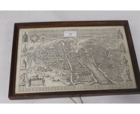
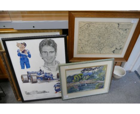
Yorkshire. Greenwood (C. & J.), Map of the West Riding of York from an actual survey..., Map of the East Riding of York from an actual survey [and] Map of the North Riding of York from an actual survey..., 1834, together three uncoloured engraved maps, each with an engraved vignette, compass rose and table of explanation, old stitch marks to left hand margin but not affecting image, very slight spotting and staining, each approximately 610 x 755 mm, together with Bowen (Emanuel), An accurate map of the County of York divided into its Ridings and subdivided into Wapontakes..., published J. & C. Bowles and Robert Sayer, circa 1764, engraved map with contemporary outline colouring, slight staining at base of central fold, central fold repaired on verso, 540 x 705 mm (4)
We found 109182 price guide item(s) matching your search
There are 109182 lots that match your search criteria. Subscribe now to get instant access to the full price guide service.
Click here to subscribe- List
- Grid
-
109182 item(s)/page

Aikin (John). England Described: being a concise delineation of every county in England and Wales..., 1818, folding hand-coloured engraved map frontispiece, some toning and offsetting to title, modern half calf, 8vo, together with Fedden (Robin & Joekes, Rosemary), The National Trust Guide, reprinted 1973, colour and black & white illustrations, modern full dark green morocco with National Trust oak leaf & acorn emblem in relief to upper board, gilt decorated spine, large 8vo, contained in slipcase, and Browne (James), A History of the Highlands and of the Highland Clans, 4 volumes, Glasgow, 1838, folding engraved map loosely inserted, engraved plates, occasional dampstaining and spotting, uniform modern half calf, contrasting morocco labels to spines, 8vo, with Cooper (W. Heaton), The Lakes, 1st edition, 1966, colour and black & white plates, map endpapers, modern full burgundy morocco, with mountainus hillscape effect in gilt lines to upper board, 4to, plus other British topography in modern leather bindings All bindings by Doreen Hedger, bookbinder & restorer of Romsey, Hampshire (each unsigned). (17)
Birch (Thomas). Memoirs of the Reign of Queen Elizabeth from the Year 1581 till her Death, 2 volumes, 1st edition, for A. Millar, 1754, occasional mild spotting, near-contemporary tan calf, black morocco spine labels, decorative frames and cornerpieces gilt to sides, extremities slightly rubbed, volume one front joint partially cracked but firm, 4to (27.5 x 20 cm), together with:Home (John), The History of the Rebellion in the Year 1745, 1st edition, for T. Cadell, Jun. and W. Davies, 1802, engraved map, portrait, 3 folding plans (spotted), contemporary marbled calf, rebacked and recornered, scuffed, 4to (27 x 20.5 cm); Hume (David), The History of England, from the Invasion of Julius Caesar to the Revolution in 1688, a New Edition, Corrected, 8 volumes, for T. Cadell, 1770, half-titles, engraved portrait frontispiece to volume 1, occasional light spotting (slightly heavier to endpapers and prelims of a few volumes), bookplates of Richard Brinsley Sheridan (1751-1816, see note), contemporary mottled calf, smooth spines gilt in compartments, spines slightly rubbed and worn, volume 1 spine relaid, joints superficially split but firm, 4to (27.5 x 21.5 cm); Robertson (William), The History of Scotland during the Reigns of Queen Mary, and of King James VI till His Accession to the Crown of England, 2 volumes, 6th edition, for T. Cadell, 1771, light spotting to endpapers, faint toning in fore margins of title pages, contemporary tan calf, spines gilt in compartments, twin morocco labels, wear to tips, volume 1 front joint cracked at foot, 4to (27.5 x 20.5 cm);Robertson (William), The History of the Reign of the Emperor Charles V, 3 volumes, 1st edition, for. W. Strahan, T. Cadell and J. Balfour, 1769, half-titles, lacking portrait frontispieces (see note) and errata leaves, contemporary tan calf uniform with the previous item, some wear to extremities, joints cracking in places, volume 1 front board detached, 4to (27.5 x 21 cm); Provenance (Hume): engraved armorial bookplates of Irish satirist Richard Brinsley Sheridan (1751-1816). ESTC states that the plates in Robertson's History of the Reign of the Emperor Charles V 'may vary from copy to copy'. (16)
Juvenal, & Persius. Decimus Junius Juvenalis, and Aulus Persius Flaccus, translated and illustrated, as well with Sculpture as Notes, by Barten Holyday, 1st edition, Oxford: for F. Oxlad Senior, J. Adams, and F. Oxlad Junior, 1673, 4 folding plates (2 with crude tape-repairs), engraved text vignettes, lacking final leaf (with vertical half-title), closed tears extending from lower edges of a few leaves, touching text to no loss in leaf 2H3, tape repaired in N2, V4, 2C2, L1 chipped in corner to loss of a few words, inner hinges reinforced, bookplate of Robert Jocelyn, Earl of Roden (1788-1870), modern bookplate of D. A. W. Russell, contemporary sheep, rubbed, some wear to extremities, front joint partially split, folio, together with:Fuller (Thomas), The Church-History of Britain; from the Birth of Jesus Christ, until the Year MDCXLVIII, 1st edition, for John Williams 1655, 5 engraved plates of which 2 folding (the map of Cambridge re-mounted on a guard), title page laid down at an early date, bound with The Appeal of Injured Innocence .. in a Controversie betwixt the Animadvertor Dr. Peter Heylyn and the Author Thomas Fuller, 1st edition, John Williams, 1659, contemporary calf, rebacked, minor wear, folio;Cave (William), Apostolici: or, the History of the Lives, Acts, Death, and Martyrdoms of those who were Contemporary with, or immediately succeeded the Apostles, 1st edition, for Richard Chiswell, 1677, half-title, additional engraved title, engraved portraits by Michael Burghers in the text, 2E2 and 2U4 repaired, endpapers renewed, contemporary calf, rebacked and recornered, covers pitted, folio;Burnet (Thomas), The Theory of the Earth, 1st edition in English, for Walter Kettilby, 1684, 2 engraved folding plates, lacking pi1 with the additional engraved title verso, spotting towards rear, final leaf torn, modern calf to style retaining contemporary front board, folio;Godwin (Francis), Rerum Anglicarum Henrico VIII, Edwardo VI et Maria regnantibus, annales, nunc primum editi, 1st edition, [?Germany]: ex officina Nortoniana, apud Joan. Bill [London], 1616,contemporary panelled calf, rebacked, folio; Willet (Andrew), Hexapla in Danielem: that is, a Six-Fold Commentarie upon the Most Divine Prophesie of Daniel, 1st edition, Cambridge: Cantrell Legge, 1610, lacking blanks, leaves G4-6 and 2R3 excised, contemporary calf, joints cracked but firm, wear to extremities, folio Wing J1276 (Juvenal), F2416 and F2410 (Fuller), C1590 (Cave), B5950 (Burnet); STC 11945 (Godwin), 25689 (Willet). (6)
Cary (John). Cary's Traveller's Companion or a Delineation of the Turnpike Roads of England and Wales; shewing the immediate route to every market and borough town throughout the kingdom...., 1814, engraved title page, advertisement and contents list, forty-three (complete as list) engraved maps with contemporary outline colouring, map of Yorkshire folding and sectionalised and laid on linen, bound with Cary's new Itinerary or an accurate delineation of the great roads both direct and cross throughout England and Wales..., 1815, folding engraved map of England & Wales with contemporary hand colouring, sectionalised and laid on linen, split along old fold, with six folding engraved regional maps with contemporary outline colouring, contemporary manuscript ownership name and address to verso of front endpaper, book plate of John Harris, upper hinge cracked, contemporary red morocco 'envelope style' binding, worn and split and crudely repaired with black tape to spine, 8vo, with another copy similar, with the folding maps of Yorkshire and England & Wales contained in a pocket at front of binding, with a folding mileage table for Lancashire, four small city plans printed on card and two 'coaching travelling cards', contemporary brown morocco 'envelope style' binding, 8vo, with another copy of Cary's Itinerary (1806), two copies of Paterson's Roads, 3rd and 18th edition, Grays's New Book of Roads (1824) and Ogilby and Morgan's Book of the Roads, 2nd edition, mostly defective, various sizes and condition Sold as a collection of maps, not subject to return. (7)
![Qur'an [English]. The Koran, commanly called the Alcoran of Mohammed, translated into English immediatelyf rom the Original A](https://cdn.globalauctionplatform.com/4a279fa1-b769-4902-bddf-a9370119dc68/4d54b8b6-fff0-4bcb-ffbd-7c2705c24ffa/468x382.jpg)
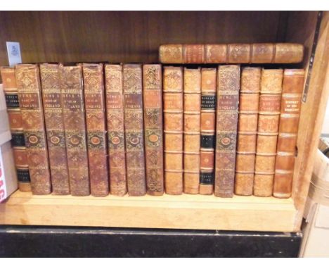
Qur'an [English]. The Koran, commanly called the Alcoran of Mohammed, translated into English immediatelyf rom the Original Arabic ... by George Sale, 2 volumes, for L. Hawes, W. Clarke, R. Collins, and T. Wilcox, 1764, engraved folding map of Arabia, 3 genealogical tables (2 folding), folding plan of Mecca, mild toning, light spotting to title pages and leaves facing plates, small faint stain to map, contemporary speckled calf, slightly rubbed and worn, volume 1 front board detached, 8vo, and 1 other First octavo edition and the second overall of Sale's Qur'an, the first English translation to be made direct from the Arabic. (3)
Smollett (Tobias). The Adventures of Peregrine Pickle. In which are included Memoirs of a Lady of Quality, 2nd Cooke edition, printed for C. Cooke, [1799], 13 engraved plates by Corbould and others (including frontispiece to each volume), publisher's catalogue to rear of volume 4, occasional light spotting and browning, closed tear to one leaf in catalogue, contemporary marbled sheep, rubbed, 12mo, together with: Kelly (Hugh), Memoirs of a Magdalen, or the History of Louisa Mildmay, 1st Cooke edition, printed for C. Cooke, [1795], 2 volumes in 1 (as issued), engraved frontispiece, 1 plate, contemporary tree calf, rubbed, 12mo; [Sterne, Laurence], A Sentimental Journey through France and Italy: to which are added the Letters to Eliza, by Yorick. Stereotype edition, according to the process of Firmin Didot, Paris: P. Didot and F. Didot, 1800, initial advertisement leaf, contemporary mottled sheep gilt, slightly rubbed, 12mo; Gilpin (William), Observations relative chiefly to Picturesque Beauty, made in the Year 1776, on Several Parts of Great Britain; particularly the High-Lands of Scotland, 1st edition, for R. Blamire, 1789, 2 volumes in 1, 40 tinted aquatints and soft-ground etchings, some offsetting and spotting to text-leaves, contemporary half calf, covers detached, worn, 8vo; Faulkner (Thomas), The History and Antiquities of the Parish of Hammersmith, 1st edition, Nichols & Son [and others], 1839, engraved frontispiece, folding plan, folding map (torn in 2 parts), text vignettes, edges untrimmed, contemporary quarter cloth, shaken, spine defective, 8vo; and approximately 25 others, mainly 1920s Macmillan pocket editions of Thomas Hardy, original cloth, gilt spines Abbey Scenery 487 for a later edition of Gilpin. Mixed lot containing attractive copies of two pocket editions by innovative publisher Charles Cooke (1759/60-1816); his second edition of Smollett's Peregrine Pickle (first published by him in 1794, possibly with fewer plates) is uncommon, with three copies traced by ESTC. (a carton)
Williams (Griffith). The Right Way to the Best Religion, wherein is largely explained the summe and principal heads of the Gospell, 1st edition, 1636, woodcut additional title (trimmed and laid down with loss), some tears, losses and repairs, occasional light toning, soiling and wormtracks (with some loss of lettering), endpapers renewed, near contemporary calf, rebacked with original spine relaid, a little rubbed with repairs, folio, together with Babington (Gervase), Comfortable Notes upon Every Chapter of the Booke of Leviticus/Comfortable Notes upon the Bookes of Numbers and Deuteronomie/A Very Fruitfull Exposition of the Commandments, by way of Questions and Answers for Greater Plainnesse, 3 parts in one, 1622, titles with woodcut devices, folding table in first part repaired, some light soiling, water stains, hinges reinforced, contemporary blindstamped calf, rebacked and repaired, folio, plus Fuller (Thomas), The Church-History of Britain; From the Birth of Jesus Christ, until the year MDCXLVIII, 1st edition, 1655, five engraved plates (2 double-page including map of Cambridge), titles with woodcut device, a few leaves at front a little frayd at foot, a few minor spots, 18th century sprinkled calf, rebacked and repaired, folio, with two others defective: Francis Mason's Of the Consecration of the Bishops in the Church of England, 1613 (lacking final leaf and blanks) and Thomas Fuller's The Holy State, 1642 (lacking additional engraved title) (5)
![Drake (James). Drake's Road Book of the London and Birmingham Railway, n.d., [1840], large hand-coloured folding engraved map](https://cdn.globalauctionplatform.com/4a279fa1-b769-4902-bddf-a9370119dc68/489ad638-2e6c-4cc9-b893-58679a090039/468x382.jpg)
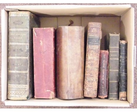
Drake (James). Drake's Road Book of the London and Birmingham Railway, n.d., [1840], large hand-coloured folding engraved map (two small sellotape repairs), wood engravings to text, Drake's Time Tables booklet present, 16 pages of adverts at rear, original gilt-decorated cloth, slightly rubbed, 8vo, together with Lever. The Railway and the Mine. Lever's Illustrated Year-Book 1861, engraved vignette title, 8 plates of fossils and other illustrations, 7 pages of adverts to rear, postage stamp to front free endpaper, owner's stamp to front and rear front endpaper, original blind-stamped and gilt-decorated cloth, spine a little sunned and frayed to head, 8vo, plus Lardner (Dionysus), The Steam Engine Explained and Illustrated...and its Application to Navigation and Railways..., 7th edition, 1840, engraved portrait frontispiece, numerous wood-engravings, later cloth with morocco label, 8vo, and Freeling (Arthur), Freeling's Grand Junction Railway Companion to Liverpool, Manchester and Birmingham... , 1838, folding map and folding table of fares, numerous adverts at rear, occasional spotting, original cloth with modern reback, rubbed, 8vo (4)


WWII RAF FLYING HELMET ETC. Various items relating to the WWII RAF service & later RAFVR service until 1959 of F/LT. Derrick C.W Olds. Included his Type C (navigator) flying helmet, his unworn Defence & War Medals, tunic badges, cap band & epaulettes, plus a War Office OS map of the London area & various flying manuals & personal service documents Also his suitcase with travel labels from his service in Rhodesia. Provenance: from his family.Please note: Our in-house postal service is NOT available for this lot due to its fragility, size or weight. Shipping is available through our recommended carrier MBE Plymouth... telephone 01752 257224.

FOLDING MAP. A Penwith peninsula & Mounts Bay folding map, now framed & glazed, 44x55cm. Sold together with its original Edward Stanford (Retailer) slip case.Please note: Our in-house postal service is NOT available for this lot due to its fragility, size or weight. Shipping is available through our recommended carrier MBE Plymouth... telephone 01752 257224.


Bernard Randolph, Morea Olim Pelopennesus, 1689, map of the Peloponnese. On the right top an Albanian shepherd in traditional clothing; on the bottom left, a view of Malvasia, 43 x 53 cm, bronzed frame. Bernard Randolph was an English merchant. He stayed in the East for approximately nine years and toured the Peloponnese, the Aegean islands, Crete and Rhodes.


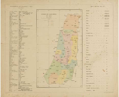
Near East.- Jerusalem.- Wilson (Capt. Charles W.) Ordnance Survey of Jerusalem, portfolio of plans only, 5 large folding engraved maps, dissected and mounted on linen, edged in blue cloth, all with printed label on verso, some light spotting and soiling, mostly to versos, a little staining to linen backs, small hole to plan of Jerusalem at centre of folds but no loss to maps, with an additional folding map (also on linen and edged in blue cloth but without label), loose as issued with lists of Contents to vol.1 & 3 (soiled & stained) in contemporary half roan folder with flap, title mounted on front pastedown and list of plates on inside of flap, rather worn, folio, 1865. ⁂ The plans portfolio from Wilson's epic survey, the first modern cartographic and archaeological survey conducted in Palestine and undertaken on behalf of the Water Relief Committee with the intention of providing a street-by-street guide to Jerusalem's wells, conduits, cisterns etc. Wilson went on to become a key member of the Palestinian Exploration Fund, involved in several futher surveys in the Middle East. Comprising: Plan of Jerusalem, with Contours; Plan of Jerusalem, Hill Shaded; Plan of the Church of the Holy Sepulchre (2, one without label); Plan of Kubbat as Sakhra, the Citadel, &c.; Plan of the Haram, with Contours. The additional map is a revised version of the plan of the Church of the Holy Sepulchre of 1892.
Algeria.- Parkhill (D.) Adventures in Algeria, autograph manuscript, 66pp., 7 watercolour scenes and a pen and ink map of Algeria, slightly browned, original boards, soiled and creased, 165 x 105mm., 1894.⁂ A 19th century juvenile story about being taken prisoner by the Turks in Algeria. The above manuscript is captioned "Book 2", but this story is complete.
Near East.- Conder (Lt. C.R.) and Lt. H.H.Kitchener. Map of Palestine in 26 Sheets from Surveys conducted for the Committee of the Palestine Exploration Fund during the years 1872-1877, title, hand-coloured key map and 26 photozincographed map sheets with partial hand-colouring, sheets c.540 x 660mm., mounted on linen (a few conjoined), title spotted and soiled, title and key map torn and frayed at edges, maps foxed and with some surface dirt, some evidence of mildew, loose as issued in original half-morocco portfolio, worn, boards detached, lacking one flap, folio, printed by the Ordnance Survey Office, 1880; sold not subject to return

Near East.- Palmer (E.H.) The Desert of the Exodus, 2 vol., Cambridge, 1971 § Conder (C.R.) Tent Work in Palestine, 2 vol., 1878 § Laborde (Léon de) Journey through Arabia Petraea, to Mount Sinai..., second edition, 1838 § Williams (George) The Holy City. Historical, Topographical, and Antiquarian Notices of Jerusalem, 2 vol., second edition, large folding map on linen, contemporary calf, gilt, g.e., rebacked with gilt spines, 1849, maps, plates and illustrations, some folding, many lithographed, some tinted, occasional spotting, all but the last original cloth, rubbed, the second recased with new endpapers; and c.20 others, Palestine and the Holy Land, 8vo (c.25)
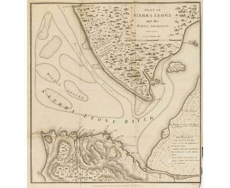
Africa.- , Account of the Colony of Sierra Leone (An), engraved folding map frontispiece, small tear, repaired, faint damp-staining to first few leaves, occasional pencil underlining and soiling, modern half calf, James Philips, 1795 § Rankin (F. Harrison) The White Man's Grave: a Visit to Sierra Leone in 1834, 2 vol., first edition, engraved frontispieces, vol. 1 frontispiece laid down, 2 plates, occasional damp-staining and browning, modern half calf, 1836; 8vo (3)
Africa.- Alldridge (T. J.) The Sherbro and its Hinterland, portrait frontispiece, plates, 2 folding maps, 1 in pocket at end (small tears to foldlines), occasional pencil annotations, modern morocco, 1901; A Transformed Colony. Sierra Leone, portrait frontispiece, folding colour map bound at end, small tears, cracked hinges, original cloth, a little rubbed, slight fading to spine, 1910 § Trotter (Lieut.-Col. J. K.) The Niger Sources, frontispiece, plates, folding map, tears (repaired), ex-library with usual ink-stamps, modern morocco, 1898; and another, similar, 8vo (4)

Africa.- Laing (Major Alexander Gordon) Travels in the Timannee, Kooranko, and Soolima Countries in West Africa, folding engraved map frontispiece, 7 aquatints, occasional faint off-setting, occasional spotting, contemporary calf, rebacked with original spine laid down, a little rubbed, 1825 § The World Displayed; or, a Curious Collection of Voyages and Travels ..., vol. XVII only, 7 engraved plates, 2 folding, ink inscription to front free endpaper, contemporary calf, slight rubbing to corners and joints, 1767; and another, an incomplete copy of John Lindsay's 'A Voyage to the Coast of Africa, in 1758', v.s. (3)
Africa.- Thompson (George) Thompson in Africa, frontispiece, folding map on blue paper at end, illustrations, spotting, modern crushed morocco, lightly faded spine, Cleveland, 1852 § Flickinger (D. K.) Off Hand Sketches of Men and Things in Western Africa, engraved portrait frontispiece (loose), pencil annotations to endpapers, original cloth, small loss to spine extremities, rubbed and worn, Dayton, 1857 § Hewett (Captain J. F. Napier) European Settlements on the West Coast of Africa, occasional pencil annotations, scattered browning and spotting, modern calf, 1862; and a small quantity of others, mostly Sierra Leone, 8vo & 4to (sm. qty)
![Ebel ([J.G.]) An Atlas to Ebel's Traveller's Guide Through Switzerland, new edition, engraved key leaf, 6 contemporary half c](https://cdn.globalauctionplatform.com/a7a0f113-2b45-4305-84bd-a92800ebcde5/3e621402-ffeb-42bf-f975-0e63932c96f5/468x382.jpg)
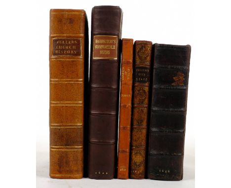
Ebel ([J.G.]) An Atlas to Ebel's Traveller's Guide Through Switzerland, new edition, engraved key leaf, 6 contemporary half calf, engraved folding maps hand-coloured in outline, 5 engraved plates (4 folding), 1 map with small tear, contemporary half calf, marbled boards, rubbed, paper label on spine, joints splitting, gilt spine, rubbed, 8vo, Samuel Leigh, 1819.

Islamic Art.- Persia.- Pope (Arthur Upham) A Survey of Persian Art from Prehistoric Times to the Present, 15 vol. including vol.13 Addendum, vol.14 New Studies and vol.15 Bibliography, second impression of vol.1-12, Addendum original wrappers, the rest original cloth, some spines a little rubbed, Tehran, London, New York & Tokyo, 1967-77; Persian Architecture, 1965 § Gluck (Jay) & others. A Survey of Persian Handicraft, map loosely inserted, Tehran etc., 1977 § Watson (Oliver) Persian Lustre Ware, 1985 § Lentz (T.W.) & Glenn D. Lowry. Timur and the Princely Vision; Persian Art and Culture in the Fifteenth Century, Los Angeles & Washington, 1989, plates and illustrations, some colour, some tipped in, original cloth, the second and last two with dust-jackets; and 4 others on Persian art, 4to & 8vo (19)
Oxford.- Plot (Robert) The Natural History of Oxford-shire, being an essay toward the natural history of England, first edition, engraved title vignette, folding map of Oxfordshire with armorial borders (a little browned), 16 engraved plates, with imprimatur, errata and final blank, occasional light marginal damp-staining, 18th century ink inscription to endpaper and occasionally to margins, contemporary mottled calf, rebacked, rubbed, [Wing P2586], folio, Oxford, 1677.


A group of cased variously .925 and .999 silver coins including two US eagles, two Canadian coloured maple leaf five dollars and one dollar coins, a Canada 125 souvenir map brilliant uncirculated thirteen coin set, Australian one dollar, Millennium five pounds etc, with further base metal commemoratives and two brilliant uncirculated coin sets for 1994 and 2000, etc.


A 17th century plan of the city and environs of London as fortified by Order of Parliament in the year 1642 and 1643, published by Hogg, 21 x 33cm, a pair of engravings depicting old Chelsea, an early engraving the perspective view of the castle and part of the city of Norwich and a map of Cheshire, all framed and glazed (4).


-
109182 item(s)/page