We found 109182 price guide item(s) matching your search
There are 109182 lots that match your search criteria. Subscribe now to get instant access to the full price guide service.
Click here to subscribe- List
- Grid
-
109182 item(s)/page
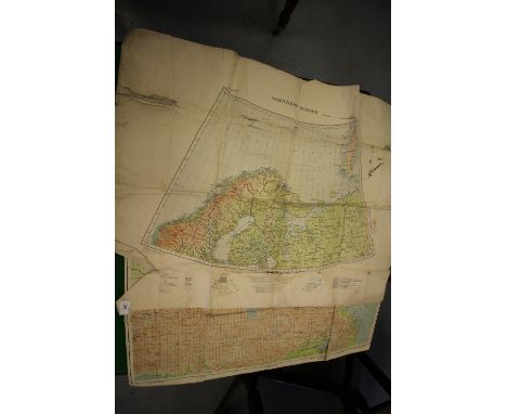


Lot 5154
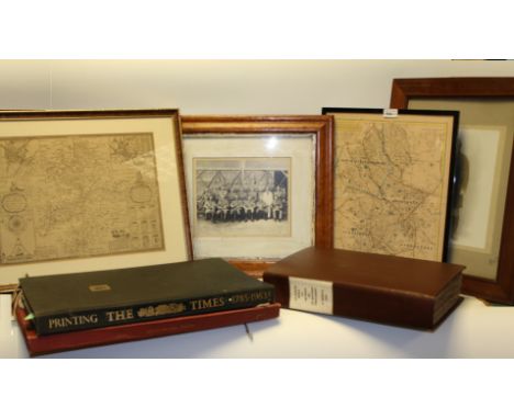
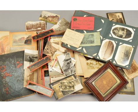
Antiquarian Books, Photographs, Maps and Ephemera - Photography, India/British Raj, Militaria, a late 19th/early 20th century Anglo-Indian Army regimental photograph, the officers and chaplain, their pith helmets inscribed King's, standing before a gut, 20cm x 24.5cm, mounted, maple cushion frame, 44cm x 49cm overall; another, of a Highland subaltern, wearing a kilt, the mount inscribed Rangoon, 44cm x 31cm, framed, (2); Books - Theology, La Sainte Bible, ou Le Vieux et Le Nouveau Testament, Traduits en François sur Les Textes Hébreu et Grec, Par les Pasteurs et les Professeurs de l'Eglise et de l'Académie de Genève, Chez J.J. Paschoud [...], A Genève 1805, later 20th century brown pebble calf binding, paper title-label to flat spine, pastedown preserving contemporary early 19th century crested bookplate: Hugh Percy (a scion of the Dukes of Northumberland), medium folio; Miscellaneous Folios, Thomas Shotter Boys Original Views of London, First Published in 1842 Now Reprinted [...] with Twenty-Six Coloured Reproductions from the Original Lithographs, the Text of 1842, and a Parallel Modern Text by James Laver, C.B.E., two-volume set, Charles W. Traylen, Guildford 1954 - 1955, each with printed card covers, red cloth portfolio binding; Repton (John Adey) and Wilkins (William), Norwich Cathedral at the end of the eighteenth century, with descriptive notes [...], limited edition 546/1000, bookplate to pastedown, Gregg Press, Farnborough 1965, fold-out architectural elevations and plates, contemporary blue cloth, pictorial printed slipcase, atlas folio; Printing The Times Since 1785: Some Account of the Means of Production and Changes of Dress of the Newspaper, Illustrated with Upwards of Fifty Facsimiles of Pages and Many Line Engravings &c., Printing House Square, London 1953, black cloth, royal folio, (3); Cartography, after John Speed, a two-fold map, of the county of Warwickshire, late 19th century monochrome strike, 31cm x 41cm, mounted and framed; 19th century map, of Staffordshire, Published by J & C Walker, London hand-coloured delineations, ebonised frame, (2), [8]
Lot 5184
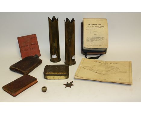
Military interest, World War Two - items relating to the military career of Trooper Eric Swainson, RAC (12th Royal Lancers) 1939-1946: Leather covered steel hip flask 6.25 x 4.25 in (15.7 x 10.7cm); leather-bound pocket French missal 12.5 x 7cm, gilt edges; Emergency ration tin, exterior gilt partly worn, impressed lid with added strip BOVRIL LTD W/E 11/41 opened but barely used 11 x 8 x 2.5cm; Italy star, no ruibbon, some verdigris, also Trencn art, pair of brass 2 pounder QF 40mm anti-tank shell cases (1942 RLB Lot 1412 & 1414/GF on base), tops serrated and everted into five points; also related documents, including an important typed account of a tour through Northern Italy betweren 31st July and 7th Agust 1945 by White armoured car under Sgt. Jordan RAC, 5pp follscap with paper covers: matter-of-fact but graphic descriptions of a countryside ruined by warfare, also 1943 Christmas menu, and race card for British Troops in Austria First Race Meeting Prater, Vienna, 27th October 1945, six races, full detail of runners & Rriders (all BRitish personnel), also Delta Airways proforma flight chart Honolulu to LA 23/10/1991 Lockheed L-19011 under Cpt. Steve Svoboda, coloured Pacific route map, full MS details entered (qty)..

Lot 422
UK Presspack folder For "The Italian Job" (1969) with six UK FOH stills and six black and white publicity photos (some stickered to the reverse), all items from the original 1969 release. The Presspack folder has the Turin map design that was also used on the Quad poster.Stills 8" x 10" (20 x 25.5 cm)Condition: ExcellentAll items unrestored and in excellent conditionArtist: Unknown ArtistVAT Status: M£100 - 200

Lot 184
A rare MAP (French) purple wool plush teddy bear, With clear and black glass eyes, black stitched nose, mouth and claws, golden push ear lining, swivel head, broad shoulders, jointed limbs with plush pads, hump and inoperative growler, 1950/55 —23½in. (59.5cm.) high (slight wear and the odd tiny bald spot) - this bear is known as Esquine from the Eric Petit collection.

Lot 185
A MAP (French) teddy bear 1950/55, With blonde long shaggy mohair, clear and black glass eyes, black stitched nose, mouth and claws coming slightly onto pads, swivel head, broad shoulders, jointed limbs with felt pads and inoperative squeaker —22½in. (57cm.) high (slight damage to hand pads) - this bear is known as Bourrut from the Eric Petit collection.

Lot 186
A MAP (French) teddy bear 1950/55, With brown curly mohair, clear and black glass with with brown backs, black velvet nose, black stitched mouth and claws, swivel head, broad shoulders, jointed limbs with felt pads and inoperative growler —23½in. (60cm.) high (back seam open slightly showing growler) - during the 1950s, FADAP bought the firm MAP, so this model was sold under both names - this actual bear appears on page 69 of Eric Petit’s book on FADAP - this bear is known as Pélégri from the Eric Petit collection.

Lot 188
A MAP (French) teddy bear 1935, With long reddish brown mohair, clear and black glass eyes, inset blonde mohair muzzle, black velvet nose, black stitched mouth and claws coming slightly on to felt pads, swivel head, jointed limbs and inoperative squeaker —15in. (38cm.) high (some thinning) - this bear is known as Peloux from the Eric Petit collection.


Lot 676
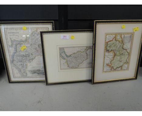
An 18th century coloured map of Wiltshire by Robert Morden, 36 x 42.5cm visible sheet size, a further late 18th century coloured map of Wiltshire in double sided glazed frame, 22.5 x 16cm approx visible sheet size, together with a further 18th century coloured map by Robert Morden Hampshire, 36.5 x 42.5cm approx visible sheet size, all framed


Lot 682
A collection of ten black and white prints of classical style busts and other statuary, together with six further coloured prints of similar classical style subjects, six black and white prints of Victorian erotic subjects and also together with a black and white map engraved Plan of the City and Liberties of London after the Fire of 1666, various sizes all framed

Lot 758
Allan Stuart (early 20th century school) - River landscape, watercolour and body colour on paper, signed, 23.5 x 35cm, together with a late 18th century map of Gloucestershire by J Cary, a 19th century map of Essex, a coloured print of the Kings Head Inn, Aylesbury after Cecil Aldin, etc, various sizes, all framed


Lot 422
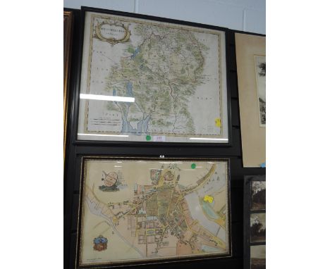
STAFFORDSHIRE, CHRISTOPHER SAXTON & PHILIP LEA, a 17th Century map with plans of Stafford and Lichfield to the right hand side, hand coloured outlines, unframed, 47cm x 58cm, together with hand coloured county maps of Staffordshire by Emanuel Bowen, one 'The Improved Map of the County of Stafford Divided into its Hundreds...' dedicated to Earl Gower, unframed, 75.5cm x 57cm, the other 'A Corrected Map of the County of Stafford Divided into Hundreds....', unframed, 58cm x 46.5cm (3)

Lot 425
ANTIQUE MAPS AND PRINTS OF THE WEST INDIES, BARBADOS AND THE ANTILLES ISLANDS, to include maps by A. Van Krevelt 1777 and Rigobert Bonne, together with engraved prints of Barbados from The London illustrated News 1888 and The Graphic 1882 (Steam Train), most mounted, framed and glazed, largest map approximately 25cm x 36cm (7)

Lot 437
A COLLECTION OF EPHEMERA, containing an eclectic mix of Victorian and Edwardian postcards and photographs, early-mid 20th Century postcards and photographs, including two semi-nude photographs of females one of which has a map with directions on the reverse (damaged) and an album of watercolours and pencil sketches of locations in Cornwall, male and female characters, churches, etc, the album dates from 1888 and is initialled W J C

Lot 691
A BOX OF PICTURES AND PRINTS to include James Priddy 'Lichfield Cathedral' aqua tint etching, 'Surreal Tree Stump' by Mary Pappin, watercolour, 'Summer Breeze' limited edition print 79/250 by Annie Soudain, prints by John Broadbent, photograph of Oxford University X1 1928, and Staffordshire map by J.Bartholomew, all framed, approximate largest size 45cm x 29cm (9)
Lot 15
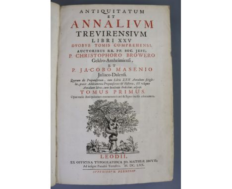
Brouwer, Christoph - Antiquitatum et annalium Trevirensium libri XXV duobus tomis comprehensi. Tomus Primus (Tomus Secundus) Opus variis antiquitatum monumentis aeri & ligno incisis adornatum, 2 vols, vellum, engraved portrait frontis, 2 plates and double page map, Ex. Officina Typographica Jo. Mathiae Hovii, Liege 1670


Lot 415
A 'Playground' London Tube map poster by Maindustrialdesign.com, MA Industrial Design 2009, unframed, 84 x 119cm, together with an exhibition poster for 'Paradise of Exiles - North European Artists in Italy 1600-1880' at the Fitzwilliam Museum, October 1990, 69 x 49cm, three Andy Warhol Marilyn Monroe reproduction posters, 84 x 60cm, and five Body Pressure posters (10)


Lot 515
A Selection of booklets to include The History of New Zealand in picture Map and Story (Published by NABISCO PTY LTD) A Booklet with artists impressions of the city, entitled Rothenburg 0.T.. A rare hand painted cartoon entitled The Lord is my Shepherd I Shall not want, (Published by The CYNICUS Publishing)
-
109182 item(s)/page