We found 109182 price guide item(s) matching your search
There are 109182 lots that match your search criteria. Subscribe now to get instant access to the full price guide service.
Click here to subscribe- List
- Grid
-
109182 item(s)/page


Lot 112
Furniture: An impressive mineral collection contained within a 40 drawer mahogany collectors cabinet This collection of mainly Great British minerals appears to have been collected during the second half of the 20th century and comes with a catalogue detailing each specimen, geological map of the area and further details. 102cm high by 104cm wide


Lot 137
An interesting collection of ephemera and photographs relating to the Stroud area, including navigation certificate for Hubert Edy 1839, a toll certificate (No. 260) otherwise unused, 1" to one mile map of Stroud, Robert K Dawson Royal Engineers Map of the Navigable Coasts and Rivers in England and Wales, advertisements, bills of sale, etc., contained in three ring binders
Lot 168
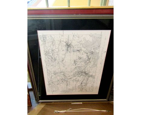
Bacon (G W) New Chart of the British Isles, New Survey Map of South Scotland and sundry Ordnance Survey and two boxes in the form of bindings with gilt lettering for Ordnance Survey of Great Britain Condition Report: Lot 168 - the OS map boxes are full and include the following:1:25,000 scale : Chalford and Sapperton, Horsley and Kingscote and Tetbury.1” scale: Stroud and Chepstow, Gloucester and Cheltenham, Cheltenham Bacon's Cheltenham.1: 25,000 scale: Ordinance survey for Miserden and Painswick.

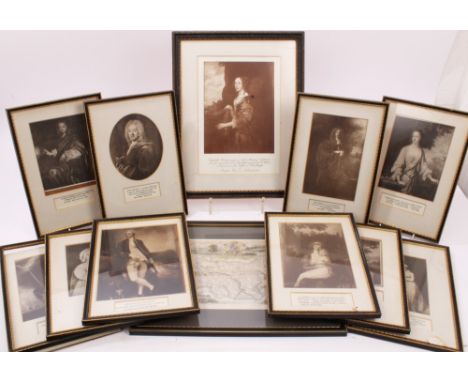
Lot 107
The Marquess of Bristol - a collection of eleven photographic reproductions of portrait paintings of members of the Hervey family, in old glazed Hogarth frames and an antique map of Suffolk, in frame (12)Provenance: Sotheby's - The Contents of Ickworth, June 1996 - The Seat of The Marquess of Bristol


Lot 914
WENCESLAUS HOLLAR (1607-1677) CzechoslovakianThe Island and Kingdom of Candia 1672, (P.691)Worked with views of the Ports of Canea, Retimo, Candia, Suda, a map of the Island, a long historical description of the Island, a map of Italy and Greece and the Mediterranean Sea and maps of the fortifications of Candia and Canea33 x 26 cm CONDITION REPORTS: Generally good condition, with expected wear, margin trimmed, some old repairs and minor losses, some slight staining, mounted.


Lot 3424
Issued 1999 AD. Comprising: a sealed Bank of Romania pack of 1,000 notes; pack serial numbers 049716; pack signed; note serial numbers not visible. Obvs: solar system. Revs: map of Romania. Pick 111a. 800 grams, 142 x 62mm. ("). The image shown for the note has the serial number blacked out as this is a generic image only, to illustrate the design; the image of the three bank packs is of this lot, as offered. [1000] Uncirculated.

Lot 3425
Issued 1999 AD. Comprising: a sealed Bank of Romania pack of 1,000 notes; pack serial numbers 049715; pack signed; note serial numbers not visible. Obvs: solar system. Revs: map of Romania. Pick 111a. 800 grams, 142 x 62mm. ("). The image shown for the note has the serial number blacked out as this is a generic image only, to illustrate the design; the image of the three bank packs is of this lot, as offered. [1000] Uncirculated.


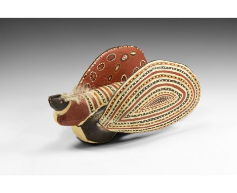
Lot 277
20th century AD. A wooden figure of a bird with black painted head with brown and white for the eyes; notch to the top for insertion of separate beak, feather to the back of the head; long body painted with stripes and dots to the upper side in ochre, black and white, to the lower black and white stripes, to the end of the body a triangular section with dot pattern; large wings back against the body decorated to the outside with ochre, black and white stripes with dot pattern, to the inside ovals against a dark ochre background with ochre, black and white circles and dot patterns to the centre. See Jelinek, J. The Great Art of the Early Australians: The Study of the Evolution and Role of Rock Art in the Society of Australian Hunters and Gatherers, Brno, 1989. Isaacs, J. Tiwi, Melbourne, 2012. 1.47 kg, 41.5cm (16 1/4"). Property of a European collector; formerly from the collection of Prof. RNDr. Jan Jelínek, DrSc., anthropologist, and Director of the Moravian museum, and the president of the International Committee of Museums (ICOM) for eight years; thence by descent 2004; collected by Professor Jelínek during the Moravian Museum expedition collaboration with Department of Aboriginal studies in Canberra, to Arhnem Land in the Northern Territory of Australia, in 1969; from Tiwi Island, Australia. Accompanied by copies of expedition photographs, map and Dr Jelinek's biography. The Tiwi Islands are eighty kilometres north of Darwin, where the Arafura and Timor Seas meet. They are comprised of Melville and Bathurst Islands and are Australia’s second and fifth largest islands respectively. Contemporary Tiwi artists draw on the elaborate decoration of traditional ceremonies, including painting patterns on the body, carving and decorating ceremonial hollow log funeral poles, the creation of elaborate head-dresses and other body adornments, weaving and printmaking borne from the tradition of ceremonial Pukamani poles. Tiwi art differs from that of the people of nearby Arnhem Land in its vibrant colour and emphasis on pattern. [A video of this lot is available on the TimeLine Auctions website] Very fine condition. Rare.

Lot 764
A coloured poster after Emma Kay for the Frieze Art Fair 2004, commissioned for the Tube map cover for Platform for Art, 90x64cm in gilt coloured aluminium frame, together with a further exhibition poster for Michel Montigne, a collage picture incorporating machinery, space rockets, etc, a further collage with sepia coloured photographs of people of the world, etc, together with a set of six coloured reproduction prints of L.N.E.R. railway travel poster after Tom Purvis showing beach scenes etc, 58x40cm in clip frames
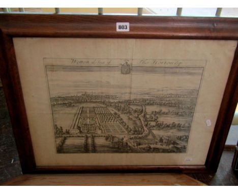
Lot 803
An antique map of Devonshire showing The Hundreds, by Richard Blome, 29x34cm, a black and white engraving after Kip, showing Wotton, The Seat of Thomas Horton, 45x56cm in wooden frame, a further example of the same subject, 34x46cm in black and gilt frame, a 19th century map of Sussex by S Hall, a pair of oriental paintings on silk of children flying a kite and figures playing a game in an interior setting, etc
Lot 807
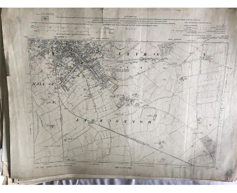
A pair of full length gouache Chinese figure studies of a lady and gentleman both with red seal marks to lower right, 35x24cm together with a framed eastern ceramic panel with painted bird and peony detail, a pair of framed coloured prints relating to the Siamese Horoscope - The Cock and the Rat, a watercolour of a coastal scene, a black and white map of the Minchinhampton area, etc

Lot 872
A 19th century watercolour of a coastal scene with fishermen and distant sailing ship, 30x48cm in gilt frame, a 19th century black and white engraving after George Morland of a piggery, a 19th century coloured engraving of figures viewing a harvesting scene, after T F Herring, an 18th century map of Worcestershire by J Cary, unframed topographical prints of 19th century views of London including Buckingham Palace, The Strand, etc
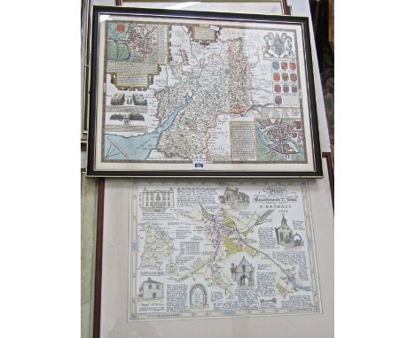
Lot 876
A collection of watercolours by Paul Webley of local subjects including Lower Church Walk, Wotton Under Edge, The Nibley Monument, The War Memorial, etc (11) various sizes, 31x47cm max, all framed, together with a 19th century map of Gloucestershire, a reproduction of an 1897 photograph of Long Street, Wotton Under Edge and a collection of unframed Ordnance Maps of the local area, etc


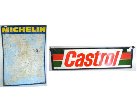
Lot 1105
A Michelin Tyres Monsieur Bibbendum Fat Tyre Man Folding Road Map (France) circa 1920s period; A Monsieur Bibbendum Decorated Napkin Ring; rare and unusual; A 1940s Chrome Plated AA Car Badge, numbered 6C57686, 9cm diameter; and A Veteran Motorists Chrome Plated VW 38 Years Membership Badge, 10cm high (4) Buyer's premium of 20% (+VAT) applies to this lot
-
109182 item(s)/page