We found 109198 price guide item(s) matching your search

Refine your search

Year

Filter by Price Range
  • List
  • Grid
  • 109198 item(s)
    /page

Lot 4002

Joseph Browne (last-quarter, 17th century), a map of Staffordshire, dated 1682 within the plate, the border with the coats of arms of all the armigerous families of the county, the upper-left margin with a Baroque dedicatory cartouche to the Earl of Shrewsbury and surmounted by the full Talbot coat of arms, the lower-right margin with a classical maiden emblematic of cartography, the remaining margins with key and armorial devices in conforming cartouches, from The Natural History of Staffordshire by Robert Plot (1640-1696), [Oxford 1686], etched and engraved with contemporary hand-colouring, 63cm x 54cm

Lot 4062

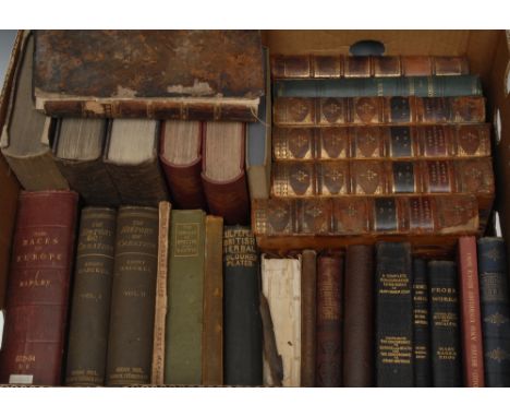
Nineteenth-Century Thought - Natural History and Anthropology - Darwin (Charles), The Origin of Species by Means of Natural Selection, Popular Impression [...], Issued with the Approval of the Author's Executors, London: John Murray, 1902, contemporary green cloth, 8vo; Haeckel (Ernst): The History of Creation [...], Translation Revised by E. Ray Lankester [...], fourth edition, second impression, two-volume set, London: Kegan Paul, Trench, Trübner & Co., Ltd., 1899, lithograph frontispiece, fold-out map and full-page plates, contemporary cloth, 8vo, (2), &, The Wonders of Life: A Popular Study of Biological Philosophy [...], Translated by Joseph McCabe, London: Watts & Co., 1910, original wrappers, 8vo; Ripley (William Z), The Races of Europe [...], London: Kegan Paul, Trunch, Trübner & Co., 1900, 20th century institutional red cloth, University of Manchester presentation plate, 8vo; Journal of the Anthropological Institute of Great Britain and Ireland: Volume III, 1865; Volume V, 1867; Volume VI, 1868; Volume XXIII, 1894; &, Volume XXIV, 1895, harlequin bindings, 8vo, (5); Magenta, [Mahon (Maurice Hartland)], The Treatment of Our Domesticated Dogs, second edition, Edinburgh and London: William Blackwood and Sons, 1868, contemporary pictorial purple cloth gilt, 12mo; Forrest (Col. Chris.), The Complete American Farrier, and Horse Doctor [...], London: W. Nicholson & Sons, [n.d., c. 1870], pictorial cloth, 12mo; Botany, Culpepper's British Herbal and Family Physician, London: Milner & Company Ltd., [n.d., c. 1860], colour plates, green cloth, 8vo; Politics and Philosophy - Mill (John Stuart), Three Essays on Religion [...], first edition, London: Longmans [...], 1874, contemporary green cloth, 19th century pasted botanical specimen to flyleaf inscribed in ink MS: Leaf of French Honeysuckle from J.S. Mill's Grave, Avignon, 8vo; The Philosophical Works of David Hume [...], four-volume set, Boston: Little, Brown and Company, 1854, contemporary three-quarter calf over marbled boards (some disbound, loose), 8vo, (4); Whately (Richard, D.D., Archbishop of Dublin), Elements of Rhetoric [...], seventh edition, London: B. Fellowes, 1846, contemporary polished calf gilt, crested ownership stamp to title-page, later 19th century Welsh lady's book label: Sarah Atkinson, Bangor, 8vo; Richard Cobden; etc

Lot 4001

John Speed (1552-1629), by and after, a two-page map, Darbieshire defcribed (sic, Derbyshire), London: [...] [A]re to be fold by Thomas Bafsett [...], [...] Richard Chifwell [...], Now Sold by Henry Overton [...], dated 1666 within the plate but 1713-1743, hand-coloured etching and engraving, 44cm x 55cm, Hogarth-type frame

Lot 4004

Robert Morden (c. 1650-1703), by and after: a set of three maps, The North, East and West Ridings of Yorskhire, [London]: Sold by Sold by Abel Swale, Awnfham (sic) and John Churchill, [n.d., 1695], monochrome etchings and engravings, 49.5cm x 40.5cm, (3); another, two-fold map, Darby Shire (sic, Derbyshire), [London]: Sold by Sold by Abel Swale, Awnfham (sic) and John Churchill, [n.d., 1695], monochrome etching and engraving, 39cm x 44.5cm, (1); Richard Blome (1635-1705), by and after, A Mapp (sic) of Nottingham Shire, upper-lefthand margin with armorial dedication cartouche to the Earl of Chesterfield, two-fold etching, 33.5cm x 28cm, (1), each map mounted and framed en suite, [5]

Lot 3999

John Ogilby (1600-1676), by and after, two-page map, The Road from London to Flamborough Head [...] [Yorkshire], the whole surmounted by the crowned Royal Arms within a Baroque cartouche, [London: 1675 or later], hand-coloured etching and engraving, 36cm x 43cm

Lot 3996

An early Victorian Scottish hand scrivened watercolour map 'sampler', by Hugh Macmillan, aged 12, with titled vignette of Royal Standard and Crown of England, signed with iniatials and dated 1845, signed again and inscribed Aberfeldy to verso, 42cm x 33cmThe Very Rev Dr Hugh Macmillan FRSE FSA DD LLD (1833-1903) went on to become a minister of the Free Church of Scotland, serving as Moderator of the General Assembly in 1897. He was also a prolific author on theological subjects, perhaps most notably of his Bible Teachings in Nature of 1867 which was published in fifteen editions.

Lot 4166

Topography and Antiquarianism - West [William], The History, Topography and Directory of Warwickshire [...], Illustrated with Characteristic Etchings and a Map of the County, Birmingham: Printed and Published by R. Wrightson [...], 1830, contemporary red cloth, 20th century pictorial bookplate to recto pastedown: F.W. Hackwood, 8vo; two copies, Burgess (J. Tom., F.S.A.), Historic Warwickshire, Edited and Revised by Joseph Hill, second edition, Birmingham, Leicester, and Leamington: The Midland Educational Company, Limited, [1893], 4to rebacked in velvet over cloth, top-edge gilt, & 8vo in contemporary red cloth pictorial gilt, (2); Atkinson (D.H.), Ralph Thoresby, the Topographer; His Town and Times, two-volume set, Leeds: Walker and Laycock, 1885-1887, 20th century green levant morocco, gilt spines, top-edge gilt, Amalfi paper endpapers, 8vo, (2); Fletcher (J.S.), Picturesque History of Yorkshire [...], six-volume set, London: The Caxton Publishing Company, [n.d., 1903-1904], contemporary red cloth, gilt armorials to upper-cover, all edges gilt, 4to, (6); Gray (Thomas), The Town of Cambridge: A History, Cambridge: W. Heffer & Sons Ltd, 1925, illustrated, contemporary three-quarter green morocco over cloth by Cox & Allen, stamped, top-edge gilt, marbled endpapers, 8vo; Roby (John), Traditions of Lancashire, Illustrated, sixth edition, two-volume set, John Heywood Ltd., [n.d. 1900], contemporary blue cloth, 8vo, (2), [14]

Lot 4160

Micali (Giuseppe), Antichi Monumenti, Per Servire All'Opera Intitolata L'Italia Avanti Il Dominio Dei Romani, Firenze: Nella Stamperia Pagani, 1821, [v], vi-xiv, illustrated with a four-fold map of Italy by Pélicier (fl. 1800-1820) after Jean Baptiste Bourguignon d'Anville (1697-1782) and 67 double- and/or full-page engravings, contemporary Italian vellum gilt, two gilt-lettered labels applied to spine, marbled endpapers, medium folio

Lot 3484

Cartography - an early 20th century lacquered brass tripod map or chart reading lens, 4.5cm diam

Lot 4104

Classics - Aristophanes: The Eleven Comedies [...], New York: Tudor Publishing Company, 1936, King's School, Canterbury half-calf and gilt cloth prize binding, marbled endpapers, presentation plate to recto pastedown, 8vo; Aikin (John), A Treatise on the Situation, Manners and Inhabitants of Germany; and the Life of Agricola; by [...] Tacitus [...], and a Map of Antient (sic) Germany), second edition, London: Printed for J. Johnson [...], 1805, contemporary speckled calf boards (upper-cover loose, absent spine), gilt, by C. Lewis, 4 Salisbury Strt, Strand, [London], his ticket, drab endpapers, Plain Armorial bookplate: Sir John Bickerton Williams, Knt, LLD, FSA (1792-1855, nonconformist author and lawyer), 8vo; Robertson (William), An Historical Disquisition Concerning the Knowledge which the Ancients had of India [...], eighth edition, London: T. Cadell [...], 1821, fold-out maps, contemporary calf boards only, gilt, 8vo, (disbound); Ovid, Metamorphoses, [Translated by Sir Samuel Garth, John Dryden, etc], London: Printed for Jacob Tonson [...], 1717, lacking title-page, 6 engraved classical and allegorical plates at the commencement of each book dedicated to aristocratic ladies with their coats of arms, woodcut vignettes and florid initials, contemporary calf boards only (loose), 12mo, (faults); Terence, Comedies Made English, with His Life, and Some Remarks at the End by Mr Laurence Echard, [London, second-quarter 18th century], title-page torn in half, contemporary panelled calf, 16mo; others, various bindings and sizes, (2), [7]

Lot 4117

Miscellaneous - The Life of John Wilkes, Patriot: An Unfinished Autobiography, with illustrations by Donald Higgins, numbered limited edition 107/200, London: The Lion and Unicorn Press, 1955, printed in Monotype Caslon Old Face on Chariot Offset Cartridge Paper, illustrated with photo-lithography, contemporary boards, gilt pictorial upper-cover and lettered spine, acid-free paper wrap, 8vo; Topography, Provincial Imprint, Allan (George Esqr., F.S.A.), Historical and Descriptive View of the City of Durham, And its Environs, To which is added a Reprint of Hegg's Legend of St. Cuthbert from the Edition of Late, Durham: Printed & Sold by T. Hoggett [...], [1824], fold-out city map frontispiece, title-page vignette by C. Thomas of Edinburgh, contemporary cloth over blue boards, 8vo, [2]

Lot 4003

Robert Morden (c. 1650 - 1703), by, two-page map, Darbyshire (sic, Derbyshire), [Published and] Sold by Abel Swale, Awnfham (sic) and John Churchill, London, dated 1695 in MS pencil within the title cartouche, hand-coloured copperplate engraving, 37cm x 43cm

Lot 101

Blome, a hand coloured map of Worcestershire, 10.5ins x 13ins, together with a hand coloured map of Glamorganshire, 15ins x 20.5ins, another antique hand coloured map of Worcestershire (Wigorniensis), 10.5ins x 12ins, a Morden map of Warwickshire, 14ins x 16.5ins and another antique map of Worcestershire, 3.5ins x 5.5ins

Lot 290

A fold-out guide map, of New York City, Manhattan and The Bronx, published by C S Hammond & Co, Church Street, New York, and dated 1912

Lot 111

An Antique hand coloured map, Bowles's New Medium Map of Oxfordshire, 14ins x 9.5ins

Lot 112

An Antique hand coloured map, A Mapp of Wiltshire by Blome, 13.75ins x 11ins

Lot 116

An Antique hand coloured map, An Accurate Map of Great Britain from the latest & best Observations, 15.5ins x 12ins

Lot 4106

Miniature Books - Fénelon [François de Salignac de la Mothe], Pious Reflections [...], With a sketch of his Life, London: Henry Washbourn, 1829, pp: x, 104, engraved portrait frontispiece, contemporary printed wrappers as issued, 48mo (9.2cm x 6.1cm); Diamond Classics, Catullus, Tibullus et Propertius, Londonini, Impensis G. Pickering, 1824, pp: [6], 92, [2], engraved frontispiece, contemporary cloth (worn, split), 48mo (8.8cm x 5.4cm); Precious Stones: Diamonds, London: Rivingtons, 1882, contemporary black cloth, gilt in the Aesthetic Movement taste, 48mo (9cm x 6cm); Cartography, Bacon's Cycling Road-Map of England, No. 6, London: G.W. Bacon & Co Ltd., [n.d. c. 1900], red cloth pasted with pictorials, (faults); John Leech's Pictures of Life and Character: from the Collection of "Mr Punch", London: Bradbury, Agnew, & Co., [n.d. c. 1864], pictorial wrappers, 4to; King James Bible, four pages of a mid-17th century imprint, comprising dedication [2] and Translatours (sic) to the Reader [2], loose; a late 19th/early 20th century Italian rounded rectangular desk clip, decorated in polychrome with the Medici arms, on a field of Florentine scrolls, 16.5cm long, c. 1900; Ephemera - a Charles II ink MS on vellum indenture, dated 1670, 24cm wide; 19th century Plain Armorial bookplate, of Stephen Allaway, later inscribed in ink MS, 11.2cm x 7.5cm; a late 19th/early 20th century Italian rounded rectangular desk clip, decorated in polychrome with the Medici arms, on a field of Florentine scrolls, 16.5cm long, c. 1900; etc, [collection, 10]

Lot 3998

Joan Blaeu (1596-1673), a two-page map, Arabia, [Amsterdam ?1662], lower-left margin with Baroque scroll title cartouche, emblematic Arabs and putti, further putti and scrolls to upper-right margin, hand-coloured copperplate engraving, 42cm x 52cm

Lot 4057

Theology - Provincial Imprint, Fleetwood (Rev. John, D.D.), The Life of [...] Jesus Christ [...], Liverpool: Printed by Nuttall, Fisher, and Dixon, 1809, engraved frontispiece, fold-out map, contemporary marbled calf, 4to; another edition, Edinburgh: Blackie and Son, 1861, engraved frontispiece and title-page vignette, further full-page engravings within decorative frames, contemporaneous panelled calf gilt and blind, marbled edges and endpapers, loosely inserted ink MS bookbinder's bill dated 1861 - this volume cost just £1 to rebind, large 8vo; Conybeare (The Rev. W.J.) & Howson (The Rev. J.S.), The Life and Epistles of St. Paul, two-volume set, London: Longman [...], 1855, additional engraved titles, full-page maps, further wood engraved vignettes and illustrations, contemporary brown morocco, covers with triple-line fillet gilt, all edges gilt, yellow endpapers, 4to, (2); Stephens (W.R.W.), The Life and Letters of Walter Farquhar Hook D.D., F.R.S., second edition, two-volume set, London: Richard Bentley & Son, 1879, Woodburtype portrait frontispieces, contemporary polished calf gilt, bookseller's tickets for A.W. Jordan, Truro, 8vo, (2); Local Provenance, The Works of Bishop Hall [...], volumes IX & X only, London: Printed by C. Whittingham [...], 1808, Plain Armorial bookplates to each pastedown: Mansfeldt Forster Mills [of Tapton Grove, Chesterfield, Derbyshire], contemporary calf (disbound), 8vo, (2); Serle (Ambrose), The Christian Remembrancer [...], Printed from the Author's fourth edition, London: Fisher, Son, & Jackson, 1831, engraved frontispiece, contemporary quarter-calf over marbled boards, 18mo; Drexelius (Jeremy), The Heliotropium [...], Translated from the Original Latin by the Rev. Reginald . Shutte [...], signed by the translator and dated 1888, fourth edition, London: Hall & Co [...], 1884, frontispiece painted in red, contemporary green cloth, 8vo; etc., [24]

Lot 3182

A George III silkwork oval map, by M Foster, Dalestorth School, [Nottinghamshire], embroidered in colourful silk threads with a map of the United Kingdom, Britannia stands in the upper-left margin, the whole within a stylized meandering floral border, inscribed reserve to apron, verre églomisé rectangular mount, 19th century gilt gesso and softwood frame by John Frost of Mansfield, labelled, 72cm x 62cm, the sampler dated 1819

Lot 181

A new map of Amsterdam engraved on canvas "Nouveau Plan D'Amsterdam 1857", after Willem Cornelis Van Baarsel and Petrus Nicolai Tuyn. 42 cm x 52 cm.

Lot 183

Seutter. Regio Canaan seu Terra Promissionis, early 18th century hand coloured engraved map, with large vignette of Christ driving out evil spirits, top left, map of the Exodus with Moses holding the tablets lower right. 50 cm x 57.5 cm, together with an 18th century map by Isaak Tirion "The Provenance of Gelderland", engraved by J Keizer, 1740. 35 cm x 39.5 cm (see illustration). CONDITION REPORT: In our opinion the maps are as dated and there is no reason to dispute this. The paper looks to be period. The Seutter map has a corner tear at the bottom left. There are creases and slight tears to the middle bottom and further creases through the centre fold. The Tirion map is unglazed. There is a Perspex window on the reverse with the letter dated 1959, this has affected the front of the map by leaving a large rectangular section to the centre which is clean but the outer 2” are darkly stained and the remainder of the map is lightly stained. It looks like the map has been glued down to its backing.

Lot 184

A hand coloured map of The United States of America, 20th century, London Atlas Series, published Edward Stanford Limited, London, glazed and framed image 45.5 cm x 61.5 cm, together with a triple A aerial base map of Brook Hill Farm, given to Washington University and two black and white photographs (framed as one) of Rockefeller Center Roof Studio, each image 18 cm x 72 cm (3).

Lot 232

A Blaeu antiquarian map, "Principality of Bearn", double sided, 39 cm x 50.5 cm.

Lot 233

A Blaeu antiquarian map, "Diocese of Sarlat", double sided, 39 cm x 50 cm, framed.

Lot 234

An antiquarian map by Petro Bertio "Imperii Caroli Magni et Vicinarum", 65 cm x 98 cm, framed.

Lot 72

A Blaeu antiquarian map, "The Middle Part of Galloway", circa 1654. 44 cm x 56 cm, framed.

Lot 1299

Russian Political Map 1789-1861 - printed in Russia. Folding canvas backed Russian label to verso - circa 1930's/1940's. Size 56" x 39".

Lot 40

Queen The Complete Works QB1 vinyl box set from 1973 containing 14 LPs and including tour itinerary map of were Queen have charted together with the Complete Works brochure. Excellent condition in box.

Lot 201

A framed & glazed antiquarian map of Devonshire. Engraved for Lewis' Topographical Dictionary c. 1840. Approx. 37 x 43cm.

Lot 465

Large Waterways map of the Norfolk Broads 1963 and framed printing plate of Salhouse, Norfolk, 1881. Waterways map was specially prepared for Shell-Mex and B.P. Ltd. by George Philip & Son Ltd. in 1963 and the etched printing plate measures approx. 35 x 3

Lot 2051

Collection of framed pictures, predominantly modern decorative prints, to include a facsimile map of British Isles by Blaeu, a late-19th century French fashion plate, a Chinese silk painting of fish, two naive watercolour street scenes in the manner of Lowry, an unframed (but mounted) 19th-century map of Shropshire by Thomas Moule, and others (16)

Lot 3081

A map of Minorca circa 17th Century coloured, rolled in tube

Lot 536A

JOHN SPEEDE; a hand tinted map of Hertfordshire, 40 x 52.5cm, also a map of Cheshire, 20 x 25cm, framed and glazed (2).Additional InformationIt is an original map with Baynton-Williams of London label verso.

Lot 618

A Dutch silver menorah on loaded spreading circular base, approx 18.5 x 18cm (af), a kiddush cup by Joseph Zimmerman, Chester 1919 and a smaller white metal example bearing map of Israel in relief with marks in Hebrew, weighable silver/white metal 2.7ozt/83g (3).Additional InformationOne end of the menorah is badly dented and misshapen, this will need attention, further dents and misshaping throughout with general wear and tear. The same applies to the other items, some dents, scuff marks etc. 

Lot 494

Three antique Southend on Sea prints and nine framed county maps, framed map size 34 x 29cm.

Lot 122

An early framed map of Essex, framed size 49.5 x 40cm.

Lot 333

Cigarette cards, Military, a collection of 25 type cards inc. Taddy VC Heroes - Boer War (1, no 62), Edwards, Ringer & Bigg War Map of the Western Front (coloured) (2), Salmon & Gluckstein Traditions of the Army & Navy (5), Salmon & Gluckstein Heroes of the Transvaal War (5) etc (gen gd) (25)

Lot 744

Ephemera, a mainly military selection of ephemera inc. engravings from the Illustrated London News 1850's - 1890's showing Queen Victoria reviewing the troops at Chobham Common, also battle re-enactments, views of the camps at Chobham & Bagshot, Aldershot review, military manoeuvres at Aldershot, Queen Victoria at Aldershot etc, Childerhouse, Her Majesty's Army, The First 50 Years No 50 of 50. Sold with a pamphlet for the Exhibition of German Aircraft & Equipment Oct-Nov 1945 at the RAE Farnborough, a map of the scene of military operations in 1791 in India for the Calcutta Monthly Register, and a few photos etc (mainly gd)

Lot 897

Buses, a 1933 issue 'Map Of Routes (No 4)' together with 2 x 1924 dated double sided Time Tables one for Ealing, Hook & Leatherhead and one for Stratford Broadway, Brentwood and Upminster, 8 x double sided 1934 dated London Transport Time Tables for Wood Green/Farningham, Chislehurst & Orpington/Eltham and Lewisham, 2 x Bexley & Dartford/Eltham & Lewisham, Welling/Catford, Eltham/Chislehurst, Forest Hill/Eltham, Welling/Penge, a double sided London Transport Time Table dated 1945 for Kingston/Ripley together with 6 other 1980s Time Tables and information (gd some with original punched holes for display) (18)

Lot 727

Ephemera, a large qty. of mainly 20thC ephemera to include military, advertising, maps (of note 1865 linen backed map of Paris), 19thC coal mining instruction booklets, touring club maps, 1927 Meccano instructions etc. (fair/gd) (qty.)

Lot 1187

Postcards, Middlesex, a selection of 15 RP cards of Harrow Middlesex inc. Kings Head Hotel, near Hallams, Speech Room, Harrow Toilet Club, Peterborough Rd, School Chapel, Sommerwelle, High St, Churchyard etc Sold with printed cards of Baker St to Harrow Metropolitan Rail Official Map (mainly gd)

Lot 1101

Postcards, Foreign selection of 80+ cards, RP's and printed inc. ethnic, Sudan, Nigeria, St Helena, Columbia, India, map cards, Bermuda, Belgium occupation of German East Africa, Zanzibar, inc. some Social History with military and football noted etc (gd)

Lot 1142

Postcards, map cards, a collection of 25, detailed, coloured, UK and world maps by various well-known publishers inc. Bacon (6), Bartholomew (cyclist touring club), USA (3) etc (gen gd)

Lot 726

Topographical Maps, Booklets and Guides, a large qty. of guide books and souvenir brochures mainly dating from the 20thC to include a booklet set of 12 postcards of Malta (circa 1930), Paris in Four Days (with pull out colour map, circa 1940s), 'Illustrated History of Conway Castle' (very early 20thC), Illustrated Guide To Royal Botanic Gardens Kew (1955), Tourists guide to Bombay (1964) etc. (fair/gd) (qty.)

Lot 680

Railwayana, 2 Underground Maps comprising 1973 'London's Railways' (approx. 102 x 128 cms) and 1974 'Underground Map' (approx. 100 x 128 cms) and a 1962 Railway timetable for Birkenhead to Paddington (approx. 84 x 100 cms) (gen gd) (3)

Lot 997

Postcards, Tony Warr Collection, a selection of approx. 76 military cards inc. personalities, Boer War, flags, patriotic, European soldiers & uniform, comic, Russian-Japanese War Map etc. Artists inc. Becker, F.E.Morgan. Also Tuck published 'The British Army' (1377-1818), Oilette series 9478 (10/12), and Connoisseur series No 2853 (set 6) (mixed condition)

Lot 691

Railwayana, 6 large scale proof sheets, tracing paper plan and maps to show the design of an underground system map in the 1990s (gen gd working copies) (6)

Lot 690

Railwayana, 3 Underground maps dating from the 1990s comprising '1994 Underground Journey Planner' (approx. size 100 x 128), 'London Connections' Underground Map (approx. size 100 x 128) and a 1998 'Tube Map' (approx. size 100 x 128) (vg) (3)

Lot 1117

Postcards, Foreign, a selection of approx. 76 mixed age cards of Russia inc. continental size, cards include anti Hitler map card with Russian bear, Russian Giant Machnow, Siberian women at Alaska-Yukon Pacific expo, railroad to Tiflis, Roosevelt & Molotoff, Lenin, advertisements for Singer sewing machines etc (mixed condition)

Lot 894

London Transport Maps and Poster, 'Night Bus' (64 x 100) (small hole to top corner) circa 1990s together with a London Transport Works and Building Dept. map and a large format 1973 'Round London Sightseeing Tour Bus Map' (100 x 128) (gd)

Lot 769

Ephemera, Motoring, a qty. of items to include 1940/41 Royal Blue timetable for London to South Devon, Official Souvenir Programme of the 1963 International and Vintage Car rally, 6 copies of 'The Queen's Highway' from the 1960s and 70s, 1951 Triumph Instruction Manual, 1930s RAC Road Map, 1952 Castrol booklet 'Achievements', and 1953 booklet 'Monte Carlo Rally', 3 1960s Daily Mail Magazines 'Motor Show Review', tour booklets, excursion maps, bus timetables etc. (mixed condition) (qty)

Lot 326

India Orientalis - Map of Southern Asia A coloured Mercator map of India, China and South East Asia, printed in Amsterdam by H. Hondius, signed 'Mercator Hondius 1630' to mount, 57.5 x 51cmFor further information on this lot please visit Bonhams.com

Lot 156

A plan of London and its environs engraved by J & Co Walker, drawn for Lewis Topographical Dictionary, drawn by R Creighton, together with another map

Lot 125

A Ogilby strip map from London to Southampton circa 1680, and an Isle of Wight and Portsmouth map with Portland, Dartmouth and Falmouth

Lot 316

MIXED LOT INCLUDING CLOTHING, CLOTH MAP AND LINENS, ETC.

Lot 34

A ROBERT MORDEN (SWALE AND CHURCHILL) MAP OF OXFORDSHIRE, in Hogarth frame

Lot 468

TWO BOXES OF BOOKS TO INCLUDE SAMUEL JOHNSON, ANTIQUE MAP INTEREST, FOLIO SOCIETY ETC.

Lot 46

THOMAS KITCHIN 'A NEW IMPROVED MAP OF HARTFORDSHIRE' (SIC), map of Hertfordshire published by Bowles c.1765, hand coloured, in traditional Hogarth frame 61 x 74 cm including frame

Loading...Loading...
  • 109198 item(s)
    /page

Recently Viewed Lots