We found 109182 price guide item(s) matching your search

Refine your search

Year

Filter by Price Range
  • List
  • Grid
  • 109182 item(s)
    /page

Lot 126

After John Cary - `A New Map of Sussex, Divided into Hundreds`, early 19th Century engraving with near period colour, sheet size approx 51cm x 62cm, together with another engraving by Cary, `A Map of Sussex`.

Lot 127

After Robert Morden - `Britannia Saxonica` (Map of England), late 17th/early 18th Century engraving, approx 39cm x 32cm, together with two further engravings, `Hartfordshire` and `Warwicum, Northapton, Hunting etc`.

Lot 128

After H. Moll - `A New Map of the World according to the New Observations`, early 18th Century engraving, together with a large collection of other engravings, all Maps of the World, and `A New Star Atlas` by R.A. Proctor.

Lot 129

After G. Mercator - `Anglia, Scotia et Hibernia` (Map of the British Isles), early 17th Century engraving, together with another engraving after Mercator, `Warwicum, Northhamtonia...`

Lot 131

After John Cary - `Sussex` (Map of the County), late 18th Century engraving, together with four other engravings, Maps of Sussex.

Lot 132

After Robert Morden - `Sussex` (Map of the County), early 18th Century engraving, approx 35cm x 41cm.

Lot 133

After Emanuel and Thomas Bowen - `Sussex, divided into its Rapes, Deanries & Hundreds` (Map of the County), 18th Century engraving with near period colour in outline, within a gilt and wood frame, together with another engraving, `Sussex`.

Lot 3110

LLOYD, Tom. The Stormcaller. London: Gollancz, 2006. First edition, 8vo (233 x 146mm.) Map. Original cloth, dust-jacket. Note: signed by the author and dated `16/3/6` to title-page. - And one other signed first edition by Lloyd (The Twilight Herald. London: 2007, 8vo) (2).

Lot 3201

SHACKLETON, Ernest. South, The Story of Shackleton`s Last Expedition 1914-1917. London: William Heinemann, 1919. First edition, 8vo (250 x 151mm.) Coloured frontispiece, full-page uncoloured illustrations, folding map. (Some browning, occasional spotting, map with minor tear at hinge.) Original decorated cloth blocked in silver (extremities somewhat bumped, head and foot of spine chipped, slight discolouration, lacking front-free endpaper and ?preliminary blank).

Lot 3210

MOGG, Edward. Paterson`s Roads… the eighteenth edition. London: [n.d.] 8vo (226 x 134mm.) 10 folding engraved maps. (Some browning, one map torn and repaired with tape, one other map torn without loss.) Modern calf-backed boards (endpapers replaced). Provenance: signature dated 1835 to title-page.
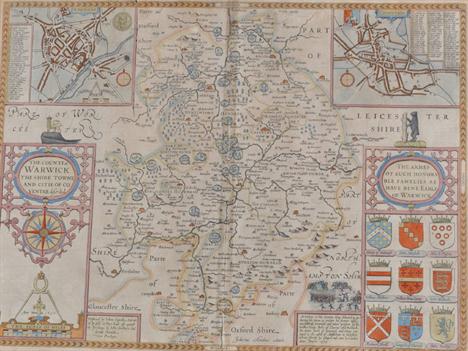
Lot 3240

MAP REFERENCE. - BAYNTON-WILLIAMS, Ashley & Miles. New Worlds, Maps from the Age of Discovery. [London: Quercus, n.d. but circa 2006.] Large 4to (430 x 350mm.) Numerous colour illustrations. (Occasional soiling.) Original cloth, dust-jacket. - And four others relating to maps (5).

Lot 3258

LUCANUS, Marcus Annaeus. Pharsalia, translated into English Verse by Nicholas Rowe. London: printed for Jacob Tonson, 1718. Folio (452 x 184mm.) Engraved frontispiece, engraved title vignette with manuscript red ruled borders, engraved vignette to dedication, double-page map, engraved head and tail pieces, engraved historiated initials. (Some browning, small worm hole affecting the margin of most leaves and the image area of the map.) Old calf (worn, upper cover detached). Provenance: unidentified armorial bookplate verso of dedication.

Lot 3272

HALL, Sydney. Black`s General Atlas. Edinburgh, London, etc: 1841. Folio (444 x 315mm.) 53 engraved maps only (of 54), hand-coloured in outline. (Some browning and spotting, lacks map of Spain.) Contemporary half-morocco, g.e. (worn, upper cover detached, first few leaves now loosely inserted).

Lot 581

A silver coloured cigarette case, stamped `Silver`, the cover engraved with a map of India, circa 1944, 10.7cm long, 144g (4.6 troy ozs) gross

Lot 462

W & A K Johnston`s Map of the Railway Systems of England and Wales also showing Canals

Lot 298

Charles G Harper: The Brighton Road; a soft leather bound miniature road book with integral ribbon map and frontispiece Venture and Viking; publ. London A Treherne, 1909 in original presentation box with compliment card from Mr Alfred G Vanderbilt (who died a hero in the sinking of the RMS Lusitania).

Lot 336

Framed Dundee Map and an 1827 Letter

Lot 91

Cornwallis Harris, W. THE WILD SPORTS OF SOUTHERN AFRICA London: Henry G. Bohn, 1852 fifth edition large 8vo col. illustrations, b/w map gilt pictoral hardcover and all edges gilded, covers scuffed, spine faded, edges worn, age browning and minor foxing, all illustrations and map present, map coming loose from binding, binding shaken 1

Lot 1991

A Large framed Map of Severn Estuary & surrounding area, showing sandbanks, navigable courses etc

Lot 289

ADVERTISING. TWO PURSE MIRRORS FOR G WOODFORD & SON LEICESTER, A MINIATURE COMPASS, FOLDING SILK MAP ETC

Lot 1214

"James Bingley, map of Northamptonshire with coloured vignettes, 26x 19cm, I Kitchin map of Northamptonshire hand coloured in outline, c.1786, 21.5x 16.5cm and J Arthur map of England and Wales, c.1841, 23.5x 18.5cm (3)"

Lot 1263

"After Thomas Speede, map of Devonshire with Excester described, coloured, 41.5x 54cm"

Lot 1480

"*Sperm whales tooth, 6.8cm l, pair of over painted marbles, box of stones and fossils, map measure, two cased cut throats, box of gramophone needles (lot) (Lot subject to VAT)"

Lot 454

EDNA BIZON. `The Deserted Village` (Egmere) , signed, oil on canvas, 7 1/2 x 11 1/2 in ; four engravings after John Dearman depicting `The Seasons`; and a coloured map of Derbyshire , engraved by J.C. Cary . six (6)

Lot 393

A quantity of mainly RAF badges, various cap badges, an embroidered Squadron 267 badge, a silver plated cigarette box decorated with map of India etc.

Lot 1284

Reproduction map of Lincolnshire etc.

Lot 71

Two map engravings of `County of Hertford`, and `Hartfordshire`, circa 1795, 42 x 52 cm, published by M. Hooper and J. Stockdale to/w a Morden Map of Hertfordshire (3)

Lot 137

After Christopher Saxton-a coloured map engraving of Devon, 31 x 36 cm

Lot 1065

Herman Moll antique tinted engraved map of Great Britain, in glazed frame, 102cm x 62cmFurther images and condition reports are available at www.reemandansie.com

Lot 1066

Antique tinted engraved map and chart of Europe and one other map of the United States (2)Further images and condition reports are available at www.reemandansie.com

Lot 298

A 17th Century framed and glazed map of Monmouthshire.

Lot 424

A framed and glazed map of Buckinghamshire, published by WH. Toms.

Lot 404

Railway interest: Official Railway Map of Scotland, pub. Railway Clearing House, London 1912, on linen; LNER Instructions Additional to the Rules, Engineer`s Dept. 1937: Grinling, Charles, The History of the Great Northern Railway 1845-95; Nock, O.S., The Railways of Britain; and Morgan, Bryan, The End of the Line. (5)

Lot 97

An Upper Wye Map by Maude Parker and a Chivas Regal Advert

Lot 268

A Victorian street map of the borough of Birmingham by Day & Son, lithographs to the Queen, together with a large print map of London and suburbs.

Lot 282

A Daily Telegraph war map of the western front from London Geographical Institute

Lot 449

Hardy Bros Graphite" 5/6 weight 9ft fly rod in original bag together with a vintage shooting stick and a cloth map of Somerset."

Lot 350F

A HAND COLOURED MAP OF STAFFORDSHIRE after Robert Morden, 17 1/2" x 15"

Lot 78

AFTER FRANCESCO BARTOLOZZI RA (1727-1815), `Summer` and `Spring`, gouttelettes on paper, 34cm x 28cm; also a map of Ireland, framed. (3)

Lot 689

Sebastian Münster, German 1489-1552- "Die newen Inseln so hinder Hispanian gegen Orient bey dem land Indie gelegen", originally publ. 1544 in Cosmographia Beschreibung aller Lender; hand coloured woodcut, 32.5x36.1cm, Provenance: The Map House, Beauchamp Place, according to label attached to the reverse of the frame: British School, late 19th/early 20th century- Portrait of a man; over painted albumen print, in a gilt wood panel frame with floral and foliate corners, 11x8.5cm: British School, late 20th/early 21st century- The hunt; oil on canvas, signed, 77x92cm: together with two reproduction prints, (5)

Lot 607

Reproduction map of Extima Scotia by Johan Blaeu and Magnae Brittaniae et Hiberniae by W& J Blaeu, both printed by John Bartholomew & Son Ltd, Edinburgh (2)

Lot 608

Johan Blaeu engraved map of Lothian and Linlitquo with text verso and fold to centre, framed 64 x 54 cm

Lot 230

John Lowther: a map of the Isle of Man and British Coast, circa 1650s, 55 by 44cm.

Lot 553

A Swain & Adie of London hunting horn, a hip flask and three maps to include a Banks hunting map of the Cotswolds

Lot 269

AN ANTIQUE HAND COLOURED MAP OF SOMERSET SHIRE BY ROBERT MORDEN IN A HOGARTH FRAME, APPROX. 41 X 38cm

Lot 1323

A framed reproduction map of Leicester and a framed print of a huntsman and a young woman.

Lot 2237

Various pictures and a map.

Lot 44

John Speede Hand coloured map print "The Counti of Warwick 1630," i 15" x 20.5", framed.

Lot 287

An early 19th Century coloured map of Westmoreland, engraved by J. Roper from a drawing by G. Cole, published by Vernor, Hood and Sharpe, Poultry March 1st 1807, 22 x 31cm.

Lot 289

An eighteen century map of London, titled, A plan of the Cities of London and Westminster and Borough of Southwark with New Buildings, ...1767, 30 x 52cm.

Lot 290

The Smaller islands of the British Ocean, a framed coloured tinted map, 19 x 13cm.

Lot 291

A 19th Century map of Island of Nevis, 48 x 63cm and four other smaller maps, including Brazil, pub 1814, Strait of Gibraltar 1818, a correct Chart of the North Sea, engraved for Malham`s Naval Gazetteer, 1801, and a coloured map of Poland, by H. Moll, (5).

Lot 293

An early 19th Century map of Yorkshire, by Jones and Smith, Strand 44 x 53cm and another map of Humberside, 45 x 51cm, (2).

Lot 528

An 18thC silk needlework map of England showing the county boundaries, within a floral border, signed by Searle, 1790, 62cm x 52cm (oval).

Lot 393

NEST OF TABLES, with brass framed tops, the largest, with terrestrial globe map detail, (marked), 107cm L x 46cm W x 40cm H, and a pair of low plain square top tables. (3)

Lot 792

A map of the Southern Hemisphere by George Philip & Sons circa 1852, a coloured map of Berkshire and a Patricia Langmead limited edition coloured print, "View of Brighton Pier", 28/175

Lot 1067

A framed Map depicting The Parish of Eardisley - Michaelmas 1910.

Lot 1184

An early 1700`s unframed Map of Monmouthshire by Robert Morden

Lot 1189

A WWI 1917 War Dept. Booklet on Valleys of Scarpe and Sensee with map plus other booklets on WWII GWR Air Raid Precautions, War Gases and Signalling.

Lot 1393

A framed (copy) Map of Britain from the original by Willem & Johan Blaeu 1635.

Loading...Loading...
  • 109182 item(s)
    /page

Recently Viewed Lots