We found 108737 price guide item(s) matching your search
There are 108737 lots that match your search criteria. Subscribe now to get instant access to the full price guide service.
Click here to subscribe- List
- Grid
-
108737 item(s)/page


Lot 94
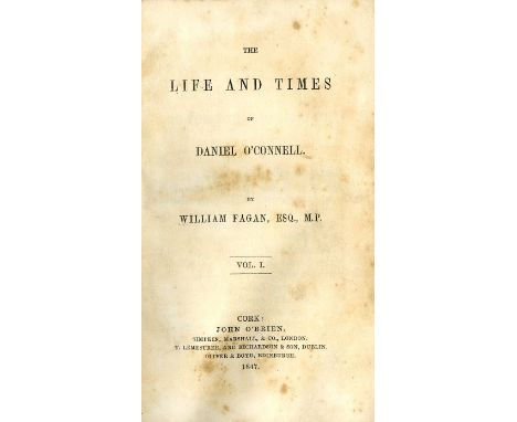
Moore (Thomas) The Life and Death of Lord Edward Fitzgerald, 2 vols. L. 1831. First Edn., 2 hf. titles, 2 frontis (port. & fold. map) cont. hf. mor., gilt spine; Fagan (Wm.) The Life and Times of Daniel O'Connell, 2 vols. Cork (John O'Brien) 1847. First Edn., cont. hf. green mor. mor. labels. Good lot. (4)
Lot 110
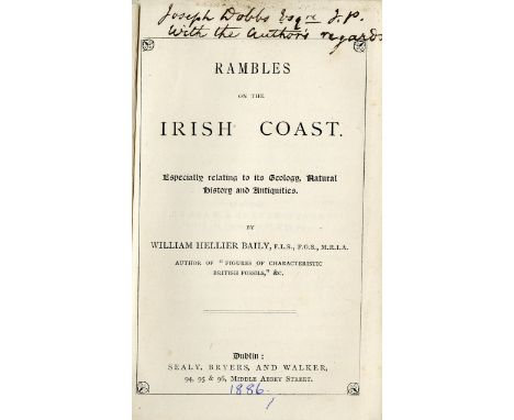
Sleater (Rev. M.) Introductory Essay to a New System of Civil and Ecclesiastical Topography, and Itinerary of Counties of Ireland. 8vo D. 1806. First Edn., uncut, orig. boards; Baily (W.H.) Rambles on the Irish Coast, sm. 8vo D. 1886. First Edn., fold. hand. cold. map frontis. Pres. Copy, cloth, stained; Curran (Wm. H.) Sketches of The Irish Bar, 2 vols. L. 1855. First Edn., cloth; Hull (E.) The Physical Geology & Geography of Ireland, L. 1878. First Edn., 2 hd. cold. maps, illus. etc. cloth. (5)

Lot 112
Smith (Charles) The Ancient and Present State of the County and City of Cork, 2 vols. D. 1774. Second & Best Edn., port. frontis Vol. 1, engd. vign. titles, lg. fold. map of County, lg. fold. plan of city & 12 engd. plts. some fold. include. 3 lg. panoramas, cont. calf, rebacked, mor. labels. (2)

![Barrington (Richard M.) The Migration of Birds as observed at Irish Lighthouses and Lightships, Thick roy 8vo L. & D. [1900]](https://cdn.globalauctionplatform.com/7a8ea991-1c32-47c1-980c-a82000b965a8/15573ed7-ca60-4887-953c-bbdee5567467/468x382.jpg)
Lot 137
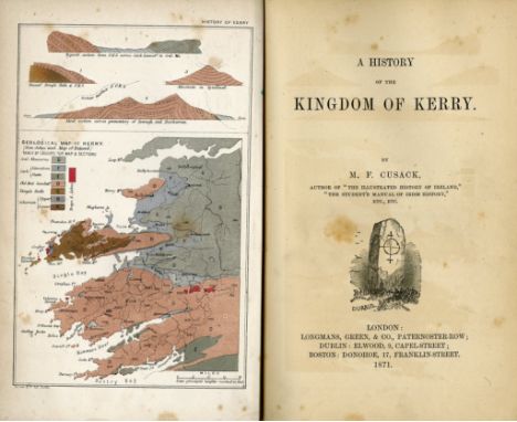
Kerry & Cork: Cusack (M.F.) A History of the Kingdom of Kerry, L. 1871. First Edn., cold. map frontis text illus. & 1 cold. litho plt., orig. gilt decor. cloth. Printed for the Catholic University Stephen's Green, Dublin; also The History of Cork, City and County, roy 8vo D. & C. 1875 First End., frontis & illus. plts., lg. fold. cold. Geological Map of Cork, fold. table, recent cloth. (2)

Lot 143
Pardoe (Julie) The Beauties of the Bosphorus, 4to L. 1839, port. frontis, add. engd. title, engd. map & 78 engd. plts. (v. clean), needs rebinding; Shepherd (Thos. H.) & Elmes (J.) Metropolitan Improvements or London in the Nineteenth Century, 4to L. 1817. Add. engd. title, & 80 engd. plts. each with dble views, cloth; The Gallery of One Hundred British Engravings, 4to L. n.d. add. engd. title, frontis & 99 engd. plts. orig. mor. worn. (3)


Lot 149
Pool (Robert) and Cash (John) Views of the Most Remarkable Public Buildings, Monuments and other Edifices, in the City of Dublin, 4to D. (J. Williams) 1780, large fold. map, engd. t.p., list of subs., fold. plan, & 29 engd. plts., contemp. hf. calf, marble boards, recent mor. labels, clean copy. (1)
Lot 151
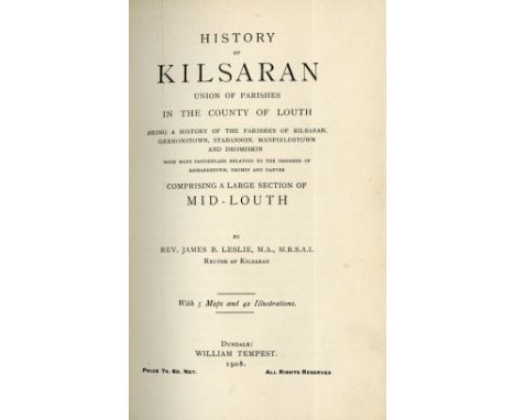
Some Presentation CopiesLeslie (Rev. J.B.) Armagh Clergy and Parishes, roy 8vo Dundalk 1911. First, fold. map & plts.; also Biographical Succession Lists of the Clergy of Down, Enniskillen 1936, First,; History of Kilsaran Union of Parishes in the County of Louth, Dundalk 1908. First, fold. map, & numerous plts. all orig. cloth. V. good. (3)


Lot 183
Fold. Maps - 19th Century: Bacon (W.) New Plan of Dublin and Suburbs; W.H. Smith & Son - Plan of London; Stanford (Ed.) Asiatic Archipelago; The 'Daily Mail' Special Map of the Far East, also 'The Daily Mail' War Map of the Balkan Peninsula, 6 varied coloured linen backed maps, in orig. cloth bindings. As a coll. of maps, w.a.f. (6)


Lot 187
Complete Set of Irish Guide BooksHall (Mr. & Mrs. S.C.)eds. Fine set of four Hand-Books for Ireland, as follows:* "Dublin & Wicklow," L. 1853* "The North and The Giant's Causeway,"* "The South and Killarney" L. 1853& * "The West and Connemara," L. 1853.each with engd. frontis & wd. cut illus. thro-out, & engd. map hd. cold. in outline, in original uniform gilt decorated cloth. a very good set. Rare.(4)

Lot 218
African Travel - Crawford (E. May) By the Equator's Snowy Peak, L. 1913. First Edn., frontis & plts. pict. cloth; Stigand (Capt. C.H.) The Land of Zinj, L. 1913. First Edn., frontis & plts., recent cloth; Dolbey (Capt. R.V.) Sketches of the East Africa Campaign, L. 1918, fold. map & plts., orig. cloth; Leys (Norman) Kenya, L. 1924. First Edn., map frontis, orig. cloth; Routlege (W.S.) & Katherine, With a Pre-historic People, The Akikuyu of British East Africa. L. 1910. First Edn., frontis plts. & fold. map, fold. tables (some cold.), later cloth; & 1 other. (6)
Lot 220
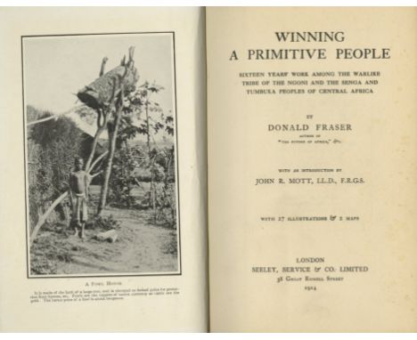
African Travel: Harris (John H.) Dawn in Darkest Africa, L. 1912. First Edn., frontis, plts. & fold. map; Hollis (A.C.) The Nandi Their Language and Folk-Lore, Oxford 1909, First Edn, illus., recent cloth; Fraser (Donald) Winning A Primitive people, L. 1914. First, illus.; Cureau (A. Louis) Savage Man in Central Africa, L. 1915, First Edn., illus., recent cloth; & Hobley (C.W.) Bantu Beliefs & Magic, L. 1922, First Edn., illus. orig. cloth. (5)


Lot 243
Rare Hand-Coloured SetBinding: Bartlett (W.H.) the Scenery and Antiquities of Ireland, 2 vols. in one, sm. folio L. (Virtue & Co.) n.d. 2 hd. cold. add. titles, hd. cold. map & 188 engd. hand - cold. plts., a.e.g., in fine cont. crimson mor. lg. tooled gilt borders, and each cover with central harp decoration, raised bands, with gilt shamrocks in panels. A very attractive copy. (1)

Lot 248
The Rare Hand-Coloured CopyCarr (John) The Stranger in Ireland; or, A Tour in the Southern and Western Parts of that Country in the Year 1805. 4to L. 1806. First Edn., 17 fine hand coloured engd. prints include frontis & hd. cold. map, & 5 lg. fold. plts. fine diced hf. calf, tooled gilt spine, marble sides. A very good copy. Rare. (1)

Lot 252
African Travel: Wilmot (A.) History of the Zulu War, L. 1880. First Edn. Fold. map, adverts at end, orig. brown cloth; Dracopoli (I.N.) Through Jubaland to the Lorian Swamp, L. 1914. First Edn., frontis, illus & 2 maps (1 fold.) 18pp Cat. at end, orig. cloth; White (Stewart Ed.) The Rediscovered Country, L. nd.. illus. thro-out, orig. cloth; Boyes (John) The Company of Adventurers, L. 1928. First Edn., map frontis, & plts. orig. cloth; Roome (Wm. J.W.) Tramping through Africa, L. 1930. First Edn., frontis & plts. cloth. (5)

Lot 257
Seward (Wm. Wenman) Topographia Hibernica; or, The Topography of Ireland, Ancient and Modern. Lg. thick 4to (interleaved copy) D. 1795. First Edn., lg. fold. hd. cold. map frontis, engd. vign. dedit, lg. fold. table at end, uncut, recent hf. calf, fine gilt spine in panels, mor. label. V. good copy. (1)


Lot 281
Maps: Stanford (Ed.) Map of China, Prepared for the China Inland Mission 1899. Lg. fold. linen backed map, full colour, approx. 37 1/2" x 47"; also The Crisis in South Africa - The Orange Free State, the Southern Part of The South African Republic ... 1899, Lg. linen backed folding map, cold. in outline, L. 1899, approx. 27" x 39", in cloth folder. Both good. (2)

Lot 320
Leslie (Rev. J.B.) Ossory Clergy and Parishes, 8vo Enniskillen 1933. First Edn., fold. map, plts., etc., recent fine mor. backed boards; Hore (H.J.) & Graves (J.)eds. The Social State of the Southern and Eastern Counties of Ireland, in the 16th Century, roy 8vo D. 1870. cont. hf. calf; Crofton Croker (T.) The Popular Songs of Ireland, 8vo L. 1839. First Edn., cloth. (3)

Lot 321
Travel: Bishop (Mrs. J.F.) The Yangtze Valley and Beyond, 8vo L. 1899. First Edn., frontis fold. cold. map, plts. etc., cont. buckram; Bell (Sir Chas.) The People of Tibet, also The Religion of Tibet, 2 vols. 8vo Oxford 1928 & 1931. Both First Edns., illus. thro-out orig. cloth. All v. good. (3)


Lot 338
Cornwall: Stockdale (F.W.L.) Excursions in the County of Cornwall, roy 8vo L. 1824. First Edn., Fold. map frontis add. engd. title, & 39 plts. cont. hf. mor.; [Redding (Cyrus)] An Illustrated Itinerary of the County of Cornwall, sm. folio L. 1842. Engd. frontis map, also engd. plts. & text illus. hf. mor.; Langdon (A.G.) Old Cornish Crosses, lg. 4to Truro 1896. First Edn., lg. fold. map, full page plts. & text illus. orig. gilt cloth; 1 other sim. with engd. plts. As a lot. Good. (4)

Lot 339
Irish Map: Hodges & Smith Publ.: Larcom (T.A.) A General Map of Ireland to Accompany the Report of the Railway Commissioners, showing the Principal Physical Features and Geological Structure of that Country. In six sections, all folding linen backed, overall approx. 75" x 61", D. 1837 - 38, in orig. folder & slipcase. As a map, w.a.f. (1)


Lot 375
From Sir Shane Leslie's Library Ruggieri (Ferdinando) Scelta di Architetture Antiche e Moderne della Cittag di Firenze, 5 vols. in 2, lg. atlas folio Florence 1755. Second Edn., ed. by Joseph Bouchard, fold. map 3 engd. ports. 4 add. engd. titles, 5 red & bl titles with engd. vignettes, & 268 engd. single & dble page plts. (ex. 279) uncut, orig. mor. backed boards. Ex. Libris Sir Shane Leslie, with bookplates. (2)


Lot 385
Attractive Group of Spanish Mapsa. Bleau (W.) Utriusque Castiliae Nova descriptio, approx. 54cms x 65cms approx, Amsterdam c. 1688, with orig. hand colouring Dutch letterpress on verso, unframed.b. Bleau (W.) Episocopatus Jacensis vulgo Jaca, approx. 55cms x 65cms Amsterdam c. 1662, cont. hand colour, blank verso;c. Bleau (Wm.) Gallaecia Regnum, approx. 55cms x 65cms, with cont. hand colouring, Amsterdam c. 1642, Dutch letterpress on verso;d. Bleau (W.) Andaluzia Continens Sevillem et Cordubam, approx. 55cms x 64cms, Amsterdam c. 1642, with cont. hand colouring Dutch letterpress on verso. All unframed, as a group of maps, w.a.f.; together with Scarce African Maps: Bleau (Wm. & J.) Aethiopia Superior vel Interior Vulgo Abissinorum sive presbiteri Joanis Imperium, approx. 55cms x 64cms. Amsterdam c. 1635, with cont. hand colouring, Dutch letterpress on reverse, unframed; Brown (Chris) Barbaria [with] [untitled map of Southern Mediterranean and N. Africa] [Malta & Sicily also], approx. 55cms x 64cms, with cont. hd. colouring, Dutch letterpress on verso, unframed. As maps, w.a.f. Both v. Scarce; Bleau (Wm.) Canibales Insulae, approx. 55cmsx 64cms Amsterdam c. 1662, with orig. hand colouring Dutch letterpress on verso, unframed. As a map, w.a.f.; Bleau (Jacob) Insulae Promonterii Viridis Hispanis Isslas de Cabo Verde Belgis de Sonte Eylanden, approx. 55cms x 64cms, Amsterdam c. 1665, with cont. hand colouring, Dutch letterpress on verso. Unframed. As a map, w.a.f.; Jansen (J.) Insulae Canarial Alias Fortunatae dictae, approx. 55cms x 64cms, lg. dble page map Amsterdam, c. 1680, with cont. hand colouring Dutch letterpress on verso, unframed. As a map, w.a.f. (9)
Lot 386
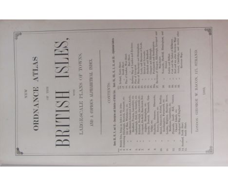
Atlas: Bacon (Geo. W.) New Ordnance Atlas of the British Isles, Lg. folio L. 1883. Printed title, 32 + 1 engd. dbl. page cold. maps & plans, all linen backed, the verso of some maps with small damp stains, not affecting map fronts, all edges gilt, orig. hf. mor. gilt lettered front cover. Good. (1)

Lot 387
With Fine Contemporary Hand-Coloured Folding MapsAtlas: Moll (Hermann) The World Described; or A New and Correct Sett of Maps, shewing the Several Empires, Kingdoms, Republics, Principalities, Provinces & c., in all known parts of the Earth; tall atlas folio L. (J. Bowles) c. 1726. With letterpress title, description and list pasted on inside front cover, with 30 lg. fold. hand coloured maps, as called for including No. 7, Map of North America, showing California as an island, and with cartouche of people preparing the cod fish, also No. 8, Map of Kings Dominions in N. America with the "Beaver" engraving, Map No. 12 South Sea Company, with additions of Bays & Ports, the entire in v. good condition, except for a few maps with upper of middle fold browned, Map 10, Germany, creased at fold (no loss), Map 30, Roman Empire damaged, with loss along two folds, all the maps have been re-strengthened along the folds, in cont. old sheep, recent re-back, with mor. labels, all restoration work by the late Sidney Aiken. As an Atlas, w.a.f. (1)The contents as follows:1.The World in Two Hemispheres2.A Map of the Whole World3.Europe4.Asia5.The East-Indies6.Africa7.North-America8.The Dominions of the King of Great Britain on the Continent of North-America9.The North Part of America10.The West-Indies11.South-America12.A New and Exact Map of the Coasts Countries and Islands within the limits of the South Sea Company13.Moscovy, Poland, Prussia, Little Tartary14.Denmark & Sweden15.A New Map of the Baltick16.Great-Britain17.The South Part of Great-Britain18.The North Part of Great-Britain19.Ireland20.Germany21.The Electorate of Brunswick - Lunenburgh22.A New Map of the Course of the Rhine23.The United Provinces of The Netherlands24.Flanders or The Austrian Netherlands25.France26.Spain & Portugal27.Italy28.The Upper Part of Italy29.The Turkish Empire30.An Historical Map of the Roman Empire
Lot 389
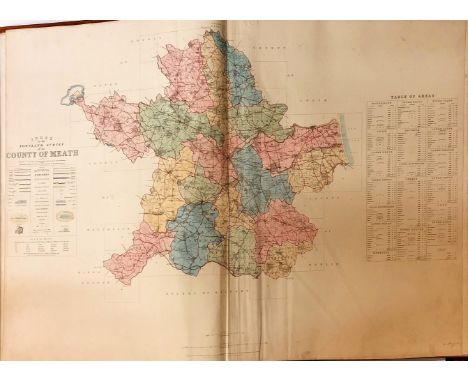
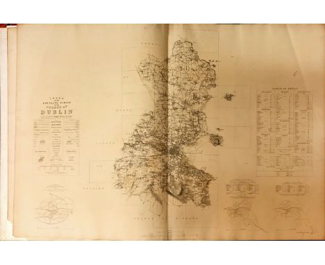
Atlas: Co. Meath: - Ordnance Survey, Atlas with Index to the Townland Survey of the County of Meath, lg. atlas folio D. May 1837. First Edn., cont. hand coloured double page index map & 53 other dbl. page maps, complete, all hd. coloured in outline, in full tooled gilt decorated calf, bound for, Gen. The Hon. Robert Taylor, inscribed in gild on front cover.* An exceptionally fine copy of this large & venerable volume. (1)
Lot 391
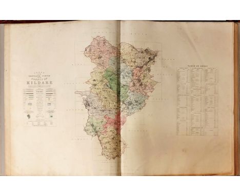
Atlas: Co. Kildare: - Ordnance Survey. Atlas, with Index to the Townland Survey of the County of Kildare, lg. atlas folio D. May 1839. First Edn., cont. hd.-coloured dble page index map, & 40 dbl. page maps, complete, all hd. coloured in outline, in full cont. tooled calf, gilt decorated, rebacked. A very good clean copy. As an atlas, w.a.f. (1)


Lot 394
Rare Map of Dublin, 1717Map: A Map of ye Strand of ye North Side of ye Channel of ye River Anna Liffe as it was granted and set out in Easter Assembly 1717 by ye Rt. Honourable Thomas Bolton Esqr. Lord Mayor of the City of Dublin William Empson and David King Esqrs. Sherriffs of the said City and the Deeds and this Map perfected in the Mayoralty of ye Rt. Honoble Anthony Barkey Esqr. Lord Mayor John Reyson & Vincent Kidder Esq. Sherriffs, An engraved map, approx. 66cms x 48cms (26" x 19") with large engraved cartouche supplied in fac-simile, and some other repairs, framed. As a map, w.a.f. Excessively Rare. The fifth earliest Map of Dublin. (1)

Lot 395
Earliest Printed Plan of Dublin, 1728Map: Brooking (Charles) A Map of the City and Suburbs of Dublin, and also the Arch-Bishop of Meaths Liberties with the Bounds of each Parish, ... Published by John Bowles, London 1728. (1)* This copy without the engraved views of the various notable buildings to either side, approx. 57cms x 89cms (22 1/2" x 35"), some age discolouration, but otherwise in good condition. Scarce in any format.

Lot 396
Rare Dublin MapRocque (John) An Exact Survey of the City and Suburbs of Dublin, in which is Expressed the Ground Plot of all Public Buildings, Dwelling Houses, Warehouses, Stables, Court Yards etc. In four sections, (some are early states), each approx. 54cms x 74cms (21 1/4" x 29") (overall size 43" x 58"). With vary large engraved cartouche enclosing title etc., some age browning, a few minor straight tears (no loss). four sheets, in portfolio. As a map, w.a.f. Ex. Rare. Bonar Law R.I.I. (1)

Lot 397
Map of Dublin: Faden (W.) A Plan of the City of Dublin as Surveyed for the Use of the Divisional Justices, to which have been added Plans of the Canal Harbour and its Junction with the Grand Canal: The Royal Canal and every Projection and Alteration to the Present Time, 1797. With engd. cartouche, approx. 52cms x 76cms (20 1/2" x 30"), now mounted on board, and laminated. As a map, w.a.f. (1)
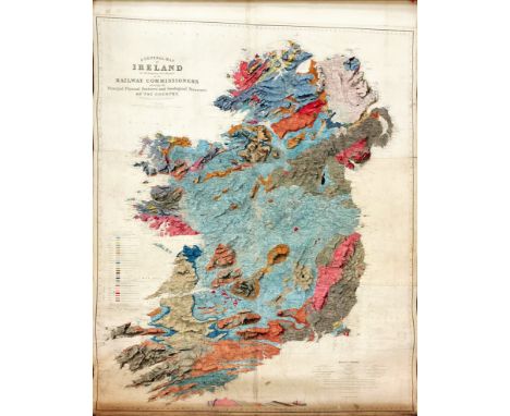
Lot 398
Extremely Fine Large Hand-Coloured Geological MapIrish Map: A General Map of Ireland to accompany the Report of the Railway Commissioners showing the Principal Physical Features and Geological Structure of that Country, Constructed in 1836 and Engraved in 1837-8. Published Dublin (Hodges Smith) & London. Made up of 6 sections now laid on linen, approx. 182cms x 152cms (72" x 60"), signed by Larcom, the entire in finely executed hand colouring, mounted on a contemporary wooden roller with brass wheels. As a map, w.a.f. A very good example. (1)


Lot 400
Rare Map of the Diocese of Meath, 1816Map: Beauford (Daniel Augustus) Rector of Navan, The Diocese of Meath comprising Meath, Westmeath and part of the Kings County, etc. etc, Divided into Baronies and Parishes with their Towns, Villages, Church & Gentleman's seats, to which is added a Sketch of the principle roads,... Fine large engd. map, approx. 63.5cms x 79cms (25" x 31"), hand coloured in outline published 1816, in gilt frame. As a map, w.a.f. (1)* An extremely rare map, in exquisite condition.


Lot 402
Map: Allard (Carol) Hyberniae Regni in Provincias Ultoniam, Connach am Lageniam Momoniamq divisi Tabula Accuratissima Editore Covens et Mortier, Amsterdam [c. 1730] approx. 64cms x 55cms (25" x 21 1/2"), with two large engraved cartouche, and contemporary hand-colouring. One of the more decorative maps of Ireland. As a map, w.a.f. (1)


-
108737 item(s)/page