We found 109198 price guide item(s) matching your search
There are 109198 lots that match your search criteria. Subscribe now to get instant access to the full price guide service.
Click here to subscribe- List
- Grid
-
109198 item(s)/page


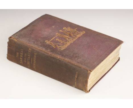
Lot 198
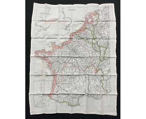
Livingstone (David & Charles), NARRATIVE OF AN EXPEDITION TO THE ZAMBESI AND ITS TRIBUTARIES; AND OF THE DISCOVERY OF THE LAKES SHIRWA AND NYASSA 1858-1864, first edition, red cloth, gilt embossed illustration to boards, pasted and tipped in advertisement pages, foldout engraved frontispiece, engraved plates and illustrations, foldout map, John Murray, London 1865 (at fault)

Lot 229
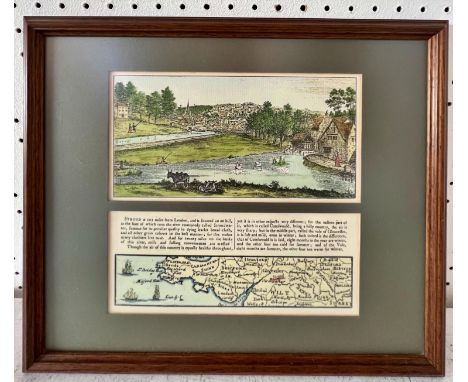
DECORATIVE BINDINGS: A miscellany of works on religion, to include Geikie (Cunningham), THE LIFE AND WORDS OF CHRIST, two vols, full tree leather, gilt embossed decoration to boards and spine, marbled block, marbled endpapers, fold out Palestine map frontispiece to volume one, Cassel & Co Ltd, London 1885; Gardner (James), THE FAITHS OF THE WORLD, A DICTIONARY OF ALL REGIONS AND RELIGIOUS SECTS, two vols, ¾ leather, marbled block, marbled endpapers, engraved frontispiece, illustrated title page, A Fullarton & Co, London; Benson (C), ON SCRIPTURE DIFFICULTIES, second edition, ¾ leather, marbled boards, Baldwin, Craddock and Joy, London 1825, Benson (C), ON EVIDENCES OF CHRISTIANITY ETC, Baldwin, Craddock and Joy, London 1825; Burkitt (W), EXPOSITORY NOTES, WITH PRACTICAL OBSERVATIONS UPON TH ENEW TESTAMENT OF OUR LORD AND SAVIOUR JESUS CHRIST, printed for John Bumpus, London 1825, etc (Qty) (at fault)

Lot 517
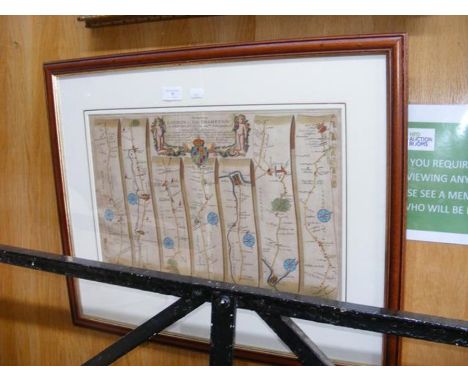
A George III Laurie & Whittle’s ‘Geographical Pastime for England and Wales’ game, comprising a hand coloured map on linen in 16 sections, with descriptions of some of the cities and towns and rules of the game on either side of the map, in original blue cardboard sleeve with applied label, published by Laurie and Whittle, London, 1794, the map 55cm x 68.5 cm (opened) (at fault)


Lot 922
George III oval silk embroidered map of the United Kingdom, dated 1796 and named Mary R Mortimore, Bradninch, in glazed mahogany frame, 54 x 47cmOverall condition is quite good, a few small tears to border (see images) colours are muted and some time staining to the linen ground, various splits to the original frame

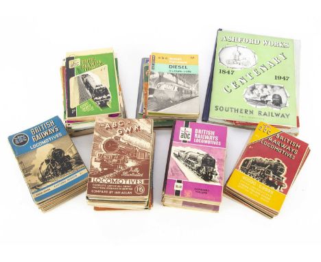
Lot 603
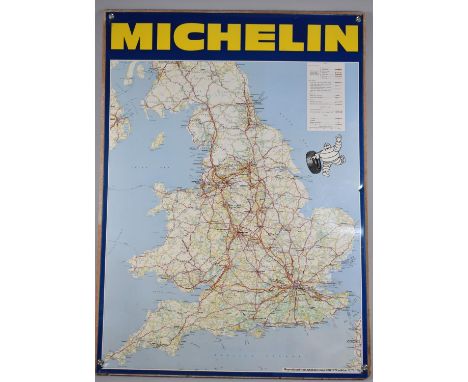
ABC Guides and Other Railway Related Volumes (70+) a large collection of Ian Allan ABC guides some with annotations/markings, British Railways Locomotives (22), ABC of LMS (2) 1943/45, ABC of LNER (4), 1943, 1946 92), 1947, ABC of Southern (3), 1943, 1945 (2), Locoshed Book (8) and two hard back combined volumes, British Railway Coaches, British Electric Trains, London Transport Railways, British Express Trains, Southern Locomotives and Electrics, BR Diesels, BR Diesel Multiple Units, Southern and LMS, ABC of GWR (3) 1943, 1945 (2) with differing covers, Famous Trains No 7, Romney Hythe & Dynchurch (4), Locomotives and Engineers of the SR 1946, Sectional Map of the BR 1948, six later/reprinted volumes, Christian & Sykes BR locomotive Reference 1951, locomotives of the LMS 1947 by LM&SR, Travelling on the Southern Railway 1946 (2), Ashford Works 1947 Centenary SR, Festival of Trains 1951 (BR), Good Firemanship 1956 (BTC) and 1951 LT/BR Welcome to London Festival of Britain pocket/guide, F-G, (70+)

Lot 615
Two Postwar Exeter Tourism Posters, two posters, one depicting a map of the county of Devon, Exeter The Heart of Devon The Finest Centre For Touring Devon, designed and printed by Southwoods Exeter (one small nick out of bottom edge), the other with text and illustrations of the Cathedral and Guildhall City and County of the City of Exeter Places of Interest, by Wheaton Exeter, each 50cm wide x 75cm high, both G, (2)

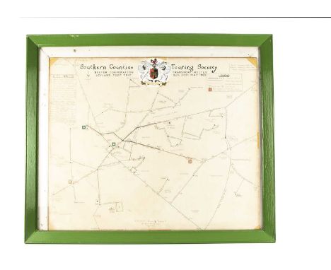
Lot 581
Southern Counties Touring Society Souvenir Excursion Maps and Tickets, two maps framed and glazed, hand drawn map of Exeter Corporation Transport Routes Leyland PD2/1 Trip Sunday 30th May 1965, depicting Horse Tramways, Electric Tramways and Motor Omnibus routes, scale 6" to 1 mile, 60cm wide x 50cm high, a printed copy of South London Tram Tour 25th June 1950 in car no 1877, originally drawn by F Merton Atkins July 1950, 55cm wide x 37cm high and a collection of related tickets, G, (Qty)

Lot 582
Edwardian and Later London Tram Bus and L&SWR Guides and Publications, 1909 edition published 1910 by Armitage and Ibbetson, Official Tramways Guide issued by London County Council, includes period advertising and guide to London and tram routes, (spine poor), The Panoramic Guide of the London & South Western Railway 1909, contains period adverts and illustrations (one page cut spine poor), London Guide No 3 issued by London Underground published by Odhams 1924, a guide to London includes a pocket map of London's transport network (spine poor), Round & About London by Tram North and South of the Thames (two volumes), by Charles G Harper, both include many period adverts 1920s/30s, both G, pocket maps,1947 Trolleybus & Tram map of routes London Transport, hand written For the Chairman's Use with inked route on map, Greenline 1948 coach map also hand written for the Chairman's Use, 1926 London & London's Country published by London Underground list of excursions, by train and bus and ABC Guides by Ian Allan, London Transport Buses and Coaches, 1952 (pages cut many notes) and the eighth edition (many notes), London's Transport Services 1944, No 2 Trams and Trolleybuses 1948, Buses Coaches & Trolleybuses ninth edition many listings underlined and Buses & Coaches 7th edition also with many listings underlined, P-VG, (14)


Lot 471
Religious needle point, National Railway Museum poster, hand coloured map of Barnsley Rail Station, print of Tattershall in Lincolnshire by Freda Marston, a print titled An Der Haspel, photographic print of Great Northern Railway train and a large tray with Blue Circle Group of Companies Long Service Certificate presented to Thomas Arthur Barlow


Lot 7338
Doom Collectors Edition Revenant figurine, Excellent, within Good PS4 edition packaging. NO GAME, Figurine only. Dark Souls III Collectors Edition, includes Red Knight figurine 2 x iron-on patches and cloth game map, Incomplete (Missing game, metal case, art book, 1 patch). within Good PS4 edition packaging. (2)
Lot 5
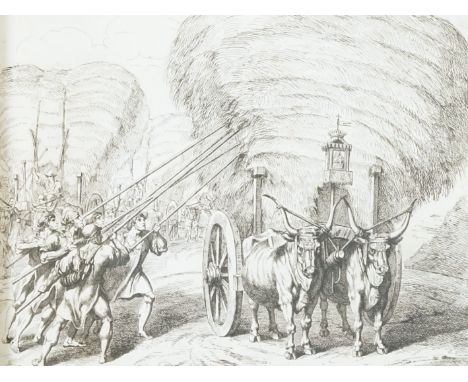
A mid 19th album of lithographs and prints, mainly Alpine views, including eleven plates from ‘’La Suisse et La Savoie’’ after photographs by Frederick Martens, lithographed by Eugene Ciceri, 42 x 33cms; 4 etchings by Bartolomeo Pinelli, dated 1820/21, 41.5 x 33cms; a coloured lithograph ‘’Panorama de la Chute de Rhin, 13.5 x 41cms; a French passport granted to Mr. Henry Newman, dated 17th July, 1845; numerous engraved and photographic views in Italy and France, some leaves loose, together with a special issue of The Morning Sun, 4pp, the centre spread a ‘’Railway Map of Great Britain’’***CONDITION REPORT***PLEASE NOTE:- Prospective buyers are strongly advised to examine personally any goods in which they are interested BEFORE the auction takes place. Whilst every care is taken in the accuracy of condition reports, Gorringes provide no other guarantee to the buyer other than in relation to forgeries. Many items are of an age or nature which precludes their being in perfect condition and some descriptions in the catalogue or given by way of condition report make reference to damage and/or restoration. We provide this information for guidance only and will not be held responsible for oversights concerning defects or restoration, nor does a reference to a particular defect imply the absence of any others. Prospective purchasers must accept these reports as genuine efforts by Gorringes or must take other steps to verify condition of lots. If you are unable to open the image file attached to this report, please let us know as soon as possible and we will re-send your images on a separate e-mail.


Lot 34
A group of silver and silver plate, comprising: a silver milk jug, London, 1954, Edward Barnard & Sons Ltd., 9cm high; a small cup, Birmingham, 1952, Barker Brothers Silver Ltd., with engraved initials and scroll handle, 6.5cm high; a silver napkin ring, engraved C. E. MORGAN, 4.7cm diameter; a silver cigarette case with map of Africa to front, Birmingham, 1938, Deakin & Francis Ltd., engraved monogram to interior and dated 24.1.42, 9.2cm high, 8.6cm wide; a silver clad hand mirror, Birmingham, 1919, probably Samuel M Levi, 28.8cm high; a Victorian mother-of-pearl handled silver paper knife , Sheffield, 1892, Mappin & Webb Ltd., 19.7cm long; a mother-of-pearl handled silver three pronged pickle fork, Birmingham, 1925, Adie & Lovekin Ltd, 11.2cm long; a silver plated tazza, the detachable bowl with scalloped rim supported by a putto, on a circular gadrooned base, 25.5cm high; and a silver plated spoon, with fruits to bowl, 16cm long, total weighable silver approx. 13.9oz (8) Condition Report: Marks rubbed to milk jug, small cup with scroll handle, napkin ring
Lot 87
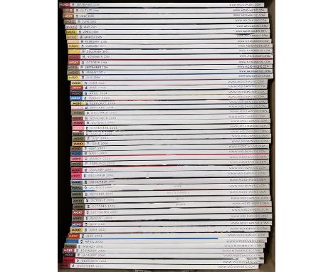
Approx 300+ issues of Mojo Magazine, covering a period c 1993 - 2023. All in excellent condition. Catalogued by vendor as below BOX 1 Issues 1 – 23 November 1993 – October 1995 Issue 24/1-3 November 1995 (3 different Beatles covers + inserts) Issues 25 – 39 December 1995 – February 1997 Issue 40 March 1997 (2 A4 poster inserts – The Beatles + Kurt Cobain) Issue 41 April 1997 (2 A4 poster inserts – Jimi Hendrix + Liam Gallagher) Issue 42 May 1997 (2 A4 poster inserts – Paul Weller + John Lennon) Issue 43 June 1997 (2 A4 poster inserts – Grateful Dead + Jim Morrison) Issue 44 July 1997 (2 A4 poster inserts – Marianne Faithfull + James Brown) Issue 45 August 1997 (2 A4 poster inserts – The Who + John Coltrane) Issue 46 September 1997 (2 A4 poster inserts – Elvis Presley x 2) Issue 47 October 1997 (2 A4 poster inserts – Bob Dylan + The Clash) Issues 48 – 50 November 1997 – January 1998 BOX 2 Issues 71 75 February 1998 – February 2000 Issue 76 March 2000 (2 copies – different UK and US covers) Issue 77 April 2000 (2 copies – different UK and US covers) Issues 78 – 82 May 2000 – September 2000 Issue 83 October 2000 (Gatefold cover – Beatles poster) Issue 84 November 2000 (2 copies – different UK and US covers) Issues 85 – 91 December 2000 – June 2001 Issue 92/1-4 July 2001 (glossy portrait of each of The Beatles on covers) Issues 93 – 95 August 2001 – October 2001 BOX 3 Issues 96 – 106 November 2001 – September 2002 Issue 107/1-4 October 2002 (4 different Rolling Stones covers) Issues 108 – 142 November 2002 – September 2005 BOX 4 Issues 143 – 197 October 2005 – April 2010 BOX 5 Issues 198 – 262 May 2010 – September 2015 BOX 6 Issues 263 – 265 October 2015 – December 2015 Issue 266 January 2016 (2 A4 poster inserts – David Bowie x 2) Issue 267 February 2016 Issue 268 March 2016 (A3 poster insert – David Bowie) Issues 269 – 270 April 2016 – May 2016 Issue 271 June 216 ( 2 A4 poster inserts – Pink Floyd x 2) Issues 272 – 274 July 2016 – September 2016 Issue 275 October 2016 (2 A4 poster inserts – The Beatles x 2) Issues 276 – 282 November 2016 – May 2017 Issue 283 June 2017 (special anniversary cover – Sgt. Pepper’s) Issues 284 – 299 July 2017 – October 2018 Issue 300 November 2018 (plain white cover with 300 stamp) BOX 6 (cont.) Issues 301 – 310 December 2018 – September 2019 Issue 311 October 2019 (A2 poster insert – The Beatles Liverpool map) Issue 312 November 2019 (A5 poster insert – Debbie Harry) Issues 313 – 324 December 2019 – November 2020 Issue 325 December 2020 (unopened, still with free CD) Issue 326 January 2021 (with Mojo 2021 calendar) Issue 327 February 2021 Issue 328 March 2021 (unopened, still with free CD) Issues 329 – 335 April 2021 – October 2021 Issue 336 November 2021 (A4 insert - glossy photo of The Beatles) BOX 7 Issues 337 – 355 December 2021 – June 2023


Lot 25A
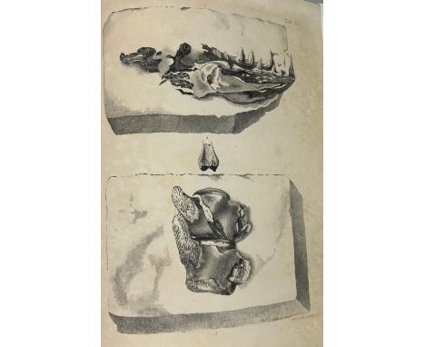
GIDEON MANTELL (1790-1852): THE FOSSILS OF THE SOUTH DOWNS, 1822.42 aquatint engraved plates including hand coloured map. The iconic work by Mantell illustrated by his wife Mary Anne, who first mentioned the unknown teeth and bones later to be described as the dinosaur Iguanodon.Ex library copy of the subscribers edition. Plates slightly foxed, consistent with age.


-
109198 item(s)/page