We found 108737 price guide item(s) matching your search
There are 108737 lots that match your search criteria. Subscribe now to get instant access to the full price guide service.
Click here to subscribe- List
- Grid
-
108737 item(s)/page


![JOAN. BLAEU REGIONES INUNDATAE... [ie THE FENS] double page map with margins, Dutch text verso, c1660, hand coloured, 48 x](http://lot-images.atgmedia.com/SR/10086/2899614/432-20141113102017_468x382.jpg)


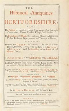
Lot 736
India Sikh Wars The Life of John Nicholson 1898 Sikh wars Brigadier-General John Nicholson (11 December 1822 23 September 1857) was a Victorian era military officer known for his role in British India. A charismatic and authoritarian figure Nicholson created a legend for himself as a political officer under Henry Lawrence in the frontier provinces of the British Empire in India. Involved in the First Anglo-Sikh War as a junior officer he was taken under the wing of Henry Montgomery Lawrence along with several other similarly-aged officers such as Herbert Edwards. Chapters include The Punjab in 1847 The Punjab Campaign The Punjab Conquest. Also chapters in Indian Mutiny. A few illustrations and a map of the Punjab. 333 pages good condition. A most detailed account of a soldier who served in the British Army during the Sikh wars.

Lot 739
India important Sikh War Large Volume 1846 London News. A volume of the London Illustrated news of 1846 covering the First Anglo Sikh War^ with many articles and Engravings and Maps covering events of the Sikh war not to mention highly detailed illustrations of the Lahore Court. The Sikh army and engraving of fighting Sikh Akalees (p 92)^ Illustrations - Sikh officer^ Suchet Singh^ General Ventura ^ Sikh at Prayer House of Colonel Wade at Lodianah (p 160-161) includes news and articles. Panoramic views of Lahore p 208^ armed Sikh Soldiers (p 209)^ an Illustration showing the battle plan of the Anglo Sikh war (pg222)^ a Sikh Preacher reading^ an Akali chief and Sikh Lancers (p 221) and news of the campaign in Punjab^ a map of the Punjab p 216. Includes the late war in the Punjaub and drawings by G T Vigne^ illustrations include Ram Singh killed in the battle of Sobraon and other illustrations of the Lahore Court(p 268). A fine engraving an article on the Maharajah of Patiala (p 257)^ Maharajah Gulab Singh p224. An Article and Engraving on Duleep Singh^ possibly one of the earliest of the Maharjah to exist (p 285)^ refers to him as the boy ruler and reputed son of Maharajah Ranjit Singh. The Volume contains hundreds of engravings relating to the news of the World^ about a dozen engravings are missing however the engravings relating to the Sikhs are all intact. Damage to spine^ first few pages are loose. The Sikh related news and illustrations looks to be in very good condition. This volume without a doubt covers the entire 1st Anglo Sikh war and goes into great detail not to mention numerous rare illustrations of the Sikhs^ the Lahore court^ Duleep Singh at as an infant and much more.

Lot 813
India rare 1st ed account of Maharajah Ranjit Singh by G T Vigne 1840 titled A personal narrative of a visit to Ghuzni^ Kabul^ and Afghanistan^ and of a Residence at the Court of Dost Mohamed: with Notices of Runjit Sing^ Khiva^ and the Russian Expedition 479 pages. Hard cover ownership inscriptions. Good. With illustrations^ from drawings made by the author on the spot. Numerous illustrations and a folded map^ numerous lithographs and engravings and a Map. Provides in depth accounts the Lahore court: Remarks on Runjit Singh conduct and character^ Akalis^ Guja Singh^ Fanes visit to Lahore^ the court of Ranjit Singh^ Military display and Magnificence of Ranjit Singh^ Khurruck Singh (eldest son of Ranjit Singh) and so much more.

Lot 828
India and the Punjab rare Sikh book with Lithographs Soltykoffs travels in Lahore Voyages dans lInde by Prince Alexis with 36 exquisite lithographs and detailed account of the Sikh court and India in French c1850s with all Sikh related lithographs intact. Soltykoff visited Punjab during the reign of Maharajah Sher Singh and his lithos includes Akalis entering Lahore Voyage on the plains of the Punjab and Maharajah Sher riding on an elephant with his troops. Soltykoff writes: this morning the King gave us a state audience. What a sight! I could scarcely believe my eyes. Everything glittered with precious stones and the brightest colours arranged in harmonious combinations. When he died in 1839 the Maharajas body was borne through the streets to his funeral pyre in a golden ship with sails of gilt cloth to waft him into paradise where four of his wives and five of his slave girls elected to burn with him in the act of sati. His most lasting cultural legacy was the enrichment with marble and gold of the Harmandir Sahib at Amritsar holiest site of the Sikhs thereafter known as the Golden Temple. Map shows Sikh territory `les Sikes. A rare book with very fine detailed lithographs of the Sikh court Nihungs and Sikh nobles.

Lot 852
India - Early Account of the Sikhs c1830 Fine Binding. An early account of the Sikhs c1830^ chapters include the Sikh territory and the Origin of the Sikhs. The book also gives an account of the Sikh territory established during the reign of Shah Jehan and describes them as a war like sect tracing back to Emperor Babur. The chapter also goes into depth of the birth of Sikhism mentioning Guru Nanak and various other Sikh sects. The books describe Sikhism as a peaceful religion until the son of Guru Tegh Bahadur^ Guru Gobind Singh Ji established the Khalsa. In these volumes Guru Tegh Bahadur is mistakenly stated as the 10th Guru^ and it confirms Banda Singh Bahadur was a follower of Guru Gobind Singh Ji and how he took charge of the Sikhs. Other chapters include the Mysore wars and Tipu Sultan and wars with Hyder Ali. The book describes the Sikhs as a friendly and peaceful neighbour. Mentions the Sikh Raja of Lahore (Maharaja Ranjit Singh). Also includes a map of India. A total of 4 volumes.


Lot 925
India Punjab Early Kashmir Map large early 1802 copper-engraved hand coloured map of Kashmir and northern Punjab^ detailed engraved folding map shows Srinagar^ lake Dal in the centre of the map^ with Rivers Chenba^ Attock^ Sind and Satluj (including the source of the Sutledge) up to the Lahore Kingdom border. The map is orientated with the east to the top. In the north with the neighbouring Tibet and in the south with the borders to Lahore^ showing Frontiers de Lahor. Measurers 39cms x 30 cms. Maps of pre-Ranjit Singh conquest of Kashmir but during his reign at Lahore is scarce.

Lot 942
Punjab - First book on Maharajah Ranjit Singh fine first edition (only edition printed) of the first book written entirely on the ruler of the Punjab^ Ranjit Singh written and published during his reign. Titled^ Origin of the Sikh Power in the Punjab and the Political Life of Muha-Raja Runjeet Singh^ with an Account of the Present Condition^ Religion^ Laws^ and Customs of the Sikhs^ complied by Henry T. Prinsep of the Bengal Civil Service^ from a report by Captain William Murray^ Late Political Agent at Umballa and also from Other Sources. Printed in Calcutta^ Huttmann Military Press^ 1834 with a map of his territory. Bound in stunning Riviere binding. This copy does not have a frontis which some copies had. This is said to be the rarest and the earliest on the famous Sikh ruler^ Ranjit Singh. It was the first publication to be completely around the life of the Maharajah^ and what make it so sought after and scarce is that it was written during his lifetime. Copies of this title seldom come on the market.


Lot 20
Early image of the Ironbridge Engineering German volume dated 1825 with a number of mostly double page copper engravings including eight plates of stone^ wooden and iron bridges^ including the Ironbridge at Coalbrookdale^ various bridges over the Thames and others in Britain^ as well as a map of Roman Britain

Lot 252
Naval sketch map of Plymouth 1792 Naval Plymouth fine ms sketch map of Plymouth docks entitled Sketch from memory of Plymouth and Dock by Liet Col J G Stedman 1792. Executed in watercolours and pen^ including a non-existent island at the entrance to Plymouth sound marked a mistake no land at all. On a leaf of paper approx 26x20cm. Together with detailed research notes on Stedman and his drawings. John Gabriel Stedman (1744-97)^ soldier and author is best known for his book Narrative of a five years expedition against the revolted negroes of Surinam (1796).

Lot 258
Antique Road Maps good selection of approx six late 18th/early 19th miniature road maps including : Salisbury to Camden and London to Truro from Bowless Post Chaise Companion; Bath to Warminster from Patersons Road (2)^ Salisbury to Warminster from Owen and Bowen and Oxford to Salisbury (no publication indicated). One close tear to one map not affecting image otherwise in good condition.


Lot 231
CARY’S New Itinerary…England and Wales, 8vo, folding map frontis, engr. title & ded’n., folding map, advert leaf for ‘New Globes,’ half calf (worn) 2nd Edn., L., 1802; New Bath Guide, 1830 (cvr. off); AIKIN (J.) England Described, 8vo, col. folding map frontis, later half morocco, L., 1818. (3).

Lot 263
TRENCH (Col.) A Collection of Papers relating the Thames Quay…, 4to, plates 1 – 9 (incl. folding & 1 extra) plates 10 – 15 = one composite folding plate, plate 16 (folding) lacks plate 17 (map after Gwynn), & 1831 supplement with folding frontis., old boards, L., 1827, (1, s.w.a.f.) [see illustration]
Lot 416
[ROAD BOOKS, etc.] PATTERSON (Lt.-Col.) New and Accurate Description of the Direct and Principal Cross Roads in England and Wales…, 8vo, folding map (torn), tree calf, 14th Edn., L., 1808; [ANON] Beauties of England…intended as a Travelling Pocket Companion, 12mo, folding map, calf, L., 1767; & 4 other vols. (6)
Lot 430
[LONDON] FAULKNER (T.) Historical and Topographical Account of Fulham…, 4to/Large Paper, engr. frontis., dedication, folding maps, 7 engr. plates, folding table, woodcut vignettes, untrimmed in 20th C. half calf, subscriber’s list, L., 1813; PINKS, History of Clerkenwell, 4to, illus., folding map, later calf, 2nd Edn., L., 1880; ALLEN, Panorama of London, 12mo, frontis, engr. t.p., 25 plates, folding map, clo., L., 1830/32. (3)
-
108737 item(s)/page