We found 109182 price guide item(s) matching your search

Refine your search

Year

Filter by Price Range
  • List
  • Grid
  • 109182 item(s)
    /page

Lot 2

Armitage (Albert). Two Years in the Antarctic, 1st edition, London: Edward Arnold, 1905, frontispiece, folding map to rear, black and white illustrations after photographs, spotting (mostly to margins), library sticker to front pastedown, bookseller's ticket to rear pastedown, original green cloth, rebacked with original spine laid on, boards lightly marked, extremities worn, 8voQty: (1)

Lot 23

Pococke (Richard). Inscriptionum Antiquarum Graec. et Latin Liber. Accedit, Numismatum Ptolemaeorum, Imperatorum, Augustarum, et Caesarum, in Aegypto cusorum, e Scriniis Britannicis, Catalogus, [London]: Typis Mandati, 1752, half-title, title, single leaf of preface and single leaf of contents, 127 pages of text, and large engraved map of Egypt on 8 folding sheets at rear, some marginal spotting and light toning to map sheets, a few scattered marginal spots to text, contemporary full calf with 20th century plain reback, rubbed and scuffed to edges, gilt armorial to centre of each cover of George Granville Leveson-Gower, 1st Duke of Sutherland, folio (sheet size 46 x 28 cm)Qty: (1)Footnote: Provenance: George Granville Leveson-Gower (1758-1833), 1st Duke of Sutherland. Member of Parliament for Newcastle under Lyme from 1779 to 1784, and for Staffordshire from 1787 to 1799.Richard Pococke (1704-1765), Bishop of Ossory and Meath, traveller and antiquarian, whose portrait in oriental costume was painted by the French artist Jean-Etienne Liotard in 1738 (Musée de'art et d'histoire, Geneva), is best known for his Description of the East of 1743-45.

Lot 24

Raunkiaer (Barclay). Gennem Wahhabiternes Land Paa Kamelryg 1912, 1st edition, Copenhagen: Gyldendalske Boghandel - Nordisk Forlag 1913, portrait frontispiece, large folding map to rear pocket, numerous black and white illustrations in-text, spotting to preliminaries, small faint marginal damp-stain to a number of leaves, original publisher's green cloth gilt, spine lettered in gilt, extremities a trifle rubbed, boards faintly marked, 8voQty: (1)Footnote: An important early account of the Arabian Peninsula, including Kuwait.

Lot 25

Schoberl (Frederic). Picturesque Tour from Geneva to Milan, by way of the Simplon ... engraved from Designs by J. and J. Lory of Neufchatel, London: R. Ackermann, 1820, 36 hand-coloured aquatint plates (including frontispiece) and uncoloured engraved map, occasional spotting mostly to title, initial leaves and map, endpapers renewed, contemporary cloth, rebacked preserving original spine, large 8voQty: (1)Footnote: Tooley 446; not in Abbey.

Lot 251

Railways. A hand-book for travellers along the London and Birmingham Railway; with the fare and time tables, &c. corrected to the present day, and portions extracted (by permission of the proprietors) from Roscoe's larger work on this railway, London: R Groombridge; Wrightson and Webb Birmingham, (1839), folding map to front, advertisements to rear, numerous wood-engraved plates, light spotting and marking, front hinge repaired, original cloth binding, yellow title label to front board, rebacked, 16mo, together with:Osborne (Edward). Osborne's London and Birmingham Railway Guide illustrated with numerous Engravings and Maps, Birmingham: E.C. & W. Osborne, (circa 1840), engraved frontispiece, numerous engraved plates, large folding map, advertisements bound to rear, lightly spotted, some leaves toned to margins, modern brown quarter morocco, spine lettered in gilt, 12mo, withRoscoe (Thomas). The London and Birmingham Railway; with the Home and Country Scenes on each side of the line; including Sketches of Kenilworth, Leamington, Warwick, Guy's Cliff, Stratford, &c., London: Charles Tilt, [1839], folding engraved map, engraved title, 16 engraved plates and one single-page engraved plan, further illustrations to text, lightly spotted, hinges cracked, bookplates to front pastedown and front free endpaper, original publisher's green cloth gilt, boards marked, extremities worn, 8vo with Coghlan (Francis). The Iron Road Book and Railway Companion; or, a Journey from London to Birmingham, containing an account of the towns, villages, mansions, &c. on each side of the line..., London: A. H. Baily & Co 1838, cartographic frontispiece, numerous engraved maps, lightly toned to margins, hinges cracked, original publisher's cloth gilt, rear joint cracked, boards faintly marked extremities rubbed, 16mo Qty: (4)

Lot 257

Sidney (Samuel). Rides on railways leading to the lake & mountain districts of Cumberland, North Wales, and the dales of Derbyshire... London: William S Orr & Co, [1851], folding map, 24 engraved plates, spotting, advertisements to rear, original salmon blindstamped cloth, joints cracked and worn, 8vo, together with:The Official Illustrated Guide to the Great Western Railway, bound with the official illustrated guide to the Bristol and Exeter, North and South Devon, Cornwall, and South Wales Railways, 2nd edition, 2 volumes in 1, London; Griffin, Bohn & Co, (1861), wood-engraved frontispiece, numerous wood-engravings, advertisements to rear, leaves lightly toned, a couple of small closed marginal tears, title to first volume stained, original publosher's blindstamped cloth, spine and front board lettered and decorated in gilt, lacking large portion of spine, boards marked, extremities rubbed, lacking head and tailcap, 8vo, withMeasom (George). The Official Illustrated Guide to the North-Western Railway, London: W.H. Smith and Son, no date, c.1860, frontispiece, numerous engraved plates (both full-page and in-text), light marginal toning, spotting to preliminary leaves, contemporary black half calf over marbled boards, spine lettered in gilt, raised bands, extremities worn, boards faintly marked, 8voQty: (3)

Lot 26

Shackleton (Ernest H.). The Imperial Trans-Antarctic Expedition, prospectus, 1st edition, 2nd state, London]: Privately printed, [1914], 30pp., mounted map of the proposed route across Antarctica and diagram of the ship Endurance tipped to inside of inner wrappers at front and rear, text in red & black, original stiff outer wrappers with printed title label to upper cover, original cord tied sewing to spine, light wear to spine edge, 4to (covers 31 x 24.2 cm)Qty: (1)Footnote: Spence 1106; Taurus 104.The first edition, second state, of the prospectus for the 1914-1916 expedition led by Shackleton. John King Davis was originally included as the Captain of Endurance before he declined the offer to join the project, and the second state was issued excluding him from the list of staff and his name is struck-through in blue pencil on page 8. The prospectus includes details of the ships, the expedition's members, its finances, expert opinions and press tributes, along with various mission statements.

Lot 27

Stanley (Henry Morton). Coomassie and Magdala: The Story of Two British Campaigns in Africa, 1st US edition, New York: Harper & Brothers, 1874, wood engraved portrait frontispiece, plates and illustrations, two folding lithograph maps (one detached and with folds repaired to verso), original cloth, 8vo, together with:Thompson (Ralph Wardlaw), Griffith John: the story of fifty years in China, London: The Religious Tract Society, 1906, photogravure portrait frontispiece, monochrome plates from photos, top edge gilt, original cloth, covers fade to spine and around board edges, board corners frayed, 8vo,Wylde (Augustus B.), Modern Abyssinia, London: Methuen & Co., 1901, monochrome portrait frontispiece and folding map, original cloth, 8vo,Vivian (Herbert), Abyssinia: through the Lion-Land to the Court of the Lion of Judah, London: C. Arthur Pearson Ltd., 1901, monochrome plates and illustrations, folding map, original cloth, 8vo,Cheesman (Robert Ernest), Lake Tana & the Blue Nile, an Abyssinian quest, London: Macmillan & Co., Ltd., 1936, folding monochrome panoramic frontispiece, monochrome plates and folding map, original cloth, 8vo, and 15 volumes of Hakluyt Society series publications and an issue of the Geographical Journal, vol. LXXI No. 4, April 1928, which includes the 'upper waters of the Blue Nile' by R.E. Cheesman, original printed wrappers, 8voQty: (21)

Lot 28

Taylor (Griffith). With Scott, The Silver Lining, 1st edition, 1st issue, London: Smith, Elder & Co, 1916, half-title, photographic frontispiece, 7 maps (including one large folding map to rear), numerous illustrations after photographs (both full-page and to text), lightly spotted, endpapers and pastedowns renewed, original pictorial cloth, rebacked with original spine laid on (some loss to extremities), boards marked, corners bumped, 8vo Qty: (1)

Lot 31

Camden (William). Camden's Brittannia, Newly Translated into English ..., 1st English edition, London: by F. Collins, 1695, engraved portrait frontispiece, 8 engraved plates of coins, without maps, letterpress illustrations, title with early ink manuscript ownership names, endpapers renewed, contemporary Cambridge panel calf, rubbed with a little wear to corners, rebacked, folio, together with: Hutchinson (William), The History of the County of Cumberland, and Some Places Adjacent ..., 2 volumes, 1st edition, Carlisle: F. Jollie, 1794, additional engraved titles, numerous engraved plates (one double-page, one hand-tinted), large folding map, hand-coloured in outline, 3 folding town plans, numerous vignette illustrations throughout, volume 2 p.585 with additional engraved illustration tipped over vignette, some (generally pale) dampstaining or discolouration, mainly affecting margins and rear of volume 2, folding map and plans with some closed tears and edge-fraying, plan of Whitehaven left & right edges cropped, volume 1 title with portion of upper margin excised, hinges cracked, contemporary quarter calf with vellum corners, worn, joints cracked, 4to, plus 8 others similar, including 2 volumes of Magna Britannia by Daniel and Samuel Lysons: vol. I part II Berkshire, & vol. IV CumberlandQty: (11)

Lot 32

Cary (John). Cary's New and Correct English Atlas..., 1793, title page and contents list, 47 (complete as list) engraved maps with contemporary outline colouring, each map with a tissue guard and a sheet of descriptive text, index bound at rear, upper hinge cracked, contemporary half speckled calf, bumped and a little worn at extremities, 4to Qty: (1)Footnote: Chubb. CCLXIII (but slight variant). Three of the maps have different publication dates. Leicestershire is dated 1792, Monmouth & Worcestershire, 1787.

Lot 321

Universal History. The Modern Part of the Universal History. Compiled from Original Writers; by the Authoors of the Ancient..., 16 volumes (volumes 9-24), London: printed for T. Osborne et al, 1759-65, monochrome folding plates, some spotting & toning throughout, contemporary uniform gilt decorated full calf, boards & spines rubbed, folio, together with;Chalmers (Alexander), The Plays of William Shakespeare,..., 9 volumes, London: printed fir F. C. And J. Rivington et al, 1805, monochrome steal engraved illustrations, bookplates to the front pastedowns, some toning & spotting throughout, volume 3 warped with damp damage, contemporary uniform gilt decorated full cross-hatched calf, boards & spines rubbed with loss to head & foot, some boards detached, 8vo Gibbon (Edward), The History of the Declibe and Dall of the Roman Empire, 12 volumes, new edition, London: printed for T. Cadell et al, 1813, monochrome frontispiece & folding map to volume 1, some toning throughout, contemporary uniform gilt decorated full calf, boards & spines heavily rubbed with some loss to head & foot, some boards detached, 8vo, plus Cassell's Illustrated History of England, 10 volumes in 5, new edition, London: Cassell, Petter and Galpin, 1874, 8vo, overall condition is generally good Qty: (3 shelves )

Lot 336

Lucas (E. V.). Playtime & Company, a book for children, 1st edition, London: Methuen & Co., 1925, black & white illustrations by E. H. Shepard, some minor toning, front gutters slightly cracked, publishers original illustrated boards to red cloth spine, boards slightly rubbed, spine label toned with loss, 4to,Forgotten Tales of Long Ago, 1st edition , London: Wells, Gardner, Darton & Co., 1906, illustrations by F. D. Bedford, bookplate to the front pastedown some light toning, top edge gilt, publishers original gilt decorated & illustrated cloth, boards & spine toned & slightly warped, 8vo, together with;Nansen (Fridtjof), "Farthest North"..., 2 volumes, Westminster: Archibald Constable and Company, 1897, black & white illustrations, 3 colour folding maps, colour folding map to the rear of volume 1 torn, ex-library copy with associated stamps & markings, period inscription to the front endpapers, gutters cracked, publishers original uniform gilt decorated blue cloth, boards & spines slightly rubbed, 8vo, plus other works E. V. Lucas & miscellaneous literature, including Fables de la Fontaine, Paris: Garnier Frères, circa 1860, contemporary gilt decorated full tree calf, large 8vo, mostly original cloth, some paperback journals, G/VG, 8vo/folioQty: (6 shelves )

Lot 34

Chauncy (Sir Henry). The Historical Antiquities of Hertfordshire..., 2 volumes, 1826, portrait frontispiece, folding lithographic map after H. Moll and 44 uncoloured lithographic plates, some spotting throughout, late 19th-century presentation inscription to the front first blank, marbled endpapers, top edge gilt, contemporary half-morocco with gilt decorated spines, rubbed at extremities, 8voQty: (2)

Lot 35

Collinson (John). The History and Antiquities of the County of Somerset, 3 volumes, Bath: Printed by R. Cruttwell, 1791, half-titles discarded, engraved folding county map and 40 engraved plates, engraved illustration to text, some erratic pagination, occasional scattered spotting, contemporary half calf, morocco title labels to spines, some joints splitting, rubbed and some wear, 4to, together with:Weaver (F.W. & Bates, E.H.), Index to Collinson's History of Somerset, Taunton: Barnicott and Pearce, Athenaeum Press, 1898, edges untrimmed, original cloth, 4to,Locke (Richard), Supplement to Collinson's History of Somerset..., Extracts from Locke's Survey with a short biography by F. Madeline Ward, Taunton: Barnicotts Ltd, The Wessex Press, 1939, armorial frontispiece, edges untrimmed, original cloth, 4toQty: (5)

Lot 353

Ireland (W. H.). England's Topographer or A new and complete history of the County of Kent, 4 volumes, London: George Virtue, 1828, monochrome folding map to the front if volume 1 plus numerous plates, bookplates to the front pastedowns, period inscription to the head of the title pages, some toning & spotting throughout, contemporary uniform gilt decorated half calf, boards & spines rubbed, volume 4 spine & front board detached, 8vo, together with other 19th-century & modern British topography reference, including Topographical and Statistical Description of the Principality of Wales, London: printed for C. Cooke, circa 1820, 2 folding maps, 8vo, & publications by Batsford, Pevsner, Faber, mostly original cloth, some in dust jackets, some paperbacks, G/VG, 8vo/4to Qty: (3 shelves )

Lot 355

printed by D. Brown. An Account of several Late Voyages and Discoveries: I. Sir John Narbrough' Voyage to the South-Sea..., II. Captain J. Tasman's Discoveries on the Coast of the South Terra Incognita, III. Captain J. Woody's Attempt to Discover a North East Passage to China, IV. F. Martin's Observations made in Greenland, and other Northen Countries, London, 1711, 20 monochrome plates, remnant of a map to pp.191, some toning & minor spotting, small worm hole to the right margin of pp.167 through to the rear pastedown, contemporary full calf with modern black morocco label, boards & spine rubbed, 8voHearne (Samuel), A Journey from Prince Wales's Fort, in Hudson's Bay to the Northern Ocean...in the years 1769, 1770, 1771, & 1772, Dublin, printed for P. Byrne, 1796, 5 folding maps & 3 folding plates, some worming to the head of the front pastedown through to a1, half-title through to pp.98 detached, some toning & marks throughout, worming to the head of the 'Plan of the Slude River' to the rear pastedown , contemporary full calf, front board detached, spine cracked, rubbed & marked with some minor loss, 8vo, plusStefansson (Vilhjalmur), The Friendly Arctic, the story of five years in Polar regions, 1st edition, New York: Macmillan Company, 1921, numerous monochrome illustrations, ex-libris blind stamp to the foot of the front endpaper, publishers original blue cloth, 8vo, and other 18th,19th-century & modern Arctic reference & related, some leather bindings, mostly original cloth, some in dust jackets, some paperbacks, G/VG, 8voQty: (5 shelves )

Lot 367

Spelman (Henry). Reliquiae Spelmannianae. The Posthumous Works of Sir Henry Spelman Kt. Relating to the Laws and Antiquities of England. Publish'd from the Original Manuscripts, Oxford: printed for Awnsham and John Churchill, black & white engraved portait frontispeice, vignette to the title page, 2 folding family trees, bookplate to the front pastedown, some light toning & spotting, contemporary full calf, front board detached, boards & spine rubbed with some minor loss, folio, together with;Palgrave (William Gifford), Personal Narrative of A Year's Journey Through Central and Eastern Arabia (1862-63), 10th thousand, London: Macmillan and Co., 1883, colour folding map and 4 black & white folding plans, bookplate to the front pastedown, some light toning & spotting, contemporary gilt decorated 'prize' binding bound by Relfe Brothers, boards & spine lightly rubbed, 8vo, plusNalson (J.), The Trail of Charles the First, King of England, before the High Court Justice, for High-Treason:..., London: printed by the Booksellers, 1740, lacking front endpaper, later news paper clippings pasted down to the rear endpapers, front & rear gutters cracked, some toning throughout, contemporary full calf, boards & spine rubbed, hinges split, 8vo, and other 17th - 19th-century literature & reference, including The History of England [The Cabinet Cyclopaedia], 10 volumes, by James Mackintosh, London: Longman, Rees, Orme, Bornw, and Green, 1830-40, uniform gilt decorated half calf, mostly leather bindings, some original clothm, some odd volumes, overall conditionis generally good/very good, 8vo/folioApproximately 120 volumesQty: (6 shelves)

Lot 37

Farington (Joseph). The Lakes of Lancashire, Westmorland, and Cumberland; delineated in forty-three engravings, from drawings by Joseph Farington, R. A., with descriptions, Historical, Topographical and Picturesque; the Result of a Tour made in the Summer of the Year 1816, 1st edition, London: by Thomas Hartwell Horne, 1816, Large Paper copy, 43 fine engraved views by Scott, Byrne, Hay and others after Joseph Farington, double-page hand-coloured engraved map of the Lakes by H. Mutlow after Hebert, occasional spotting, many to margins, light water stain to upper inner margins towards rear of volume, each plate with tissue-guard, some marks to endpapers, original boards, some soiling and wear to edges, modern reback with paper label to spine, folio (39 x 28 cm)Qty: (1)Footnote: Upcott, volume, 603-05; Bicknell, p86.

Lot 38

Jeboult (Edward). A General Account of West Somerset, description of the valley of the Tone, and the history of the town of Taunton, Taunton: Somerset and Bristol Steam-Press, 1873, photographic & heliotype map frontispiece and 13 plates, original gilt-blocked cloth, some fading, 4to, together with: Bulleid (Arthur & St. George Gray, Harold), The Meare Lake village: a full description of the excavations and the relics from the eastern half of the west village, 1910-1933, 3 volumes, Taunton: Printed privately at Taunton Castle, 1948-66, numerous monochrome plates and illustrations, original cloth-backed boards, 4to,Robinson (W.J.), West Country Manors, Bristol: St. Stephen's Press, 1930, monochrome frontispiece and plates, original cloth, 8vo,Robinson (W.J.), West Country Churches, 4 volumes, Bristol: Bristol Times and Mirror, Ltd., 1914-16, numerous monochrome plates, original cloth, some fading to covers of volume 4, 8vo, and other Somerset & Bristol topography related etc., including parish records, plus,Taunt (Henry W.), A new map of the River Thames from Oxford to London, 2nd edition, Oxford: Henry W. Taunt, 1873, 24 lithograph maps with mounted albumen photograph views, original cloth, oblong 8voQty: (36)

Lot 39

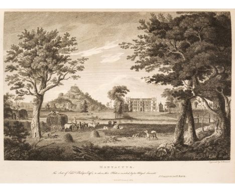
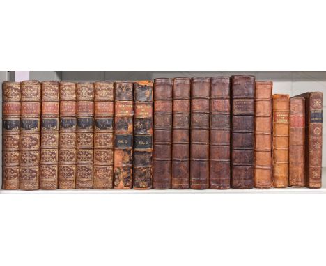
London and Its Environs Described, Containing an account of whatever is most remarkable for grandeur, elegance, curiosity or use, in the city and in the country twenty miles round it... decorated and illustrated with a great number of views in perspective, engraved from original drawings, taken on purpose for this work. Together with a plan for London, a map of the environs and several other useful cuts, 6 volumes, 1st edition, London: Printed for R. and J. Dodsley, 1761, half-title to each volume, 4 folding maps and plans (The Environs, or Countries Twenty Miles Round London, New and Correct Plan of London and Plan of Windsor Castle, and one other), and 76 single-page engraved plates, occasional light spotting, minor marginal browning to endpapers and one or two adjacent leaves, as often, contemporary uniform sprinkled full calf, gilt decorated spines with red and black morocco labels, slightly rubbed with a few joints a little cracked at head (generally a handsome set), 8vo, together with:A New View of London; or an Ample Account of that City, 2 volumes, London: A and J Churchill, 1708, adhesive tape repairs to folding map, folding map of London in the Raign of Queen Elizabeth with sellotape repairs to folds and verso... together with the Suburbs as they are now standing, armorial bookplate and ownership inscriptions to front pastedown, front hinge of volume 1 cracked, speckled text block, later speckled calf, boards rubbed, front joint of volume 1 cracked, spine rubbed with loss, 8vo with:New Remarks of London: or A Survey of the Cities of London and Westminster, of Southwark and part of Middlesex and Surrey, London: E Midwinter, 1732, damp-staining to some rear leaves, marginal toning to preliminaries, front hinge cracked, spotting, contemporary calf, rebacked, corners repaired, boards and joints rubbed with loss, 8voEntick (John). A New and Accurate History and Survey of London, Westminster, Southwark, and Places Adjacent, 4 volumes, London: Edward and Charles Dilly, 1766, engraved frontispieces, spotting, contemporary calf, lacking the map of London in volume 3, some spotting, contemporary calf, joints rubbed, corners bumped, 8vo and 4 other antiquarian volumes related to London Qty: (17)

Lot 42

Plot (Robert). The Natural History of Oxford-shire, being an essay towards the Natural History of England, 2nd edition, with large additions and corrections: to which is prefix'd a short account of the author, &c., Oxford: Printed by Leon. Lichfield, for Charles Brome and John Nicholson, 1705, folding engraved map of the county, engraved by Michael Burghers (with neatly repaired closed tear), 16 engraved plates, publisher's adverts to verso of final leaf, marbled endpapers with neatly repaired hinges, all edges gilt, 19th century calf by F. Bedford, rebacked preserving original gilt-decorated spine and title label, folioQty: (1)Footnote: Upcott p.1069-1070.

Lot 44

Scotland. Swan's Views of the Lakes of Scotland .. with historical and descriptive illustrations, by John M. Leighton, 2 volumes in one, 2nd edition, Glasgow: Joseph Swan, 1836, additional engraved titles, numerous engraved plates, generally spotted throught, preliminary blank with early ink manuscript inscription dated 1840, hinges cracked, all edges gilt, contemporary maroon morocco gilt, rubbed with some wear to extremities, short split at head of front joint, 4to, together with: The Imperial Gazetteer of Scotland; or Dictionary of Scottish Topography, edited by the Rev. John Marius Wilson, 2 volumes, Edinburgh: A. Fullarton, circa 1867, additional engraved titles, numerous maps and plates, one folding map with a few tears, occasional generally minor spotting, hinges cracked, contemporary dark green morocco gilt, rubbed with some wear, some splitting to joints, large 8vo, plus: Caledonia Illustrated in a series of views ... by W.H. Bartlett, T. Allom, and others, ...text by William Beattie, 2 volumes, London and New York: James S. Virtue, [1838], additional engraved titles, engraved map, numerous engraved plates, some minor spotting and marks, mainly to blank margins, pictorial bookplates of Victor Hilton, Pencombe Hall, hinges cracked, contemporary half calf gilt, rubbed with some wear, some short splits to joint ends, 4to, and volume 1 only of Scotland Illustrated in a series of views, by William Beattie, 1838Qty: (6)

Lot 51

Bolognini (Emerico). Memorie dell’antico, e presente stato delle paludi pontine… , Rome, Eredi Barbiellini a Pasquino, 1759, folding engraved map at rear, some spotting throughout, library stamps and marks to title verso, armorial bookplate to front pastedown, contemporary half calf over patterned boards with leather label to upper cover, some soiling and edge wear, white ink classification number near foot of spine, 4to, together with:Stillingfleet (Benjamin), Miscellaneous Tracts relating to Natural History, Husbandry, and Physick, to which is added the Calendar of Flora, 2nd edition, R. & J. Dodsley, 1762, 11 engraved plates at rear, some heavy spotting or browning, old ownership monogram at foot of title, contemporary calf gilt, rubbed, upper joints cracked, 8vo, plus Berkenhout (John), Clavis Anglica linguae botanicae; or, A Botanical Lexicon… , 2nd edition, to which is added, Calendarium Botanicum, 1789, contemporary ownership inscription of Joseph Hutton to front free endpaper and ink initials to title, contemporary reversed calf, rubbed and soiled, upper joints cracked, 8vo, plus other 19th & 20th-century botany, agriculture and related including some pamphletsQty: (11)

Lot 6

Bates (Henry Walter). The Naturalist on the River Amazons, 1st edition, 2 volumes, London: John Murray, 1863, frontispieces, 7 wood-engraved plates, folding map, 32 pp. advertisements to volume 1, wood-engraved illustrations to text, bookplates to front free endpapers, bookbinder's ticket to rear pastedown of volume 1, hinges cracked with sewing exposed, lightly spotted, some marginal loss to volume 1 title (not affecting text), original maroon cloth, gilt vignette to front boards, spine lettered in gilt, spine extremities rubbed and worn, boards faintly marked, a couple of faint marks to spine of volume 2, 8voQty: (2)Footnote: Borba de Moraes I p. 77; Sabin 3932a.A 'major contribution to the knowledge and literature of Amazonia' (ODNB). During his time in the Amazon Bates collected around 14,000 insects and was urged to write the account by Charles Darwin.

Lot 8

Beechey (Frederick William). A Voyage of Discovery towards the North Pole, Performed in His Majesty's Ships Dorothea and Trent, under the command of Captain David Buchan, R.N.,; 1818; to which is added, a summary of all the early attempts to reach the Pacific by way of the Pole, 1st edition, Richard Bentley, 1843, half-title present, folding lithographed map and 6 plates, including 2 folding lithographed panoramas (short closed tears), heavy spotting to first and last few leaves and to single-page plates, prize presentation inscription to John Hanbury dated 1860 at front, contemporary prize calf binding with gilt coat of arms of the Brewers Company School in Islington, London, to upper cover, rubbed and old water stain tide-marks to covers, a little frayed at head of spine, 8vo, together with: Ross (John), Appendix to the Narrative of a Second Voyage in Search of a North-West Passage, and of a Residence in the Arctic Regions During the Years 1829, 1830, 1831, 1832, 1833, Appendix volume only, 1st edition, A.W. Webster, 1835, 20 plates including frontispiece and 11 hand-coloured lithographs, subscribers' list at rear, spotting throughout, sometimes heavy, upper hinges cracked and some leaves starting, original blue cloth gilt, rubbed and marked, 4toQty: (2)

Lot 136

Cased map mileage calculator, metric. P&P Group 1 (£14+VAT for the first lot and £1+VAT for subsequent lots)

Lot 327

A quantity of decorative pictures and prints to include a portrait of a young girl, indistinctly signed lower left, framed and glazed, a pair of contemporary prints of fields of crops, a courtyard scene, further landscapes including a signed limited edition print by Kay Melling 'Arncliffe' and numbered 628/850, two prints by F Robinson, one titled 'A Peep at Old Truro', the other 'York Minster from Stonegate', both framed and glazed, a pair of prints depicting musicians and a reproduction Johan Blaeu map of Cheshire, published jointly with The Royal Geographical Society of London, framed and glazed.

Lot 207

Pair of framed and glazed prints, depicting harbour scenes with fishing vessels, frame size 51 x 72cm each; with print in the manner of Constable, gilt foliate frame, frame size 30 x 35cm; map of Asia, published by Henry Teesdale, London, framed and glazed, map size 33 x 41cm; with framed embroidery panel, 49 x 33cm. (5)

Lot 220

Collection of books and ephemera, to include: Henri Bergson, 'L'evolution creatrice' (1934 edition), album of postcards, books on magic, a map of Sheffield, ephemera on British railways, among other books and items of ephemera. (3 boxes)

Lot 379

Box of French and English maps dating from beginning of 20th century to right through the 20th century, one entitled Service Hydrographique de la Marine, Paris 1959, another is an instructional chart not to be used for navigation Falmouth - Plymouth with depth, etc, some ordinance survey maps, map of Perthshire, etc. (B.P. 21% + VAT)

Lot 523

ANTIQUE HAND-COLOURED MAP OF THE COUNTY OF CUMBERLAND

Lot 530

HAND-COLOURED ANTIQUE MAP OF ASIA BY T J ALLMAN, 463 OXFORD STREET, LONDON

Lot 866

OLD MAP OF LONDON, PHILIPS WAR MAP OF THE PACIFIC, WARE MAP OF THE RUSSIAN FRONT, OLD MAP OF BATH, & OLD ADDRESS BOOK WITH RECIPES

Lot 182

CARTON OF MISC F/G PICTURES INCL; ONE OF ST. MICHAELS MOUNT, CORNWALL BY BIRKET FOSTER, A MAP OF THE WORLD & A PEN & INK DRAWING OF AN OTTER BY P. PARKER 1976

Lot 354

F/G MAP OF GLOUCESTERSHIRE & 11 OLD ORDNANCE SURVEY 1'' MAPS

Lot 521

COLOUR PRINT OF AN ANTIQUE MAP OF THE BRITISH ISLES & IRELAND WITH HAND-COLOURING

Lot 3061

Framed Great Britain and Ireland map with mileage matrix John Swaledale Piccadilly March 1805, some foxing, 53 x 41 cm, overall. Not available for in-house P&P, contact Paul O'Hea at Mailboxes on 01925 659133

Lot 3062

Mounted map of England by WH Toms and Badeslade 1742, 16 x 16 cm. Not available for in-house P&P, contact Paul O'Hea at Mailboxes on 01925 659133

Lot 3065

Framed hand coloured Chester map C Smith Strang January 1801, heavily stained, 49 x 54 cm overall. Not available for in-house P&P, contact Paul O'Hea at Mailboxes on 01925 659133

Lot 3066

A map of The Country Palatine of Lancaster after Robert Morden, 38 x 45 cm, together with a coloured etching book plate and a Victorian print (3). Not available for in-house P&P, contact Paul O'Hea at Mailboxes on 01925 659133

Lot 359

BOXED ATARI JAGUAR CONSOLE, BOCED CD UNIT, BOXED ADDITIONAL CONTROLLER , 1 MEMORY TRACK CARTRIDGE , 1 TEAM MAP MULTIPLAYER ADAPTOR, 20 GAMES MOST OF WHICH ARE BOXED

Lot 148

AVIATION POSTER: Imperial Airways The British Airline Weekly Service Between Africa, India, Egypt and England. The British Colour Printing Co., London and Liverpool. (ca. 1930s). lithograph, depicting a Handley Page Type 42 aircraft flying in a night sky over a control tower, a route map in the background, numbered lower r.h. margin A/X/51, 98 x 60cm within frame, 105 x 66.5cm overall, framed and glazed.Imperial Airways was the early British commercial long-range airline operating from 1924 to 1939, principally serving routes to South Africa, India and the Far East, including Australia, Malaya and Hong Kong. The airline merged into the British Overseas Airways Corporation (BOAC) in 1939. BOAC in turn merged with the British European Airways (BEA) in 1974 to form British Airways.Condition Report: four small pin holes to corners, minor creasing, a small mark to lower centre, within a black modern frame.This is an original poster, printed by The British Colour Printing Co., London and Liverpool.Please note as the poster has been framed and is behind plastic, we have not removed it from the frame.     Condition Report Disclaimer

Lot 743

An unusual and humorous Chinese needlework map of the City of Peking, worked in coloured silks on linen and showing the inner and outer city walls, the Forbidden City, temples, Chinese Theatre, Missions, Methodist Bean Milk Station, camels, donkeys and a rickshaw, circa mid-1900's, 34 x 47cm.

Lot 310

Attributed to Leonaert Bramer (Dutch 1596-1674) Mary Magdalene washing the feet of Christ Oil on copper, with copperplate map of the Netherlands to reverse 22.2 x 25.6cm; 8¾ x 10in

Lot 832

A quantity of 19th century and later topographical engravings, a black and white engraved map of Gloucestershire after Christopher Saxton, a further map of Gloucestershire after Robert Morden, a set of four coloured etchings of sporting subjects in the 18th century manner, various sizes all framed (collection)

Lot 22

Selous (Frederick, Courteney), A Hunter's Wanderings in Africa, 1st Edn, fldg map (small tear), frontis and plts, tissue gd, spotting, orig cl gt, some pp loose with stuck-down newspaper cuttings about Capt. Selous and annotation Lewis Horner's copy - Mr Horner is mentioned on p.229, 8vo, 1881.

Lot 489

A framed Bartholomew map of British Isles together with further pictures, oil on boards etc.

Lot 763

A pair of large coloured prints of classical style frescos with female characters, 71.5 x 53.5cm approx, together with a reproduction coloured map of Great Britain, 96 x 70cm all in gilt frames (3)

Lot 959

Edward Stanford, Victorian one inch to one mile Irish Fox Hunting Maps (Galtee Fox Hounds) sheet 176 with radius miles outward from mountain Lodge Geefin Mountain, Winch Range, County Limerick, paper on canvas with leather slip case, labelled Hunt Map, G.F.H, (100cm x 140cm approx)

Lot 780

Henry Wilkinson (British 1921-2011) - Two signed limited edition etchings of hunting scenes, both signed editions /200, 27 x 36cm approx visible sheet size, together with a framed coloured map showing the Harrier and Beagle hunts of Great Britain published by Hampton, 67 x 48cm approx, all framed (3)

Lot 265

John Speed, Cambridgeshire described with the devision of the hundreds..., dated 1610,engraved and handcoloured map, published by John Sudbury and George Humbell [sic],39x51.5cm.

Lot 287

Peter Atkin, four country scenes,signed, watercolours,framed and glazed;and after Robert Morden, engraved and hand-coloured map of Northamptonshire, 1722 edition37x43cm.

Lot 290

Christopher Saxton & William Kip, engraved map of Northamptoniae, 33x40cm; and three other Victorian maps of Northamptonshire, Bedfordshire, and England.

Lot 306

Emanuel Bowen, An Accurate map of Cambridgeshire divided into its hundreds,...engraved and hand-coloured map, printed by Robert Wilkinson,73x56cm;and another map of Oxfordshire, Thomas Kitchin, 71x55cm.

Lot 221

Negretti & Zambra pocket forecaster, a compass and a map distance measurer 

Lot 227

Kodak Boy Scout camera, a pair of binoculars in case, and a Daily Express wall map 

Lot 232

Emanuel Bowen, hand coloured engraved map, A new and accurate map of the Netherlands or Low Countries, 36 x 43cm

Lot 719

A late 19th/ early 20th century silk gambling pouch with English, French and Dutch flags, a small beaded pouch (shattered lining), vintage eye glasses, a Victorian millinery feather and a silk hankie with a map of the Indian continent and four 50s hats (qty) condition reports available on request. 

Loading...Loading...
  • 109182 item(s)
    /page

Recently Viewed Lots