We found 109182 price guide item(s) matching your search

Refine your search

Year

Filter by Price Range
  • List
  • Grid
  • 109182 item(s)
    /page

Lot 103

France.- French Alps.- Hondius (Jodocus) Sabaudia Ducatus. La Savoié, map of Savoy showing Geneva and part of Lac Leman, engraved map with early hand-colouring, on laid paper without watermark, sheet 510 x 610 mm (20 x 24 in), full margins, without text verso, central vertical fold with minor repairs to splitting verso, some minor surface dirt, spotting, unframed, [circa 1630]

Lot 104

France.- Jaillot (Alexis-Hubert) Le Comté de Bourgogne, ou La Franche Comté, Divisée en Trois Grands Balliages, Scavoir d'Amont, d'Aval, et du Milieu, ou de Dole, Subdivisés en Leurs Balliages, et Jurisdictions Subalternes, large regional map centred on Besançon, engraving with full hand-colouring, four sheets conjoined, platemark 830 x 570 mm (32 3/4 x 22 1/4 in), sheet 925 x 660 mm (36 1/4 x 26 in), old folds, minor handling creases, unframed, 1695; together with 11 other maps of France, including Ortelius's 'Regionis; Biturigum Exactiss: Descriptio per D. Ioannem Calamaeum [on sheet with] Limaniae Topographia Gabriele Symeoneo Auct' and 'Caletensium et Bononiensium Ditionis Accurata Delinatio [on sheet with] Veromanduorum Eorumque Confinium Exactissima Discriptio. Iohanne Surhonio Auctore', Matthias Quad's 'Artesia cuius incolae Atrebates olim dicti', de Vaugondy's 'Partie Méridionale du Comté de Bourgogne', and other regional maps and plans of harbours, engravings and woodcuts, various sizes between 160 x 220 mm (6 1/4 x 8 1/2 in) and 515 x 660 mm (20 1/4 x 26 in), old folds and minor handling creases, all unframed, mainly 18th and 19th century (12) .

Lot 105

France.- Various cartographers (18th and 19th century) Collection of 11 maps of France, including d'Anville's 'Gallia Antiqua...', Edward Well's 'A New Map of Ancient Gaul or Gallia Transalpina', de Vaugondy's ' Le Royaume de France', Melchior Tavernier's 'Antiquorum Galliae Episcopatuum Geographica Descriptio', and others by John Cary, Brion, Vaugondy, Moll, Thomson and others, engravings, some with hand-colouring, various sizes between 250 x 320 mm (9 3/4 x 12 1/2 in) and 510 x 580 mm (20 x 22 3/4 in), occasional minor spotting and browning, some minor surface dirt, all unframed, mainly 18th and 19th century (11)

Lot 108

India.- Atkinson (Thomas Witlam) Travels in the Regions of the Upper and Lower Amoor and the Russian Acquisitions on the confines of India and China, first edition, chromolithograph frontispiece, folding map, woodcut illustrations, spotting to first and last few leaves, contemporary calf, rebacked retaining original backstrip, a little rubbed, 1860 § Forbes (Duncan) A Grammar of the Hindústání Language, engraved frontispiece and 15 plates, occasional pencil underlining and marginal notes, scattered spotting, modern half-morocco, 1862 § Boyce (W. B.) Notes on South-African Affairs, unopened, scattered faint spotting, original cloth, slight bumping to corners and extremities, 1839; and 2 others similar, 8vo (5)

Lot 11

Africa.- d'Anville (Jean Baptiste Bourguignon) Africa, According to Mr. D'Anville with Several Additions, & Improvements, with a Particular Chart of the Gold Coast, Wherein Are Distinguished All the European Forts and Factories..., large wall map with inset chart of the Gold Coast in the lower left corner, numerous descriptive texts, and a large title cartouche decorated with local figures, engraving on four sheets, not joined, with some hand-colouring, each sheet approx. 550 x 620 mm (21 3/4 x 24 1/2 in), old folds with restoration, marginal losses, browning, rough edges with minor nicks and tears, scattered spotting and surface dirt, unframed, Robert Sayer, 1772.

Lot 112

India.- Chatelain (Henri Abraham) Genealogie des Empereurs Mogols Depuis Tamberlan ou Tamerlan Jusques a Present, sheet focussing on the history and genealogy of the Mogol Empire and its Emperors, with inset map of the Indian subcontinent in the upper left, a bird's-eye plan of the Kingdom of Kashmir in the upper right, and with three vignettes along the lower edge including elephants in combat, and other rituals, engraving with full hand-colouring, platemark 380 x 440 mm (15 x 17 1/4 in), sheet 440 x 480 mm (17 1/4 x 18 7/8 in), central vertical fold with minor splitting to lower margin, some minor spotting and surface dirt, unframed, [Paris, 1719]; together with John Russell's map Hindostan or India Drawn from the best Authorities, from 'Guthrie's New System of Geography', engraving with hand-colouring, sheet 430 x 530 mm (16 7/8 x 20 7/8 in), minor browning and surface dirt, unframed, 1811 (2)

Lot 116

India.- De L'Isle (Guillaume) Carte des Cotes de Malabar et de Coromandel, detailed map of India with part of Sri Lanka in the lower right corner and decorative title cartouche, engraving with original outline hand-colouring on laid paper without watermark, platemark 475 x 585 mm (18 3/4 x 23 in), sheet 520 x 615 mm (20 1/2 x 24 1/8 in), central vertical fold with careful repairs verso, spot of browning to the right cof compass rose, other minor surface dirt and handling creases unframed, Covens & Mortier, [circa 1730].

Lot 128

NO RESERVE India.- Ross (David) The Land of the Five Rivers and Sindh, first edition, folding map, lacking half-title, original decorative cloth, gilt, light toning to spine, spine ends and corners a little bumped, 1883 § Shaw (Robert) Visits To High Tartary, Yarkand And Kashgar, plates, original cloth, dust-jacket, light sunning to spine, creasing to head and foot, 1984; and 7 others, India, 8vo & 4to (9)

Lot 132

India.- Tallis (John) and others. Collection of 14 maps of India and Ceylon, including Tallis's 'Northern India', 'Cabool, The Punjab and Beloochistan', 'Ceylon', 'British India', 'Southern India', 'Overland Route to India', an anonymous unusual 'Political Map of the Indian Empire', Moll's 'India or the Mogul's Empire', a small Arrowsmith map of Ceylon, Bonne's 'Carte de la Partie Inferieure de L'Inde...', Russell's 'Hindostan or India', The Weekly Dispatch map of 'The Residency, Palaces, &c., of Lucknow', and John Blair's 'The East Indies', engravings and lithographs, various sizes between 280 x 225 mm (11 x 8 3/4 in) and 460 x 600 mm (18 1/8 x 23 3/4 in), occasional minor handling creases and surface dirt, all unframed, 18th and 19th century (14)

Lot 135

India.- Weiland (Carl Ferdinand) Vorder Indien, detailed map of India that uses colour coding to identify the various regions under British, Portuguese, Danish, and French control, engraving with hand-colouring, sheet 695 x 550 mm (27 1/4 x 21 3/4 in), horizontal fold with careful repairs, minor surface dirt, unframed, [1838] § Chatelain (Henri Abraham) Carte de l'Asie Selon les Auteurs Anciens Enrichie de Remarques Historiques sur les Changemens qui y sont Arrivez, historical map of Asia and the East Indies centred on India, engraving with hand-colouring, platemark 380 x 490 mm (15 x 19 1/4 in), sheet 440 x 530 mm (17 1/4 x 20 7/8 in), central vertical fold with careful repairs verso, unframed, [circa 1720].

Lot 14

Africa.- Gold Mines.- The African Review Map of Rhodesia, (Showing the Gold Districts.), lithographed folding map, printed in colour, 815 x 612 mm, mounted on linen, some light toning, the odd spot, strengthened with tape to verso, folding into contemporary green cloth with printed label to upper cover, bookplate of Forster Groom & Co., covers lightly rubbed, 8vo, W. H. & L. Collingridge, [c.1890].

Lot 140

Italy.- Magini (Giovanni Antonio) Territorio di Pavia, Lodi, Novarra, Tortona, Alessandria e altri uicini dello stato di Milano, detailed map with Milan in the upper centre, and showing south with part of The Apennines, engraving with hand-colouring, platemark 360 x 480 mm (14 1/8 x 18 7/8 in), sheet 415 x 545 mm (16 1/4 x 21 1/2 in), some early ink marginalia, unframed, 1620; together with Luigi Balatri's Pianta della città di Firenze, engraving with outline hand-colouring, sheet 410 x 410 mm (16 1/4 16 1/4 in), old folds, minor spotting and handling creases, unframed, [1846] (2)

Lot 142

Italy.- Sicily.- Wit (Frederik de) Insula sive Regnum Siciliae Urbibus Praecipuis Exornatum, detailed map of Sicily with 5 inset plans and bird's-eye views of Messina, Milazzo, Palermo, Catania, and Trapano, the map of Sicily itself shows numerous details including Mt. Etna reupting, engraving with early hand-colouring, platemark 500 x 590 mm (19 3/4 x 23 1/4 in), sheet 510 x 615 mm (20 1/8 x 24 1/4 in), central vertical fold with some splitting with old repairs verso, scattered spotting and some browning, numbered in ink to upper right margin, unframed, [circa 1680].

Lot 148

Japan.- Taiwan.- Mitchell (Charles Archibald) Camphor in Japan and in Formosa, first edition, printed on crepe paper, some light creasing, folding map of Taiwan at rear, floral endpapers, original roan-backed boards, spine chipped at head, extremities rubbed, 8vo, Printed at the Chiswick Press for Private Circulation, 1900.⁂ A rare work discussing the cultivation of camphor that goes into great detail about life in Taiwan, especially among the Japanese ex-pat communities.

Lot 150

Malaysia.- Singapore.- Maxwell (George) In Malay Forests, second edition, signed presentation inscription from the author to half-title, some light spotting, occasional splitting at gutter, rear hinge cracked but holding, spine sunned, 1911 § Weller (George) Singapore is Silent, map frontispiece, bookplate and ink ownership inscription to front free endpaper, light discolouration to spine and upper cover, New York, 1943, original cloth, lightly rubbed, corners and spine ends bumped; and 34 others, most Malaysia, Singapore and Hong Kong, v.s. (36)

Lot 151

Malta.- Wit (Frederik de) Insula Malta Accuratissime Delineata, Urbibus, et Fortalitiis, map centred of Malta and Gozo, with Sicily and the northern coast of Africa shown, the fortified cities of Tunis and Tripoli identified, with inset map in the lower right that shows the extensive fortifications of Valleta that were built by the famous Knights of Malta after the Siege of Malta, engraving with hand-colouring, some pigments offset, 445 x 545 mm (17 1/2 x 21 1/2 in), sheet 510 x 605 mm (20 x 23 3/4 in), central vertical fold with minor splitting, scattered spotting and surface dirt, unframed, [circa 1680]

Lot 155

Mediterranean.- Dépôt des cartes et plans De La Marine (publisher) Carte Reduite de la Mer Mediterranée, three sheet map of the entire Mediterranean, the western sheet extends from Gibraltar to Corsica and Sardinia, the central sheet shows Italy and Greece, with the eastern sheet showing the Aegean, Asia Minor and Cyprus, engravings by Dheulland, on thick laid paper, platemarks each approx. 630 x 540 mm (24 3/4 x 21 1/4 in), each sheet approx. 935 x 640 mm (36 3/4 x 25 1/4 in), small number of minor spots and surface dirt, but generally a crisp bright impression, unframed, with publisher's anchor ink stamp, Paris, 1737.

Lot 156

Mediterranean.- Wit (Frederik de) Insularum Sardiniae et Corsicae Descriptio, map of the islands of Sardinia and Corsica, engraving with early hand-colouring, on laid paper without visible watermark, sheet 605 x 510 mm (23 3/4 x 20 in), some off-setting, scattered spotting and browning, unframed, Amsterdam, [circa 1680]; together with de Wit's Novissima et Accuratissima Totius Italiae Corsicae et Sardiniae Descriptio, a map of Italy extending to include Corsica and Sardinia in the west and the Dalmatian coast in the east, engraving with hand-colouring, sheet 515 x 610 mm (20 1/4 x 24 in), some off-setting and surface dirt, minor nicks and tears to extremities, unframed, Amsterdam, [circa 1680] (2)

Lot 157

Middle East.- Bell (Gertrude) Amurath to Amurath, first edition, half-title, numerous photographic plates and illustrations, folding colour map at end, light browning to endpapers, armorial bookplate of Norman Lamont to front pastedown, original pictorial cloth, uncut, slight bumping and light rubbing to spine tips and corners, but a sharp and excellent copy overall, 8vo, 1911.⁂ Bell's account of her first visit to modern-day Iraq, the second edition was not printed until 1924.

Lot 158

Middle East.- Bell (Gertrude) The Letters..., 2 vol., first edition, plates, folding map at rear of vol. 2, light browning to endpapers, both volumes double-jacketed, lower jackets near-fine, upper jackets with light creasing to head and light surface soiling, 1927 § Raswan (Carl S.) Black Tents of Arabia, first American edition, plates, jacket price-clipped, spine faded, worn with flaps separated, 1935 § Reitlinger (Gerald) A Tower of Skulls. A Journey through Persia and Turkish Armenia, first edition, folding map, plates, jacket chipped with loss, laid down browned and soiled, 1932; and 22 others, Middle East, 8vo & 4to (26)

Lot 16

Africa.- Jansson (Jan) Africae Propriae Tabula, based on Ortelius's map of the same name showing present-day Tunisia and Libya, with the southern part of Sicily, engraving with full hand-colouring, platemark 375 x 520 mm (14 3/4 x 20 1/2 in), sheet 510 x 640 mm (20 x 25 1/4 in), without text verso, minor spotting and browning, unframed, 1741; together with 13 other maps of North Africa and Morocco, including Ruscelli's 'Tabula Aphricae II', Brion's 'Géographie Modern, Historique et Politique', and others by Mercator and Hondius, Giovanni Botero, and others, engravings, some hand-colouring, various sizes between 100 x 130 mm (4 x 5 1/4 in) and 660 x 510 mm (26 x 20 in), minor handling creases, some minor surface dirt and browning, unframed, mainly 18th and 19th century (14)

Lot 160

Middle East.- Burton (Sir Richard Francis) Personal Narrative of a Pilgrimage to El-Medinah and Meccah, 3 vol., first edition, half-title in volume 3 (not called for in other volumes), 14 plates (5 chromolithographed), one folding engraved map, 3 plans (2 folding), lacking advertisements, light marginal toning and some light staining or soiling (mostly towards end of vol. 3), ink library stamp to vol. 1 & 2 titles verso, vol. 3 with library blindstamp to head of title, modern calf-backed cloth, spines gilt with red and brown morocco lables, [Abbey, Travel 368; Penzer, pp.49-50], 8vo, Longman, 1855-1856⁂ First edition of "one of the greatest works of travel ever published" (Penzer). Disguised as a Muslim pilgrim, Burton was one of the first westerners to visit Mecca and other holy Islamic sites.

Lot 161

Middle East.- Cheesman (R. E.) In Unknown Arabia. Forward by Sir Percy Cox, first edition, photographic plates, folding map at rear, half-title a little browned, original pictorial cloth, light rubbing to spine tips and corners, a bright and excellent copy overall, 8vo, 1926.⁂ Cheesman's account of his 1923-24 expedition from Bahrain during which he identified the site of ancient Gerra and mapped some 150 miles of desert.

Lot 163

Middle East.- Hondius (Jodocus) and Gerard Mercator. Turcici Imperii Imago, detailed map showing from Sicily and the Balkan Peninsula across to the Caspian Sea in the north, and from Northern Africa through to the Arabian peninsula in the south, with decorative title cartouche surmounted with portrait of Sultan Mehmed II, engraving with full-hand-colouring, platemark 365 x 490 mm (14 1/4 x 19 1/4 in), sheet 390 x 525 mm (15 1/4 x 20 3/4 in), Latin text verso, printer's crease to left half, minor surface dirt and browning, unframed, [Amsterdam, 1633].

Lot 164

Middle East.- Iran.- Stein (Sir Marc Aurel) Old Routes of Western Iran: Narrative of an Archaeological Journey, first edition, half-title, plates and maps, folding map in pocket at rear, original cloth, light rubbing to spine tips and corners, but a bright and excellent copy overall, 4to, 1940.⁂ "A record of the last and longest of four journeys which carried me during the years 1932-6 through an extensive belt of Southern and Western Iran. That belt stretches from the extreme south-east of Persian Baluchistan on the Arabian sea coast close to where the frontier of the present state of Iran meets the frontiers of Iraq and Turkey in the hills of Kurdistan far away in the north-west." - Introduction.

Lot 165

Middle East.- Lawrence (T. E.).- Thomas (Bertram) Arabia Felix: Across the Empty Quarter of Arabia. With a Foreword by T. E. Lawrence, first edition, maps and plates including large folding map at rear, dust-jacket, very light fading to spine, a few small nicks and tears to head and foot with light creasing, 1932 § Lawrence (T. E.) and C. Leonard Woolley. The Wilderness of Zin, second edition, folding plan, plates and illustrations, some light spotting, 1936 § Lawrence (T. E.) Oriental Assembly, first edition, maps and plates, slight shelf-lean, dust-jacket, very light creasing to spine ends, else near-fine, 1939; and 9 others, Lawrence, 8vo & 4to (12)

Lot 168

Middle East.- Layard (Austen H.) Discoveries in the Ruins of Nineveh and Babylon, first edition, folding frontispiece, 10 plates (most lithographs), 5 folding maps and plans, some fraying and tearing to maps and plans, hinges weak, original pictorial blind-stamped cloth, bumping and fraying to spine ends and corners, light mottling to covers, 1853 § Blunt (Lady Anne) Bedouin Tribes of the Euphrates, edited by W.S.Blunt, 2 vol., first American edition, 12 wood-engraved plates, folding colour map, folding pedigree of Arabian thoroughbreds, New York, 1879; and 14 others, Middle East, 8vo (16)

Lot 169

NO RESERVE Middle East.- Layard (Austen H.) Nineveh and its Remains, 2 vol., lithograph frontispieces, 16 plates, 4 folding plans, 1 folding map, illustrations, 1854 § Fergusson (James) The Palaces of Nineveh and Persepolis, frontispiece, 5 plates, 1 folding plan, 1851, bookplates, scattered spotting to first and last few leaves, uniform later half-morocco, gilt, 8vo (3)

Lot 170

Middle East.- Moxon (Joseph) Paradise, or the Garden of Eden. With the Countries Circumjacent Inhabited by the Patriarchs, map of the Middle East, including Cyprus, a portion of the Persian Gulf and the north shore of the Red Sea filled with details of Old Testament locations, vignette in the upper right corner with the expulsion of Adam and Eve, engraving on laid paper with small text-based watermark, sheet 390 x 490 mm (15 1/4 x 19 1/4 in), without text verso, small marginal losses to corners, left and right edges reinforced verso, associated surface dirt, old folds and handling creases, unframed, [1671].

Lot 174

Middle East.- Philby (Harry St. John Bridger) Sheba's Daughters. A Record of Travel in Southern Arabia, plates, folding map at rear, light fading to spine, jacket price-clipped, "Reduced to 12/6" price sticker to spine, a few small nicks and tears with some creasing to head and foot, light rubbing to extremities, 1939; Arabian Days, plates, jacket with light toning to spine, spine end and corners a little chipped, crease to lower panel, 1948, first editions, original cloth, dust-jackets; and 2 others, Philby, 8vo (4)

Lot 175

Middle East.- Speed (John) The Kingdome of Persia with the cheef Citties and Habites described, carte-de-figures map of the Persian Empire, with vignettes of Isphan, Hormuz, Tabris, and Tehran along the upper edge, with side panels of eight noblemen and citizens of Persia, engraving with hand-colouring on laid paper with indistinct watermark of fleur-de-lis, sheet 404 x 518 mm (15 3/4 x 20 1/4 in), English text verso, central vertical fold reinforced verso with repairs, small marginal nicks, handling creases and surface dirt, unframed, George Humble, 1626.

Lot 177

Middle East.- Sykes (Ella C.) Through Persia on a Side-Saddle, first edition, plates, folding map at rear, some light scattered spotting, hinges repaired, W. H. Smiths bookplate to pastedown, original cloth, recased, spine a little darkened, marking to upper cover, 8vo, 1898.⁂ Scarce. Ella Sykes spent three years travelling with the British Frontier Commission, and her brother Percy, who was to open the first British Consulate in Kerman.

Lot 178

Middle East.- Thesiger (Wilfred) Arabian Sands, folding map in pocket at rear, light toning to spine and cover, jacket spine a little toned, creasing to head and foot, light rubbing and surface soiling, 1959; The Marsh Arabs, jacket price-clipped, light rubbing and minor chipping to spine tips and corners, 1964, first editions, plates, original cloth, dust-jacket; and another, Thesiger, 8vo (3)

Lot 179

Middle East.- Vaugondy (Didier Robert de) Antiquor? Imperiorum Tabula, in qua Prae Caeteris, Macedonicum seu Alexandri Magni Imperium et Expeditiones Exarantur, map of the ancient empires of the Middle East, centered on the Arabian Peninsula and extending to the Caspian Sea in the north, west to show Greece, east to the Indus River, and south to include all the Red Sea and the Nile River valley, with the campaigns of Alexander the Great (356-323 B.C.) shown, engraving with outline hand-colouring on laid paper with text-based watermark, platemark 495 x 620 mm (19 1/2 x 24 1/4 in), good margins, central vertical fold with minor splitting, handling creases, marginal nicks and tears, minor surface dirt, unframed, [1753]; together with another small map centre on the Arabian Peninsula by Suetter, Magni Turcarum Dominatoris Imperium accurate cura delin per Seutter, engraving with hand-colouring, sheet 200 x 260 mm (7 7/8 x 10 1/4 in), laid onto support, browning and surface dirt, unframed, [18th century] (2)

Lot 180

Middle East.- Yemen.- Harris (Walter B.) A Journey Through the Yemen, first edition, presentation inscription "To Mrs Jenkins from the father of the author. Jany. 12th 1894" to half-title, plates, folding map at rear, 32 pp. advertisements, bookplate of K. E. Jenkins to pastedown, original pictorial cloth, repair to foot of lower joint, light bumping to spine tips and corners, an excellent copy overall, 8vo, 1893.

Lot 19

Africa.- Livingstone (David) Missionary Travels and Researches in South Africa, first edition, second issue, folding tinted lithographed frontispiece, engraved portrait and 21 plates, folding plan, 2 folding maps (1 in pocket at end), illustrations, 8pp. advertisements, some light spotting and occasional light finger-soiling, ink ownership inscription to endpaper, original cloth, rebacked, retaining original backstrip, [Czech p.97], 1857 § Burton (Sir Richard Francis) The Lake Regions of Central Africa, first American edition, frontispiece, folding map, 11 plates, illustrations, 4 pp. advertisements, very occasional scattered foxing, original cloth, repair to lower joint, spine ends and corners a little bumped and frayed, [Penzer p.66], New York, 1860; and 4 others, Africa, 8vo (6)

Lot 191

NO RESERVE Portugal.- Peninsular War.- Baptista (Francisco Eduardo) and others. Roteiro das Linhas de Torres Vedras: implantadas em 1809-1811 para a cobertura de Lisboa, 2 printed maps, each c.770 x 101mm., both signed presentation copies to 'Sandy' from Baptista, also with a long autograph letter signed to and from the same, 1 map with small piece of lower corner torn away and loosely inserted (affecting border only), original boards, printed label to upper cover, small 4to, [Portugal], 1956.⁂ Rare publication showing the lines of fortifications built in secrecy to defend Lisbon during the Peninsular War.

Lot 195

NO RESERVE Scandinavia.- Du Chaillu (Paul B.) The Land of the Midnight Sun, 2 vol., first American edition, frontispieces, one folding, becoming loose in vol. 1, previous owner's ink inscriptions to endpapers and p.1 in vol. 1, large folding map in pocket at end vol. 1, one or two short tears to folds, original decorative cloth, gilt, slight bumping to corners and extremities, New York, 1881 § Lynam (C. C.) The Log of the 'Blue Dragon' 1892-1904, 1908; The Log of the 'Blue Dragon II' in Orkney and Shetland 1909-1910, first edition, 1911; To Norway and the North Cape in 'Blue Dragon II' 1911-1912, first edition, presentation copy from author, 1913, frontispieces, plates and maps, scattered faint spotting, bookplate, original decorative cloth, slight bumping to corners and extremities, 8vo (5)

Lot 196

Scandinavia.- Sweden.- Blaeu (Johannes) Nordlandiae et quibies Gestricia et Helsingicae regiones, regional map showing Gästriklanda and Hälsingland on the east coast of Norrland, from Atlas Maior, engraving with original hand-colouring on laid paper without watermark, platemark 410 x 480 mm (16 1/8 x 18 7/8 in), sheet 525 x 615 mm (20 3/4 x 24 1/4 in), without test verso, central vertical fold with some signs of restoration to old splitting, surface dirt and browning, some marginal faint damp-stains, unframed, [circa 1662-1690].

Lot 199

South America.- Caribbean.- Waterton (Charles) Wanderings in South America, the North-West of the United States and the Antilles, first edition, half-title, scattered spotting, bookplate, modern half-morocco, sunned spine, 1825 § Hall (Captain Basil) Extracts from a Journal written on the Coasts of Chili, Peru, and Mexico, 2 vol., folding engraved map, scattered spotting, original cloth, rebacked retaining original backstrip. a little rubbed,Edinburgh, 1824 § Franklin (James) The Present State of Hayti (Saint Domingo), first edition, scattered spotting, bookplate, contemporary half-calf, 1828; and 7 others South America or Caribbean, 4to & 8vo (11)

Lot 2

Africa.- Algeria & Egypt.- Vue d'Optique (18th century) Alger Ville Capitale d'Afrique dans la Barbarie..., harbour view, etching and engraving, with original hand-colouring, platemark 345 x 520 mm (13 1/2 x 20 1/2 in), sheet 360 x 530 mm (14 1/4 x 20 7/8 in), minor nicks to extremities, some handling creases and surface dirt, unframed, [18th century]; together with Blaeu's Nova Aegypti tabula, modern map of Egypt oriented with north to the left, and two panoramic views of Egypt by Olfert Dapper, including De Stadt Alexandrie and De Stadt Cairus, engravings, each platemark approx. 255 x 340 mm (10 x 13 1/4 in), sheets 565 x 660 mm (22 1/4 x 26 in), full margins, minor spotting and surface dirt, unframed, [circa 1660-70] (4)

Lot 201

NO RESERVE South America.- Peru.- Vega ("El Inca" Garcilaso de la) Commentarios Reales de los Incas [&] Historia General del Peru, edited by Angel Rosenblat, with prologue by Ricardo Rojas, together 5 vol., second edition of first part, titles in red & black, initials and ornaments after original woodcuts, folding colour map detached (torn at fold and crudely repaired with sticky tape), occasional spotting, contemporary sheep, a little rubbed and faded, 8vo, Buenos Aires, 1945-44.⁂ Important record of Inca daily life and the Spanish conquest by a native of Cuzco, son of a Spanish conquistador and an Inca woman of noble ancestry. It was first published in Lisbon in 1609 and 1617, and translated into English by Sir Paul Rycaut in 1685. In the 18th century it was banned by Spain from being published in Quechua in Lima and was not published again in the Americas until 1918.

Lot 202

South Asia.- White (J. Claude) Sikhim & Bhutan: Twenty-One Years on the North-East Frontier 1887-1908, first edition, half-title, plates, 7 photogravure with tissue guards, 2 printed in red and black, one folding, folding map at rear, browning to endpapers, upper hinge neatly repaired, original pictorial cloth, gilt, light rubbing and bumping to spine tips and corners, light marking to lower cover, an excellent example, 8vo, 1909.⁂ The author was Sikkim's first Political Officer; he accompanied Younghusband on his mission to Lhasa in 1903-04 and subsequently became Political Officer for Bhutan and part of Tibet.

Lot 203

Spain.- Braun (Georg) and Franz Hogenberg. Sevilla Hispalis, panoramic view of Seville after Josef Hoefnagel, engraving on laid paper with indistinct watermark, platemark 380 x 505 mm (15 x 19 7/8 in), sheet 410 x 540 mm (16 1/8 x 21 3/4 in), Latin text verso, central vertical fold with parallel creasing and minor splitting, some spotting and browning, minor exposure lines, unframed, [circa 1593 or later]; together with Ortelius' Carpetaniae Partis Descr. / Guipus Coae Regionis Typus / Hanc Insulam perlustrabat et sua..., with semi-circular map of Cadiz, engraving, on laid paper without watermark, platemark 395 x 490 mm (15 1/2 x 19 1/4 in), sheet 430 x 535 mm (16 7/8 x 21 in), French text verso, central vertical fold with some splitting and minor loss to lower section, repairs verso, marginal stains, surface dirt, unframed, [circa 1584 or later]; and with Frederik de Wit's Regni Navarrae Accurata Tabula Nuper Correcta et in Lucem Edita, showing the Navarre region of northern Spain, centred on Pamplona, extending to the Bay of Biscay, and as far south as Tarazona, engraving with hand-colouring on laid paper without watermark, sheet 510 x 605 mm (20 x 23 3/4 in), central vertical fold with some splitting, scattered spotting and surface dirt, unframed, Amsterdam, [1680] (3)

Lot 205

NO RESERVE Voyages.- Campbell (George) Log Letters from "The Challenger", fifth edition, colour folding map, light spotting and a few small tape repairs to folds on verso, half-title, 19 ff. of advertisements at rear, very occasional faint spotting, original blind-stamped cloth, ends a little bumped and scuffed, 8vo, 1877.⁂ The voyage of the Challenger included visits to the Cape of Good Hope, Australia, New Zealand, Tonga, Fiji, Hawaii, China and Japan.

Lot 208

Voyages.- Kerguelen Islands.- Nunn (John) Narrative of the Wreck of the "Favourite" on the Island of Desolation, first edition, folding map, spotted with large tear but no loss, illustrations, 8ff. of advertisements at rear, a few small stains to title, some light finger soiling, original blind-stamped cloth, spine gilt, recased, corners slightly bumped, 8vo, 1850.

Lot 21

NO RESERVE Africa.- Lyell (Denis D.) Nyasaland for the Hunter and Settler, first edition, signed inscription from the author to George Garden on slip laid onto front pastedown, frontispiece and 19 photographic plates, map, illustrations, advertisements at rear, original pictorial cloth, gilt, spine ends and corners bumped and frayed, light rubbing and marking, [Czech, p. 101], 8vo, 1912.⁂ An excellent association copy of scarce book on the region's game. George Garden was a tea-planter noted for his collection of early photography, his is thanked in the preface to the present work and 7 of the illustrations are credited to him.

Lot 218

Atlases.- Le Rouge (Georges-Louis) Introduction a la Geographie, with engraved double-page additional allegorical title 'Atlas Nouveau Portatif à l'Uage des Militaires et du Voyageur', 2 hand-coloured engraved plates of globes and instruments, 86 maps hand-coloured in outline, including a celestial and terrestrial double hemisphere map, also with an engraved plan of Paris, and plate of flags, lacking map no. 64, all double-page and mounted on stubs, several maps incorporating cartouches and/or vignettes, map of France split along central fold with marginal losses, other occasional minor splitting to folds, scattered spotting and surface dirt throughout, a few minor nicks and marginal losses, some ink stains to one regional map of Germany, a few other maps with stains and marginalia, minor ink stains to extreme edges of some towards end, manuscript pen and ink contents list tipped in at end, contemporary mottled calf, spine gilt, splitting to spine, some losses, rubbed and scuffed, worn, 4to, Paris, chez l'Auteur, Prault le fils, la Veuve Robinot, 1756.

Lot 219

NO RESERVE World.- Chapman (Abel) Savage Sudan, first American edition, map frontispiece, plates and illustrations, original cloth, faint spotting, slight bumping to corners and extremities, New York, 1922 § Edwards (Amelia) Pharaohs, Fellahs and Explorers, portrait frontispiece, illustrations, original cloth, gilt, slight bumping to corners and extremities, New York, 1892 § Martial (A.) Paris en 1867, etched text and illustrations only, contemporary morocco-backed boards, rubbed, slight staining, a little rubbed, Paris, n.d; and 13 others, world, 8vo (16)

Lot 222

World.- Fries (Lorenz) [Untitled World Map, later editions with title 'Typus Orbis descriptione Ptolemaei'], a reduced copy of Waldseemüller's 1513 Ptolemaic map, centred on the Arabian peninsula, a good impression of the second edition with the 12 wind heads representing the various wind directions, printed before the title found in the 1541 edition, and before wear to the block in the upper right corner, woodcut on laid paper with small fleur-de-lis watermark, sheet 375 x 540 mm (14 3/4 x 21 1/4 in), central vertical fold with some careful restoration to old splitting and worm holes, other small worm holes repaired within the map, exposure lines from old map, visible well outside the map itself, handling creases and surface dirt, unframed, [Strasbourg, circa 1525-1535]⁂ Scarce, early edition of this medieval map of the world.

Lot 225

World.- Lawrence (T.E.) Revolt in the Desert, first edition, portrait frontispiece, plates, folding map, original buckram, dust-jacket, a little rubbed, slight chipping to extremities, 1927 § Wood (Frances) The Silk Road, illustrations, original decorative silk, browned spine, housed in original pictorial slipcase, a little rubbed, 2002; and others similar, v.s. (30).

Lot 226

World.- Musters (George Chaworth) At Home with the Patagonians, second edition, wood engraved frontispiece, plates, folding map, tears, most neatly repaired, scattered staining, ex-library with usual labels and stamps, later cloth, a little rubbed, 1873 § Piccoli (Raffaello, editor) The Book of Italy, first edition, frontispiece, plates, partially unopened, original vellum, rubbed, 1916 § Laing (Samuel) A Tour in Sweden in 1838, occasional marginal staining, ex-library with usual labels and stamps, later morocco-backed cloth, a little rubbed, 1839 § Smith (G. W.) Conquests of Christ in the West Indies, presentation copy from the author, corrections inserted by hand, ex-library with bookplate, remnants of label inside upper cover, original paper wrappers, blind-stamp to upper cover, rubbed, chipping to corners and extremities, Jamaica, "The Evangelical Book-room", [1939]; and 8 others similar, 8vo & folio (12)

Lot 228

World.- Stoopendaal (Daniel) Werelt Caert, double hemisphere world map, showing California as an island with a flat northern coastline, Australia's western and northern coastlines, and numerous islands in the South Pacific, the borders decorated with allegorical vignettes and two solar system plans, one centered on the earth, and the other the sun, engraving on laid paper without watermark, sheet 350 x 480 mm (15 x 18 7/8 in), Dutch text verso, central vertical fold with repairs verso, marginal loss and restoration to each of the corners, not affecting the map, surface dirt and browning to edges, old folds and handling creases, unframed, [1738]; together with a variant impression of the same map, by an unidentified engraver, engraving, 335 x 460 mm (13 1/4 x 18 in), central vertical fold, surface dirt and browning, handling creases, unframed, [circa 1740] (2)

Lot 239

NO RESERVE Space.- Gemini.- Gemini Mission Chart (GMC) 8, first edition, colour map, folds, unbound, fractional creasing to edges, c.815 x 270 mm. (32 x 10 3/4 in.), USAF Aeronautical Chart and Information Center, Jan. 1966.⁂ Scarce. Showing the route of a flight that was recreated in the 2018 film "First Man."

Lot 26

Africa.- Stanley (Henry Morton) In Darkest Africa, 2 vol., first edition, 4 maps (3 folding), 2 with short tears affecting image, vol. 2 with folding table at end, embossed stamp 'IHA' to first few pp., some light foxing and splitting at gutter, vol. 1 with occasional damp-staining to lower margin and minor cockling to covers, corners and spine ends bumped, slight shelf-lean, [Hosken p.189], 1890 § Baines (Thomas) The Gold Regions of South Eastern Africa, tipped-in folding facsimile letter from David Livingstone, rear pocket with folding map, p.71 repaired at inner margin, ink stamp to verso of final text leaf, hinges cracked but holding, rebacked, with original back strip laid down, quite rubbed, ink library marking to spine, London & Cape Colony, 1877, frontispieces, plates and illustrations, original pictorial cloth, gilt; and 3 others, India etc, 8vo (6)

Lot 28

America.- Boston.- Urban (Sylvanus) The Gentleman's Magazine, and Historical Chronicle. Volume XLV, one vol. only, with the 3 folding maps of Boston, including 'A Plan of the Town and Chart of the Harbour of Boston' from January 1775, 'A Map of 100 Miles round Boston' from June 1775, and 'A New and Correct Plan of the Town of Boston' from October 1775, engravings, various sizes, old folds, spotting and surface dirt, each folding with text into modern cloth, ex-Library stamp of Leigh Public Library, 8vo, 1775.

Lot 3

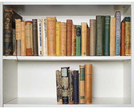
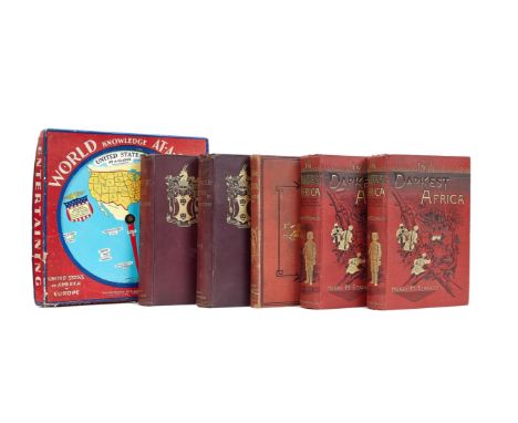
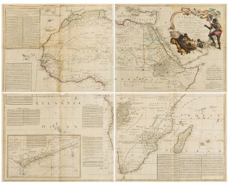
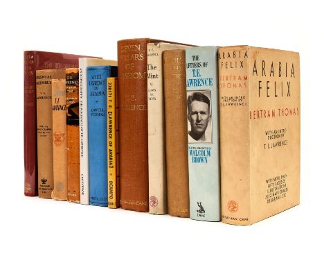
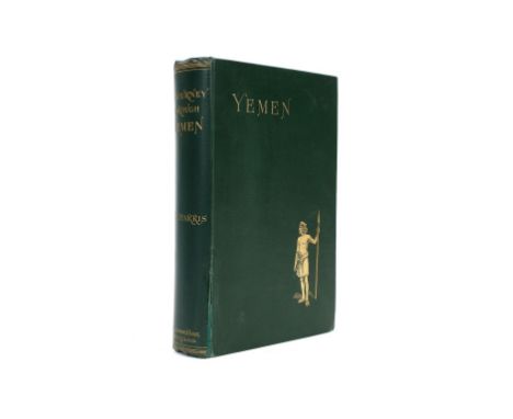
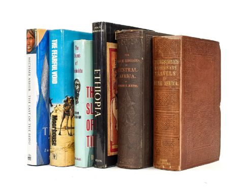
Africa.- Baker (Sir Samuel White) The Albert N'Yanza, Great Basin of the Nile, and Explorations of the Nile Sources, 2 vol., first edition, engraved portrait frontispiece, tinted lithograph frontispiece, 12 wood-engraved plates, 2 maps, 1 folding, illustrations, occasional faint spotting, new endpapers, original decorative cloth, slight bumping to corners and extremities, [Czech p.10], 1866 § Du Chaillu (Paul) Explorations & Adventures in Equatorial Africa, folding frontispiece, plates and illustrations, folding map at end, short tears with tape repairs, strengthened joints, original decorative cloth, neat restoration to spine extremities, a little rubbed, bumping to corners and spine extremities, 1861 § Griffiths (V. L.) and Abdel Rahman Ali Taha, Sudan Courtesy Customs, original cloth, bumping to corners and spine extremities, The Sudan Government, 1936 § Driberg (J. H.) The Lango: a Nilotic Tribe of Uganda, first edition, portrait frontispiece, plates and illustrations, folding map, scattered spotting, original cloth, slight bumping to spine extremities, dust-jacket, short tear to top edge, chipping and small loss to spine extremities, a little rubbed, 1923; and others Africa, 8vo & 4to (c.65)

Lot 31

America.- Delamarche (Charles-François) Etats-Unis de l'Amerique Septentrionale avec les Isles Royale, de Terre Neuve, de St. Jean, l'Acadie &c, map of the newly created United States and shows much of the Louisiana Territory and part of New Mexico, the detailed map also identifies many Indian villages and tribal territories, engraving with hand-colouring, on laid paper with text-based watermark, sheet 505 x 685 mm (19 7/8 x 27 in), minor nicks and repaired marginal splits, some surface dirt and minor browning, handling creases and some thinning to sheet in the upper right corner, unframed, Paris, 1785.

Lot 32

America.- Hutchings (James M.) In The Heart Of The Sierras. The Yo Semite Valley, first edition, folding map, plates and illustrations, original cloth, spine a little darkened, spine ends and corners a little bumped, Yo Semite Valley, CA, Pacific Press, 1888 § Klondike. The Chicago Record's Book for Gold Seekers, first edition, original pictorial cloth, rubbed, Chicago, 1897 § Baedekker (Karl) The United States with an Excursion into Mexico, third edition, folding maps, one with tear running into image, contemporary limp green straight-grain morocco, Leipzig, 1904; and 11 others, America, 8vo (14)

Lot 33

NO RESERVE America.- Riker (James) The Annals of Newtown, in the Queens County, New-York, folding map and folding facsimile at end, later half-morocco, gilt, New York, D. Fanshaw, 1852.

Loading...Loading...
  • 109182 item(s)
    /page

Recently Viewed Lots