A Falkland Islands Royal Engineers briefing map, with typed annotations relating to the condition and suitability of airfields, roads, and tracks etc., stating it is effective from 20th April 1982, some personal notes made relating to east and west Falkland, with additional attachable note relating to possible Argentinian Hercules sites, and an Operation Corporate Manoeuvre map (21st May- 14th June 1982), showing east Falkland, both maps printed in colour and are from the period of the Falkland Island conflict (3, AF).
We found 109182 price guide item(s) matching your search
There are 109182 lots that match your search criteria. Subscribe now to get instant access to the full price guide service.
Click here to subscribe- List
- Grid
-
109182 item(s)/page
3 Maps from the British Isles Including Pont, Timothy, comprising Praefectura Renfroana... the Baronie of Renfrow, double page engraved map, hand coloured in outline, 48 x 61cm., double glazed; Collins, Greenville The Isle of Man. [1693], engraved by H. Moll, hand-coloured in outline, slight crease mark at centre fold, laid down on board, light overall discolouration, framed and glazed; 49 x 60cm.; Morden, Robert Surrey, engraved map, hand-coloured in outline, 36 x 42.5cm. slightly dust-soiled and slight crease marks at centre fold, framed and glazed (3)
Blaeu, Joan Toonneel des Aerdryck oft Nieuwe Atlas...Vyfde Deel [Theatrum Orbis Terrarum, part V] Amsterdam: Joannem Blaeu, 1654. Folio, engraved title-page and 55 engraved maps including the maps of Ireland, an uncoloured set, 20th century vellum, a small repair to the lower corner of one map without loss to engraved area, some very light and occasional browning Note: This atlas comprises volume five of the six-volume Dutch text edition of Blaeu's Theatrum, in first edition. Each volume of the work was published separately between 1635 and 1655, in several languages. In its era, the Theatrum was considered to be the most comprehensive and accurate atlas produced, with volume 5 being regarded to this day first atlas of Scotland, using many maps developed by the cartographer, Timothy Pont. Forty-nine of the maps are of Scotland and 6 of Ireland.
Stevenson, Robert Louis Kidnapped London: Cassell & Company, Limited, 1886. 8vo, first edition, first issue, with "business" p.40 line 11, "nine o'clock" p.64 line 1, "Long Islands" p.101 lines 9/10 and 16pp. of adverts at rear dated 5G.4.86, folding map, original red cloth gilt, shelf lean, spine darkened, map becoming detached, some slight internal soiling
Tolkien, J.R.R. The Lord of the Rings The Fellowship of the Ring. London: George Allen & Unwin Ltd., 1954. Second impression (December 1954), 8vo, map, original red cloth gilt, a little darkening and dampstaining to dust-jacket; The Two Towers. London: George Allen & Unwin Ltd., 1955. Second impression, 8vo, map, original red cloth gilt, dust-jacket slightly dampstained also very slightly affecting a couple of rear leaves, dust-jacket spine darkened; The Return of the King. London: George Allen & Unwin Ltd., 1955. First edition, 8vo, original red cloth gilt, dust-jacket with some minor dampstaining, spine darkened (3)
Six hand-coloured maps of Southern Italy, The Black Sea and Europe, including Ortelius, Abraham Pontus Euxinus... 1590, double-page engraved map of The Black Sea, hand-coloured in outline, [Antwerp, c. 1624], 37 x 52cm., Ortelius, Abraham Galliae veteris typus, double page engraved map, hand-coloured [Antwerp, 1624], 42 x 52cm; Magini, Giovanni Antonio Maps of Calabria and Otranto [Terra di Otranto; Calabria citra, olim Magna Graecia], c. 1610, 355 x 490mm.; Janvier, Sieur L'Europe divisé en ses principaux Etats. Venice: FR. Santini, c. 1780, 50 x 68cm.; Jansson, Jan Calabria Ultra, olim altera Magnae Graecia pars. Amsterdam: J. Jansson, c. 1630, 41 x 52cm., engraved map, hand-coloured in outline, crease at centre fold; all framed and glazed (6)
Newberry, J.S. Report of the Exploring Expedition from Santa Fé...in 1859 Washington: Government Printing Office, 1876. First edition, 4to, 22 plates including several chromolithographs, folding map detached but present, contemporary black cloth gilt, Edinburgh Geological Society inscription, small cancelled stamp and library bookplate
Forsyth, J., Captain The Highlands of Central India London: Chapman & Hall, 1871. 8vo, 7 plates, 6 coloured, 1 folding map, green cloth, inscription to end-paper, rubbing to cover, spine sunned, corners edge-worn, hinge split; Hooker, J. Himalayan Journals…, [n.d. but c.1890]; also Vol. 2, 1854 (4)
India - Anderson, John Corbet To India and Back by the Cape Croydon: J.A. Anderson, 1858. Subscriber's Copy, 4to, [4], 28, [1]; list of subscribers at end, 19 lithographed plates (including 5a; 2 coloured), lithograph map with hand-coloured highlights at centre of 1st text page, original pictorial blue cloth gilt, head and tail of spine rubbed, slight spotting, occasionally more pronounced
Lawrence, Thomas Edward Revolt in the Desert London: Jonathan Cape, 1927. 8vo, number 281 (of 300 copies) of the large paper edition, colour portrait frontispiece, 18 plates (10 of which are colour) and folding map, original quarter brown morocco gilt, spine very slightly rubbed, some pages uncut
Pennant, Thomas A Tour in Scotland London: Benjamin White, 1790. Fifth edition, 8vo, folding map and 42 plates, contemporary half calf, joints cracked, bookplates; A Tour in Scotland MDCCLXXII, part ii. London: Benjamin White, 1776. 8vo, 57 plates, contemporary half calf, joints cracked, upper cover nearly detached, bookplates; A Tour in Scotland and Voyage to the Hebrides. Chester: printed by John Monk, 1774. 8vo, 57 plates, contemporary half calf, joints worn, bookplates (3)
Polar Exploration 5 volumes, comprising Shackleton, Edward Arctic Journeys. London: Hodder & Stoughton Limited, [1937]. First edition, 8vo, 41 plates, folding map, original blue cloth gilt, dust-jacket not price-clipped; Nansen, Fridtjof Fram Over Polhavet. Oslo: H. Aschehoug & Co., 1897. 2 volumes, 8vo, original blue cloth gilt; Starritt, S. Stuart The Life of Nansen. London: The Religious Tract Society, [n.d.] 8vo, original red cloth; Evans, Admiral Sir Edward South with Scott. London: Collins, [1954]. Ninth edition, 8vo (5)
Roberts, William An Account of the First Discovery and Natural History of Florida London: T. Jefferys, 1763. 4to, 6 folding maps and plates, all in facsimile, 20th century half calf gilt, a little rubbing, neat repair to reverse of initial map, maps and plates trimmed down (not affecting engraved areas) [ESTC T100147] Provenance: Bookplate of Lord Napier
Uring, Nathaniel A History of the Voyages and Travels of Capt. Nathaniel Uring London W. Wilkins, for J. Peele, 1726. 8vo, 4 folding maps, contemporary panelled calf, bookplate of Lord Sandys, upper cover detached, foxing, folding map of Honduras laid down with repairs, some small neat repairs to folding map of the Caribbean, two maps of St. Lucia a little trimmed [ESTC N9980]; Dodsley , Robert The Geography of England. London: R Dodsley, 1744. 8vo, 50 (of 56) folding maps only, contemporary calf, lacking pp.227-8 and pp.259-270 [ESTC T57743] (2)
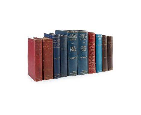
World Travel 10 volumes, comprising Landor, A. Henry Savage Across Widest Africa. London: Hurst and Blackett Ltd., 1907. 2 volumes, 8vo, 2 frontispieces (repaired in volume 1), 145 plates & 3 maps (two folding, one large), original blue cloth gilt; Kingsley, Mary H. West African Studies. London: Macmillan and Co. Limited, 1901. Second edition, 8vo, 'presentation copy' blindstamp, original red cloth gilt; [Idem] Travels in West Africa. London: Macmillan and Co., 1897. Second edition, abridged, original red cloth gilt; Kelly, Talbot Egypt Painted and Described. London: A. & C. Black, 1904. 8vo, contemporary red half calf gilt, upper cover becoming detached; Wigram, W.A. & Sir Edgar T.A. The Cradle of Mankind. London: A. & C. Black, 1922. Second edition, 8vo, original blue cloth; Younghusband, Sir Francis Dawn in India. London: John Murray, [1930]. First edition, 8vo, original blue cloth, dust-jacket remnants present; Dodds, James Records of the Scottish Settlers in the River Plate and their Churches. Buenos Aires: Grant and Sylvester, 1897. 8vo, original blue cloth gilt, cancelled library bookplate; Hübner, Baron von Through the British Empire. London: John Murray, 1886. 2 volumes, 8vo, folding map, original brown cloth gilt (10)
Campo, Antonio Cremona Fedelissima Città et Nobilissima Colonia de Romani Cremona: Ippolito Tromba and Ercoliano Bartoli, 1585. Folio, 4 parts in one volume, engraved title-page with engraved portrait of Philip II on verso, woodcut initials, decorative woodcut borders, engraved and woodcut illustrations (mostly portraits), folding engraved map, double-page engraved map, double-page engraved plate (of the cathedral) with further engraved details on versos, later speckled calf, leaf ***4 possibly from a later printing, text at foot of 8*3v obscured, without blank leaf 10*4, woodcut printer's device above colophon, first few leaves and final leaf repaired at edges, engraving on verso of title-page shaved, folding map laid down and slightly damaged, double-page plate slightly torn, joints cracked, binding slightly rubbed [Edit16 8843; IA 130.903; Mortimer, Harvard Italian 100] Note: This seems to be a later state of printing, with the caption "David de Laude Crem. hebreus incid." on the folding map (see Mortimer). The plates were all engraved by Agostino Carracci, according to the note on [2]+2r.
Low, Charles Rathbone The Afghan War, 1838-1842, from the Journal and Correspondence of the Late Major-General Augustus Abbott London: Richard Bentley and Son, 1879. 8vo, frontispiece map, blue cloth gilt, cancelled plate and blindstamps of Manchester Central Library, lacking half-title?, a little spotting
EMANUEL BOWEN MAP OF STAFFORDSHIRE c.1760 from 'The Large English Atlas', cartouche dedicated to 'The Noble and Right Honourable John Gower', has original outline colour and is framed and glazed, frame size 88 x 67 cmCondition Report:/b>Good margins, plate mark visible, some light offsetting. Not inspected out of frame.
Blaeu,Jan.Derbyshire, Darbiensis comitatus vernacule Darbie shire. Amsterdam, [c.1662]. later colour, 37.5cm x 50cm, Speed, John (1552-1629). 17th-century map of Derbyshire, 'Darbieshire Described', 38.5cm x 50cm, and John Tallis, Three maps: 'Nova Scotia and Newfoundland' , 'East Canada, and New Brunswick', and West Canada each 26.5 x34.5cm (5).
SAINT JOHN DE PREBEUF: THE TRAVELS AND SUFFERINGS OF FATHER JEAN DE PREBEUF AMONG THE HURONS OF CANADA AS DESCRIBED BY HIMSELF, ed/trans Theodore Besterman, London, The Golden Cockerel Press, 1938 (300), 1st edition, numbered, engraved titling on title page by Eric Gill, uncut, map end papers, folio, original two-tone cloth
J COAD? OR HENRY BRERETON CODY? "GREGORY GREENDRAKE": THE ANGLING EXCURSIONS OF GREGORY GREENDRAKE ESQ IN THE COUNTIES OF WICKLOW, MEATH, WESTMEATH, LONGFORD AND CABAN WITH ADDITIONS BY GEOFFREY GREYDRAKE ESQ [IE THOMAS ELLINGSDALE], Dublin, Grant & Bolton, London, Longman, Rees, Orme, Brown, Green & Longman, 1832, 4th edition, engraved frontis and map as called for, 12mo, original cloth worn, lacks parts of backstrip
HENRY STEVENSON: THE BIRDS OF NORFOLK, London, John van Voorst, Norwich Matchett and Stevenson, 1866-70, 1st edition, 2 vols, 2 coloured and 3 tinted lithoplates as called for, original blind stamped cloth gilt, worn and soiled, vol 1 inner joints weak + OLIVER VERNON APLIN: THE BIRDS OF OXFORDSHIRE, Oxford, The Clarendon Press, 1889, 1st edition, hand coloured litho frontis and folding map as called for, original cloth gilt + STEWART ANGUS (ED): SUTHERLAND BIRDS, Golspie Sutherland, The Northern Times Ltd, 1983, 1st edition, original cloth gilt, dust wrapper (4)
HERBERT EDWARD FORREST: 2 titles: THE VERTEBRATE FAUNA OF NORTH WALES, London, Witherby & Co, 1907, 1st edition, 28 plates, folding map at end as list, folding map with split at fold and small old repair, rebound (not recent) cloth, morocco gilt spine label; A HANDBOOK TO THE VERTEBRATE FAUNA OF NORTH WALES, London, Witherby & Co, 1919, 1st edition, original cloth, spine faded + GEORGE BOLAM: WILD LIFE IN WALES, London, Frank Palmer 1913, 1st edition, rebound (not recent), morocco gilt spine label (3)
-
109182 item(s)/page