We found 109198 price guide item(s) matching your search
There are 109198 lots that match your search criteria. Subscribe now to get instant access to the full price guide service.
Click here to subscribe- List
- Grid
-
109198 item(s)/page
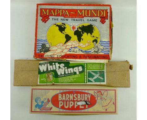


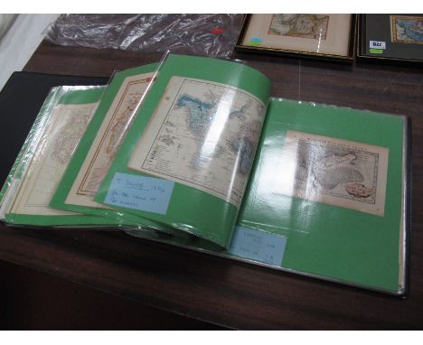
Lot 729
An Album of Unframed Maps - J Van Hangerton 1643, published Jenner, A New Direction for the English Traveller, Petras Bertius Map of New Zemlya 1565, 1629, T Moule Map of East Riding of Yorkshire, 1842-52, Sanson Map of Old France, 1650?, and other XIX Century maps, Asia, Australia, The World, a page from double leaf XV Century manuscript, XVI Century woodcut map Sabastian Munster and XIX Century maps.


Lot 731
An Album of Unframed Maps - J Dower Black and White Map of Berlin 1840, J Dower black and white map of Australia 1840, John Stockdale coloured map of Derbyshire, 1794, Samuel Clark, coloured map of France, 1822, W.B.Whittaker black and white map of Somerset 1824 and other XVIII / XIX Century maps.


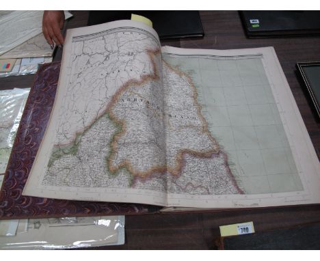
Lot 733
Unframed Maps - John Stow 1720 Survey of The Cities of London and Westminster, XVIII Century map "Boundaries of The City of York", XIX Century map of Doncaster, T.L. Murray map of Durham 1830, XVII Century John Morden map of Middlesex (damaged), XIX Century plan of a new line of road between Andover and Honiton being part The Great Western Rd from London to Exeter, Plymouth and Falmouth 1802.


Lot 737
Five Antiquarian Atlases: Atlas Antiques : Twelve Maps of the Ancient World, by Dr. Henry Kiepert, 1886; Longman's New Atlas Political and Physical, 1889, with forty quarto and sixteen octavo maps and diagrams by Edward Stanford; The Century Atlas and Gazetteer, John Walker & Co., 1890; The Peoples Atlas, c.1920 and The Royal Atlas of England and Wales, J.G. Bartholomew, 1899; plus a folder of Antiquarian Book and Map Dealers catalogues.

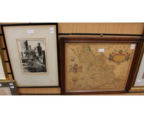
Lot 278
AFTER JOHN SPEEDE "The Countye Palatine of Chester ...", hand-coloured map, together with another AFTER H. MOLL "North Wales" (2) CONDITION REPORTS Chester - wear, dirt, browning, foxing and some staining. This does have some age, but may be one of the later editions. Printed on a fairly thick paper. Sealed within a frame with a wood back. Map may be laid down. Some losses to corners. Vertical centre fold with some wear. There do appear to be some variations to colour, so possibly some touching-up of paint or repair. The Wales map is very foxed, stained and browned and wrinkled, and is unglazed. Frames with some damage and losses.


Lot 473
JOHN SPEEDE; an early 17th century hand coloured engraved map of Britain, Saxon Heptarchy, displaying the publishers John Sudbury and George Humble, c.1627, double glazed frame, 38 x 50cm. CONDITION REPORT: There is a 4cm tear to the lower right hand portion, rippling to the map throughout, a small 1 x 1cm tear and repair top right hand corner, the mount showing no margins so possibly trimmed tight to the edge of the engraving, several tiny tears running up each side of the map.

Lot 474
JOHN SPEEDE; an early 17th century hand coloured engraved map of Cambridgeshire detailing Sudbury and Humble, c.1610, with vignettes to the border, 39 x 50cm, framed and double glazed. CONDITION REPORT: Showing a 1cm margin to the top, cut elsewhere and trimmed directly to the edge of the engraving, overall a rippling throughout, several small tears to the edge, a couple of light areas of foxing, otherwise OK.


Lot 1329
WW2 Leather Flying Jacket/ Waistcoat, sheepskin lined kid leather outer. The back designed with a map of Europe, the front signed with numerous signatures and various American/British army personnel. Some signatures dated 1941-1945. Stamped to inside AFS Liverpool and JC Howden NFS 4 DY 332530.


Lot 1543
17th century hand tinted map of Great Britain, to show the cities of London, Edinburgh, engraved by I. Hondius and are able to be sold by I. Sudbury and George Humble in Popeshead Alley, London, 1610, 38x50cm, verso with general description of Great Britain, a hand tinted road map from Denby to Holyhead, circa 1730, 18x12cm, double sided, both framed and glazed CONDITION REPORT: No damage to the centrefold, colours bright, some minor foxing to the right beneath the a on ocean , north of that not a lot of white margin around the border of the map, verso small piece of tape across the bottom of the centrefold, minor staining to the left hand side, minor foxing, pencil inscription top right hand side 1614, two pin prick holes of light showing through, left hand side sector 9 has not been removed from glass can't determine if it is laid down, small map good condition, printing visible verso

Lot 1548
A late 17th/early 18th century hand tinted map of The County Palatine of Chester, performed by John Speede, sold by Thomas Bassett in Fleet Street, with inset map of the city of Chester, together with the coats of arms of the various Earls of Chester, 38x50cm, framed and glazed CONDITION REPORT: No tears to map, colours bright, some rubbed colouring right hand side, part of Derbyshire otherwise good condition, the back is enclosed and we can't see or get any pictures of the back.

Lot 1550
A mid 17th century hand tinted map of Northumberland, by S R Sanson of Paris dated 1658, 38x53cm, mid 18th century hand tinted map of the county Palatine of Lancaster by Robert Morden, 41x36cm, late 18th century tinted map of Cumberland, published January 1st 1793 by J. Cary, 27x22cm, all framed and glazed (3)


Lot 603
An extensive collection of 18th, 19th century and later prints and engravings including a road map showing the road from Bristol to Banbury by Thomas Gardner, two pages from the London Gazette Extraordinary dating from November 11th 1805 and March 23rd 1806 and relating to naval battles, engravings showing natives of Holland and Japan, various topographical views, etc (all framed)


Lot 777
Six Gloucestershire related books including topographical and statistical description of the County of Gloucester by G A Cooke, with county map, A Tour To Cheltenham Spa or Gloucestershire Displayed, 1805, Saxton Charters and Field Names of Gloucestershire parts 1 and 2 published 1935 and 1936, Anglo-Saxon and Medieval Gloucester by Fullbrook-Leggatt and An Analysis of the Domesday Survey of Gloucestershire by Charles S Taylor, (6 volumes)


Lot 370
A collection of ten framed and glazed maps relating to troop positions and movements during the first world war, to include the third battle of Ypres, German offensive on Lys dated April 1918, British advance to the Rhine etc, together with a red cloth covered map box titled Sir Douglas Haig despatches maps


-
109198 item(s)/page