We found 109198 price guide item(s) matching your search
There are 109198 lots that match your search criteria. Subscribe now to get instant access to the full price guide service.
Click here to subscribe- List
- Grid
-
109198 item(s)/page
![Suffolk. Blaeu (Joan), Suffolcia. Vernacule Suffolke, [1647 or later], uncoloured engraved map, title cartouche and several](http://lot-images.atgmedia.com/SR/10729/2718225/341-70-10729_468x382.jpg)

![Suffolk. Blaeu (Joan), Suffolcia. Vernacule Suffolke, [1646 or later], hand coloured engraved map, title cartouche and numer](http://lot-images.atgmedia.com/SR/10729/2718225/342-70-10729_468x382.jpg)

Lot 351
* Wiltshire. Blaeu (Guilielmus). Wiltonia sive Comitatus Wiltoniensis; Anglis Wilshire, n.d., c. 1645, hand-coloured engraved map, ornamental title cartouche, separate scale of distance, royal crest, numerous county armorials, plate size approx. 410 x 500 mm (16 x 19.75 ins), Hogarth-style frame, glazed (1)
Lot 352
Wiltshire & Berkshire. Bleau (Joan), Wiltonia sive Comitatus Wiltoniensis; Anglis Wil Shire, [1646 or later], hand coloured engraved map, title cartouche and several armorials, repair to verso at head of central fold and some marginal restoration, 420 x 500 mm, together with Bercheria Vernacule Barkshire, [1646 or later], hand coloured engraved map, restoration to right margin, 385 x 505 mm, both German text to verso (2)
![Wiltshire. Jansson (Jan), Wiltonia sive Comitatus Wiltoniensis. Anglis Wil Shire, [1646 or later], hand coloured engraved ma](http://lot-images.atgmedia.com/SR/10729/2718225/354-70-10729_468x382.jpg)
![Wiltshire. Blaeu (Joan), Wiltonia sive Comitatus Wiltoniensis; Anglis Wil Shire, [1659 or later], hand coloured engraved map](http://lot-images.atgmedia.com/SR/10729/2718225/355-70-10729_468x382.jpg)
![* Worcestershire & Warwickshire. Blaeu (Joan), Wigorniensis Comitatus et Comitatus Warwicensis, [1645 or later], hand colour](http://lot-images.atgmedia.com/SR/10729/2718225/356-70-10729_468x382.jpg)
Lot 358
Yorkshire & Staffordshire. Bleau (Joan), Ducatus Eboracensis Anglice York Shire, together with Staffordiensis Comitatus; vulgo Stafford Shire, [1645 or later], two hand coloured engraved maps, the latter with one small hole to map area, the former restored to right margin not affecting engraved area, each 395 x 500 mm, German and French text to verso respec. (2)

Lot 364
Yorkshire - West Riding. Blaeu (Joan), Ducatus Eboracensis pars Occidentalis; The West Riding of Yorke Shire, [1646 or later], hand coloured engraved map, title cartouche and armorials, repair to lower-right corner with some resoration of engraved border, 385 x 500 mm, German text to verso (1)
![Yorkshire - North Riding. Blaeu (Joan), Ducatus Eboracensis pars Borealis. The North Riding of York Shire, [1647 or later],](http://lot-images.atgmedia.com/SR/10729/2718225/367-70-10729_468x382.jpg)
Lot 400
* Warwickshire-Coventry. An album containing a collection of prints, a map & watercolour etc. relating to Coventry, 17th-19th c., includes eng. views & ports. after Hollar, three folding manuscript floor/gallery plans of St. Michaels' Coventry, c.1850, providing details of named family pews etc., a watercolour courtyard scene, plus a copy of 'The Antiquties of Coventre, Illustrated..., (text only), by William Dugdale, Coventry, 1765', each sheet window mounted, plus other Coventry related items inc. photos etc., later 19th c. dec.. vellum, 4to (1)
Lot 408
Adams (W.H. Davenport). The History and Topography of the Isle of Wight, Ventnor, 1864, eng. frontis., twenty-nine eng. plts. on 23 leaves (of 25?, inc. extra plt.), two col. litho geological plts., folding col. litho map at rear, occ. scattered spotting, a.e.g., inner joints repaired, orig. red cloth gilt, spine neatly repaired at head & foot, 4to (1)
Lot 414
Baker (Thomas). Baker's Practical Survey of the Geology, Mineralogy, and Historical Events of the District of Dudley..., with a Compendium of the History of the Castle and Priory..., also, some Instructive Remarks... on the Rise & Progress of the Coal & Iron Trade..., pub. Birmingham, 1848, folding map frontis., occ. minor spotting, contemp. half calf gilt, joints slightly rubbed, 8vo (1)
Lot 425
Cary (John). Cary's Traveller's Companion, or, a Delineation of the Turnpike Roads of England and Wales..., 1819, eng. title (browned at blank margins), advertisement & contents leaves, forty-two (of 43) maps hand-col. in outline, lacking folding map of Yorkshire, 4pp. pubs. ads. at rear, recent blind-panelled calf, sm. 8vo, together with Cary's New Itinerary..., 1812, large folding map, with left-hand margin (incl. border) excised and re-joined on verso, six folding eng. maps, ink stamp to title-page, some browning, upper hinge split, contemp. straight-grained calf, rubbed, spine torn at head with loss, joints cracked, 8vo (2)
Lot 426
Cary (John). Carys Actual Survey of the Country Fifteen Miles round London. On a Scale of one Inch to a Mile, 1st ed., Printed for J. Cary, Published ... June 20 1786, eng. title-page, engraved leaf of "Explanation", double-page general map, and 50 single-page engraved maps, partly hand-coloured, with the letterpress Index, 14 leaves, at the end, a little light staining, recent half calf, marbled board sides, 8vo (1)
Lot 429
Derbyshire. The History and Topography of Ashbourn, the Valley of the Dove, and the Adjacent Villages; with Biographical Sketches of Eminent Natives, &c., 1st ed., pub. Dawson & Hobson, Ashbourn, 1839, eng. frontis., addn. title-page, and twenty eng. views, foxed, contemp. half calf gilt, rubbed and scuffed, 8vo, together with The Peak Guide, Containing the Topographical, Statistical and General History of Buxton, Chatsworth, Edensor, Castleton, Bakewell, Haddon, Matlock, and Cromford..., by Stephen Glover; edited by Thomas Noble, 1845, folding eng. map with border of sixteen views, three eng. views, two folding genealogical tables, plans (incl. one folding), vigns. to letterpress, rough-trimmed, orig. blindstamped cloth, sometime re-covered in paper, with endpapers renewed, spine deficient, 8vo, plus Peak Scenery; or, The Derbyshire Tourist, by E. Rhodes, 1st ed., 1824, letterpress maps, first gathering detached, endpapers renewed, untrimmed, contemp. half morocco gilt, rubbed, spine with gilt dulled and new label, upper cover and spine detached at upper hinge, 8vo, plus five other Derbyshire interest (8)
Lot 441
Hasted (Edward). The History and Topographical Survey of the County of Kent, containing the antient and present state of it, civil and ecclesiastical, collected from public records, and other authorities, 2nd ed., 12 vols., 1797-1801, eng. frontis. (two folding) and title vign. to each, thirty-four folding maps as per list, some torn and repaired, plus addn. folding map of the Hundreds of Toltingtrough and Shamel to vol. 3 (not called for), eng. plts. inc. twenty-two full-page, complete, contemp. polished calf, gilt dec. spine, rubbed with a little wear to extrems. of some vols. (a few joints partly cracked), 8vo. Upcott 368 (12)
Lot 442
Hoare (Sir Richard Colt). The Itinerary of Archbishop Baldwin Through Wales, A.D. MCLXXXVIII. By Giraldus de Barri; Translated into English, and Illustrated with Views, Annotations, and a Life of Giraldus, by Sir Richard Colt Hoare, 2 vols., 1st ed., 1806, half-titles with name excised from upper margin, with consequent paper repair to each, eng. frontis. to each vol., fifty-seven eng. plts. and plans, large folding hand-col. map (sl. foxed and with short handling tear), all correct as list, recent half morocco, gilt dec. spines, with orig. labels relaid, 4to (2)
Lot 443
Ingram (James). Memorials of Oxford, 3 vols., Oxford, 1837, wood-eng. vign. title to each vol., 35 eng. plts. only (of 100), single-page eng. map, numerous wood-eng illusts., occasional spotting, t.e.g., contemp. half morocco gilt, rubbed, 4to, together with Ireland (Samuel), Picturesque Views on the River Thames, from its Source in Glocestershire to the Nore..., vol. 1 only (of 2), 1792, addn. aquatint title, single-page eng. map, twenty-seven aquatint plts., inner joints repaired, contemp. tree calf, rebacked, 8vo, plus two other Oxford related, both early 20th c. vols. (6)
Lot 444
Ireland (Samuel). Picturesque Views, on the River Medway, from the Nore to the Vicinity of its Source in Sussex: with Observations on the Public Buildings and other Works of Art in its Neighbourhood, 1793, half-title, addn. aquatint titloe, eng. map and twenty-eight aquatint plts., few woodcut illusts. to text, contemp. diced calf, joints slightly rubbed, 4to (1)
Lot 445
Ireland (Samuel). Picturesque Views on the River Wye, from its Source at Plinlimmon Hill, to its Junction with the Severn below Chepstow..., 1797, half-title, eng. map, thirty aquatint plts. and one eng. port. plt., few woodcut illusts. to text, some slight offsetting to text, contemp. diced calf gilt, joints slightly rubbed, 4to (1)
Lot 446
Ireland (Samuel). Picturesque Views on the Upper, or Warwickshire Avon, from its Source at Naseby to its Junction with the Severn at Tewkesbury: with Observations on the Public Buildings, and other Works of Art in its Vicinity, 1795, half-title, eng. map, twenty-nine aquatint plts. and two eng. port. plts., few woodcut illusts. to text, contemp. calf gilt, joints cracked, 4to (1)
Lot 450
Lambard (William). A Perambulation of Kent: Conteining the description, Hystorie, and Customes of that Shyre. Collected and written (for the most part) in the yeare 1570 ... and nowe increased by the addition of some things which the Authour himselfe hath observed since that time, 1st ed., Imprinted at London [by Henry Middleton] for Ralphe Newberie, 1576, title within a border of typographic ornaments, the full-page woodcut map of the Angliae Heptarchia present, slightly shaved at the foot, with the duplicate leaf H2, paginated 58/59, containing a list of the names of Kentish writers, historiated and floriated woodcut initials, a little light soiling, running head-line of last two leaves just touched by the binder, early 18th century calf, gilt fillet border to sides with decorative cornerpieces, elephant crest of Sir Andrew Fountaine (1676-1753) in gilt in five compartments on the spine, slightly faded and rubbed, small 4to. First edition of the first English county history, containing a list of the nobility and gentry from the Herald's Visitation in 1574, omitted from later editions. Considered to be a model of topographical writing by William Camden. De Ricci, English Collectors of Books & Manuscripts, p. 42, remarks that books from the library with the elephant stamped direct onto the binding, as here, were added from 1830 onwards by Andrew Fountaine. The library was dispersed in 1902. S.T.C. 15175. (1)
Lot 451
Leigh (Charles). The Natural History of Lancashire, Cheshire and the Peak, in Derbyshire, with an Account of the British, Phoenician, Armenian, Gr. and Rom. Antiquities in Those Parts, Oxford, printed for the Author, 1700, eng. port. frontis., double-page eng. map hand-col. in outline, two plts. of arms, twenty-two eng. plts. (correct according to Upcott I, pp.456-57), some worming to upper margins of some leaves, occ. slight finger-soiling, contemp. calf, gilt dec. spine, red morocco title label, upper joint split and some wear to extrems., folio. Wing L975. (1)
Lot 454
Mackenzie (Murdoch). Orcades; or, a Geographic and Hydrographic Survey of the Orkney and Lewis Islands, in Eight Maps..., 4th ed., sold S. Smith, 1810, eight uncoloured double-page charts, most with insets of headlands, offsetting throughout, one map with some colour additions and marginal notes showing the routes of the mail ferry, title with oval library stamp, title and all maps laid onto linen, contemp. half sheep, scuffed and rubbed, folio (1)

Lot 469
Slater (Isaac). I. Slater's New British Atlas, comprising the Counties of England, (upon which are Laid Down all Railways Completed and in Progress)..., Manchester, c.1847, engraved title, three linen-backed engraved folding maps of Scotland, Ireland and England & Wales (two maps detached), 39 engraved county maps (including folding map of Yorkshire) and a folding map of the environs of London, all maps complete and with bright original colour, orig. half calf gilt, worn with defective spine and covers detached, folio (1)
Lot 475
Walker (J. & C.). Hobson's Fox-Hunting Atlas; containing Separate Maps of Every County in England, and the Three Ridings of Yorkshire, c.1848, letterpress title and contents leaf, 42 double-page maps with original outline colouring, old owners inscription to title, contemp. blindstamped sheep, worn and lacking upper cover, folio. The maps in very good condition. Contains a duplicate frayed map of Essex loosely inserted. (1)
Lot 489
Clark (J.H.). Usk and its Neighbourhood, Usk, [J. H. Clark], [1856], two engraved plates, extensive ink scoring in the four-page Directory at the end, orig. red cloth, rebacked, together with A Brief Account of the Picturesque Scenery on the Banks of the Wye between Ross and Chepstow, Gloucester, T. Jew, 1836, 32 pages, orig. printed wrappers, slightly frayed, and Black (A. and C.), Black's Guide to the Counties of Hereford & Monmouth, 1873, folding map, illustrations, Black's 84-page "Guide Book Advertiser" at the end, orig. green cloth, and Clark (Arthur), Raglan Castle and the Civil War in Monmouthshire, Chepstow, 1953, illusts., orig. blue cloth, and Johns (W. N.), Johns's Directory of Newport and Neighbourhood 1881, orig. blue cloth, spine bumped, gilt lettering dull, and others, Monmouthshire guides, history, and topography, 8vo et infra (54)
Lot 494
Coxe (William). An Historical Tour in Monmouthshire; illustrated with Views by Sir R. C. Hoare, Bart. A New Map of the County, and other Engravings, 2 vols., 1st ed., Printed for T. Cadell, Jun. and W. Davies, 1801, the half-titles present, complete with the 109 engraved plates, plans, portraits, etc., as called for by Upcott, including a folding map of Monmouthshire by N. Coltman, a folding facsimile, and seventeen engravings in the letterpress, three full-page pedigrees in vol. 1, some light soiling and browning, page *9 in vol. 1 ink scored, contemp. half russia, corners rubbed, cloth sides faded and marked, rebacked, orig. gilt backstrips laid down, now rubbed at joints and top and bottom of spines, 4to. One of just sixty copies printed on Royal Paper. (2)
Lot 496
Davies (Henry). The Stranger's Guide through Cheltenham; containing an Account of its Mineral Waters; with Descriptions of the Various Pump Rooms, Public Institutions, and Places of Fashionable Amusement. And an Account of the Principal Places in the Environs. Second Edition, Cheltenham, H. Davies, Montpellier Library, [1834], the half-title present, additional lithographed title-page, fourteen lithograph and two engraved plates, sixteen full-page wood-engravings, with a folding map, a folding plan (with two clean tears), and a folding coloured geological diagram, orig. green cloth, blocked in blind, the sides with floral decoration around a central panel, the panel on the upper cover lettered in gilt, and that on the lower cover with a design in blind representing a sacrifice to Amitie, spine lettered in gilt, and faded, covers a little rubbed, stitching weak in places, large 12mo. Hyett and Bazeley, Vol. II p. 94. Austin 6054. Many of the plates were drawn and lithographed by George Rowe. (1)
Lot 522
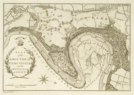
Willett (Mark). The Stranger's Guide to the Banks of the Wye; including Chepstow, Piercefield, Wyndcliff, Tintern Abbey, Raglan Castle, and other parts of the Welsh Borders: with Historical, Topographical, & Antiquarian Remarks. Third Edition, Bristol, Printed and Published by T. Bedford, 1831, engraved frontispiece map of the Wye, three folding engraved plans, that of Chepstow Castle damaged and repaired on the reverse, three pages of adverts. for Bedford's lithographic prints at the end, slight soiling, recent calf, 18mo (1)
Lot 523
Willett (Mark). The Stranger's Guide to the Banks of the Wye, including Chepstow, Piercefield, Wyndcliff, Tintern Abbey, Raglan Castle, and other parts of the Welsh Borders: with Historical, Topographical, and Antiquarian Remarks. Fourth Edition, Bristol, Printed and Published by T. Bedford, [c. 1845], lithographed frontispiece map of the Wye, three folding lithographed plans, two lithograph plates, orig. green diagonal-ribbed cloth, upper cover lettered in gilt, a few leaves rather roughly opened, an excellent copy, small 8vo (1)
Lot 524
Willett (Mark). An Excursion from the Source of the Wye. The Second Edition, Chepstow: Printed for the Author, and Sold at his Residence in Moor-Street ..., [1818], engraved frontispiece map of the Wye (just shaved at the fore-edge, and the imprint shaved at the foot), adverts. for Willett's other publications on the verso of the last leaf, contemp. half calf, marbled board sides, a trifle rubbed, 18mo. The author asserts that "In order to survey the many and varied beauties of the Wye, the progress from hence [Ross-on-Wye] to Monmouth and Chepstow should be performed in a pleasure-boat only". "The present edition has been entirely re-written". (1)
Lot 525
Willett (Mark). An Excursion from the Source of the Wye. The Second Edition, Chepstow: Printed for the Author, and Sold at his Residence in Moor-Street, [1818], engraved frontispiece map of the Wye, adverts. for Willett's other publications on the verso of the last leaf, orig. wrappers, spine defective, edges untrimmed, 18mo (1)
Lot 104
MAP OF SCOTLAND: HERMAN MOLL -The North Part of Great Britian called Scotland, dated 1714 with dedication to the Right Honourable John Earl of Marr, engraved views of Edinburgh, Stirling, the Bass, Glasgow, St Andrews and Montrose, detail of Shetland and Orkney, with hand coloured borders, 63cm high x 103cm wide
Lot 186
* Maps. Faden (William), A Map of the Seven United Provinces with the Land of Drent, and the Generality Lands, 1789, engraved map of the Netherlands with contemp. wash coloring, 710 x 535 mm, together with Morden (Robert), England, [1695 or later], hand coloured engraved map of England and Wales, 355 x 420 mm, and Thomson (John), East India Isles, 1814, hand coloured engraved map, 495 x 590 mm, plus Zoon (J. Boelen Joh.), Kaart ter Aanwijzung der Reize van het Schip Wilhelmia en Maria, 1835, engraved map of the Southern hemispher, hand coloured in outline, 220 x 685 mm, and other maps, mostly framed and glazed (12 incl. tube)
Lot 187
* Maps. Collins (Captain Greenvile), Chart of Leith, 18th century, hand coloured, with inset view and dedication cartouche, 365 x 565 mm, together with Cluver (Philip), Imperium Sinicim Quindecupartitum, c.1700, uncoloured engraved map, somewhat toned with one small hole, 295 x 380 mm, and Horsley (John), Britanniae Antiquae Tabula Geographica ex Aevi Romani Monumentis, pub. Laurie & Whittle, 1821, uncoloured engraved map of England, Wales and Southern Scotland, 560 x 510 mm, plus two other copies of this map including one hand colouring in outline, plus other maps including a plan of the Battle of Waterloo, plan of Sevastapol, etc. (17)
Lot 188
* Maps. Blaeu (Joan), Picardia, [1619 or later], hand coloured engraved map, title cartouche surmounted by armorial, 378 x 505 mm, and four other framed and glazed maps including an 18th century map of Turkey and Cyprus, a Keere map of Zeelandia, uncoloured Owen & Bowen map of Somerset and a Jansson map of part of France, plus a collection of unframed maps and prints including a map of Ireland by Edward Weller, facsimile maps, etc. (approx. 100)

Lot 191
Middle East. Homann (Johann Baptist), Imperium Turcicum in Europa, Asia et Africa, c.1730, engraved map with contemp. wash colouring, worm trail and small split to lower margin, 490 x 560 mm, together with Imperii Persici in Omnes suas Provincias, c.1730, engraved map with original wash colouring, title and scale cartouches,485 x 570 mm (2)
-
109198 item(s)/page