We found 109198 price guide item(s) matching your search

Refine your search

Year

Filter by Price Range
  • List
  • Grid
  • 109198 item(s)
    /page

Lot 209

Crete. Coronelli (Vicenzo Maria), Isola e Regno di Candia, published Venice, circa 1695, large uncoloured engraved map on two sheets (as published), elaborate floral border with medallions containing the names of 100 towns and cities, slight browning to central folds, slight worming to margins, each sheet approximately 455 x 620 mm, Italian text on verso (2)

Lot 71

Higgins (Godfrey). The Celtic Druids; or, An Attempt to Shew, that the Druids were the Priest of Oriental Colonies who Emigrated from India..., 1829, additional lithographed vignette title, single-page map and 46 plates and plans (including 4 double-page), 7 lithographic illustrations, all on india paper, a few woodcut vignette illustrations to text, some heavy spotting, mainly affecting plate leaves, scattered browning, old closed tear repairs to inner and lower margins of printed title and new preface leaf, armorial bookplate of Randall Hatfeild to front pastedown, uncut with wide margins (?large paper copy), modern tan brown morocco, spine lettered in gilt, a little rubbed and bumped at extremities, 4to (32 x 25 cm) (1)

Lot 259

Yorkshire. Jansson (Jan), Ducatus Eboracensis pars Borealis. The North Ridinge of Yorkshire, circa 1655, engraved map with contemporary hand colouring, printers fold just affecting image, 385 x 500 mm, Latin text on verso (1)

Lot 218

England & Wales. Walker (J. & C.), A Geological Map of England & Wales showing also the Inland Navigation by means of Rivers and Canals with their Elevation in feet above the Sea, together with the Rail Roads and principal Roads, published J & C Walker, 1835, large engraved map with contemporary hand colouring, sectionalised and laid on linen, calligraphic title, table of explanation with a geological and mineralogical cross section below map, slight staining and offsetting, cloth endpapers with a book plate of J.C.Thackray, 1260 x 980 mm, contained in a contemporary cloth slipcase worn and frayed with 'envelope style' flap detached Some of the railways highlighted on the map were constructed after 1835 which would indicate that the colouring for the railways is slightly later than the published date. (1)

Lot 29

Johnston (Alexander Keith). The Physical Atlas of Natural Phenomena, published William Blackwood and Sons, Edinburgh and London, 1850, printed title, frontspiece of a double page palaeontological map of the British Isles, twenty-four (complete as list), engraved maps with contemporary outline colouring, slight marginal spotting and finger soiling, all edges gilt, contemporary gilt panelled and decorated dark maroon morocco, spine a little faded, minor rubbing to extremities, folio (1)

Lot 170

[Serao, Francesco]. The Natural History of Mount Vesuvius, with the Explanation of the various Phenomena that usually attend the Eruptions of this celebrated Volcano. Translated from the Original Italian, composed by the Royal Academy of Science at Naples, by Order of the King of Two Sicilies, 1st English edition, London: E. Cave, 1743, two folding woodcut plates (one lined to verso & with closed tear to central fold), folding table, blind library stamp to title plates, few other leaves & free endpapers, ink library stamp to verso of title, occasional scattered spotting, ownership signature of John Wickins 1744 to front free endpaper, later quarter sheep, joints cracked, spine worn, 12mo in 6s, together with Winchilsea (Heneage Finch, 2nd Earl of), [A True and Exact Relation of the Late Prodigious Earthquake & Eruption of Mount Aetna, or, Mount-Gibello; as it came in a Letter Written to His Majesty from Naples by the Right Honorable The Earle of Winchilsea, His Majesties late Ambassador at Constantinople, who in his Return from thence, Visiting Catania in the Island of Sicily, was an Ey-witness of that Dreadfull Spectacle. Together with a more particular Narrative of the same, as it is collected out of severall relations sent from Catania, Printed by T. Newcomb, 1669], folding engraved frontispiece present with few repairs to edges (dust-soiled and dampstained, old ink stamp to verso of Royal Meteorological Society, Symons Bequest), facsimile title and final leaf, first & last leaf repaired at gutter margin, spotting and dust-soiling, early 20th century wrappers with manuscript title and ink stamp to upper cover, slim 8vo, contained in modern portfolio, plus Hamilton (William), Observations on Mount Vesuvius, Mount Etna, and Other Volcanos: In a Series of Letters Addressed to the Royal Society, 2nd edition, 1773, five engraved plates and one folding map, contemporary half calf, rebacked preserving original spine, 8vo, plus four 18th century disbound pamphlets (one defective), including A Sermon on the Late Earthquakes, More particularly that at Lisbon..., by Thomas Alcock, Oxford, 1756 (7)

Lot 478

Tolkien (J.R.R.). The Fellowship of the Ring, 2nd impression, 1954; The Two Towers, 1st edition, 1954; The Return of the King, 1st edition, 1955, folding map at end of each, light spotting front and rear, previous owner inscription to Fellowship, original red cloth, dust jackets, some fading to spines, a few tears, chips and stains, 8vo (3)

Lot 235

Lancashire. Blaeu (Johannes), Lancastria palatinatus Anglis Lancaster et Lancashire, published Amsterdam, circa 1648, hand coloured engraved map, 400 x 510 mm, Latin text on verso, together with Cumbria vulgo Cumberland, published Amsterdam, circa 1646, engraved map with contemporary hand colouring, large decorative cartouche and mileage scale, 415 x 505 mm, Dutch text on verso (2)

Lot 25

Gordon (Patrick). Geography Anatomiz'd: or, The Geographical Grammar. Being a short and exact analysis of the whole body of modern geography, after a new and curious method, Seventeenth edition, corrected, and somewhat enlarged; and a set of new maps, by Mr. Senex, 1741, half-title, title printed in red and black, folding map of the world, and 16 folding engraved maps by Senex, including Asia, Africa, North America and South America, contemporary blind-panelled calf, spine label loosely inserted at front of volume, a little rubbed and upper joint partly cracked, a very good clean copy, together with a defective copy of William Salmons's Geographical and Astronomical Grammar, mid-18th century, with 16 folding maps, some tears, soiling and defects, contemporary calf, some wear, both 8vo (sold with all faults) (2)

Lot 150

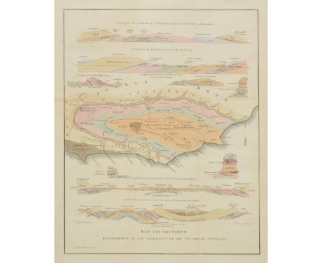
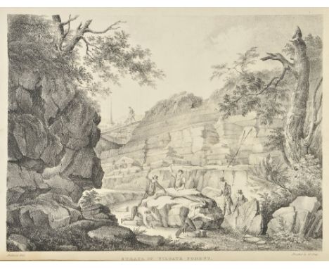
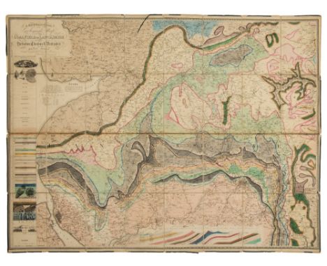
Mawe (John). The Mineralogy of Derbyshire: with a Description of the most Interesting Mines in the North of England, in Scotland, and in Wales; and an Analysis of Mr. William's Work, Intitled "The Mineral Kingdom", Subjoined is a Glossary of the Terms and Phrases used by Miners in Derbyshire, 1802, three engraved plates (including frontispiece) and single-page map, edges untrimmed, original boards, printed title label to spine, loss at head & foot of spine and some wear, 8vo, together with Sopwith (T., land & mine surveyor), An Account of the Mining Districts of Alston Moor, Weardale, and Teesdale, in Cumberland and Durham; comprising Descriptive Sketches of the Scenery, Antiquities, Geology, and Mining Operations, in the Upper Dales of the Rivers Tyne, Wear, and Tees, Alnwick: Printed by and for W. Davison, 1833, hand-coloured engraved map frontispiece (lightly offset to title), scattered spotting, original cloth, neatly rebacked preserving original printed title label, some fading to boards, 8vo, with Forster (Westgarth), A Treatise on a Section of the Strata, from Newcastle Upon Tyne, to the Mountain of Cross Fell, in Cumberland; with Remarks on Mineral Veins in General. Also, Tables of the Strata, in Yorkshire, Derbyshire, &c., To which is added, a Treatise on the Discovery, the Opening, and the Working of Lead Mines; with the Dressing and Smelting of Lead Ores, 2nd edition, greatly enlarged, Alston, Cumberland: Printed for the Author by John Pattinson, 1821, ink initial stamp to title, eleven plates (4 hand-coloured, some folding, plates 1, 2 & 11 not published), folding table, wood engraved diagrams & illustrations to text, endpapers renewed, contemporary half calf, rebacked, 8vo, plus Werner (Abraham Gottlob), New Theory of the Formation of Veins; with its Application to the Art of Working Mines..., Translated from the German, to which added, containing notes illustrative of the subject by Charles Anderson, 1st English Edition, Edinburgh: Printed at the Encyclopaedia Britannica Press for Archibald Constable & Co., 1809, half-title, lacking portrait frontispiece, edges untrimmed, original boards, repair to upper joint, wear to spine & upper joint, 8vo (4)

Lot 193

Brecknockshire. Speed (John), Breknoke both Shyre and Towne described, published John Sudbury and George Humble, circa 1627, uncoloured engraved map, inset town plan of Brecknock, 385 x 515 mm, English text on verso, together with Kitchin (Thomas), An Accurate Map of Brecknockshire drawn from an actual Survey with various improvements..., published R.Wilkinson, Laurie & Whittle and Bowles and Carver, circa 1785, uncoloured engraved map, trimmed to neatline along upper border, margin replaced, 350 x 530 mm (2)

Lot 196

British Isles. Magini (Giovanni), Britanicae Insulae, published Venice, [1596 or later], hand coloured engraved map, 140 x 180 mm, Latin text on verso R.W.Shirley, Early Printed Maps of the British Isles 1477 - 1650, no.192. (1)

Lot 393

Fuller (Thomas). The Holy State, & The Profane State, 3rd edition, printed by R.D. for John Williams, 1652, title to each part, with woodcut vignette of a crown, and woodcut border to each, additional engraved title to first part, 20 engraved portraits to text, with fore-margin partially excised, upper outer corner and inner margin restrengthened, several engraved portraits to text, bound with The Historie of the Holy Warre, 3rd edition, Cambridge, Roger Daniel, 1647, additional engraved title, folding engraved map of the Holy Land, early ownership inscriptions of Henry Montfort at head of title, and 'William Williams His Booke 1692' to foot of main title, 19th century bookplate of John Russell to front pastedown, near-contemporary calf-backed boards, heavily rubbed and some wear, with joints partly cracked, folio (1)

Lot 242

Netherlands. Blaeu (Johannes), Hollandiae pars septentrionalis vulgo Westuriesland en 't Noorder quartier [and] Ultraiectum dominium, published Amsterdam, circa 1643, two engraved maps with contemporary outline colouring, the first map orientated to the west, each approximately 390 x 500 mm, Latin text on verso (2)

Lot 241

*Monmouthshire. Speed (John), The Countye of Monmouth with the sittuation of the shire towne described, published Thomas Bassett & Richard Chiswell, [1676], hand coloured engraved map, inset town plan of Monmouth, large strapwork cartouche and mileage scale, slight creasing, central fold strengthened on verso, 385 x 510 mm, English text on verso, mounted, framed and double glazed, together with Blome (Richard), A Mapp of ye County of Mounmouthshire, [1673], hand coloured engraved map, slight spotting to margins, 315 x 245 mm, mounted, framed and glazed (2)

Lot 260

Yorkshire. Dix (Thomas), A New Map of the County of York, divided into its Ridings with their Subdivisions, Exhibiting the whole of the Mail, Direct and Principal Cross Roads, Navigable Canals, Rivers &c &c, published William Darton, 1820, engraved map with contemporary outline colouring, circular cartouche, uncoloured engraved vignette of 'South East View of York', table of explanation, list of market towns and their market days and a list of Wapontakes, old folds, backed with archival tissue and folds strengthened, 580 x 710 mm, together with Smith (T.M., Darton, Thomas, & Clark William), Yorkshire divided into its Ridings with their subdivisions, exhibiting the whole of the Mail, Direct and Principal Cross Roads, Rivers, Navigable Canals, Railways and the Parliamentary Divisions, published Darton & Clark, 1845, engraved map with contemporary outline colouring, hand coloured engraved vignette of the South East View of York, list of market towns and their market days and a list of the Wapontakes, some staining and slight offsetting, old folds, repaired closed tear and central fold repaired on verso, 580 x 710 mm Both maps are scarce with the second described map apparantly unrecorded. (2)

Lot 233

Japan. Coronelli (Vicenzo Maria),Isola del Giapone e Penisola di Corea, published Venice, circa 1695, uncoloured engraved map of Japan and the peninsula of Korea, ornate cartouche, vignette of a Korean vessel, 465 x 620 mm, Italian text on verso (1)

Lot 459

Folio Society. The Source of the Nile, The Lake Regions of Central Africa, by Richard F. Burton, 1993, including facsimile map, William Russell, Special Correspondent of The Times, edited by Roger Hudson, 1995, The Count of Monte Cristo, by Alexander Dumas , 1994, The Goodman of Paris (Le M‚nagier de Paris), A Treatise on Moral and Domestic Economy by A Citizen of Paris, circa 1393, by Eileen Power, 1992, The Retreat from Moscow, The Memoirs of Sergeant Bourgogne 1812-1813, by J.W. Fortescue, 1985, together with 35 further volumes in original cloth and slipcases, and 8 volumes in original cloth only, G/VG, 8vo (43)

Lot 42

Shackleton (Ernest). South. The Story of Shackleton's Last Expedition 1914-1917, 1st edition, 1919, colour frontispiece, folding map at end, numerous half-tone illustrations, errata slip, usual toning to textblock, original blue cloth, upper cover blocked in silver, edges a little rubbed, 8vo (1)

Lot 19

Denham (Major Dixon, Clapperton, Captain Hugh & Oudney, Dr Walter). Narrative of Travels and Discoveries in Northern and Central Africa, in the Years 1822, 1823, and 1824..., Extending across the Great Desert to the Tenth Degree of Northern LAtitude, and from Kouka in Bornou, to Sackatoo, the Capital of the Fellatah Empire. With an Appendix..., London: John Murray, 1826, engraved portrait frontispiece, thirty-six engraved plates & plans, few vignettes to text, folding engraved map at rear, some spotting and offsetting, bookplate of Lord Francis de Dunstanville to upper pastedown, hinges cracked, contemporary half calf, crudely rebacked, 4to, together with Stanley (Henry M.), In Darkest Africa or the Quest, Rescue, and Retreat of Emin Governor of Equatoria..., 2 volumes, 1890, wood engraved plates and illustrations, two folding lithograph maps, contemporary half calf, rubbed and some wear, 4to (3)

Lot 14

Burton (Richard F.). Personal Narrative of a Pilgrimage to Al-Madinah & Meccah, edited by Isabel Burton, 2 volumes, Memorial Edition, 1893, folding map, colour and black and white illustrations, scattered light spotting, top edge red, original black cloth gilt, a little rubbed with small tear at foot of volume I, 8vo, together with In Unknown Arabia, by Major R.E. Cheesman, 1st edition, 1926, portrait frontispiece, folding map, half-tone illustrations, a few light spots, library stamps and labels, top edge gilt, original green cloth gilt, lower joint split, label removed from spine, 8vo (3)

Lot 197

British Isles. Speed (John), Britain as it was devided in the tyme of the Englishe Saxons especially during their Heptarchy, published John Sudbury & George Humble, circa 1627, hand coloured engraved map, compass rose and numerous rhumb lines, fourteen engraved historical scenes to vertical margins, some damage to left hand vertical margin, professionally repaired, right hand margin extended, 385 x 510 mm, English text on verso R.W.Shirley. Early Printed Maps of the British Isles, 1477 - 1650, no.317. (1)

Lot 157

Murchison (Roderick Impey). The Silurian System, Founded on Geological Researches in the Counties of Salop, Hereford, Radnor..., with Descriptions of the Coal-Fields and Overlying Formations, 2 volumes in 1, 1st edition, John Murray, 1839, subscribers list, 2 maps and 54 engraved plates including 9 hand-coloured folding sections, some spotting or browning to plates, occasionally heavy, small closed tear repair to blank margin of first title, errata slip before plates at rear, lacks separate large geological map, engraved armorial bookplate to front pastedown, contemporary polished calf, neatly rebacked with leather spine labels, rubbed and some edge and corner wear, 4to (1)

Lot 198

British Isles. Ortelius (Abraham), Angliae, Scotiae et Hiberniae sive Britannicar Insularum descriptio, [1574], hand coloured engraved map orientated to the west, two large strapwork cartouches, slight creasing, central fold repaired on verso, 345 x 495 mm, French text on verso Marcel van den Broecke, Ortelius Atlas Maps, no 16. R.W.Shirley, Early Printed Maps of the British Isles 1477 - 1650 no.86. (1)

Lot 133

Luc (Jean Andre de). An Elementary Treatise on Geology: Determining Fundamental Points in that Science, and Containing an Examination of some Modern Geological Systems, and Particularly of the Huttonian Theory of the Earth, translated from the French Manuscript by the Rev. Henry de la Fite, 1st English edition, 1809, bookplate of the Earl of Ilchester, contemporary tan straight-grained morocco gilt, a little rubbed, 8vo, together with Geological Travels, 3 volumes, 1st English edition, 1810-11, folding engraved plate, lacking engraved map, some spotting, British Geological Society of Cornwall ink stamps to front endpapers, contemporary half calf, spines a little rubbed, 8vo (4)

Lot 143

Mantell (Gideon Algernon). The Geology of the South-East of England, 1st edition, 1833, lithographed frontispiece, five lithographed plates, including one folding, folding colour geological map, publisher's catalogue at front, a little light spotting front and rear, original boards, paper label to spine, some light edge wear and stains, 8vo (1)

Lot 189

Asia Minor. Jansson (Jan), Natolia quae olim Asia Minor, published Amsterdam, circa 1648, engraved map with contemporary hand colouring, 385 x 505 mm, French text on verso, together with Mercator (Gerard), Tab.I. Asiae in qua Galatia, Cappadocia, Pontus, Bithynia, Asia Minor, Pamphylia, Lycia ac Cilicia..., circa 1695, uncoloured engraved map, 350 x 465 mm, with Ortelius (Abraham & Jansson Jan), Pontus Euxinus aequor Jasonio pulsatum remige premum..., published Amsterdam, circa 1660, engraved map with contemporary hand colouring, 375 x 480 mm, plus Du Val (Pierre), L'Empire des Turcs en Europe, en Asie et en Afrique..., published Paris, 1677, engraved map with sparse outline colouring, inset map of the Algerian coast, slight staining, central fold with small hole repaired on verso, slight fraying and worming to margins, 385 x 540 mm (5)

Lot 510

Topography. A large collection of 19th century and modern topographical reference and related, including Dugdale's England and Wales Delineated, volumes 1-7, circa 1890s, numerous black and white illustrations and coloured maps, uniform rebound gilt decorated blue cloth, covers rubbed with some loss to head and foot, 8vo, together with Proceedings of the Society of Antiquaries of Scotland, volumes 101-135, a broken run, 1968-2005, uniform original blue cloth, and Kelly's Directory of Warwickshire 1921..., of Lincolnshire with map 1937, original gilt decorated red cloth, mostly original cloth, some leather bindings, G/VG, 8vo/folio (3 shelves + 2 cartons)

Lot 220

England & Wales. Ramsay (Andrew C.), Geological Map of England & Wales, published Edward Stanford, February 22nd 1859, engraved map with contemporary hand colouring, sectionalised and laid on linen, publisher's advertisements as endpapers, slight staining and dust soiling, 930 x 810 mm, contained in a contemporary blue cloth slip case with gilt title to upper board, a little worn (1)

Lot 213

Dorset. Blaeu (Johannes), Comitatus Dorcestria sive Dorsettia vulgo Anglice Dorset Shire, published Amsterdam, circa 1648, hand coloured engraved map, 380 x 500 mm, Latin text on verso, together with Sarnia Insula vulgo Garnsey et Insula Caesarea vernacule Jarsey, published Amsterdam, circa 1648, engraved map with contemporary hand colouring, slight spotting and staining, 390 x 470 mm, Latin text on verso (2)

Lot 88

Yorkshire Tuke (John), General View of the Agriculture of the North Riding of Yorkshire, Drawn up for the Consideration of the Board of Agriculture and Internal Improvement, 1800, hand-coloured folding map, fourteen engraved plates and plans (some folding), some offsetting, occasional spotting, verso of title with small circular armorial book ticket of T. Maynard, small repair to half-title, untrimmed, renewed endpapers, modern half morocco binding by Bayntun of Bath, 8vo, together with Brown (Robert), General View of the Agriculture of the West Riding of Yorkshire, Surveyed by Messers Rennie, Brown, & Shirreff, 1793..., Edinburgh: James Watson, 1799, folding engraved map, title lightly marked, marbled endpapers, hinges repaired, contemporary half calf, neatly rebacked, extremities worn and rubbed, 8vo, plus Strickland (H.E.), A General View of the Agriculture of the East-Riding of Yorkshire, Published by Order of the Board of Agriculture, York: Thomas Wilson and Son, 1812, hand-coloured folding map frontispiece, one folding table, eight engraved plates, including two folding with hand-colouring, offsetting from map and plates, one uncoloured plate with some water staining at gutter, title with closed tear (repaired but discolouration from previous repair), hinges split, untrimmed, original boards, rebacked with some discolouration from previous repairs to back board, edges worn, 8vo, plus eight others similar including: The Rural Economy of Yorkshire, by Mr. Marshall, two volumes, 1st edition, 1788; the same title, volume one only of the 2nd edition, 1796; General View of the Agriculture of the West Riding of Yorkshire, by Messers. Rennie, Broun, and Shirreff, 1794; another copy of the second title, by Robert Brown, 1799; The Flora of Yorkshire, with Two Plates, by Henry Baines, 1840; A Supplement to Baines' Flora of Yorkshire, with A Map, by Baker and Nowell, 1854; The Flora of the East Riding of Yorkshire, by J. Fraser Robinson, 1902; The Flora of West Yorkshire, by F.A. Lees, 1888, mixed bindings (12)

Lot 217

England & Wales. Seutter (George Matthaus), Britanniae sive Angliae regnum tam secundum prisca Anglo-Saxonum Imperia..., published Augsburg, circa 1740, engraved map with contemporary outline colouring, large ornate cartouche, 575 x 500 mm R.W.Shirley, Printed Maps of the British Isles 1650 - 1750, Seutter 2, state 2. (1)

Lot 248

Reference. A collection of approximately fifty map reference books, 20th century, reference books and facsimile atlases including Joan Blaeu's Atlas Major in two volumes published by Taschen, folio, Ogilby's Road maps published by Osprey, folio, Blaeu's The Grand Atlas, published by the Royal Geographical Society, folio, together with Manasek's Collecting Old Maps, (revised edition), 4to and Mitchell & James's 'Maps their untold Stories', plus many others similar, together with approximately seventy five auction catalogues relating to books and maps, published by Bonhams and Bloomsbury Book Auctions, dealers catalogues from Jonathan Potter and a broken run of the IMCOS journal, various sizes and condition (approx.125)

Lot 254

Staffordshire. Phillips (J. & Hutchings W.F.), A Map of the County of Stafford, Divided into Hundreds & Parishes from an accurate Survey, made in the years 1831 and 1832, [published Henry Teesdale, 1832], large scale map engraved by John Dower, sectionalised and laid on linen, calligraphic title, compass rose, table of explanation and uncoloured engraved vignette of the 'South East View of Lichfield Cathedral', slight dust soiling, 1310 x 970 mm, contained in a contemporary marbled paper card slipcase, case worn at extremities B.Kentish. Large Scale Maps of England and Wales 1705 - 1832. Item 53. (1)

Lot 257

West Africa. Mercator (Gerard & Hondius Jodocus), Guineae nova Descriptio, circa 1620, uncoloured engraved map, inset map of St. Thomas Island, large strapwork cartouche and mileage scale, central fold strengthened on verso, professionally repaired marginal closed tears, 350 x 495 mm, Dutch text on verso (1)

Lot 210

Cyprus. Blaeu (Johannes), Cyprus Insula, published Amsterdam, circa 1648, engraved map with contemporary hand colouring, ornate cartouche, compass rose and numerous rhumb lines, slight adhesian to central heraldic shield, 385 x 510 mm, French text on verso (1)

Lot 195

*British Isles. Allard (Hugo), Regnorum magnae Britanniae Angliae Scotiae nec non Hiberniae nuperrima delineatio..., published Covens & Mortier, circa 1730, hand coloured engraved map, inset map of the Orkney Islands, old folds, 510 x 595 mm, framed and glazed R.W.Shirley. printed Maps of the British Isles, 1650 - 1750. Allard no.4 state 3. (1)

Lot 30

Kelly (Christopher). A New and Complete System of Universal Geography; or an Authentic History and Interesting Description of the Whole World and its Inhabitants..., with faithful accounts of all the new discoveries..., 2 volumes, 1814-1817, 2 engraved frontispieces, 2 additional engraved titles, 30 engraved maps, including some folding, and 57 engraved plates, small worm track at front of first volume, affecting some letters (folding world map, with small worm hole to blank fore-margin), second volume, light waterstain to first few leaves of second volume, contents generally in clean condition, contemporary uniform diced full calf gilt, rubbed and a little wear to extremities, large 4to (2)

Lot 240

Mercator (Gerard, and Hondius, Jodocus). Anglia Scotia et Hibernia, Scotia, Scotiae tabula II, Scotiae tabula III, Anglia, Northumbr. Cumberladia Dunelm Episcop, Westmorland Castria Cestria etc, Eboracum Linconia Derbia Stafford etc, Cornub. Devonia Somerset etc [and] Warwicum Northampton Huntingdon Cantar etc [1608 or later], ten hand coloured engraved maps, secondary title above maps in French, map of Scotia trimmed to strapwork margin with very slight loss, each approximately 135 x 175 mm, French text on verso Originally published in 'Atlas Minor Gerardi Mercatoris a I Hondio...'. (10)

Lot 247

*Portugal. Visscher (Nicolas), Portugalliae et Algarbiae Regna, circa 1680, engraved map with contemporary outline colouring, some overall spotting and toning, 465 x 570 mm, framed and glazed (1)

Lot 246

Pine (John). Six sea charts originally published in 'The Tapestry Hangings of the House of Lords, Representing the Several Engagements between the English and Spanish Fleets, in the Ever Memorable Year MDLXXXVII..., published John Pine, 1739, set of six hand coloured engraved sea charts comprising five double charts of the English Channel showing the progress of the Spanish Armada and the deployment of the English fleet and one chart of the British Isles, all after H. Gravelot, each map displayed within highly decorative borders, some soiling and repairs to margins but not affecting image, each approximately 385 x 615 mm (6)

Lot 68

Gorton (John). A Topographical Dictionary of Great Britain and Ireland compiled from local information and the most recent and official authorities, 3 volumes, published Chapman and Hall, 1833, title pages with near contemporary ownership signature, fifty-four uncoloured engraved folding maps by Sidney Hall, some offsetting and staining to maps, later endpapers, contemporary half calf, rebacked, worn at extremities, 8vo, together with Capper (Benjamin Pitts), A Topographical Dictionary of the United Kingdom containing every city, town, village, hamlet, parish, district, object and place in England, Wales, Scotland, Ireland and the small islands dependent, published George Whittaker, 1826, title page with slight spotting, folding engraved map of England & Wales and forty-five uncoloured engraved maps, slight spotting, later endpapers, contemporary half calf, rebacked but retaining original spine, worn and rubbed, 8vo (4)

Lot 230

Hampshire. Milne (Thomas), Hampshire, or the County of Southampton including the Isle of Wight. Surveyed by Thos. Milne in the years 1788, 89 & 90, executed and published at the private expense of the proprietor W.Faden..., Decr. 20th 1791, large scale engraved map with contemporary outline colouring, printed on six sheets, calligraphic title, engraved vignette of a 'View of the West Gate Winchester', two inset town plans of Winchester and Southampton, very slight staining and creasing, two sheets with small holes affecting image crudely repired on verso, each sheet approximately 500 x 700 mm (6)

Lot 144

Mantell (Gideon Algernon). Illustrations of the Geology of Sussex: Containing a General View of the Geological Relations of the South-Eastern Part of England, with Figures and Descriptions of the Fossils of Tilgate Forest, 1st edition, 1827, lithographed frontispiece, folding coloured sectional map, 21 lithographed plates, including four folding, some light offsetting and scattered spotting, armorial bookplate of Francis Sterry, top edge gilt, contemporary half morocco, spine a little rubbed, 4to (1)Please note the estimate of this lot has been revised. 

Lot 223

France. Coronelli (Vicenzo Maria), La Francia Antica e Moderna..., published Venice, circa 1696, uncoloured engraved map on two sheets, large ornate cartouche, thirty heraldic coats of arms, slight worming to margins not affecting image, Italian text and engraved vignette views and maps to verso, each sheet approximately 605 x 455 mm (2)

Lot 126

Jackson (Sir Frederick John and W.L. Sclater). The Birds of Kenya Colony and the Uganda Protectorate, 3 volumes, Gurney and Jackson, 1938, 24 colour plates, folding map, scattered light spotting, a few fore edges slightly frayed, top edges gilt, original black buckram, one or two small indentations and some fading at extremities, dust jackets, toned with some losses to spines and edges, 4to (3)

Lot 410

Paris (Matthew, 1200-1259). Matthaei Paris Monachi Albanensis Angli, Historia Major. Juxta Exemplar Londinense 1571, Verbatm Recusa. Et cum Rogeri Wendoveri, Willielmi Rishangeri..., 2 parts in one, London: Richard Hodgkinson, 1640, title printed in red & black, separate title page to second part dated 1639, some dampstaining to lower outer corners, armorial bookplate of John Francis Basset to upper pastedown, endpapers renewed, contemporary blind & gilt panelled calf, gilt arabesque to centre of each board, rebacked and corners repaired, extremities lightly rubbed, folio, (STC 19210), together with Sermons, Certaine Sermons or Homilies appointed to be read in Churches, in the Time of the late Queene Elizabeth of famous memory. And now thought fit to bee reprinted by Authority from the Kings most Excellent Maiestie, London: Printed by John Bill, 1623, engraved portrait frontispiece remargined, title within decorative woodcut border, title strengthened to inner margin & following two leaves repaired to lower margins, contents leaf lined to verso, black letter text, manuscript notes to verso of final leaf, later endpapers cracked at hinges, contemporary calf, lacking clasps, rebacked, joints cracked at head, small folio, with Bentivoglio (Cardinal), The History of the Wars of Flanders..., Englished by the Right Honourable Henry Earl of Monmouth, 1678, engraved portrait frontispiece, title in red & black, folding engraved map lined to verso, engraved portrait illustrations, some dust-soiling and few marks, modern half calf, small folio, plus to other 17th century folio volumes (5)

Lot 82

Thompson (Thomas). Ocellum Promontorium, or Short Observations on the Ancient State of Holderness, 1st edition, Hull, 1821, frontispiece folding engraved map, one engraved plate and one full-page engraved illustration, cockled pages with spotting and discolouration (heavy towards rear of book), original paper wrappers (spine missing), with early ink manuscript title to front cover, stitching broken with final leaves nearly detached, 4to, together with Page (Edward), Holderness Drainage: the Report of Mr. Edward Page, upon the Better Drainage of the Lands within the Level of the Holderness Drainage, published Beverley, M. Turner, 1831, letterpress title, lacking folding map, three additional pages of contemporary manuscript notes at the end, signed by Thomas Hamer (surveyor of works of the Driffield Navigation) and on behalf of the author, followed by a handwritten statement of support signed by Thomas Hamer, page 15 with contemporary manuscript annotation to foot, marbled endpapers, sprinkled edges, contemporary half calf, 4to Ocellum Promontorium: A second volume was later published and the two are usually bound together. Extremely rare to find the first volume alone in its original paper wrappers. (2)

Lot 236

Lancashire. Hall (Elias), A Mineralogical and Geological Map of the Coalfield of Lancashire with parts of Yorkshire, Cheshire & Derbyshire, published Manchester, circa 1836, large engraved map with contemporary outline colouring, sectionalised and laid on linen, calligraphic cartouche, geological cross section and table of explanation, ink manuscript ownership signature to upper margin, two splits to old linen folds, one crudely repaired with sellotape, green silk edging frayed with partial loss, green endpapers, 995 x 1275 mm, contained in contemporary diced cloth slipcase with ownership signature and morocco gilt label to upper board, slipcase worn and chipped (1)

Lot 33

Livingstone (David). The Last Journals of David Livingstone, in Central Africa, from 1865 to his death. Continued by a Narrative of his last Moments and Sufferings, obtained from his Faithful Servants Chuma and Susi, by Horace Waller, 2 volumes, 1874, wood engraved frontispiece to each volume (including portrait to vol. 1), wood engraved plates and illustrations, two folding lithograph maps, occasional spotting, contemporary half calf, green morocco title labels to spines, extremities rubbed, 8vo, together with Oliphant (Laurence), The Russian Shores of the Black Sea in the Autumn of 1852, with a Voyage Down the Volga, and a Tour through the Country of the Don Cossacks, 2nd edition, revised & enlarged, Edinburgh & London: William Blackwood & Sons, 1853, tinted lithograph frontispiece, wood engraved illustrations, folding lithograph map at rear, oval ink library stamp to title, some light browning to margins, modern buckram, 8vo (3)

Lot 142

Two vintage car badge bars with various car badges including: AA; 'The Welsh Counties Car Club'; 'The Five Star Club'; Royal Automobile Club; Ford Dealers Fellowship etc., together with a Blackwell Mark II index of performance circular calculator, Welsh Car bumper badge and a further AA badge, AA map of England and Wales etc.

Lot 601

Reproduction map of Italy and a map of Rome; an exhibition poster; together with three others various. (6)

Lot 39

Cary's Great Roads of England and Wales, 1810, with folding frontispiece map, modern leather half-calf, folding map torn with tape-repairs

Lot 190

An 18th century hand coloured map of Derbyshire, after Robert Morden

Lot 181

A 19th century English rural study with ruined watermill and figures, watercolour, unsigned and unframed, 20 x 30cm, together with a hand tinted map of Montgomery after Christopher Saxton

Lot 65

"Wallis's New Pocket Edition of the English Counties or Travellers Companions in which are carefully laid down all the direct and cross roads, cities... and a general map of England and Wales", hinges cracked, front bd repaired, very bumped and worn Paterson, Daniel "The New and Accurate Description of all the Direct and Principal Cross Roads in England and Wales...", 9th ed, Longman 1792, frontis folding map of England, some staining, contemporary writings on ep, contemporary marbled bds, 1/4 leather "Careys Actual Survey of the Country 15 Miles Round London on a scale of 1" to a mile...", pub J Carey engraver, map and print seller, June 20th 1786, index, numerous coloured maps, contemporary marbled bds rebacked, 1/2 leather and inscription on ffep dated 1790 (3) CONDITION REPORT: note: every page of every book is not checked, if you are unable to view yourself please ask for detailed information

Lot 146

Quantity of Ordnance Survey maps including 19th century Harrow, later edition of Manchester, etc. together with reproduction London and c/d and a prospect of London and Westminster after the original and a folio including Stanford's Library Map of London, loose sheets, further reproduction maps, reproduction of Charles Booth Descriptive Map of London Poverty 1889, architectural drawing of St Paul's Cathedral, etc.

Lot 150

19th century handcoloured engraved map of the County of Wilts from an actual survey, made in the years 1819 and 1820 by C & I Greenwood, bearing Salisbury Cathedral vignette to lower left, 63cm x 81cm

Lot 147

Quantity of reproduction maps and London Topographical Society reprints including the 1981 copy of the Rhinebeck panorama of London circa 1810, a survey of Hatton Gardens after Abraham Arlidge, the Earl Cadogan..., Chelsea from a new and actual survey... together with acetate overlays of North England coastline and Scotland, and a poster of the map of the Railways proposed by the bills of the session of 1863 in the Metropolis and its vicinity, etc. (1 box)

Lot 155

Map depicting West London with Pall Mall and other street names and others

Loading...Loading...
  • 109198 item(s)
    /page

Recently Viewed Lots