We found 109182 price guide item(s) matching your search

Refine your search

Year

Filter by Price Range
  • List
  • Grid
  • 109182 item(s)
    /page

Lot 508

HALL (SYDNEY) HALL'S TRAVELLING ATLAS ENGLISH COUNTIES, CHAPMAN & HALL, 1842 46, hand coloured double page engraved maps (including 4 folding) loose (gutta percha perished) several separating, map of Wales in two, another with marginal loss but all clean, ownership signature and date to title (M & G F[ludyer] Octr 21 1844) dark green wallet binding with gilt title

Lot 111

An 18th century map together with a South African war souvenir and picture of a Victorian steam train

Lot 371

R W Searle - an 18th century map of St George's Channel and the Irish Sea, 19" x 15", glazed frame and another of the English Channel, 15 5/8" x 19 6/8", glazed frame

Lot 373

I Harris - a coloured map of the county of Devonshire, 20" x 23 1/2", glazed frame

Lot 642

QUANTITY OF MAPS FROM 1970S ONWARD OF NORFOLK AND ITS TOWNS INC 4 ORDANANCE SURVEY MAPS AND VINTAGE MAP OF AN ESTATE AND ITS GROUNDS

Lot 329

VINTAGE HAND COLOURED MAP OF LINCOLNSHIRE (60 X 80)CM

Lot 1

Acerbi (Joseph). Travels through Sweden, Finland and Lapland to the North Cape in years 1798 and 1799, 2 volumes, 1802, engraved portrait frontispiece to volume I, folding engraved map, 15 engraved plates, including five hand-coloured, some light offsetting and spotting, small presentation inscription, 1859, to front endpapers, contemporary half calf, rebacked, a little rubbed, 4to (Qty: 2)Provenance: Library of Colin and Joan Deacon.

Lot 100

Wild (John James). At Anchor. A Narrative of Experiences Afloat and Ashore during the Voyage of H.M.S. "Challenger" from 1872 to 1876, 1st edition, 1878, double page colour map, 12 mounted chromolithographed plates, scattered light spotting, a few pink stains to endpapers, all edges gilt, original green pictorial cloth gilt, a little rubbed, 4to (Qty: 1)Spence 1258. Provenance: Library of Colin and Joan Deacon.

Lot 101

Wilkinson (John Gardner). Dalmatia and Montenegro; with a Journey to Mostar in Herzegovina, and remarks on the Slavonic nations; the History of Dalmatia and Ragusa; the Uscocs &c., 2 volumes, 1st edition, 1848, half title for volume II only , folding map, seven tinted lithograph plates (two folding with small reinforcements to verso), seven wood-engraved plates, two folding tables, one or two repaired tears, light offsetting to titles, contemporary calf gilt, small repairs at head of upper joints, 8vo (Qty: 2)Provenance: Library of Colin and Joan Deacon.

Lot 102

Willyams (Cooper). A Voyage up the Mediterranean in His Majesty's Ship the Swiftsure, one of the Squadron under the command of Rear-Admiral Sir Horatio Nelson... with a description of the Battle of the Nile on the First of August 1798, and a detail of events that occurred subsequent to the Battle in various parts of the Mediterranean, 1st edition, 1802, folding aquatint map, 41 sepia aquatint plates and plan, title, engraved dedication and first two preface leaves repaired, a little light spotting and toning, hinges reinforced, contemporary half calf, rebacked with original spine relaid, corners repaired, a little rubbed, 4to (Qty: 1)Abbey Travel 196 (large-paper copy); Blackmer 1813. Willyams served as chaplain aboard the Swiftsure during the Battle of the Nile, of which he provides an eyewitness account.

Lot 11

Barrow (John). Travels into the Interior of Southern Africa, 2 volumes, 2nd edition ('with additions and alterations'), T. Cadell, 1806, 8 hand-colured aquatint plates after Samuel Daniell, 10 folding maps, volume 2 half-title discarded, browning, volume 1 signatures U1-2 and quire 3H marginally damp-stained, pp. 218-19 browned from laid-in bookmark, maps variably offset or damp-stained, map 1 (volume 1 frontispiece) with small hole at intersection of folds, map 3 (facing volume 2 p. 223) with repairs verso, ink-stamps 'Bibliothèque du roi, Neuilly' to title-pages, contemporary mottled calf, rebacked retaining old morocco labels, Greek key border gilt to sides, corners restored, 4to (25.7 x 20.2 cm) (Qty: 1)Abbey Travel 322; Mendelssohn I pp. 88-9; Tooley 85. The first edition (1801-4) contained only one plate, an uncoloured aquatint. Provenance: Library of Colin and Joan Deacon.

Lot 111

[China]. Timkovski (Egor Fedorovich). Voyage à Péking, à travers la Mongolie, en 1820 et 1821. Traduit du russe par M. N******, revu par J.-B. Eyriès; publié, avec des corrections et des notes, par M. J. Klaproth, 1st edition in French, 3 volumes (2 text volumes, 1 atlas), Paris: Librairie orientale de Dondey-Dupré père et fils, 1827, text volumes with half-titles, contents toned, spotting to preliminaries of volume 1 and occasionally elsewhere, volume 2 partly unopened, atlas volume with original lithographic wrappers bound in, additional vignette title-page, folding map, 2 double-page plans of the Forbidden City and the Russian embassy, 8 plates of costume and genre scenes, all lithographic, marginal damp-stain to lower margin of vignette title, plan of the Forbidden City and one other plate, folding map with 10 cm closed tear, bookplates, modern 20th-century tan calf-backed marbled boards by Laurenchet of Paris, text volumes 8vo (20.7 x 12.7 cm), atlas volume folio (33.1 x 24.8 cm) (Qty: 3)Cordier Sinica 2473-4; Western Travellers in China 64 (this copy; exhibited at the Bibliotheca Wittockiana, Brussels, October 2009-January 2010).

Lot 113

Cluverius (Philippus). Introductionis in Universam Geographiam, tam veterem quam novam, libri VI, Amsterdam, Joannem Janssonium, 1661, 45 fine double-page engraved maps after Ortelius, Van den Keere and others, including double-hemisphere world map, America, China, etc., some with early partial hand-colouring, single folding engraved plate of the tropics, winds, points of the compass, etc. (repaired with minor loss, generally not affeccting the engraving), world map with 10-line verse added to lower blank margin in a neat early hand, minor soiling to printed title, engraved bookplate of Watkin Williams Esqr. of Penbedw, Count of Denbigh to front pastedown, contemporary blind-ruled calf some marks and wear to edges, including splits to head and foot of joints and outer corners showing, small 4to (Qty: 1)Provenance: Ex libris Watkin Williams (1742-1808 of Penbedw, Denbighshire, MP for Montgomeryshire (1772-1774) and Flint (1777-1806). Sabin 13805. Shirley 426. Another edition of this work, with only 38 maps was also published in 1661 in Amsterdam by Elzevir, in duodecimo.

Lot 117

Dalzel (Archibald). The History of Dahomy, an Inland Kingdom of Africa; compiled from Authentic Memoirs; with an Introduction and Notes, 1st edition, London: Printed for the Author by T. Spilsbury & Son, 1793, folding engraved map frontispiece (short closed tear and fraying to fore-edge margin), 6 engraved plates, title inscribed 'William Shaw from his friend George Dalzel Dec. 1833' and 'Given to John Archibald Shaw by his Uncle William Shaw, June 1859', C2 torn across lower outer blank corner, O2 with long horizontal closed tear repaired with transparent paper tape, occasional light dampstains, near contemporary half calf gilt, some wear to head & foot of spine and extremities, 4to (Qty: 1)Together with a small selection of mid/late 19th century carte de viste photographs and genealogical notes relating to the Dalzel Dickson and Shaw family etc.

Lot 12

Barth (Henry). Travels and Discoveries in North and Central Africa, 5 volumes, mixed editions, Longman, Brown, Green, Longmans, & Roberts, 1857-8, half-titles to volumes 1, 4 and 5 as called, 60 tinted lithographic plates, 1 folding wood-engraved plate, 15 folding maps, 2 + 24 pp. advertisements to volumes 1 and 4, errata leaf to rear of volume 5,marginal damp-staining, occasional spotting to plate margins, maps faintly offset, some with closed tears at inner folds, map facing volume 1 p. 297 scorched in margin, engraved bookplates of George Warde Norman (see note), original cloth, Wrecased, variable discolouration to cloth, 8vo (Qty: 5)Abbey Travel 274. Second edition of volume one, first editions of the remaining volumes. Provenance: George Warde Norman (1793-1882), director of the Bank of England (bookplates); Library of Colin and Joan Deacon.

Lot 122

Hughes (Thomas Smart). Travels in Sicily, Greece and Albania, 2 volumes, 1st edition, for J. Mawman, 1820, 14 engraved or aquatint plates and maps (of 15: lacking volume 2 plate facing p. 35), spotting and browning, ink-stamps of the Royal College of Surgeons in Ireland to title-pages, preliminary text leaves and volume 2 frontispiece, later 19th-century red calf, worn, loss to volume 1 lower spine compartment, 4to (27 x 20.5 cm), together with: Gell (William, & John P. Gandy ). Pompeiana. The Tography, Edifices, and Ornaments of Pompeii, 2 volumes, 2nd edition, Rodwell and Martin, 1824, engraved frontispiece, unnumbered plate, map, 2 folding plans, 75 plates numbered 1-77 (some double-page or folding, 2 hand-coloured), half-titles discarded, spotting to frontispiece, text-block and plate margins, partly unopened, bookplate, top edges gilt, others untrimmed, later half morocco, spines refurbished, chipping to paper sides, large 8vo (27 x 17.2 cm), Carne (John), Syria, the Holy Land and Asia Minor, 3 volumes, Fisher, Son, & Co., 1842, 123 engraved plates including vignette titles and portrait frontispiece of Muhammad 'Ali Pasha after W. H Bartlett, William Purser and Thomas Allom, 2 engraved maps, tissue-guards throughout, first 3 plates of volume 2 creased and marginally damp-stained, a few other faint marginal marks, inner hinges skilfully reinforced, remains a bright copy with strong impressions of the plates, contemporary ownership inscription dated 1844 to title-pages, all edges gilt, original cloth gilt, volume 1 front joint partially cracked at head, 4to (27.2 x 21 cm), and 1 other (Qty: 8)Blackmer 843 (Hughes, proof copy) 666 (Gell) & 291 (Carne, first edition, 1836-8); Abbey Travel 203 & Atabey 599 (Hughes). This 'new edition' of Gell's work 'is a large-paper issue of the 1817-19 octavo [first] edition spread out into two volumes with new titles and half-titles' (Blackmer).

Lot 130

Nares, Captain Sir G.S. Narrative of a Voyage to the Polar Sea during 1875-6 in H.M. Ships 'Albert' and 'Discovery', 2 volumes, 1st edition, 1878, two folding maps (one repaired to verso with small loss), six mounted Woodburytype photographs, illustrations, 32 pp. publisher's catalogue at end, a little light spotting and toning, original green cloth, volume I rebacked with original spine relaid, a little rubbed, 8vo, together with, Rich, E.E. The History of the Hudson's Bay Company 1670-1870, 2 volumes, Hudson's Bay Record Society, 1958-59, colour frontispieces, folding map, partly unopened, map endpapers, previous owner inscription of Michael Browne Rich to half titles, top edge gilt, original blue cloth, spines faded, 8vo, limited edition number 6, together with two other Hudson's Bay Record Society publications: Cumberland House Journals and Inland Journal 1775-82, 2 volumes, First and Second Series, 1951-52, limited edition 1033, and John Rae's Correspondence with the Hudson's Bay Company on Arctic Exploration 1844-1855, 1953, limited edition, this copy unumbered, volumes XIV, XV, XVI, XXI & XXII of The Hudson's Bay Record Society series (Qty: 7)

Lot 131

O'Donovan (Edmond). The Merv Oasis. Travels and Adventures East of the Caspian during the Years 1879-80-81, including Five Months' Residence among the Tekkés of Merv, 2 volumes, 1st edition, Smith, Elder, & Co., 1882, half-titles, engraved portrait frontispiece with tissue guard to volume 1, lithographic frontispiece ('Seal of the principal cadi of Merw') printed in blue to volume 2, 10 plates, 5 maps and plans, including one large folding map in end-pocket, 4 pp. advertisements to rear of volume 1, light spotting to endpapers and half-titles, very faint marginal tide-marks to frontispiece of volume 1, ink-stamps (J. Herbert Lewis) to front pastedowns, original brown pebble-grain cloth, a few splash-marks to top edges, 8vo (Qty: 2)One of the few 19th-century English-language accounts of what is now Turkmenistan.

Lot 132

Pinkerton (John). Modern Geography ... including the Most Recent Discoveries, and Political Alterations. Digested on a New Plan, 2 volumes, 1st edition, for. T. Cadell Jun. and W. Davies, 1802, half-titles, 44 engraved maps after Arrowsmith including 2 double-page world-maps, the Central Asia map also double-page, 1 further engraved plate ('Sketches of Central Africa'), ink-stamps removed from title-pages, contemporary marbled calf, backstrips perished, volume 2 lacking front board, 4to (27.9 x 21.3 cm) (Qty: 2)Australia is depicted as New Holland with the south coast uncharted.

Lot 134

Rennie (David Field). Bhotan and the Story of the Dooar War, including Sketches of a Three Months' Residence in the Himalayas, and Narrative of a Visit to Bhotan in May 1865, 1st edition, John Murray, 1866, half-title, 4 wood-engraved plates including frontispiece, similar vignettes to title-pages and text, folding lithographic map, 2 pp. advertisements to front, 32 pp. advertisements to rear, initial advertisement leaf chipped with partial loss of text verso, half-title slightly spotted, short closed tear to folding map, pink coated endpapers, binder's ticket to rear pastedown, original green cloth, light wear to spine-ends and tips, 8vo (Qty: 1)A bright, unrestored copy.

Lot 135

Salmon (William). A New Geographical and Historical Grammar: wherein the geographical part is truly modern; and the present state of the several kingdoms of the world is so interpreted, as to render the study of geography both entertaining and instructive, 1st edition, printed for William Johnston, 1749, half-title, title printed in red and black, old ownership signature of W.B.L. Sergeantson to head of title (and bookplate to front pastedown), 22 folding engraved maps (including one single-page of an Artifical Sphere), complete as list at end of volume, including double-hemisphere world map, north America, south America and west-Indies, endpapers browned to edges, contemporary calf, heavily rubbed and some wear to joints and extremities, partly split on joints, 8vo, together with Anson (George). A Voyage Round the World in the Years MDCCXL , I, II, III, IV by George Anson... published under his direction by Richard Walter, 2nd edition, printed for John and Paul Knapton , 1748, 3 folding engraved maps (Track of the Centurion Round the World, Chart of the Pacific Ocean & Chart of the Southern Part of South America), short closed marginal tear to second map without loss, a few minor marks (generally in good condition), contemporary mottled calf gilt, rubbed and some wear to joints and edges, joints partly split at head and foot, 8vo (Qty: 2)Sabin 75827 and 1646 respectively.

Lot 137

Sherring (Charles A.). Western Tibet and the British Borderland. The Sacred Country of Hindus and Buddhists, with an Account of the Government, Religion and Customs of its Peoples, 1st edition, Edward Arnold, 1906, photogravure frontispiece, 2 folding colour maps, numerous photographic and other illustrations in the text, partial superficial cracking to front inner hinge, free endpapers browned, spotting to half-title, frontispiece, and title-page, folding maps offset and adjacent text-leaves spotted, bookplate of N. A. Tombazi (see note), original blue pictorial cloth gilt, a few marks to extremities, 8vo, together with: Fergusson (W. N.), Adventure, Sport and Travel on the Tibetan Steppes, 1st edition, Constable and Company Limited, 1911, photogravure portrait frontispiece, numerous halftone photographic illustrations in text, many full-page, folding map, spotting to endpapers, preliminaries, edges and occasionally to margins, top edge gilt, original green pictorial cloth, 8vo (Qty: 2)Provenance (Sherring): N. A. Tombazi FRGS, Anglo-Greek photographer and Himalayan explorer, today remembered for reporting the first sighting of the Yeti by a Westerner, on a 1925 expedition to the southern glaciers of Kangchenjunga.

Lot 143

Tully (Miss). Letters written during a Ten Years' Residence at the Court of Tripoli; published from the Originals in the Possession of the Family of the late Richard Tully, the British Consul: comprising Authentic Memoirs and Anecdotes of the Reigning Bashaw, his Family, and Other Persons of Distiction; also, an Account of the Domestic Manners of the Moors, Arabs, and Turks, 2 volumes, 3rd edition, for Henry Colburn, 1819, half-title to volume 2, 7 hand-coloured aquatint plates, folding map, light offsetting, armorial bookplates of the Thorold baronets of Syston Park, monogram book-labels 'J H T' (Sir John Hayford Thorold, 10th Baronet, 1773-1831), later book-labels of Sefik Atabey (see note), contemporary straight-grain pink calf by R. Storr of Grantham for Sir John Hayford Thorold, gilt spines with twin olivine morocco labels, joints rubbed, 8vo (21.4 x 12.4 cm) (Qty: 2)Atabey 1242 (this copy; illustrated); Blackmer 1682; cf. Abbey Travel 299 & 301, and Tooley 493-4. Ramsden Outside London p. 157 for the binder. 'According to the introduction these letters were written by the ... sister-in-law of Richard Tully, British consul at Tripoli from 1873 to 1793 ... The work is particularly valuable for its details of family life in the seraglio ... The very attractive plates depict genre scenes and costumes (Blackmer). The library of the Thorold baronets at Syston Park, Lincolnshire, was sold by Sotheby, Wilkinson and Hodge in December 1884.

Lot 144

Werner (Carl). Nile-Sketches Painted from Nature During his Travels through Egypt... with accompanying Text by Dr A.E. Brehm and Dr Johannes Dümichen, first edition, Hildesheimer & Faulkner, [1875], half-title and lithographed map frontispiece, 24 chromolithographed plates, each with a captioned tissue guard, some spotting throughout, occasionally heavy, damp-staining throughout affecting blank lower and outer margins, partly broken with some leaves detached and a little frayed at fore-edges, all edges gilt, original decorative cloth with morocco gilt onlays, soiled and worn, folio (Qty: 1)Blackmer 1947.

Lot 145

Weygand (Maxime). Histoire militarie de Mohammed Aly et de ses fils, 2 volumes, 1st edition, Paris: Imprimerie nationale, 1936, numerous plates (9 folding), original front wrappers bound in, bookplates of orientalist C. Burckhardt-Sarasin, near-contemporary half cloth by Rudolf Flügel of Basel, extremities rubbed, 4to, together with: Pélissié du Rausas (Gérard), Le régime de capitulations dans l'Empire ottoman, 2 volumes, 2nd edition, Paris: Arthur Rousseau, 1910-11, half-titles, contemporary half sheep, spines faded and worn, partial cracking to front joints, 8vo, Thielmann (Max von), Le Caucase, la Perse et la Turquie d'Asie [translated by] le baron Ernouf, 1st edition, in French, Paris: E. Plon, 1876, 16 wood-engraved plates including frontispiece, folding colour map, browning, front free endpaper loose, original maroon cloth, gilt prize stamp to front cover, some minor wear, 12mo, and Gasztowtt (Thadée), La Pologne et l'Islam (Notes Historiques), 1st edition, Paris: Société Française d'Imprimerie et de Librairie, 1907, browned, ownership inscription to title-page, contemporary red half roan, 8vo (18.1 x 11.8 cm) (Qty: 6)

Lot 147

Bell (James). [A New and Comprehensive Gazetteer of England and Wales, A. Fullarton & Co., 1833], lacking title and preliminaries, folding uncoloured engraved map of England & Wales, laid on linen, 44 engraved county maps by Archibald Fullarton, maps with old folds, some marginal repaired closed tears, map of Devonshire with repaired hole affecting image, some spotting and soiling, later endpapers, modern half calf gilt over marbled boards with contrasting label to spine, oblong 8vo (Qty: 1)

Lot 148

Camden (William). Britannia siue Florentissimorum Regnorum, Angliae, Scotiae, Hiberniae, et insularum adiacentium ex intima antiquitate chorographica descriptio..., Nunc postremo recognita, & magna accessione post Germanicam aeditionem adaucta, London, George Bishop, 1600, additional engraved title by William Rogers (close-trimmed to fore-edge but in tact), letterpress title with large woodcut royal coat-of-arms bound in before A4, 2 folding engraved maps by William Rogers (Britannia Provincia Romanorum, & Englalond Anglia Anglosaxonum Heptarchia), both in very good condition, 10 full-page engraved illustrations of coins and antiquities, including map of Ireland, separate title page for Hiberniae, et Insularum Britanniae adiacentium descriptio, woodcut head-pieces, decorative initials, etc., final blank Nnn4 present, endpapers renewed, contemporary full calf (with faint ownership blindstamped initials S L), modern antique-style dark calf reback and overall restoration (by Pat Bruno of Sacramento), outer corners showing, small thick 4to (Qty: 1)STC 4507. The fifth edition, and the first with maps.

Lot 151

Geological map. Th. Guibal, Al. Boty & G. Glepin, Rapport sur les mines de houille de l'Angleterre, published Mons, 1844, additional half title, folding engraved geological map of England & Wales and part of Scotland with contemporary hand colouring and twenty-four uncoloured folding plates of cross sections, plans, equipment, maps and elevations of mines, partially uncut, publisher's printed yellow paper wrappers, worn and frayed and lacking spine, 4to (Qty: 1)We can find no auction or institutional record for this volume.

Lot 152

Kitchen (Thomas), Kitchen's English Atlas: or, A Compleat set of Maps of all the Counties of England and Wales. Containing all the Cities, Towns, Parishes, Roads, Seats and in General every other Particular that is usually sort for or to be found in maps, published J.Dodsley, circa 1770, double page printed title, folding map of England & Wales, detached and torn along old folds, (lacks second general map of England & Wales), and fifty-two uncoloured engraved county and regional maps, front and rear endpaper and a few maps with near contemporary ink marginalia, several maps detached, very occasional spotting, near contemporary 'advertisement' of 'The Advantages of a Carriage-Road from Taly-cafn to Aber, near Bangor in the county of Carnarvon', to front pastedown, some fraying to front paste down (removal of book-plate?), contemporary calf gilt, worn and frayed, 4to (Qty: 1)Chubb. CCXXXVIII. Sold as a collection of maps, not subject to return.

Lot 153

Lambarde (William). A Perambulation of Kent, 1596, title within decorative woodcut border, with 19th century bookplate of Charles Sandys to verso, black letter text, single-page woodcut map of Angliae-Heptarchia, folding woodcut map of the Beacons in Kent, trimmed with slight loss to upper and lower margins, woodcut initials, early underlining in ink and pencil, and occasional 17th century marginal manuscript annotations, and manuscript index of 'Stories out of ye legend' at rear, later engraved portrait of William Lambarde (published in 1812 by William Richardson) tipped-in facing title, additional engraved bookplate of Charles Sandys to front pastedown, and old bookseller's ticket of Henry Ward, Bookseller, Canterbury to upper outer corner, later vellum, soiled and discoloured, closed tear or snag to head of spine, small 4to (Qty: 1)Provenance: Charles Sandys (1786-1859), Canterbury solicitor and antiquary, and author of several works on Kentish history. ESTC 108239.

Lot 154

Lewis (Samuel) [Topographical Dictionary], Atlas volume only, circa 1840, lacking titles and preliminaries, three folding engraved maps of England and Wales, Yorkshire and of London sectionalised and laid on linen, with forty-three uncoloured engraved county maps (including twelve folding), some staining and spotting throughout, contemporary cloth, heavily stained and frayed, 4to, together with, Cary (John), A map of Warwickshire from the best authorities, published John Stockdale, 1805, uncoloured engraved folding map, and pages 443 - 467 from William Camden's 'Britannia', text block detached, contemporary quarter cloth, frayed and worn, slim folio, with, Bartholomew (John), The Library Reference Atlas of the World, published Macmillan and Co., 1890, printed title and eighty-four colour lithographic maps, index bound at rear, text block detached, all edges gilt, boards detached, spine partially lacking, heavily worn and frayed, folio (Qty: 3)

Lot 155

London. London (Illustrated). A Complete of the places of amusement, objects of interest, parks, clubs, markets, docks, principal railway routes, leading hotels, and also a directory in a concise form of first class reliable houses in the various branches of the trade, eighth year of publication, Henry Herbert, 1879, numerous advertisement leaves within chromolithographed borders, 13 with mounted albumen prints (faded), map of the Metropolitan Railway/Distric Railway (frayed margins) loosely inserted, a little slight soiling, all edges gilt, original cloth gilt, light mottled staining to lower cover, corner wear, large 8vo (Qty: 1)

Lot 16

Belzoni (Giovanni Battista). Narrative of the Operations and Recent Discoveries within the Pyramids, Temples, Tombs, and Excavations, in Egypt and Nubia; and of a Journey to the Coast of the Red Sea, in search of the Ancient Berenice; and another to the Oasis of Jupiter Ammon, 2nd edition, 1821, lithographed portrait frontispiece, folding map (reinforced at gutter), engraved plate, some light spotting, bookplate, contemporary calf gilt, rebacked with original spine relaid, a little rubbed, 4to (Qty: 1)Blackmer 116. Without the atlas volume. First published in 1820. Provenance: Library of Colin and Joan Deacon.

Lot 168

Horsley (John). Britannia Romana: or the Roman Antiquities of Britain: in Three Books..., 1st edition, printed for John Osborn and Thomas Longman, 1732, half-title with neat early manuscript note by George Allan pertaining to this work and its author, 105 engraved plates and maps, including five double-page maps, one plate near-detached, one single page map torn in two and repaired, large engraved head-piece to dedication, numerous early manuscript marginalia and underlinings, and some additional ink drawings and notes bound in or loosely inserted, damp-staining to first half of volume, first and final pages dust-soiled, Z1 with 4" repaired tear in lower margin, inscription on front pastedown 'W. Hylton Dyer Longstaffe, F.S.A. From William Kell, Esq. F.S.A. 10 May. 1862', 4pp. autograph letter signed from William Kell dated 1859 loosely inserted, bookplates of Graham Webster and Sir Jonathan E. Backhouse, Bart., loosely inserted, contemporary calf, heavily worn, with covers detached and spine deficient, folio (Qty: 1)Inscribed on the half-title by English antiquary, author and attorney George Allan (1736-1800). Allan gives some brief details about John Horsley, and the fate of the plates used in the volume (purchased for the British Museum), going on to say: "Most of the notes in this Copy, I transcribed from those in the hand writing of Dr. Hunter of Durham, which belonged to Tho Gyle Esqr of Durham, G. Allan". Physician and antiquary Dr. Christopher Hunter (1675-1757), apparently assisted John Horsley in compiling his Britannia Romana. The accompanying letter from William Kell thanks the unnamed recipient for "the curious extracts from Horsley's great book" and discusses the etymology of certain place names, saying "Mr. Allan is quite wrong in deriving the name from that of a family. The surnames of persons were taken from the names of places, and not the names of places from those of persons".

Lot 169

Jack (G.H.). Excavations on the Site of The Romano-British Town of Magna, Kenchester, Herefordshire, during the years 1912-1913 & 1924-1925, 2 volumes, Woolhope Naturalist's Field Club, 1916 & 1926 respectively, colour and black & white plates, some after photographs, some folding, letterpress illustrations, a number of leaves to first volume detached, first volume with endpapers toned, and with signature of Graham Webster (both volumes with his bookplate), original dark green cloth gilt, first volume lightly rubbed, large 8vo, together with Fellows (Sir Charles) , Coins of Ancient Lycia before the reign of Alexander, with an essay on the relative dates of the Lycian monuments in the British Museum, 1st edition, John Murray, 1855, folding colour map frontispiece, lithographed plates (one with small hole not affecting image), some spotting, original olive green moiré cloth gilt, rubbed and some marks, faded spine slightly frayed to extremities, large 8vo, plus Faussett (Rev. Bryan) , Inventorium Sepulchrale: An Account of Some Antiquities dug up at Gilton, Kingston, Sibertswold, Barfriston, Beakesbourne, Chartham, and Crundale, in the County of Kent, from A.D. 1757 to A.D. 1773... edited... by Charles Roach Smith, printed for the subscribers only, 1856, stipple engraved portrait frontispiece, 20 plates (7 hand-coloured), some spotting, hinges split, front pastedown with bookplate of JFS Stone (as well as that of Graham Webster), original blindstamped cloth, spine faded and with extremities frayed, 4to, plus o ther late 19th and early 20th century archaeological and antiquities studies, mostly bound in original cloth or wrappers, including: Illustrations of Roman London, by Charles Roach Smith, 1859, (water-stained); Chester in the Plantagenet and Tudor Reigns, by Rupert H. Morris, printed for the author, [1894?]; and Excavations at Pevensey, Second Report, 1908 (Qty: 33)A number of volumes bear the bookplate of Graham Webster.

Lot 178

Jones (A.H.M.). The Later Roman Empire 284-60. A Social, Economic and Administrative Survey, 3 volumes, 1st edition, Oxford: Basil Blackwell, 1964, without supplementary map folder, original cloth, dust jackets, 8vo, together with: Meiggs (Russell), Roman Ostia, 1st edition, Oxford: Clarendon Press, 1960, 40 halftone photographic plates to rear, original cloth, dust jacket, 8vo, White (K. D.), Farm Equipment of the Roman World, 1st edition, Cambridge: Cambridge University Press, 1975, 8 halftone photographic plates, original boards, dust jacket, 4to, and other Roman history and archaeology, mostly original cloth in dust wrappers, mainly 8vo (approximately 100 volumes) (Qty: 3 shelves)

Lot 197

Percival (Robert). An Account of the Island of Ceylon, containing its history, geography, natural history, with the manners and customs of its various inhabitants; to which is added, the Journal of an Embassy to the Court of Candy, 1st edition, 1803, folding map with outline colour (repaired), three folding charts (two with imprints shaved), some offsetting and marginal soiling, bookplate of Bloomfield, contemporary mottled calf gilt, a little rubbed, 4to (Qty: 1)

Lot 2

Adams (Robert). The Narrative of Robert Adams, a Sailor, who was Wrecked on the Western Coast of Africa, in the year 1810, was detained three years in Slavery by the Arabs of the Great Desert, and resided several months in the city of Tombuctoo, 1st edition, 1816, folding engraved map, King's Inns (Dublin) library stamp to title verso, final index leaf verso and front pastedown, scattered spotting, hinges reinforced, contemporary calf, rebacked and recornered, 4to (Qty: 1)Provenance: Library of Colin and Joan Deacon.

Lot 20

Browne (J. Ross). Etchings of a Whaling Cruise, with Notes of a Sojourn on the Island of Zanzibar; and a Brief History of the Whale Fishery, in its Past and Present Condition, 1st UK edition, John Murray, 1846, 13 engraved plates including frontispiece, 12 pp. advertisements to rear, spotting, occasional finger-soiling, presentation ink-stamp 'With Mr Murray's Compts' to title-page, contemporary ownership inscription to initial blank, modern half morocco, 8vo (23.2 x 14.3 cm), together with: Albert Victor (Duke of Clarence and Avondale, & George V, King of the United Kingdom), The Cruise of Her Majesty's Ship "Bacchante" 1879-1882, 2 volumes, 1st edition, Macmillan and Co., 1886, folding colour map frontispiece (spotted and offset), 16 wood-engraved plates, contemporary blue half morocco, 8vo (21.5 x 14 cm), Campbell (George), Log Letters from "The Challenger", 1st edition, Macmillan and Co., 1876, folding colour map frontispiece (spotted and offset), contemporary ownership inscription 'F. J. Blandy, Fremantle Lodge' to title-page and front free endpaper, contemporary blue half calf by Knill of Reading, spine relaid, 8vo (21.5 x 13.5 cm), and Choules (John Overton), The Cruise of the Steam Yacht North Star; a Narrative of the Excursion of Mr. Vanderbilt's Party to England, Russia, Denmark, France, Spain, Italy, Malta, Turkey, Madeira, etc., 1st edition, Boston: Gould and Lincoln, 1854, engraved portrait frontispiece, 20 pp. advertisements to rear, moderate spotting and browning, original green pictorial cloth gilt, head of spine repaired, 8vo (Qty: 5)Ferguson 4244 (Browne: 'A detailed and realistic account'); Sabin 8658 (Browne, first edition, New York, 1846). Provenance: Library of Colin and Joan Deacon.

Lot 205

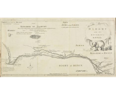
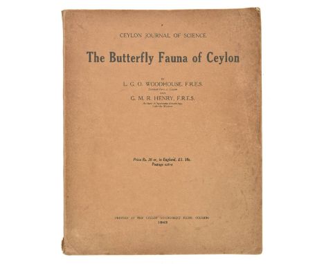
Woodhouse (Lionel George Ollyet, & George Morrison Reid Henry). The Butterfly Fauna of Ceylon, 1st edition, Colombo: Ceylon Government press, 1942, 52 plates (mainly in colour), plates 22 and 27 loose, a few other plates starting, original card wrappers, slightly marked, small chip to foot of spine, small section of separation along front joint, 4to, together with: ibid., The Butterfly Fauna of Ceylon, 2nd ('complete') edition, Colombo: The Colombo Apothecaries' Co., Ltd., 1949, 57 plates including frontispiece and map (plates 37-55 printed on 10 sheets), bookplate of noted lepidopterist Graham Howarth (1918-2015), dust jacket (a few nicks and closed tears), a bright copy, 4to, Westwood (John Obadiah), The Butterflies of Great Britain with their Transformations Delineated and Described, 2nd edition, William and Robert Chambers, 1860, hand-coloured lithographic title-page, 21 lithographic plates (all but 2 hand-coloured), original red pictorial cloth gilt, recased, slightly rubbed and worn, 8vo, Coleman (William Stephen), British Butterflies. Figures and Descriptions of Every Native Species, 1st edition, Routledge, Warne, & Routledge, 1860, 16 wood-engraved plates (14 printed in colours), 32 pp. advertisements to rear, original red pebble-grain cloth, spine faded, small 8vo, Kappel (August Wilhelm, & William Egmont Kirby), British and European Butterflies and Moths (Macrolepidoptera), 1st edition, Ernest Nister, [1896], 30 colour plates, a few spotted, top edge gilt, original blue pictorial cloth gilt, a little rubbed and faded, some minor wear to extremities, 4to, Ford (Edmund Brisco), Butterflies, 1st edition, Collins, 1945, photographic colour plates, original cloth, spine slightly faded, dust jacket (spine toned and slightly chipped), 8vo, and 20 others, illustrated lepidopterology books, 19th and 20th-century, original cloth, some with dust jackets, mainly 8vo (Qty: 28)Nissen ZBI 4461 (Woodhouse & Henry, both editions), 4377 (Westwood), 923 (Coleman), 2153 (Kappel & Kirby). Ford's work was the first title in the New Naturalist series.

Lot 207

Americas. Van der Aa (Pieter), Scheeps-Togt door Ferdinand Magellaan uit Kastilien Gedaan na R. de la Plata en van daar door zyn Ontdekte Straat tot aan de Moluccas, Leiden, circa 1706, uncoloured engraved map, insular California and a primitive outline of Australia, slight browning, 155 x 220 mm (Qty: 1)

Lot 208

* Antipodes. Rapkin (J.), New Zealand, published John Tallis, circa 1850, engraved map with contemporary outline colouring, decorated with four uncoloured engraved vignettes, 355 x 260 mm, mounted, framed and glazed, together with, Wilkinson (Robert), New South Wales, New Zealand, New Hebrides and the islands adjacent..., 1808, engraved map with contemporary outline colouring, inset maps of Norfolk Island, Port Jackson and its Environs [and] Howe's Island, slight overall toning, 310 x245 mm, mounted, framed and glazed (Qty: 2)

Lot 21

Browne (William George). Travels in Africa, Egypt, and Syria, from the Year 1792 to 1798, 1st edition, for T. Cadell junior and W. Davies, 1799, engraved frontispiece after Luigi Mayer, 2 folding maps, 1 plan, half-title discarded, toning, offsetting, a few spots, contemporary bookseller's ticket (Congdon, Plymouth), contemporary tree calf, rebacked, 4to (26.3 x 20.2 cm), together with: Sonnini de Manoncourt (Charles Nicolas Sigisbert), Travels undertaken in Upper and Lower Egypt, 2nd edition in English, for J. Debrett, 1800, engraved portrait frontispiece, folding map, 27 plates, half-title discarded, frontispiece offset, marginal spotting to plates, modern calf, 4to (26.9 x 20.9 cm) (Qty: 2)Blackmer 219 & 1573; Cox I pp. 394 & 395. '[Browne's] important work contains the earliest information in English about Darfur (Sudan). Browne ... was the first Englishman to explore the temple of Jupiter Ammon at the Oasis of Siwa' (Blackmer). This translation of Sonini de Manoncourt's work is by William Combe, author of Doctor Syntax; another English translation had appeared the previous year. Provenance: Library of Colin and Joan Deacon.

Lot 210

Australasia. Bernard (Robert), Carte d'une partie de la côte de la Nle. Galles Meridle. depuis Cap Tribulation jusqu'au Détroit de l'Endeavour par le Lieut J. Cook, 1770, [1774], uncoloured engraved chart of part of New South Wales, slight spotting, old folds, 310 x 350 mm, together with, Plan de la Terre de Van Diemen reconnue par le Cap. Furneaux en Mars, 1773, [1774], uncoloured engraved chart, 230 x 160 mm, with, Weller (Edward), Map showing explorations to the Eastward & Southward of Hampton Plains (Western Australia) by Alexander Forrest, Assistant Surveyor, 1871, published for the Journal of the Royal Geographical Society by J. Murray, 1872, engraved map with contemporary outline colouring, 205 x 345 mm, plus, Arrowsmith (John), Map to illustrate the Report of an Expedition into the interior of Western Australia in 1854 by Robert Austin, Assistant Surveyor, published for the Journal of the Royal Geographical Society by J. Murray, 1856, engraved map with contemporary outline colouring, 205 x 170 mm, and, Tardieu (J. B.), Océanique Orient..., circa 1812, engraved map with contemporary outline colouring, 240 x 310 mm, with, Strahan (Wm., publisher), Norfolk Isle, 1777, uncoloured engraved map, some text offsetting and slight staining, 220 x 200 mm, and, Walker (J & C), New South Wales, Eastern Coast of Terra Australis or New Holland, 1836, engraved map with contemporary outline colouring, 185 x 115 mm (Qty: 7)

Lot 212

Australia. Tardieu (J. P.), Oceanique centrale, circa 1820, engraved map with contemporary outline colouring, vignette of an Aborigine and native animals, with the map title on the side of a reed canoe, 235 x 305 mm, together with, Frentzel (George Freiderich Jonas) Charte von Australien oder Polynesien, Leipzig, circa 1790, engraved map with contemporary hand colouring, slight overall toning, 170 x 210 mm (Qty: 2)

Lot 213

* Bath. Godwin (H., publisher), A new and correct plan of the city of Bath from a recent survey, 1816, uncoloured engraved map, sectionalised and laid on linen, compass rose, crest of the city of Bath, decorative cartouche and table of explanation, tipped on to later card, 445 x 525 mm, framed and glazed in a 19th century maple frame (Qty: 1)

Lot 216

British Isles. National Savings Committee (publishers), National Savings Map of the British Isles showing Festivals and Customs and the Arms or Seals of the Counties, circa 1954, large colour printed decorative map, some marginal creasing and fraying, slight creasing to map, 985 x 730 mm, together with, Illustrated map of the Holy Land for use in schools, circa 1954, large colour printed decorative map, some marginal fraying and creasing, occasional marginal closed tears, slight creasing to map, 1000 x 750 mm (Qty: 2)

Lot 217

British Isles. Mannert (C.), Grosz-Britannien und Ireland nach Rocque, Jefferys, Kitchin, Kampbell, Cary entworfen, published Adam Gottlieb Schneider und Weigel, Nuremberg, 1822, engraved map with contemporary outline colouring, sectionalised and laid on linen, inset map of the environs of London, some dust soiling, 725 x 530 mm, contained in a contemporary marbled card slipcase with manuscript title label to upper cover and spine, very slight wear to extremities, together with, Andriveau J. Carte Générale des Isles Britanniques contenant L'Angleterre, L'Écosse et L'Irlande..., published J. Andriveau-Goujon, Paris, 1842, engraved map with contemporary hand colouring, sectionalised and laid on linen, inset map of the Shetland Islands, 865 x 625 mm, contemporary printed title label to verso, with, Blondeau (Alexandre), Carte des Isles Britanniques ou Royaume-Uni de la Grande Bretagne & d'Irlande..., 1812, engraved map with contemporary outline colouring, dissected and laid on linen in six sections, large calligraphic cartouche, inset map of the Shetland Islands, table of explanation, contemporary publisher's printed labels on verso of each section, overall size approximately 1600 x 1600 mm, contained in contemporary marbled paper book box but lacking lid, some wear to extremities, plus, Perrier Ltd, (publisher), Perrier Motor Map, circa 1920, colour photolithographic map, sectionalised and laid on linen, on two sections, inset manufacturer's advertisement, each section approximately 690 x 1110 mm, contained in a contemporary cloth slipcase with red printed title to upper siding, heavily worn and frayed (Qty: 4)

Lot 219

British Isles. Quad (Matthias), Angliae regni florentisimi nova descriptio auctore Humeredo Lluyd Denbygiense, [1608], uncoloured en graved map, slight dust soiling and text show through, 185 x 270 mm, Latin text on verso, together with, Munster (Sebastian), Das under buch Beschreibung Engellandts und Schottlandts, [1598], hand coloured woodblock map, 275 x 175 mm, German text on verso, with, Hole (William), Britannia [1607], uncoloured engraved map, some creasing and repairs to margins, 270 x 165 mm, plus, Porcacchi (Tomaso), Anglia, [1572 but 1713 impression], uncoloured engraved map orientated to the west, 110 x 150 mm, polyglot text above and on verso, and, Magini (Giovanni Antonio), Britanicae Insulae, [1713], uncoloured engraved map, 135 x 175 mm Latin text above, below and on verso of map (Qty: 5)

Lot 22

Buchanan (Francis). A Journey from Madras through the Countries of Mysore, Canara, and Malabar, performed under the Orders of the Marquis of Wellesley, 3 volumes, 1st edition, for T. Cadell and W. Davies, 1807, half-title, 38 engraved plates including frontispiece, folding hand-coloured engraved map, 5 folding tables, spotting, browning and offsetting, folding map partially split along one fold and and worn away at central intersection, corner of volume 2 signature 2T2 excised, contemporary marbled boards, rebacked, vellum tips, 4to (26.4 x 19.5 cm) (Qty: 3)Cox I p. 310. 'In 1800 Lord Wellesley appointed [Buchanan] to survey the newly conquered kingdom of Mysore, a posting which enabled him to collect a vast number of new botanical specimens. At the same time his survey, in both its portrayal of Tipu Sultan as a rapacious tyrant and its inventory of Mysore's natural wealth, vindicated Wellesley's controversial conquest, thereby earning Buchanan the governor-general's continued affection' (ODNB). Provenance: Library of Colin and Joan Deacon.

Lot 220

British Isles. Inselin (Charles), Carte des Royaumes d'Angleterre d'Ecosse et d'Irlande avec Les Costes Maritimes de France, Pais-Bas, d'Allemagne, Danmarck et Norwege, qui environment de Mer du Nord, ou sont marquez les Bancs et les Sondes &c. Dressée, sur plusiers cartes particulieres, memoires, et autres faites sur les lieux; par Operations Geometriques, Gravée et Dediée Au Roy D'Angleterre D'Ecosse et d'Irlande, Paris, 1793, engraved map with contemporary outline colouring on two conjoined sheets, some worming, repaired on verso, some creasing and dust soiling, slight spotting, old folds repaired on verso, lower margin strengthened and repaired on verso, 620 x 835 mm, together with, England & Wales. Delarochette (Louis Stanislas D'Arcy & Kitchin Thomas), England and Wales laid down from all the surveys of particular counties hitherto published. Distincly shewing the cities, market towns & villages. The roads with all the measured distances thereon according to Mr. Ogilby's survey. Also an accurate delineation of the sea coasts and Rivers, Laid down by Delarochette & engraved by Thos. Kitchin, printed for John Bowles, Carington Bowles and Robt. Sayer, circa 1765, large engraved map on twelve sheets with contemporary outline colouring, each sheet approximately 445 x 520 mm (Qty: 2)The first map described:- R. W. Shirley. Printed maps of the British Isles. Inselin 1. Only one state listed dated 1715. The map has always been associated with the Jacobite cause with another edition of the map being published in 1745, the year of the Second Jacobite Rebellion. A final edition was published in 1793 (this example) after the Jacobite movement was ended with the death of Bonnie Prince Charlie in 1788.

Lot 221

* British Isles. Munster (Sebastian), Anglie triquetra descriptio, Basle, 1538, uncoloured woodcut map, map size 145 x 120 mm, Latin text surrounding and on verso of the map, mounted, framed and double glazed (Qty: 1)R. W. Shirley. Early Printed maps of the British Isles, no. 26. Munster published his 'Cosmographia' in 1544. This compendium of historical, legendary and geographical information is what he is best known for. This small wood cut map was published earlier and is the first printed map to show an outline of the British isles derived from the Gough map. It is also the first map to clearly delineate Wales and Anglesey. The Bay of Cardigan is not shown, this does not appear on maps until the later half of the 16th century. It is also the first map to show with roughly correct proportions East Anglia and the relationship between middle and southern England. Several places are named on the map including London, Canterbury, York, Oxford and Waterford in Ireland. Six main rivers are also shown: Tueda (Tweed), Humbro (Humber) Trenta, Veius (Wye) Sabrina (Severn) and Thamesis (Thames). This map was re issued once, in 1543.

Lot 223

California. De Fer (Nicolas), Cette carte de Californie et du Nouveau Mexique est tirée de celle qui a êté envoyée par un grand d'Espagne pour être communiquée a Mrs. de l'Academie Royal des Sciences, Paris, 1700, map of an insular California, engraved by C. Inselin, contemporary outline colouring, large key identifying 314 locations, slight staining largely confined to margins, 230 x 345 mm (Qty: 1)

Lot 225

Canada. Lescarbot (Marc), Figure du Port Royal en la Nouvelle France, Paris [1609], uncoloured map of the Port Royal settlement in Nova Scotia, engraved by Jan Swelinck, old folds, 145 x 240 mm (Qty: 1)Philip D. Burden, The Mapping of North America, no. 158. A rare map, one of three relating to North America from Lescarbot's first history of the French settlements in America 'Histoire de la Nouvelle France'. The map shows the basin of Port Royal which is now called Annopolis Royal. The buildings (including the grist mill) in the lower right corner, fortifications, gun emplacements and river inlets are clearly shown.

Lot 226

East Indies. Blaeu (Guillaum), India quae Orientalis dicitur et Insulae Adjacentes, circa 1640, engraved map with contemporary outline colouring, decorative cartouche and mileage scale, compass rose and numerous rhumb lines, toned overall, 415 x 505 mm, Latin text on verso (Qty: 1)

Lot 227

England & Wales. Speed (John), The Kingdome of England, published Thomas Bassett & Richard Chiswell, [1676], hand coloured engraved map, eight costumed figures to vertical margins, title, text on verso and margins 'red-ruled', several marginal repaired closed tears, royal coat of arms cut away and replaced in facsimile, slight mount staining, 390 x 520 mm, English text on verso (Qty: 1)

Lot 228

England & Wales. A collection of ten folding maps, mostly 19th century, including, Langley (Edward & Belch William), Langley's new travelling and commercial map of England and Wales. Containing a list of all the cities, borough and market towns, the days on which the markets are held together with the rates of postages and measured miles from London, 1817, engraved map with contemporary hand colouring, sectionalised and laid on linen, inset views of London and Vauxhall, Waterloo and Southwark bridges, columns of tables to vertical margins, slight staining. one small hole in linen where folds cross, 475 x 665 mm, lacking slipcase, together with, Darton (William, publisher), Brookes' Travelling Companion through England and Wales, 2nd edition, July 1st. 1819, engraved map with contemporary hand colouring, sectionalised and laid on linen, decorative uncoloured cartouche, slight staining, 570 x 495 mm, contained in a contemporary marbled card slipcase with printed label to upper cover, with, Cary (John), Cary's reduction of his large map of England and Wales with part of Scotland..., 1811, engraved map with contemporary outline colouring, sectionalised and laid on linen, slight overall toning, 750 x 625 mm, contained in a contemporary card slipcase with circular printed label to upper cover, some wear to extremities, plus, Kitchin (Thomas), An accurate map of England and Wales drawn from all the particular surveys hitherto published..., J & C Bowles & Robert Sayer, circa 1765, engraved map with contemporary outline colouring, sectionalised and laid on linen, decorative uncoloured cartouche, two ink library stamps affecting image, with an additional stamp to verso, 600 x 515 mm, lacking slipcase, and, Cruchley (G. F.), Cruchley's improved Geographical Companion throughout England & Wales including part of Scotland, 1827, engraved map with contemporary hand colouring, sectionalised and laid on linen, 950 x 655 mm, marbled endpapers with additional calligraphic title pasted on one endpaper, contained in a contemporary marbled card slipcase with printed label to upper siding, slight wear to extremities, with another five folding maps of England & Wales, including examples by Cooper, Stanford, Wyld and Perrier (publishers), various sizes and condition (Qty: 10)

Lot 232

Geological maps. Geikie (Archibald), Geological map of England & Wales, reduced chiefly from the Ordnance and Geological surveys, published John Bartholomew & Co., circa 1875, colour lithographic map, sectionalised and laid on linen, table of reference, some spotting, occasional pencil annotations, 1020 x 850 mm, marbled endpapers, some fraying to endpapers, manuscript title label to upper cover, with another copy similar but retaining one cloth board, together with, G eikie (Archibald), Geological map of Scotland, published W. & A. K. Johnston, 1875, colour lithographic map, sectionalised and laid on linen, inset map of the Shetland islands, 860 x 585 mm, contemporary gilt decorated cloth boards, with another two similar copies with cloth boards (1892 & 1910 editions), plus, Ramsay (Andrew C.), Geological map of England & Wales, published Edward Stanford, 1859, engraved map with contemporary hand colouring, sectionalised and laid on linen, slight dust soiling, 930 x 810 mm, contained in a contemporary gilt cloth slip case, slight wear, with another four geological maps and atlases by Stanford, Reynolds, Letts and Ordnance Survey (Geological Survey of England and Wales), and a folding map of Denmark by Edward Stanford, various sizes and condition (Qty: 11)

Lot 234

Hampshire. Milne (Thomas), Hampshire, or the County of Southampton including the Isle of Wight. Surveyed at the expense of the proprietor in 1788, 89 & 90, by Thos. Milne, printed for Will. Faden..., Octobr. 1st, 1791, large scale engraved map, sectionalised and laid on linen, with contemporary outline colouring, printed on two sheets, calligraphic title, engraved vignette of a 'View of the West Gate Winchester', two inset town plans of Winchester and Southampton, large compass rose and numerous rhumb lines, slight staining, town plan of Southampton skilfully replaced in facsimile, each sheet approximately 745 x 1400 mm, contained in a contemporary marbled card slip case with manuscript label to upper board, heavily worn and frayed (Qty: 1)

Loading...Loading...
  • 109182 item(s)
    /page

Recently Viewed Lots