Johnston T. & Robertson J. : Historical Geography of the Clans of Scotland with A Narrative of the Highland Campaigns by K. Dickson, 1899. Third Ed. Large qto Hb. Original green buckram, gilt. Illustrated. Large folding linen backed map frontis. Copies with folding map are scarce. Together with : Macdonald W. : Scottish Armorial Seals, 1904, 1st. Ed. 8vo. Hb. CONDITION REPORT: Generally vg copy. Scarce with map
We found 109182 price guide item(s) matching your search
There are 109182 lots that match your search criteria. Subscribe now to get instant access to the full price guide service.
Click here to subscribe- List
- Grid
-
109182 item(s)/page
Samuel Butler : A General Atlas of Ancient and Modern Geography, 1832. Qto. Hb. Original marbled boards with label. Forty three engraved maps hand coloured in outline with paper guards. Index with references at rear. Together with : Edward Stanford : Large folding, linen backed, Map of England & Wales, ( drawn by Creighton, engraved by Dower ), hand coloured in outline. Showing Principal Roads, Railways, Rivers, Canals etc. Under direction of Board of Ordnance. Three folding sections ( of four ) with slip case. Batholomew's Handy General Atlas of the World, Nd. C. 1900. Double page coloured maps. CONDITION REPORT: Butler - boards detached & worn. Contents vg. Stanford - lacking one map, slip case worn. Bartholomew upper board det., lacking spine, contents vg.
Samson C. : A Flight From Cairo to Cape Town and Back, 1931. 1st. Ed. 8vo. Hb. Text, Photo plates & Folding map. Very scarce. Fights and Flights, 1930. 1st. Ed. 8vo. Hb. Uncommon. Together with : Sprigg C. : Great Flights, 1935; Barker R. The Royal Flying Corps in France, 1995 and 12 other Military and Naval titles.
A substantial collection of finely produced facsimile maps, plans and engravings, including : Two Hundred & Fifty Years of Map Making in Surrey with notes by Ravenhill, The Rhinebeck Panorama of London and a coloured 1682 Plan of the Tower of London & Hatton Garden Survey, 1694. CONDITION REPORT: Vg/ Nf
THE KINGDOME OF PERSIA with the cheef Citties and Habites described"Speed J. ( John Speede sic ) : Printed date of 1626 ( Humble ). Country's borders hand coloured in outline, also showing the Caspian Sea and the territories of modern-day Iran, Iraq and Pakistan together with topographical features shown and most major towns, cities, mountain ranges and waterways are named. Vertical borders feature the social hierarchy of Persian society with full-length illustrations of a nobleman, citizen, countryman, and Turkish man with their respective female partners. The upper horizontal border features panoramas of four major Persian cities: "Spaha, Ormus, Tarvis & Gilan" (present day Isfahan, Hormuz, Tabriz & Tehran). Engraved cartouche for title and scale. English text to verso. The map originally featured in Speed's Atlas : "A Prospect Of The Most Famous Of The World", published 1626. Scarce. CONDITION REPORT: There are borders of slight discolouration across the map and some repaired closed tears to the extreme margins ( not printed margins ) o/w an intact example of a scarce map.
Robert Morden : Playing cards - III of Hearts - Map of Bedfordshire, ( also featuring sections of neighbouring counties, a 'Dividers' scale, compass & other mileage details ), 1676. Hand coloured in outline, 91 x 56mm. Together with : VI of Clubs featuring textual details of Bedfordshire with the club symbol over a dotted outline map & engraving of tree lined landscape, 92 x 56mm, 1676. Extremely scarce. CONDITION REPORT: Black and White card is clubs. Colour card is hearts. Fair condition for age. See further images
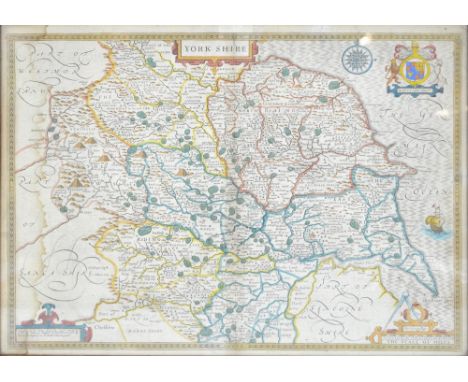
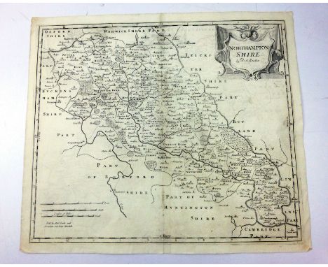
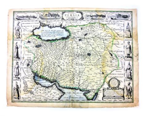
Miscellaneous 18th.C. Road Maps : Kitchin T. : Road maps from the 'Traveller's Companion -London to Hitchin, Northampton, Hyth, Holy Head, C.1771 and from Post Chaife Companion : London - Okeham, Norwich, Newmarket, Northampton, Nottingham, Newhaven, 1767. Armstrong's Biggleswade to Baldock, 1776; Gentleman's Magazine : Roads from London to Norwich, Cambridge, King's Lynn; Oxford - Cambridge; London to Chester, 1765; Jeffery T. : Road maps from Itinerary or Traveller's Companion : Post - Map of Roads of England, Oxford to Cambridge, Cambridge to Coventry, London to Holy Head, Flamborough, St. Neots, Okeham, Newmarket, 1775; Carrington Bowles - Post Chaise Companion : London to Hitchin, Northampton, Holyhead, Richmond, Exeter, Okeham; Oxford to Cambridge; Canterbury to Margate, 1782. Gardner T. : London to Oakeham, Holyhead, 1719. Ogilby J. : Cambridge to Coventry, London to St.Neots, Flamborough, Okeham, C. 1719. Paterson D. : British Itinerary - 9 smaller format road maps featuring Bedfordshire, 1785, CONDITION REPORT: Vg.
Bacon's fldg. County Map & Guide for Cyclists & Tourists, C.1920; Philips' linen backed fldg. Cyclists' County Map of Bedford, C. 1910 and Bedfordshire from the Ordnance Survey (Weller) 1865; W.H. Smith's Reduced linen backed, fldg. Ordnance Map of Bedford & Environs, C1920. Walker's ( J. & C. ) : Fldg, Linen-backed County Map of Bedfordshire, 1843. All with original covers. CONDITION REPORT: VG
A box containing Art Deco style barometer / thermometer, a Brown's Self-Interpreting Bible, two vintage tennis racquets, two vintage Shell Motor Spirit petrol cans, a Butler's Flexilight map reading light, various other lights, a vintage Underwood portable typewriter and a Garrards record deck, etc
All World Stamps, a very good mixed accumulation , mint and used early to mid XX Century in albums, packets, stock pages and F.D.C's. Plenty of interest, nice mint block of 8 G.B. 1881 S.G. 172 1 Penny lilac noted, along with nice clean mint lower value Commonwealth, also a couple of George VI Malaya straights settlement, censor covers 1941. Together with a quantity philatelic literature including 1940 S.G. catalogue and Benham 1981 F.D.C catalogue and a framed 'Stamp Map of Britain'.
[TOPOGRAPHY]. IRELAND Weld, Isaac. Illustrations of the Scenery of Killarney and the Surrounding Country, for Longman et al., London, 1807, dark green leather gilt, all edges gilt, engraved vignette title page, map, further vignette and fifteen (of seventeen) plate illustrations, quarto (edges scuffed; spine ends nicked).
[TRAVEL] Whymper, Edward. Travels Amongst the Great Andes of the Equator, second edition, Murray, London, 1892, bevelled green cloth gilt, three (of four) maps, plate and text illustrations, ASSOCIATION COPY inscribed 'Gladys Whymper / from / her Grandfather / on her 21st Birthday / July 19th 1901', quarto (spine dulled and faded; one folding map torn, without loss).
[MISCELLANEOUS] Tytler, Patrick Fraser. Historical View of the Progress of Discovery on the More Northern Coasts of America, with Descriptive Sketches of the Natural History of the North American Regions by James Wilson, second edition, Oliver & Boyd / Simpkin & Marshall, Edinburgh / London, 1833, half calf gilt, the spine decorated in compartments, folding map frontispiece, vignette half title, five plate and three vignette illustrations, small octavo; and six other assorted works, (7).
[MAPS]. Willem Blaeu (1571-1638), 'Afbeeldinge vande vermaerde seehaven ende stadt van Duynkercken met der omliggende plaetsen sandem ende droochten afgeteeckent door Capiteijn pieter Codde van Enchuysen' [Dunkirk, France], engraved map, hand-coloured, Latin text verso, 45.5cm x 70cm, framed and glazed.
COOKE, JH; 5,000 Miles with The Cheshire Yeomanry in South Africa, limited to 500 copies and signed by compiler, 'illustrated by 160 plates, photographs and portraits' and retaining 'reference plan of part of South Africa' coloured military map (Spottis Wood & Co, London), Mackie & Co, Warrington and Phillipson & Golder, Chester 1913-1914, in contemporary relined boards and with original illustrated dust cover. CONDITION REPORT: Deterioration to dust cover particularly to edges and spine with two holes to spine and fraying to edges, insect damage to front board leaving a number of small holes to spine, further staining and fading to boards and lining, some minor foxing to pages but overall good, map remains in good condition, some foxing/spotting to page edges.
An early 17th century and later coloured map of 'The Countie Palatine of Lancaster described and divided into hundreds', illustrated with royal portraits and with gazetteer verso, 39.5 x 53.5cm, and a further John Speed early 17th century and later coloured map of Yorkshire, 30 x 52cm, both framed and glazed (2). CONDITION REPORT: The map of Lancashire has several creases to the image, the top margin is short, it is heavily stained with a circular patch to lower left, The map of Yorkshire is heavily stained, creases to image and the margins are trimmed.
Twelve Stereoscopic Glass Slides of Niagara Falls, a Descriptive Booklet and a Hand Held Stereoscopic Viewer, twelve slides, various maker's and condition, P-F, with a hard bound booklet, “Niagara through the Stereoscope”, produced by Underwood and Underwood, with folding map inset to rear, 1900, and a hand-held stereoscopic viewer, G (14)
Books of Zulu War Interest. Comprising: 'Narrative of The Field Operations connected to The Zulu War of 1879'. This is an official War Department publication published 1881. Complete with maps and original red cloth cover. ... 'History of the Zulu War and its Origin' by Frances E Colenso & Lt Col Edward Durnford' Published 1881. Complete with fold out map. This original edition has been professionally rebound. ... 'War Map of Zulu Land' Published 1879. Please note this map with basic restoration' (3 items)
German Third Reich manufacturer's sample board of awards Grey cardboard sheet with manufacturer's logo with attached to it : Close Combat Clasp in bronze ... RAD Long Service Medal... Driver's badge ... Mothers Cross in silver (MINIATURE) ... 1939 War Merit Cross with swords 2nd Class ... West Wall Medal ... Customs Service Long Service Medal ... 1939 Bar to the Iron Cross 1st Class ... 1939 Iron Cross 2nd class ... Wound Badge in black ... 1939 War Merit Cross without swords 1st Class ... Narvik Shield ... Faithful Service Medal ... Krim Shield ... Order of the Silesian Eagle. All except the latter complete with fixings and the shields with only two blades on each otherwise VGC. (14) items ... together with a BeVo cloth cap eagle and swastika and similar for breast ... 1943 edition of Cherbourg & Caen 'ARM/AIR' ... Second Army Thanksgiving Service booklet ... French phrase book, the end pages with ink dates ie '3/5/45 Crossed Elbe thro' Lubeck' '4/5/45 Germany surrenders at 0800 5/5/45. Big binge held' .. and a double sided broad sheet bearing ma of Western Front on one side, 'The Blow from the East' with map and Russian soldiers on the other
-
109182 item(s)/page