British A group of four prints [a] 19th Century, A view outside Bristol, coloured lithograph on paper [b] Sir William Nicholson, An Almanac of Twelve Sports, coloured lithograph on paper [c] Bowen/Owen, Circa 1720, A map of Wiltshire [d] Liam Thompson (b. 1956), Love In A Mist, coloured lithograph [e] 20th Century, A study of geranium sanguineum To be sold without reserve Dimensions: [a] (Paper) 9 in. (H) x 15 in. (W); (Frame) 16 in. (H) x 23 in. (W) [b] (Image) 8 in. (H) x 8.5 in. (W) [c] (Image) 7.5 in. (H) x 4.75 in. (W) [d] (Image) 7.75 in. (H) x 7.75 in. (W) [e] (Paper) 8 in. (H) x 5.5 in. (W); (Frame) 15.25 in. (H) x 12 in. (W)
We found 109198 price guide item(s) matching your search
There are 109198 lots that match your search criteria. Subscribe now to get instant access to the full price guide service.
Click here to subscribe- List
- Grid
-
109198 item(s)/page
THE WORLD OF MERCANTORS PROJECTION, 1854. Annotated world map of R W Poore, CPT of the 8th King's Royal Irish Hussars, charting his journey from Queenstown (now Cobh) at 5pm, 8th October 1857 to Bombay 5pm, 17th December 1857. Linen mounted and folded (rip to bottom right corner), size approximately: 81x126cm
After John Ogilby (1600-1676), THE ROAD FROM WELSHPOOL COM MONTGOMERY TO CARNARVON IN NORTH WALES, a strip road map on paper, second edition, later hand coloured, visible plate mark, the plate 34cm x 42.5cm, framed and glazed, text from the first edition applied verso; with an Owen Bowen strip map on laid paper showing roads from Anglesey to North Wales and Chester, 18.5cm x 12cm, in double-sided glazed frame (2)
2017 Britannia 1oz silver proof coin in the original Royal Mint presentation packaging with certificate. Obverse: Jody Clark's fifth and final definitive portrait of Queen Elizabeth II, facing right, 'ELIZABETH II · D · G · REG · F · D · 2 POUNDS ·' around. Reverse: map of Great Britain and Northern Ireland overlaid on the figure of Britannia with helmet, shield and trident on Union Jack field with trident mint mark to right. Artist: Louis Tamlyn. Legend: 'BRITANNIA 1OZ FINE SILVER 999' with '2017' to the bottom right. Offered in the original Royal Mint packaging with a numbered certificate of authenticity. Mintage: 7.500. Face value: £2. Finish: proof. Composition: 999 silver. Weight: 31.21g. Diameter: 38.61mm.2017, Queen Elizabeth II. Silver Proof One Ounce Britannia. Royal Mint issue, in full packaging.
TALISKER 10 YEAR OLD MAP LABEL ISLAND SINGLE MALT 45.8% ABV / 70cl Even by today’s standards Talisker distillery is a bit out of the way, nestled on the shore of Loch Harport on the west coast of the isle of Skye. This might explain why, in its early days, the distillery frequently changed hands, with owners struggling to turn a profit. It wasn’t until owner Roderick Kemp oversaw construction of a pier in the late 19th century, allowing much easier access for the boats that transported the casks to the mainland, that the distillery’s fortunes began to improve.Despite a minor stumbling block in 1960 when the distillery burned down and had to be completely rebuilt, it has grown to become one of the most recognisable single malt brands in the world.
British Boer War Full Uniform, Headdress and Equipment Mannequin of a Private in the 2nd Battalion ‘F’ Company Hampshire Regiment Mounted Infantry, fine khaki four pocket tunic with high collar. Brass post 1902 general service buttons. Brass Hampshire regiment (rose) collar badges and brass HANTS shoulder titles. KD other ranks trousers with khaki putties and black leather boots with stirrups. Complete with a rare early Boer War period enlisted ranks felt slouch hat with cloth pagri and brass 2/MI headdress badge. The set is mounted onto a museum display mannequin with a full set of leather equipment, including cavalry ammunition bandolier, early pattern felt covered water bottle with leather harness and strap, pistol holster with leather cross strap having loops for spare ammunition. Brown leather map / document case with shoulder strap. Enamel drinking cup and heliograph mirror in circular tin. The mannequin is mounted onto a moveable museum display stand. We have not removed any items from this display. We are not able to offer in house post and packing on this lot as it stands, specialist shipping or personal collection recommended. Late Rod Flood collection.
WW2 German 1940 Operation Sea Lion Invasion Maps of Great Britain, interesting grouping housed in the printed card outer cover, consisting of single map of the railway network in the United Kingdom and large reconnaissance book produced on the south coast with printed images and two further smaller reconnaissance books with information produced to be issued for German troops during the aborted German invasion of Great Britain in 1940, code name Operation Sea Lion. All remain in excellent condition.
Grouping of Original Artwork by G.H.Davis, the grouping consists of three artists boards, the first being a series of images on one board has as its main theme the Normandy invasion with a drawing of Mulberry Harbour, Pluto (the petrol pipe line) Artificial moonlight etc. Signed by Davis in 1945 and some pencilled notes to margin 11 images in total; second Mix of Images including Magnetic mines and counter measures, use of heavier bombs by the RAF up to 22,000 lbs, Rocket Projectiles, British Tank Development, "Crocodile" Flame Throwing Tank, The Bailey Bridge etc; 3rd board being a map showing Rommel’s defences in North Africa, signed to the bottom corner. G H Davis was a well known artist whose realistic portrayal of aircraft, vehicles, ships, many of them cutaway, made him the Artist of choice for such work during the Second World War. He worked for the Illustrated London News for some forty years and passed away in 1963
George V, Sovereign Mintmark Collection, Perth Mint set comprising 7x George V, sovereigns; 1911 Melbourne Mint, 1912 London Mint, 1913 Sydney Mint, 1918 Bombay Mint, 1919 Ottawa Mint, 1920 Perth Mint and 1927 Pretoria Mint; presented across a map of the world, one time framed but since removed; set no. 236/250; all coins are encapsulated and grading near extremely fine to extremely fine with lustre
Bristol. An aquatint of the conflagration of the city and a town plan first 'The City of Bristol, as it appeared generally on Sunday Night (time from 6 to 12 o'clock) 30th October 1831'., from a sketch taken from Brandon Hill, by C.H. Walters, an aquatint, gilt frame together with Hoefnagel, Joris (Flemish, 1542-1600) 'Brightstowe', a 19th century reissue of the 1575 map, uncoloured, gilt and ebonised frame, (2)first 30.5 x 43cm.Condition: Unexamined out of frames. First mould spots on inside of glass. Area of sky with section repaired to edge. toning/yellowing to paper. feint crease lines running running through centre vertically and horizontally. frame later gold painted.
Two Cypriot silver bowls and five pin dishesunmarkedone bowl repousse embossed with a Greek Key band, the other scrolling fruiting vine design, on feet, the dishes chased variously with a pomegranate goat, gauloi, map of Cyprus etc, (7)various, weight approx. 9.73oztCondition: good condition
A 19thC colour map depicting Somersetshire and the mouth of the River Severn, published by G&J Cary 86 St James' Street July 2nd 1832, 50cm x 60cm, and another of Pembrokeshire, together with a further map depicting the Arasaig Harbour, surveyed by James Geoffrey and dated 1858, 49cm x 62cm.
Südwestdeutschland.: A New and Correct Map of the South West part of Germany. ...Mentzand Triers... Palatinate of the Rhine...Wirtemberg...Franconia, Swabia, Alsace, Lorrain. Kupferstichkarte v. Emanuel Bowen, um 1763. Aus: Tindal's Continuation of Rapin's History of England. Plgr. 35 x 43 cm. Leicht gebräunt u. minimal fl. auf dem weißen Rand. R
Kongo.: Congi Regni Christiani in Africa nova descriptio Auctore Philippo Pigafetta. Kupferstichkarte bei C.J. Visscher, Amsterdam 1649 (in Tabulae Geographicae Contrare). 8,5 x 12 cm (Blattgr. 13 x 17). Koeman III, map 8755:341, ed. 341:54 (1649, Tabulae, Visscher). - Die kleinformatige Karte zeigt neben dem Kongogebiet das heutige Gabun und Angola. - Gutes Ex. D
Staden,H.: De voorname Scheeps-togten van Homburg in Hessen, na Brazil, gedaan Anno 1547 en 1549... Nu eerst uyt 't Hoogduytsch vertaald na den egten laatsten vermeerderden derden Druk. Leiden, P. van der Aa (1706). Fol. Mit gest. Titelvign., 1 gefalt. Kupferkarte u. 23 Textkupfern. 2 Bl., 76 Sp., 1 Bl. Spät. Ldr. im Stil d. Zt. mit Rverg., goldgepr. Rsch. u. goldgepr., doppelt gestaffelten Deckelfileten. (Berieb., etw. best., tls. kratzspurig). Sabin 90057. Henze V, 205f. Alden 706/209. Borba de Moraes 786. - Separat-Abdruck aus Pieter van der Aa's "De Aanmerkens-waardige voyagien door Francoisen ... Bd. I". - Herausragendes Werk über die Entdeckung Brasiliens von Hans Staden (um 1525-1576), einem deutschen Söldner, der 9 Monate von Tupinambá-Indianern verschleppt, an einem Festtag rituell getötet und verspeist werden sollte. - "This edition ... was printed from the same setting of type as the preceeding octavo edition, rearranged to make two columns to a page ... all but one of the copper plates in the octavo edition are included as illustrations in the text of the folio. The map is printed on the same sheet with one of the other maps of this volume" (Sabin). - Das Kupfer in Sp. 61/62 wie manchmal montiert. - Seiten unbeschnitten, papierbedingt gebräunt u. etwas braunfleckig, wenige Blätter restauriert mit Ergänzungen im w. Rand.
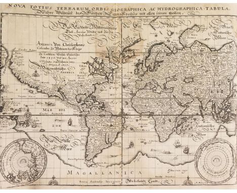
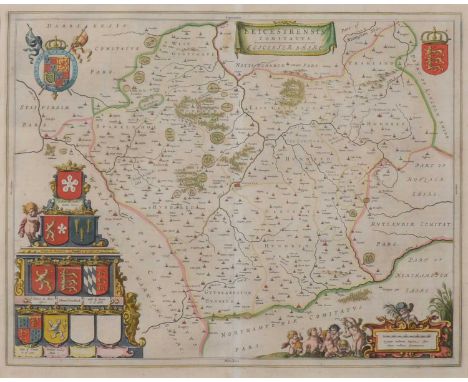
Gottfried,J.L.: Neuwe Archontologia cosmica, Das ist, Beschreibung aller Kayserthumben, Königreichen und Republicken der gantzen Welt. Frankfurt, W. Hoffman für M. Merian 1638. Folio. Mit Kupfertitel, gestochener Titelvignette und 30 doppelblattgroßen Kupferkarten und 69 meist doppelblattgroßen Kupfertafeln (st. 71). 20 (st. 21) Bll., 732 (st. 760) S., 5 (st. 12) Bll. Spät. Hldrbd. Wüthrich III, 321ff. Jantz 1135. Erste deutsche Ausgabe der bekannten und umfangreichen Kosmographie, die neben Europa auch über Asien, Afrika und Amerika berichtet. - Der Text folgt dem französischen Werk Les états du Monde von Pierre d'Avity von 1613. Die schönen Kupfer mit der doppelblattgr. Weltkarte (Shirley 345) und den Karten von Amerika, Afrika, Griechenland, China, Türkei, Persien, Deutschland u. a. sowie mit Ansichten von Frankfurt, Augsburg, Köln, Innsbruck, Heidelberg, Straßburg, Paris, Sevilla, Rom, Neapel, Mailand, London, Moskau, Florenz, Venedig, Antwerpen, Genua, Konstantinopel, Jerusalem, Zürich u. v. m. Von den drei häufig vorkommenden, aber nicht im Buchbinderverzeichnis aufgeführten Tafeln sind Hamburg und Neapel Stadt vorhanden. - Durchgestrichener Besitzeintrag. 321ff. First German edition. - Comprehensive cosmography, reporting on Europe as well as on Asia, Africa and America. With engr. title vignette, 30 engr. maps and 69 copperplates (of 71). Later half vellum. 31.5 : 20 cm. - Missing 1 leaf of the preface, 7 index leaves, pp. 731-756 and pp. 759/760 as well as the unrecorded plate from La Valetta; map of Prague is only half present. - Browned, particularly in the upper margin partly stronger stained by damp (sporadically moulding) and waterstained, plates occasionally with backed defects in the fold and a few in the margin area, last approx. 15 leaves reinforced in the gutter, copper title and typographic title with marginal blemishes and remounted. Title with crossed out ownership entry by Georg Rudolf von Hessler (probably 1678-1726, son of the same name; 1640-1687).
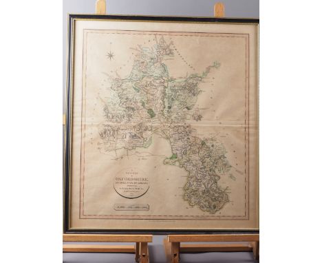
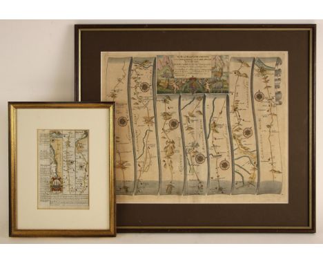
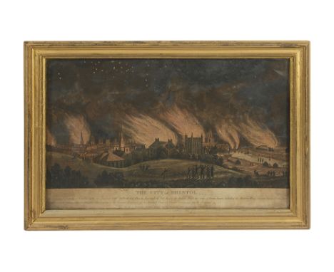
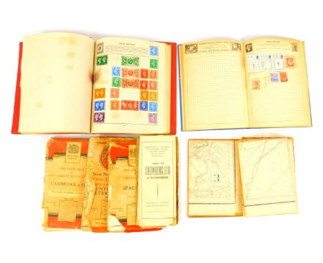
John Ogilby, Road from London to St Neots .. continued to Oakeham, 36x47cm; Emmanuel Bowen, Road from Hereford to Leicester, including a small map of Leicestershire; Emmanuel Bowen, The Road from London to Norwich, incorporating a small map of Rutlandshire; and a distances chart from Jacob Van Langeren, (4).
EMANUEL BOWEN 'DORSET SHIRE' dedicated to the Right Hon. Anthony, Earl of Shaftesbury, published by John Tinney for John Bowles & Son, hand coloured engraved map, 60cm x 76cm (unframed); together with a similar unframed map of the County of Dorset surveyed by Isaac Taylor, published by Faden, July 1st 1796, 57cm x 79cm (2)
JOHN SPEED uncoloured engraved map of Wales, John Sudbury and George Humble, dated 1610, twelve oval vignettes of principal cities of Wales to the vertical margins, inset views of Bangor, St Davids, Llandaff and St Asaph, English text verso, 42 x 52cmsProvenance: deceased estate GwyneddComments: framed and glazed both sides
![Loading...](/content/bs/images/ajax-loader.gif)
-
109198 item(s)/page